Fish Passage Site 20501466
Coordinates (dec. deg.): 61.98929°, -149.99706°
Legal Description: S022N004W22
Region: South Central
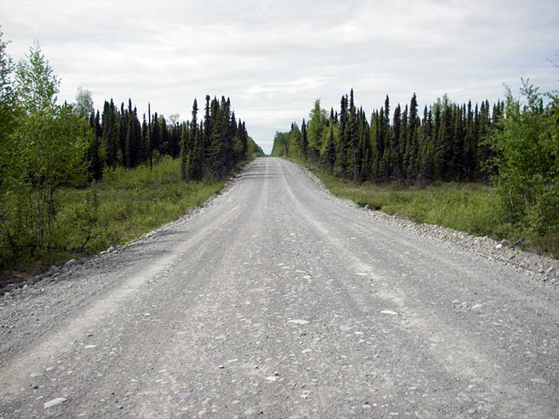
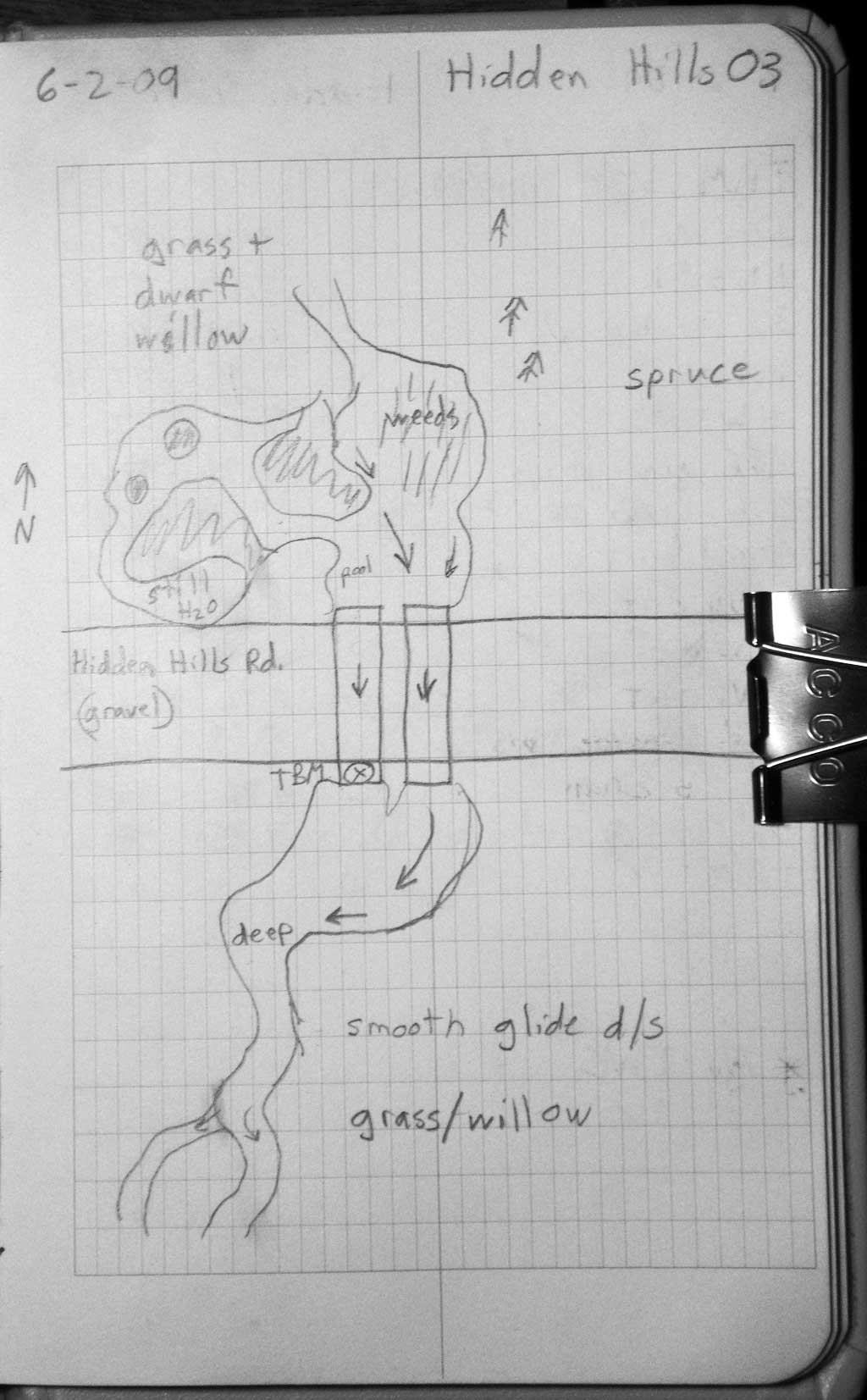
Road Name: Hidden Hills Road
Datum: WGS84
Quad Name / ITM: Anchorage D-8
AWC Stream #:
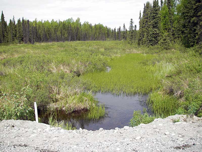
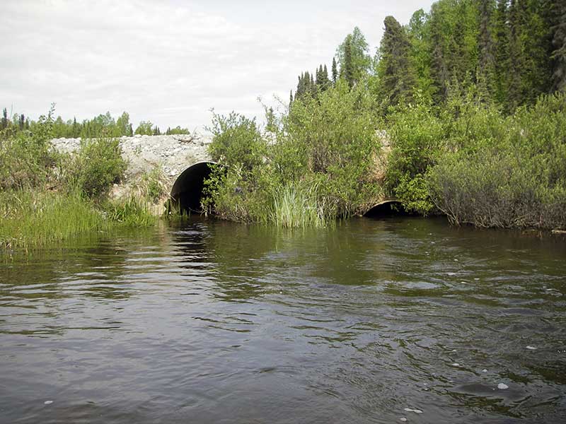
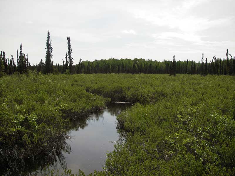
Stream Name: Caswell Creek
Elevation:
Site Comments: None
arrow to the right of the survey date below to choose a different report for this site.
Survey PRK09-HHR03
Project Supervisor: Gillian O'Doherty, ADFG
Observers: Heidi Zimmer, Ben Histand, Gillian O'Doherty
Overall Fish Passage Rating:
Tidal: No
Backwatered: No
Step Pools: No
Construction Year:
Site Observations:
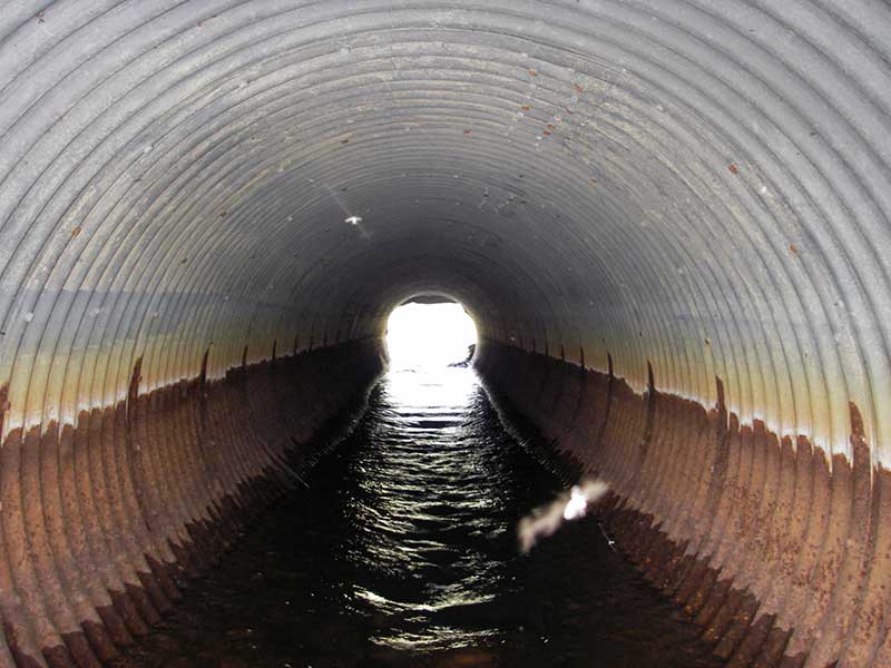
- Mechanical damage or joints parting
- Culvert gradient red
- Structural Problem
- Shallow fill; inadequate roadfill volume above culvert
Comments: Visual observation of juvenile salmonids (which side of culvert was not recorded).
Culvert Measurements
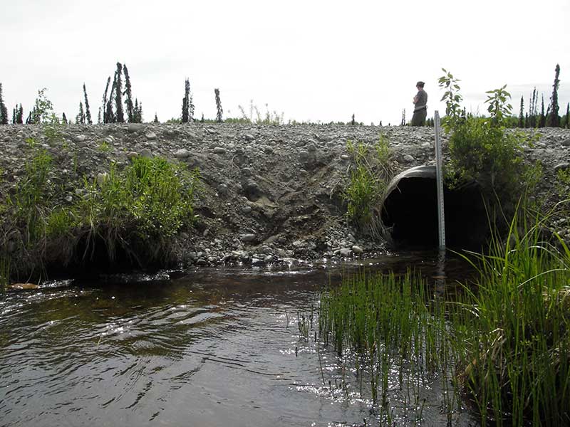
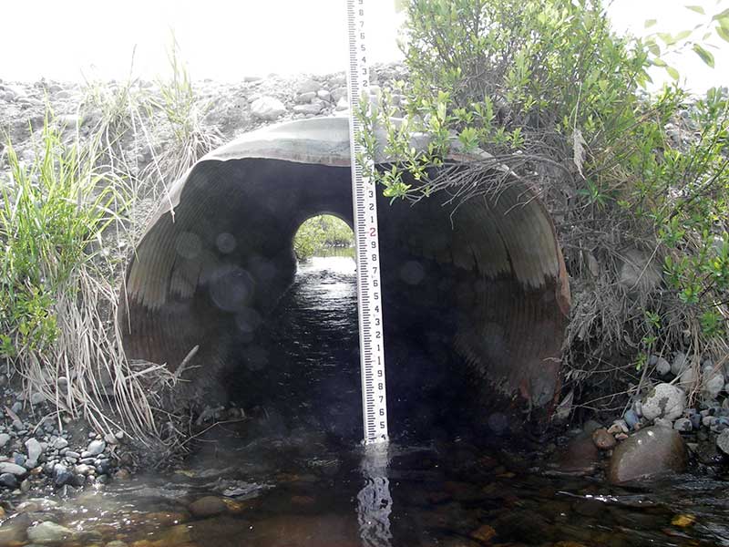
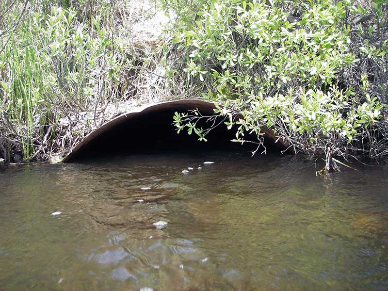
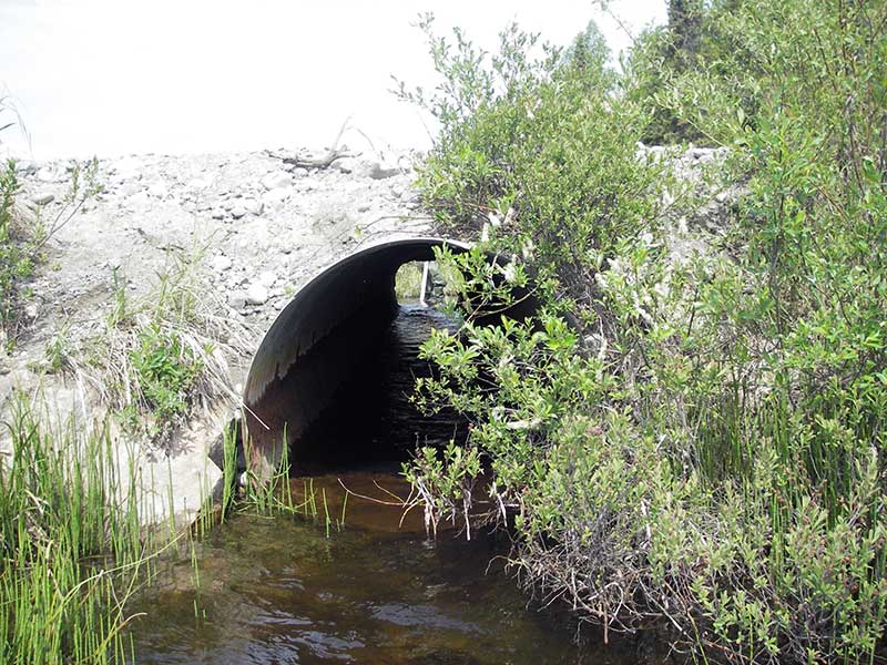
| ID: 1 | Structure Type: Circular pipe (Corrugated steel) | Fish Passage Rating: | |||||||||||||||||||||||||||||||||||||||||
|
|
|
|||||||||||||||||||||||||||||||||||||||||
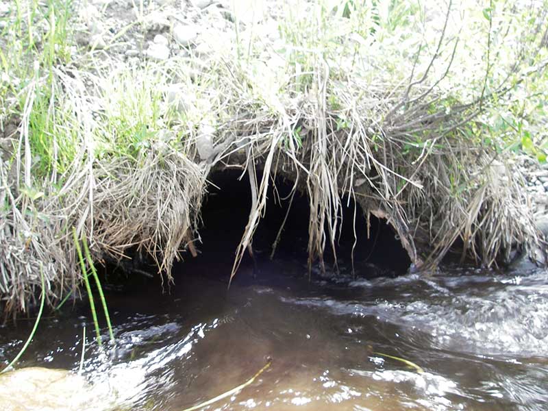
Comments: Pipe 1 is collapsed 3' in from inlet. Probably rusted through bottom. No freeboard @ base. Outlet mostly buried |
|||||||||||||||||||||||||||||||||||||||||||
Culvert Observations:
|
|||||||||||||||||||||||||||||||||||||||||||
| ID: 2 | Structure Type: Circular pipe (Corrugated steel) | Fish Passage Rating: | |||||||||||||||||||||||||||||||||||||||||
|
|
|
|||||||||||||||||||||||||||||||||||||||||
Culvert Observations:
|
|||||||||||||||||||||||||||||||||||||||||||
Stream Measurements
|
|
No stream width data available.
Elevations
| Locator ID | Culvert Number |
River Distance (ft)1 |
Distance From Crossing (ft)2 |
Relative Elevation (ft) |
|---|---|---|---|---|
| Outlet Pool Water Elev | 2 | 97.34 | ||
| Outlet Pool Water Elev | 1 | 97.39 | ||
| U/S Headwater | 1 | 97.62 | ||
| U/S Headwater | 2 | 97.68 | ||
| D/S Grade Ctrl (Thalweg) | 0.00 | 75.0 | 95.53 | |
| D/S Water Surface Elev (ws @ gp - use ws for d/s grade) | 0.00 | 75.0 | 97.34 | |
| D/S Water Surface Elev (ws @ GP) | 2 | 73.40 | 1.6 | 97.77 |
| Outlet Invert | 1 | 75.00 | 0.0 | 96.07 |
| Outlet Invert | 2 | 75.00 | 0.0 | 96.43 |
| Road Elev | 96.50 | 101.98 | ||
| Inlet Culvert Invert | 2 | 118.00 | 0.0 | 97.31 |
| Inlet Culvert Invert | 1 | 118.00 | 0.0 | 96.28 |
| U/S Thalweg (TC of u/s pool) | 2 | 119.60 | 1.6 | 97.30 |
| U/S Grade Ctrl (Thalweg) (run u/s) | 1 | 121.20 | 3.2 | 98.71 |
Notes:
- River distance is measured continuously throughout the survey reach along the thalweg of the stream.
- Measured from each end of the crossing along the thalweg of the stream.
Fish Sampling Efforts
| Gear Type: Visual Observation, Ground (A) | ||
| Comments: Visual observation of juvenile salmonids, which side of culvert not recorded. | ||
Fish Observations
No fish observations occurred during this survey.
Photos
Questions or comments about this report can be directed to dfg.dsf.webmaster@alaska.gov