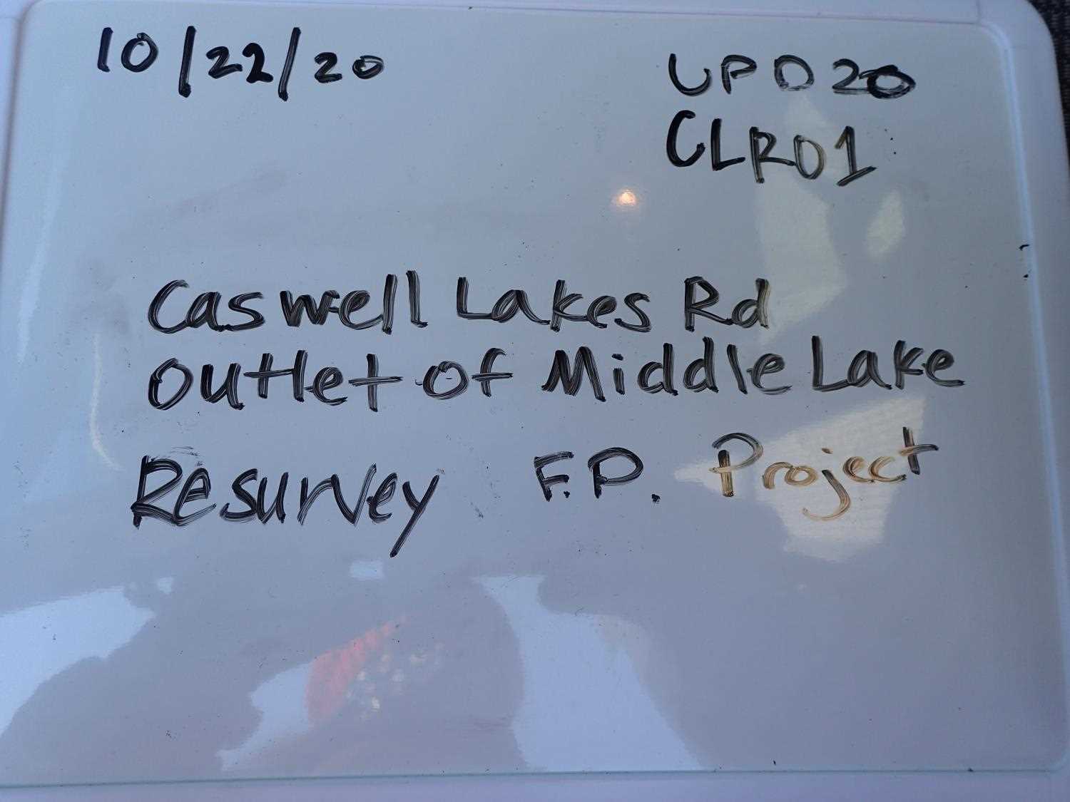
Fish Passage Site 20501461
Coordinates (dec. deg.): 62.00057°, -149.95615°
Legal Description: S022N004W14
Region: South Central
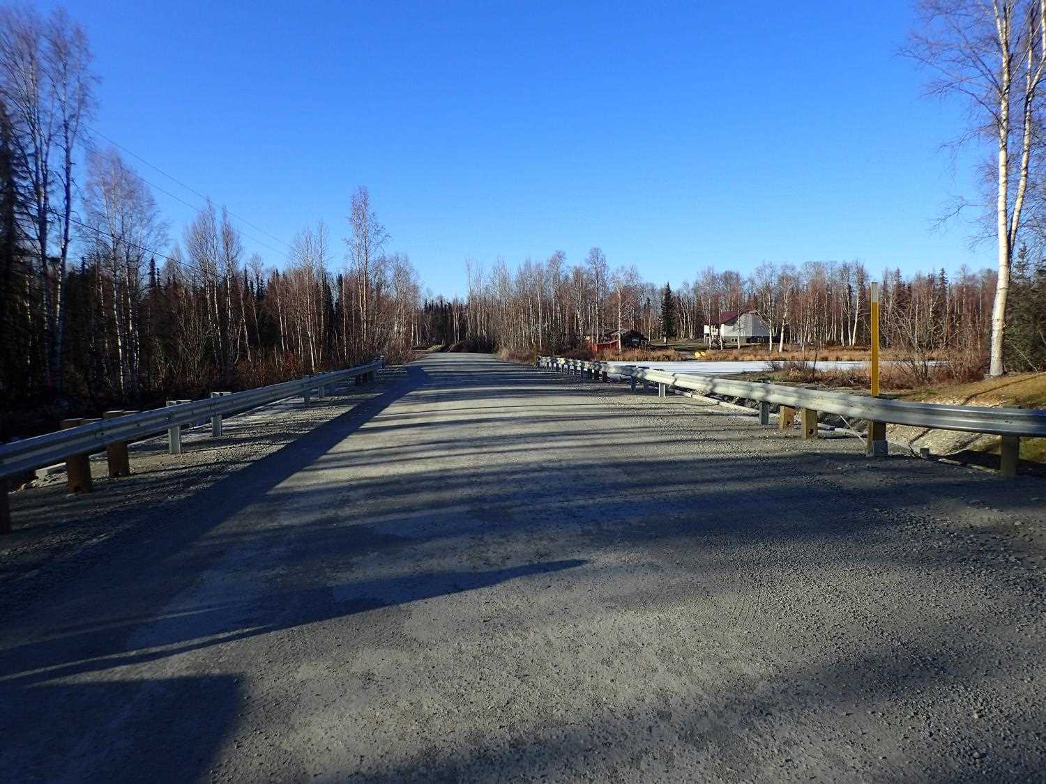
Road Name: Caswell Lakes Road
Datum: WGS84
Quad Name / ITM: Talkeetna Mts A-6
AWC Stream #: 247-41-10200-2190-3020
Stream Name: Unnamed
Elevation:
Site Comments: None
arrow to the right of the survey date below to choose a different report for this site.
Survey UPD20-CLR01
Project Supervisor: Gillian O'Doherty, Alaska Department of Fish and Game
— Anchorage, AK
Observers: Gillian O'Doherty, Kim Clark
Overall Fish Passage Rating:
Tidal: No
Backwatered: No
Step Pools: No
Construction Year: 2019
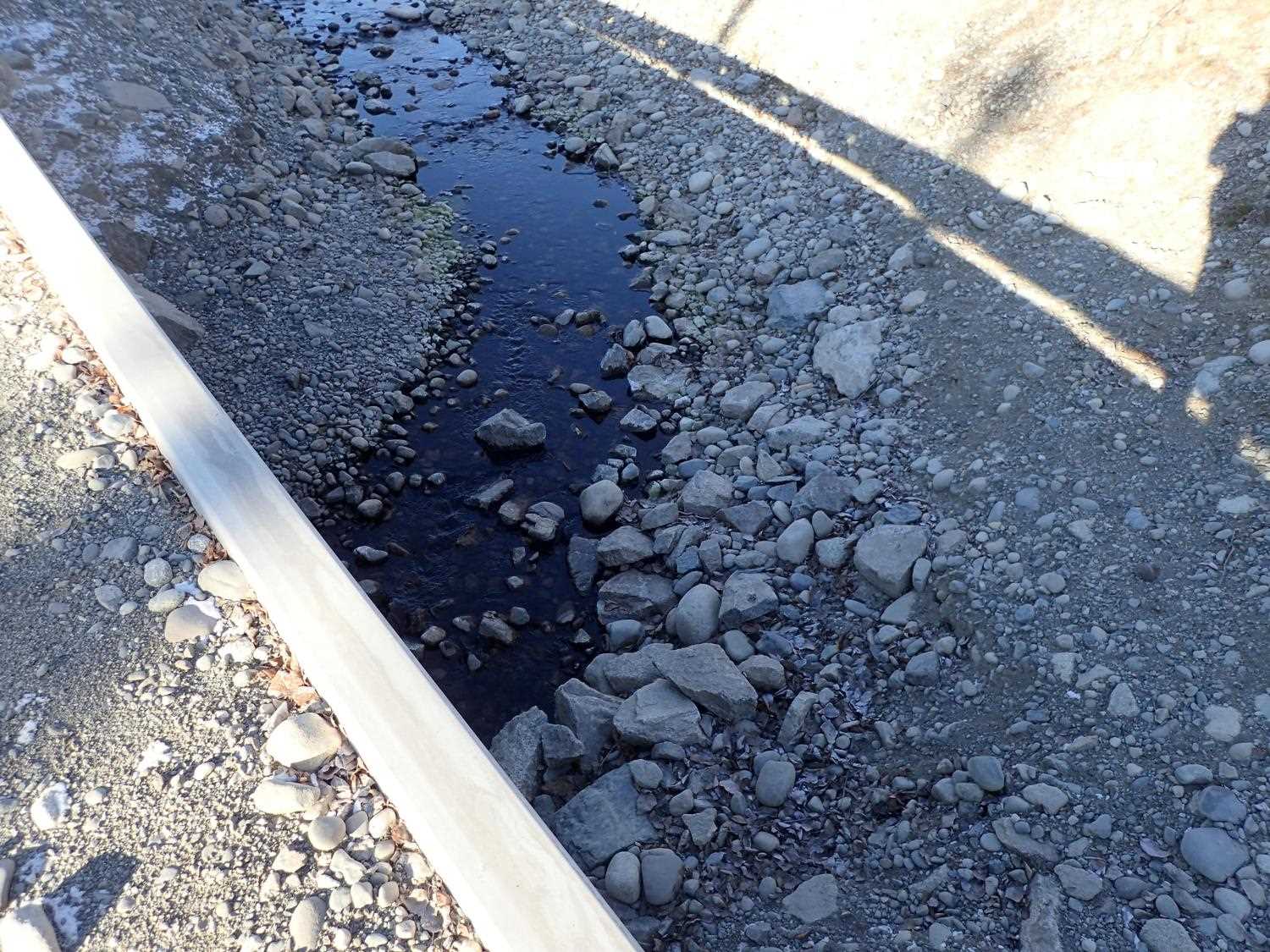
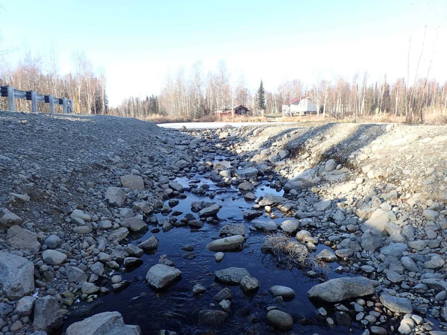
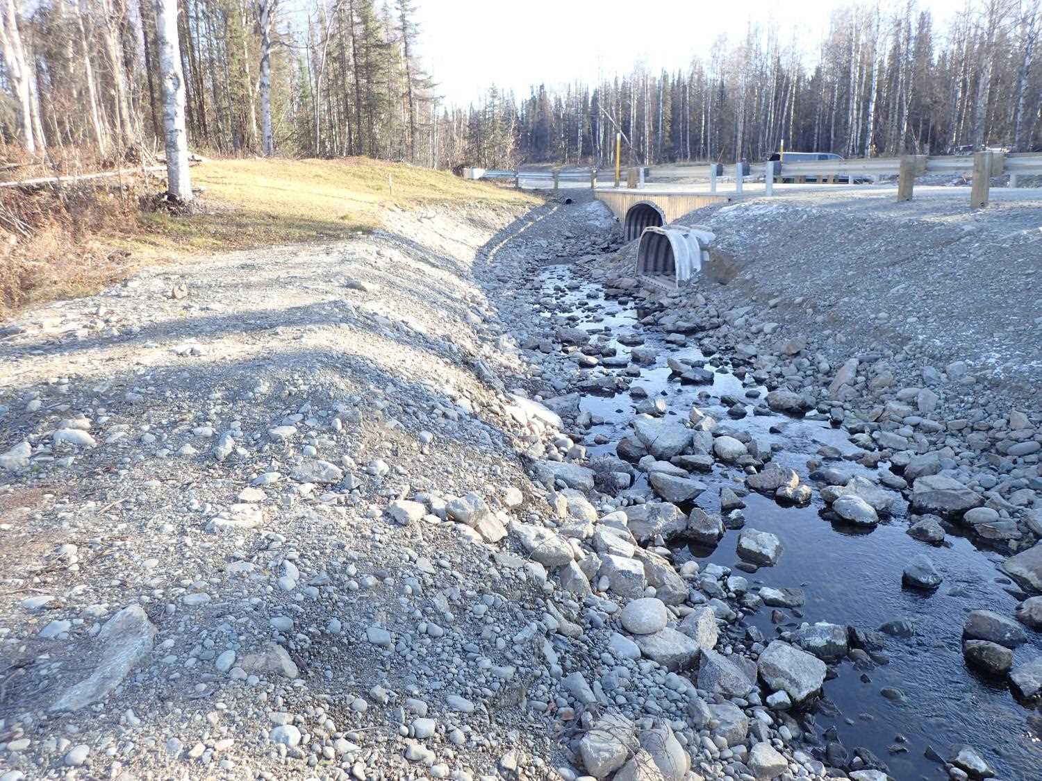
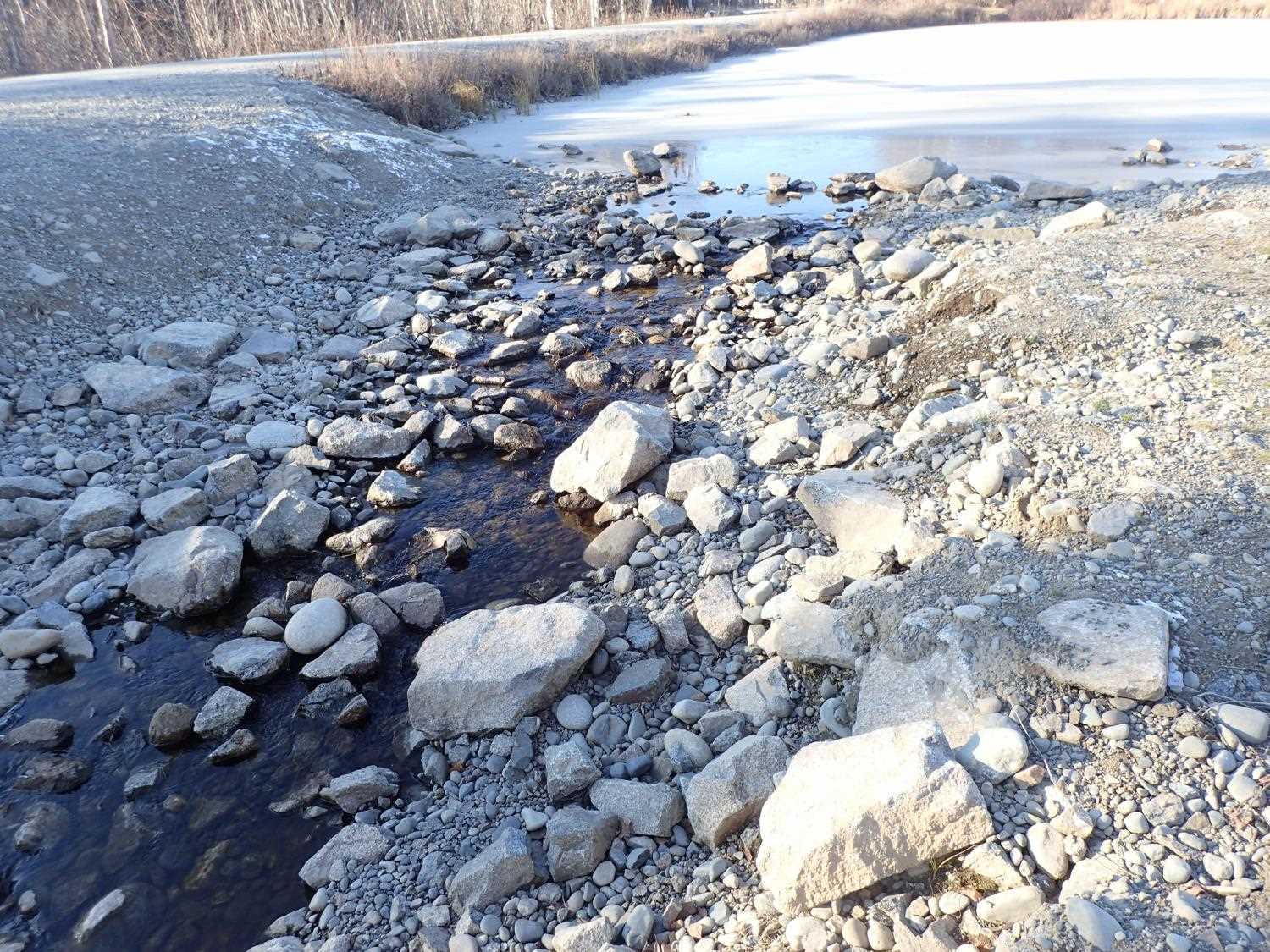
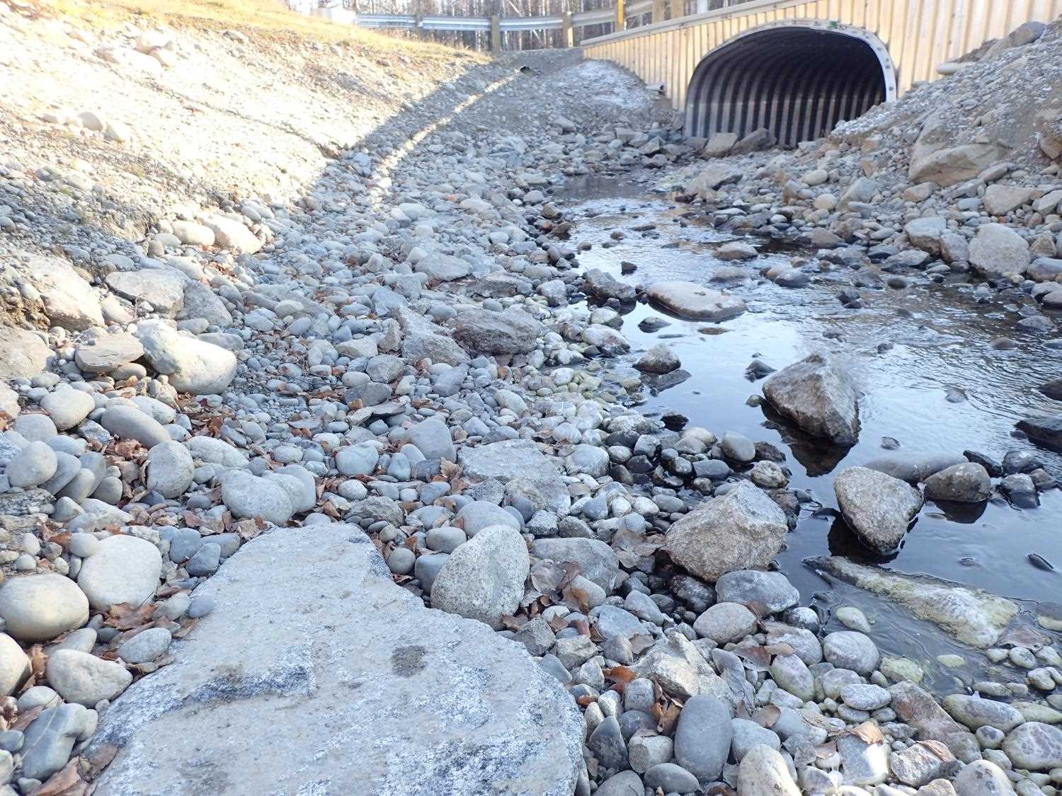
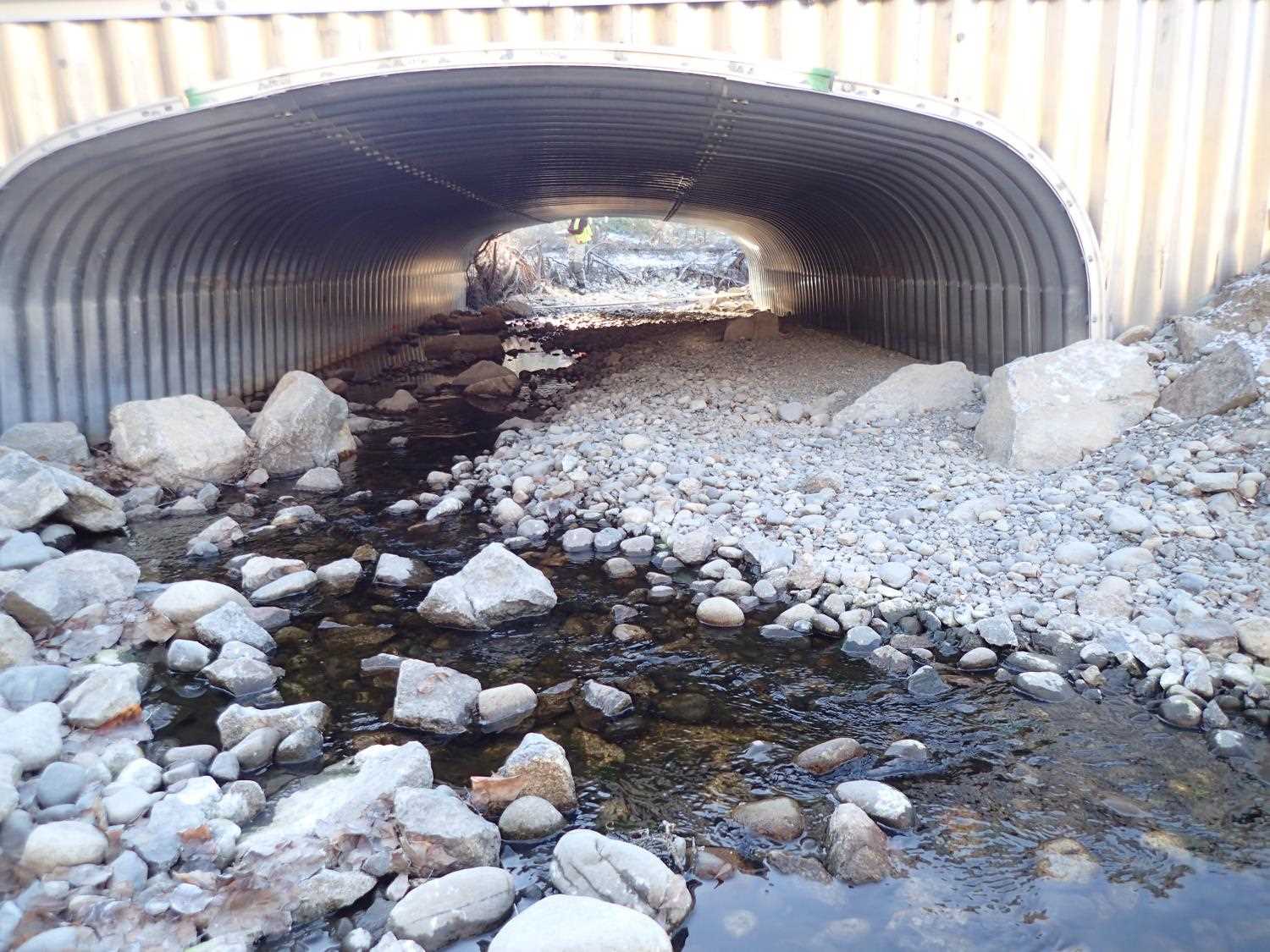
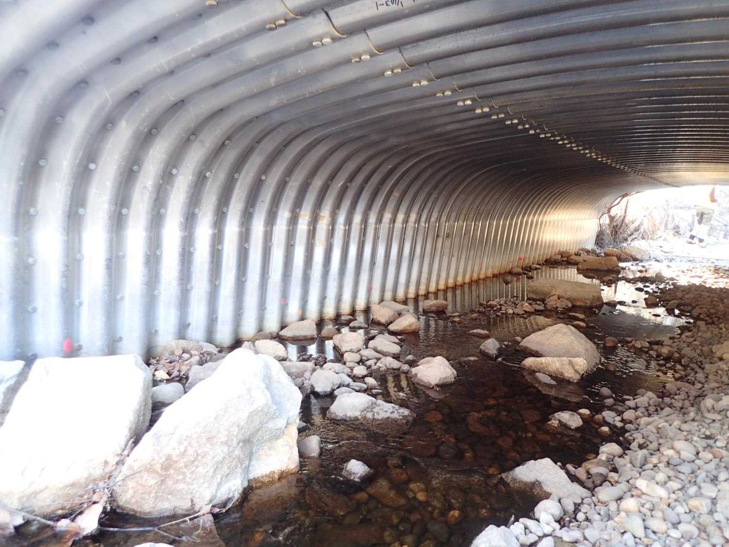
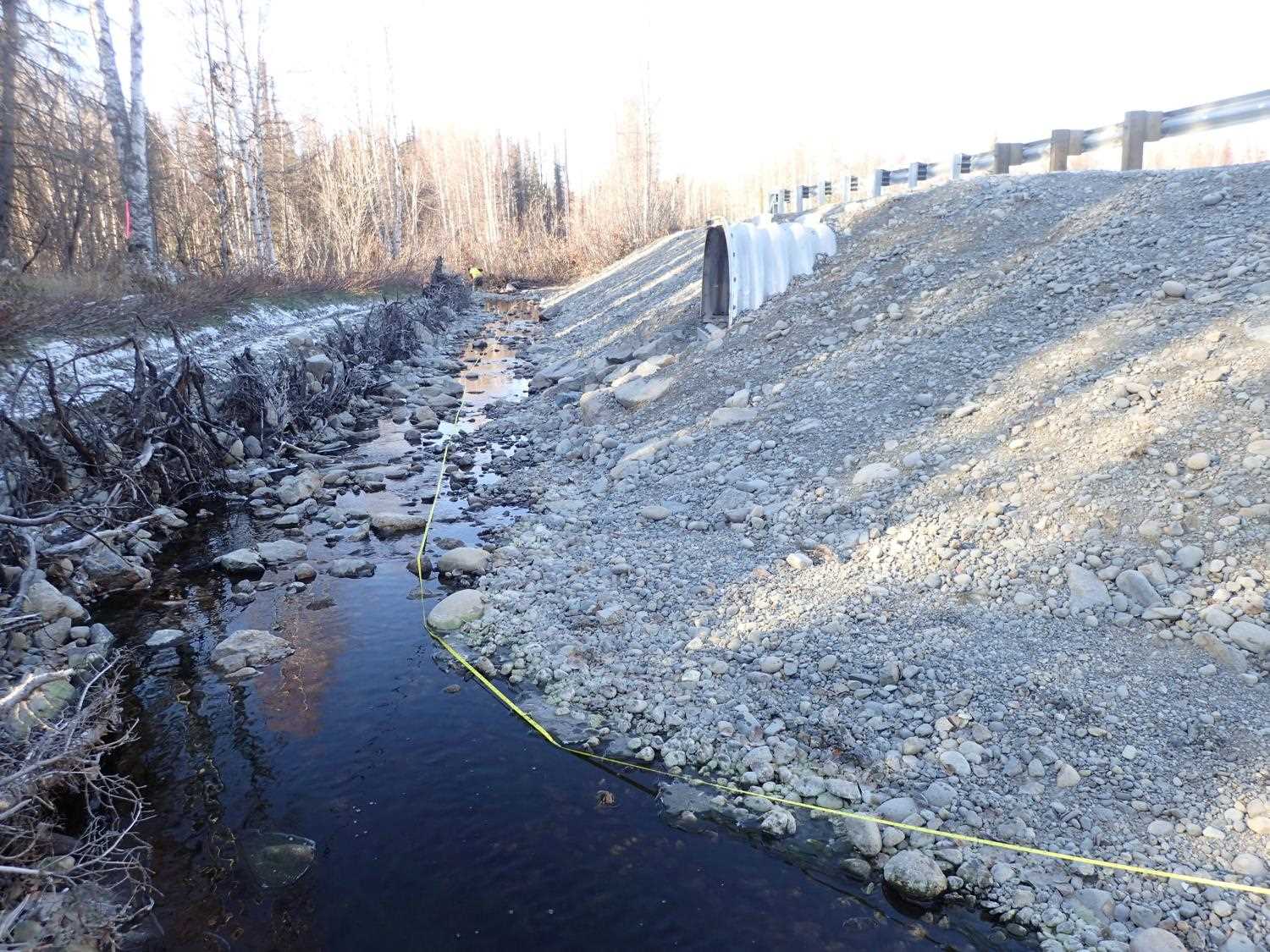
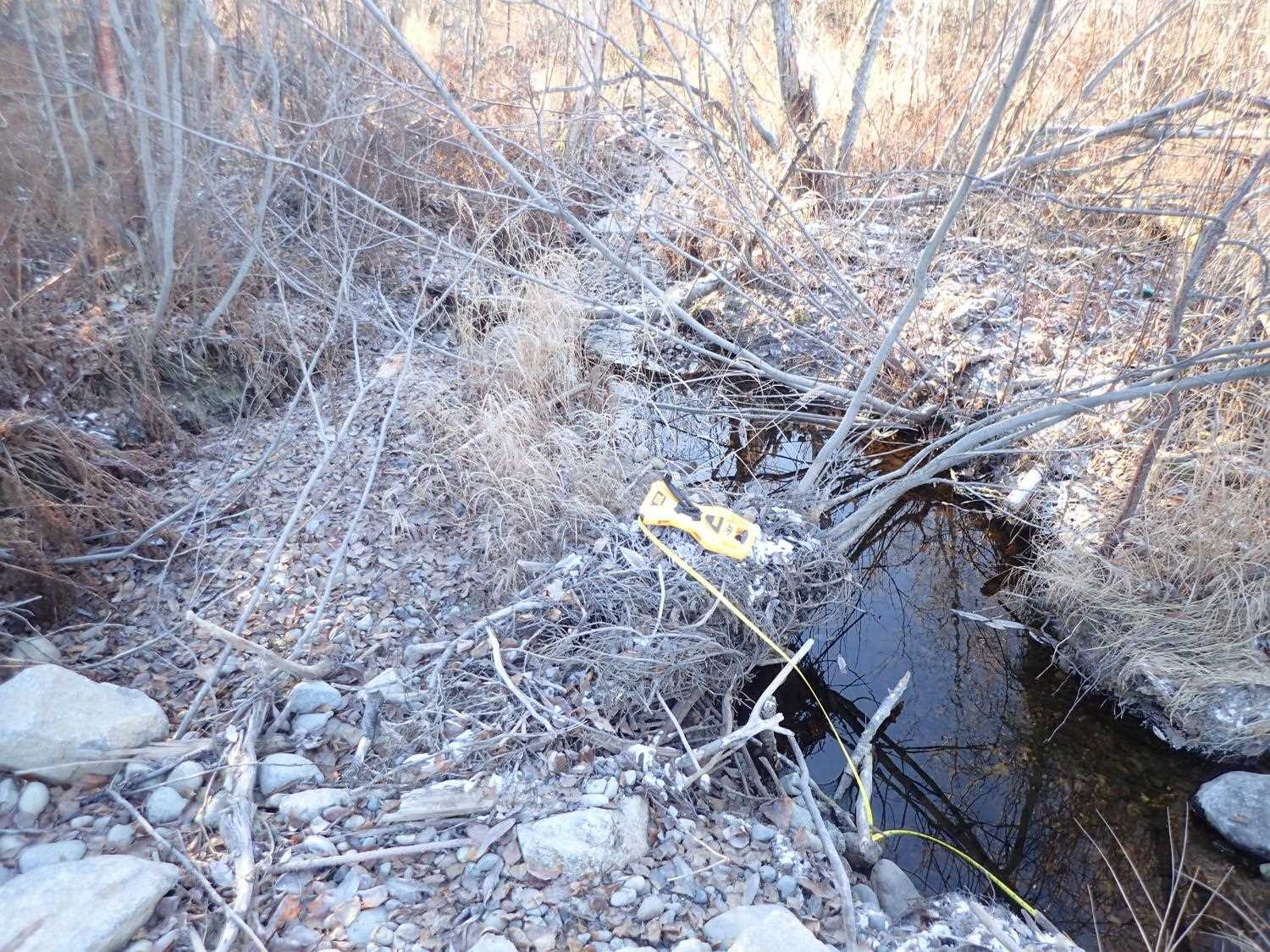
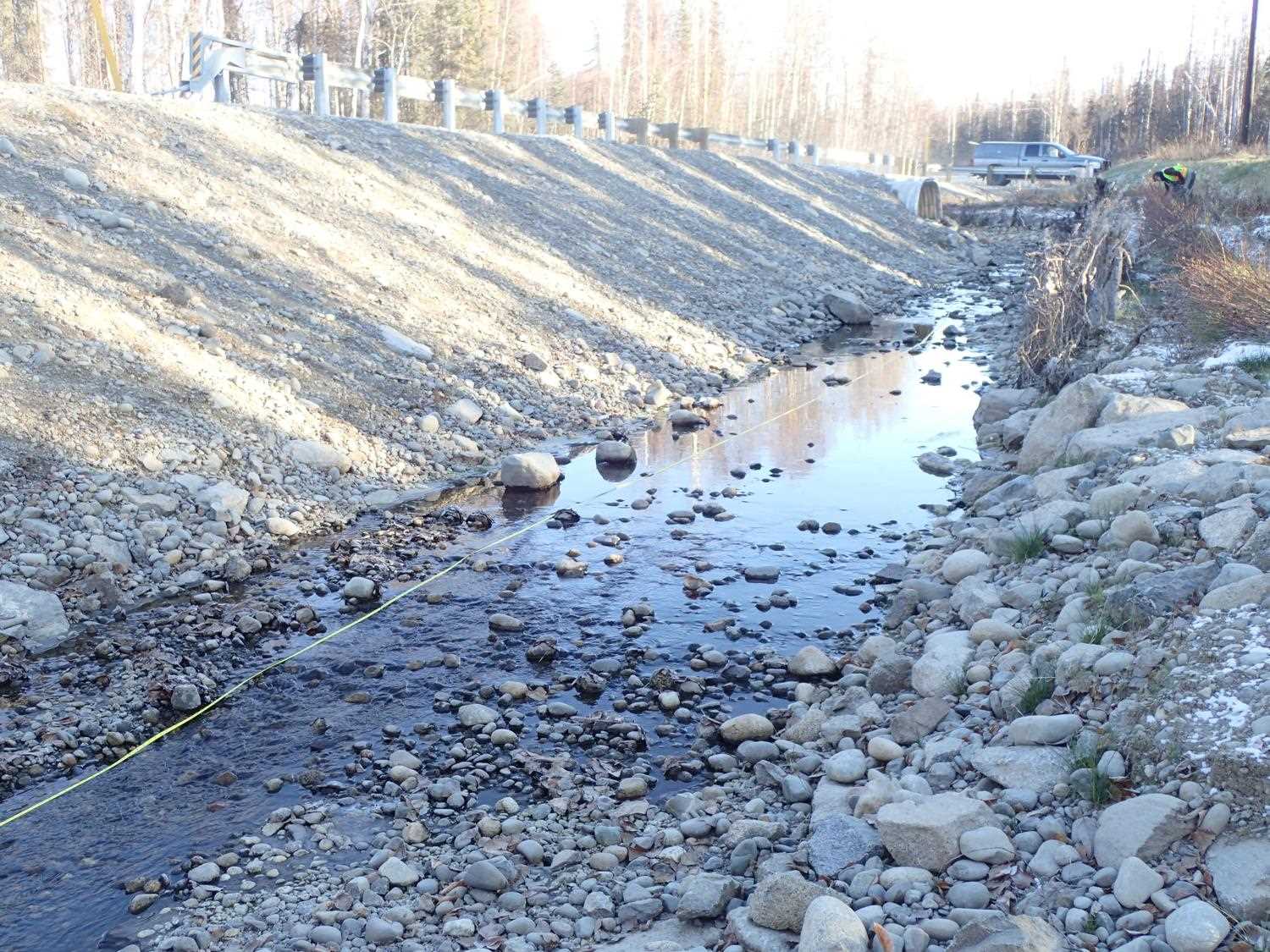
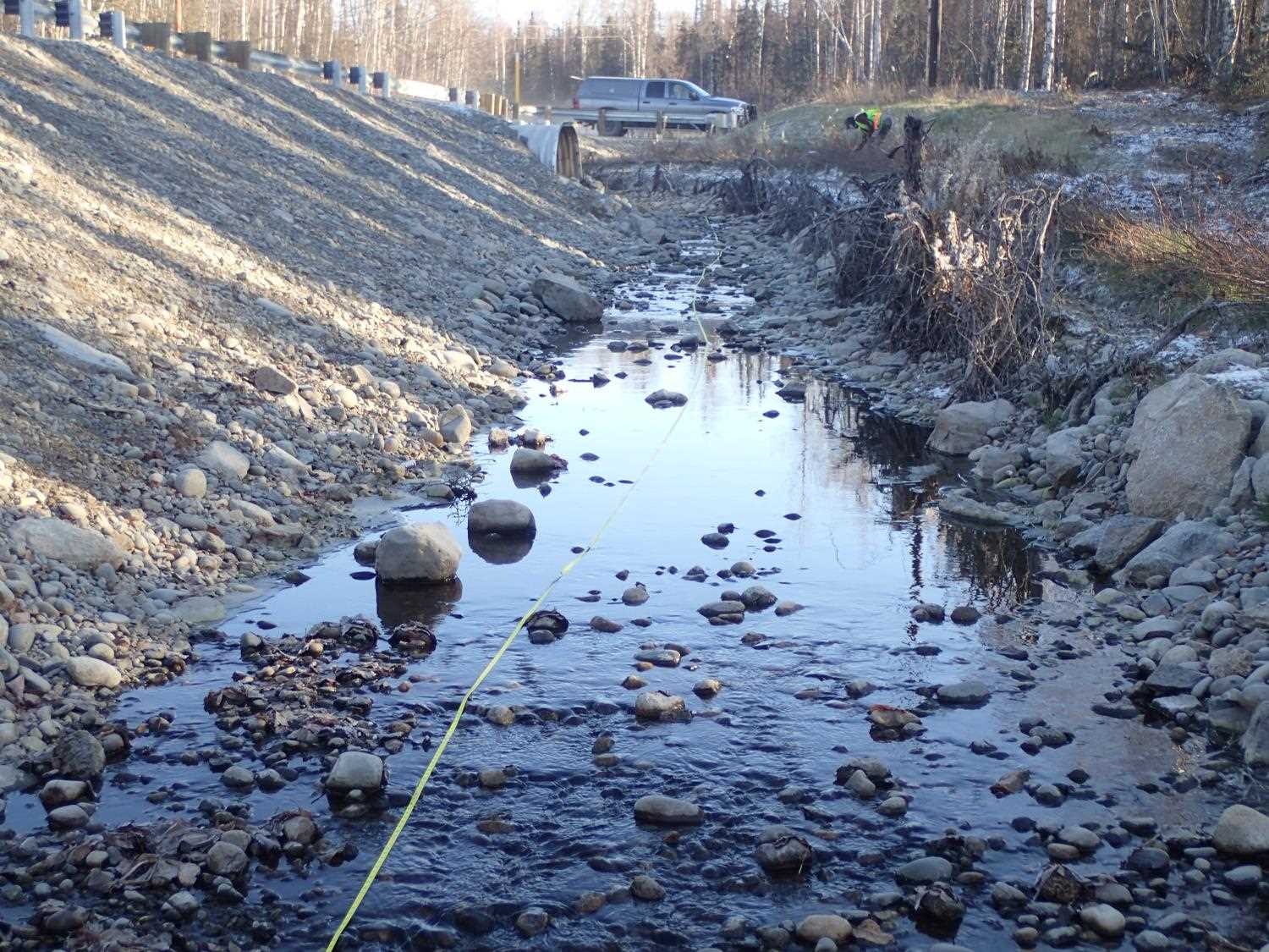
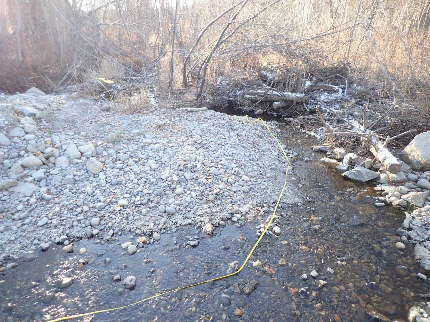
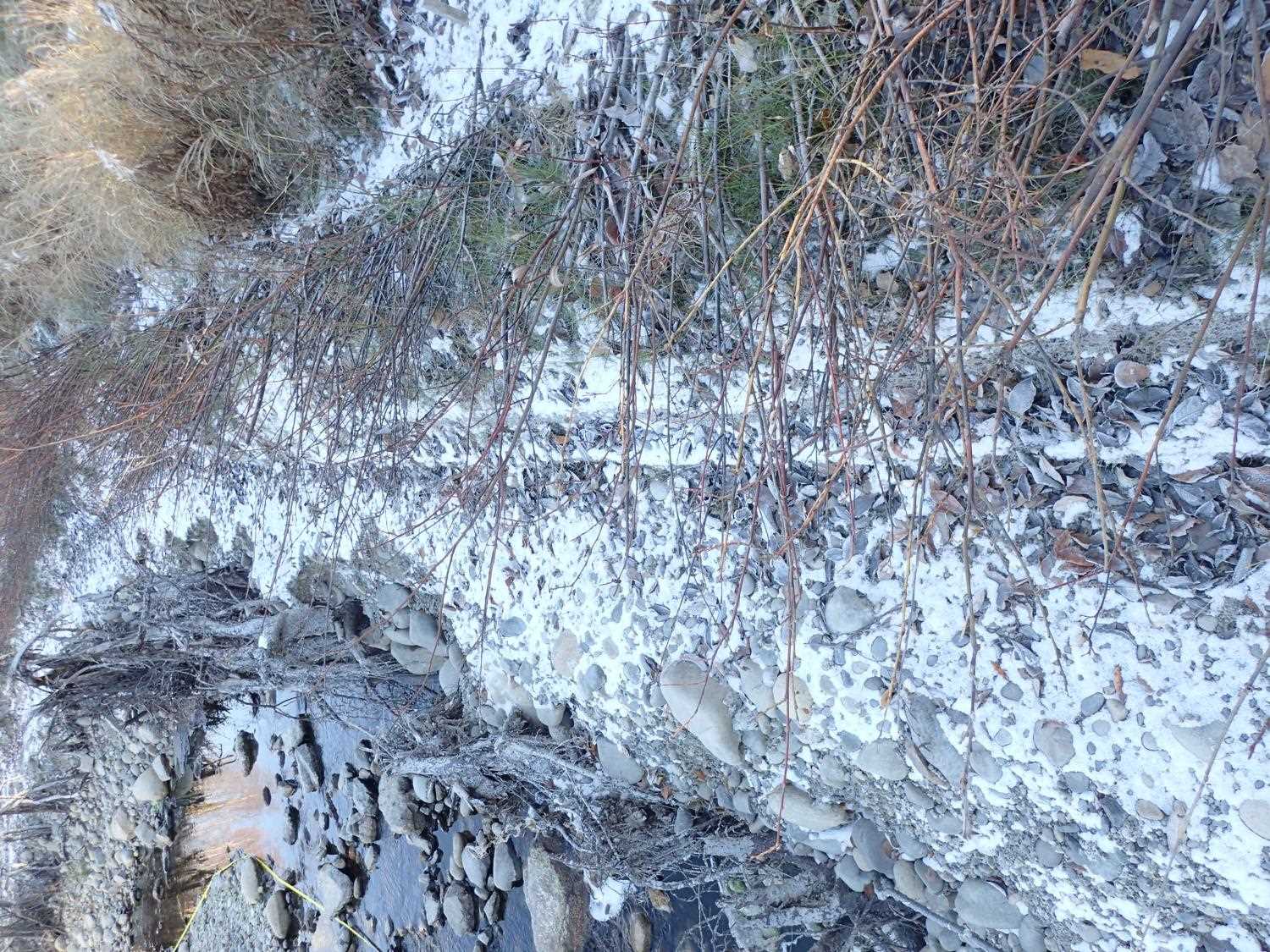
Comments: Low flow along the left edge of the pipe. Erosion on all slopes upstream and downstream. Poor willow survival. Damage to root wads just downstream of outlet. Erosion control materials not removed yet.
Culvert Measurements
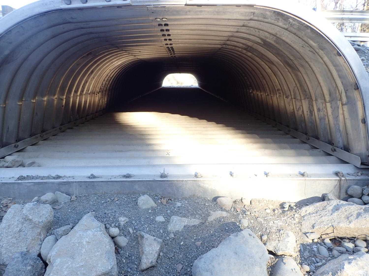
| ID: 1 | Structure Type: Box culvert (Structural aluminum plate) | Fish Passage Rating: | ||||||||||||||||||||||||||||||||||||||||||
|
|
|
||||||||||||||||||||||||||||||||||||||||||
| ID: 2 | Structure Type: Box culvert (Structural aluminum plate) | Fish Passage Rating: | |||||||||||||||||||||||||||||||||||||||||
|
|
|
|||||||||||||||||||||||||||||||||||||||||
Comments: Overflow pipe, not included in rating. |
|||||||||||||||||||||||||||||||||||||||||||
Stream Measurements
|
|
No stream width data available.
Elevations
| Locator ID | Culvert Number |
River Distance (ft)1 |
Distance From Crossing (ft)2 |
Relative Elevation (ft) |
|---|---|---|---|---|
| Outlet Invert (outlet of Pipe # 2) | 94.62 | |||
| Inlet Culvert Invert (Inlet of Pipe #2) | 94.82 | |||
| Outlet Culvert Top (measurement taken on Rib) | 98.54 | |||
| Inlet Culvert Top | 98.71 | |||
| D/S Thalweg (channel tie in) | 0.00 | 89.31 | ||
| D/S Water Surface Elev | 0.00 | 89.76 | ||
| D/S Thalweg (bottom of outlet riffle) | 27.00 | 90.30 | ||
| D/S Water Surface Elev | 27.00 | 90.41 | ||
| D/S Thalweg (below overflow outlet) | 132.00 | 91.33 | ||
| D/S Water Surface Elev | 132.00 | 91.66 | ||
| Outlet Invert (Outlet of Pipe #1) | 188.00 | 92.67 | ||
| D/S Water Surface Elev | 188.00 | 92.82 | ||
| Outlet Culvert Top | 188.00 | 98.35 | ||
| Inlet Culvert Invert (Inlet of Pipe #1) | 229.20 | 92.91 | ||
| U/S Water Surface Elev | 229.20 | 93.32 | ||
| Inlet Culvert Top | 229.20 | 99.15 | ||
| U/S Thalweg | 269.20 | 93.97 | ||
| U/S Water Surface Elev | 269.20 | 94.28 | ||
| U/S Water Surface Elev | 344.20 | 96.81 | ||
| U/S Grade Ctrl (Thalweg) | 344.20 | 96.64 | ||
| U/S Water Surface Elev | 357.20 | 96.77 | ||
| U/S Thalweg | 357.20 | 97.57 |
Notes:
- River distance is measured continuously throughout the survey reach along the thalweg of the stream.
- Measured from each end of the crossing along the thalweg of the stream.
Fish Sampling Efforts
No fish sampling occurred during this survey.
Fish Observations
No fish observations occurred during this survey.
Photos


Questions or comments about this report can be directed to dfg.dsf.webmaster@alaska.gov