Fish Passage Site 20501426
Coordinates (dec. deg.): 61.89577°, -150.07790°
Legal Description: S021N004W19
Region: South Central
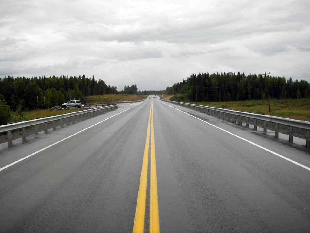
Road Name: PARKS Highway
Datum: NAD83
Quad Name / ITM: Tyonek D-1
AWC Stream #: 247-41-10200-2170-3006
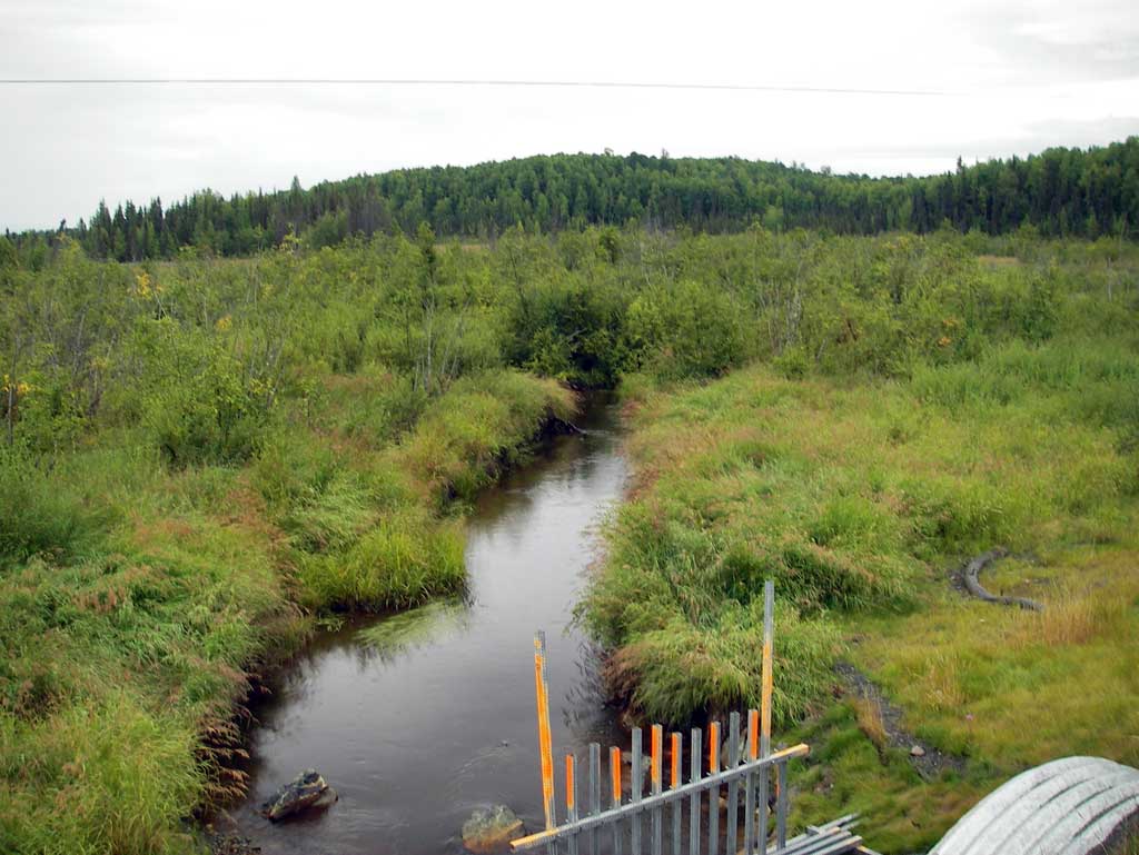
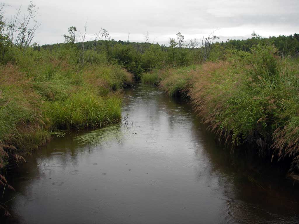
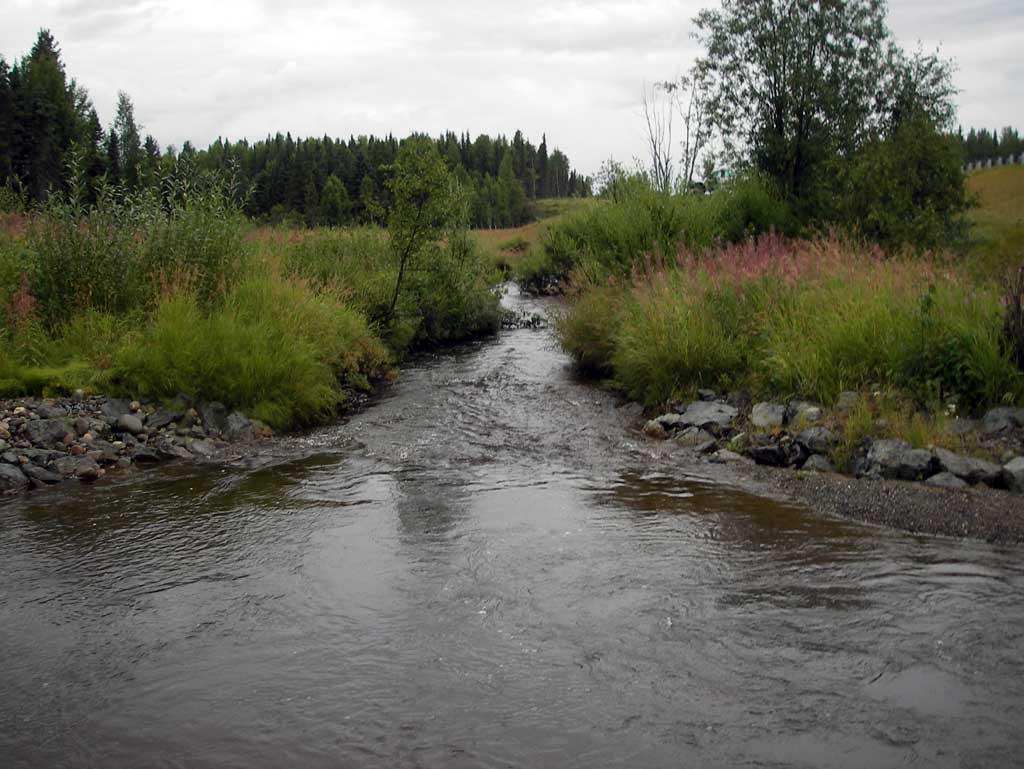
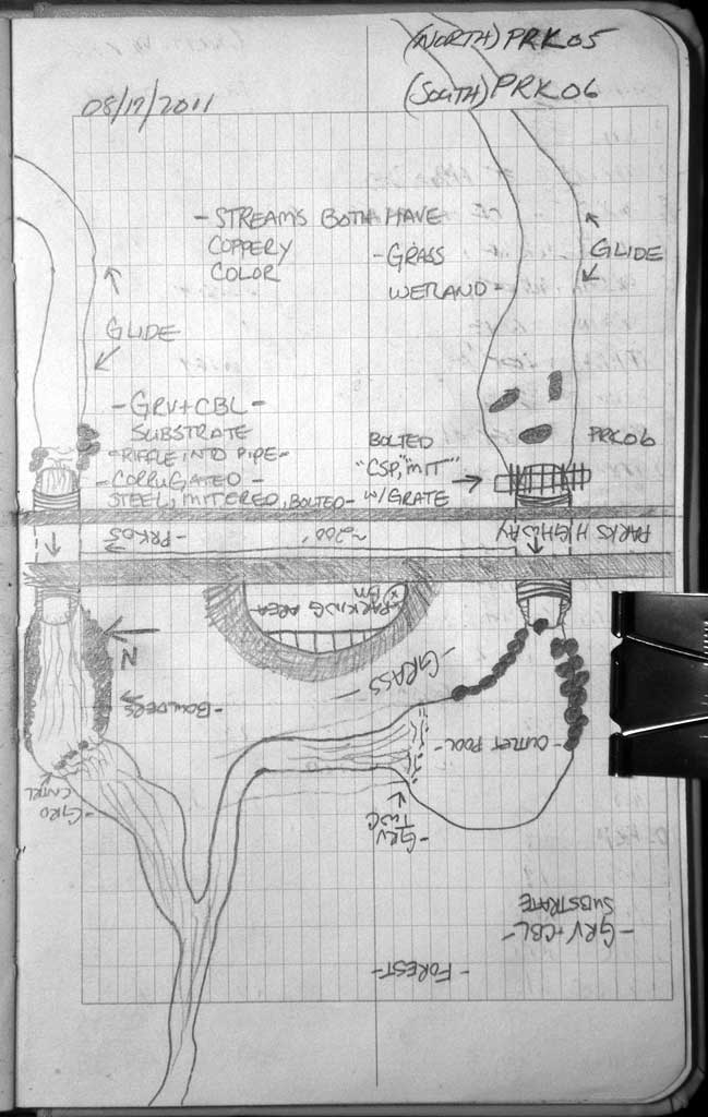
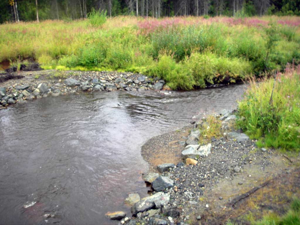
Stream Name: Grey's Creek
Elevation:
Site Comments: SUSITNA RIVER WATERSHED
arrow to the right of the survey date below to choose a different report for this site.
Survey MSB11-PRK06
Project Supervisor: Gillian O'Doherty, Alaska Department of Fish and Game
— Anchorage, AK
Observers: John Greuey, Abraham Gioffre
Overall Fish Passage Rating:
Tidal: No
Backwatered: No
Step Pools: No
Construction Year: 2010
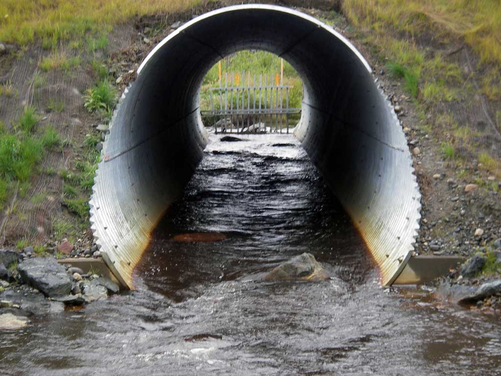
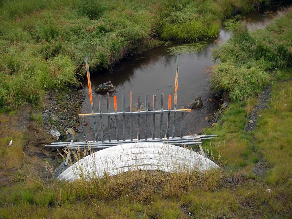
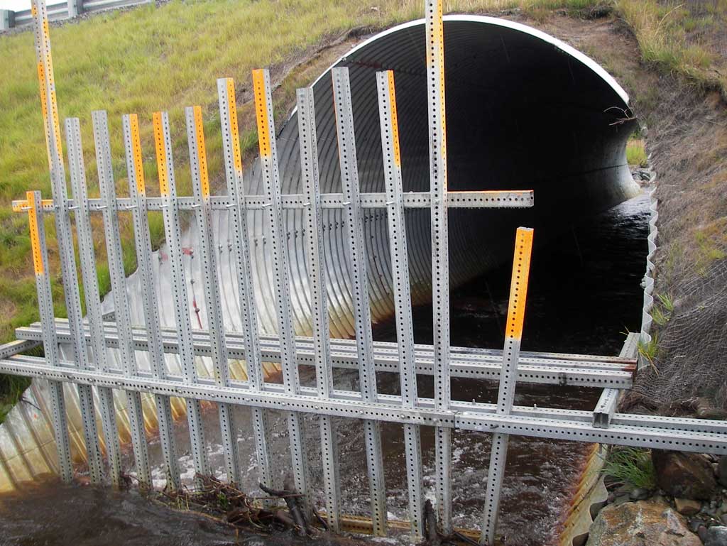
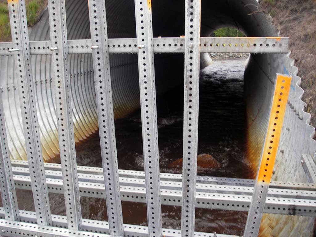
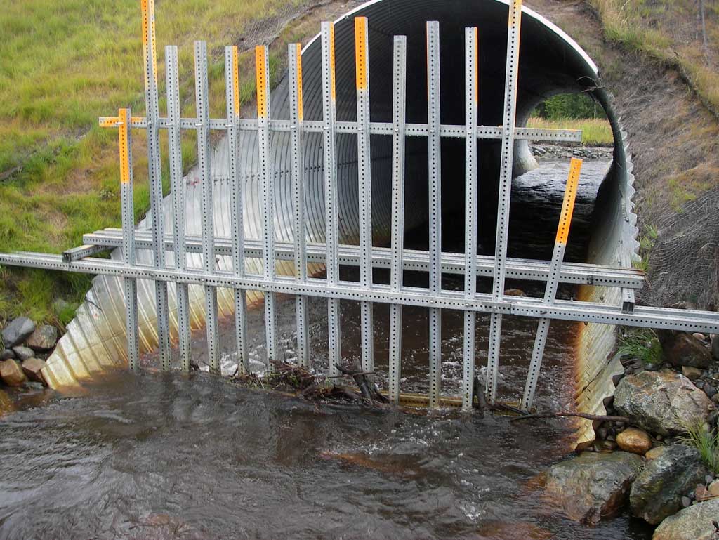
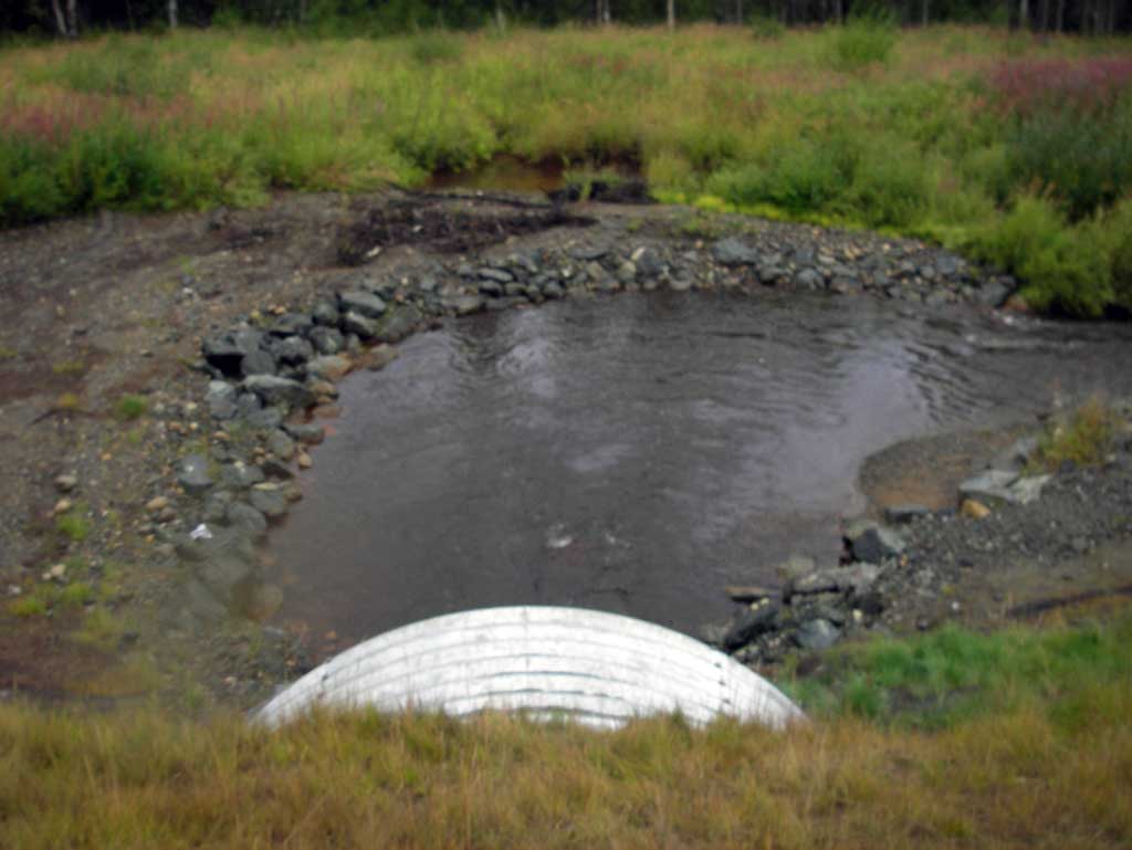
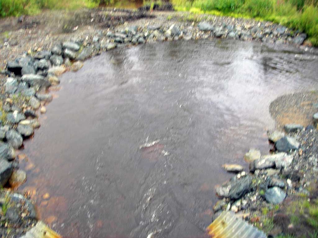
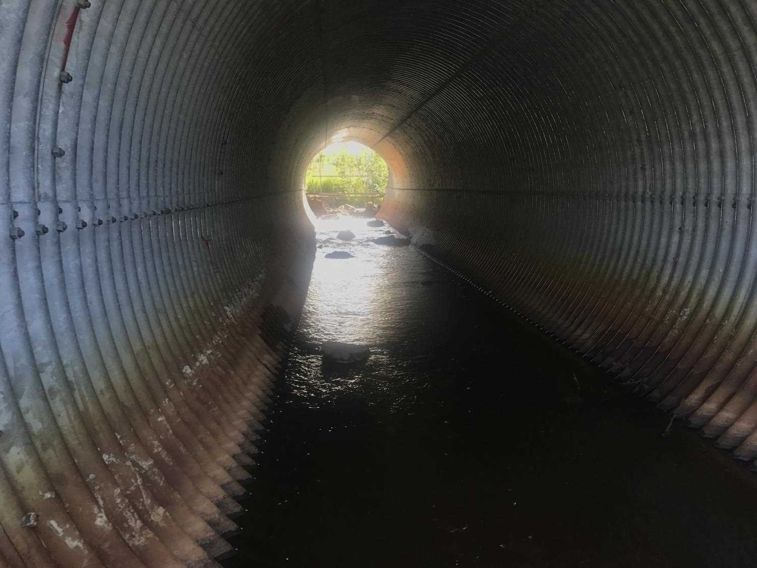
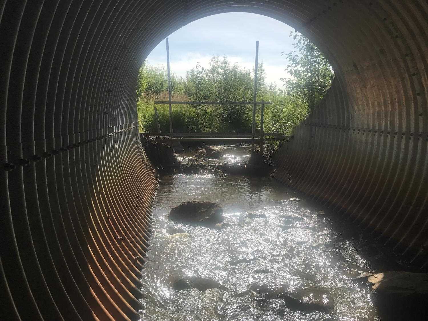
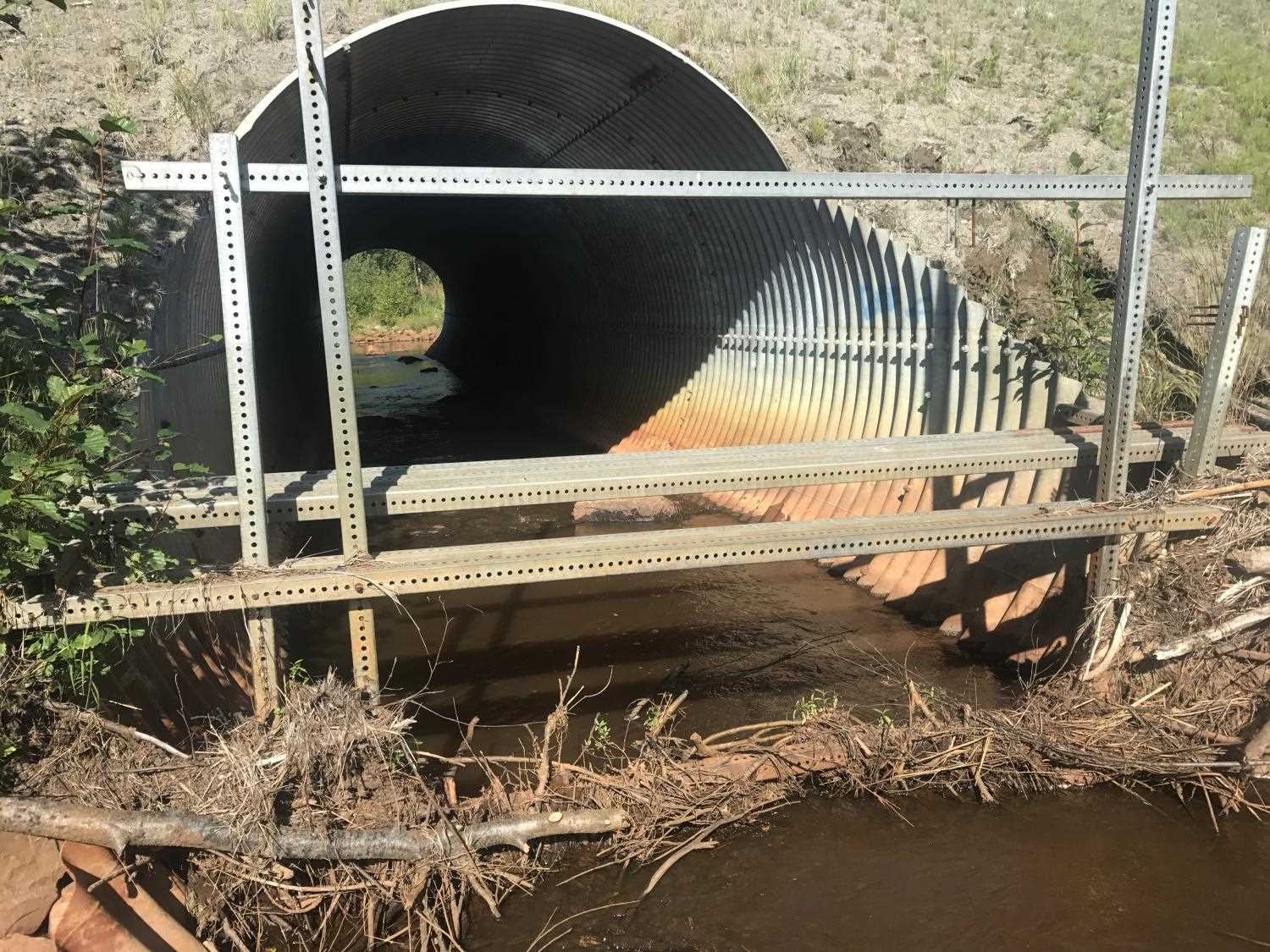
Comments: **2017: Updated photos submitted by Franklin Dekker, USFWS.*** Culvert located on one channel of Grey's Creek along the Parks Highway next to culvert PRK05 on the same creek which originates through a lowland marsh area with slough flow. Inlet has a large grate made from several vertical pieces of box tubing. Grate contains woody debris restricting some flow at inlet.
Culvert Measurements
| ID: 1 | Structure Type: Circular pipe (Structural steel plate) | Fish Passage Rating: | |||||||||||||||||||||||||||||||||||||||||
|
|
|
|||||||||||||||||||||||||||||||||||||||||
Stream Measurements
|
|
| Stream Width Type | Distance From Crossing (ft) |
Stream Width (ft) |
|---|---|---|
| Downstream ordinary high water | 83.0 | 13.50 |
| Downstream ordinary high water | 138.0 | 14.00 |
| Downstream ordinary high water | 190.0 | 12.50 |
Elevations
| Locator ID | Culvert Number |
River Distance (ft)1 |
Distance From Crossing (ft)2 |
Relative Elevation (ft) |
|---|---|---|---|---|
| D/S Water Surface Elev (Bottom of riffle. Used for stream gradient) | 0.00 | 83.33 | ||
| D/S Grade Ctrl (Thalweg) (Top of riffle) | 79.00 | 83.11 | ||
| D/S Water Surface Elev | 79.00 | 83.93 | ||
| D/S Water Surface Elev (Used for stream gradient.) | 200.00 | 84.51 | ||
| D/S Water Surface Elev (Tail water surface) | 215.00 | 84.93 | ||
| D/S Tailcrest or 1st Thalweg (Tail water control) | 215.00 | 83.81 | ||
| Max Pool Depth (Outlet pool depth) | 255.00 | 82.75 | ||
| D/S Water Surface Elev (Water surface at outlet invert) | 287.50 | 85.12 | ||
| Outlet Invert (On substrate) | 287.50 | 83.95 | ||
| Outlet Culvert Top | 287.50 | 95.32 | ||
| Road Elev | 328.00 | 101.00 | ||
| Inlet Culvert Top | 369.50 | 95.75 | ||
| Inlet Culvert Invert (On substrate) | 369.50 | 84.49 | ||
| U/S Water Surface Elev (Water surface at inlet invert) | 369.50 | 85.85 | ||
| U/S Water Surface Elev | 439.00 | 86.41 | ||
| U/S Thalweg (Profile point. Upstream glide, thalweg deeper than invert) | 439.00 | 83.56 |
Notes:
- River distance is measured continuously throughout the survey reach along the thalweg of the stream.
- Measured from each end of the crossing along the thalweg of the stream.
Fish Sampling Efforts
No fish sampling occurred during this survey.
Fish Observations
No fish observations occurred during this survey.
Photos
Questions or comments about this report can be directed to dfg.dsf.webmaster@alaska.gov