Fish Passage Site 20501425
Coordinates (dec. deg.): 61.94751°, -150.05571°
Legal Description: S022N004W32
Region: South Central
Road Name: PARKS Highway
Datum: NAD83
Quad Name / ITM: Tyonek D-1
AWC Stream #: 247-41-10200-2190
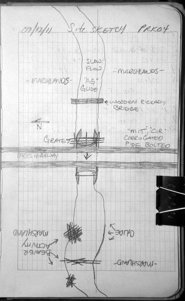
Stream Name: Caswell Creek
Elevation:
Site Comments: SUSITNA RIVER WATERSHED
arrow to the right of the survey date below to choose a different report for this site.
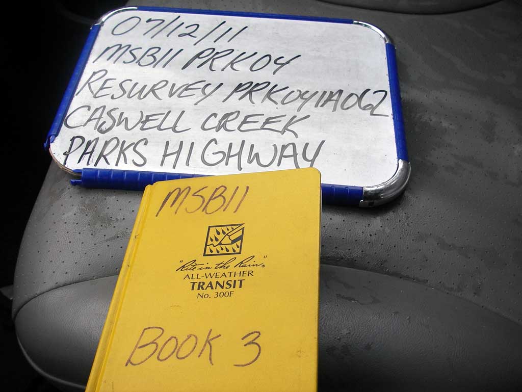
Survey MSB11-PRK04
Project Supervisor: Gillian O'Doherty, Alaska Department of Fish and Game
— Anchorage, AK
Observers: John Greuey, Abraham Gioffre
Overall Fish Passage Rating:
Tidal: No
Backwatered: Yes
Step Pools: No
Construction Year:
Site Observations:
- Constriction ratio gray
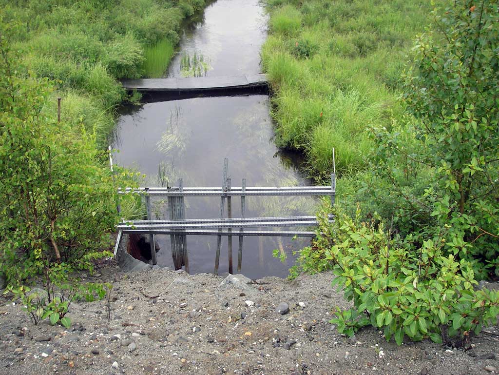
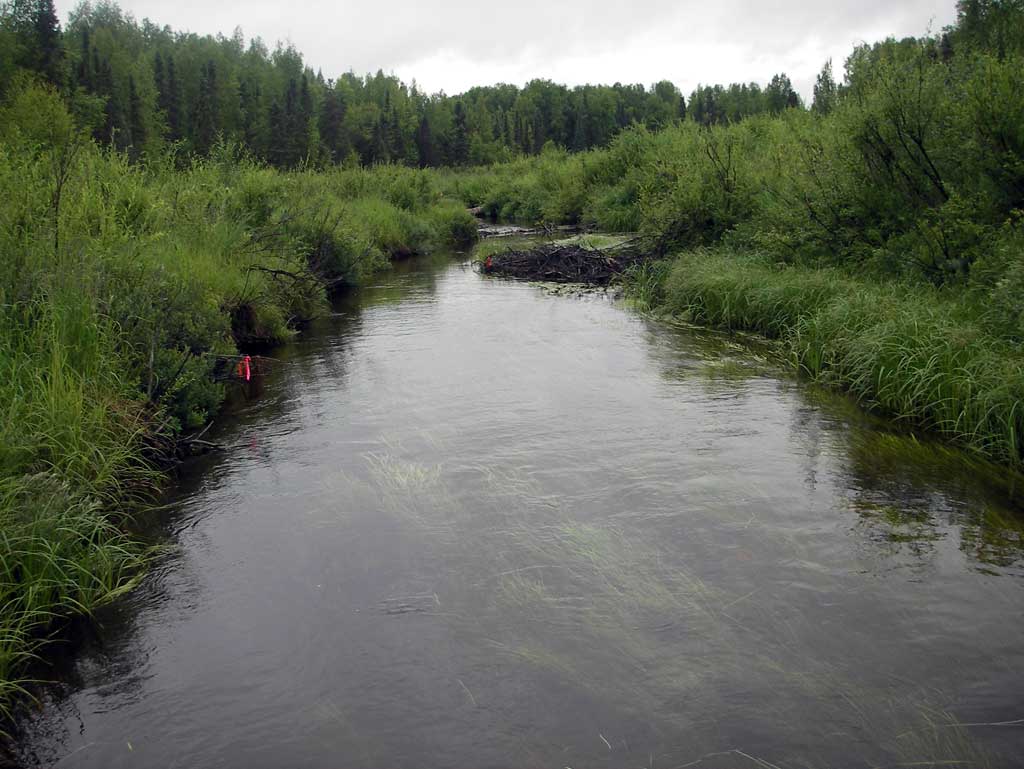
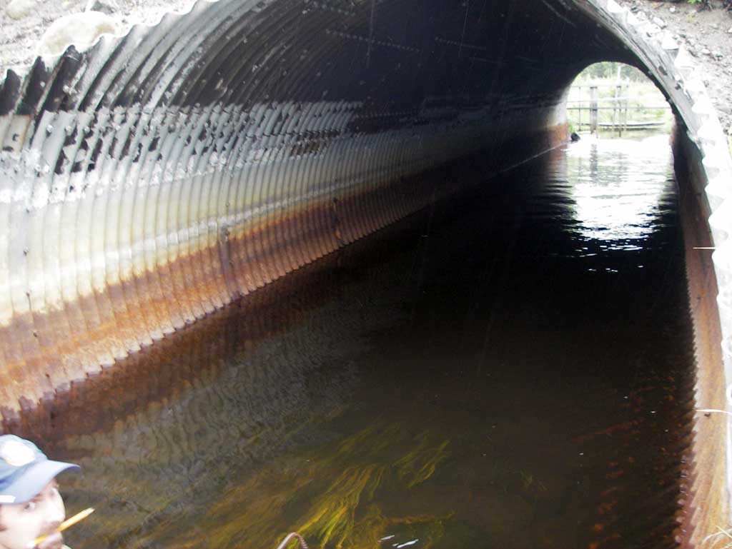
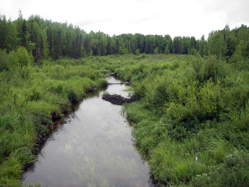
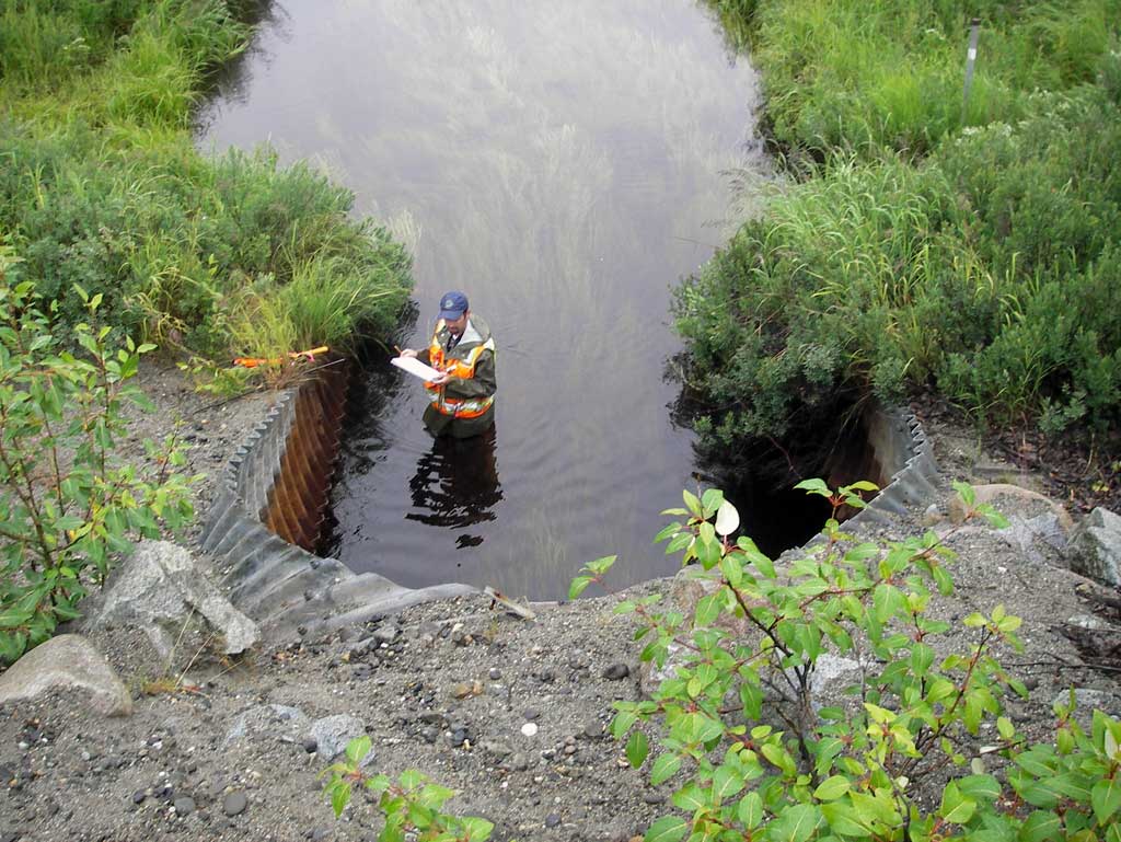
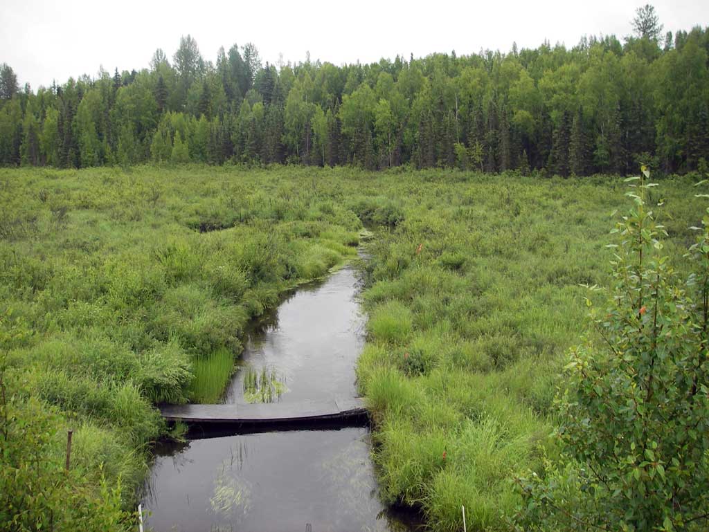
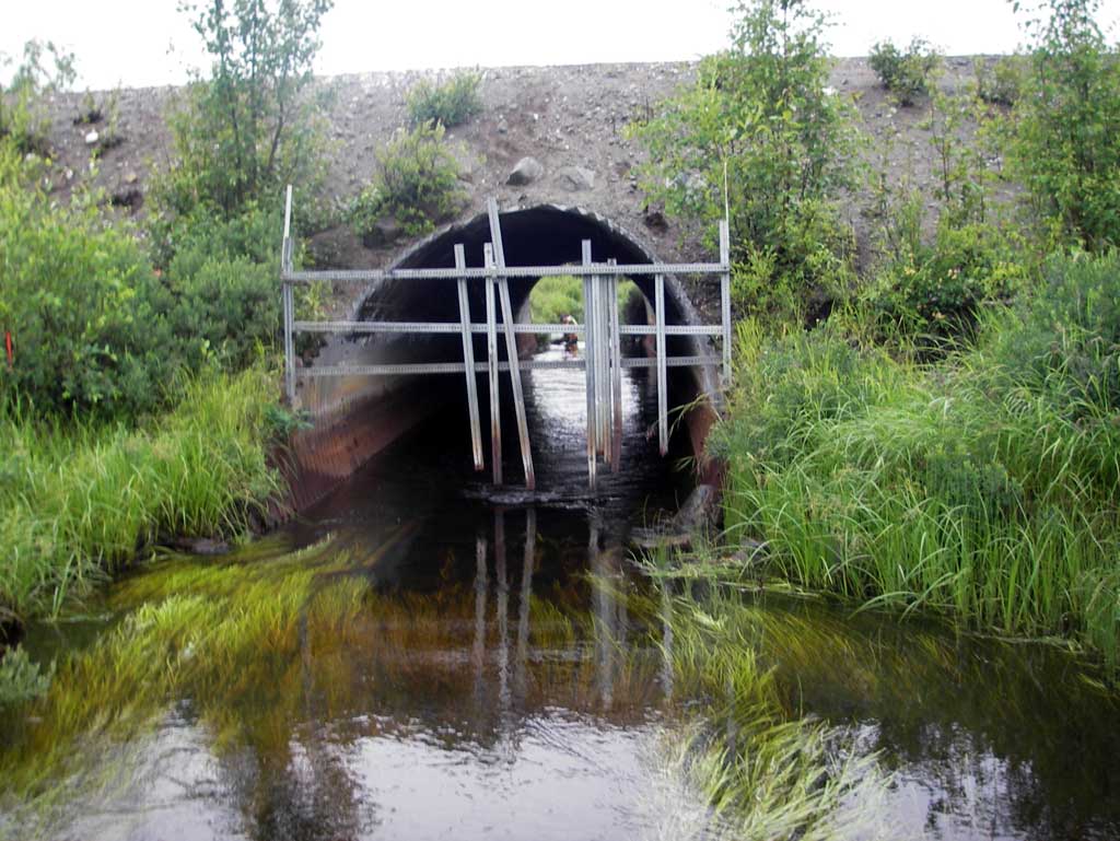
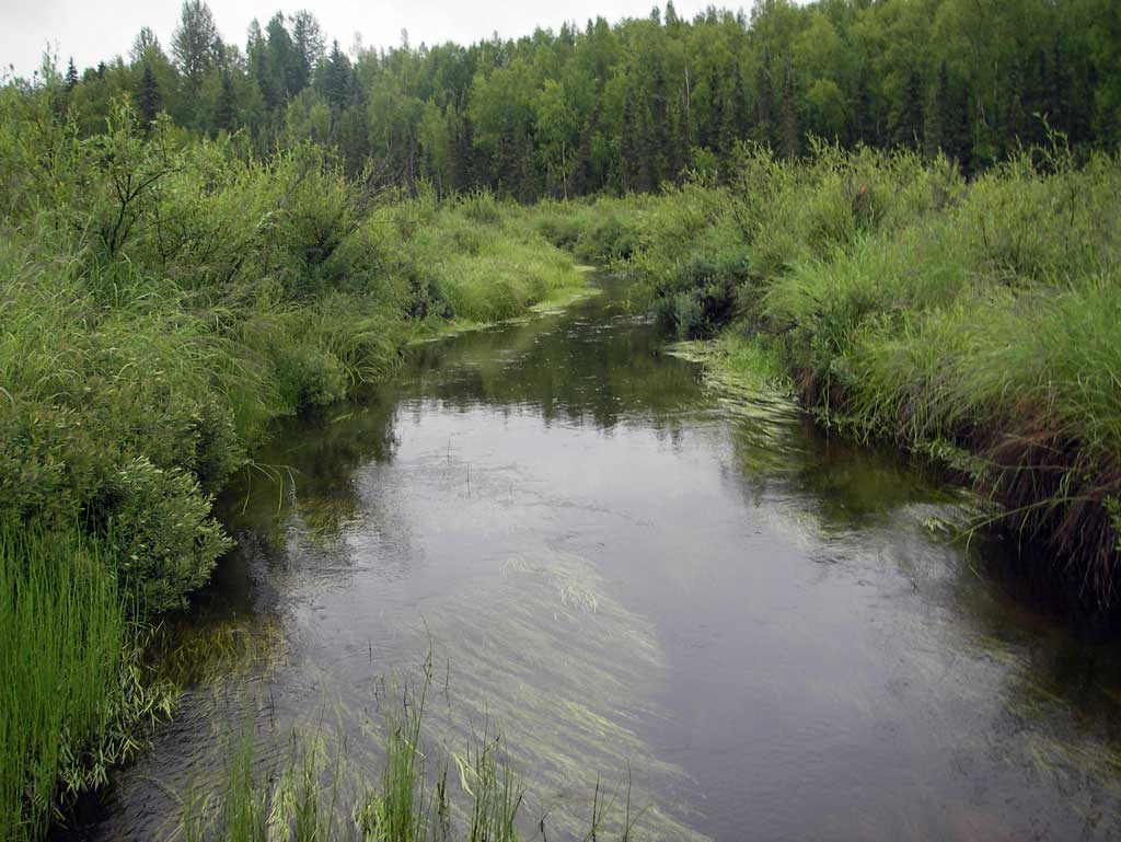
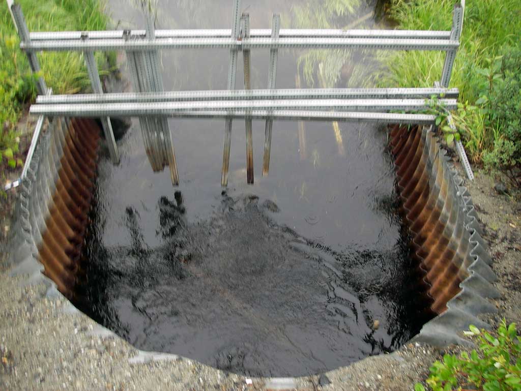
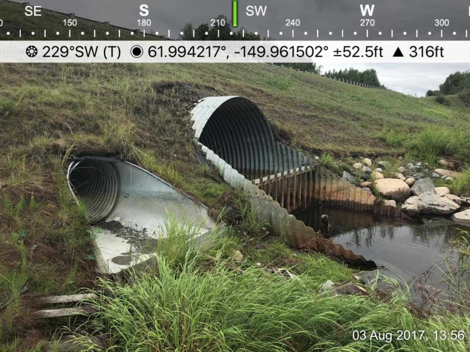
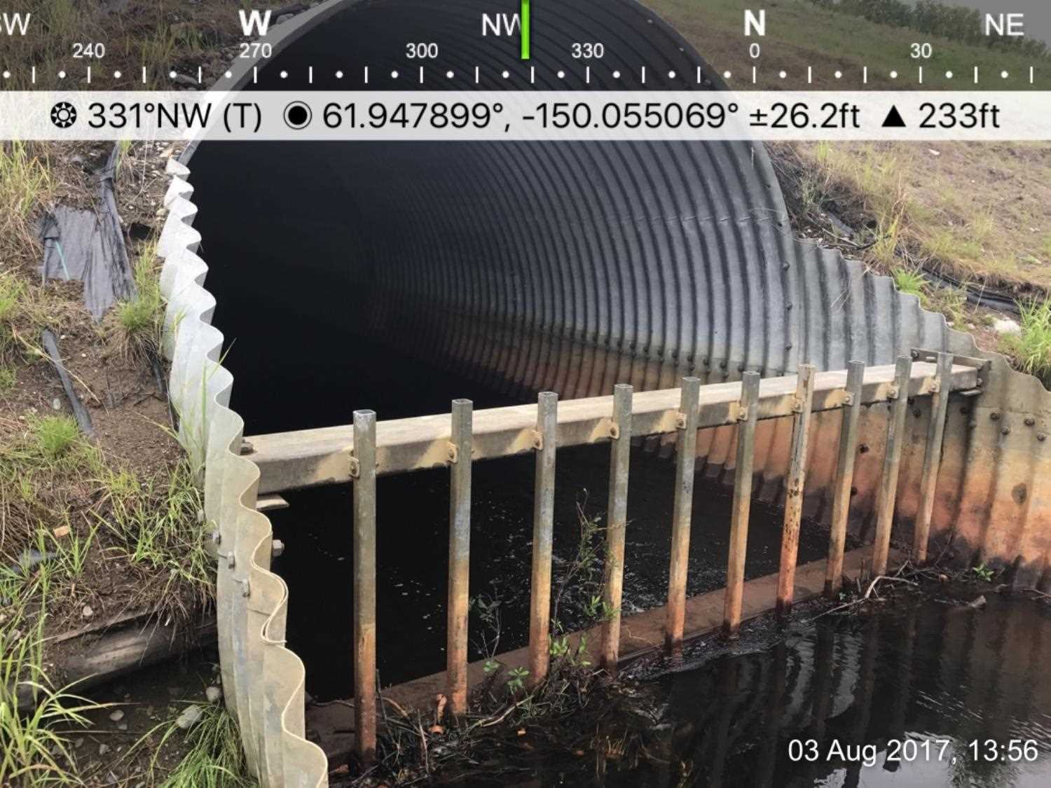
Comments: **2017: A new trash rack has been added to the inlet. Photos submitted by Heather Hanson USFWS.** Upst and Dwst areas are gentle glide areas meandering through lowlands marsh with slough flow. Water surface at inlets and outlets are equal making the site Backwatered.
Culvert Measurements
| ID: 1 | Structure Type: Circular pipe (Structural steel plate) | Fish Passage Rating: | |||||||||||||||||||||||||||||||||||||||||
|
|
|
|||||||||||||||||||||||||||||||||||||||||
Culvert Observations:
|
|||||||||||||||||||||||||||||||||||||||||||
Stream Measurements
|
|
| Stream Width Type | Distance From Crossing (ft) |
Stream Width (ft) |
|---|---|---|
| Downstream ordinary high water | 16.0 | 22.50 |
| Downstream ordinary high water | 66.0 | 24.50 |
| Downstream ordinary high water | 104.0 | 21.50 |
Elevations
| Locator ID | Culvert Number |
River Distance (ft)1 |
Distance From Crossing (ft)2 |
Relative Elevation (ft) |
|---|---|---|---|---|
| D/S Thalweg (Profile point. Glide in downstream slough.) | 0.00 | 89.16 | ||
| D/S Water Surface Elev (Used for Stream Grade) | 0.00 | 92.73 | ||
| D/S Water Surface Elev | 142.00 | 93.00 | ||
| D/S Thalweg (Profile point. Mid point of downstream glide.) | 142.00 | 90.25 | ||
| D/S Thalweg (Profile point. End of apron/miter.) | 240.00 | 90.26 | ||
| D/S Water Surface Elev (Used for stream grade) | 240.00 | 93.07 | ||
| D/S Water Surface Elev (Water surface at outlet invert.) | 262.00 | 93.08 | ||
| Outlet Culvert Top | 262.00 | 101.33 | ||
| Outlet Invert | 262.00 | 90.07 | ||
| Road Elev | 312.00 | 108.35 | ||
| Inlet Culvert Top | 325.55 | 101.62 | ||
| U/S Water Surface Elev (Water surface at inlet invert.) | 325.55 | 93.07 | ||
| Inlet Culvert Invert | 325.55 | 89.23 | ||
| U/S Thalweg (Profile point. Thalweg in upstream glide.) | 375.55 | 90.94 | ||
| U/S Water Surface Elev | 375.55 | 93.15 |
Notes:
- River distance is measured continuously throughout the survey reach along the thalweg of the stream.
- Measured from each end of the crossing along the thalweg of the stream.
Fish Sampling Efforts
| Gear Type: Minnow Trap (A) | Trap Duration(h): 1.33 | |
| Comments: No fish caught | ||
Fish Observations
No fish observations occurred during this survey.
Photos
Questions or comments about this report can be directed to dfg.dsf.webmaster@alaska.gov