Fish Passage Site 20501421
Coordinates (dec. deg.): 62.06127°, -150.06006°
Legal Description: S023N004W29
Region: South Central
Road Name: PARKS Highway
Datum: NAD83
Quad Name / ITM: Talkeetna A-1
AWC Stream #: 247-41-10200-2230
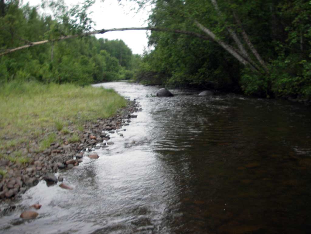
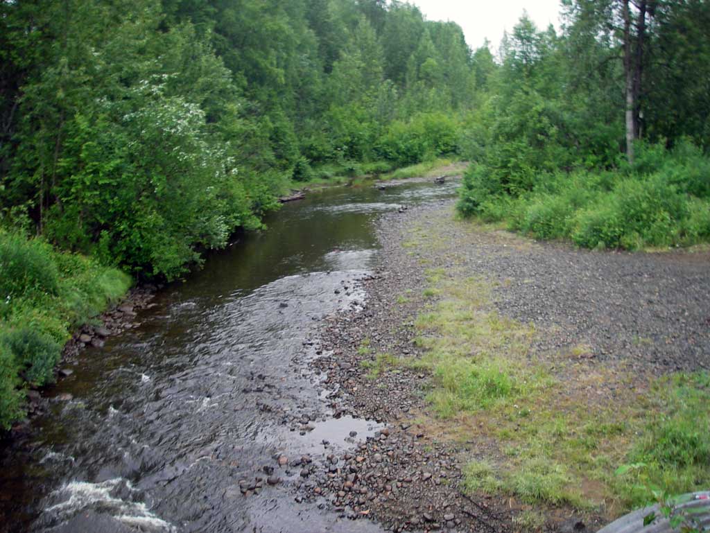
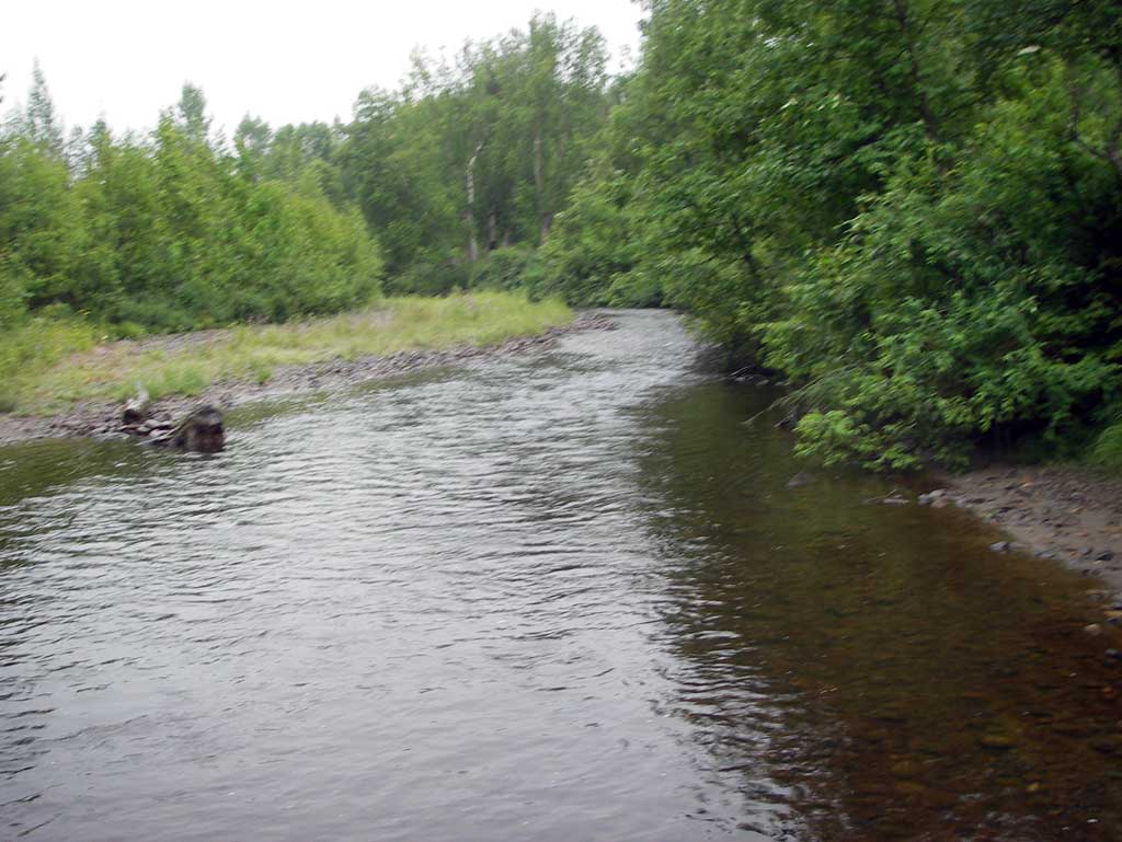
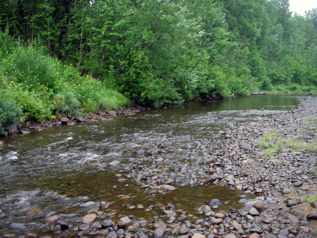
Stream Name: Goose Creek
Elevation:
Site Comments: SUSITNA RIVER WATERSHED
arrow to the right of the survey date below to choose a different report for this site.
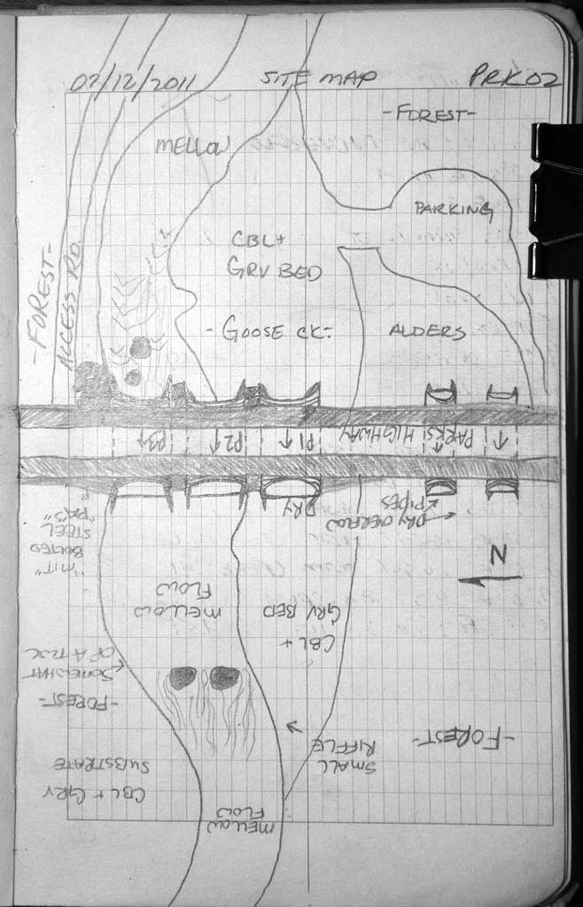
Survey MSB11-PRK02
Project Supervisor: Gillian O'Doherty, Alaska Department of Fish and Game
— Anchorage, AK
Observers: John Greuey, Abraham Gioffre
Overall Fish Passage Rating:
Tidal: No
Backwatered: No
Step Pools: No
Construction Year:
Site Observations:
- Constriction ratio red
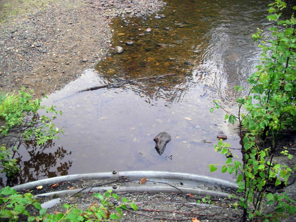
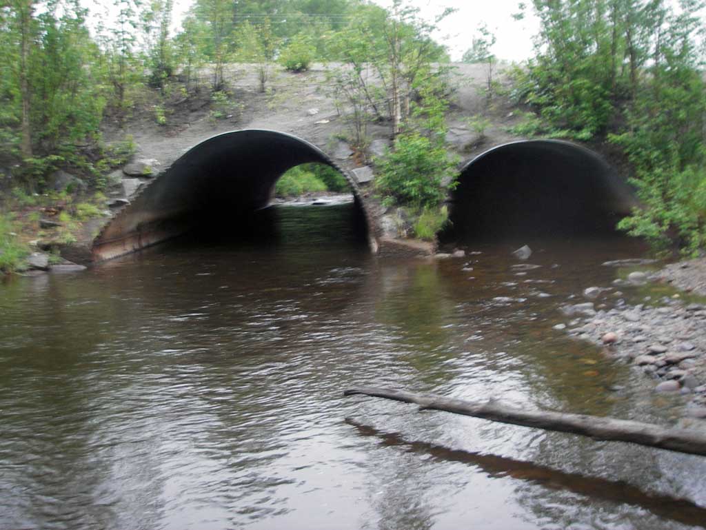
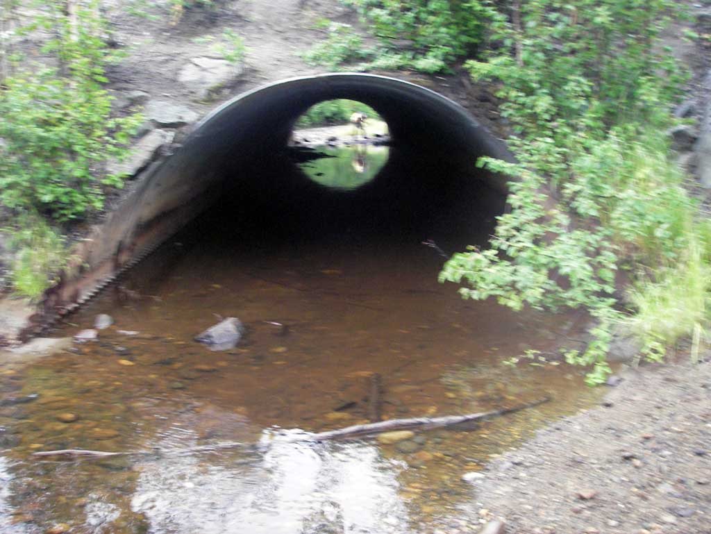
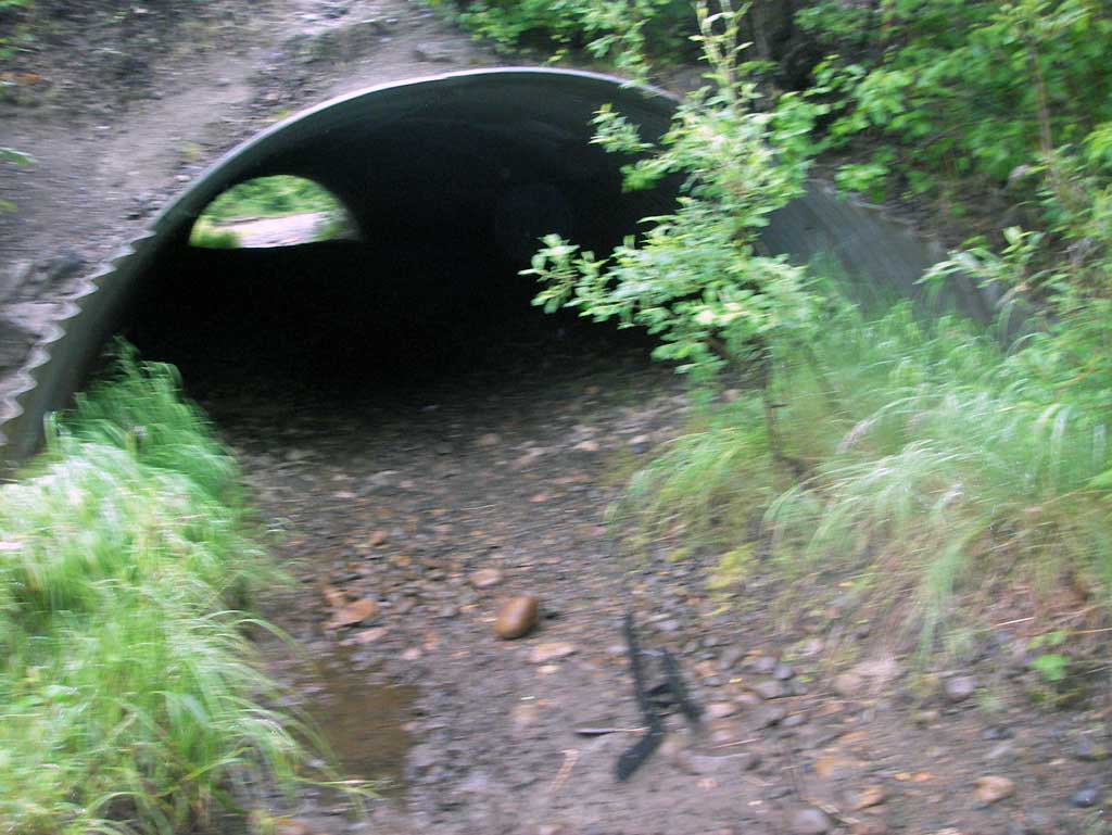
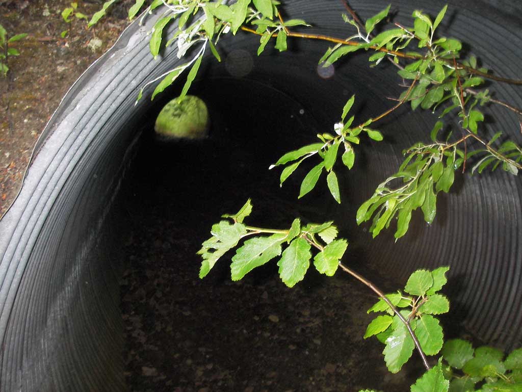
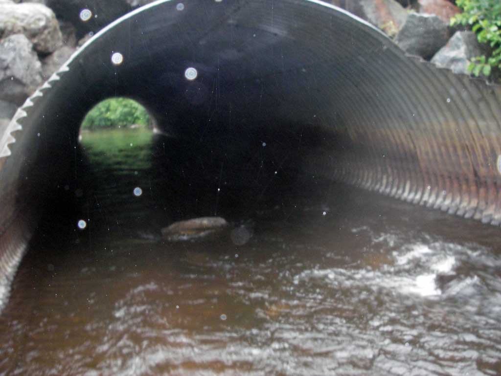
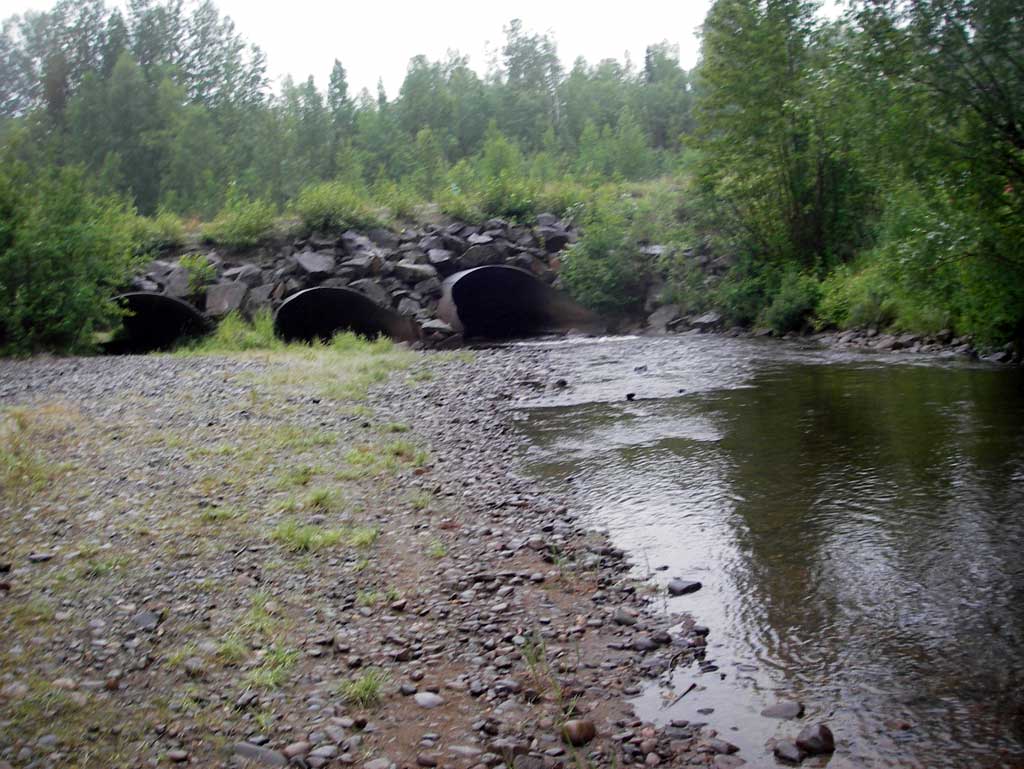
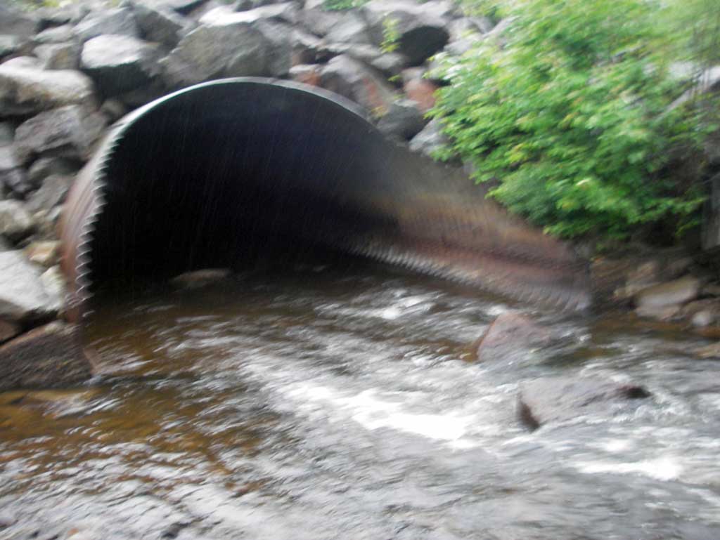
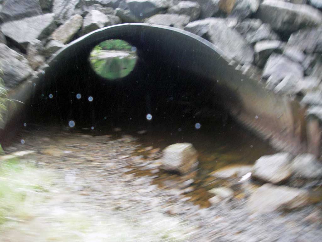
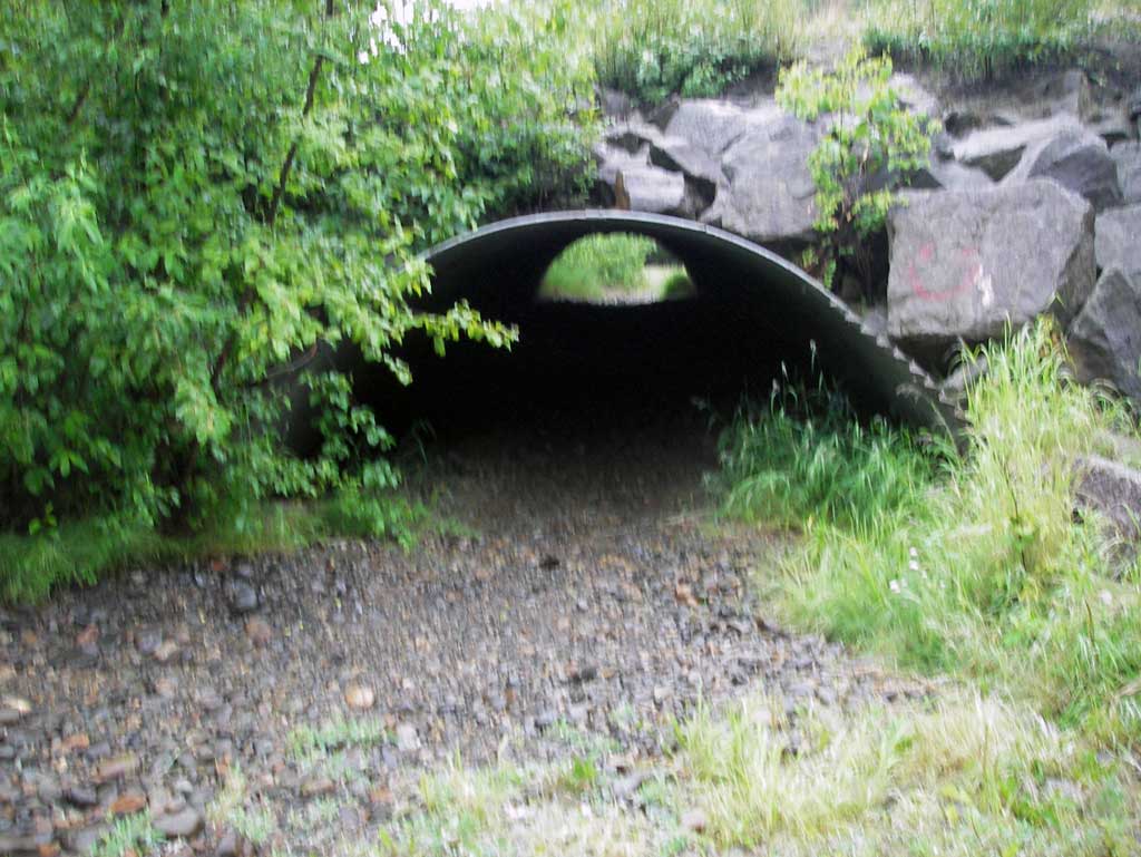
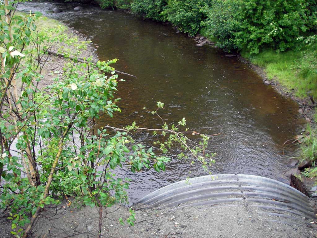
Comments: Three pipe arches with pipes 2 and 3 in the stream channel. Pipe 1 is located outside of the channel and dry with several feet of gravel and cobble embeddness. Two additional smaller pipes were located to the far left upstream side as your looking downstream well outside of the ordinary high water mark.
Culvert Measurements
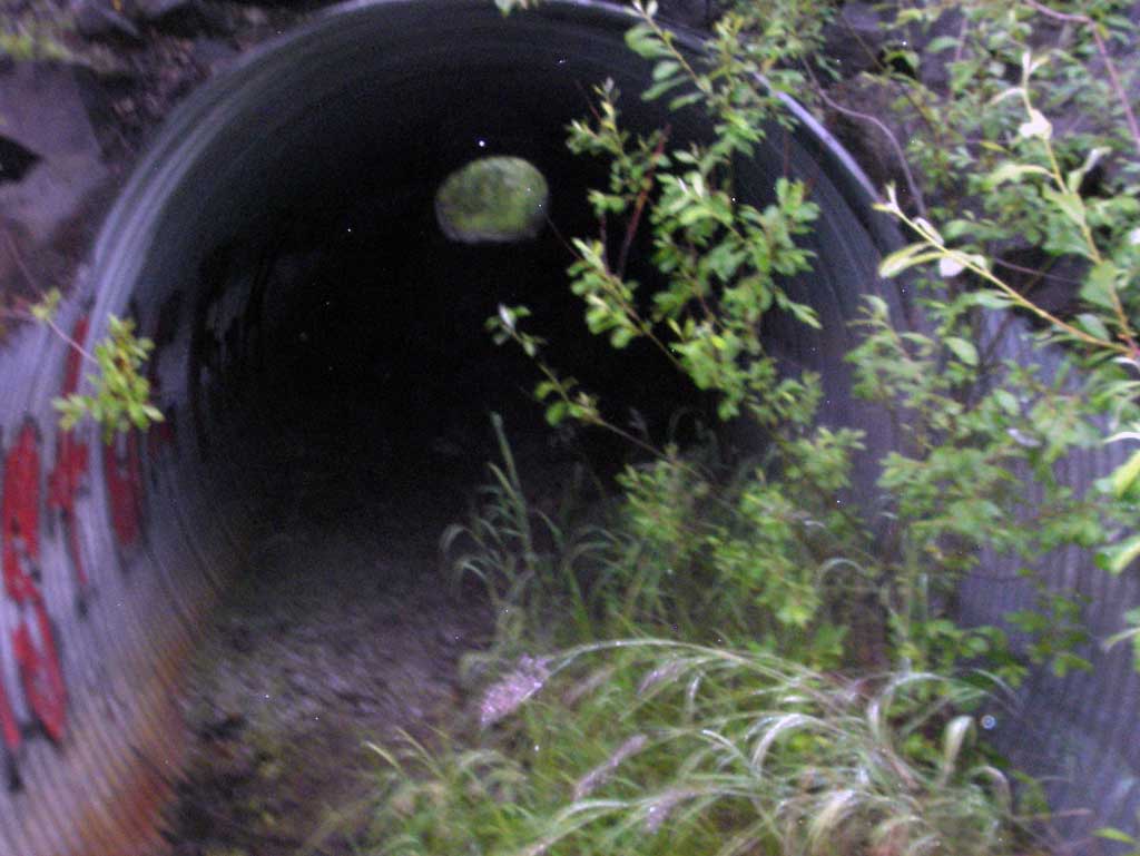
| ID: 1 | Structure Type: Pipe-arch (Structural steel plate) | Fish Passage Rating: | ||||||||||||||||||||||||||||||||||||||||||
|
|
|
||||||||||||||||||||||||||||||||||||||||||
Comments: Pipe located on far left upstream side on a gravel bar outside of the stream channel and was dry with a thick substrate layer. All three pipes are located in a slight bend of creek and Pipe 1 is on the point bar side beginning to get buried. |
||||||||||||||||||||||||||||||||||||||||||||
Culvert Observations:
|
||||||||||||||||||||||||||||||||||||||||||||
| ID: 2 | Structure Type: Pipe-arch (Structural steel plate) | Fish Passage Rating: | ||||||||||||||||||||||||||||||||||||||||||
|
|
|
||||||||||||||||||||||||||||||||||||||||||
Culvert Observations:
|
||||||||||||||||||||||||||||||||||||||||||||
| ID: 3 | Structure Type: Pipe-arch (Structural steel plate) | Fish Passage Rating: | |||||||||||||||||||||||||||||||||||||||||
|
|
|
|||||||||||||||||||||||||||||||||||||||||
Culvert Observations:
|
|||||||||||||||||||||||||||||||||||||||||||
Stream Measurements
|
|
| Stream Width Type | Distance From Crossing (ft) |
Stream Width (ft) |
|---|---|---|
| Downstream ordinary high water | 124.0 | 29.00 |
| Downstream ordinary high water | 164.0 | 30.50 |
| Downstream ordinary high water | 248.0 | 51.00 |
Elevations
| Locator ID | Culvert Number |
River Distance (ft)1 |
Distance From Crossing (ft)2 |
Relative Elevation (ft) |
|---|---|---|---|---|
| D/S Thalweg (Profile point at bottom of riffle) | 0.00 | 84.49 | ||
| D/S Water Surface Elev | 0.00 | 85.94 | ||
| D/S Water Surface Elev | 112.00 | 86.46 | ||
| D/S Thalweg (Profile point) | 112.00 | 85.80 | ||
| D/S Water Surface Elev | 240.00 | 87.53 | ||
| D/S Grade Ctrl (Thalweg) (Top of riffle) | 240.00 | 86.42 | ||
| Outlet Pool Water Elev (Water surface at outlet pool) | 295.00 | 87.68 | ||
| Max Pool Depth (Outlet pool elevation) | 295.00 | 85.77 | ||
| Outlet Invert | 2 | 330.00 | 87.02 | |
| Outlet Invert (Dry. All pipes on substrate) | 1 | 330.00 | 87.84 | |
| D/S Water Surface Elev (Water surface at Pipe 2 outlet invert) | 2 | 330.00 | 87.66 | |
| D/S Water Surface Elev (Water surface at pipe 3 outlet invert) | 3 | 330.00 | 87.66 | |
| Outlet Invert | 3 | 330.00 | 86.13 | |
| Outlet Culvert Top | 2 | 330.00 | 94.20 | |
| Outlet Culvert Top | 1 | 330.00 | 95.12 | |
| Outlet Culvert Top | 3 | 330.00 | 95.25 | |
| Road Elev | 388.00 | 103.70 | ||
| Inlet Culvert Top | 1 | 445.92 | 95.57 | |
| Inlet Culvert Top | 3 | 445.92 | 95.60 | |
| Inlet Culvert Top | 2 | 445.92 | 94.71 | |
| Inlet Culvert Invert (Dry) | 1 | 445.92 | 88.85 | |
| U/S Water Surface Elev (Water surface at pipe 2 inlet invert) | 2 | 445.92 | 87.70 | |
| U/S Water Surface Elev (Water surface at pipe 3 inlet invert) | 3 | 445.92 | 87.82 | |
| Inlet Culvert Invert | 2 | 445.92 | 87.13 | |
| Inlet Culvert Invert | 3 | 445.92 | 86.06 | |
| U/S Grade Ctrl (Thalweg) (Top of riffle) | 515.92 | 87.51 | ||
| U/S Water Surface Elev | 515.92 | 88.79 |
Notes:
- River distance is measured continuously throughout the survey reach along the thalweg of the stream.
- Measured from each end of the crossing along the thalweg of the stream.
Fish Sampling Efforts
| Gear Type: Minnow Trap (A) | Trap Duration(h): 1.83 | |
| Comments: No fish caught although juveniles were seen in Pipe 2. | ||
Fish Observations
No fish observations occurred during this survey.
Photos
Questions or comments about this report can be directed to dfg.dsf.webmaster@alaska.gov