Fish Passage Site 20501409
Coordinates (dec. deg.): 62.31550°, -150.21874°
Legal Description: S026N005W28
Region: South Central
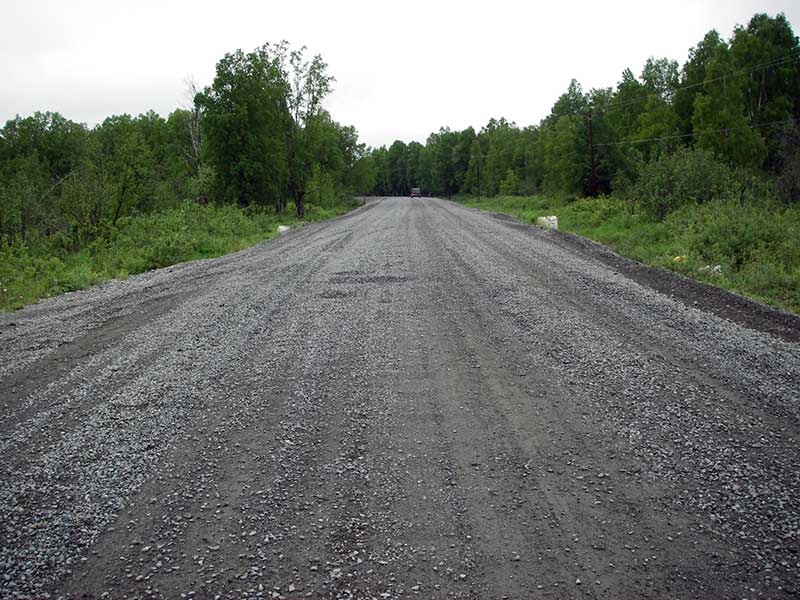
Road Name: Susitna River Road
Datum: NAD83
Quad Name / ITM: Talkeetna B-1
AWC Stream #: 247-41-10200-2341
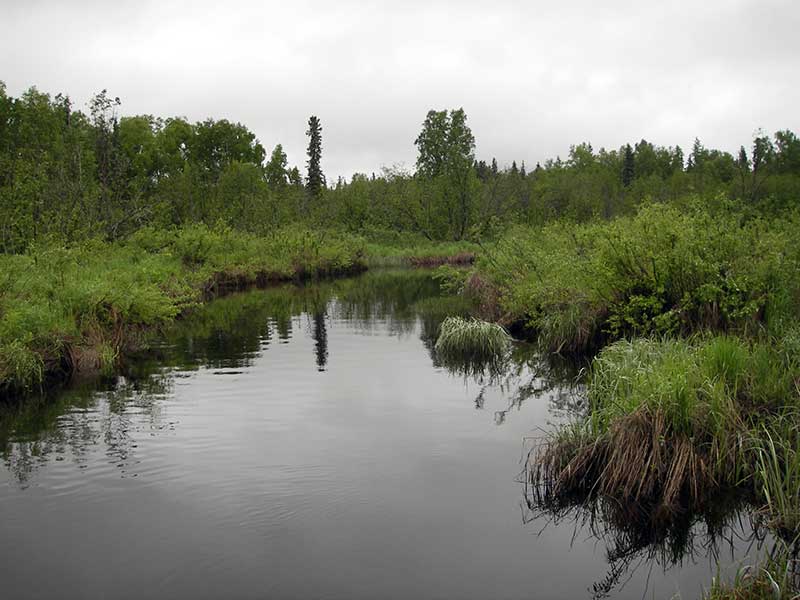
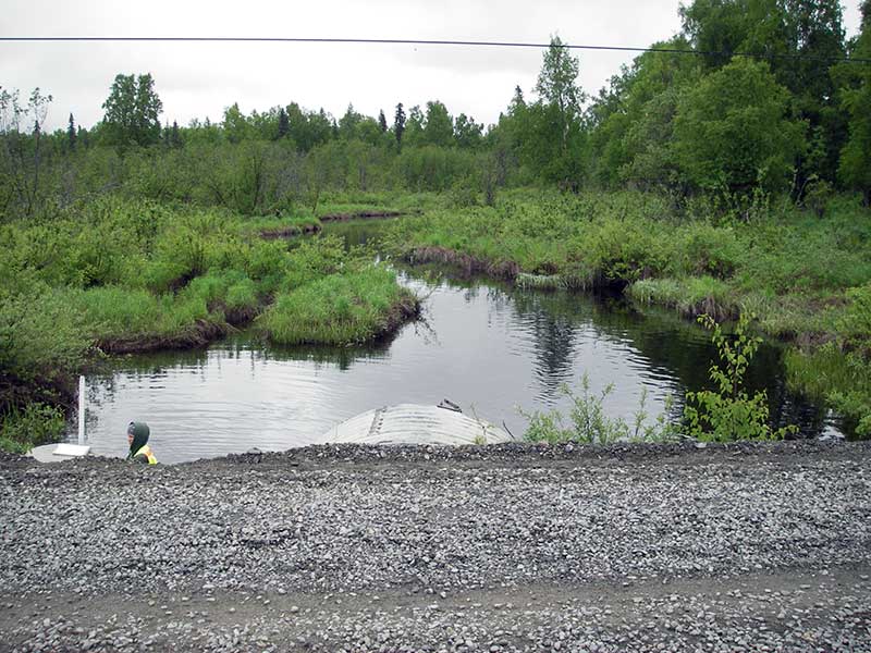
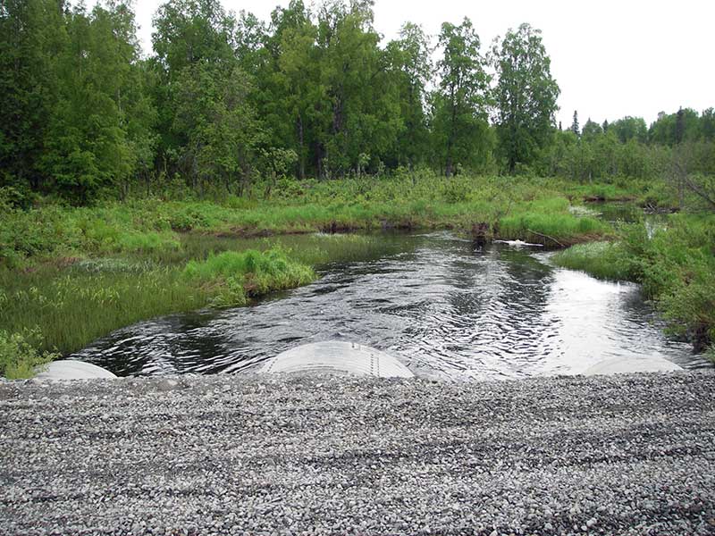
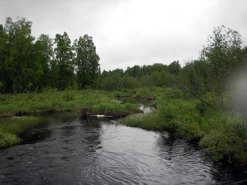
Stream Name: Trapper Creek
Elevation:
Site Comments: Susitna River watershed
arrow to the right of the survey date below to choose a different report for this site.
Survey PRK09-SRR03
Project Supervisor: Gillian O'Doherty, ADFG
Observers: Heidi Zimmer, Ben Histand
Overall Fish Passage Rating:
Tidal: No
Backwatered: No
Step Pools:
Construction Year:
Site Observations:
- Constriction ratio red
- Culvert gradient gray
- Beaver Activity
- Woody Debris
Comments: Resurvey of PRK041A046; Red due to CR, but prob only partial barrier.
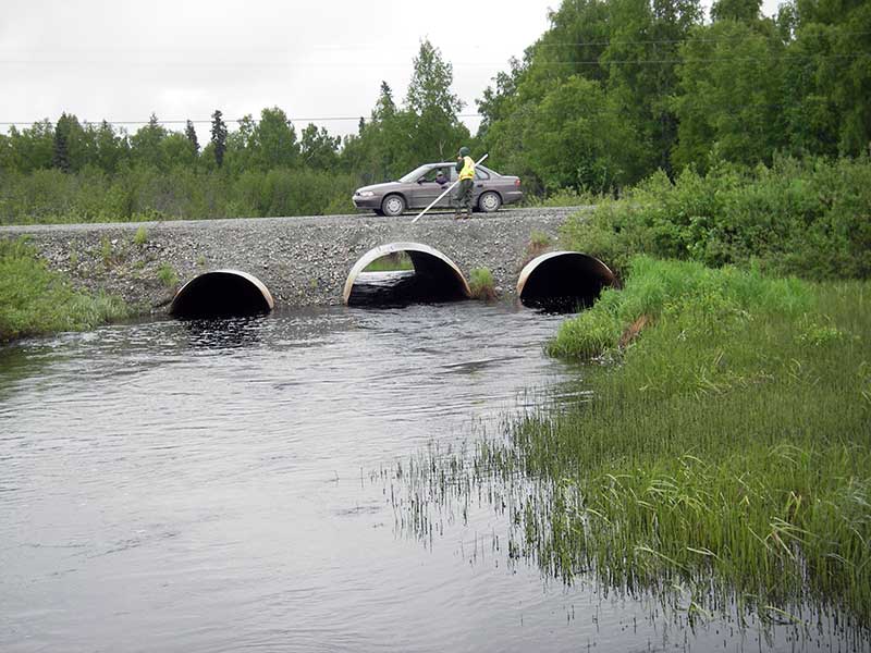
Culvert Measurements
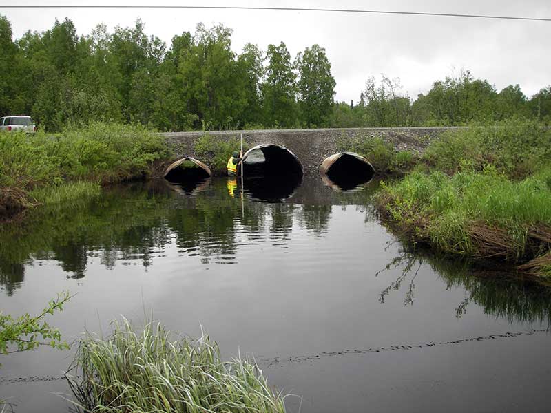
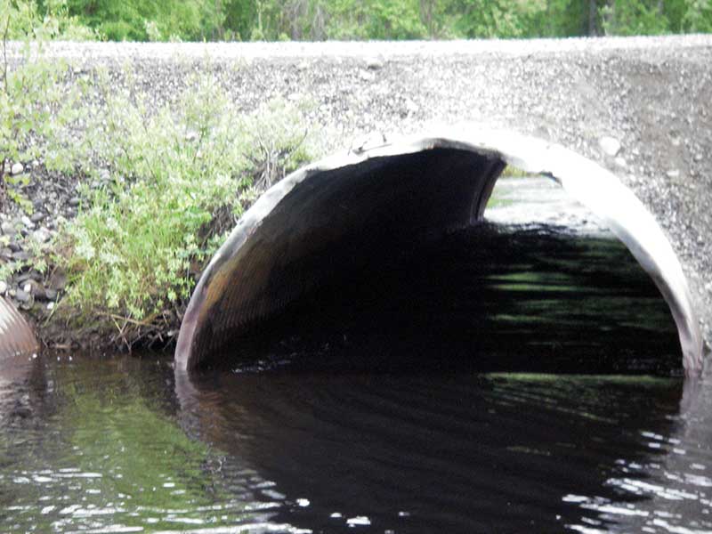
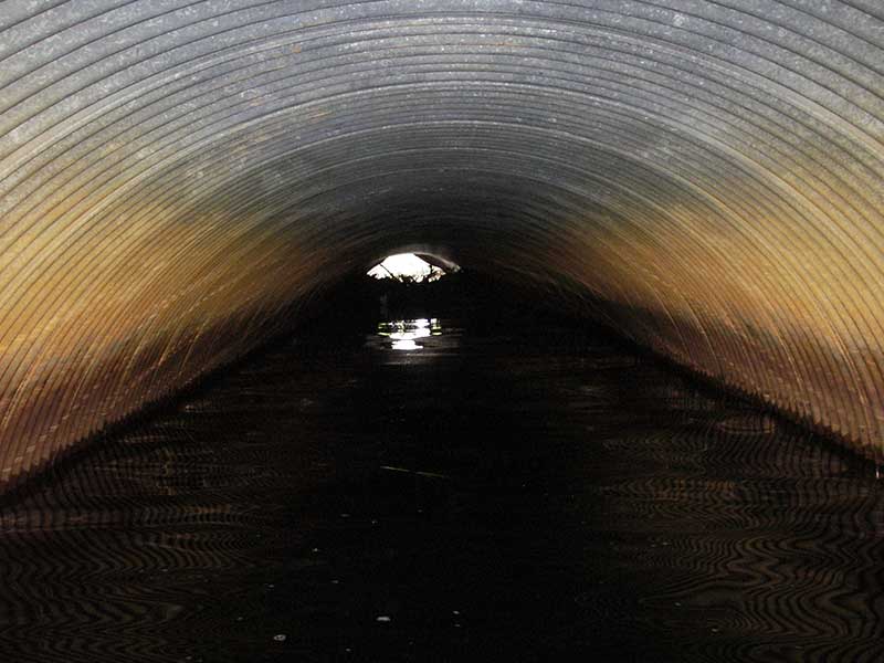
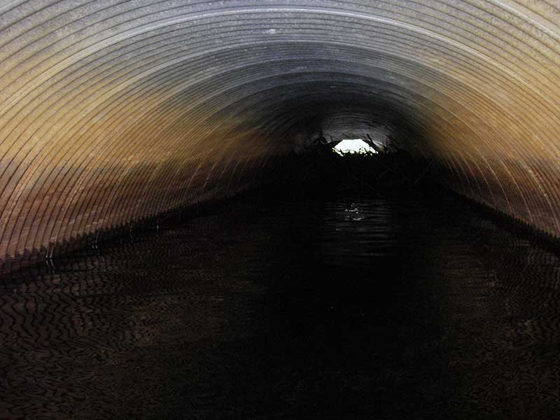
| ID: 1 | Structure Type: Circular pipe (Corrugated steel) | Fish Passage Rating: | |||||||||||||||||||||||||||||||||||||||||
|
|
|
|||||||||||||||||||||||||||||||||||||||||
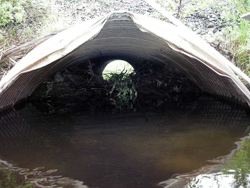
Comments: Culvert plugged with woody debris. |
|||||||||||||||||||||||||||||||||||||||||||
Culvert Observations:
|
|||||||||||||||||||||||||||||||||||||||||||
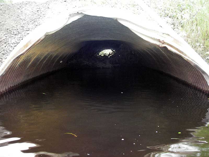
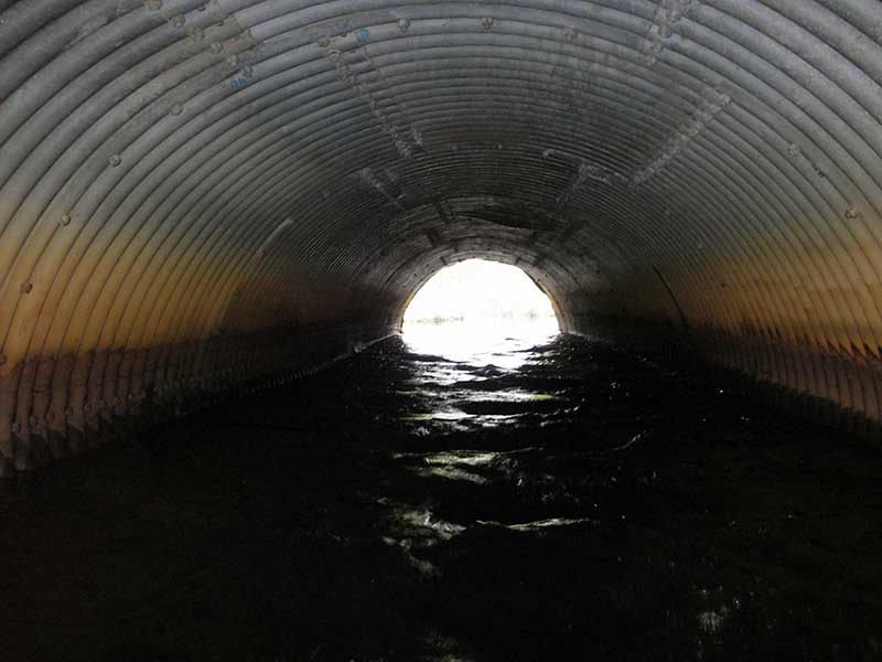
| ID: 2 | Structure Type: Circular pipe (Structural steel plate) | Fish Passage Rating: | |||||||||||||||||||||||||||||||||||||||||
|
|
|
|||||||||||||||||||||||||||||||||||||||||
Comments: Resurvey of 1A046; Red due to CR, but prob only partial barrier - main pipe (pipe 2) is green otherwise |
|||||||||||||||||||||||||||||||||||||||||||
Culvert Observations:
|
|||||||||||||||||||||||||||||||||||||||||||
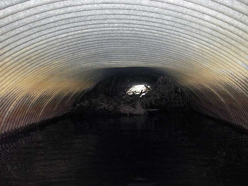
| ID: 3 | Structure Type: Circular pipe (Corrugated steel) | Fish Passage Rating: | |||||||||||||||||||||||||||||||||||||||||
|
|
|
|||||||||||||||||||||||||||||||||||||||||
Comments: Resurvey of 1A046; Red due to CR, but prob only partial barrier. Culvert plugged with woody debris. |
|||||||||||||||||||||||||||||||||||||||||||
Culvert Observations:
|
|||||||||||||||||||||||||||||||||||||||||||
Stream Measurements
|
|
| Stream Width Type | Distance From Crossing (ft) |
Stream Width (ft) |
|---|---|---|
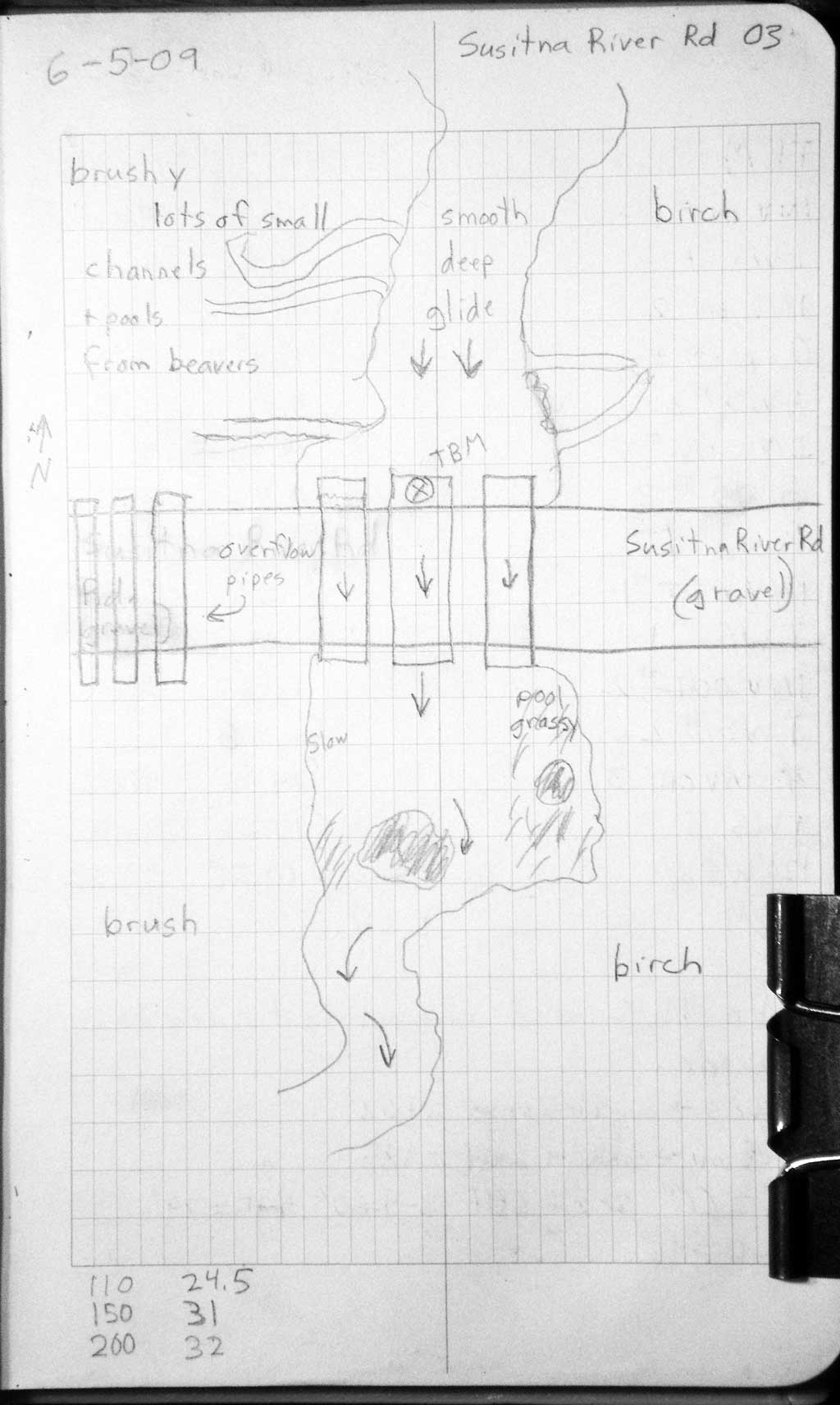
| Upstream ordinary high water | 110.0 | 24.50 |
| Upstream ordinary high water | 150.0 | 31.00 |
| Upstream ordinary high water | 200.0 | 32.00 |
Elevations
| Locator ID | Culvert Number |
River Distance (ft)1 |
Distance From Crossing (ft)2 |
Relative Elevation (ft) |
|---|---|---|---|---|
| Outlet Pool Water Elev | 2 | 95.32 | ||
| Outlet Pool Water Elev | 1 | 95.34 | ||
| Outlet Pool Water Elev | 3 | 95.34 | ||
| U/S Headwater | 2 | 95.76 | ||
| U/S Headwater | 1 | 95.87 | ||
| U/S Headwater | 3 | 95.87 | ||
| D/S Water Surface Elev (ws D/S - no TWC and channel is too deep to wade) | 0.00 | 120.0 | 95.32 | |
| Outlet Invert | 2 | 120.00 | 0.0 | 93.35 |
| Outlet Invert | 3 | 120.00 | 0.0 | 91.52 |
| Outlet Invert | 1 | 120.00 | 0.0 | 92.00 |
| Road Elev | 150.00 | 102.15 | ||
| Inlet Culvert Invert | 3 | 180.00 | 0.0 | 92.22 |
| Inlet Culvert Invert | 1 | 180.00 | 0.0 | 92.62 |
| U/S Thalweg | 2 | 180.00 | 0.0 | 92.81 |
| Inlet Culvert Invert | 2 | 180.00 | 0.0 | 93.62 |
Notes:
- River distance is measured continuously throughout the survey reach along the thalweg of the stream.
- Measured from each end of the crossing along the thalweg of the stream.
Fish Sampling Efforts
No fish sampling occurred during this survey.
Fish Observations
No fish observations occurred during this survey.
Photos
Questions or comments about this report can be directed to dfg.dsf.webmaster@alaska.gov