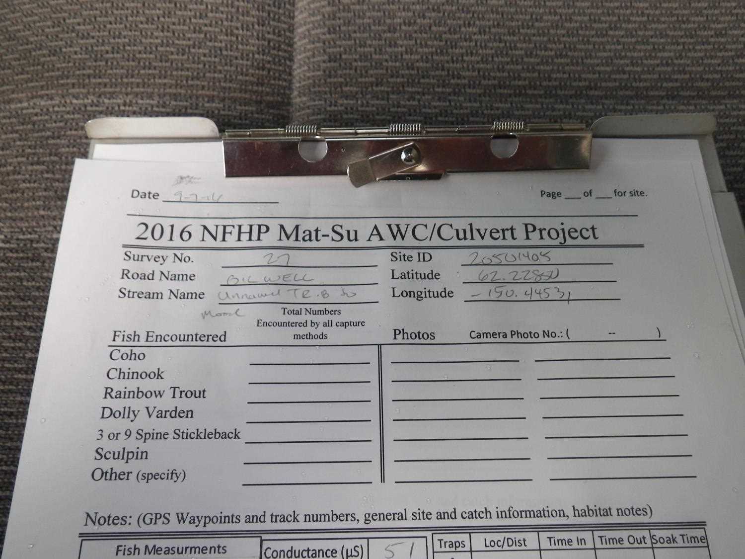
Fish Passage Site 20501405
Coordinates (dec. deg.): 62.22848°, -150.44498°
Legal Description: S025N006W30
Region: South Central
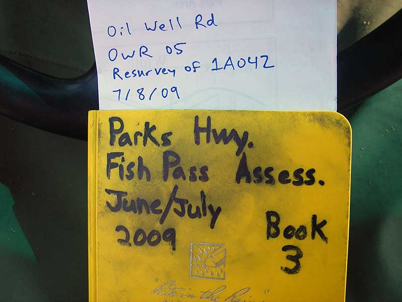
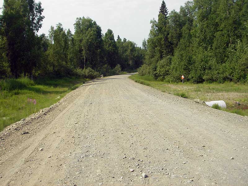
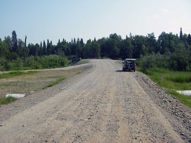
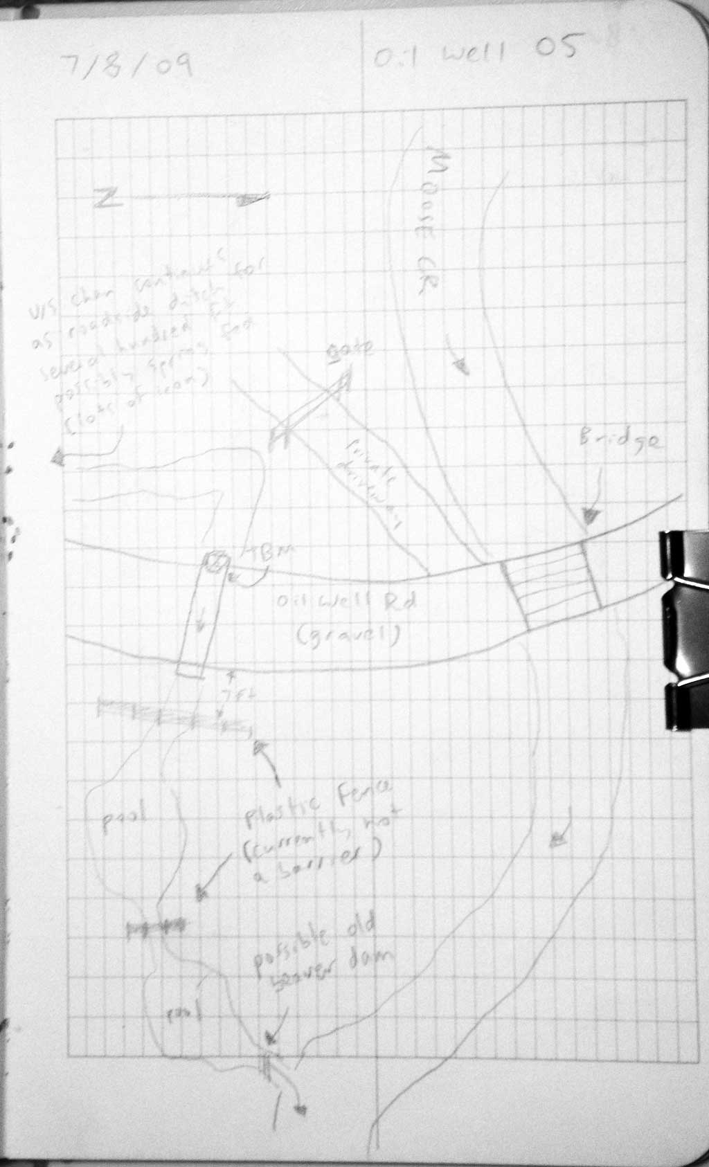
Road Name: Oil Well Road
Datum: NAD83
Quad Name / ITM: Talkeetna A-1
AWC Stream #: 247-41-10200-2081-3100-4163
Stream Name: Moose Creek tributary
Elevation:
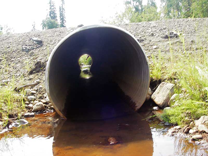
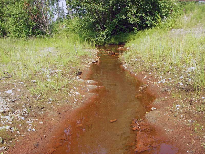
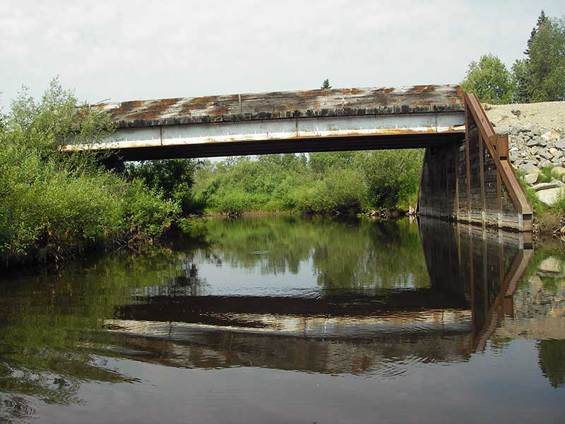
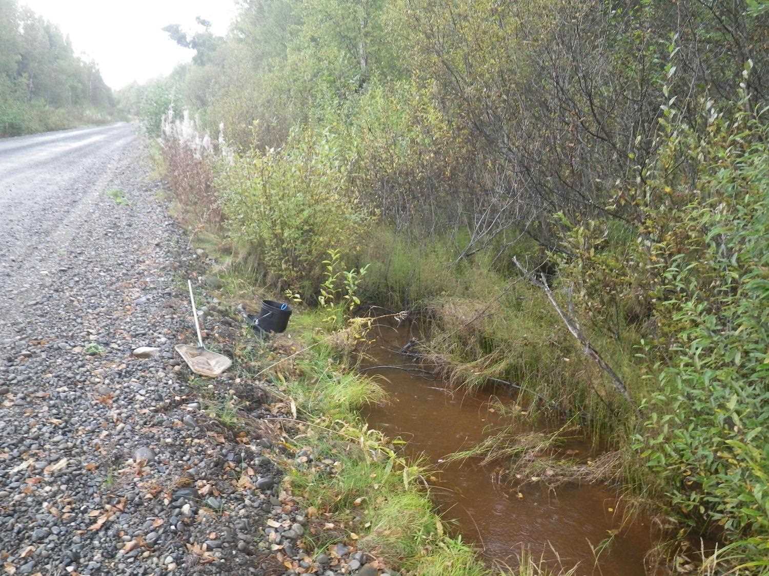
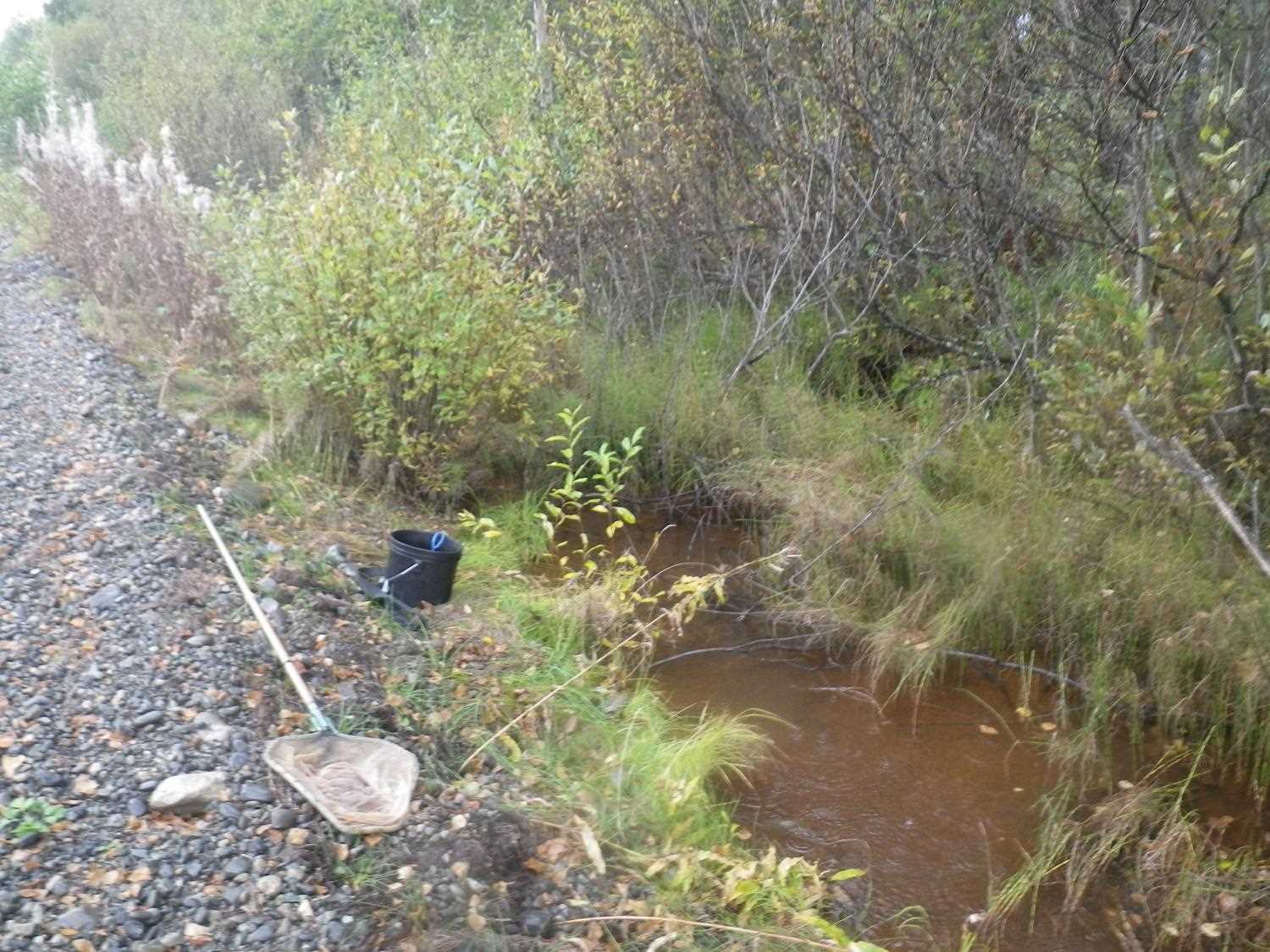
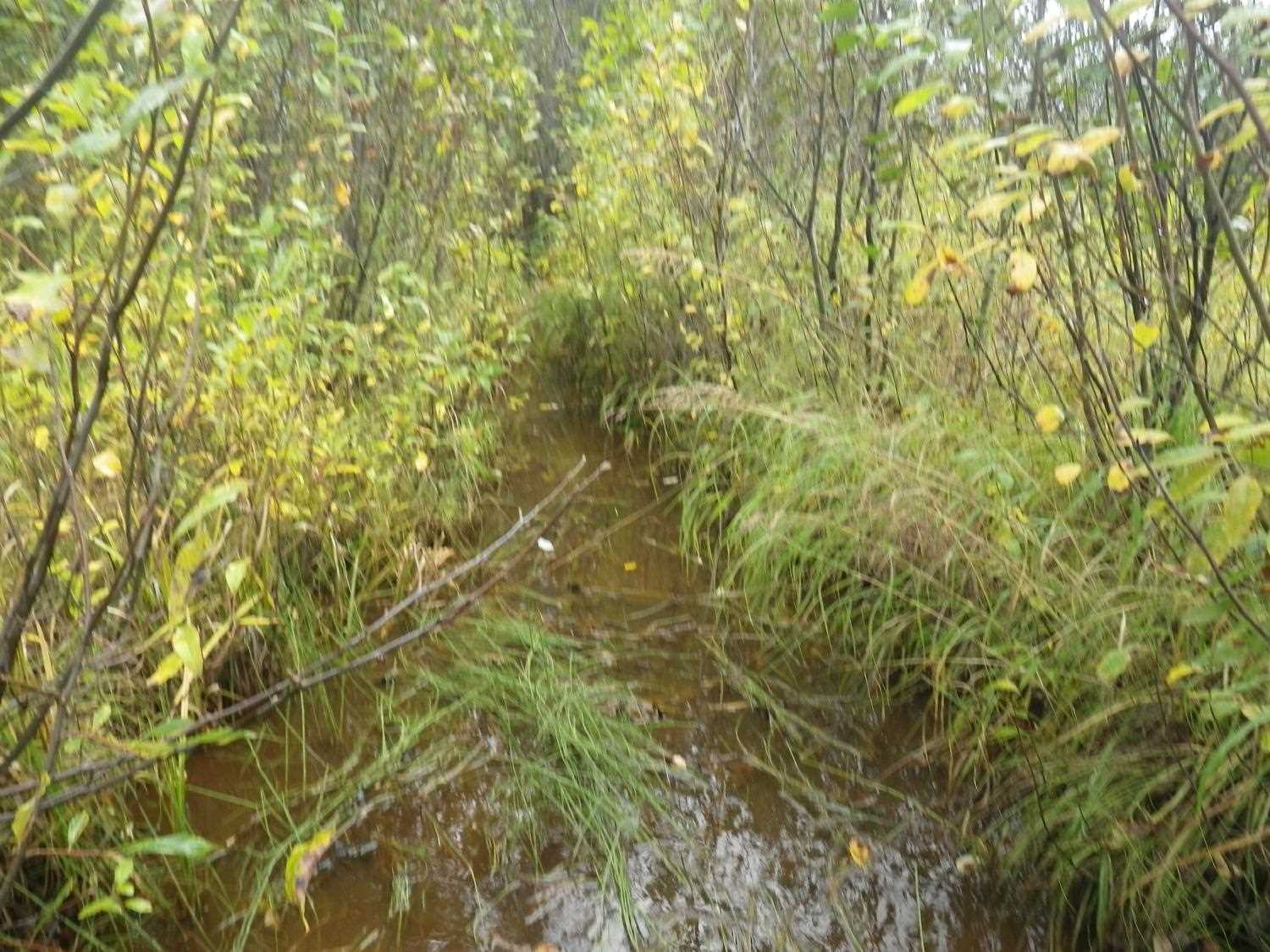
Site Comments: SUSITNA RIVER WATERSHED, Moose Creek Bridge is about 300 feet northeast of site.
arrow to the right of the survey date below to choose a different report for this site.
Survey PRK09-OWR05
Project Supervisor: Gillian O'Doherty, ADFG
Observers: Heidi Zimmer, Ben Histand
Overall Fish Passage Rating:
Tidal: No
Backwatered: No
Step Pools:
Construction Year:
Site Observations:
- Culvert gradient gray
- Constriction ratio gray
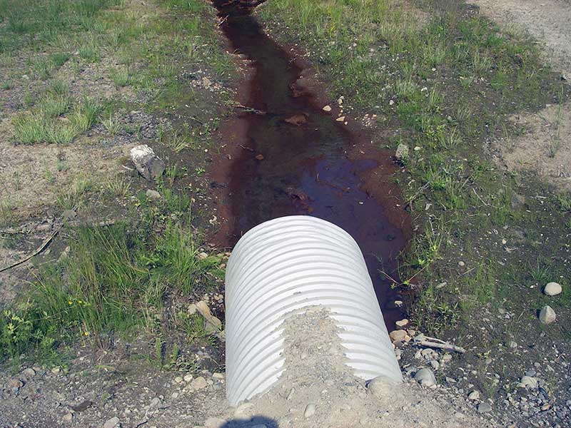
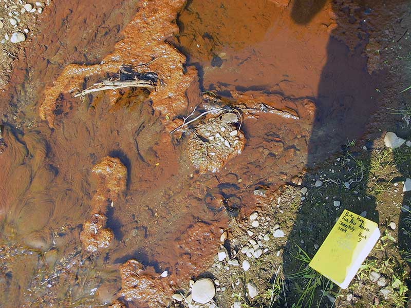
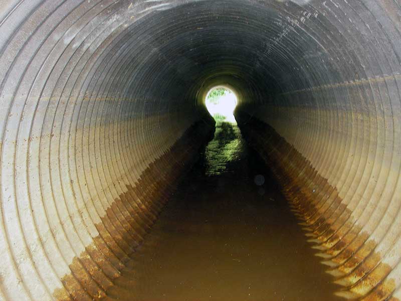
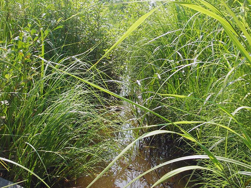
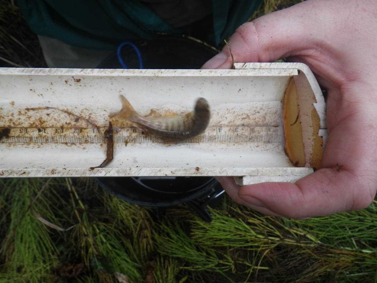
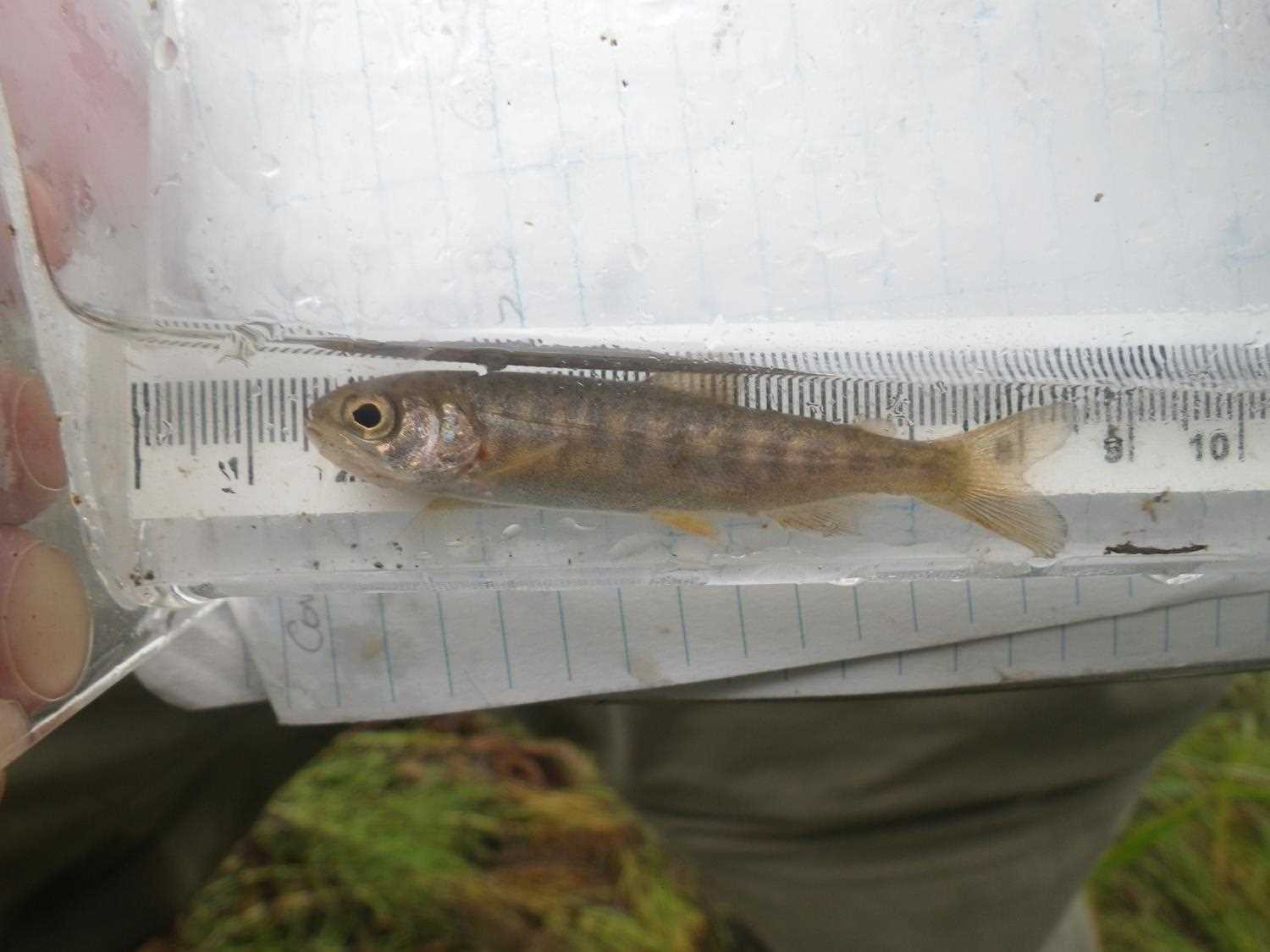
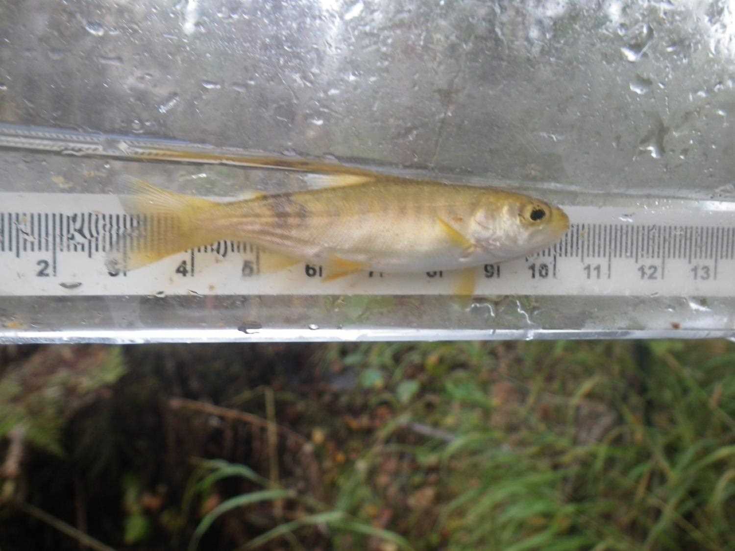
Comments: Resurvey PRK041A042. u/s is rust-stained ditch along road w/ lots of slimy algae and coho fry. Probably not a barrier. **Updated site photos added from 9/7/16 site visit from Sampling Unmapped Streams in the MSB project. Fish sampling information added to AFFI.
Culvert Measurements
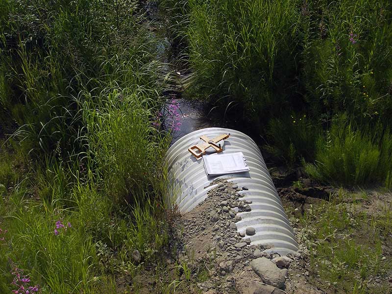
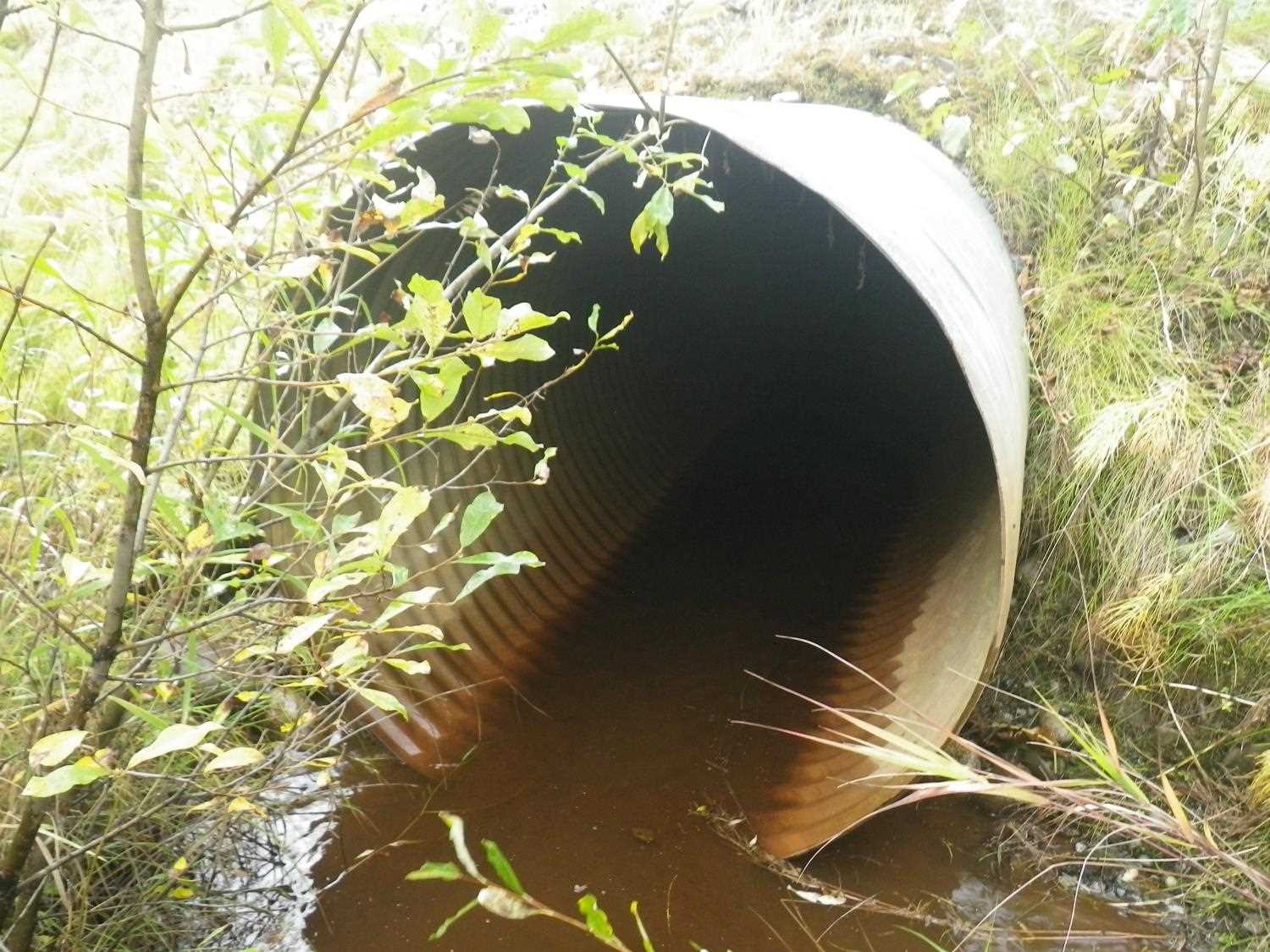
| ID: 1 | Structure Type: Circular pipe (Corrugated steel) | Fish Passage Rating: | |||||||||||||||||||||||||||||||||||||||||
|
|
|
|||||||||||||||||||||||||||||||||||||||||
Culvert Observations:
|
|||||||||||||||||||||||||||||||||||||||||||
Stream Measurements
|
|
| Stream Width Type | Distance From Crossing (ft) |
Stream Width (ft) |
|---|---|---|
| Upstream ordinary high water | 75.0 | 3.50 |
| Upstream ordinary high water | 110.0 | 4.00 |
| Upstream ordinary high water | 127.0 | 4.50 |
Elevations
| Locator ID | Culvert Number |
River Distance (ft)1 |
Distance From Crossing (ft)2 |
Relative Elevation (ft) |
|---|---|---|---|---|
| Outlet Pool Water Elev | 1 | 97.21 | ||
| U/S Headwater | 1 | 97.38 | ||
| D/S Water Surface Elev (d/s WS) | 1 | 0.00 | 95.0 | 96.93 |
| D/S Water Surface Elev (WS @ GP) | 1 | 64.00 | 31.0 | 97.48 |
| D/S Tailcrest or 1st Thalweg | 1 | 80.50 | 14.5 | 96.99 |
| D/S Water Surface Elev (WS @ TWC) | 1 | 80.50 | 14.5 | 97.20 |
| D/S Thalweg (bottom of outlet pool) | 1 | 91.00 | 4.0 | 95.92 |
| Outlet Invert | 1 | 95.00 | 0.0 | 96.77 |
| Road Elev | 1 | 118.50 | 101.88 | |
| Inlet Culvert Invert | 1 | 142.00 | 0.0 | 97.03 |
| U/S Grade Ctrl (Thalweg) (1st TC u/s) | 1 | 173.00 | 31.0 | 97.30 |
Notes:
- River distance is measured continuously throughout the survey reach along the thalweg of the stream.
- Measured from each end of the crossing along the thalweg of the stream.
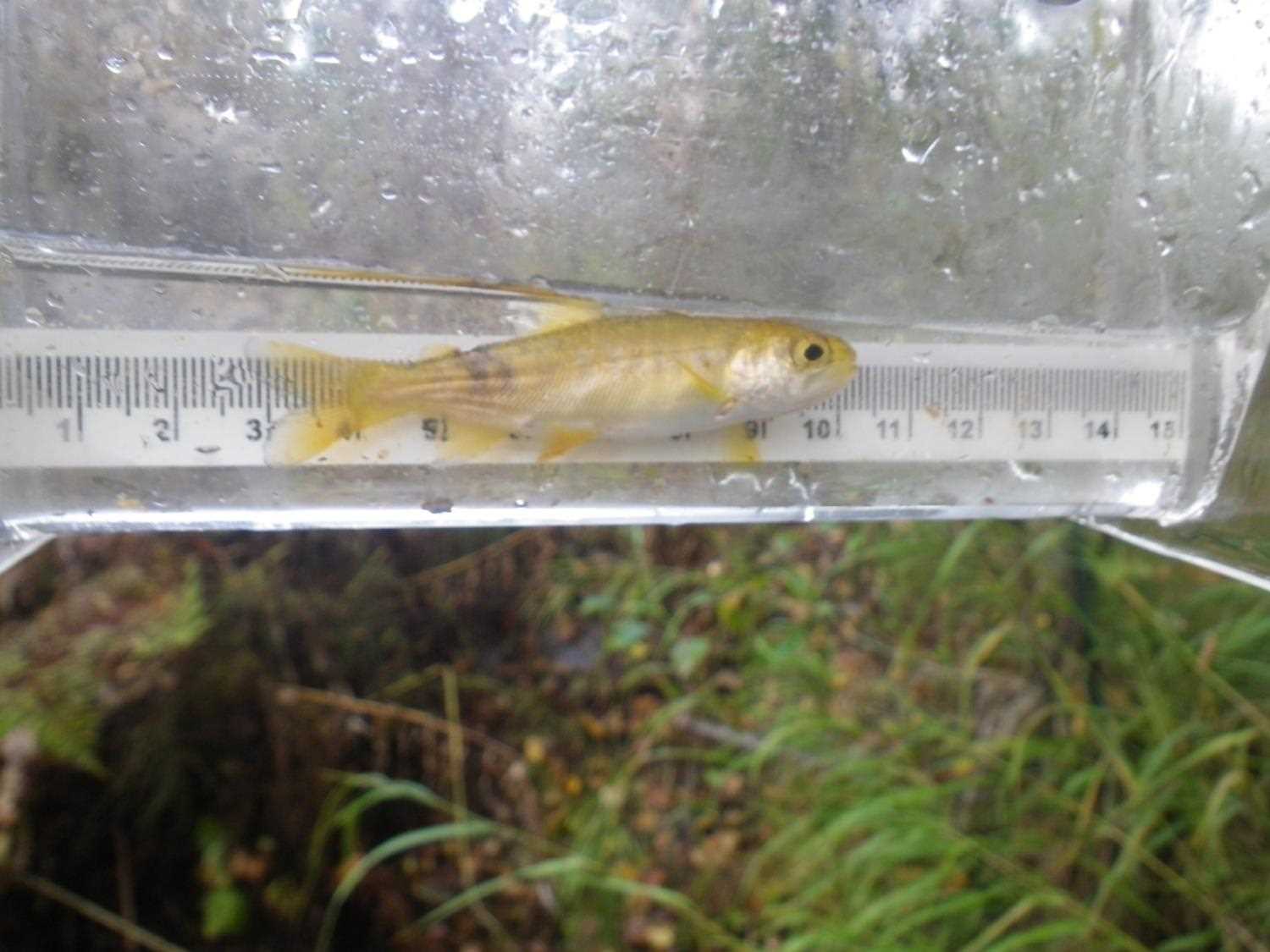
Fish Sampling Efforts
| Gear Type: Visual Observation, Ground (A) | ||
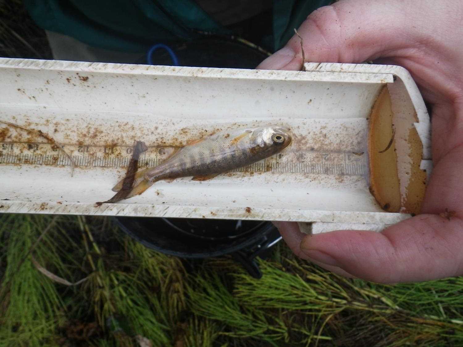
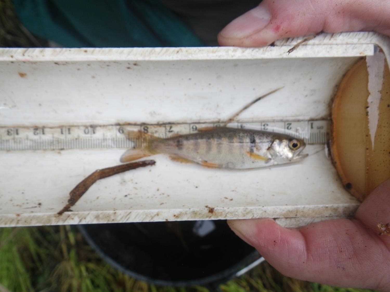
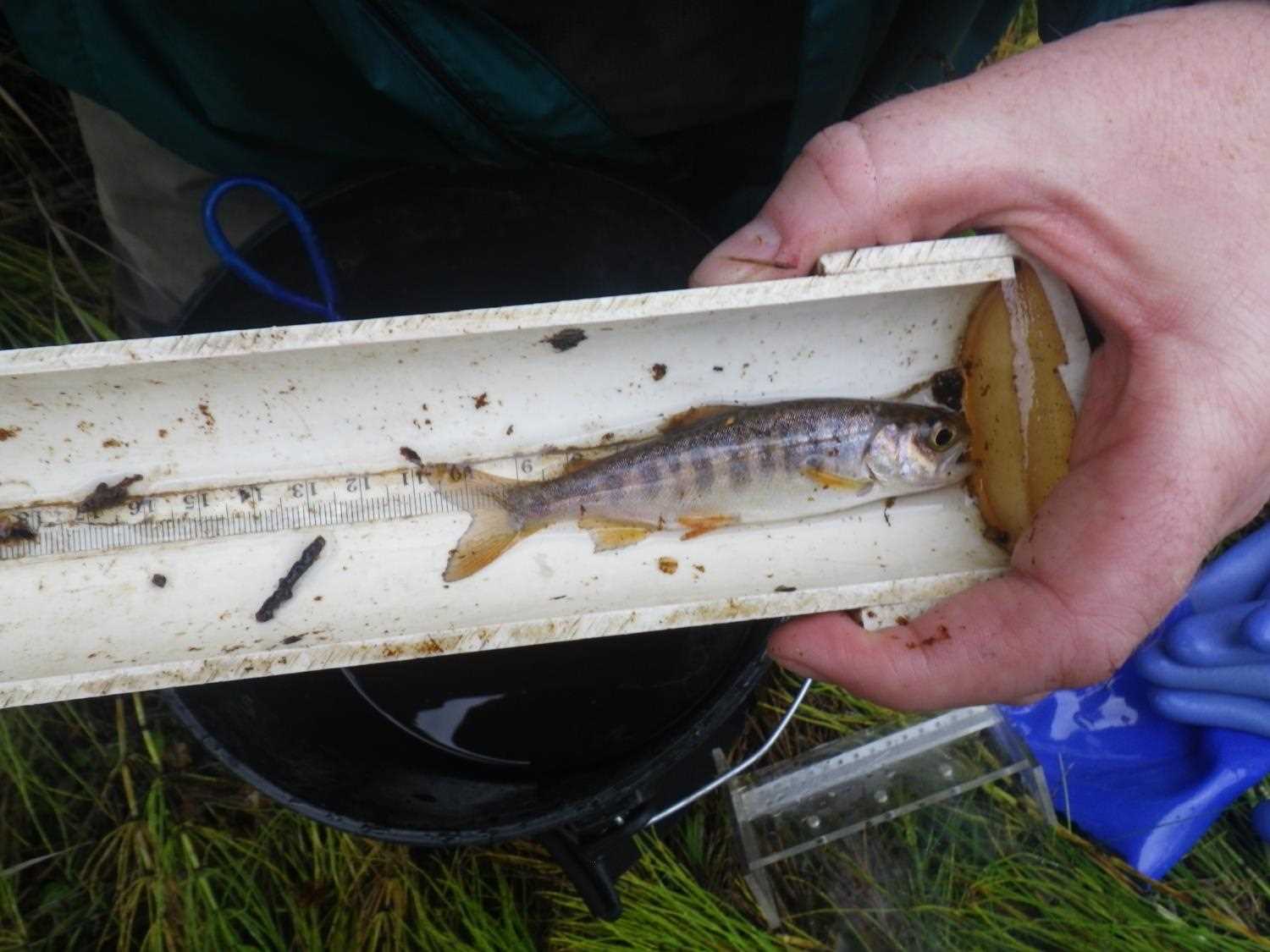
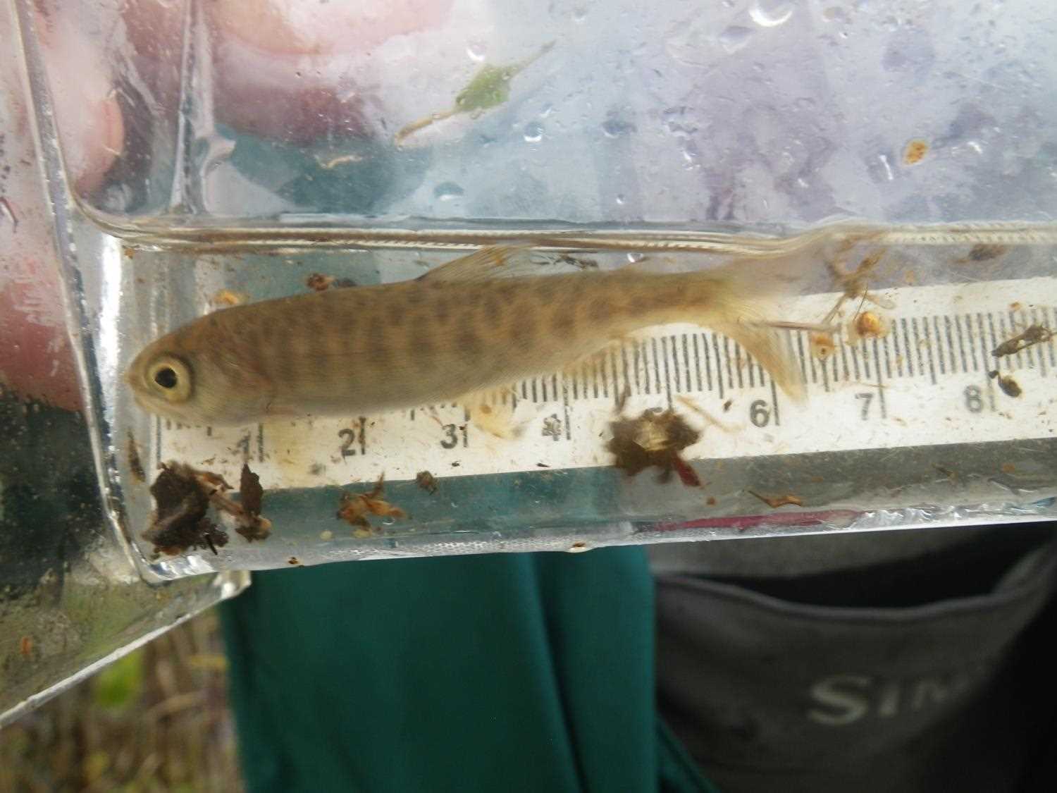
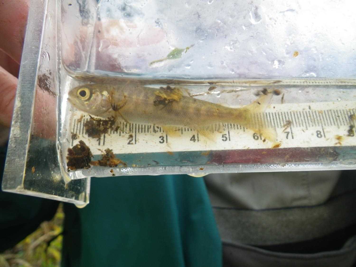
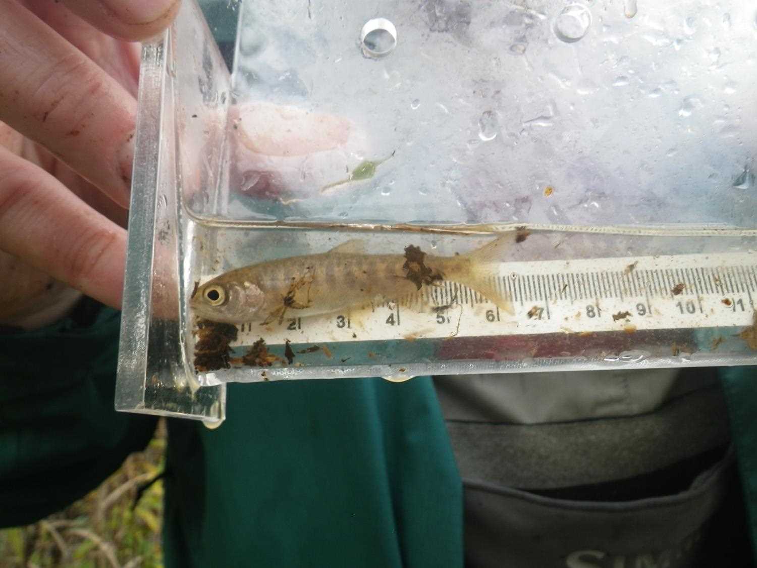
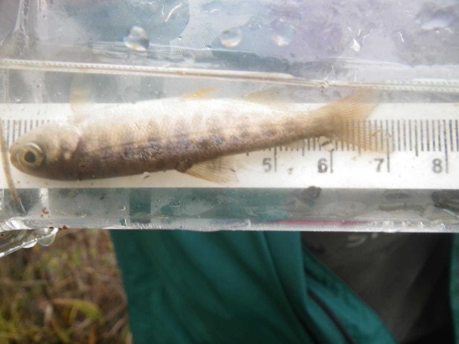
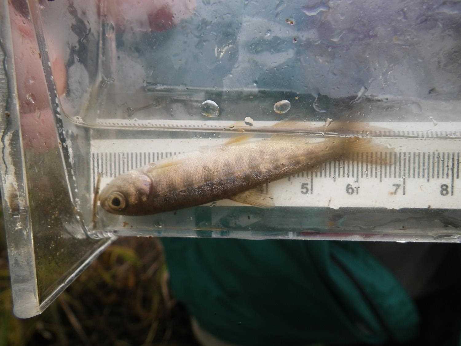
| Comments: Lots of small salmonids, most likely coho fry. | ||
Fish Observations
No fish observations occurred during this survey.
Photos


Questions or comments about this report can be directed to dfg.dsf.webmaster@alaska.gov