Fish Passage Site 20501395
Coordinates (dec. deg.): 62.30992°, -150.36887°
Legal Description: S026N006W27
Region: South Central
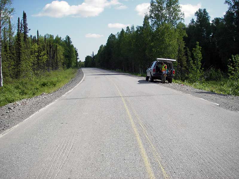
Road Name: Petersville Road
Datum: NAD83
Quad Name / ITM: Talkeetna B-1
AWC Stream #: 247-41-10200-2081-3100-4136-5027
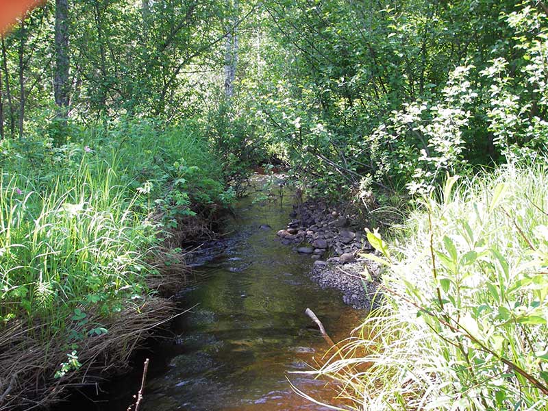
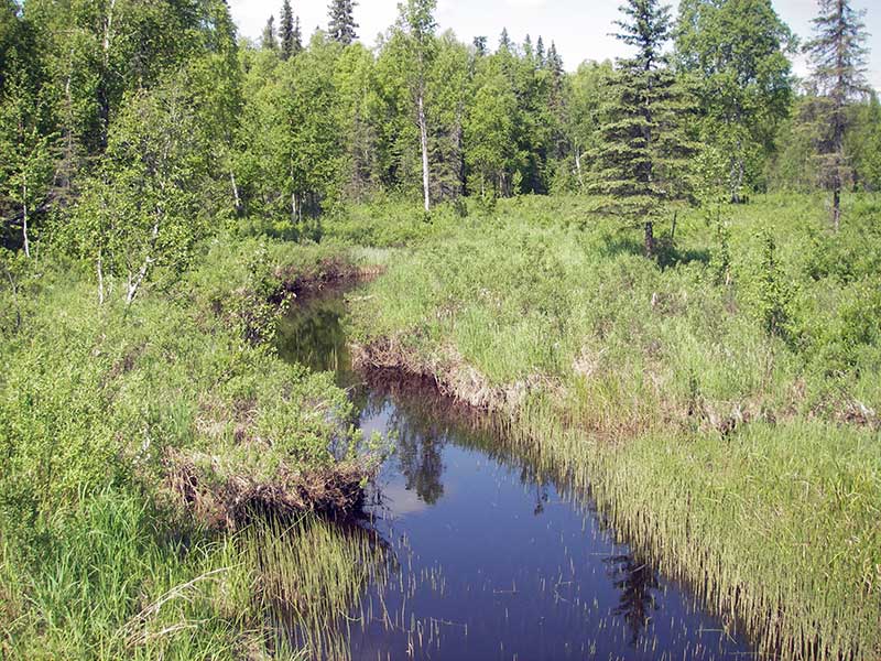
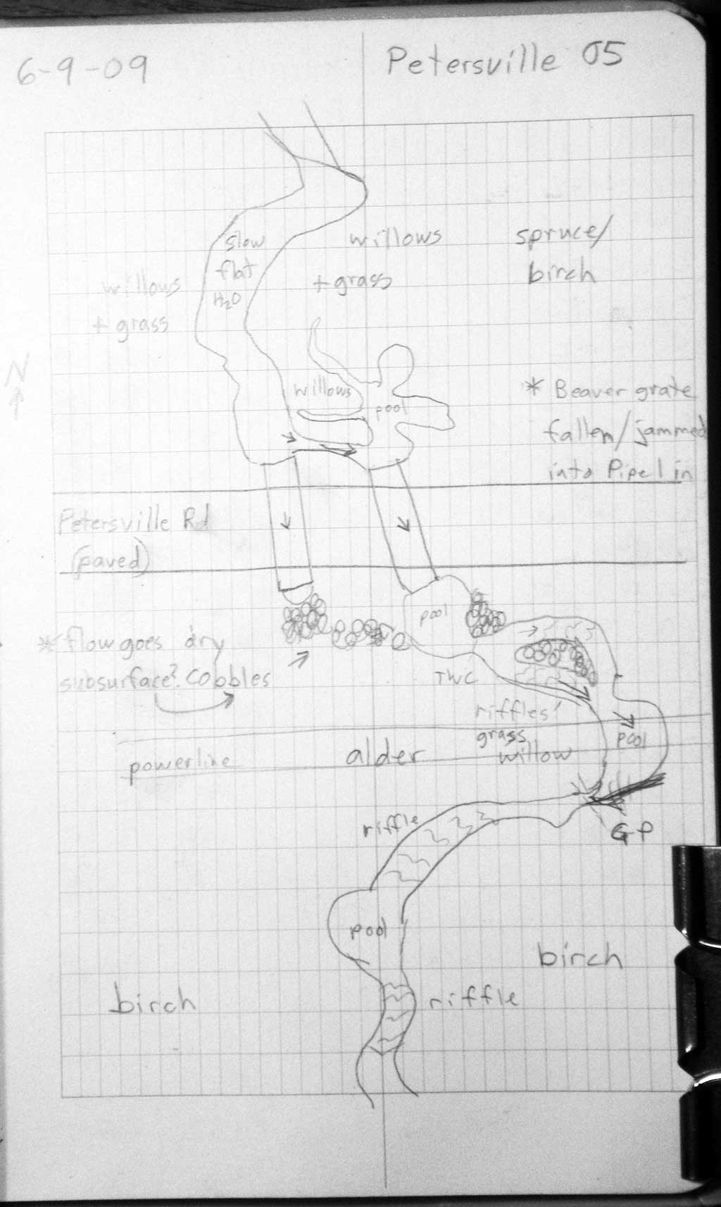
Stream Name: Ninemile Creek tributary
Elevation:
Site Comments: SUSITNA RIVER WATERSHED
arrow to the right of the survey date below to choose a different report for this site.
Survey PRK09-PVR05
Project Supervisor: Gillian O'Doherty, ADFG
Observers: Heidi Zimmer, Ben Histand
Overall Fish Passage Rating:
Tidal: No
Backwatered: Yes
Step Pools:
Construction Year:
Site Observations:
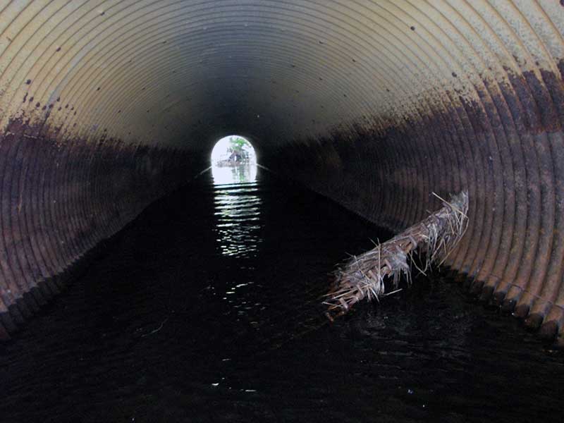
- Mechanical damage or joints parting
- Hydraulic flows exceeded capacity
- Constriction ratio red
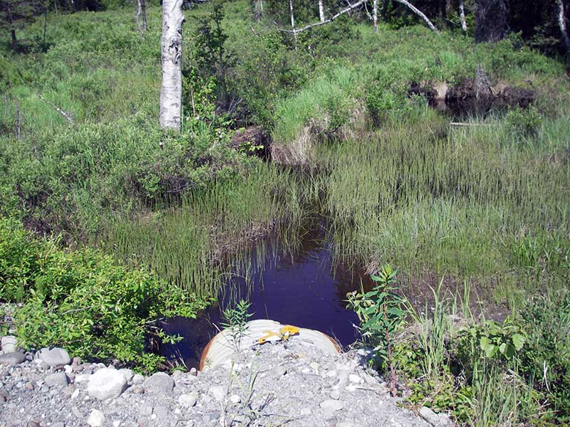
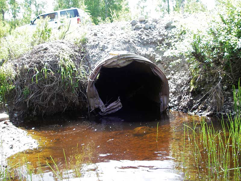
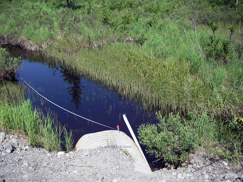
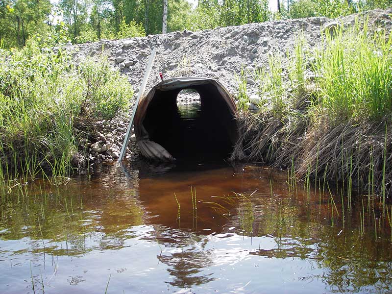
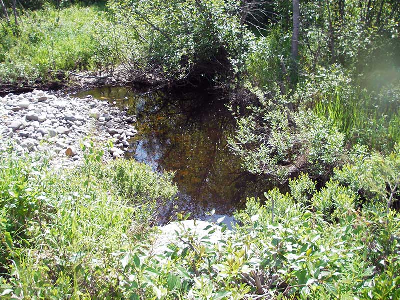
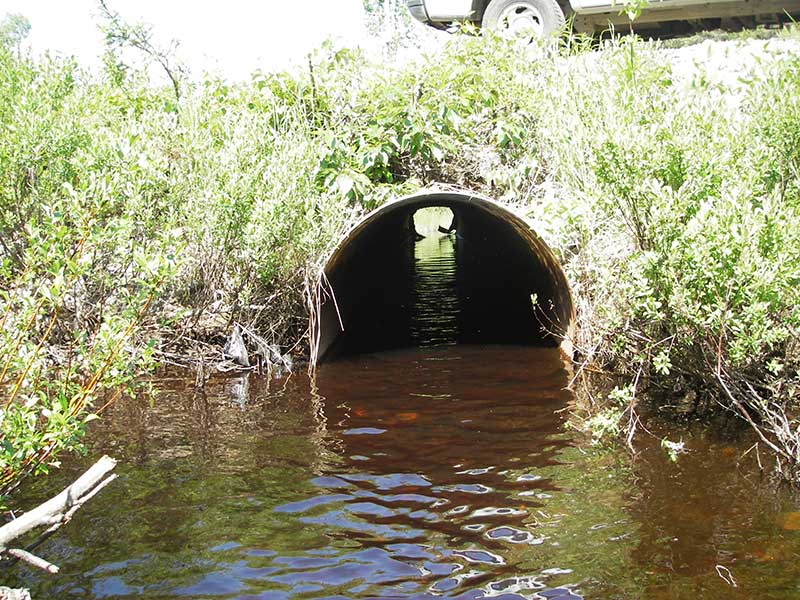
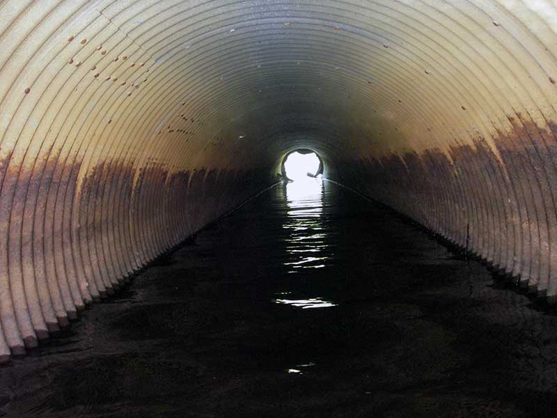
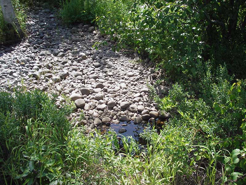
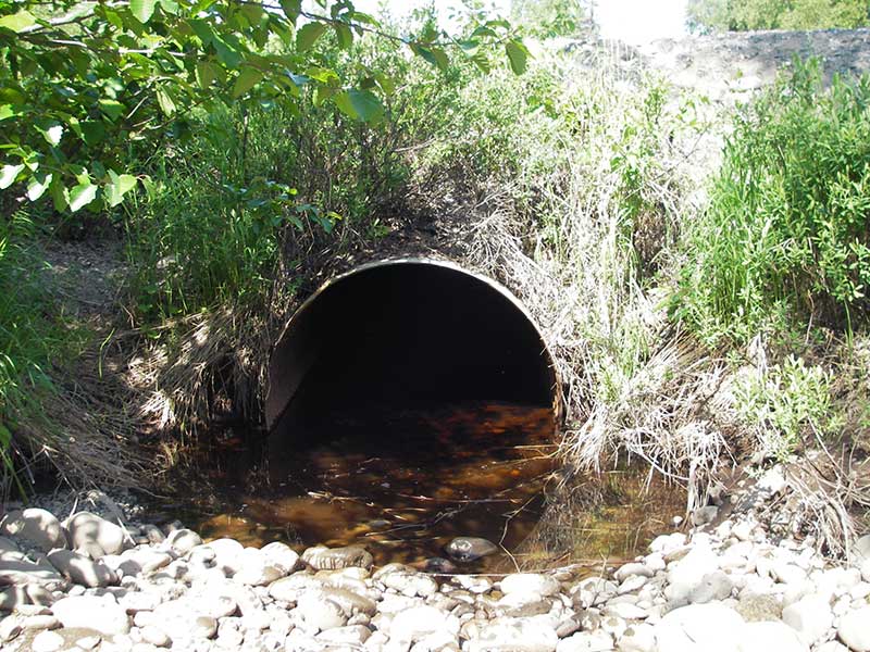
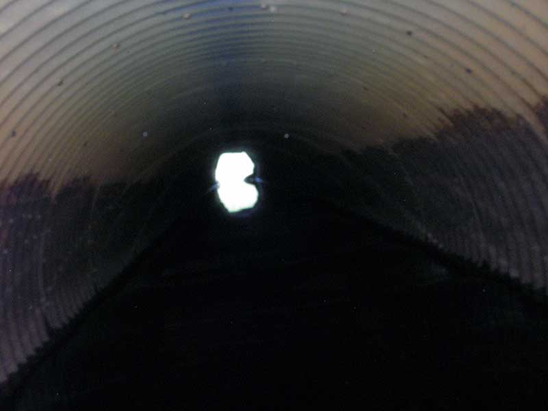
Comments: TWC > both inverts = BW; inlet is crumpled and rusted out; resurvey of PRK04IA032. Visual observation of juvenile salmonids u/s. Site is a resurvey and connected to and AWC system so no traps were set. Water goes subsurface after exiting pipe 2 for a short distance.
Culvert Measurements
| ID: 1 | Structure Type: Circular pipe (Structural steel plate) | Fish Passage Rating: | |||||||||||||||||||||||||||||||||||||||||
|
|
|
|||||||||||||||||||||||||||||||||||||||||
Culvert Observations:
|
|||||||||||||||||||||||||||||||||||||||||||
| ID: 2 | Structure Type: Circular pipe (Structural steel plate) | Fish Passage Rating: | |||||||||||||||||||||||||||||||||||||||||
|
|
|
|||||||||||||||||||||||||||||||||||||||||
Comments: Resurvey of IA032; HWS = TWS = BW; inlet crumpled and torn; vis obs juv salmonid 2-8 cm u/s. Water goes subsurface after exiting culvert for a short distance. |
|||||||||||||||||||||||||||||||||||||||||||
Culvert Observations:
|
|||||||||||||||||||||||||||||||||||||||||||
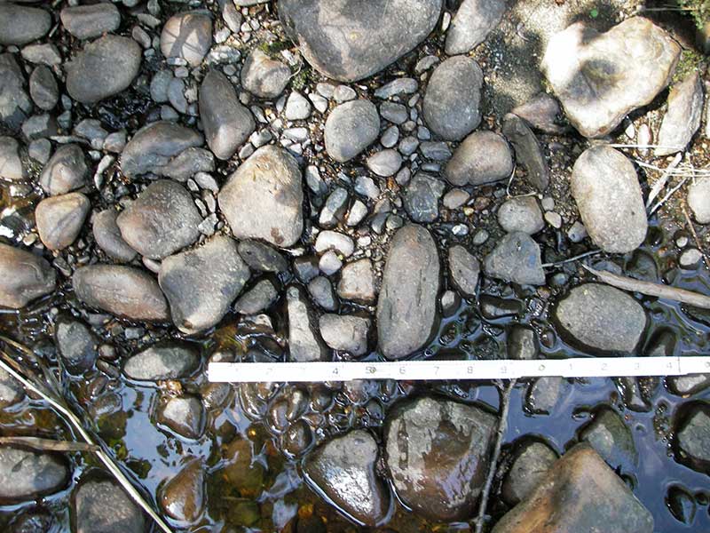
Stream Measurements
|
|
| Stream Width Type | Distance From Crossing (ft) |
Stream Width (ft) |
|---|---|---|
| Upstream ordinary high water | 42.0 | 10.50 |
| Upstream ordinary high water | 122.0 | 11.00 |
| Upstream ordinary high water | 190.0 | 9.50 |
Elevations
| Locator ID | Culvert Number |
River Distance (ft)1 |
Distance From Crossing (ft)2 |
Relative Elevation (ft) |
|---|---|---|---|---|
| Outlet Pool Water Elev | 1 | 93.93 | ||
| U/S Headwater | 1 | 93.94 | ||
| Outlet Pool Water Elev | 2 | 94.02 | ||
| U/S Headwater | 2 | 94.04 | ||
| Road Elev (d/s edge of pavement) | 100.86 | |||
| D/S Grade Ctrl (Thalweg) | 1 | 0.00 | 66.0 | 92.53 |
| D/S Water Surface Elev (ws at gp) | 1 | 0.00 | 66.0 | 92.98 |
| D/S Tailcrest or 1st Thalweg | 1 | 32.00 | 34.0 | 93.58 |
| D/S Water Surface Elev (ws at twc) | 1 | 32.00 | 34.0 | 93.89 |
| D/S Thalweg | 1 | 60.00 | 6.0 | 92.15 |
| D/S Water Surface Elev (ws at gp) | 2 | 63.50 | 2.5 | 94.03 |
| D/S Water Surface Elev (ws at gp) | 1 | 64.00 | 2.0 | 93.97 |
| Outlet Invert | 1 | 66.00 | 0.0 | 92.76 |
| Outlet Invert | 2 | 66.00 | 0.0 | 92.97 |
| Inlet Culvert Invert | 1 | 126.00 | 0.0 | 92.49 |
| Inlet Culvert Invert | 2 | 126.00 | 0.0 | 93.20 |
| U/S Grade Ctrl (Thalweg) | 1 | 128.00 | 2.0 | 93.03 |
| U/S Grade Ctrl (Thalweg) | 2 | 128.50 | 2.5 | 92.98 |
Notes:
- River distance is measured continuously throughout the survey reach along the thalweg of the stream.
- Measured from each end of the crossing along the thalweg of the stream.
Fish Sampling Efforts
| Gear Type: Visual Observation, Ground (A) | ||
| Comments: Visual observation of juvenile salmonids (unidentified) upstream from culvert. Estimated length between 2-8 cm. | ||
Fish Observations
No fish observations occurred during this survey.
Photos
Questions or comments about this report can be directed to dfg.dsf.webmaster@alaska.gov