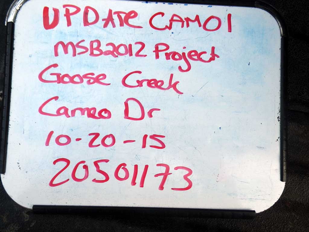
Fish Passage Site 20501173
Coordinates (dec. deg.): 61.42235°, -149.91904°
Legal Description: S015N004W01
Region: South Central
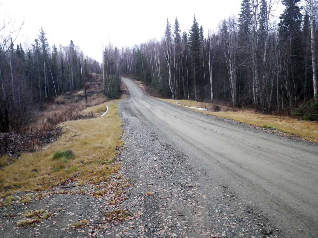
Road Name: Cameo Road
Datum: WGS84
Quad Name / ITM: Anchorage B-8
AWC Stream #:
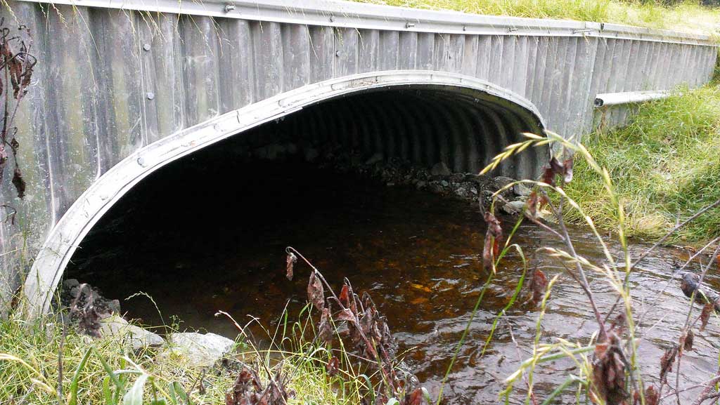
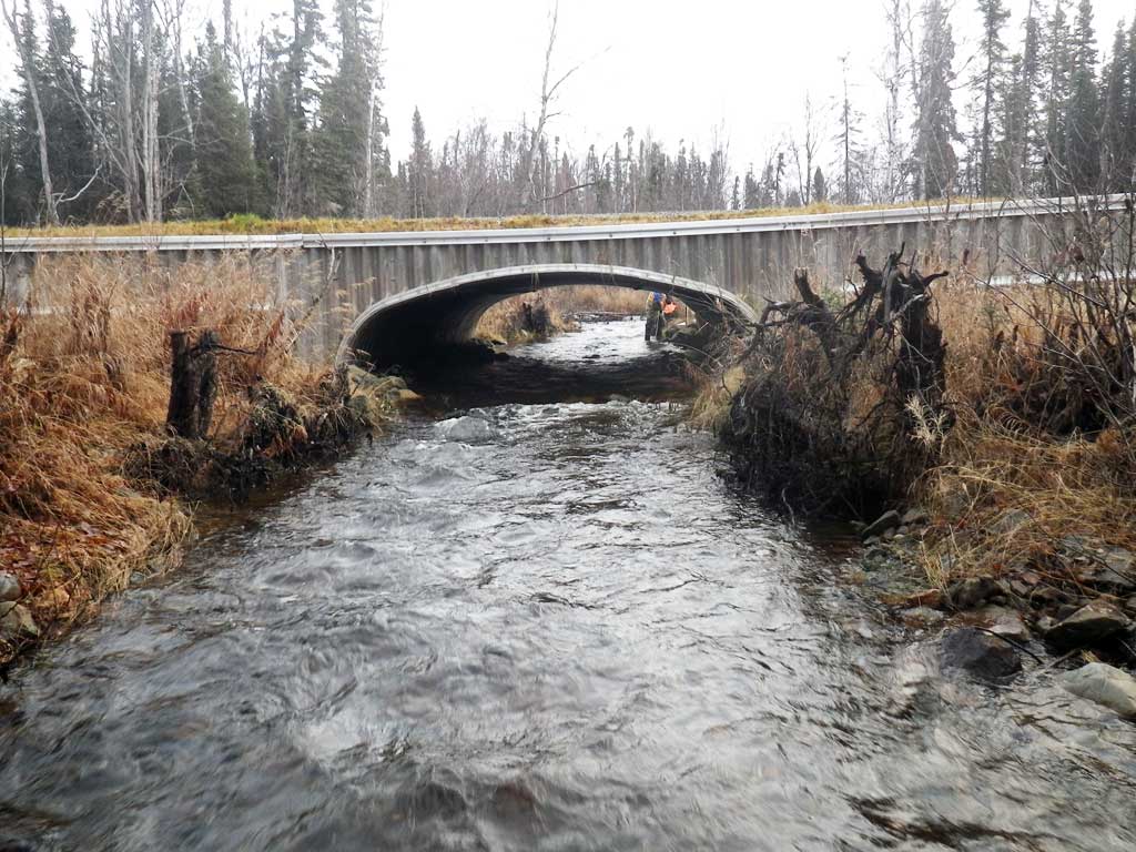
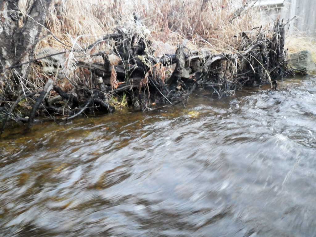
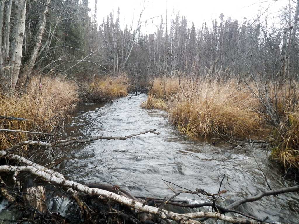
Stream Name: Goose Creek
Elevation:
Site Comments: Approach from north!
arrow to the right of the survey date below to choose a different report for this site.
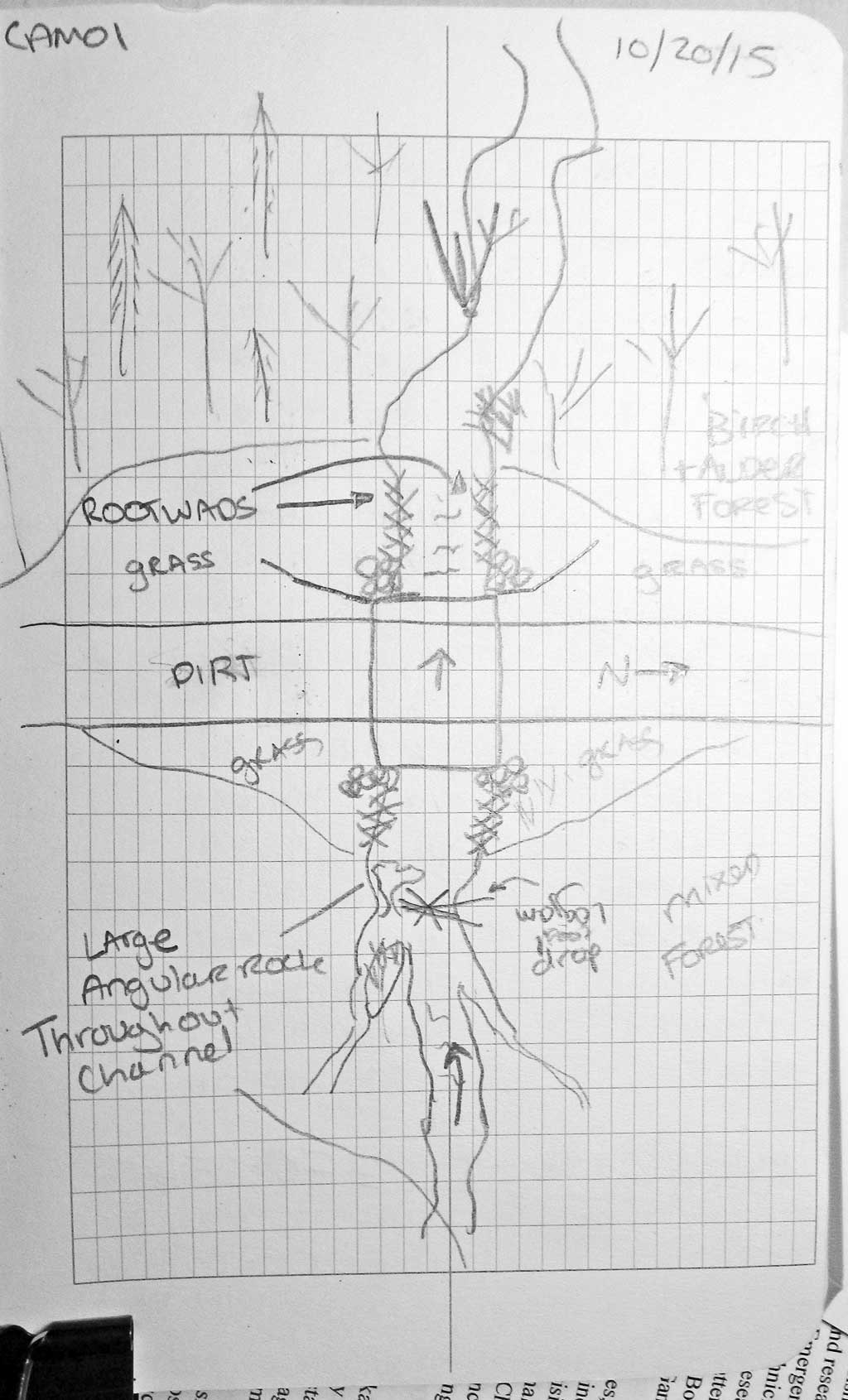
Survey UPDATE-CAM01
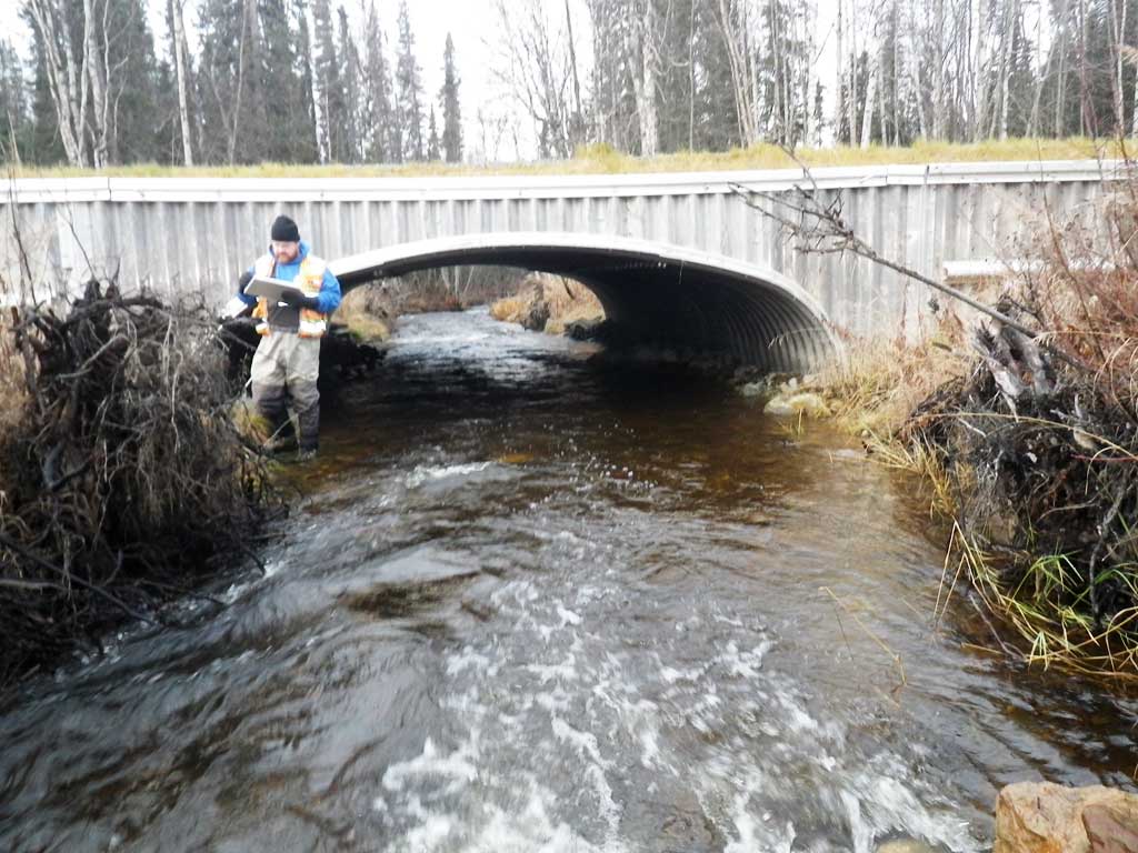
Project Supervisor: Gillian O'Doherty, ADFG
Observers: Gillian O'Doherty, Mark Eisenman
Overall Fish Passage Rating:
Tidal: No
Backwatered: No
Step Pools: No
Construction Year: 2013
Site Observations:
- None of this type
Comments: Replaced with a stream simulation culvert in June 2013. Site resurveyed 10/20/15.
Culvert Measurements
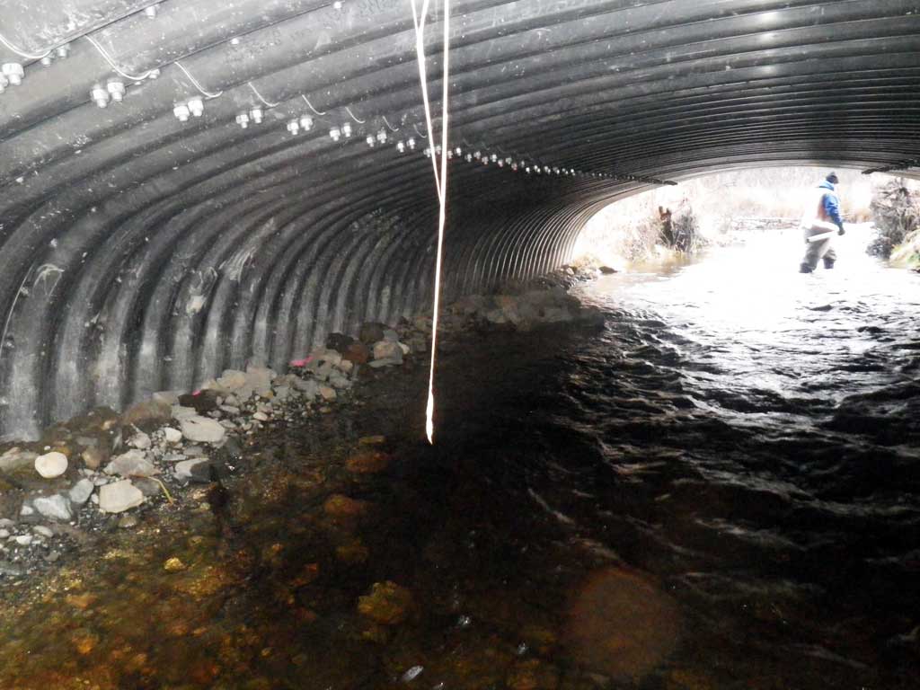
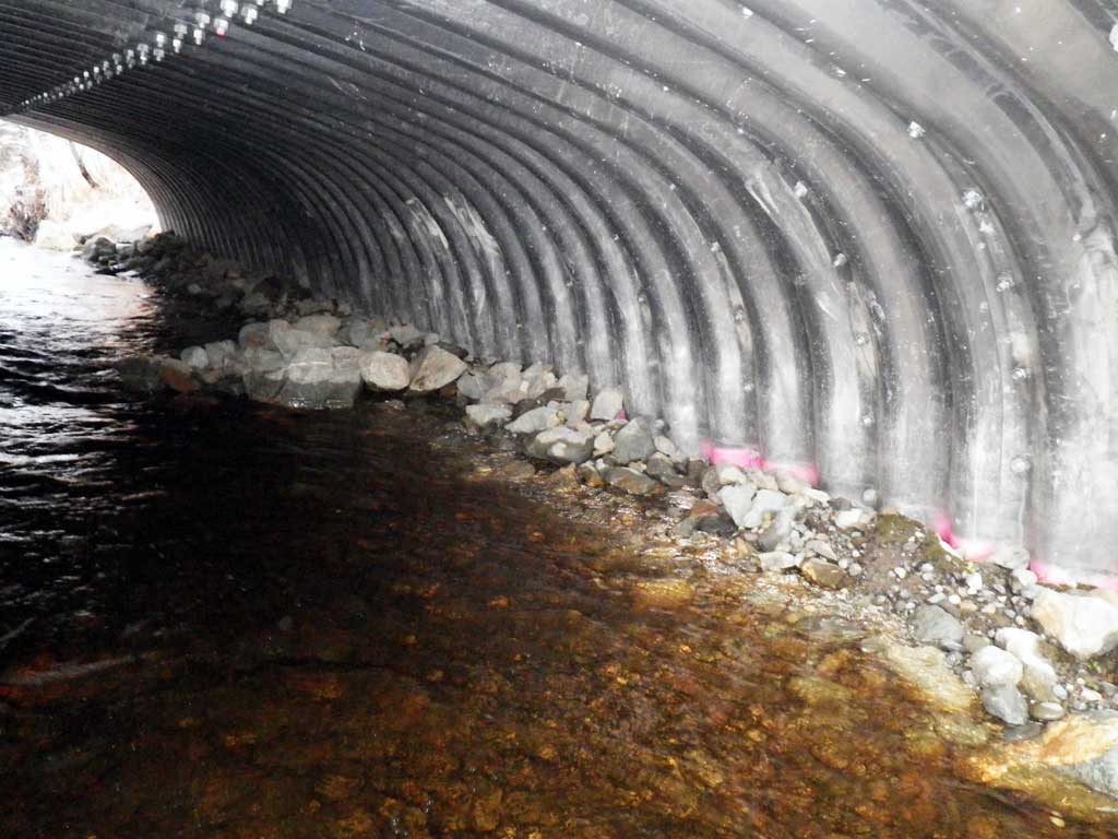
| ID: 1 | Structure Type: Box culvert (Structural aluminum plate) | Fish Passage Rating: | ||||||||||||||||||||||||||||||||||||||||||
|
|
|
||||||||||||||||||||||||||||||||||||||||||
Comments: Stream slope taken from site plans. Upstream stream slope is .54%, downstream stream slope is 1.67%.. Culvert dimensions from plans are 19.8' wide x 7.66' tall. |
||||||||||||||||||||||||||||||||||||||||||||
Culvert Observations:
|
||||||||||||||||||||||||||||||||||||||||||||
Stream Measurements
|
|
| Stream Width Type | Distance From Crossing (ft) |
Stream Width (ft) |
|---|---|---|
| Downstream ordinary high water | 300.0 | 13.00 |
| Downstream ordinary high water | 500.0 | 14.60 |
| Downstream ordinary high water | 700.0 | 16.00 |
Elevations
| Locator ID | Culvert Number |
River Distance (ft)1 |
Distance From Crossing (ft)2 |
Relative Elevation (ft) |
|---|---|---|---|---|
| Road Elev | 101.19 | |||
| D/S Thalweg (riffle) | 0.00 | 90.66 | ||
| D/S Water Surface Elev | 0.00 | 91.93 | ||
| D/S Water Surface Elev | 27.00 | 92.07 | ||
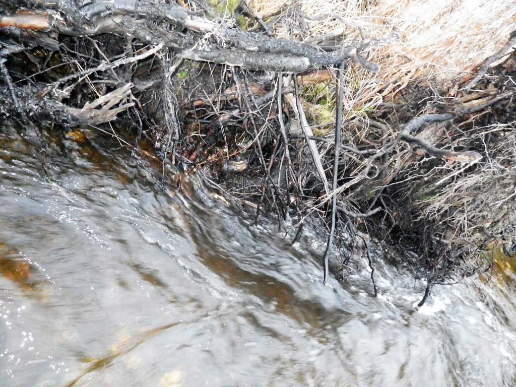
| D/S Grade Ctrl (Thalweg) (rock step across 1/2 of channel) | 27.00 | 90.75 | ||
| D/S Thalweg (end of rootwads) | 66.00 | 91.43 | ||
| D/S Water Surface Elev | 66.00 | 92.49 | ||
| D/S Water Surface Elev | 89.00 | 92.86 | ||
| Outlet Culvert Top (edge of culvert) | 89.00 | 97.88 | ||
| Outlet Culvert Top (On center bolt of outlet collar) | 89.00 | 97.98 | ||
| Outlet Invert (On substrate) | 89.00 | 91.61 | ||
| Inlet Culvert Invert (on substrate) | 125.70 | 91.68 | ||
| Inlet Culvert Top (edge of culvert) | 125.70 | 97.86 | ||
| Inlet Culvert Top (on center bolt of inlet collar) | 125.70 | 97.96 | ||
| U/S Water Surface Elev | 125.70 | 92.99 | ||
| U/S Water Surface Elev | 148.70 | 93.15 | ||
| U/S Grade Ctrl (Thalweg) (pile of rocks that cover about half of channel) | 148.70 | 91.58 | ||
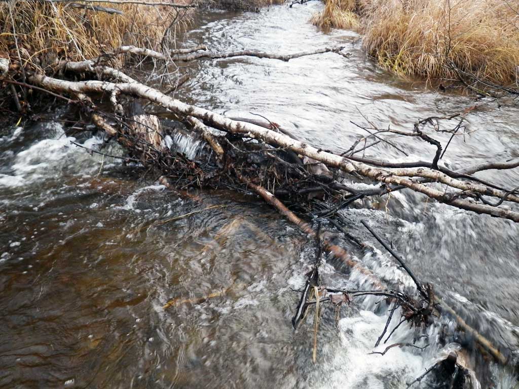
| U/S Grade Ctrl (Thalweg) (log jam) | 171.70 | 92.18 | ||
| U/S Water Surface Elev | 171.70 | 93.64 |
Notes:
- River distance is measured continuously throughout the survey reach along the thalweg of the stream.
- Measured from each end of the crossing along the thalweg of the stream.
Fish Sampling Efforts
| Gear Type: Visual Observation, Ground (A) | ||
Fish Observations
No fish observations occurred during this survey.
Photos


Questions or comments about this report can be directed to dfg.dsf.webmaster@alaska.gov