Fish Passage Site 20401294
Coordinates (dec. deg.): 61.52991°, -149.51996°
Legal Description: S017N001W30
Region: South Central
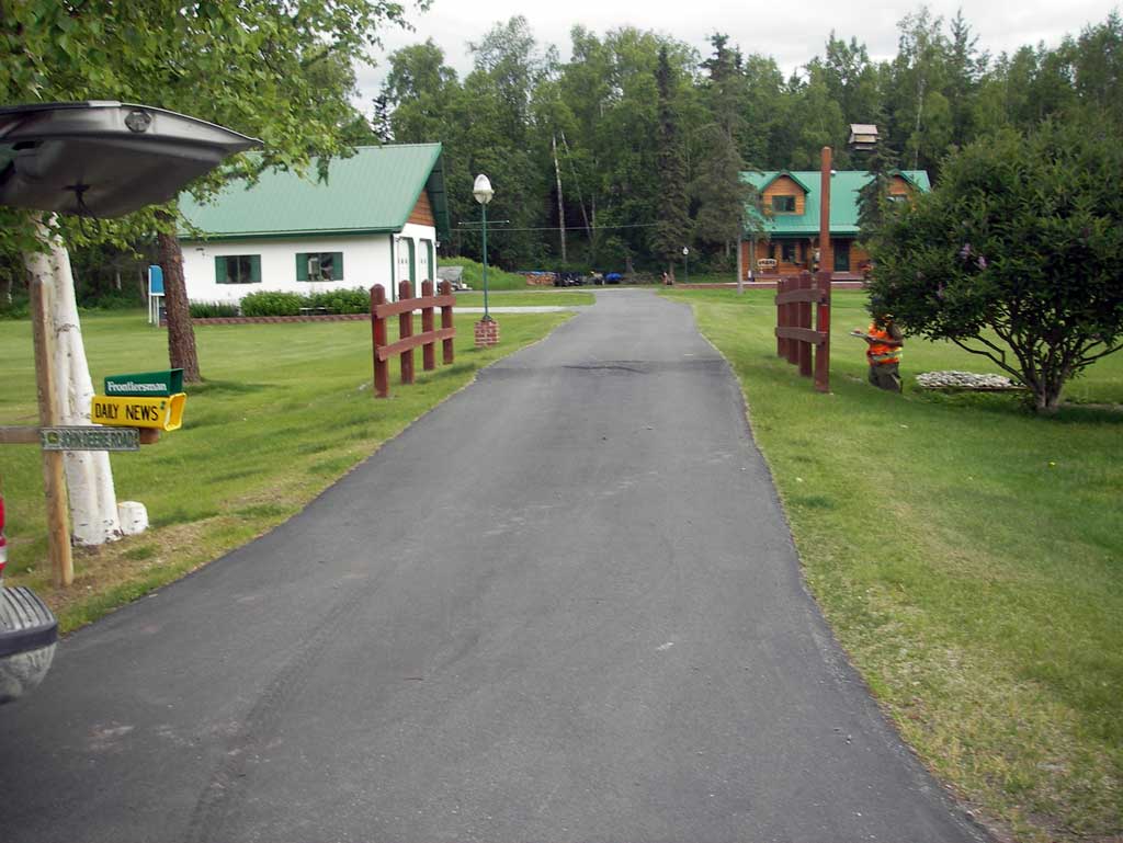
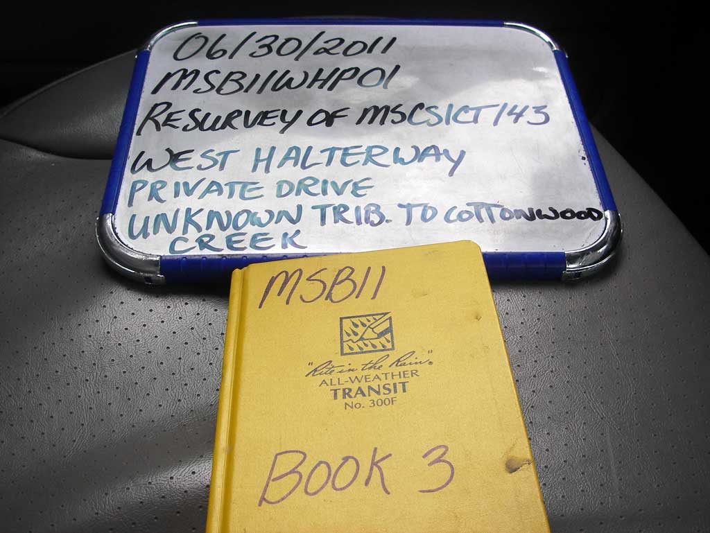
Road Name: West Halter Way
Datum: NAD83
Quad Name / ITM: Anchorage C-7
AWC Stream #: 247-50-10300-2022
Stream Name: Cottonwood Creek tributary
Elevation:
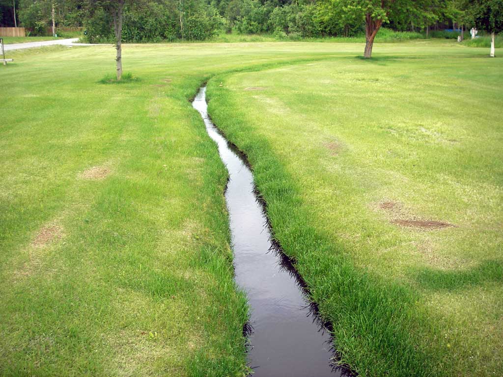
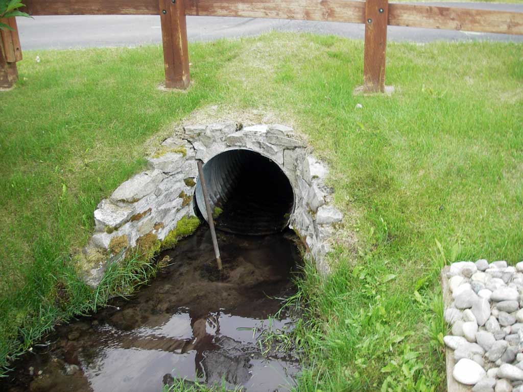
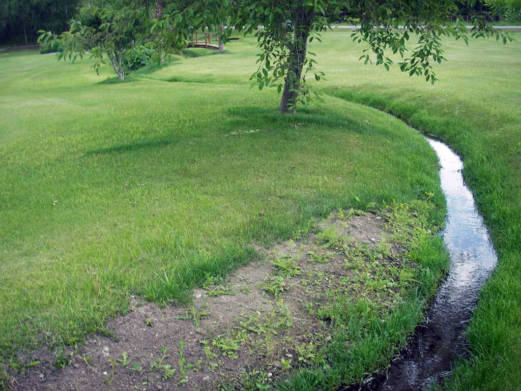
Site Comments: Private driveway w/ culvert over small drainage on the Robinson Family property yard.
arrow to the right of the survey date below to choose a different report for this site.
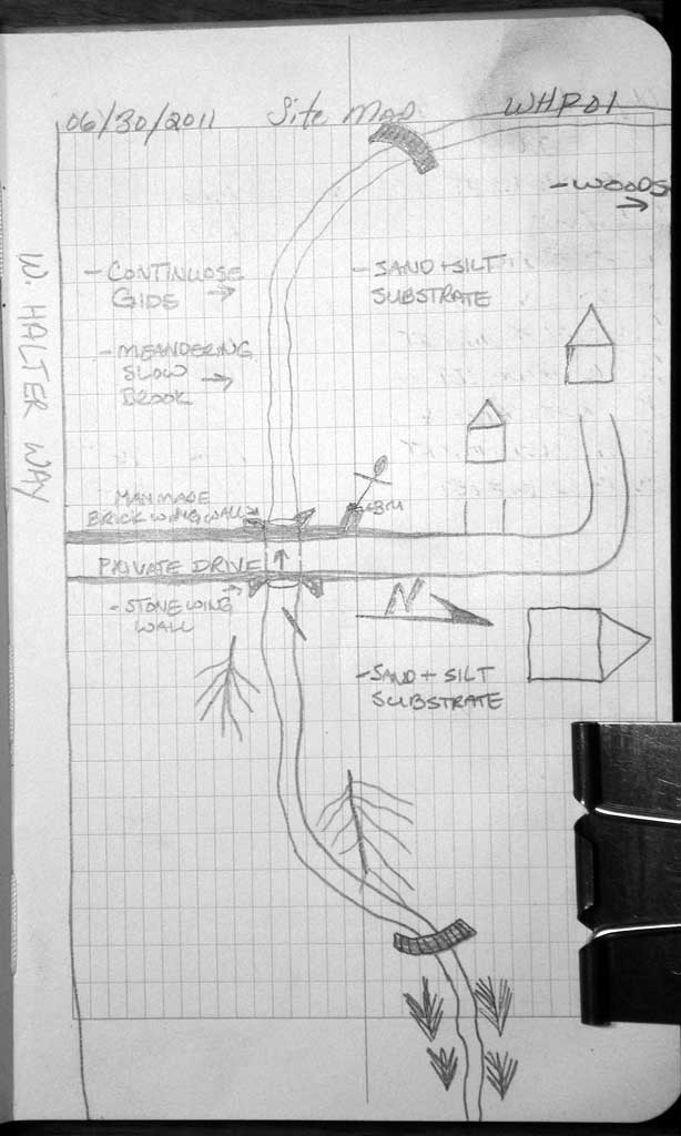
Survey MSB11-WHP01
Project Supervisor: Gillian O'Doherty, Alaska Department of Fish and Game
— Anchorage, AK
Observers: John Greuey, Abraham Gioffre
Overall Fish Passage Rating:
Tidal: No
Backwatered: No
Step Pools: No
Construction Year:
Site Observations:
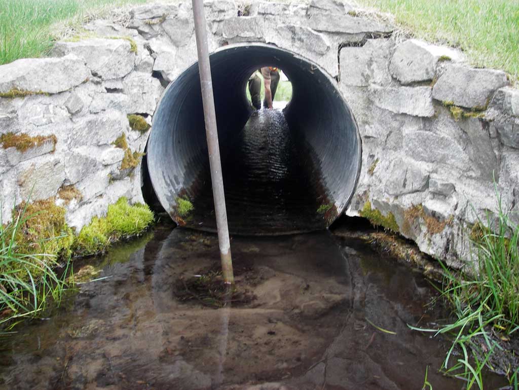
- Culvert gradient gray
- Shallow fill; inadequate roadfill volume above culvert
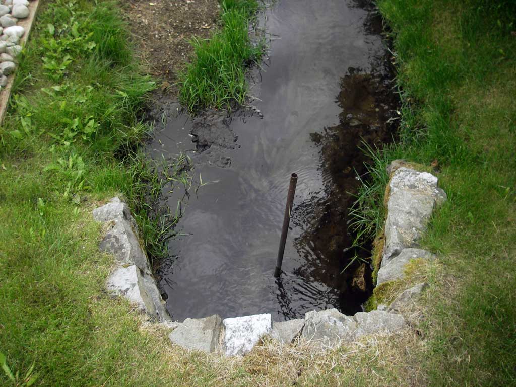
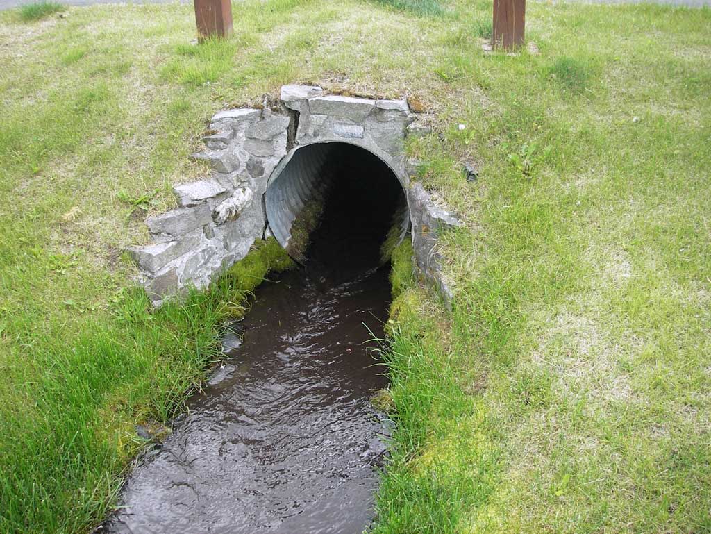
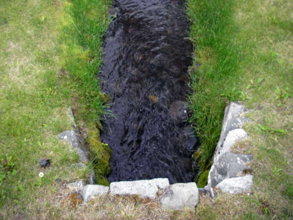
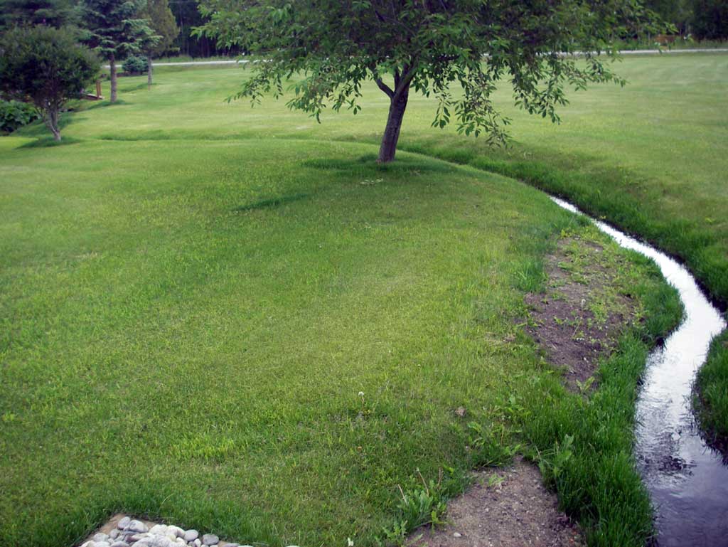
Comments: Private driveway w/ culvert over small drainage on the Robinson Family property yard. Heaving asphalt above culvert. Stream channelized through yard upstream & downstream and lawn groomed down to waterline. Very slow flow at culvert, almost still shallow pool area.
Culvert Measurements
| ID: 1 | Structure Type: Circular pipe (Corrugated steel) | Fish Passage Rating: | ||||||||||||||||||||||||||||||||||||||||||
|
|
|
||||||||||||||||||||||||||||||||||||||||||
Culvert Observations:
|
||||||||||||||||||||||||||||||||||||||||||||
Stream Measurements
|
|
| Stream Width Type | Distance From Crossing (ft) |
Stream Width (ft) |
|---|---|---|
| Downstream ordinary high water | 13.0 | 1.85 |
| Downstream ordinary high water | 22.0 | 1.65 |
| Downstream ordinary high water | 34.0 | 1.35 |
Elevations
| Locator ID | Culvert Number |
River Distance (ft)1 |
Distance From Crossing (ft)2 |
Relative Elevation (ft) |
|---|---|---|---|---|
| D/S Water Surface Elev | 0.00 | 96.17 | ||
| D/S Thalweg (Profile point at top of small riffle.Not a real grade point.) | 0.00 | 95.85 | ||
| D/S Thalweg (Profile point at beginning of glide.) | 30.00 | 95.75 | ||
| D/S Water Surface Elev | 30.00 | 96.17 | ||
| D/S Water Surface Elev (Water surface at outlet invert.) | 36.00 | 96.17 | ||
| Outlet Invert (On pipe) | 36.00 | 96.01 | ||
| Road Elev (Road is a private drive off West Halter Way.) | 46.00 | 99.35 | ||
| Inlet Culvert Invert (On pipe) | 56.44 | 96.19 | ||
| U/S Water Surface Elev (Water surface at inlet invert) | 56.44 | 96.46 | ||
| U/S Water Surface Elev | 68.44 | 96.51 | ||
| U/S Thalweg (Profile point at glide upstream of inlet. No features. Substrate deeper than inverts.) | 68.44 | 96.01 |
Notes:
- River distance is measured continuously throughout the survey reach along the thalweg of the stream.
- Measured from each end of the crossing along the thalweg of the stream.
Fish Sampling Efforts
No fish sampling occurred during this survey.
Fish Observations
No fish observations occurred during this survey.
Photos
Questions or comments about this report can be directed to dfg.dsf.webmaster@alaska.gov