Fish Passage Site 20401268
Coordinates (dec. deg.): 61.62885°, -149.26083°
Legal Description: S018N001E22
Region: South Central
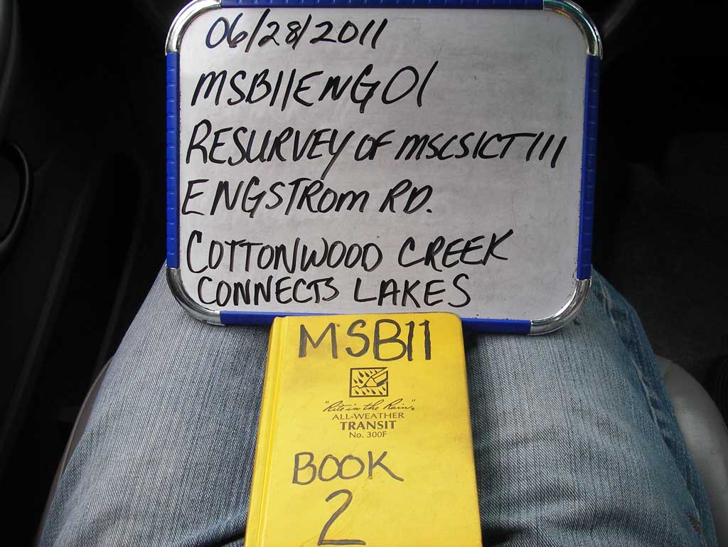
Road Name: Engstrom Road
Datum: NAD83
Quad Name / ITM: Anchorage C-7
AWC Stream #: 247-50-10300-2054
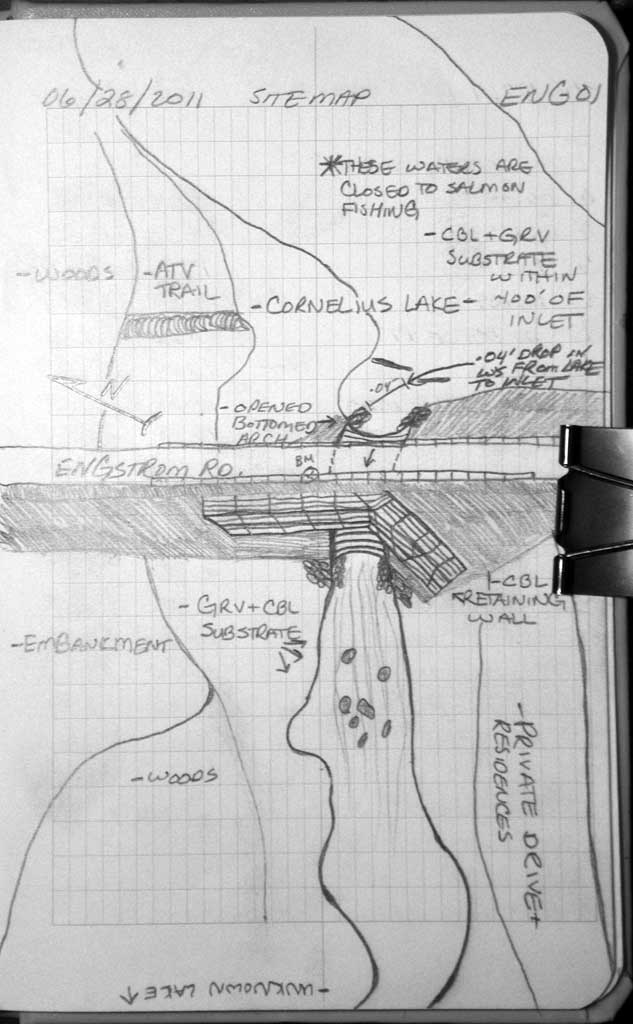
Stream Name: Cornelius and Nekleson Lakes
Elevation:
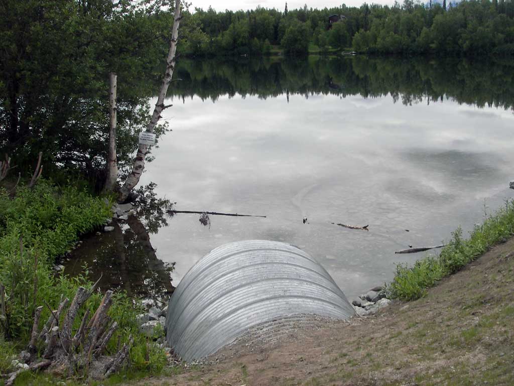
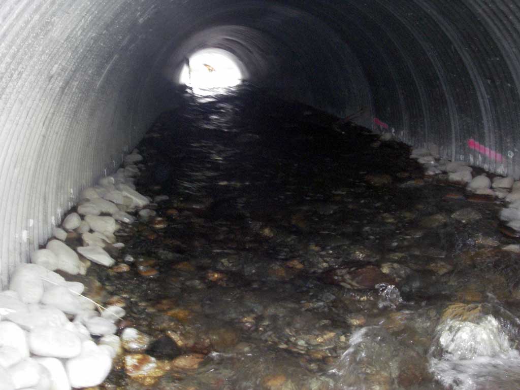
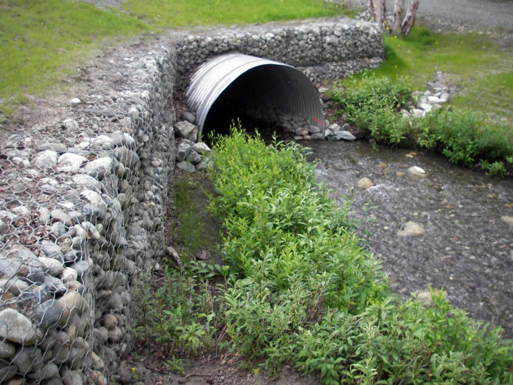
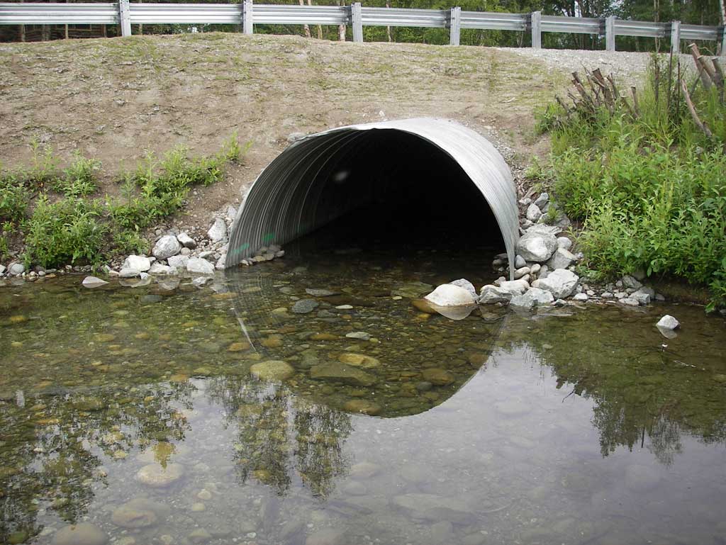
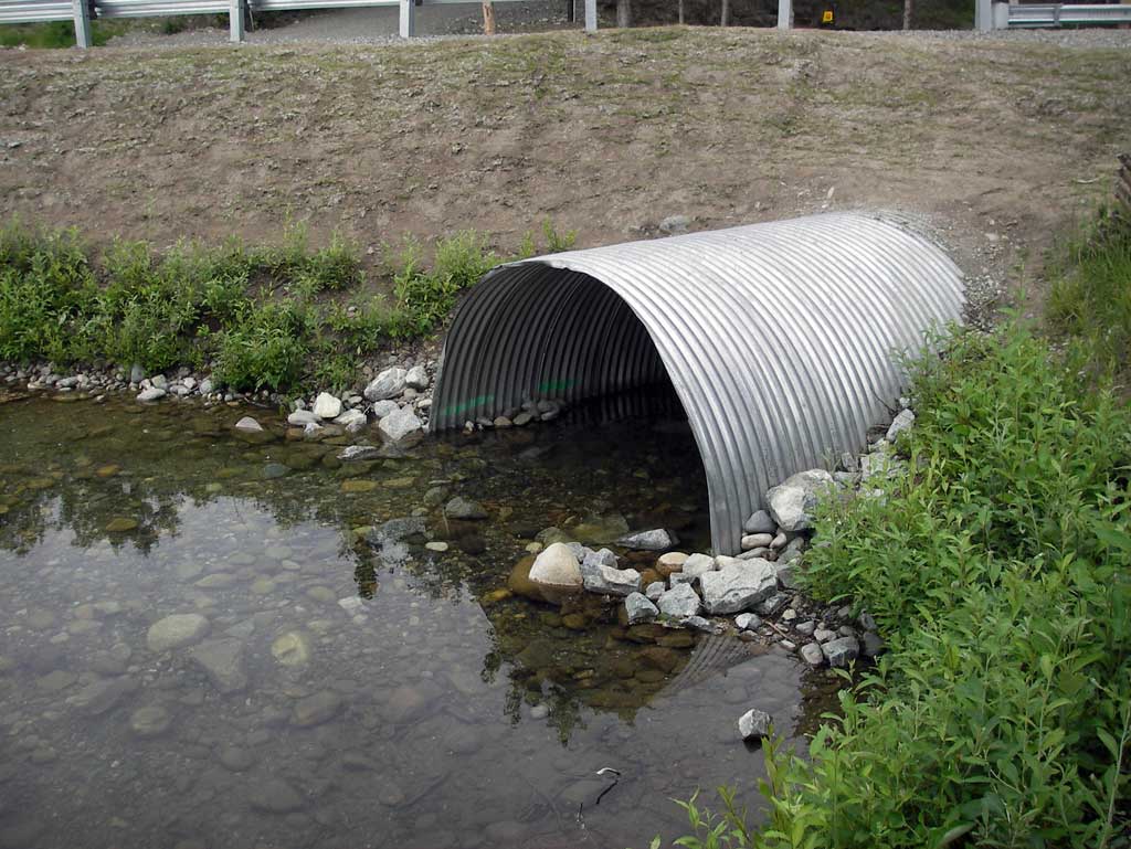
Site Comments: Culvert inlet at mouth of Cornelius Lake
arrow to the right of the survey date below to choose a different report for this site.
Survey MSB11-ENG01
Project Supervisor: Gillian O'Doherty, Alaska Department of Fish and Game
— Anchorage, AK
Observers: John Greuey, Abraham Gioffre
Overall Fish Passage Rating:
Tidal: No
Backwatered: No
Step Pools: No
Construction Year: 2010
Site Observations:
- Constriction ratio gray
Comments: Post-replacment survey. Resurvey of MSCS1CT111 and MSB10ENG01
Culvert Measurements
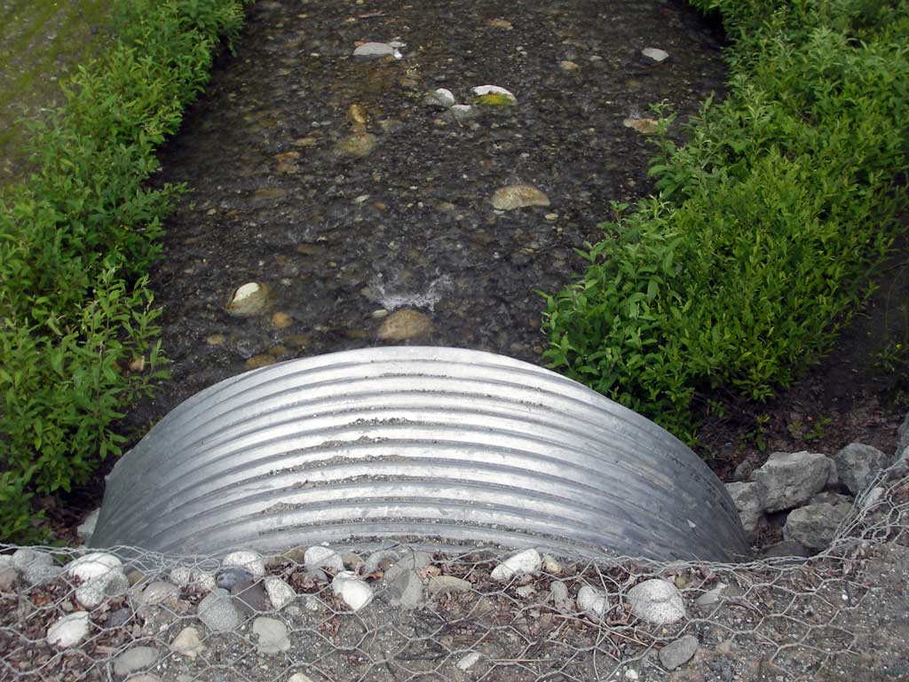
| ID: 1 | Structure Type: Open-bottom arch (Corrugated steel) | Fish Passage Rating: | |||||||||||||||||||||||||||||||||||||||||
|
|
|
|||||||||||||||||||||||||||||||||||||||||
Culvert Observations:
|
|||||||||||||||||||||||||||||||||||||||||||
Stream Measurements
|
|
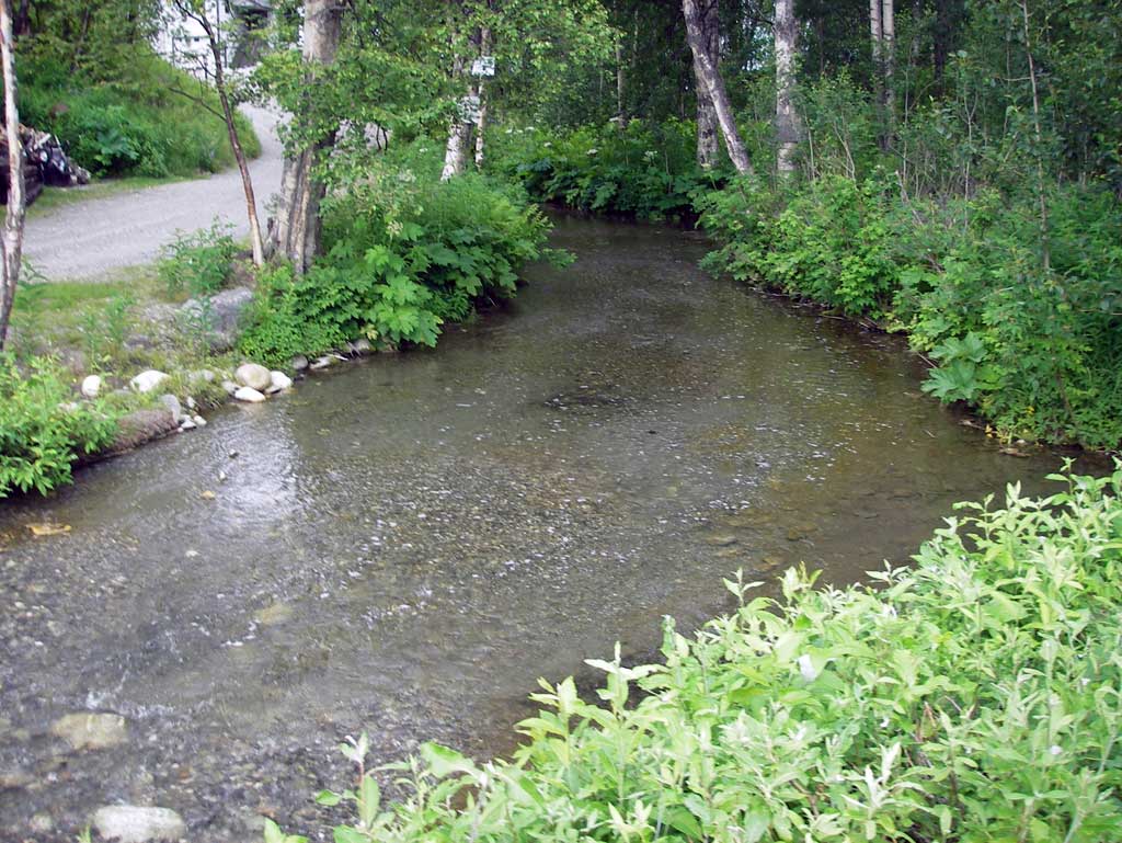
| Stream Width Type | Distance From Crossing (ft) |
Stream Width (ft) |
|---|---|---|
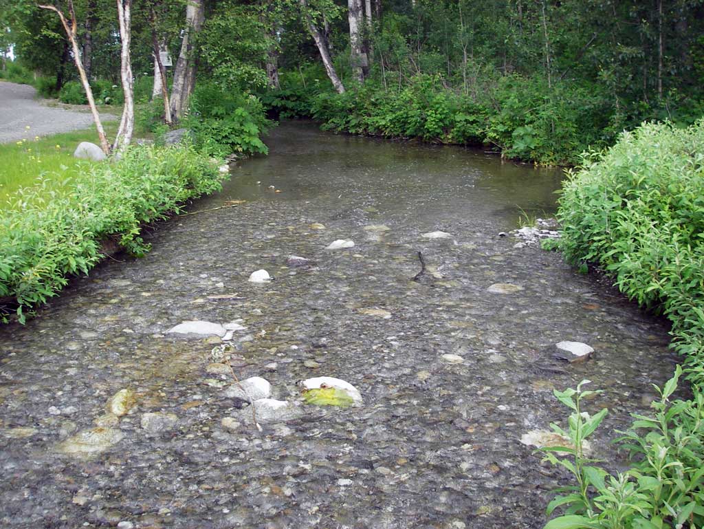
| Downstream ordinary high water | 83.0 | 13.00 |
| Downstream ordinary high water | 124.0 | 13.20 |
| Downstream ordinary high water | 155.0 | 12.80 |
Elevations
| Locator ID | Culvert Number |
River Distance (ft)1 |
Distance From Crossing (ft)2 |
Relative Elevation (ft) |
|---|---|---|---|---|
| D/S Grade Ctrl (Thalweg) (Top of riffle) | 0.00 | 85.93 | ||
| D/S Water Surface Elev (Used for stream gradient) | 0.00 | 86.27 | ||
| D/S Grade Ctrl (Thalweg) (Top of riffle) | 50.00 | 86.69 | ||
| D/S Water Surface Elev | 50.00 | 87.17 | ||
| D/S Thalweg (Down stream profile point.Top of glide) | 92.00 | 87.36 | ||
| D/S Water Surface Elev | 92.00 | 87.73 | ||
| Outlet Pool Water Elev (Water surface at max pool) | 164.00 | 87.78 | ||
| Max Pool Depth (Outlet pool depth at bottom of outlet riffle 36' downstream.) | 164.00 | 87.00 | ||
| Outlet Culvert Top | 220.00 | 93.20 | ||
| Outlet Invert (On substrate) | 220.00 | 87.97 | ||
| D/S Water Surface Elev (Water surface at outlet invert) | 220.00 | 88.65 | ||
| Road Elev (Center of road) | 267.00 | 97.77 | ||
| Inlet Culvert Invert (On substrate) | 315.15 | 88.89 | ||
| Inlet Culvert Top | 315.15 | 94.07 | ||
| U/S Water Surface Elev (Water surface at inlet invert) | 315.15 | 89.67 | ||
| U/S Water Surface Elev (Water surface of lake) | 335.15 | 89.71 | ||
| U/S Grade Ctrl (Thalweg) (Cobble substrate in lake) | 335.15 | 88.89 |
Notes:
- River distance is measured continuously throughout the survey reach along the thalweg of the stream.
- Measured from each end of the crossing along the thalweg of the stream.
Fish Sampling Efforts
No fish sampling occurred during this survey.
Fish Observations
No fish observations occurred during this survey.
Photos
Questions or comments about this report can be directed to dfg.dsf.webmaster@alaska.gov