Fish Passage Site 20400588
Coordinates (dec. deg.): 61.73055°, -148.79634°
Legal Description: S019N004E18
Region: South Central
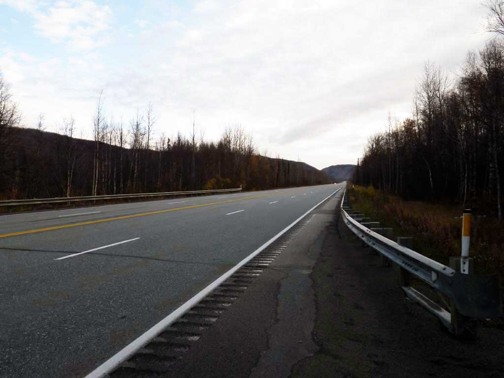
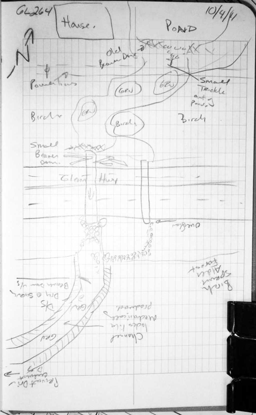
Road Name: Glenn Highway
Datum: NAD83
Quad Name / ITM: Anchorage C-5
AWC Stream #:
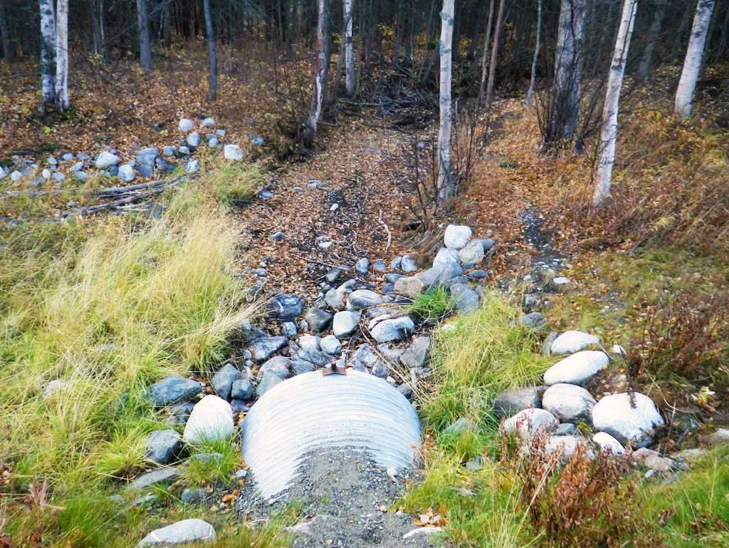
Stream Name: Matanuska River tributary
Elevation:
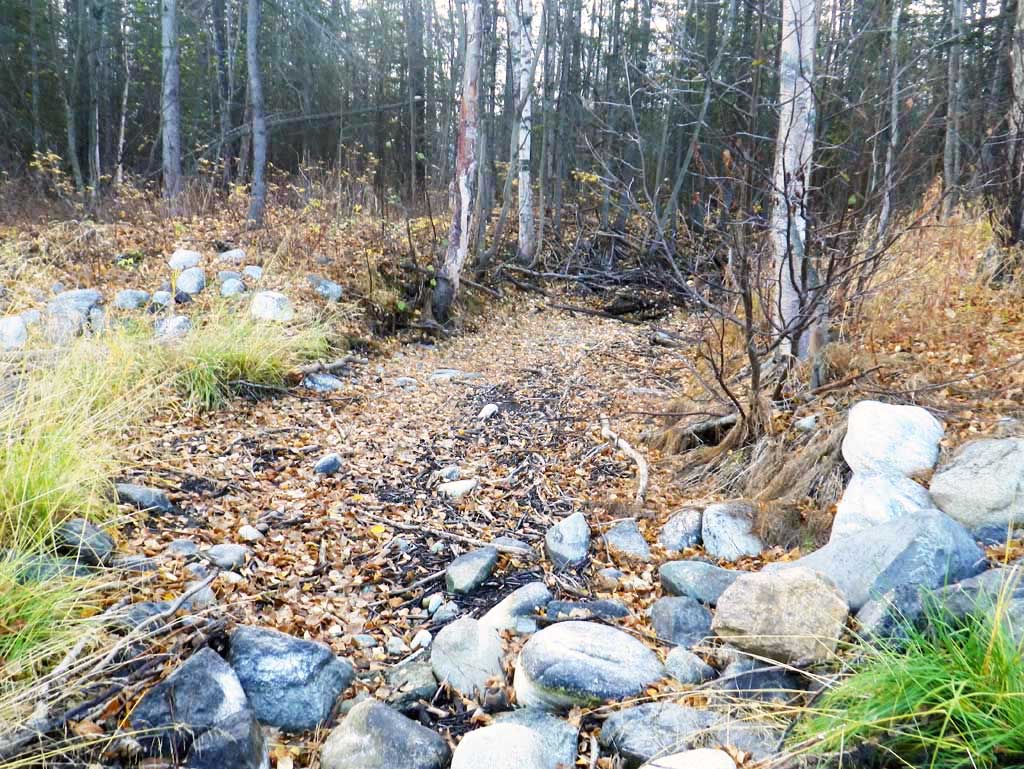
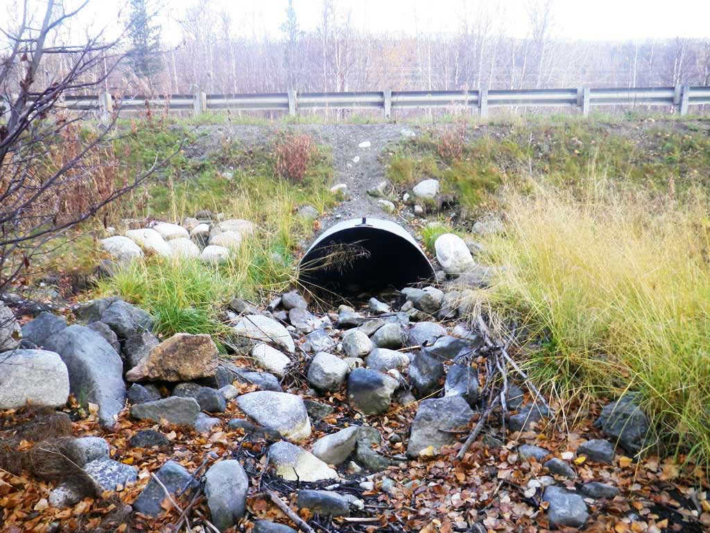
Site Comments: Site is between Mile Post 64 and 65. Under 4 lanes of road.
arrow to the right of the survey date below to choose a different report for this site.
Survey MSB11-GL264
Project Supervisor: Gillian O'Doherty, Alaska Department of Fish and Game
— Anchorage, AK
Observers: Mark Eisenman, John Greuey
Overall Fish Passage Rating:
Tidal: No
Backwatered: No
Step Pools: No
Construction Year:
Site Observations:
- Culvert gradient gray
- Woody Debris
- Beaver Activity
- Constriction ratio gray
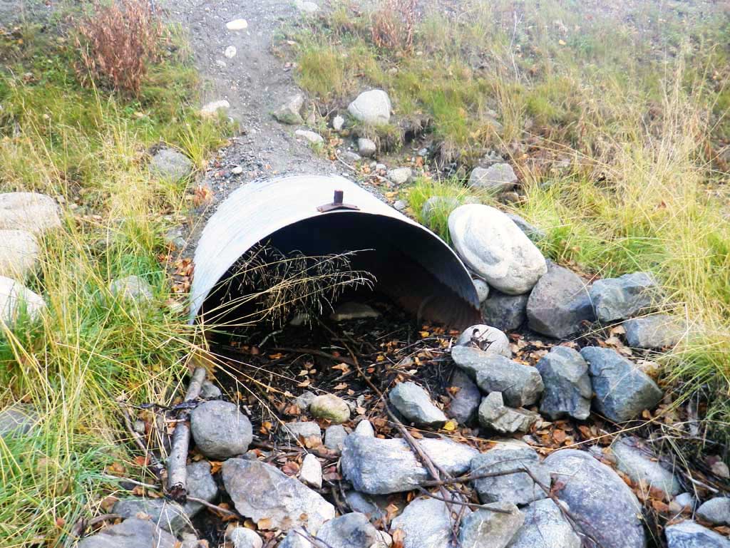
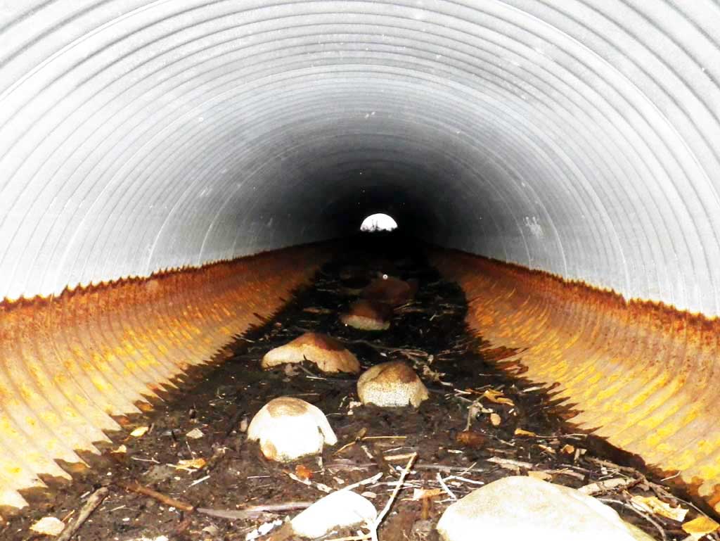
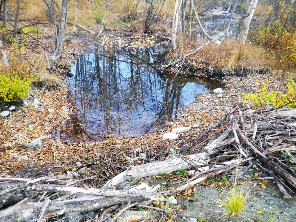
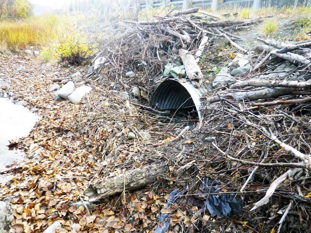
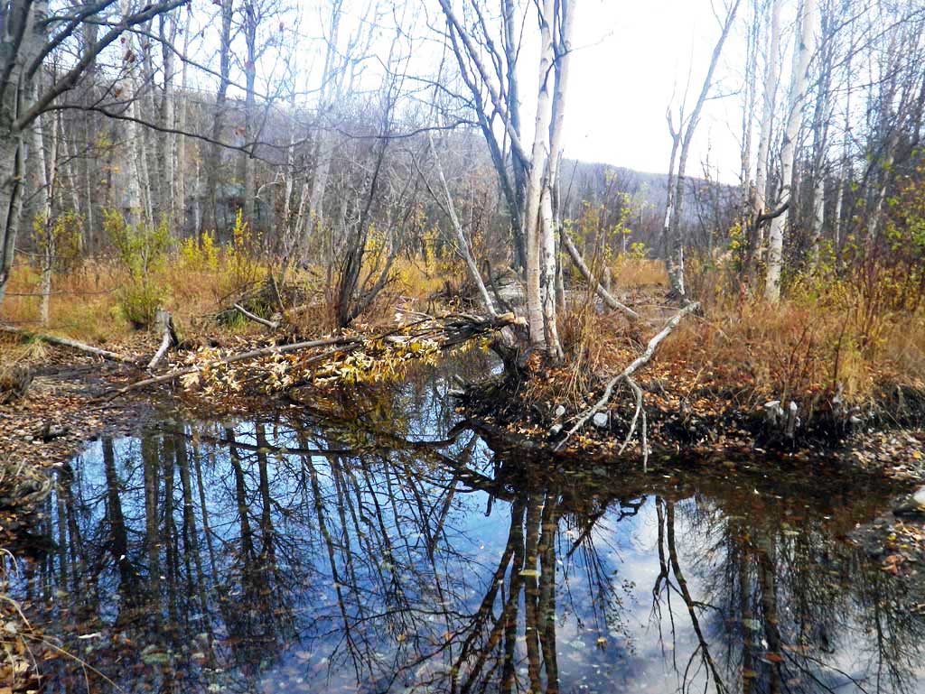
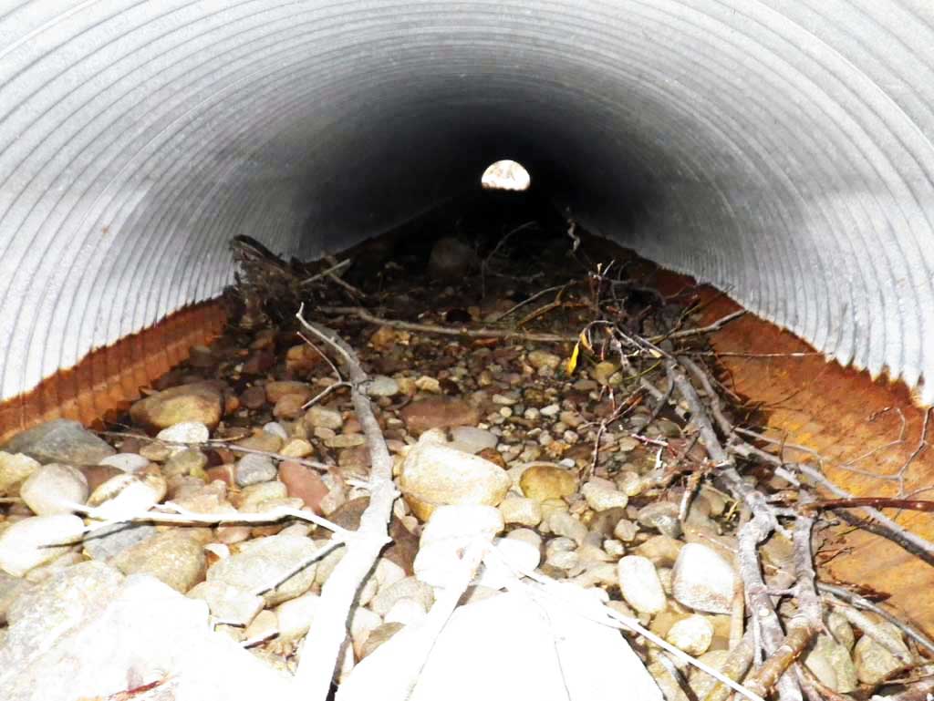
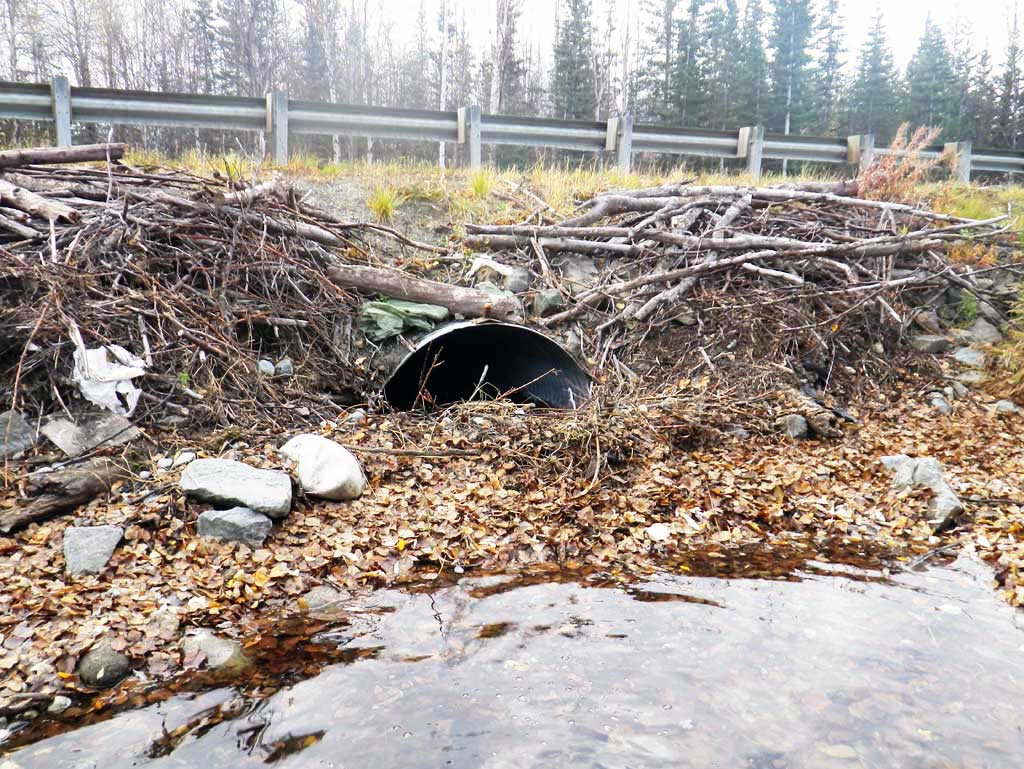
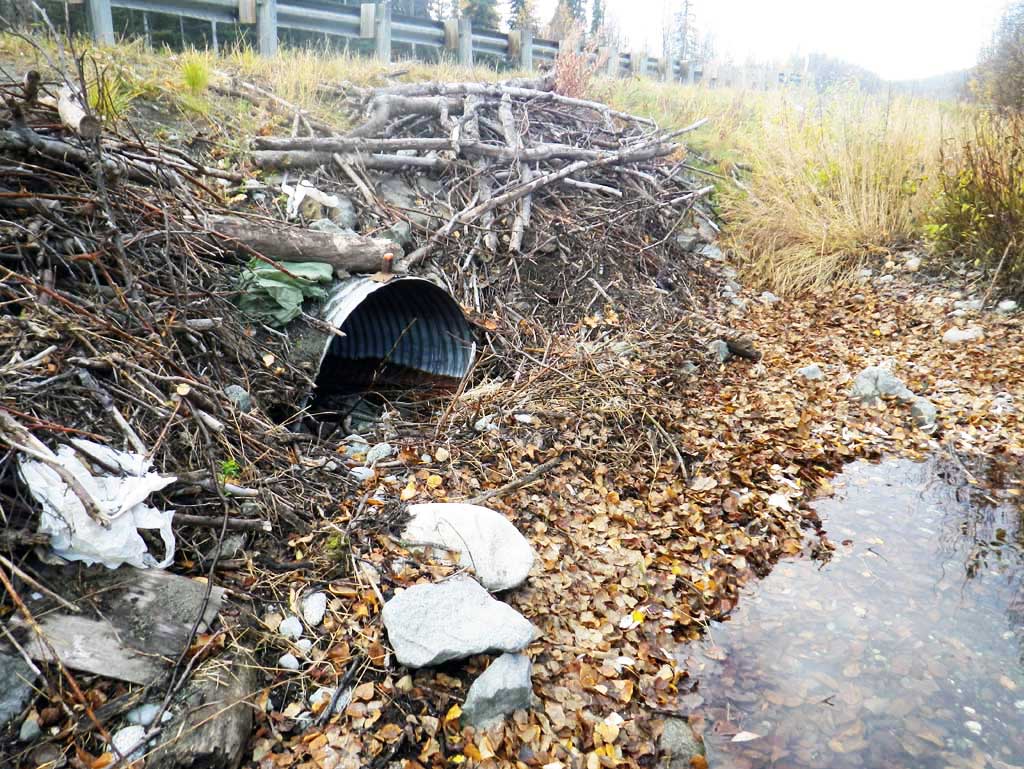
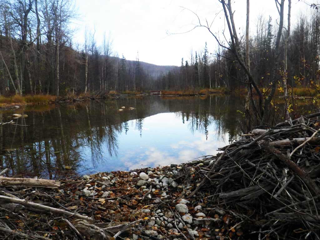
Comments: Culvert had no flow at time of survey. U/S has heavy beaver activity with wide pools. Small beaver dam at inlet completely plugging culvert. Small overflow culvert present. Upstream of beaver dam there is slight flow out of pond and water goes subsurface before reaching pipe. Downstream channel appears mechanically influenced with fairly consistant stream width.
Culvert Measurements
| ID: 1 | Structure Type: Pipe-arch (Corrugated steel) | Fish Passage Rating: | |||||||||||||||||||||||||||||||||||||||||
|
|
|
|||||||||||||||||||||||||||||||||||||||||
Culvert Observations:
|
|||||||||||||||||||||||||||||||||||||||||||
Stream Measurements
|
|
| Stream Width Type | Distance From Crossing (ft) |
Stream Width (ft) |
|---|---|---|
| Downstream ordinary high water | 70.0 | 9.50 |
| Downstream ordinary high water | 102.0 | 9.70 |
| Downstream ordinary high water | 128.0 | 8.90 |
Elevations
| Locator ID | Culvert Number |
River Distance (ft)1 |
Distance From Crossing (ft)2 |
Relative Elevation (ft) |
|---|---|---|---|---|
| Road Elev | 105.46 | |||
| D/S Grade Ctrl (Thalweg) (Stream dry downstream from pipe) | 0.00 | 97.27 | ||
| D/S Tailcrest or 1st Thalweg | 51.00 | 97.35 | ||
| Outlet Invert | 80.00 | 97.28 | ||
| Outlet Culvert Top | 80.00 | 100.41 | ||
| Inlet Culvert Top | 171.40 | 101.38 | ||
| Inlet Culvert Invert | 171.40 | 98.69 | ||
| Misc. (Top of Beaver Dam in front of Inlet) | 175.40 | 99.84 | ||
| U/S Thalweg (Profile point) | 179.40 | 98.35 | ||
| U/S Water Surface Elev | 179.40 | 98.66 |
Notes:
- River distance is measured continuously throughout the survey reach along the thalweg of the stream.
- Measured from each end of the crossing along the thalweg of the stream.
Fish Sampling Efforts
No fish sampling occurred during this survey.
Fish Observations
No fish observations occurred during this survey.
Photos
Questions or comments about this report can be directed to dfg.dsf.webmaster@alaska.gov