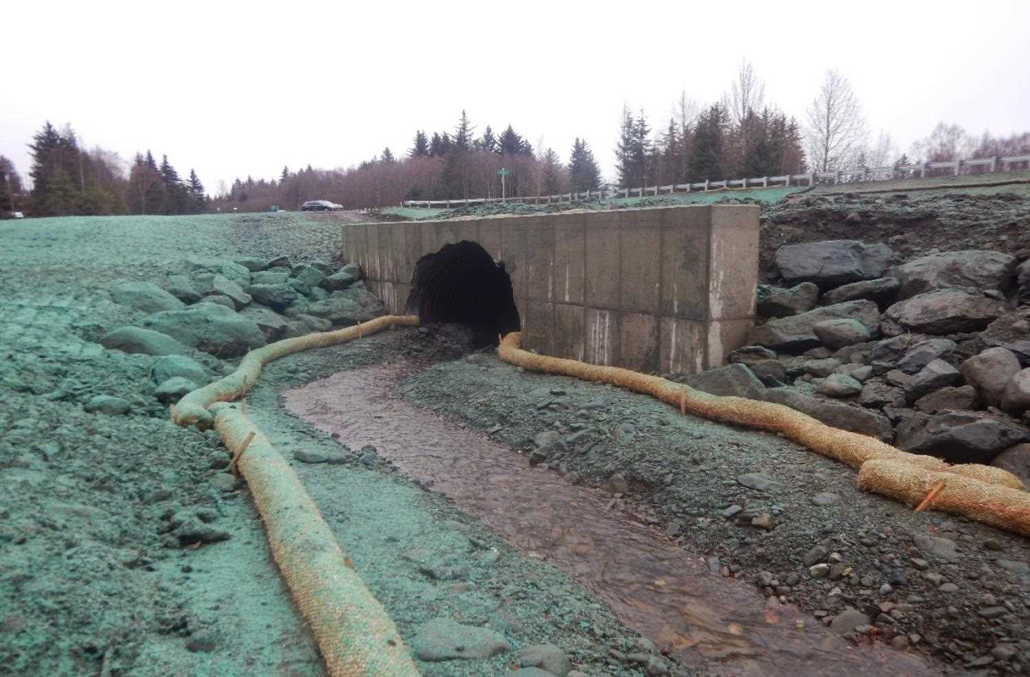
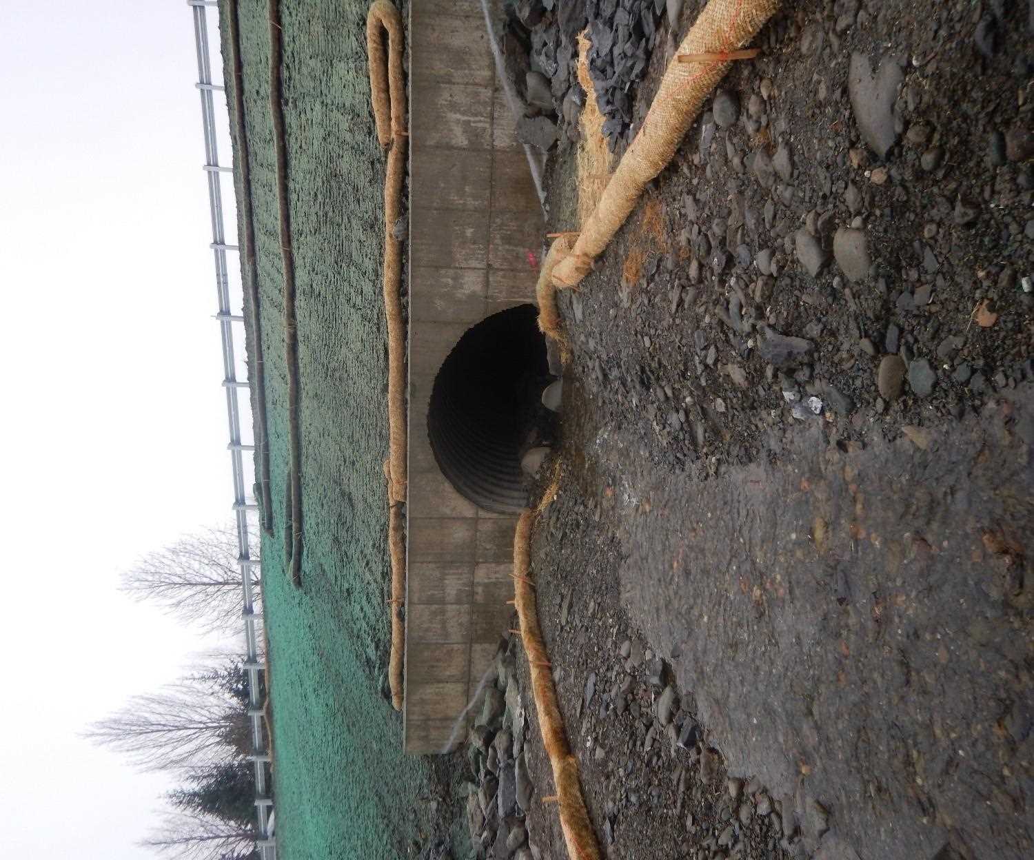
Fish Passage Site 20303943
Coordinates (dec. deg.): 60.96680°, -149.44250°
Legal Description: S010N001W10
Region: South Central
Road Name: Bike Path
Datum: WGS84
Quad Name / ITM: Seward D-7
AWC Stream #: 247-60-10278
Stream Name: Bear Creek
Elevation:
Site Comments: Located on a bike path next to the Seward Highway
Survey UPD20-SWP20
Project Supervisor: Gillian O'Doherty, Alaska Department of Fish and Game
— Anchorage, AK
Observers: Kim Clark, William Frost
Overall Fish Passage Rating:
Tidal:
Backwatered:
Step Pools:
Construction Year: 2019
Comments: Information submitted by Will Frost ( ADFG). New fish passage site on the bike path.
Culvert Measurements
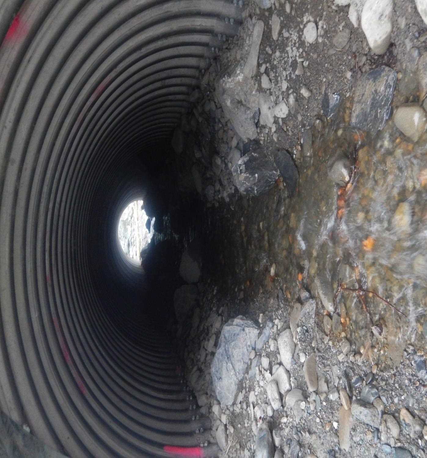
| ID: 1 | Structure Type: Circular pipe | Fish Passage Rating: | |||||||||||||||||||||||||||||||||||||||||
|
|
|
|||||||||||||||||||||||||||||||||||||||||
Comments: Measurements are estimated from FH19-II-0088. H 108" x W 108"' x L 68'. |
|||||||||||||||||||||||||||||||||||||||||||
Stream Measurements
|
|
No stream width data available.
Elevations
No elevation data available.
Fish Sampling Efforts
No fish sampling occurred during this survey.
Fish Observations
No fish observations occurred during this survey.
Photos

Questions or comments about this report can be directed to dfg.dsf.webmaster@alaska.gov