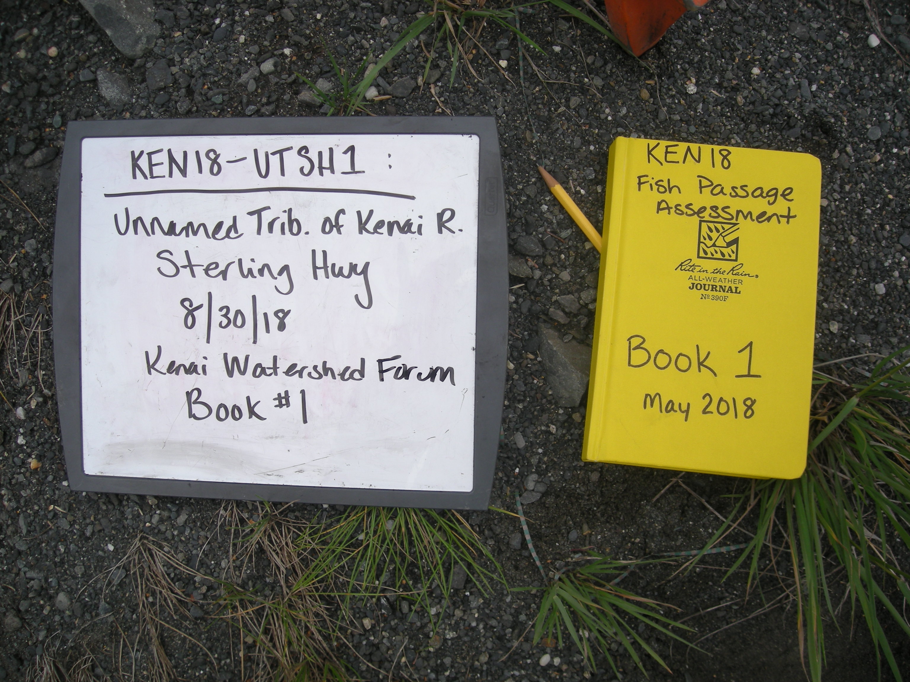
Fish Passage Site 20303808
Coordinates (dec. deg.): 60.48749°, -149.98402°
Legal Description: S005N004W28
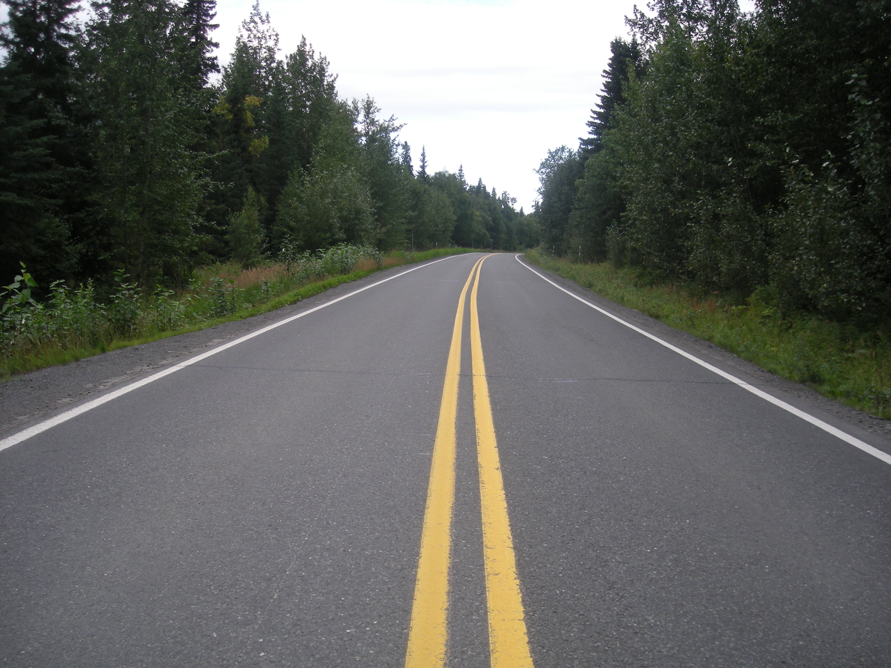
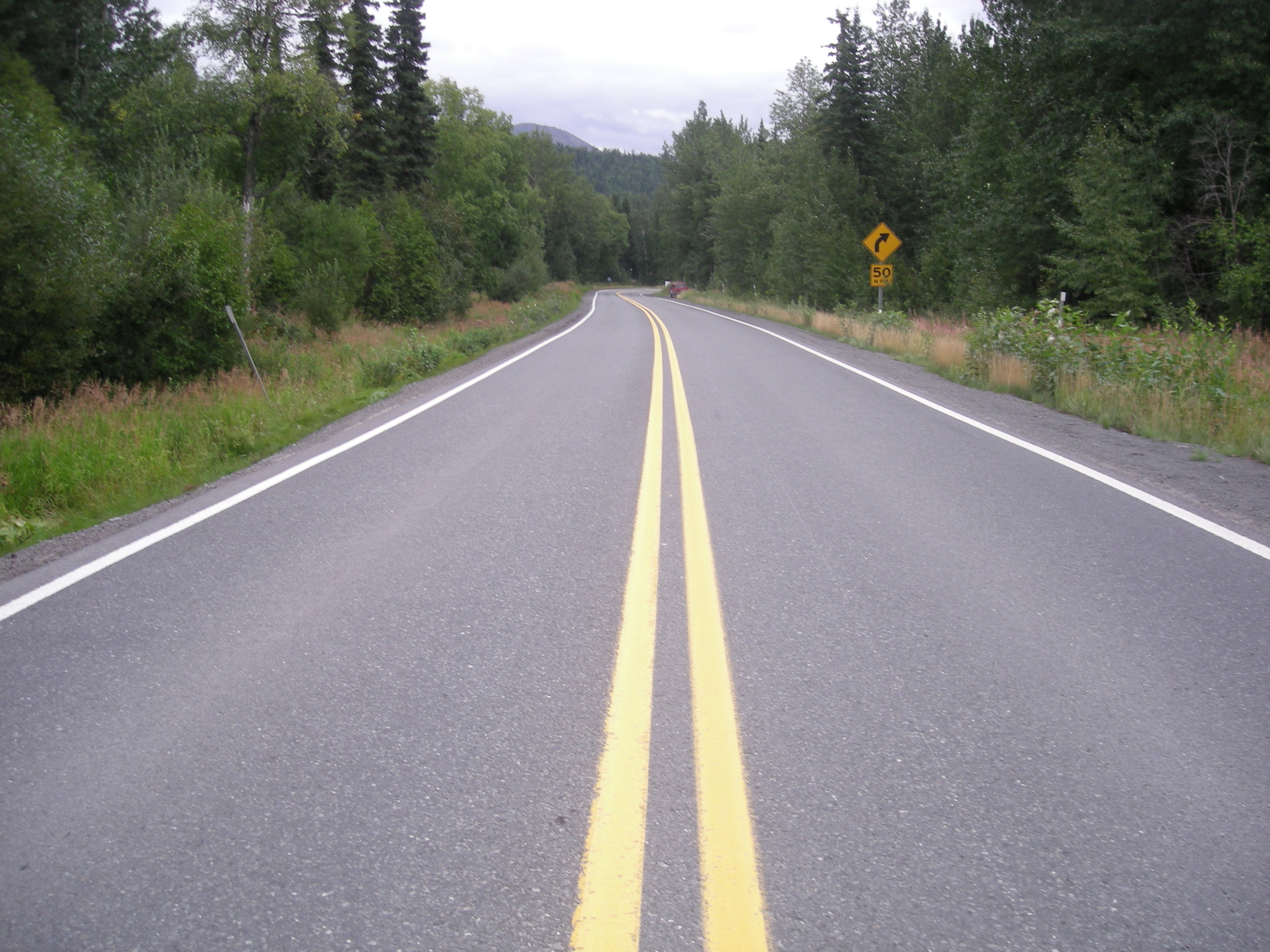
Region: South Central
Road Name: Sterling Highway
Datum: NAD83
Quad Name / ITM: Seward B-8
AWC Stream #: 244-30-10010-2157
Stream Name: Unnamed
Elevation:
Site Comments: None
Survey KEN18-UTSH1
Observers: Maggie Harings, Alice Main
Overall Fish Passage Rating:
Tidal: No
Backwatered: Yes
Step Pools: No
Construction Year:
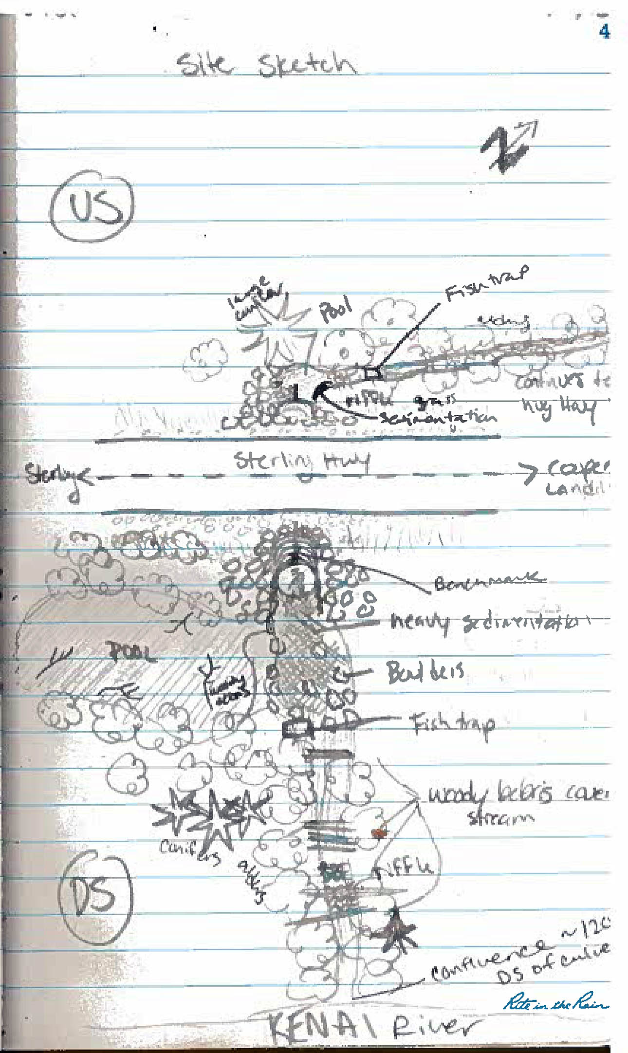
Site Observations:
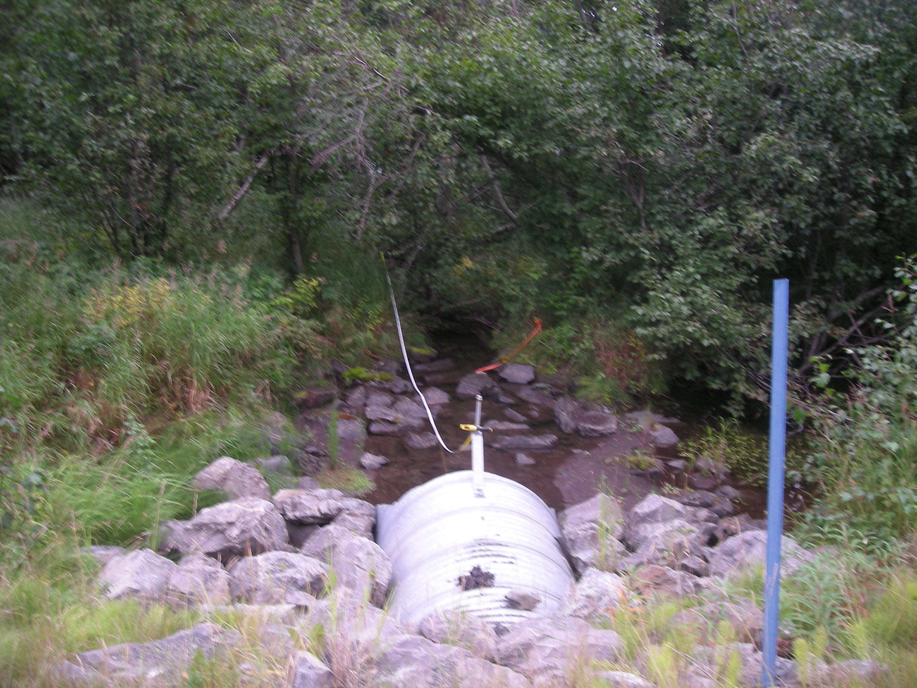
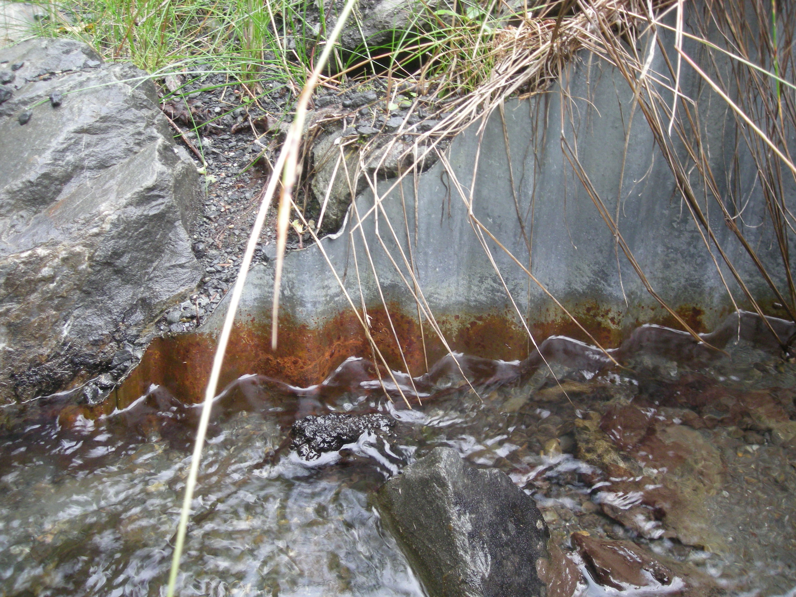
- Sediment accumulation
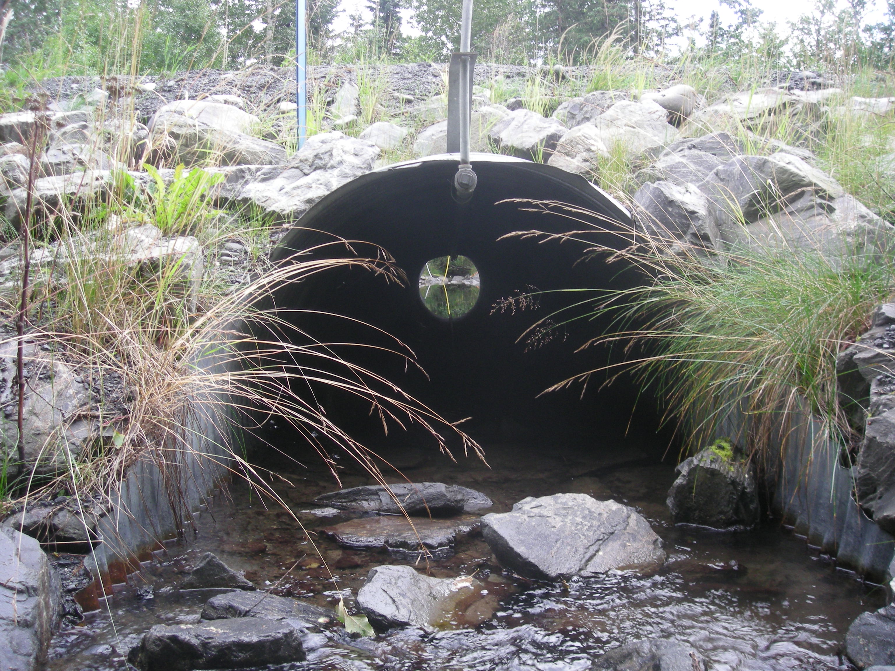
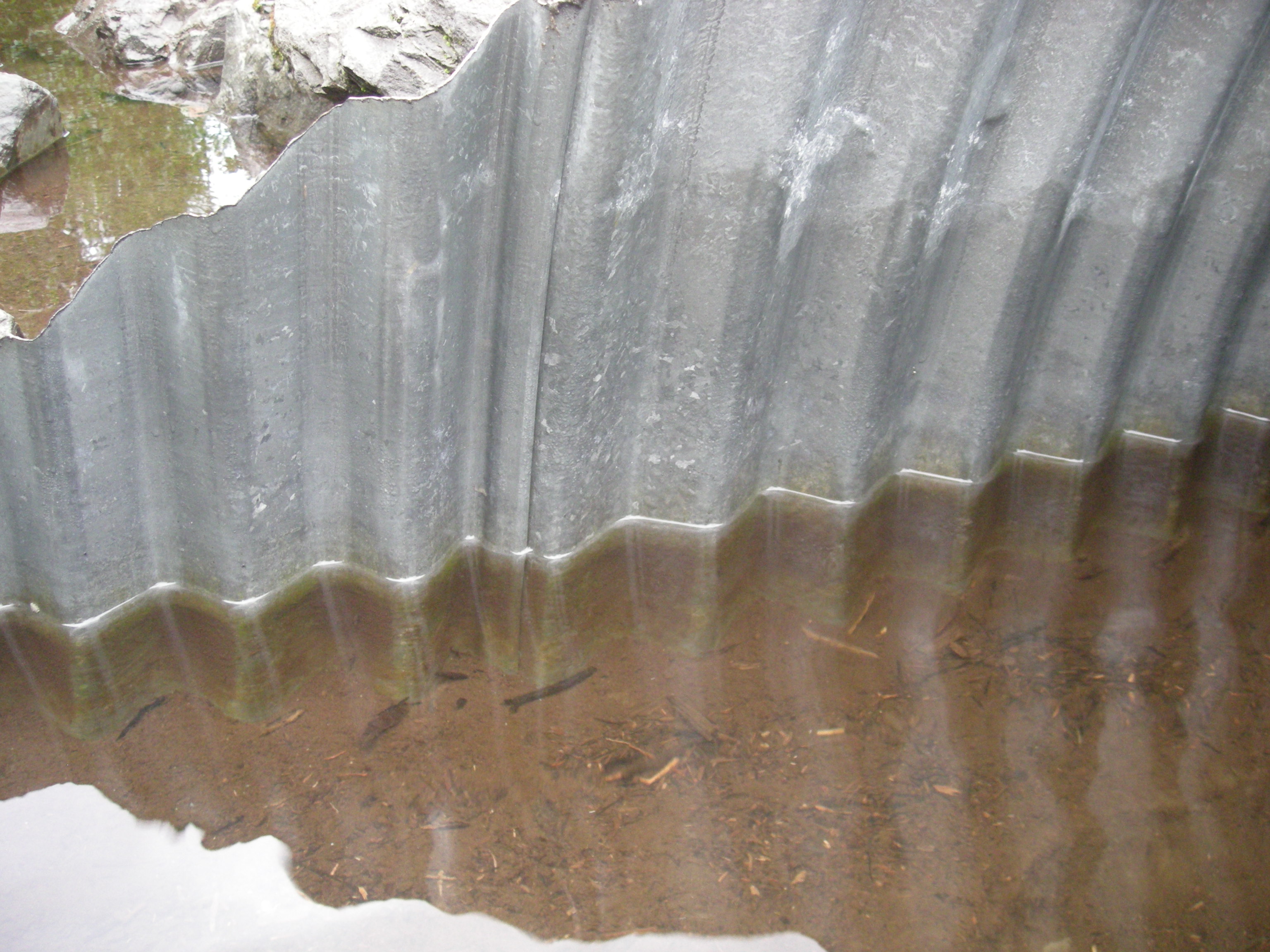
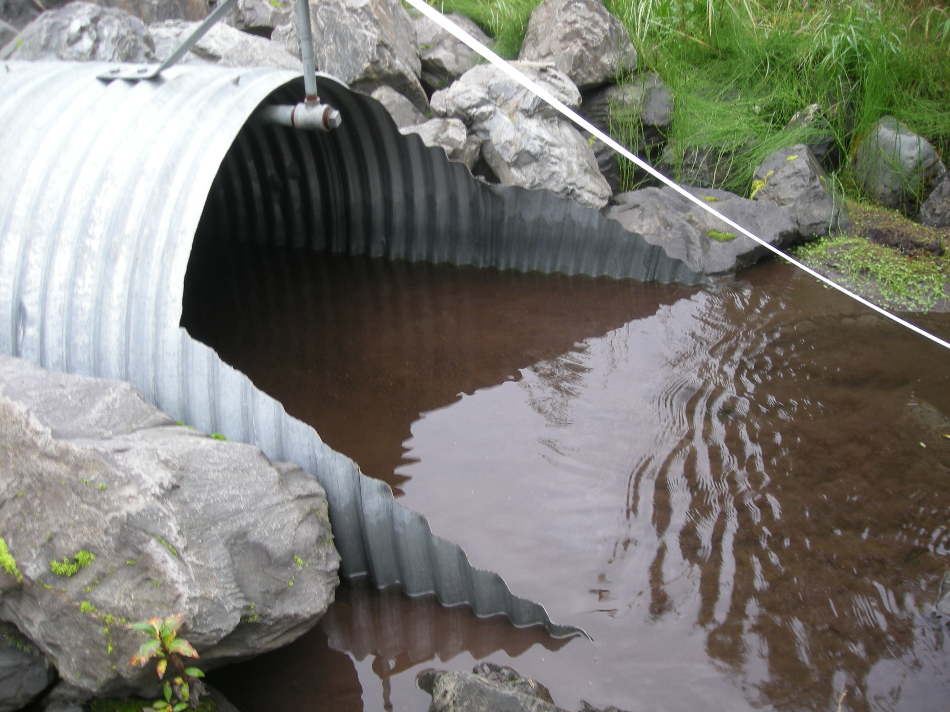
- Culvert is poorly aligned
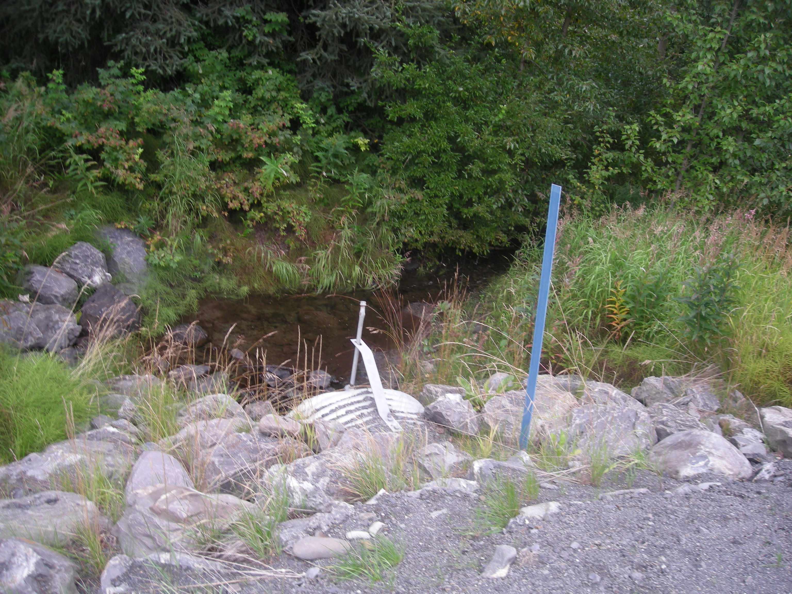
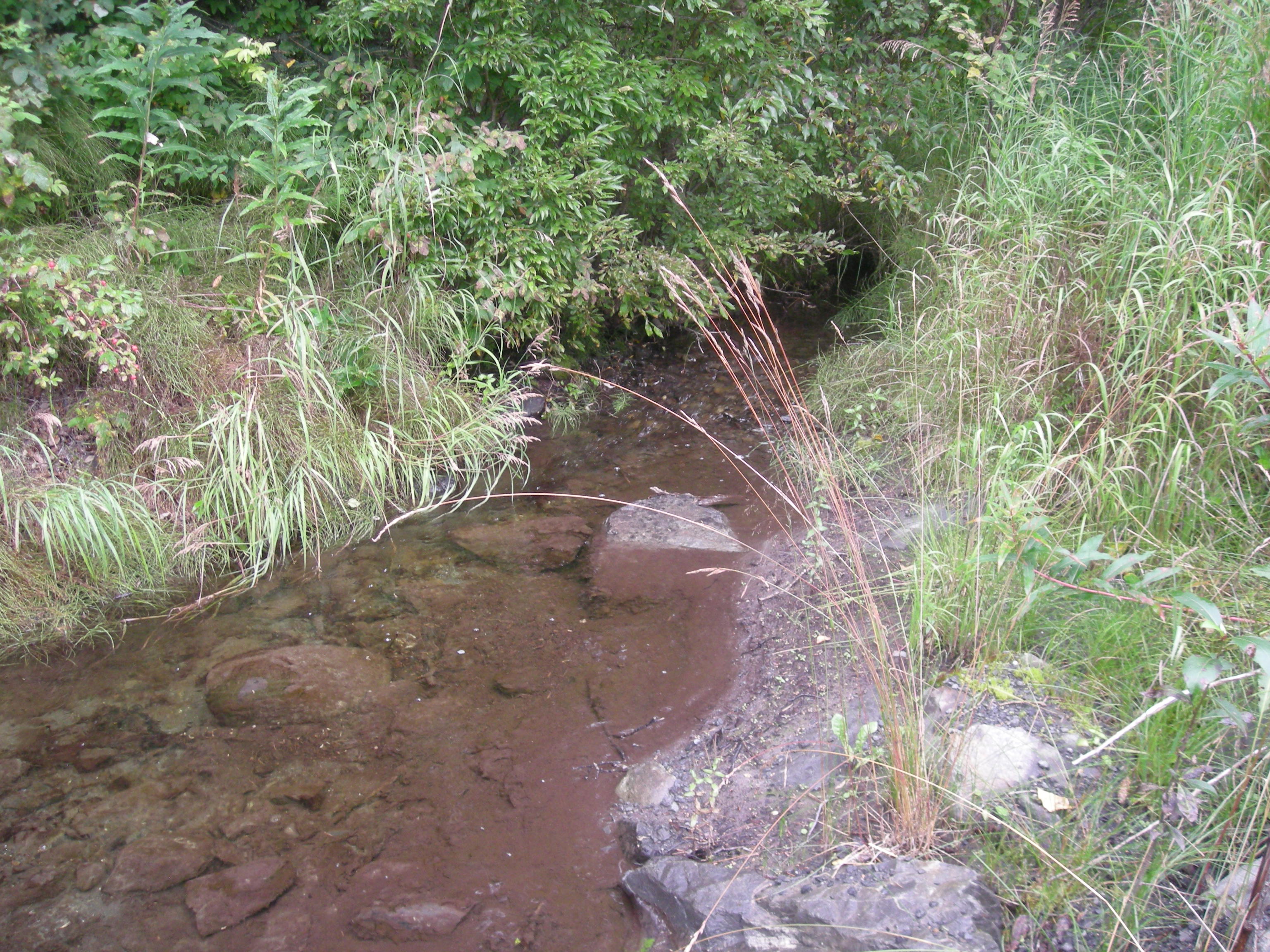
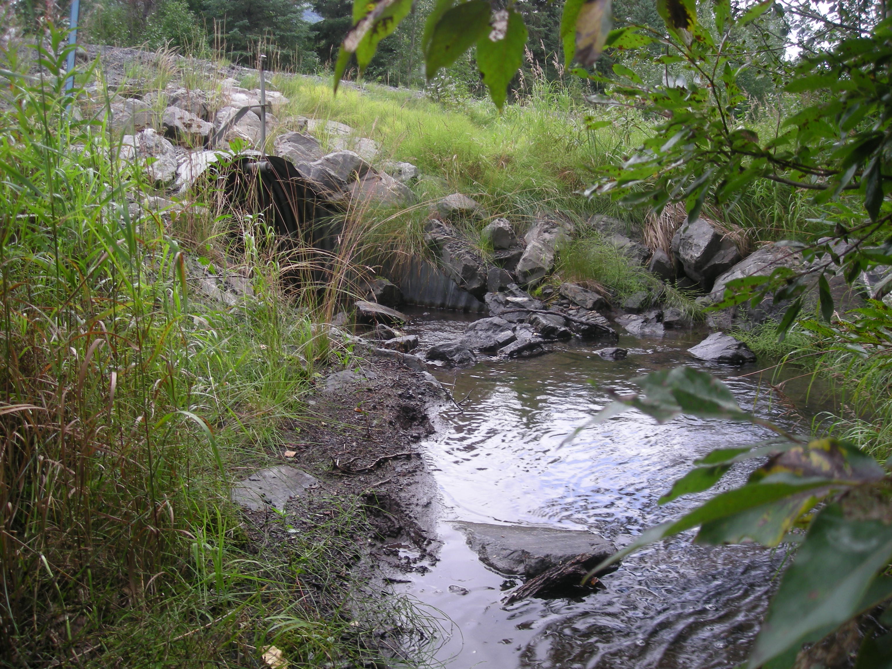
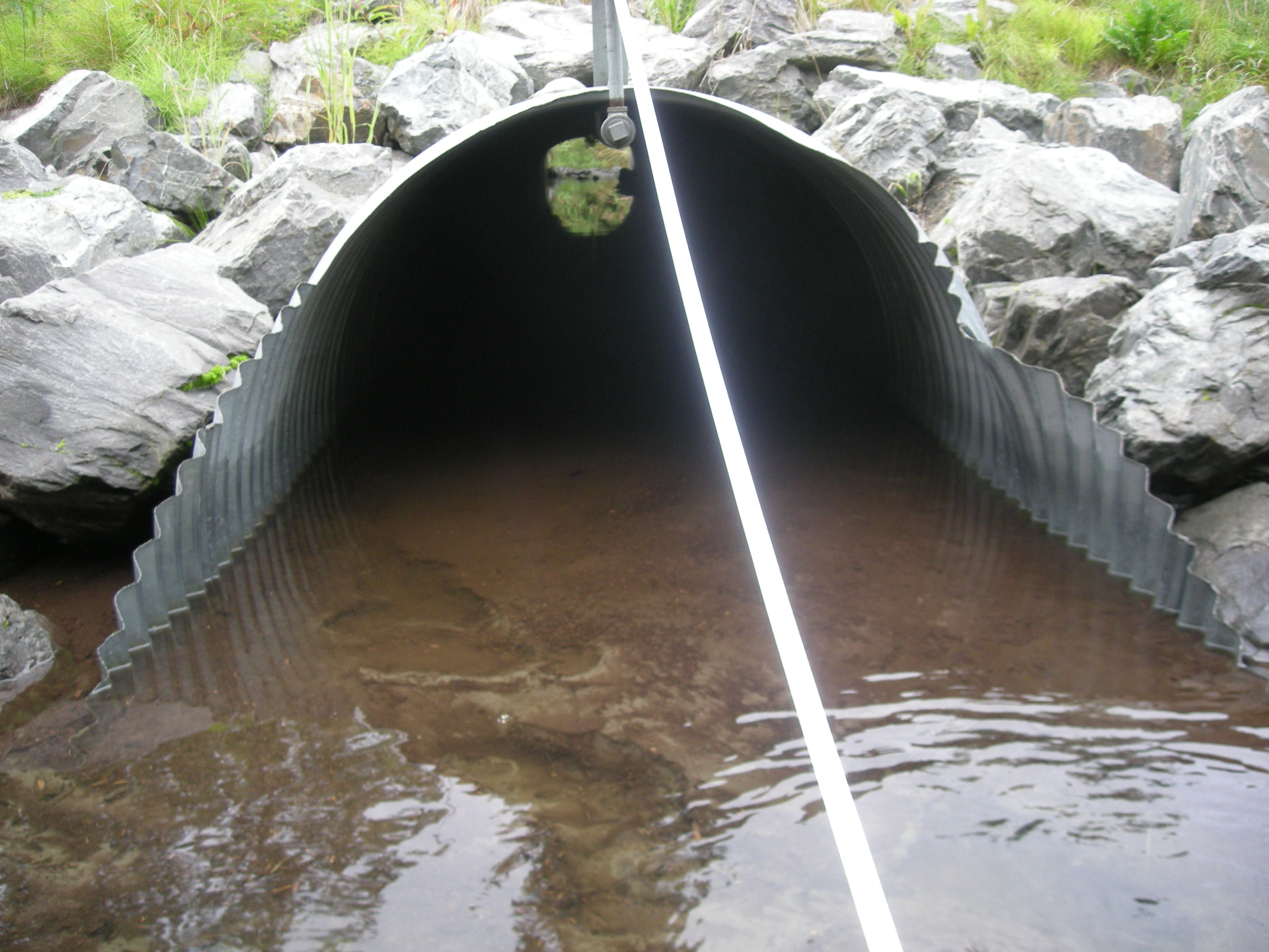
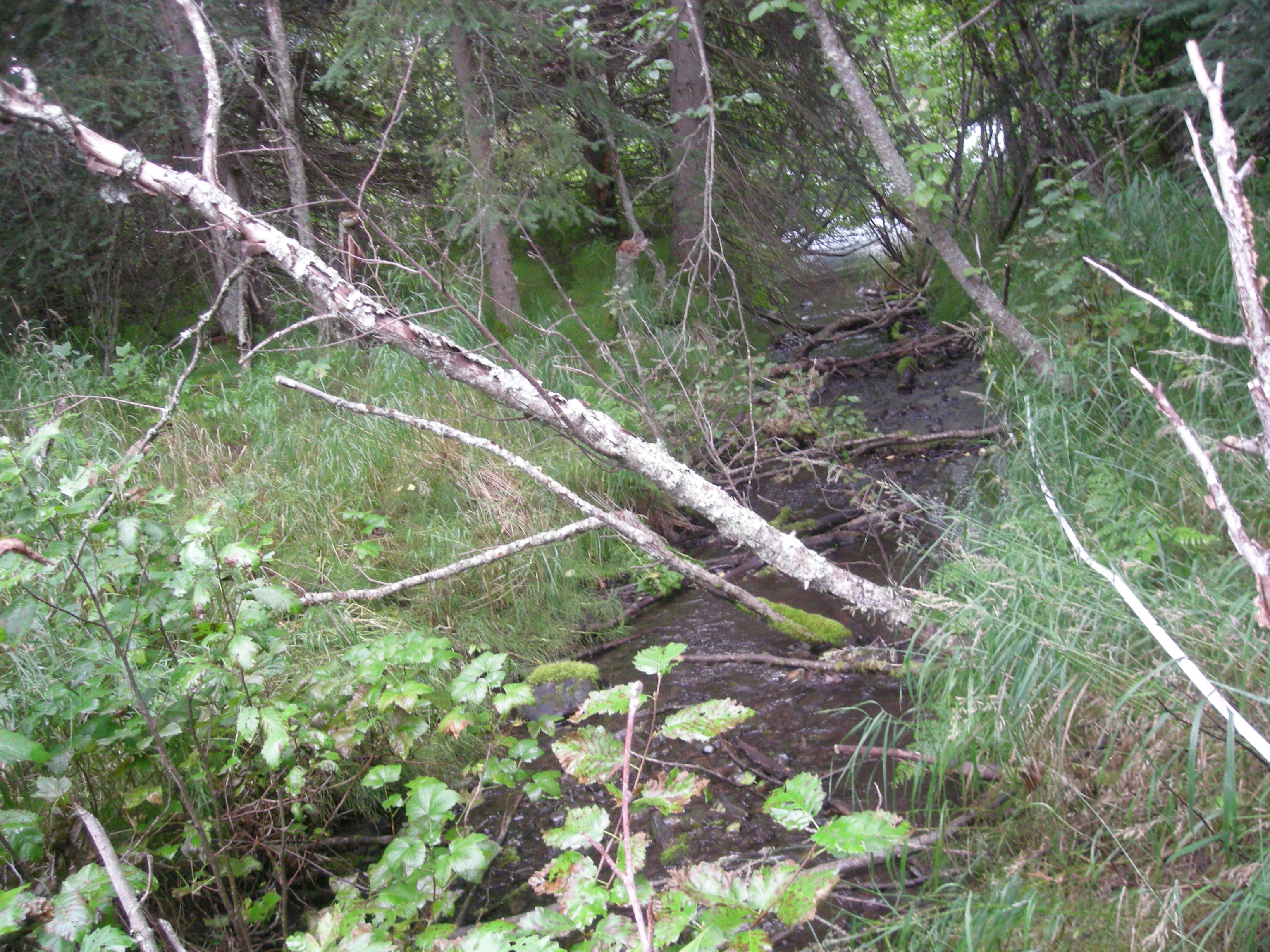
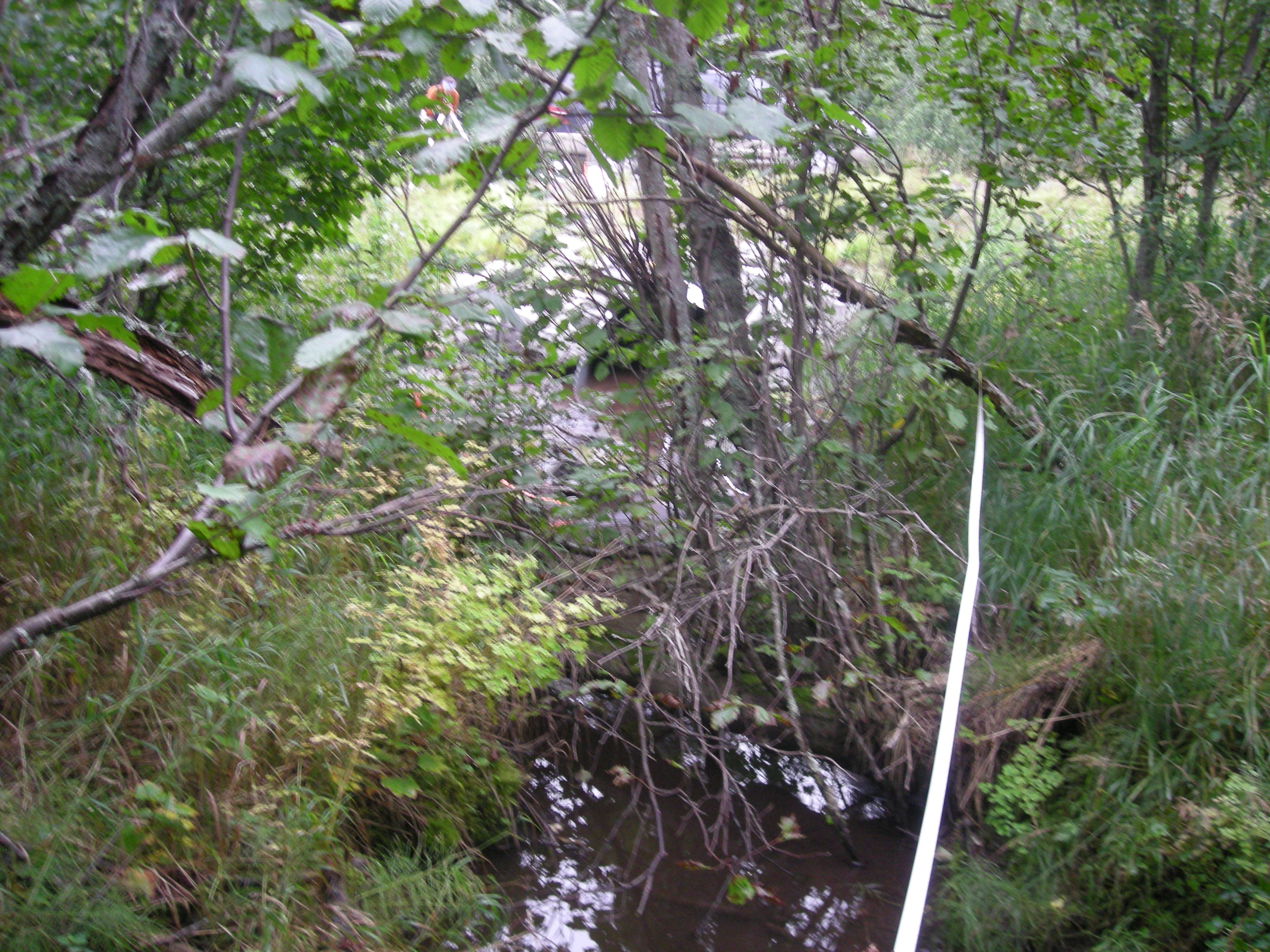
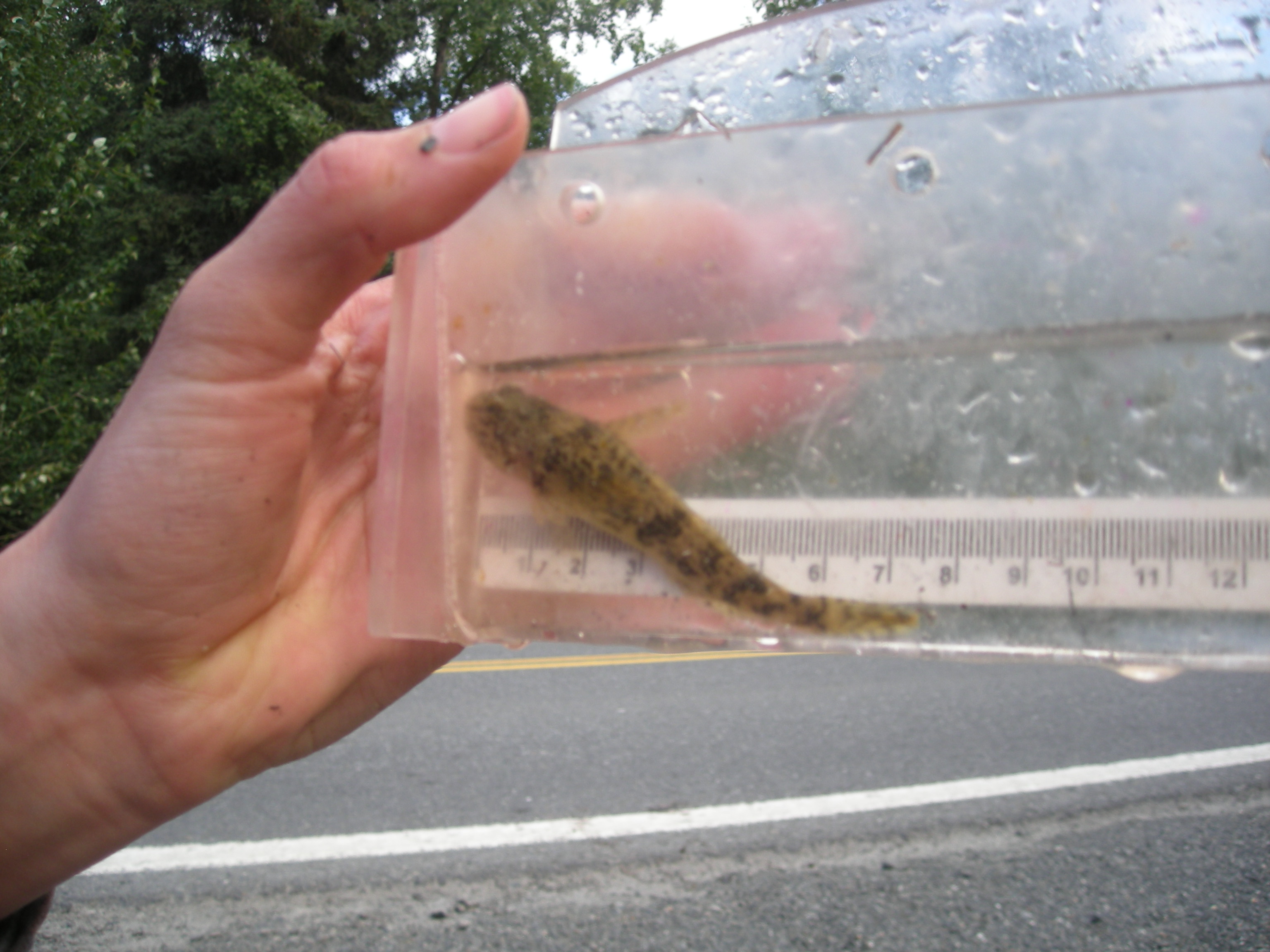
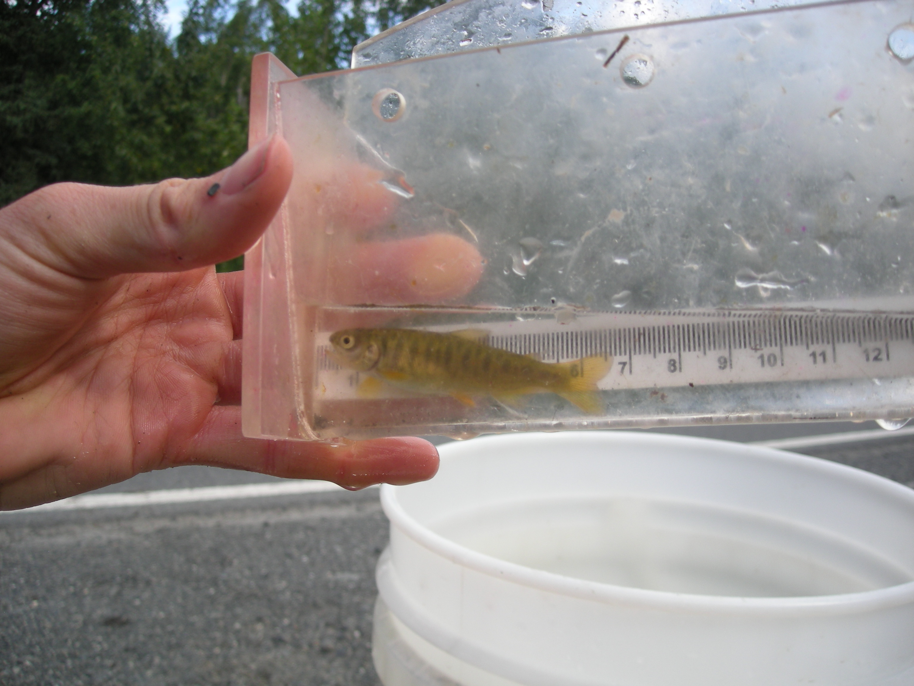
Comments: Culvert assessment and photos submitted by the Kenai Watershed Forum. Inlet and outlet water surface elevations within margin of error, site is backwatered and embedded. Culvert gradient within 1% of stream gradient. Site is Green. Lots of silt sediment and organics throughout crossing. Small juvenile fish observed downstream of culvert, but none caught.
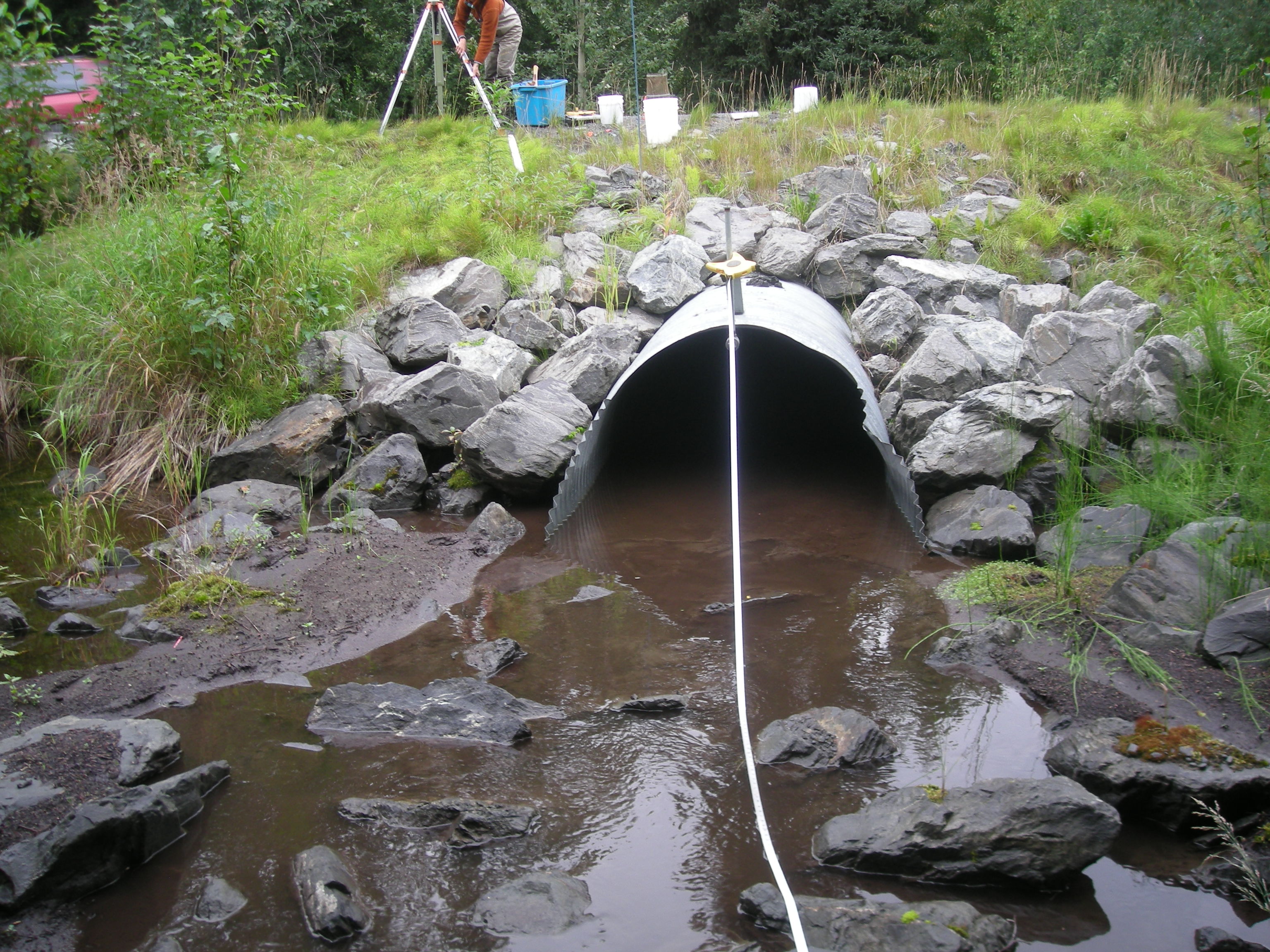
Culvert Measurements
| ID: 1 | Structure Type: Circular pipe (Corrugated steel) | Fish Passage Rating: | ||||||||||||||||||||||||||||||||||||||||||
|
|
|
||||||||||||||||||||||||||||||||||||||||||
Comments: Some minor damage at outlet. Not noted if culvert length is full bottom length or top of culvert length. |
||||||||||||||||||||||||||||||||||||||||||||
Culvert Observations:
|
||||||||||||||||||||||||||||||||||||||||||||
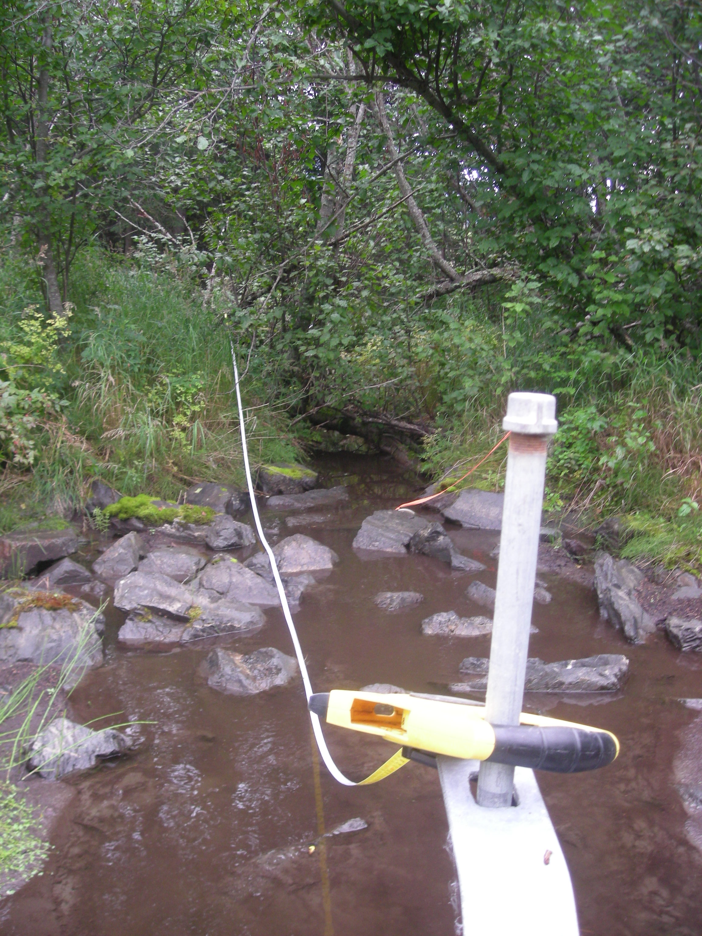
Stream Measurements
|
|
| Stream Width Type | Distance From Crossing (ft) |
Stream Width (ft) |
|---|---|---|
| Downstream ordinary high water | 35.0 | 5.67 |
| Downstream ordinary high water | 50.0 | 7.10 |
| Downstream ordinary high water | 59.0 | 7.33 |
| Upstream ordinary high water | 18.0 | 6.70 |
| Upstream ordinary high water | 27.0 | 2.90 |
| Upstream ordinary high water | 33.0 | 3.30 |
| Upstream ordinary high water | 53.0 | 4.60 |
Elevations
| Locator ID | Culvert Number |
River Distance (ft)1 |
Distance From Crossing (ft)2 |
Relative Elevation (ft) |
|---|---|---|---|---|
| Road Elev | 103.95 | |||
| D/S Grade Ctrl (Thalweg) | 25.00 | 97.18 | ||
| D/S Water Surface Elev | 25.00 | 97.20 | ||
| D/S Water Surface Elev | 32.00 | 97.22 | ||
| D/S Thalweg (max pool depth) | 32.00 | 96.68 | ||
| D/S Thalweg | 47.00 | 96.40 | ||
| D/S Water Surface Elev | 47.00 | 97.20 | ||
| D/S Tailcrest or 1st Thalweg | 59.50 | 96.68 | ||
| D/S Water Surface Elev | 59.50 | 97.19 | ||
| Outlet Pool Water Elev | 69.00 | 97.24 | ||
| Max Pool Depth | 69.00 | 96.35 | ||
| Outlet Culvert Top | 80.00 | 99.89 | ||
| D/S Water Surface Elev | 80.00 | 97.25 | ||
| Outlet Invert (on substrate) | 80.00 | 97.08 | ||
| Inlet Culvert Invert (on substrate) | 143.70 | 97.09 | ||
| U/S Water Surface Elev | 143.70 | 97.27 | ||
| Inlet Culvert Top | 143.70 | 100.45 | ||
| U/S Water Surface Elev | 149.70 | 97.41 | ||
| U/S Thalweg (1st resting) | 149.70 | 96.66 | ||
| U/S Grade Ctrl (Thalweg) | 156.70 | 96.92 | ||
| U/S Water Surface Elev | 156.70 | 97.42 | ||
| U/S Water Surface Elev | 199.70 | 97.68 | ||
| U/S Grade Ctrl (Thalweg) | 199.70 | 97.23 |
Notes:
- River distance is measured continuously throughout the survey reach along the thalweg of the stream.
- Measured from each end of the crossing along the thalweg of the stream.
Fish Sampling Efforts
| Gear Type: Minnow Trap (A) | Trap Duration(h): 1.6666666 | |
| Comments: Trap set about 35 feet upstream. | ||
| Gear Type: Minnow Trap (B) | Trap Duration(h): 2.0 | |
| Comments: Trap set about 25 feet downstream | ||
Fish Observations
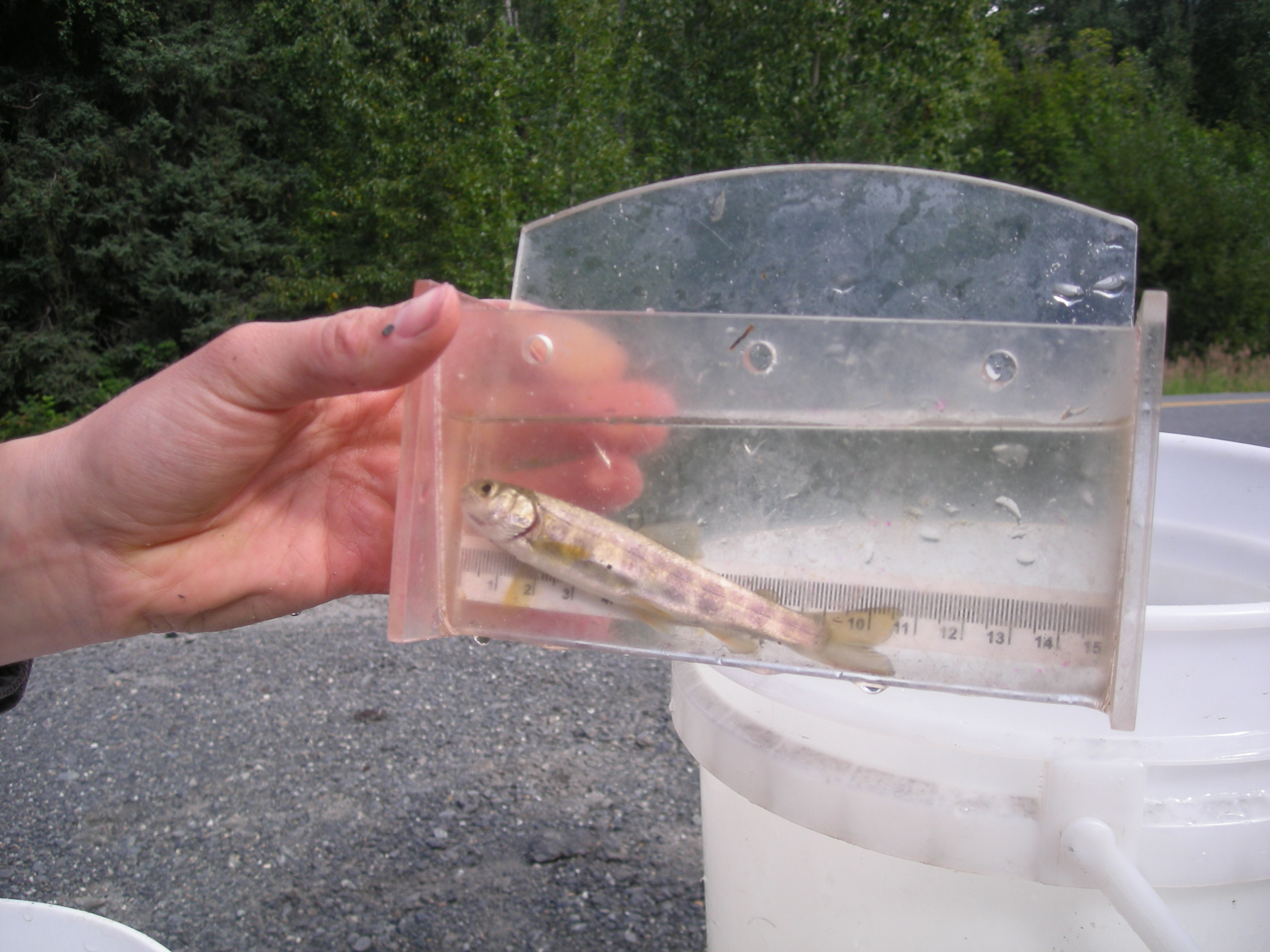
| Species: juvenile coho salmon | Life History: Anadromous | ||
| Total Fish Observed: 2 | Fish Measured: 2 | Fork Lengths (mm) Min: 56 Max: 76 Mean: 66 | |
| Collected/Observed by Gear Type: Upstream Minnow Trap (2) | |||
| Species: juvenile Dolly Varden | Life History: Unknown | ||
| Total Fish Observed: 2 | Fish Measured: 2 | Fork Lengths (mm) Min: 86 Max: 102 Mean: 94 | |
| Collected/Observed by Gear Type: Upstream Minnow Trap (2) | |||
| Species: sculpin-unspecified | Life History: Resident | ||
| Total Fish Observed: 1 | Fish Measured: 1 | Fork Lengths (mm) Min: 77 Max: 77 Mean: 77 | |
| Collected/Observed by Gear Type: Upstream Minnow Trap (1) | |||
Photos
Questions or comments about this report can be directed to dfg.dsf.webmaster@alaska.gov