Fish Passage Site 20303743
Coordinates (dec. deg.): 60.56728°, -151.18916°
Legal Description: S006N011W34
Region: South Central
Road Name: Akiak Road
Datum: NAD83
Quad Name / ITM: Kenai C-4
AWC Stream #: 244-30-10010-2007
Stream Name: Unnamed
Elevation:
Site Comments: None
Survey KEN17-AR01
Observers: Elise Idle, Maggie Schaffer
Overall Fish Passage Rating:
Tidal: No
Backwatered: Maybe
Step Pools: No
Construction Year:
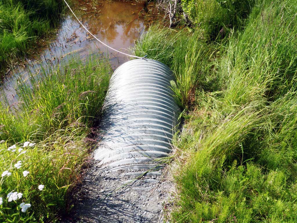
Comments: Culvert information and assessment data collected and submitted by USFWS. Predominantly standing water with lots of woody debris. Stream gradient begins 70 feet upstream. Groundwater upwelling was present at this site. Older culvert was present 8 feet from the culvert, was completely submerged. Lot's of small fish upstream. Long Water surface looks flat through culvert and this site is most likely backwatered from photos. Rated black from lack of information.
Culvert Measurements
| ID: 1 | Structure Type: Circular pipe (Corrugated steel) | Fish Passage Rating: | |||||||||||||||||||||||||||||||||||||||||
|
|
|
|||||||||||||||||||||||||||||||||||||||||
Comments: Inlet submerged. Culvert measurements not recorded. |
|||||||||||||||||||||||||||||||||||||||||||
| ID: 2 | Structure Type: Circular pipe (Corrugated steel) | Fish Passage Rating: | |||||||||||||||||||||||||||||||||||||||||
|
|
|
|||||||||||||||||||||||||||||||||||||||||
Stream Measurements
|
|
| Stream Width Type | Distance From Crossing (ft) |
Stream Width (ft) |
|---|---|---|
| Upstream ordinary high water | ||
| Upstream ordinary high water | ||
| Upstream ordinary high water | ||
| Upstream ordinary high water |
Elevations
| Locator ID | Culvert Number |
River Distance (ft)1 |
Distance From Crossing (ft)2 |
Relative Elevation (ft) |
|---|---|---|---|---|
| Road Elev | 95.39 | |||
| D/S Tailcrest or 1st Thalweg | 0.00 | 95.94 | ||
| D/S Water Surface Elev | 0.00 | 96.01 | ||
| D/S Water Surface Elev | 25.00 | 96.03 | ||
| D/S Tailcrest or 1st Thalweg | 25.00 | 95.18 | ||
| D/S Water Surface Elev | 52.00 | 96.04 | ||
| D/S Thalweg | 52.00 | 94.45 | ||
| D/S Grade Ctrl (Thalweg) (End of pool) | 77.00 | 95.03 | ||
| D/S Water Surface Elev (End of pool) | 77.00 | 95.08 | ||
| D/S Water Surface Elev | 90.00 | 96.07 | ||
| Outlet Invert | 90.00 | 95.43 | ||
| Outlet Culvert Top | 90.00 | 98.49 | ||
| Inlet Culvert Top | 143.00 | 98.52 | ||
| U/S Water Surface Elev | 143.00 | 96.15 | ||
| Inlet Culvert Invert | 143.00 | 95.15 | ||
| U/S Grade Ctrl (Thalweg) (Beginning of pool) | 158.00 | 94.68 | ||
| U/S Water Surface Elev (Beginning of pool) | 158.00 | 95.89 |
Notes:
- River distance is measured continuously throughout the survey reach along the thalweg of the stream.
- Measured from each end of the crossing along the thalweg of the stream.
Fish Sampling Efforts
| Gear Type: Minnow Trap (A) | Trap Duration(h): 1.5 | |
| Gear Type: Minnow Trap (B) | Trap Duration(h): 1.0 | |
Fish Observations
| Species: stickleback-unspecified | Life History: | ||
| Total Fish Observed: 4 | Fish Measured: 4 | Fork Lengths (mm) Min: 26 Max: 37 Mean: 32 | |
| Collected/Observed by Gear Type: Downstream Minnow Trap (1) Upstream Minnow Trap (3) | |||
Photos


Questions or comments about this report can be directed to dfg.dsf.webmaster@alaska.gov