Fish Passage Site 20300195
Coordinates (dec. deg.): 60.89625°, -149.06791°
Legal Description: S009N002E03
Region: South Central
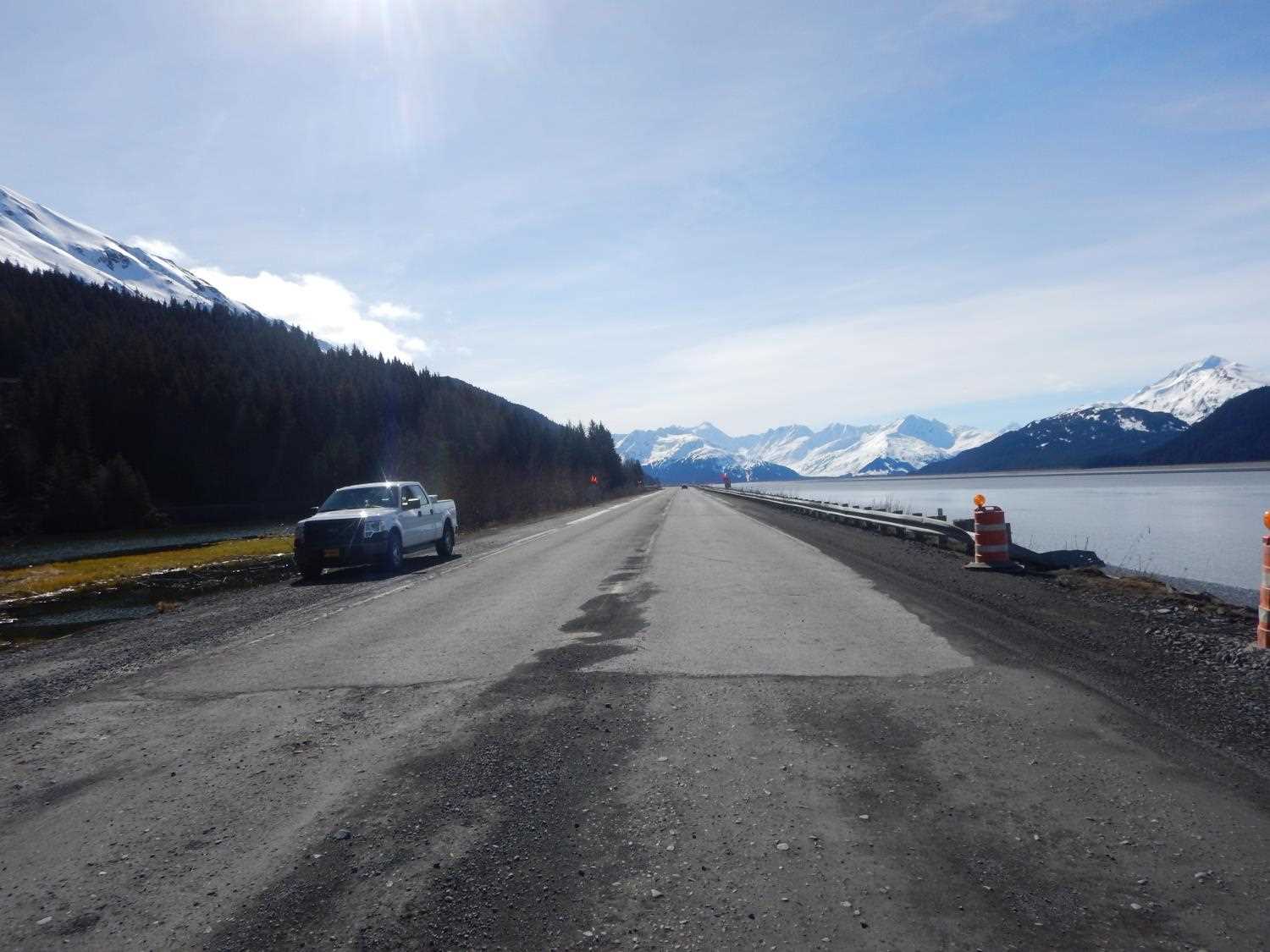
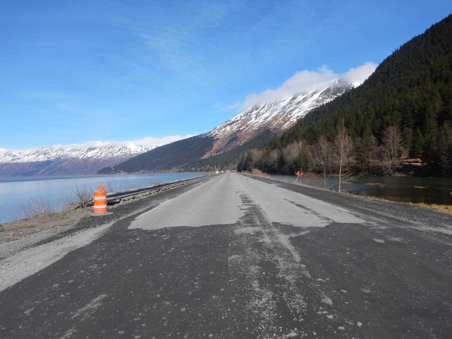
Road Name: SEWARD HIGHWAY
Datum: NAD83
Quad Name / ITM: Seward D-6
AWC Stream #: 247-60-10240
Stream Name: Unnamed
Elevation:
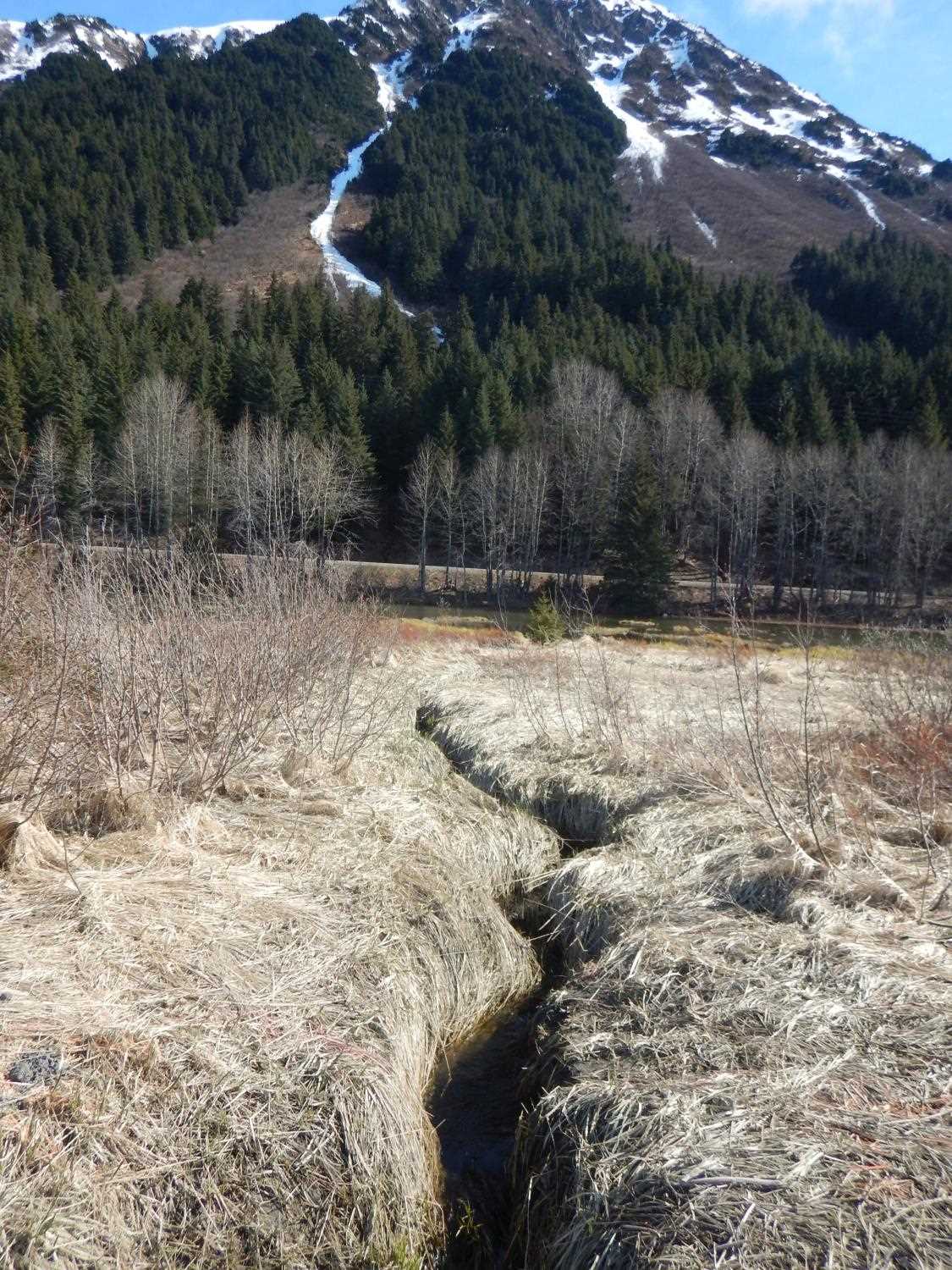
Site Comments: UNAMED WATERSHED ADJACENT TO SEWARD HIGHWAY, UPSTREAM AREA IS A MARSH.
arrow to the right of the survey date below to choose a different report for this site.
Survey UPDATE-0195
Project Supervisor: Gillian O'Doherty, ADFG
Observers: William Frost
Overall Fish Passage Rating:
Tidal: Yes
Backwatered:
Step Pools:
Construction Year: 2019
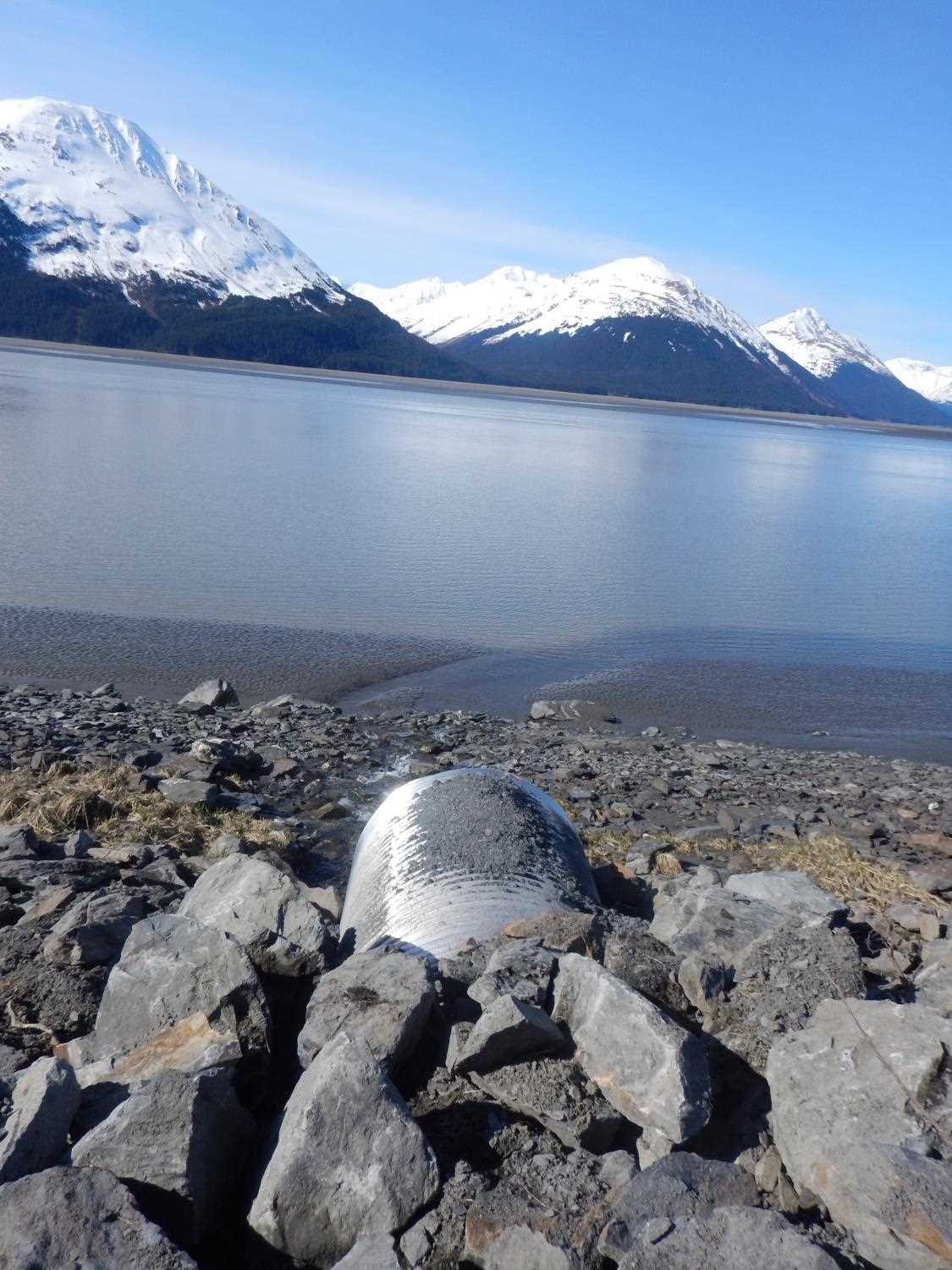
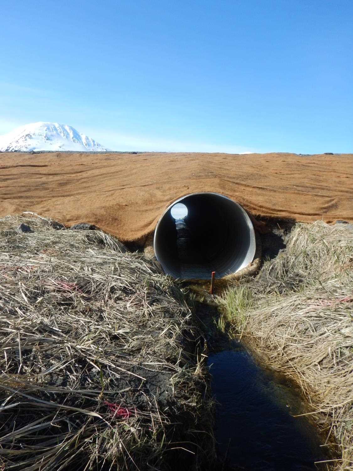
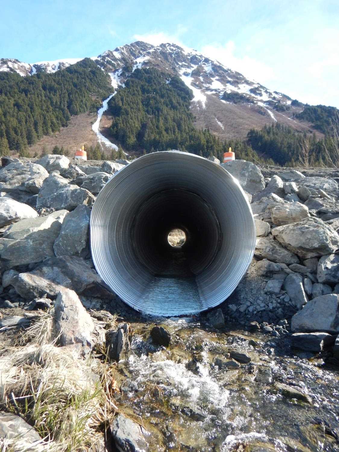
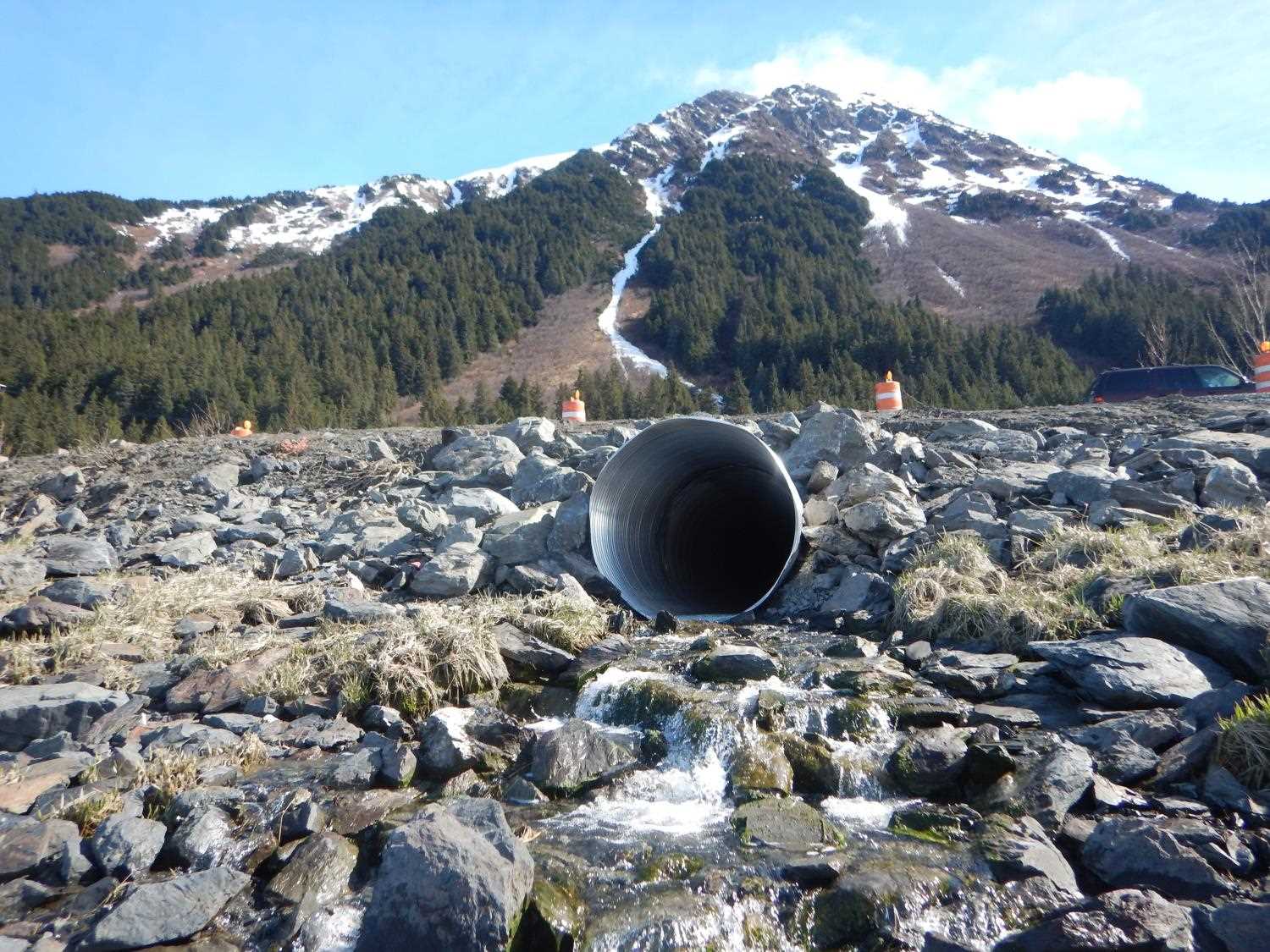
Comments: Culvert information and photos submitted by Will Frost, ADFG, HB. Culvert replaced as part of the Seward Highway Phase I improvement project. Culvert replaced under fish habitat permit FH 17-II-0009. Culvert is tidally influenced.
Culvert Measurements
| ID: 1 | Structure Type: Circular pipe (Corrugated aluminum) | Fish Passage Rating: | |||||||||||||||||||||||||||||||||||||||||
|
|
|
|||||||||||||||||||||||||||||||||||||||||
Comments: Culvert measurments taken from fish habitat permit and have not been verified. Culvert diameter 4 feet, culvert length 106 feet, culvert gradient 0.5%. |
|||||||||||||||||||||||||||||||||||||||||||
Stream Measurements
|
|
No stream width data available.
Elevations
No elevation data available.
Fish Sampling Efforts
No fish sampling occurred during this survey.
Fish Observations
No fish observations occurred during this survey.
Photos

Questions or comments about this report can be directed to dfg.dsf.webmaster@alaska.gov