Fish Passage Site 20203770
Coordinates (dec. deg.): 60.12901°, -149.41766°
Legal Description: S001N001W34
Region: South Central
Road Name: Taxiway A
Datum: NAD83
Quad Name / ITM: Seward A-7
AWC Stream #: 231-30-10075
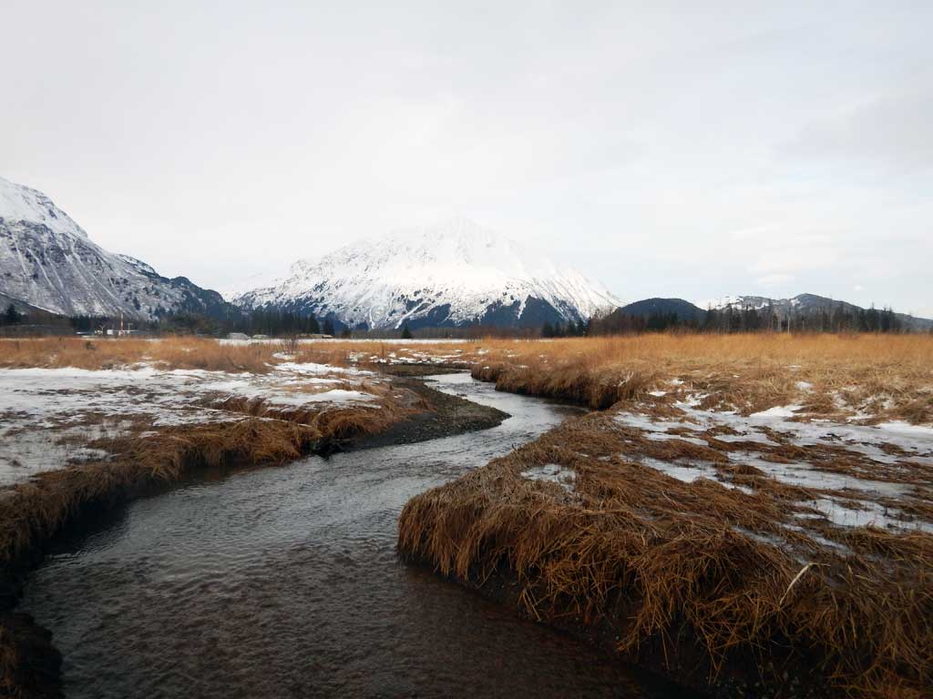
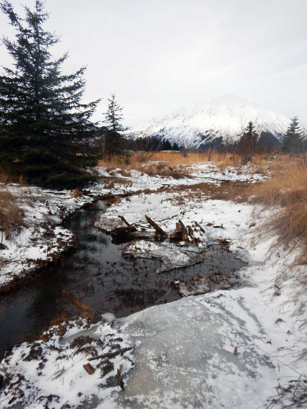
Stream Name: Unnamed
Elevation:
Site Comments: Site is the long taxiway at the Seward ariport between the two runways.
Survey UPDATE-TAXIA
Project Supervisor: Gillian O'Doherty, ADFG
Observers: William Frost
Overall Fish Passage Rating:
Tidal:
Backwatered:
Step Pools:
Construction Year:
Comments: Site has not been assessed. Submitted by Will Frost, HB, ADF&G, Anchorage. The upstream of crossing has been nominated for pink salmon present.
Culvert Measurements
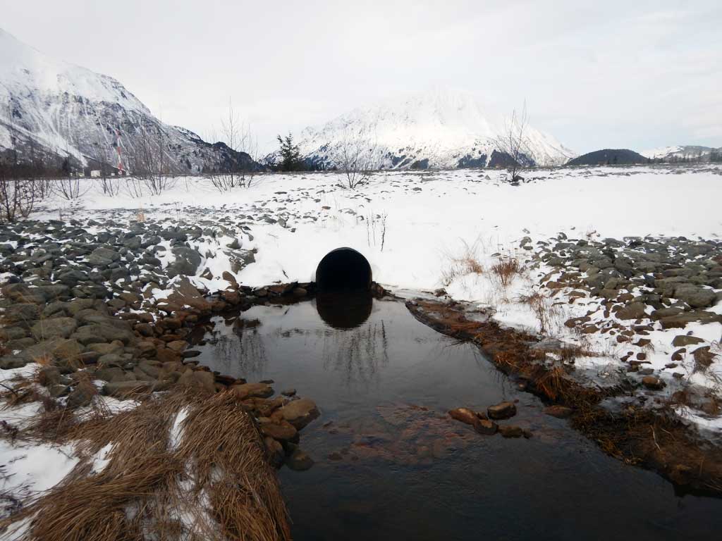
| ID: 1 | Structure Type: Circular pipe (Corrugated steel) | Fish Passage Rating: | |||||||||||||||||||||||||||||||||||||||||
|
|
|
|||||||||||||||||||||||||||||||||||||||||
Comments: Culvert length estimated from satellite imagery at 88 ft. Cuvlert diameter estimated at 3 ft. |
|||||||||||||||||||||||||||||||||||||||||||
Stream Measurements
|
|
No stream width data available.
Elevations
No elevation data available.
Fish Sampling Efforts
No fish sampling occurred during this survey.
Fish Observations
No fish observations occurred during this survey.
Photos

Questions or comments about this report can be directed to dfg.dsf.webmaster@alaska.gov