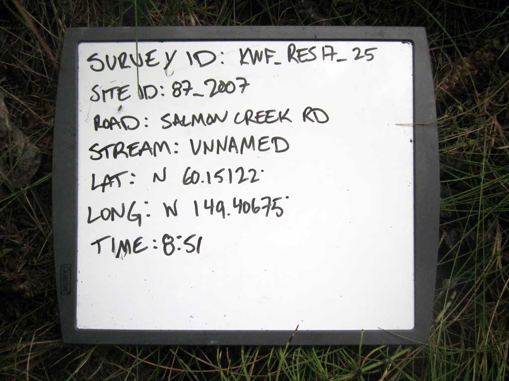
Fish Passage Site 20203741
Coordinates (dec. deg.): 60.15122°, -149.40675°
Legal Description: S001N001W26
Region: South Central
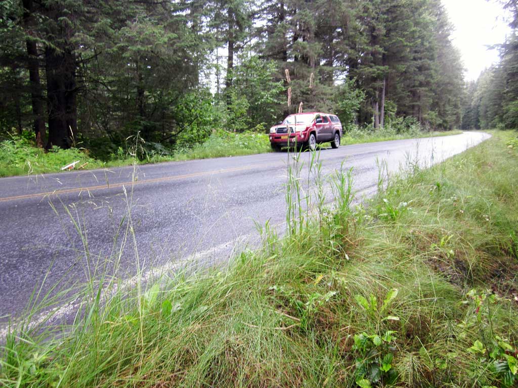
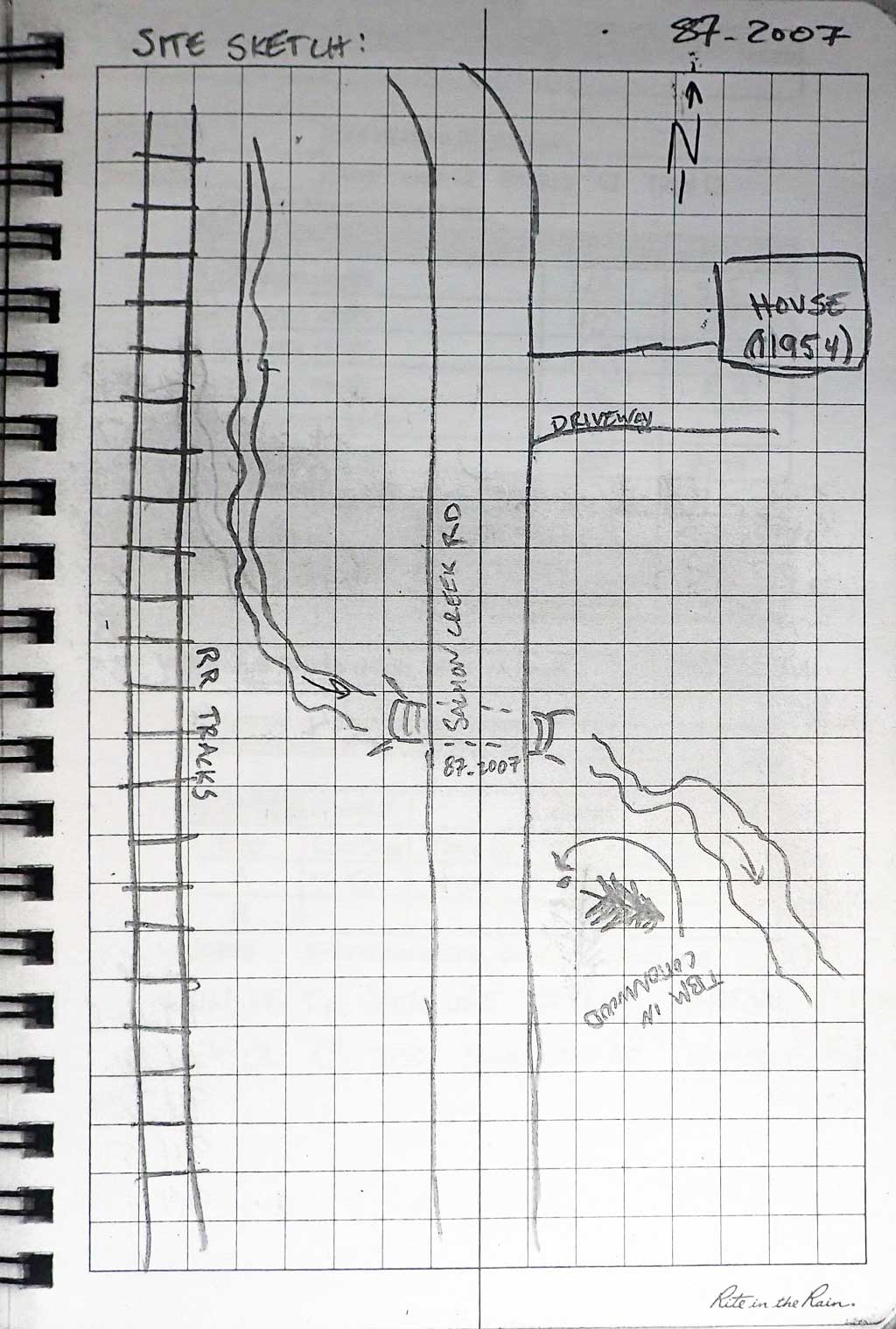
Road Name: Salmon Creek Road
Datum: NAD83
Quad Name / ITM: Seward A-7
AWC Stream #: 231-30-10080-2010-3022
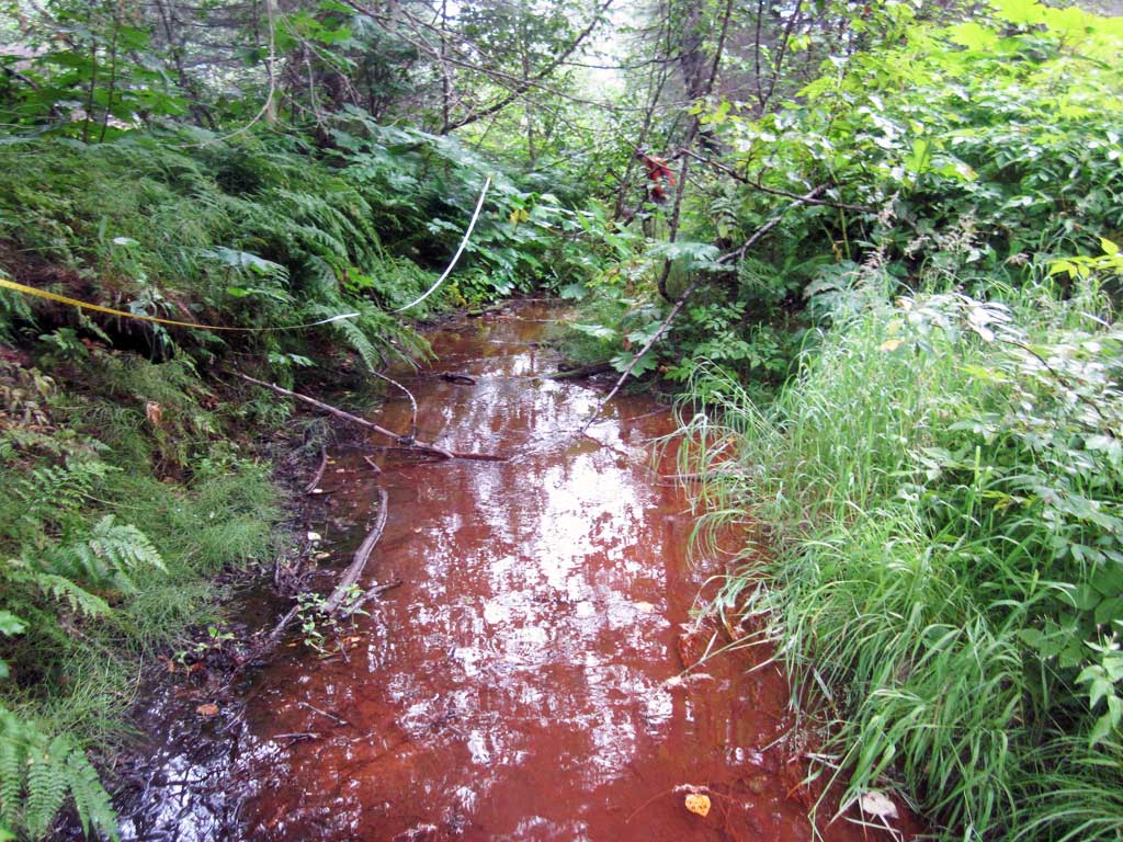
Stream Name: Unnamed
Elevation:
Site Comments: None
Survey KEN17-87_2007
Observers: Louis Mitchell, Luke Violette, Mary Richardson
Overall Fish Passage Rating:
Tidal: No
Backwatered: Maybe
Step Pools: No
Construction Year:
Site Observations:
- Constriction ratio gray
- Culvert gradient gray
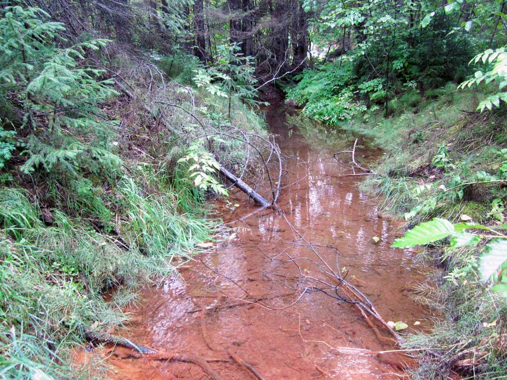
Comments: KWFRES_17_25. Culvert assessment performed and submitted by the Kenai Watershed Forum. Water surface elevations a inconsistent. Site maybe backwatered and embedded, but notes not clear. Site does appear to be constricted. Water too shallow upstream for trapping.
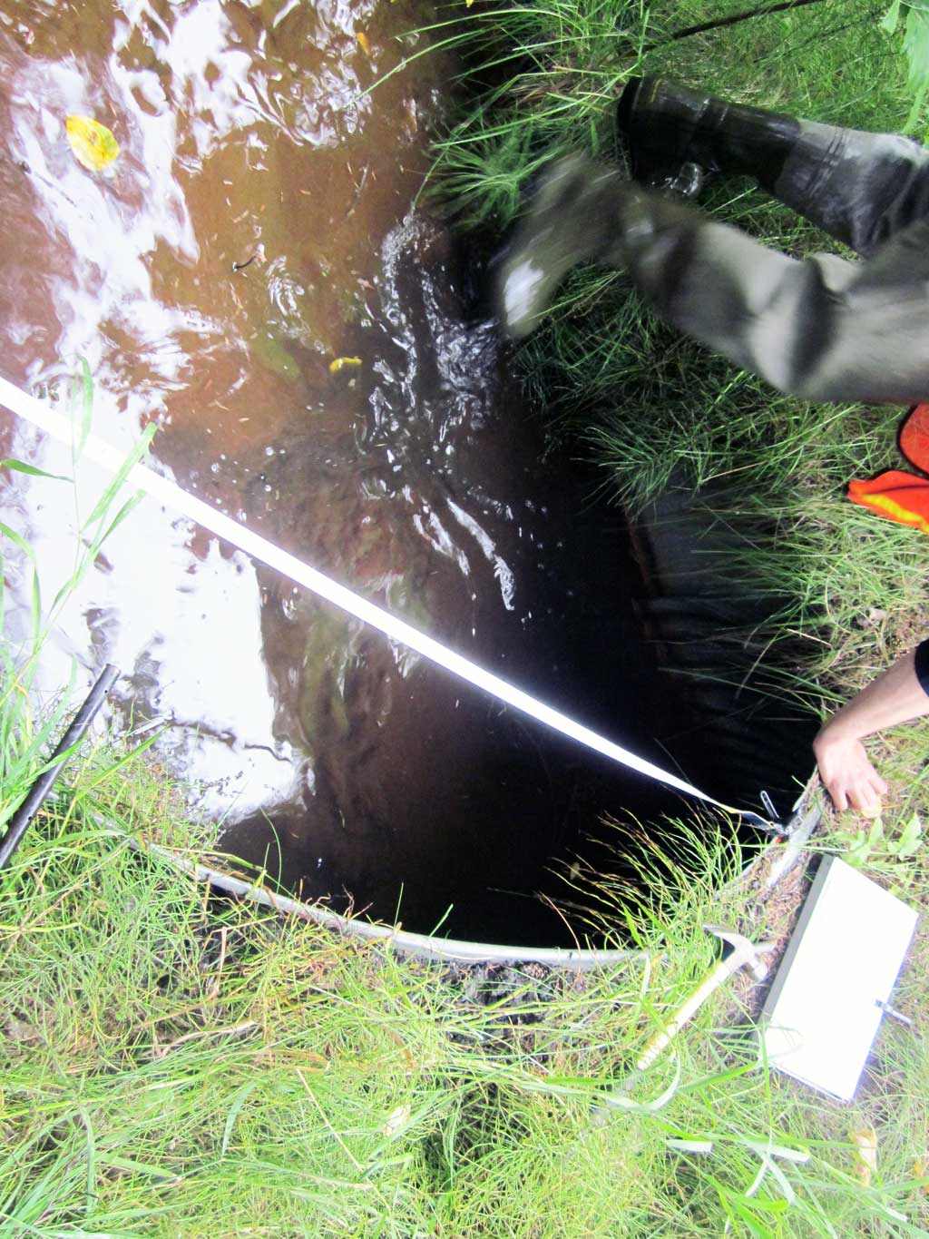
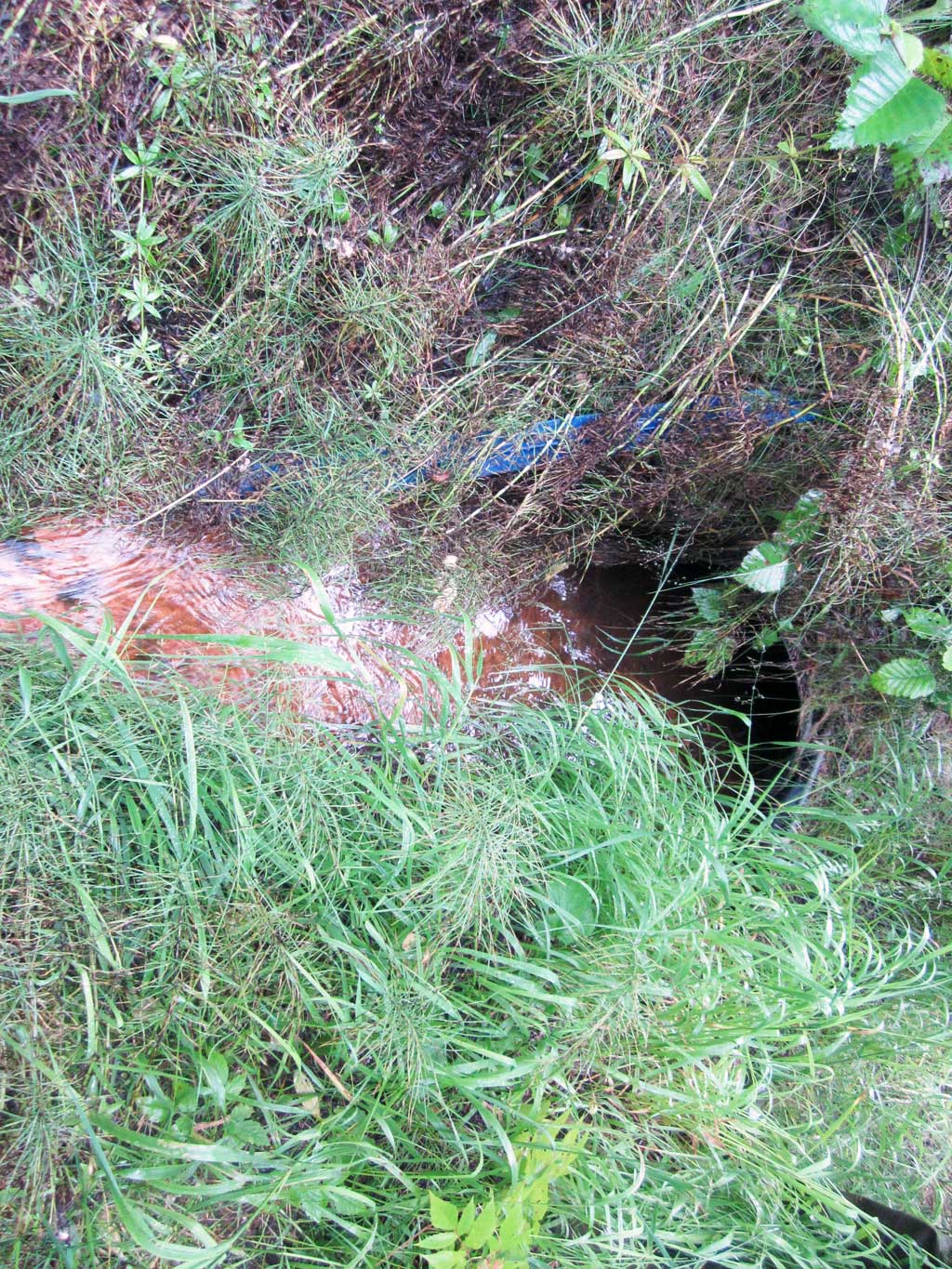
Culvert Measurements
| ID: 1 | Structure Type: Circular pipe (Corrugated steel) | Fish Passage Rating: | ||||||||||||||||||||||||||||||||||||||||||
|
|
|
||||||||||||||||||||||||||||||||||||||||||
Comments: Inlet and Outlet aprons estimated to be about 5 feet. |
||||||||||||||||||||||||||||||||||||||||||||
Culvert Observations:
|
||||||||||||||||||||||||||||||||||||||||||||
Stream Measurements
|
|
| Stream Width Type | Distance From Crossing (ft) |
Stream Width (ft) |
|---|---|---|
| Downstream ordinary high water | 10.0 | 1.30 |
| Downstream ordinary high water | 30.0 | 7.33 |
| Downstream ordinary high water | 50.0 | 8.50 |
| Upstream ordinary high water | 20.0 | 5.50 |
| Upstream ordinary high water | 40.0 | 5.00 |
| Upstream ordinary high water | 60.0 | 5.00 |
| Upstream ordinary high water | 80.0 | 5.50 |
Elevations
| Locator ID | Culvert Number |
River Distance (ft)1 |
Distance From Crossing (ft)2 |
Relative Elevation (ft) |
|---|---|---|---|---|
| Road Elev | 99.79 | |||
| D/S Thalweg | 0.00 | 92.71 | ||
| D/S Water Surface Elev | 0.00 | 94.17 | ||
| D/S Water Surface Elev | 19.00 | 94.21 | ||
| D/S Thalweg | 19.00 | 93.80 | ||
| D/S Thalweg (outlet of small stream) | 45.00 | 92.85 | ||
| D/S Water Surface Elev | 45.00 | 94.29 | ||
| D/S Thalweg | 60.00 | 93.11 | ||
| D/S Water Surface Elev | 60.00 | 93.30 | ||
| D/S Grade Ctrl (Thalweg) | 88.00 | 94.17 | ||
| D/S Water Surface Elev | 88.00 | 94.43 | ||
| D/S Water Surface Elev | 92.00 | 94.51 | ||
| D/S Thalweg | 92.00 | 94.29 | ||
| D/S Grade Ctrl (Thalweg) (outlet apron) | 98.00 | 94.61 | ||
| D/S Water Surface Elev | 98.00 | 94.76 | ||
| Outlet Invert | 100.00 | 94.43 | ||
| D/S Water Surface Elev | 100.00 | 94.83 | ||
| Outlet Culvert Top | 100.00 | 95.60 | ||
| Inlet Culvert Top | 146.00 | 96.67 | ||
| U/S Water Surface Elev | 146.00 | 94.80 | ||
| Inlet Culvert Invert | 146.00 | 94.35 | ||
| U/S Thalweg (End of inlet Apron) | 150.00 | 94.09 | ||
| U/S Water Surface Elev | 150.00 | 94.78 | ||
| U/S Water Surface Elev | 161.00 | 94.80 | ||
| U/S Thalweg | 161.00 | 94.57 | ||
| U/S Grade Ctrl (Thalweg) (Railroad Tie blocking creek just upstream of this grade point) | 196.00 | 94.09 | ||
| U/S Water Surface Elev | 196.00 | 97.87 | ||
| U/S Water Surface Elev | 216.00 | 94.92 | ||
| U/S Thalweg | 216.00 | 94.63 | ||
| U/S Thalweg | 246.00 | 94.70 | ||
| U/S Water Surface Elev | 246.00 | 94.97 |
Notes:
- River distance is measured continuously throughout the survey reach along the thalweg of the stream.
- Measured from each end of the crossing along the thalweg of the stream.
Fish Sampling Efforts
| Gear Type: Minnow Trap (A) | Trap Duration(h): 0.9 | |
| Comments: Trap set about 50 feet downstream. | ||
Fish Observations
No fish observations occurred during this survey.
Photos
Questions or comments about this report can be directed to dfg.dsf.webmaster@alaska.gov