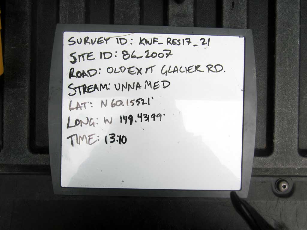
Fish Passage Site 20203740
Coordinates (dec. deg.): 60.15521°, -149.43199°
Legal Description: S001N001W27
Region: South Central
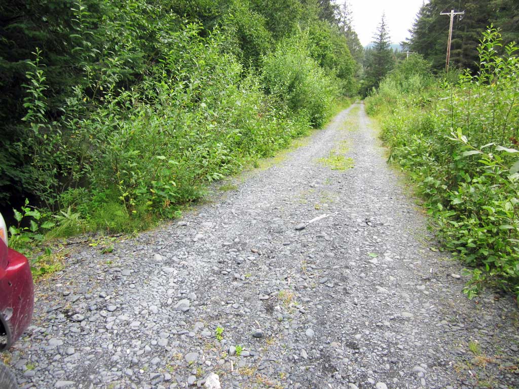
Road Name: Clear Creek Road
Datum: NAD83
Quad Name / ITM: Seward A-7
AWC Stream #: 231-30-10080-2010-3029-4019
Stream Name: Unnamed
Elevation:
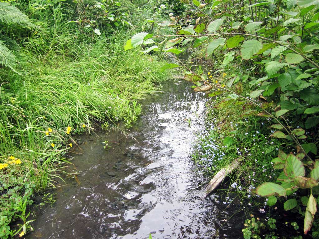
Site Comments: Unnamed Tributary to Clear Creek. Site is downstream from 85_2007.
Survey KEN17-86_2007
Observers: Louis Mitchell, Luke Violette, Mary Richardson
Overall Fish Passage Rating:
Tidal: No
Backwatered: No
Step Pools: No
Construction Year:
Site Observations:
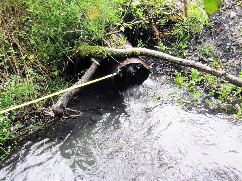
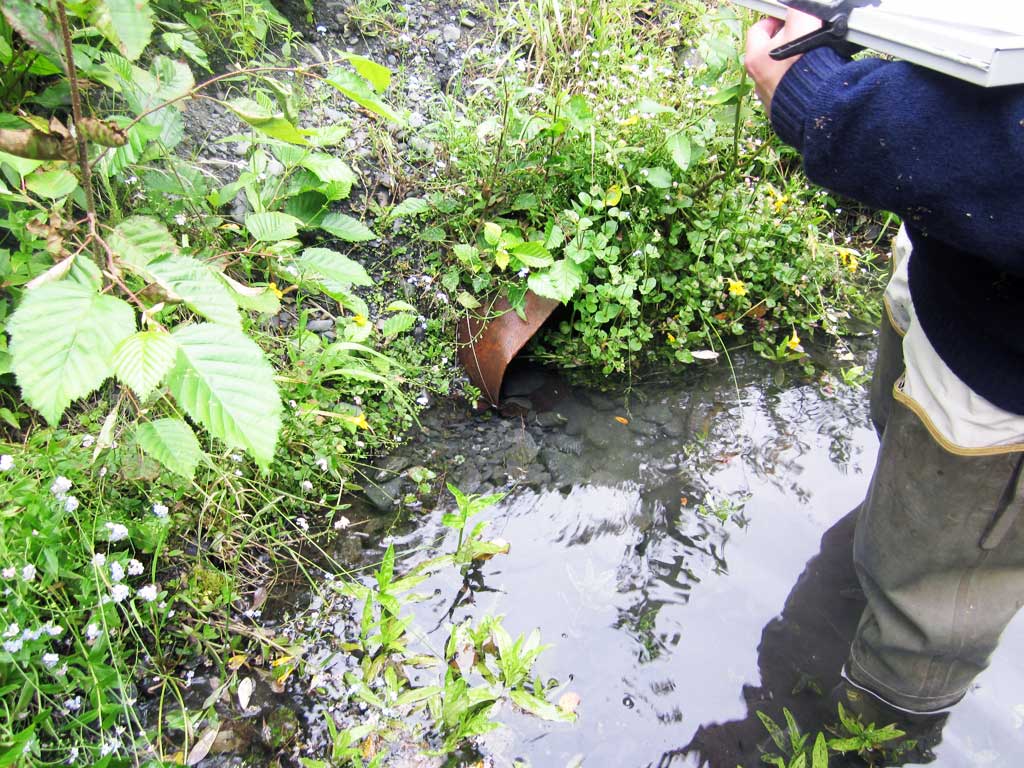
- Outfall height gray
- Culvert is poorly aligned
- Mechanical damage or joints parting
- Structural Problem
- Constriction ratio red
Comments: KWFRES_17_21. Culvert Assessment performed and submitted by Kenai Watershed Forum.
Culvert Measurements
| ID: 1 | Structure Type: Circular pipe (Non-corrugated metal) | Fish Passage Rating: | |||||||||||||||||||||||||||||||||||||||||
|
|
|
|||||||||||||||||||||||||||||||||||||||||
Comments: Outlet of culvert has considerable damage with a large side puncture leaking water. Puncture diameter 0.5'. |
|||||||||||||||||||||||||||||||||||||||||||
Culvert Observations:
|
|||||||||||||||||||||||||||||||||||||||||||
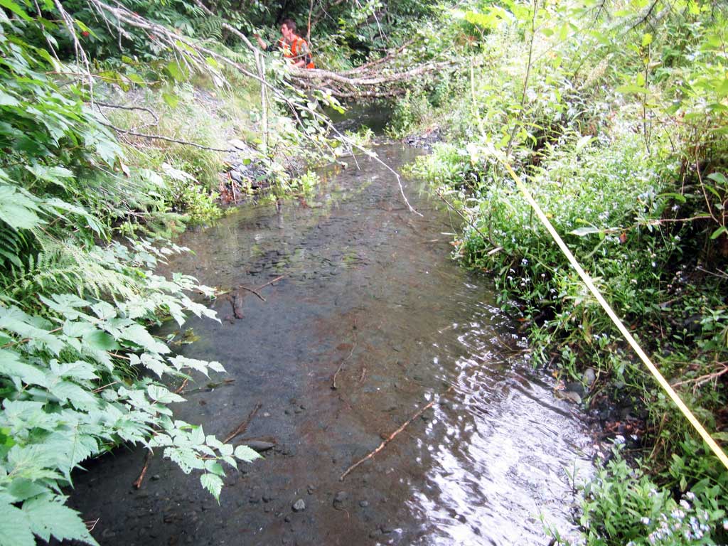
Stream Measurements
|
|
| Stream Width Type | Distance From Crossing (ft) |
Stream Width (ft) |
|---|---|---|
| Downstream ordinary high water | 20.0 | 5.33 |
| Downstream ordinary high water | 40.0 | 10.50 |
| Downstream ordinary high water | 80.0 | 12.00 |
| Upstream ordinary high water | 20.0 | 4.25 |
| Upstream ordinary high water | 40.0 | 4.25 |
| Upstream ordinary high water | 60.0 | 3.00 |
| Upstream ordinary high water | 80.0 | 3.50 |
Elevations
| Locator ID | Culvert Number |
River Distance (ft)1 |
Distance From Crossing (ft)2 |
Relative Elevation (ft) |
|---|---|---|---|---|
| Max Pool Depth (Distance not recorded) | 96.19 | |||
| D/S Water Surface Elev (Distance not recorded) | 96.84 | |||
| Road Elev | 99.25 | |||
| D/S Water Surface Elev | 0.00 | 96.63 | ||
| D/S Thalweg | 0.00 | 95.77 | ||
| D/S Thalweg | 20.00 | 95.71 | ||
| D/S Water Surface Elev | 20.00 | 96.60 | ||
| D/S Thalweg | 40.00 | 96.07 | ||
| D/S Water Surface Elev | 40.00 | 96.63 | ||
| D/S Water Surface Elev | 60.00 | 96.63 | ||
| D/S Thalweg | 60.00 | 96.35 | ||
| D/S Grade Ctrl (Thalweg) | 70.00 | 96.43 | ||
| D/S Water Surface Elev | 70.00 | 96.76 | ||
| Outlet Invert | 100.00 | 96.76 | ||
| D/S Water Surface Elev | 100.00 | 96.98 | ||
| Outlet Culvert Top | 100.00 | 97.83 | ||
| Inlet Culvert Top | 120.66 | 97.85 | ||
| U/S Water Surface Elev | 120.66 | 97.22 | ||
| Inlet Culvert Invert | 120.66 | 96.80 | ||
| U/S Thalweg (Inlet pool max depth) | 122.66 | 96.19 | ||
| U/S Water Surface Elev | 122.66 | 97.24 | ||
| U/S Water Surface Elev (Stream gradient) | 130.66 | 97.20 | ||
| U/S Thalweg | 130.66 | 96.69 | ||
| U/S Grade Ctrl (Thalweg) | 155.66 | 97.17 | ||
| U/S Water Surface Elev | 155.66 | 97.27 | ||
| U/S Water Surface Elev | 170.66 | 97.41 | ||
| U/S Thalweg | 170.66 | 97.15 | ||
| U/S Grade Ctrl (Thalweg) | 200.66 | 97.65 | ||
| U/S Water Surface Elev | 200.66 | 97.99 | ||
| U/S Thalweg | 220.66 | 98.16 | ||
| U/S Water Surface Elev (Stream gradient) | 220.66 | 98.16 |
Notes:
- River distance is measured continuously throughout the survey reach along the thalweg of the stream.
- Measured from each end of the crossing along the thalweg of the stream.
Fish Sampling Efforts
| Gear Type: Minnow Trap (A) | Trap Duration(h): 1.25 | |
| Comments: Trap set about 60 feet downstream | ||
| Gear Type: Minnow Trap (B) | Trap Duration(h): 1.0 | |
| Comments: Trap set about 10 feet upstream. | ||
Fish Observations
No fish observations occurred during this survey.
Photos

Questions or comments about this report can be directed to dfg.dsf.webmaster@alaska.gov