Fish Passage Site 20203737
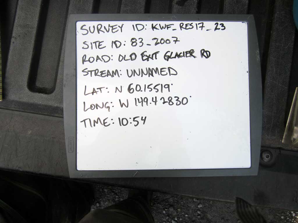
Coordinates (dec. deg.): 60.15519°, -149.42830°
Legal Description: S001N001W27
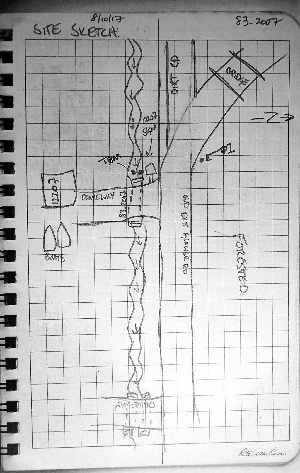
Region: South Central
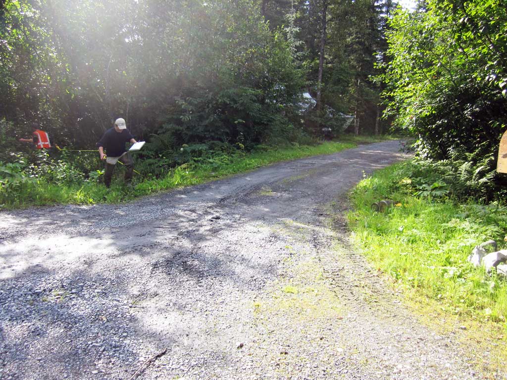
Road Name: Driveway
Datum: NAD83
Quad Name / ITM: Seward A-7
AWC Stream #: 231-30-10080-2010-3029-4015
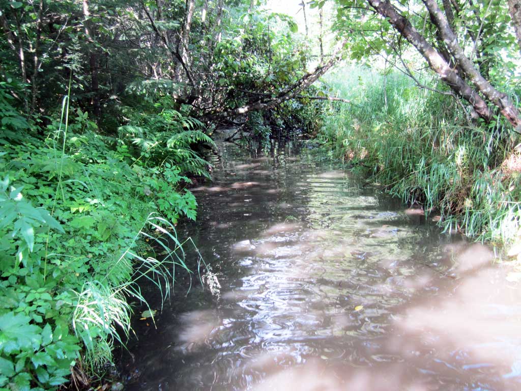
Stream Name: Unnamed
Elevation:
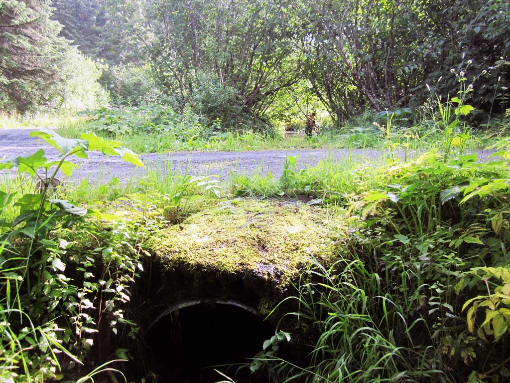
Site Comments: Site is on a driveway off of Old Exit Glacier Road
Survey KEN17-83_2007
Observers: Luke Violette, Louis Mitchell, Mary Richardson
Overall Fish Passage Rating:
Tidal: No
Backwatered: Maybe
Step Pools: No
Construction Year:
Site Observations:
- Constriction ratio red
- Culvert gradient red
- Hydraulic flows exceeded capacity
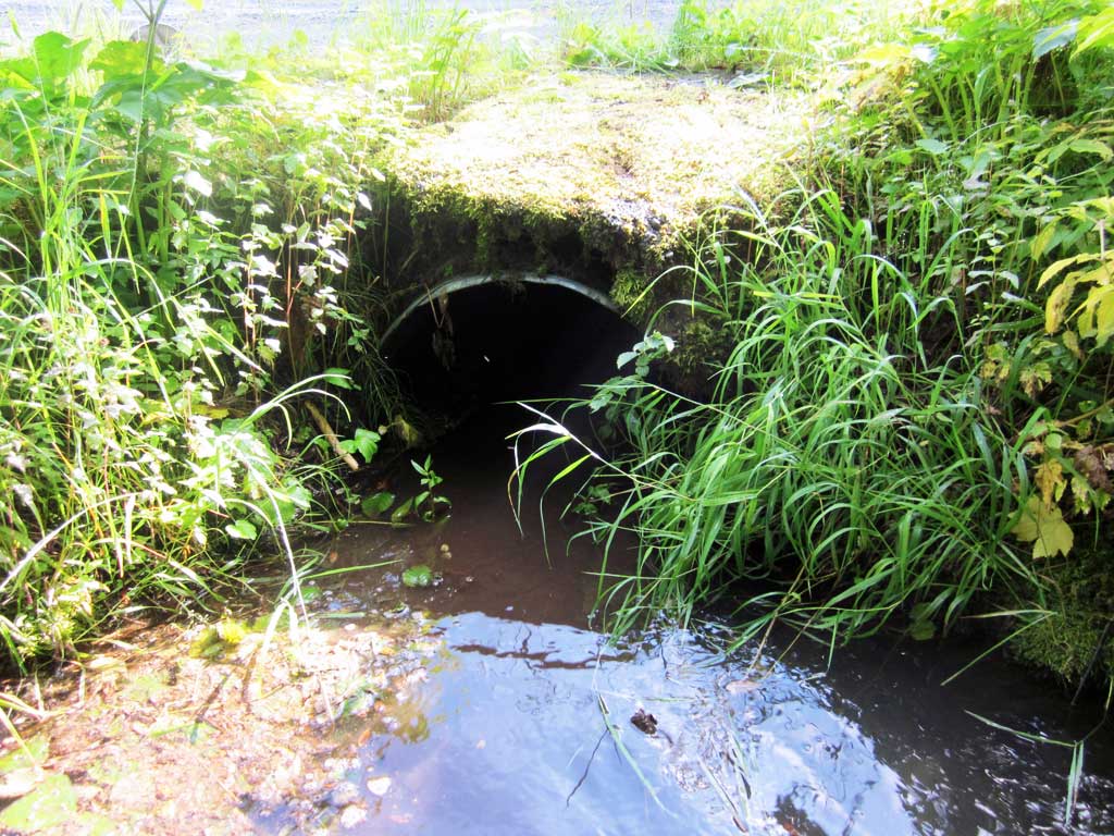
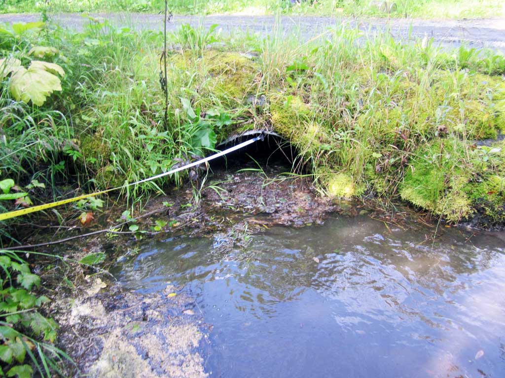
Comments: KWFRES_17_23. Water surface elevations are inconsistent and site may be backwatered, but photos inconclusive on flow. Culvert is undersized.
Culvert Measurements
| ID: 1 | Structure Type: Circular pipe (Corrugated steel) | Fish Passage Rating: | |||||||||||||||||||||||||||||||||||||||||
|
|
|
|||||||||||||||||||||||||||||||||||||||||
Comments: Invert gradient 1.42%, water surface gradient through culvert 0.34% (although water surface elevations are not very consistant in long profile) |
|||||||||||||||||||||||||||||||||||||||||||
Culvert Observations:
|
|||||||||||||||||||||||||||||||||||||||||||
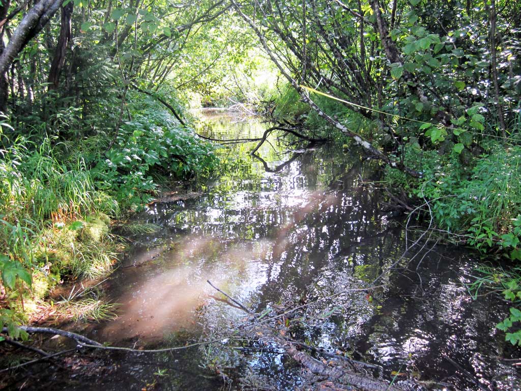
Stream Measurements
|
|
| Stream Width Type | Distance From Crossing (ft) |
Stream Width (ft) |
|---|---|---|
| Downstream ordinary high water | 20.0 | 9.50 |
| Downstream ordinary high water | 40.0 | 10.25 |
| Downstream ordinary high water | 70.0 | 12.00 |
| Upstream ordinary high water | 20.0 | 9.00 |
| Upstream ordinary high water | 40.0 | 10.25 |
| Upstream ordinary high water | 60.0 | 9.00 |
| Upstream ordinary high water | 80.0 | 11.00 |
Elevations
| Locator ID | Culvert Number |
River Distance (ft)1 |
Distance From Crossing (ft)2 |
Relative Elevation (ft) |
|---|---|---|---|---|
| Road Elev | 100.24 | |||
| D/S Thalweg | 0.00 | 97.46 | ||
| D/S Water Surface Elev | 0.00 | 98.02 | ||
| D/S Water Surface Elev | 20.00 | 98.04 | ||
| D/S Thalweg | 20.00 | 96.44 | ||
| D/S Thalweg | 60.00 | 97.23 | ||
| D/S Water Surface Elev | 60.00 | 96.94 | ||
| Max Pool Depth | 87.00 | 96.94 | ||
| Outlet Pool Water Elev | 87.00 | 96.94 | ||
| Outlet Invert | 100.00 | 96.66 | ||
| D/S Water Surface Elev | 100.00 | 98.05 | ||
| Outlet Culvert Top | 100.00 | 99.08 | ||
| Inlet Culvert Top | 120.40 | 98.41 | ||
| U/S Water Surface Elev | 120.40 | 98.10 | ||
| Inlet Culvert Invert (on substrate) | 120.40 | 96.95 | ||
| U/S Thalweg (inlet pool) | 122.40 | 96.99 | ||
| U/S Water Surface Elev | 122.40 | 97.91 | ||
| U/S Thalweg | 135.40 | 97.46 | ||
| U/S Water Surface Elev | 135.40 | 98.10 | ||
| U/S Water Surface Elev | 175.40 | 98.08 | ||
| U/S Thalweg | 175.40 | 97.27 | ||
| U/S Grade Ctrl (Thalweg) | 210.40 | 97.94 | ||
| U/S Water Surface Elev | 210.40 | 98.28 | ||
| U/S Water Surface Elev | 260.40 | 98.37 | ||
| U/S Thalweg | 260.40 | 98.04 | ||
| U/S Thalweg | 310.40 | 97.58 | ||
| U/S Water Surface Elev | 310.40 | 98.43 |
Notes:
- River distance is measured continuously throughout the survey reach along the thalweg of the stream.
- Measured from each end of the crossing along the thalweg of the stream.
Fish Sampling Efforts
| Gear Type: Minnow Trap (A) | Trap Duration(h): 1.25 | |
| Comments: Trap set about 60 feet downstream. | ||
| Gear Type: Minnow Trap (B) | Trap Duration(h): 1.25 | |
Fish Observations
No fish observations occurred during this survey.
Photos
Questions or comments about this report can be directed to dfg.dsf.webmaster@alaska.gov