Fish Passage Site 20203736
Coordinates (dec. deg.): 60.15505°, -149.42659°
Legal Description: S001N001W27
Region: South Central
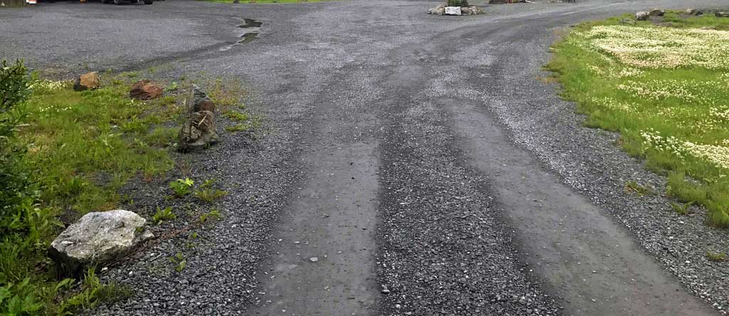
Road Name: Driveway
Datum: NAD83
Quad Name / ITM: Seward A-7
AWC Stream #: 231-30-10080-2010-3029-4015
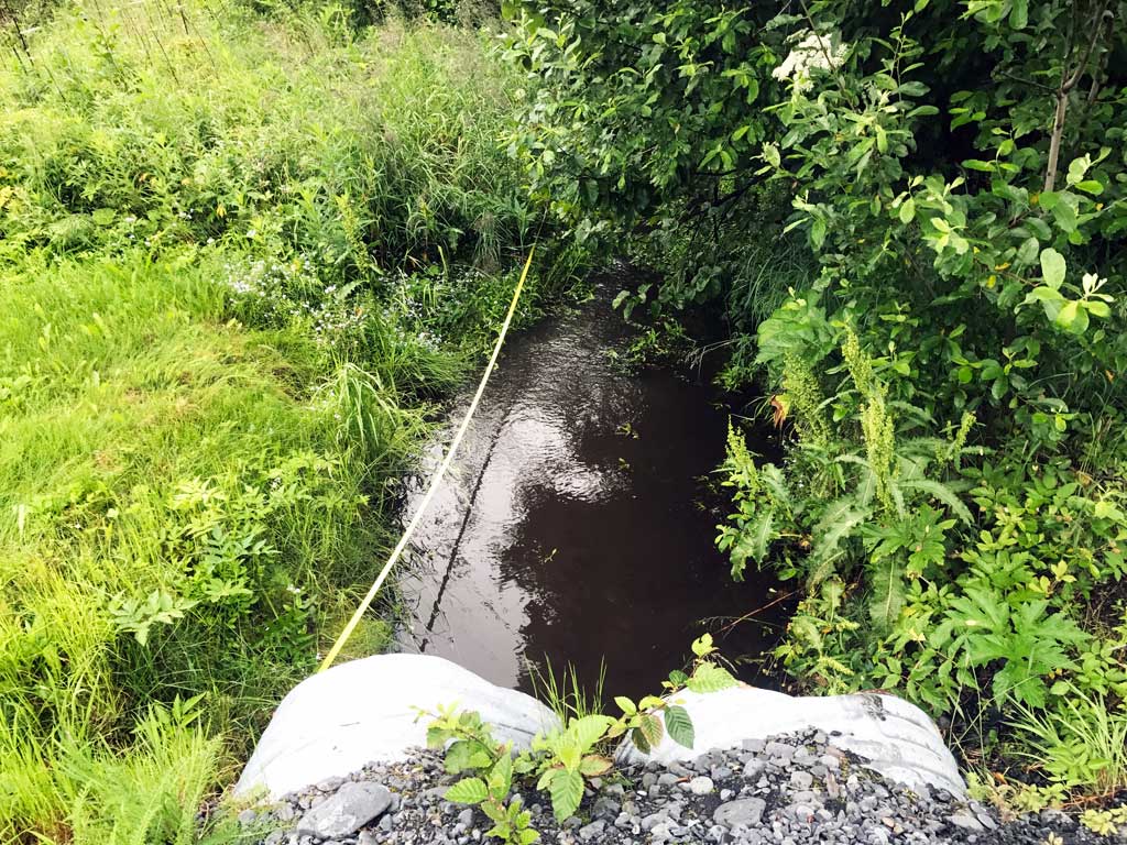
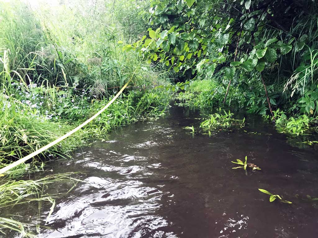
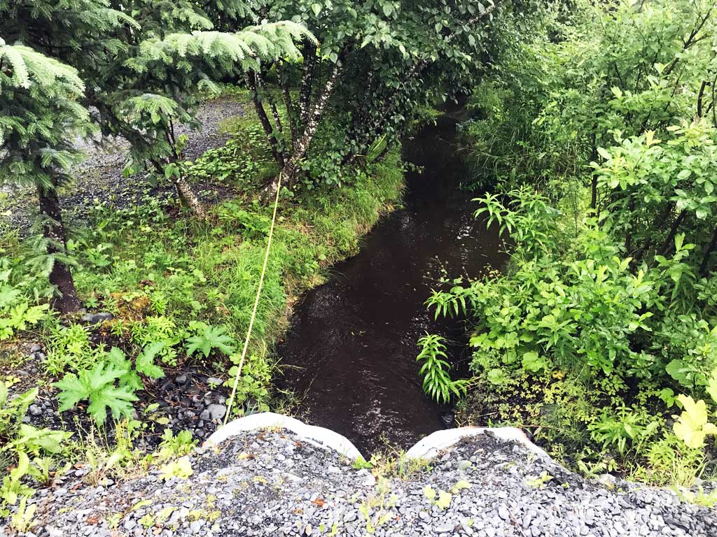
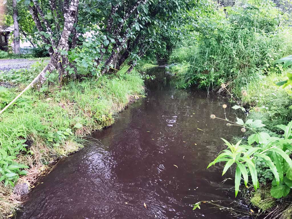
Stream Name: Unnamed
Elevation:
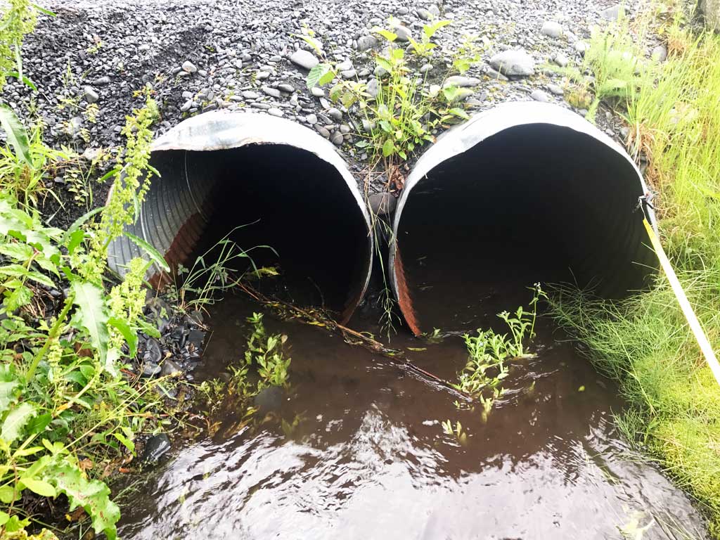
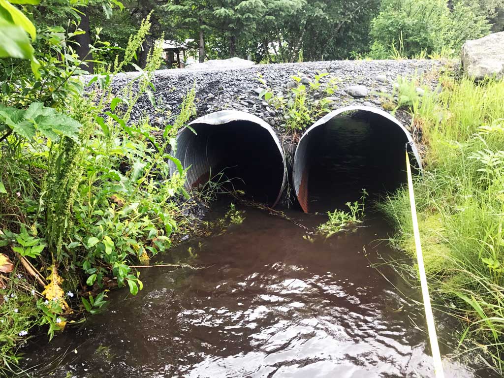
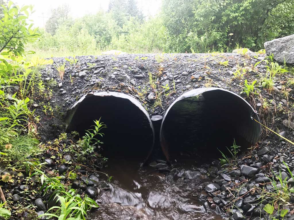
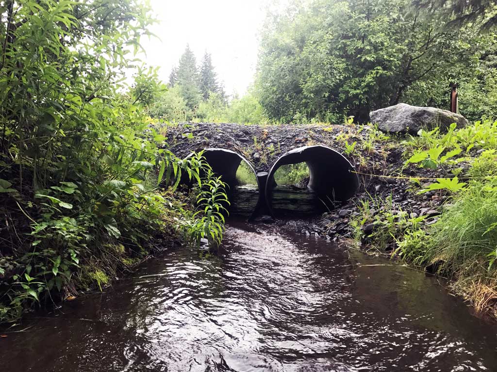
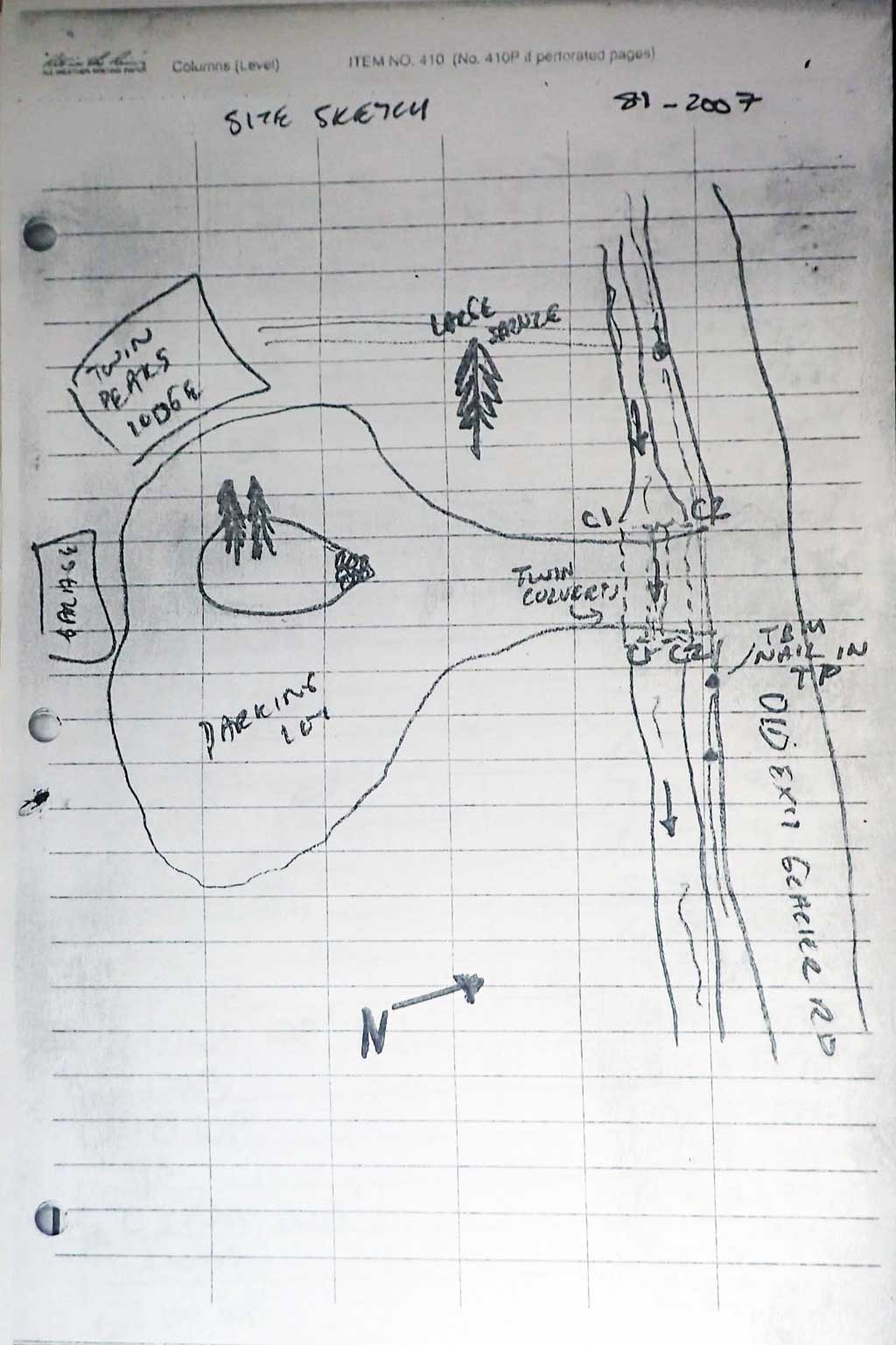
Site Comments: Culverts on driveway to Twin Peaks Lodge just off of Old Exit Glacier Road
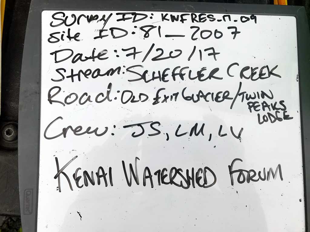
Survey KEN17-81_2007
Observers: Jeff Sires, Luke Violette, Louis Mitchell
Overall Fish Passage Rating:
Tidal: No
Backwatered: No
Step Pools: No
Construction Year:
Site Observations:
- Constriction ratio red
- Culvert gradient red
- Road bank erosion
Comments: KWFRES_17_09. Culvert assessment data and photographs submitted by Kenai Watershed Forum. Road fill eroding into creek. Notes indicated 2 Coho were caught in upstream trap. No photos for positive ID.
Culvert Measurements
| ID: 1 | Structure Type: Circular pipe (Corrugated steel) | Fish Passage Rating: | |||||||||||||||||||||||||||||||||||||||||
|
|
|
|||||||||||||||||||||||||||||||||||||||||
Comments: Water surface gradient through culvert 1.11%. Downstream stream gradient 0.41%. |
|||||||||||||||||||||||||||||||||||||||||||
Culvert Observations:
|
|||||||||||||||||||||||||||||||||||||||||||
| ID: 2 | Structure Type: Circular pipe (Corrugated steel) | Fish Passage Rating: | |||||||||||||||||||||||||||||||||||||||||
|
|
|
|||||||||||||||||||||||||||||||||||||||||
Comments: No substrate depth recorded for culvert. Water surface gradient through culvert 0.93%. Downstream gradient at 0.41%, upstream 0.48%. |
|||||||||||||||||||||||||||||||||||||||||||
Culvert Observations:
|
|||||||||||||||||||||||||||||||||||||||||||
Stream Measurements
|
|
| Stream Width Type | Distance From Crossing (ft) |
Stream Width (ft) |
|---|---|---|
| Downstream ordinary high water | 20.0 | 7.50 |
| Downstream ordinary high water | 40.0 | 6.25 |
| Downstream ordinary high water | 71.0 | 6.50 |
| Upstream ordinary high water | 28.0 | 12.00 |
| Upstream ordinary high water | 48.0 | 12.50 |
| Upstream ordinary high water | 80.0 | 10.50 |
| Upstream ordinary high water | 100.0 | 13.00 |
Elevations
| Locator ID | Culvert Number |
River Distance (ft)1 |
Distance From Crossing (ft)2 |
Relative Elevation (ft) |
|---|---|---|---|---|
| Road Elev | 101.42 | |||
| D/S Thalweg | 0.00 | 96.75 | ||
| D/S Water Surface Elev | 0.00 | 97.10 | ||
| D/S Grade Ctrl (Thalweg) | 26.00 | 97.07 | ||
| D/S Water Surface Elev | 26.00 | 97.33 | ||
| D/S Water Surface Elev | 69.00 | 97.50 | ||
| D/S Grade Ctrl (Thalweg) (grade point in middle of riffle) | 69.00 | 97.24 | ||
| D/S Thalweg | 88.00 | 96.61 | ||
| D/S Water Surface Elev | 88.00 | 97.56 | ||
| D/S Water Surface Elev | 108.00 | 97.54 | ||
| D/S Thalweg | 108.00 | 96.70 | ||
| D/S Thalweg (At end of outlet riffle) | 115.00 | 96.93 | ||
| D/S Water Surface Elev | 115.00 | 97.54 | ||
| D/S Grade Ctrl (Thalweg) (2 feet below outlet at head of outlet riffle) | 118.00 | 97.29 | ||
| D/S Water Surface Elev | 118.00 | 97.52 | ||
| Outlet Invert | 1 | 120.00 | 97.59 | |
| D/S Water Surface Elev | 2 | 120.00 | 97.67 | |
| D/S Water Surface Elev | 1 | 120.00 | 97.75 | |
| Outlet Culvert Top | 2 | 120.00 | 99.98 | |
| Outlet Culvert Top | 1 | 120.00 | 100.14 | |
| Outlet Invert | 2 | 120.00 | 97.39 | |
| Inlet Culvert Invert | 2 | 140.00 | 97.39 | |
| Inlet Culvert Invert | 1 | 140.00 | 97.51 | |
| Inlet Culvert Top | 1 | 140.00 | 100.40 | |
| Inlet Culvert Top | 2 | 140.00 | 100.42 | |
| U/S Water Surface Elev | 2 | 140.00 | 97.86 | |
| U/S Water Surface Elev | 1 | 140.00 | 97.97 | |
| U/S Water Surface Elev | 144.00 | 97.98 | ||
| U/S Thalweg | 144.00 | 97.07 | ||
| U/S Thalweg | 178.00 | 97.58 | ||
| U/S Water Surface Elev | 178.00 | 98.18 | ||
| U/S Water Surface Elev | 230.00 | 98.39 | ||
| U/S Thalweg | 230.00 | 97.72 |
Notes:
- River distance is measured continuously throughout the survey reach along the thalweg of the stream.
- Measured from each end of the crossing along the thalweg of the stream.
Fish Sampling Efforts
| Gear Type: Minnow Trap (A) | Trap Duration(h): 0.9 | |
| Comments: Trap set about 38 feet upstream. Noted 2 coho in trap, no photos for positive ID. | ||
| Gear Type: Minnow Trap (B) | Trap Duration(h): 1.0 | |
| Comments: Trap set about 30 feet downstream. | ||
Fish Observations
No fish observations occurred during this survey.
Photos
Questions or comments about this report can be directed to dfg.dsf.webmaster@alaska.gov