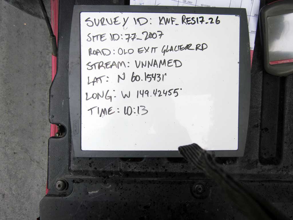
Fish Passage Site 20203735
Coordinates (dec. deg.): 60.15431°, -149.42455°
Legal Description: S001N001W27
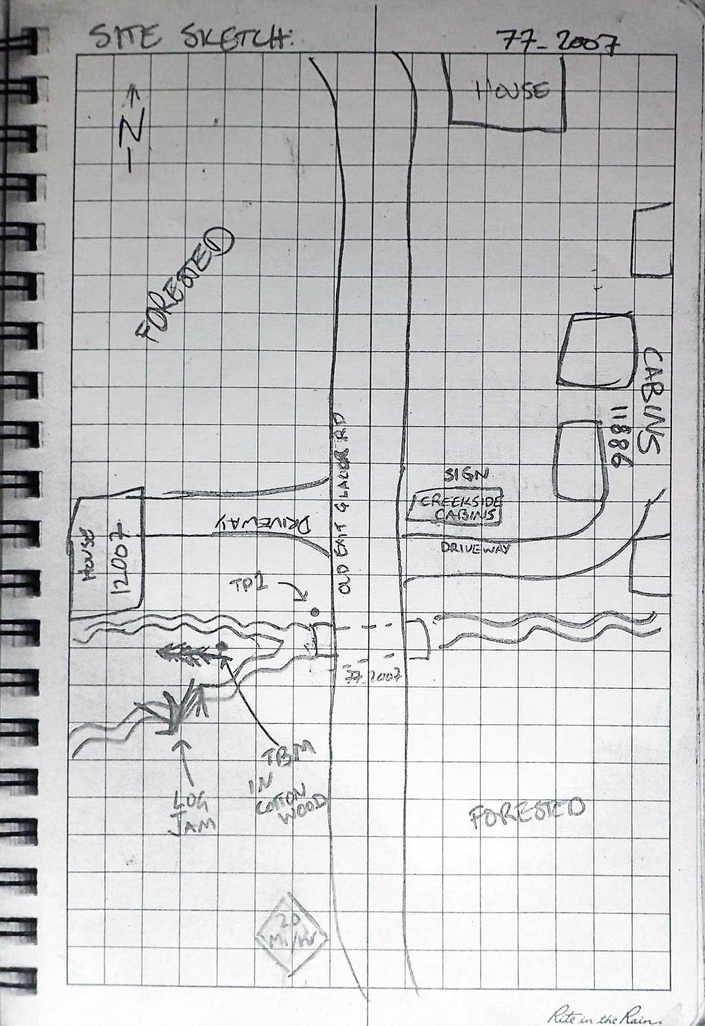
Region: South Central
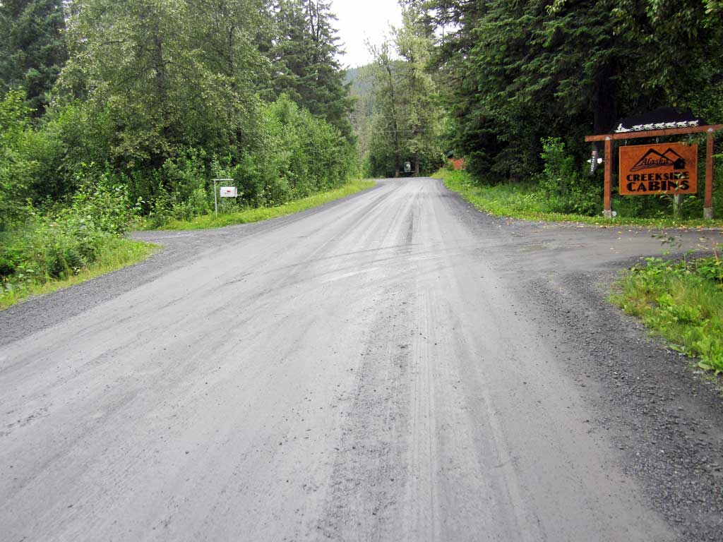
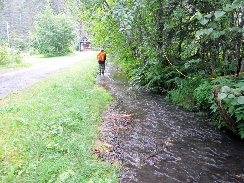
Road Name: Old Exit Glacier Road
Datum: NAD83
Quad Name / ITM: Seward A-7
AWC Stream #: 231-30-10080-2010-3029-4015
Stream Name: Unnamed
Elevation:
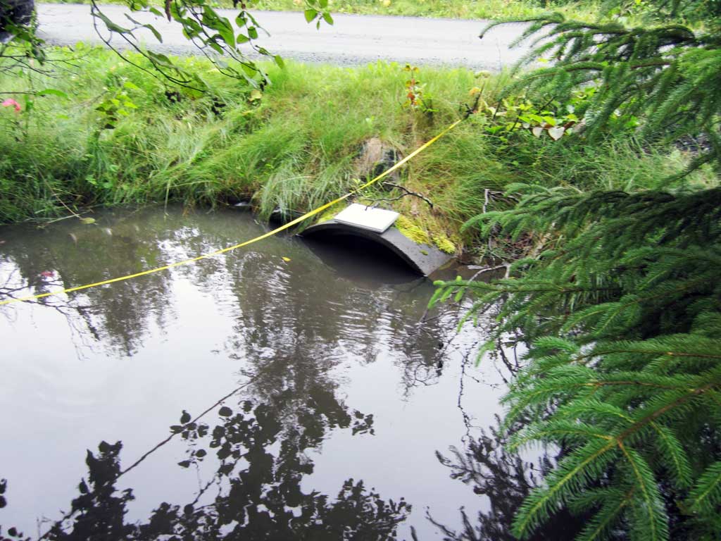
Site Comments: Site is right before driveway for Creekside Cabins and creek runs alongside Creekside Cabins driveway downstream from crossing.
Survey KEN17-77_2007
Observers: Louis Mitchell, Luke Violette, Mary Richardson
Overall Fish Passage Rating:
Tidal: No
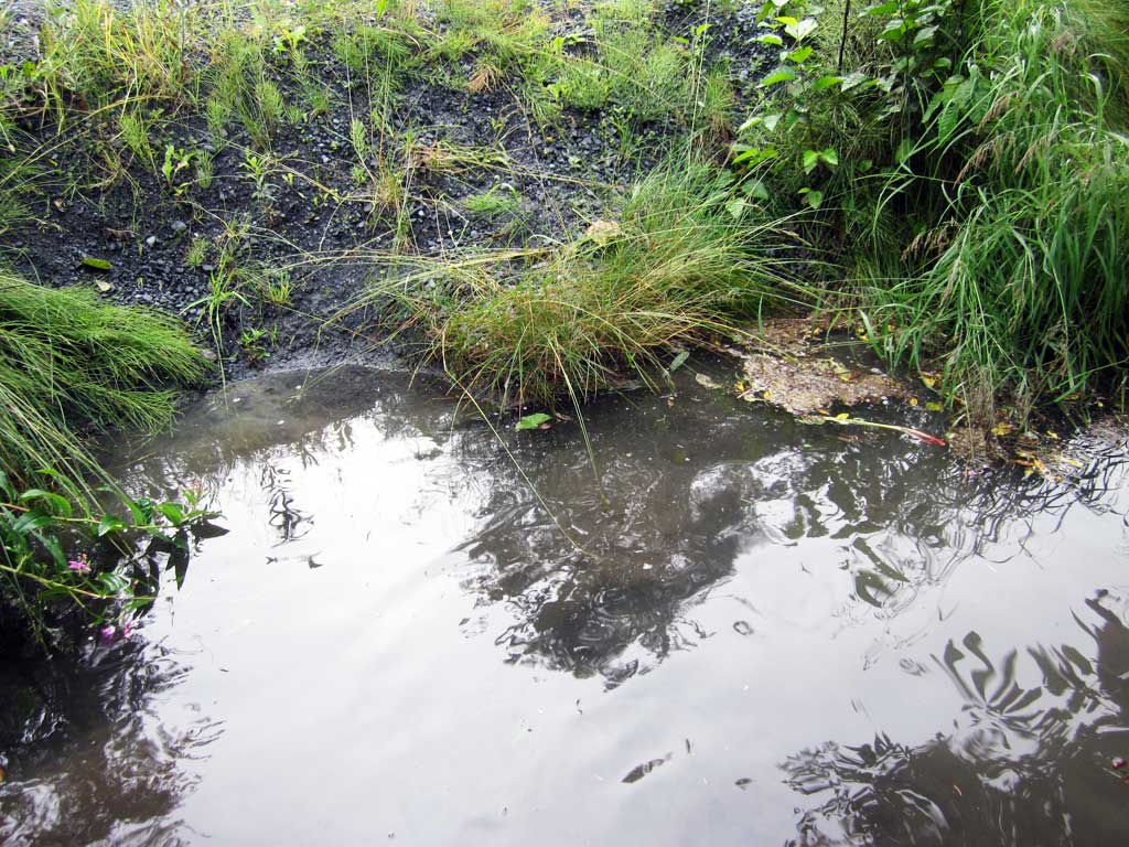
Backwatered: Yes
Step Pools: No
Construction Year:
Site Observations:
- Constriction ratio red
- Road Fill (pushed off road by grader)
- Subsidence
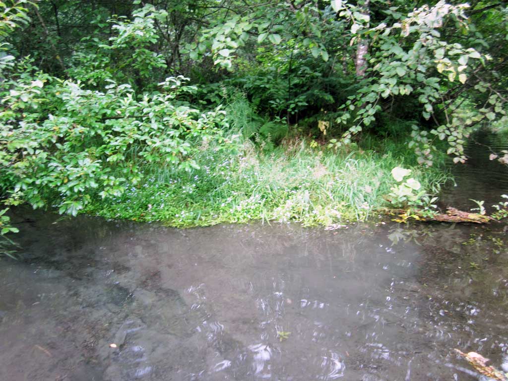
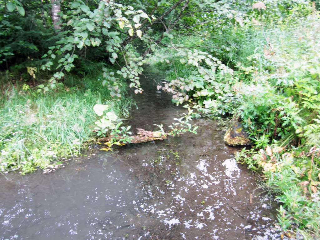
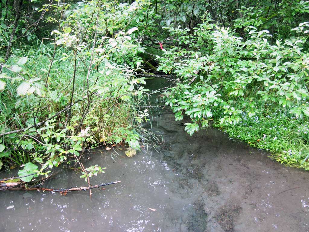
Comments: KWFRES_17_26. Culvert assessment performed and submitted by the Kenai Watershed Forum. Two streams come together just upstream of inlet. Downstream grade control higher than culvert inlet invert elevation, water surfaces very close upstream and downstream of culvert, site is backwatered. Constriction based on downstream widths, since two stream converge upstream of culvert, but downstream also looks ditched. Water surface elevations equal between downstream pool water surface elevation and upstream pool water surface elevation, but unable to confirm that the culvert is not obstructed since inlet is submerged. Road fill also being pushed into creek. Water looks fairly slow moving around crossing site, but photos inconclusive. Site rated gray, but does meet criteria for being backwatered. Upstream stream gradient for inlet creek #1 is 0.58 on right hand side facing upstream (north creek). Upstream stream gradient for inlet creek #2 (south creek) is 0.21%.
Culvert Measurements
| ID: 1 | Structure Type: Circular pipe (Reinforced concrete) | Fish Passage Rating: | |||||||||||||||||||||||||||||||||||||||||
|
|
|
|||||||||||||||||||||||||||||||||||||||||
Comments: Substrate gradient through culvert 0.28%. Water surface flat though cuvlert. Culvert set at adverse angle |
|||||||||||||||||||||||||||||||||||||||||||
Culvert Observations:
|
|||||||||||||||||||||||||||||||||||||||||||
Stream Measurements
|
|
| Stream Width Type | Distance From Crossing (ft) |
Stream Width (ft) |
|---|---|---|
| Downstream ordinary high water | 20.0 | 6.00 |
| Downstream ordinary high water | 40.0 | 6.50 |
| Downstream ordinary high water | 60.0 | 8.33 |
Elevations
| Locator ID | Culvert Number |
River Distance (ft)1 |
Distance From Crossing (ft)2 |
Relative Elevation (ft) |
|---|---|---|---|---|
| Road Elev | 100.65 | |||
| D/S Thalweg | 0.00 | 96.09 | ||
| D/S Water Surface Elev | 0.00 | 96.38 | ||
| D/S Water Surface Elev | 50.00 | 96.51 | ||
| D/S Thalweg | 50.00 | 95.71 | ||
| D/S Water Surface Elev | 70.00 | 97.05 | ||
| D/S Grade Ctrl (Thalweg) | 70.00 | 97.36 | ||
| D/S Water Surface Elev | 100.00 | 97.33 | ||
| D/S Thalweg | 100.00 | 96.99 | ||
| D/S Grade Ctrl (Thalweg) | 125.00 | 97.62 | ||
| D/S Water Surface Elev | 125.00 | 97.88 | ||
| Outlet Pool Water Elev | 144.00 | 97.95 | ||
| Max Pool Depth | 144.00 | 97.18 | ||
| Outlet Invert | 149.00 | 96.53 | ||
| D/S Water Surface Elev | 149.00 | 97.94 | ||
| Outlet Culvert Top | 149.00 | 98.53 | ||
| Inlet Culvert Top | 173.66 | 97.95 | ||
| U/S Water Surface Elev | 173.66 | 97.98 | ||
| Inlet Culvert Invert | 173.66 | 96.60 | ||
| U/S Thalweg (upstream inlet pool) | 178.66 | 96.65 | ||
| U/S Water Surface Elev | 178.66 | 97.95 | ||
| U/S Water Surface Elev | 194.66 | 97.93 | ||
| U/S Thalweg (Upstream inlet stream #2) | 194.66 | 97.39 | ||
| U/S Thalweg (Upstream inlet stream #1) | 199.66 | 97.07 | ||
| U/S Water Surface Elev | 199.66 | 97.86 | ||
| U/S Water Surface Elev | 214.66 | 98.06 | ||
| U/S Thalweg | 214.66 | 97.37 | ||
| U/S Water Surface Elev | 234.66 | 98.34 | ||
| U/S Grade Ctrl (Thalweg) | 234.66 | 97.93 | ||
| U/S Water Surface Elev | 239.66 | 97.87 | ||
| U/S Thalweg | 239.66 | 97.37 | ||
| U/S Thalweg | 249.66 | 97.86 | ||
| U/S Water Surface Elev | 249.66 | 98.33 | ||
| U/S Water Surface Elev | 264.66 | 98.41 | ||
| U/S Thalweg | 264.66 | 98.09 | ||
| U/S Water Surface Elev | 274.66 | 98.02 | ||
| U/S Thalweg | 274.66 | 98.04 | ||
| U/S Water Surface Elev | 274.66 | 98.39 | ||
| U/S Thalweg | 274.66 | 97.73 |
Notes:
- River distance is measured continuously throughout the survey reach along the thalweg of the stream.
- Measured from each end of the crossing along the thalweg of the stream.
Fish Sampling Efforts
| Gear Type: Minnow Trap (A) | Trap Duration(h): 1.5 | |
| Comments: Trap set about 60 feet upstream | ||
| Gear Type: Minnow Trap (B) | Trap Duration(h): 1.5 | |
| Comments: Trap set about 100 feet downstream. | ||
Fish Observations
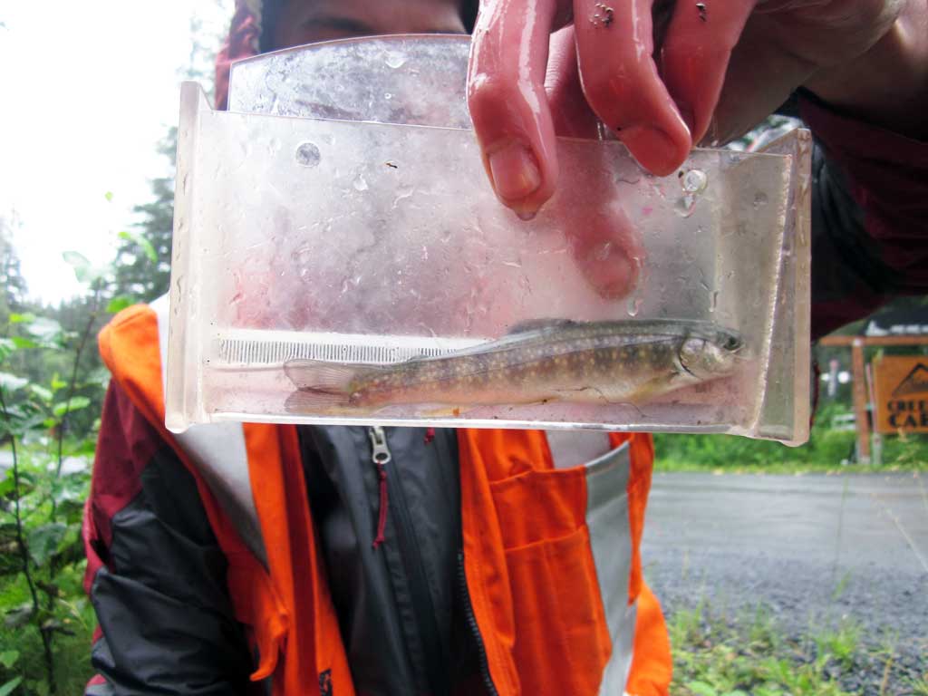
| Species: juvenile/adult Dolly Varden | Life History: Unknown | ||
| Total Fish Observed: 1 | Fish Measured: 1 | Fork Lengths (mm) Min: 130 Max: 130 Mean: 130 | |
| Collected/Observed by Gear Type: Upstream Minnow Trap (1) | |||
Photos
Questions or comments about this report can be directed to dfg.dsf.webmaster@alaska.gov