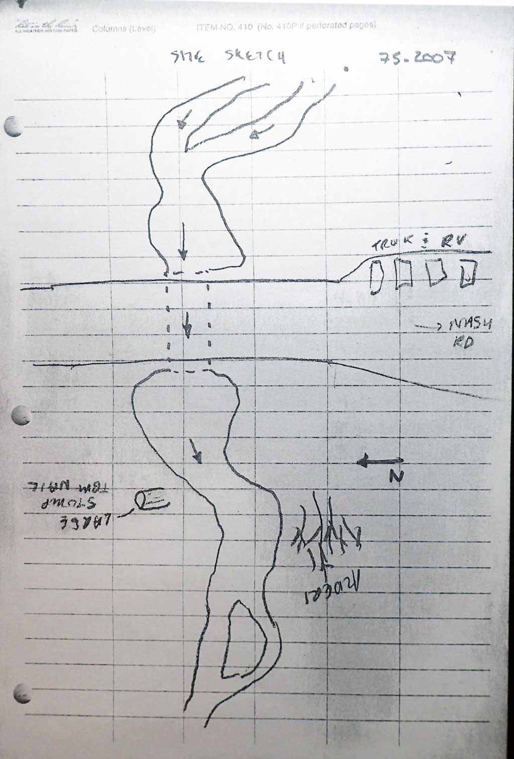
Fish Passage Site 20203734
Coordinates (dec. deg.): 60.12344°, -149.36717°
Legal Description: S001S001W01
Region: South Central
Road Name: Driveway
Datum: NAD83
Quad Name / ITM: Seward A-7
AWC Stream #: 231-30-10104
Stream Name: Unnamed
Elevation:
Site Comments: Cuvlert is on a gravel pit access road
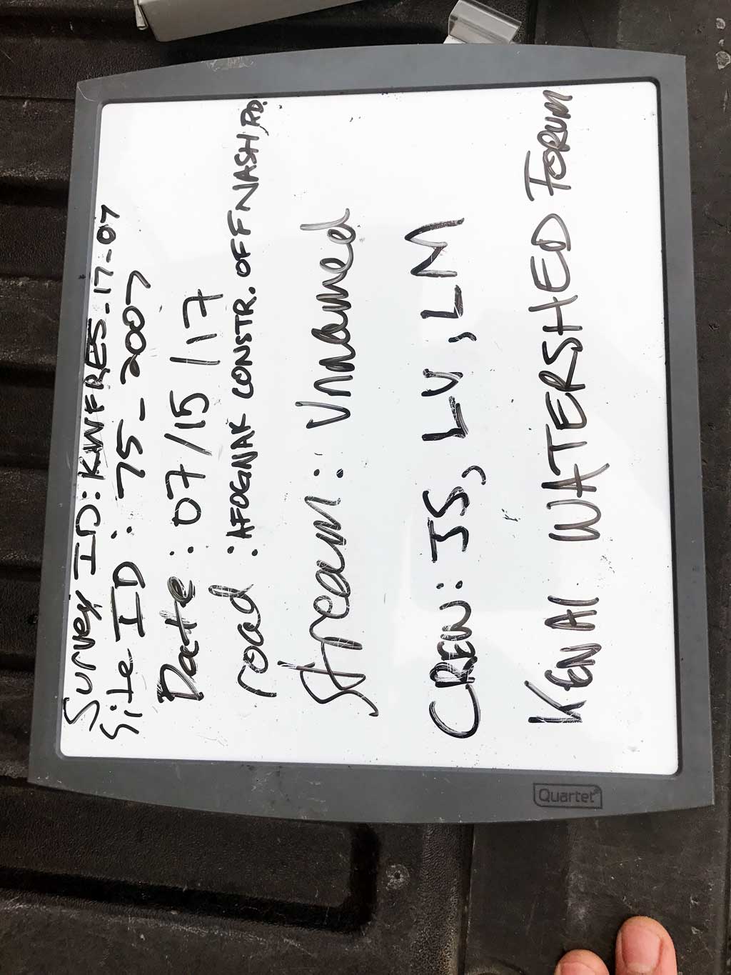
Survey KEN17-75_2007
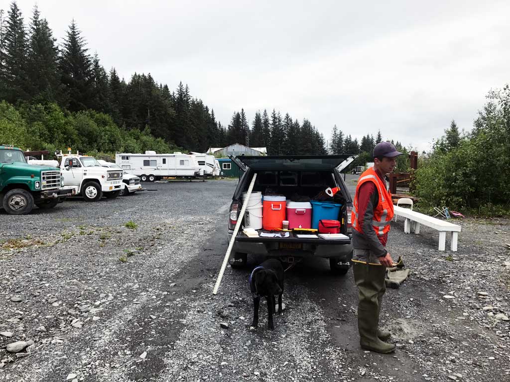
Observers: Jeff Sires, Luke Violette, Louis Mitchell
Overall Fish Passage Rating:
Tidal: No
Backwatered: No
Step Pools: No
Construction Year:
Site Observations:
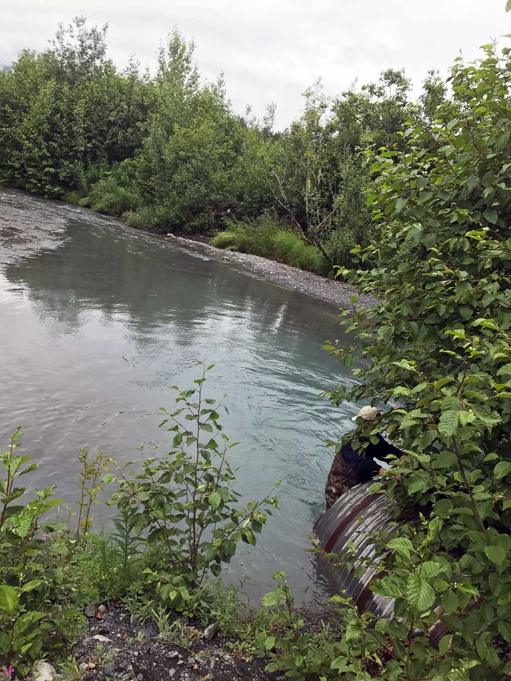
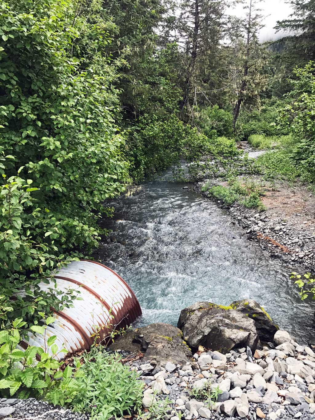
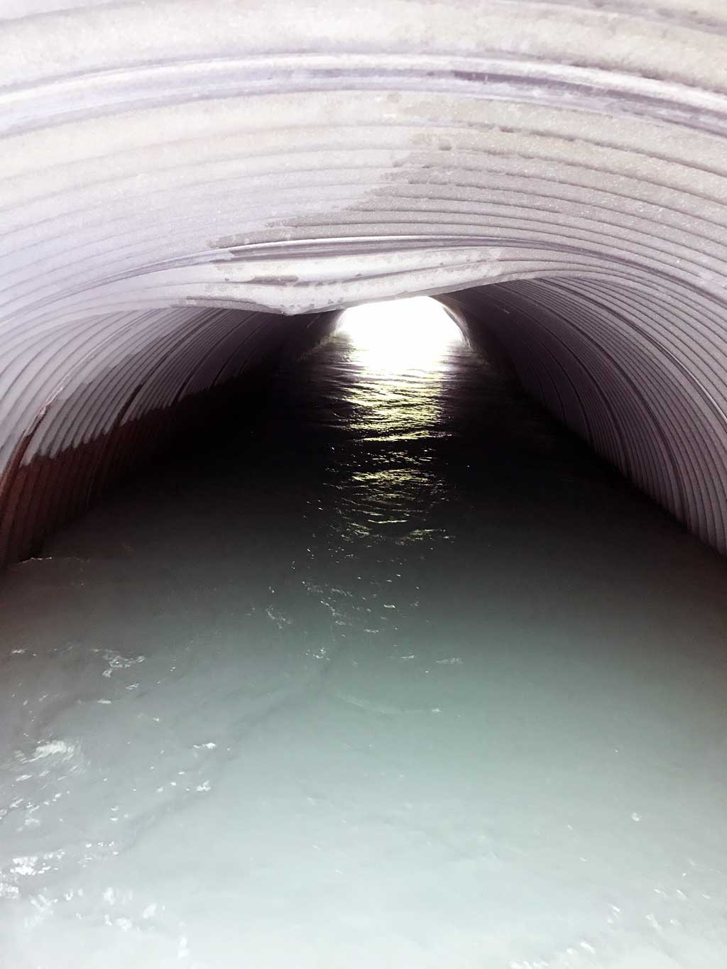
- Constriction ratio red
- Shallow fill; inadequate roadfill volume above culvert
- Structural Problem
- Mechanical damage or joints parting
- Hydraulic flows exceeded capacity
- Culvert gradient gray
Comments: KWFRES_17_07. Culvert assessment data and photographs submitted by the Kenai Watershed Forum.
Culvert Measurements
| ID: 1 | Structure Type: Circular pipe (Corrugated steel) | Fish Passage Rating: | |||||||||||||||||||||||||||||||||||||||||
|
|
|
|||||||||||||||||||||||||||||||||||||||||
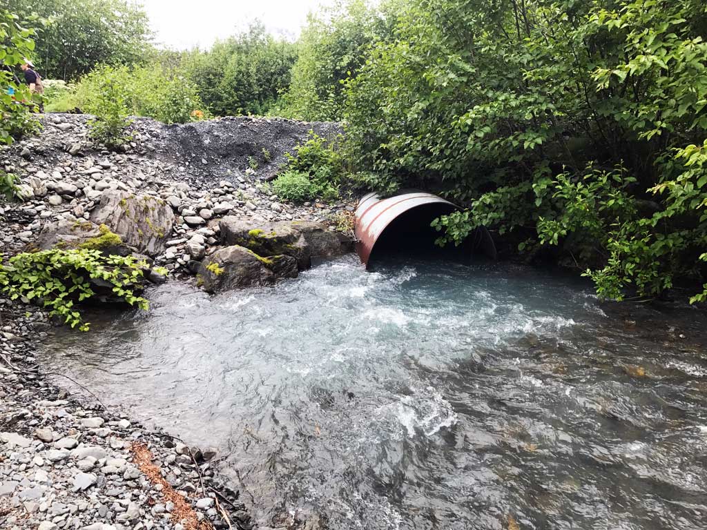
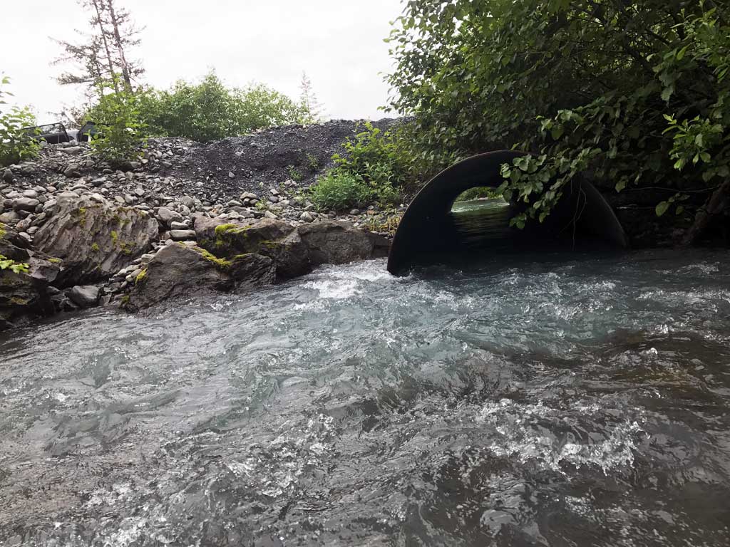
Comments: Interior of culvert shows damage from shallow fill. Culvert undersized for creek. |
|||||||||||||||||||||||||||||||||||||||||||
Culvert Observations:
|
|||||||||||||||||||||||||||||||||||||||||||
Stream Measurements
|
|
| Stream Width Type | Distance From Crossing (ft) |
Stream Width (ft) |
|---|---|---|
| Downstream ordinary high water | 110.0 | 21.00 |
| Downstream ordinary high water | 240.0 | 19.00 |
| Downstream ordinary high water | 300.0 | 21.00 |
| Upstream ordinary high water | 50.0 | 13.00 |
| Upstream ordinary high water | 200.0 | 19.00 |
| Upstream ordinary high water | 250.0 | 22.00 |
Elevations
| Locator ID | Culvert Number |
River Distance (ft)1 |
Distance From Crossing (ft)2 |
Relative Elevation (ft) |
|---|---|---|---|---|
| Road Elev | 100.08 | |||
| D/S Thalweg | 0.00 | 90.73 | ||
| D/S Water Surface Elev | 0.00 | 91.64 | ||
| D/S Water Surface Elev | 61.00 | 92.25 | ||
| D/S Grade Ctrl (Thalweg) | 61.00 | 91.47 | ||
| D/S Thalweg | 100.00 | 91.51 | ||
| D/S Water Surface Elev | 100.00 | 92.58 | ||
| D/S Water Surface Elev | 124.00 | 93.04 | ||
| D/S Grade Ctrl (Thalweg) | 124.00 | 92.34 | ||
| D/S Grade Ctrl (Thalweg) | 210.00 | 94.00 | ||
| D/S Water Surface Elev | 210.00 | 94.41 | ||
| D/S Water Surface Elev | 254.00 | 95.16 | ||
| D/S Grade Ctrl (Thalweg) | 254.00 | 94.39 | ||
| D/S Grade Ctrl (Thalweg) | 344.00 | 95.59 | ||
| D/S Water Surface Elev | 344.00 | 96.25 | ||
| D/S Water Surface Elev | 367.00 | 96.46 | ||
| D/S Thalweg | 367.00 | 95.73 | ||
| Max Pool Depth | 396.00 | 93.44 | ||
| Outlet Pool Water Elev | 396.00 | 96.56 | ||
| Outlet Culvert Top | 400.00 | 98.69 | ||
| D/S Water Surface Elev | 400.00 | 96.44 | ||
| Outlet Invert | 400.00 | 93.88 | ||
| Inlet Culvert Invert | 445.38 | 93.12 | ||
| U/S Water Surface Elev | 445.38 | 96.55 | ||
| Inlet Culvert Top | 445.38 | 99.27 | ||
| U/S Water Surface Elev | 446.38 | 96.53 | ||
| U/S Thalweg | 446.38 | 93.36 | ||
| U/S Grade Ctrl (Thalweg) | 462.38 | 96.06 | ||
| U/S Water Surface Elev | 462.38 | 97.00 | ||
| U/S Grade Ctrl (Thalweg) | 499.38 | 98.50 | ||
| U/S Water Surface Elev | 499.38 | 98.90 | ||
| U/S Thalweg | 595.38 | 100.25 | ||
| U/S Water Surface Elev | 595.38 | 100.52 |
Notes:
- River distance is measured continuously throughout the survey reach along the thalweg of the stream.
- Measured from each end of the crossing along the thalweg of the stream.
Fish Sampling Efforts
| Gear Type: Minnow Trap (A) | Trap Duration(h): 1.75 | |
| Comments: Trap set about 50 feet upstream. | ||
| Gear Type: Minnow Trap (B) | Trap Duration(h): 1.75 | |
| Comments: Trap set about 20 feet downstream | ||
Fish Observations
No fish observations occurred during this survey.
Photos
Questions or comments about this report can be directed to dfg.dsf.webmaster@alaska.gov