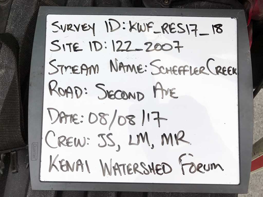
Fish Passage Site 20203728
Coordinates (dec. deg.): 60.11215°, -149.44386°
Legal Description: S001S001W03
Region: South Central
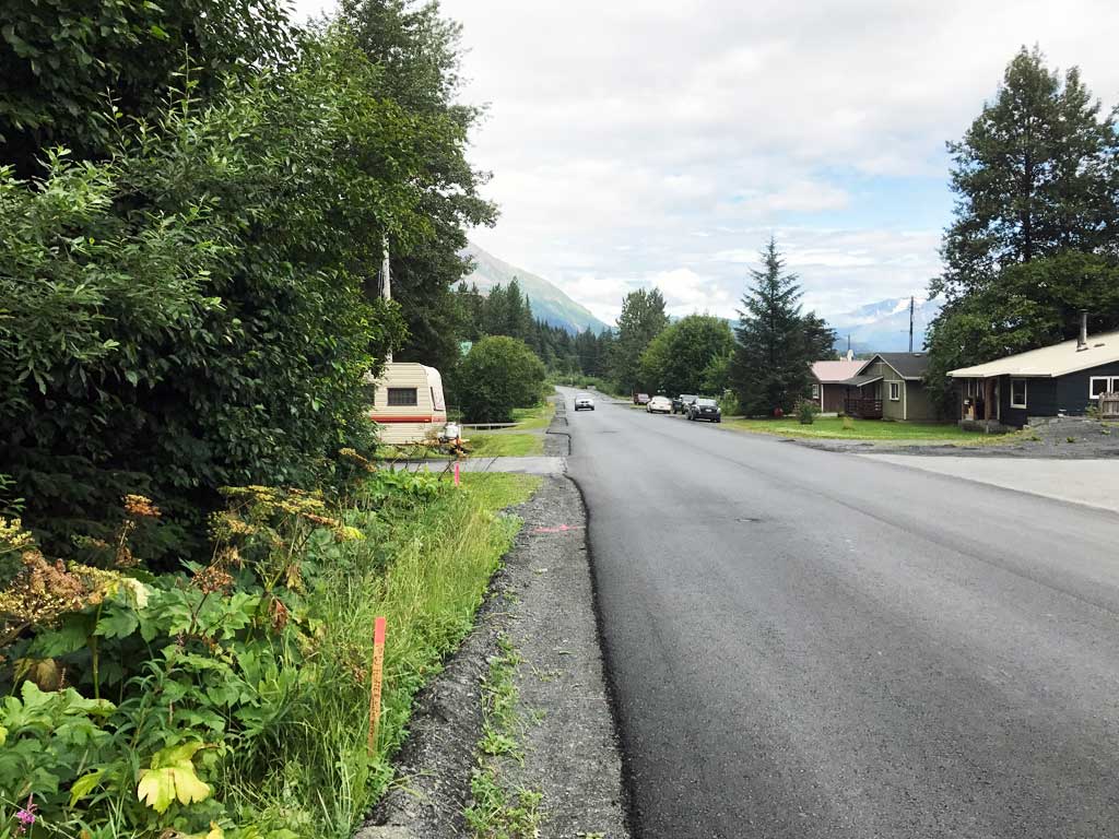
Road Name: Driveway
Datum: NAD83
Quad Name / ITM: Seward A-7
AWC Stream #: 231-30-10070-2009
Stream Name: Scheffler Creek
Elevation:
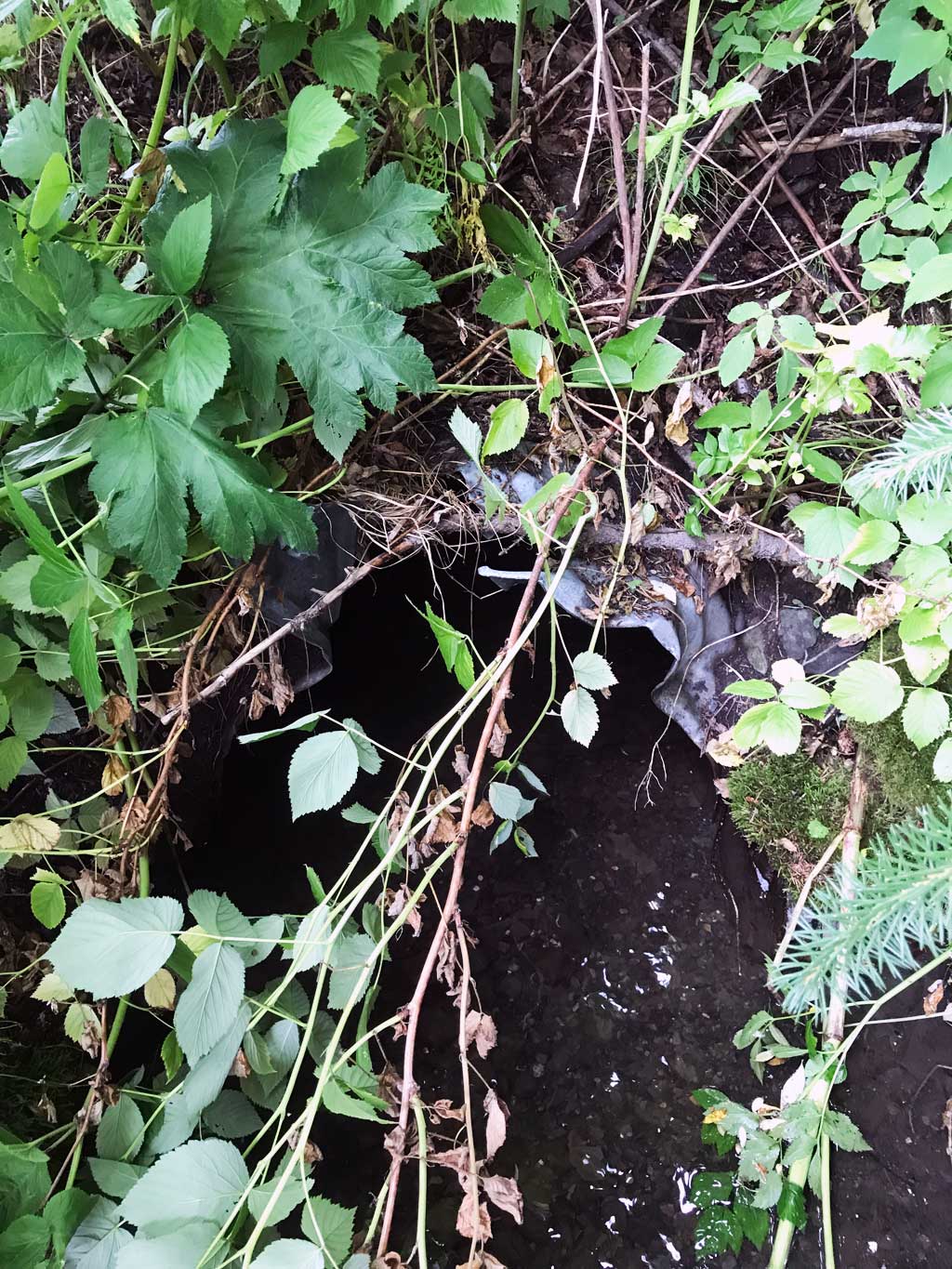
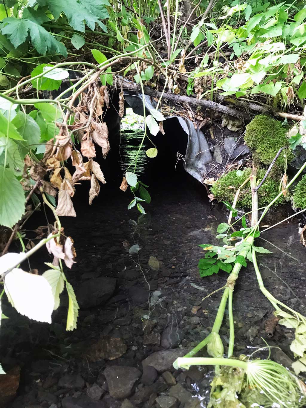
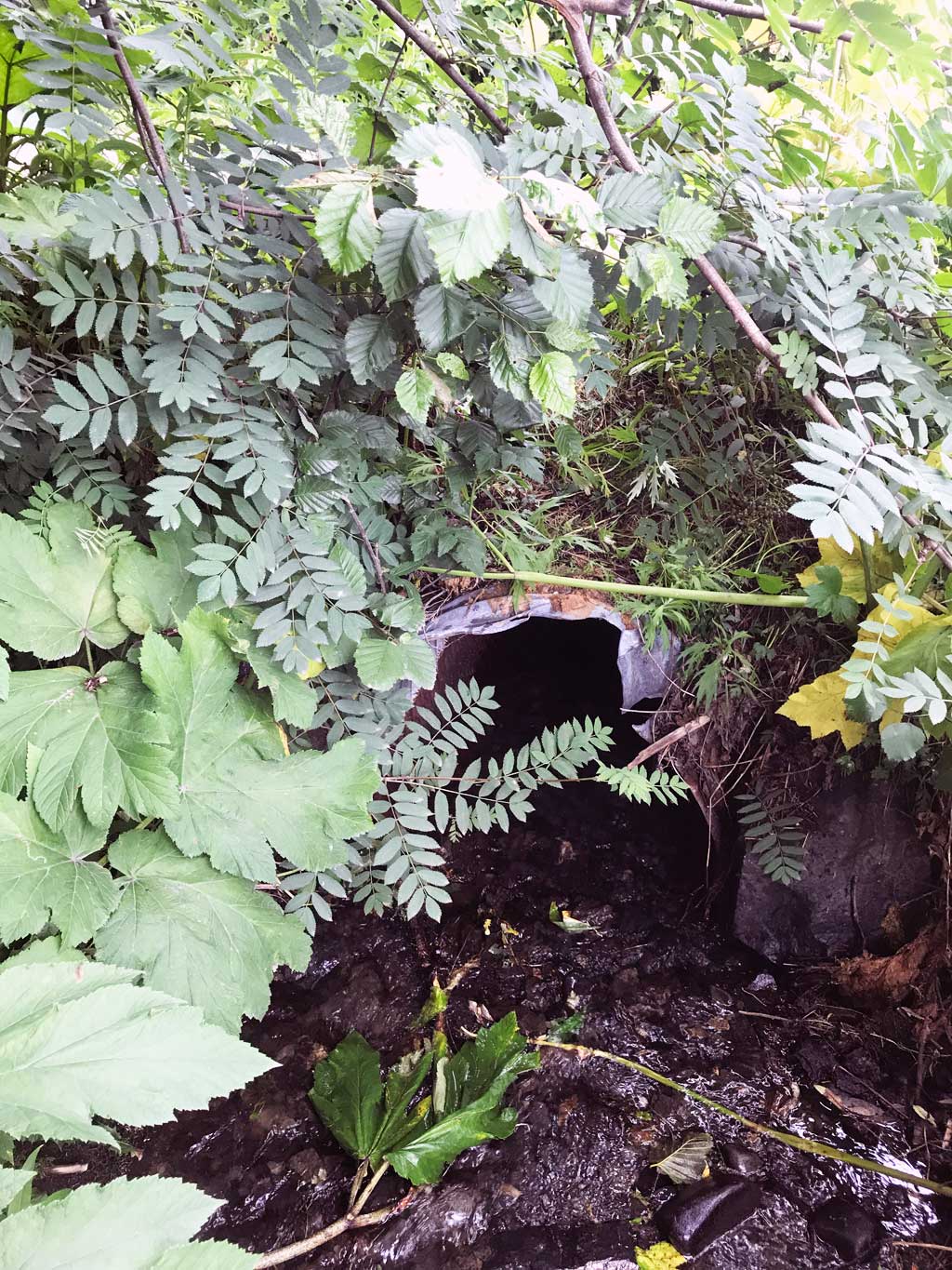
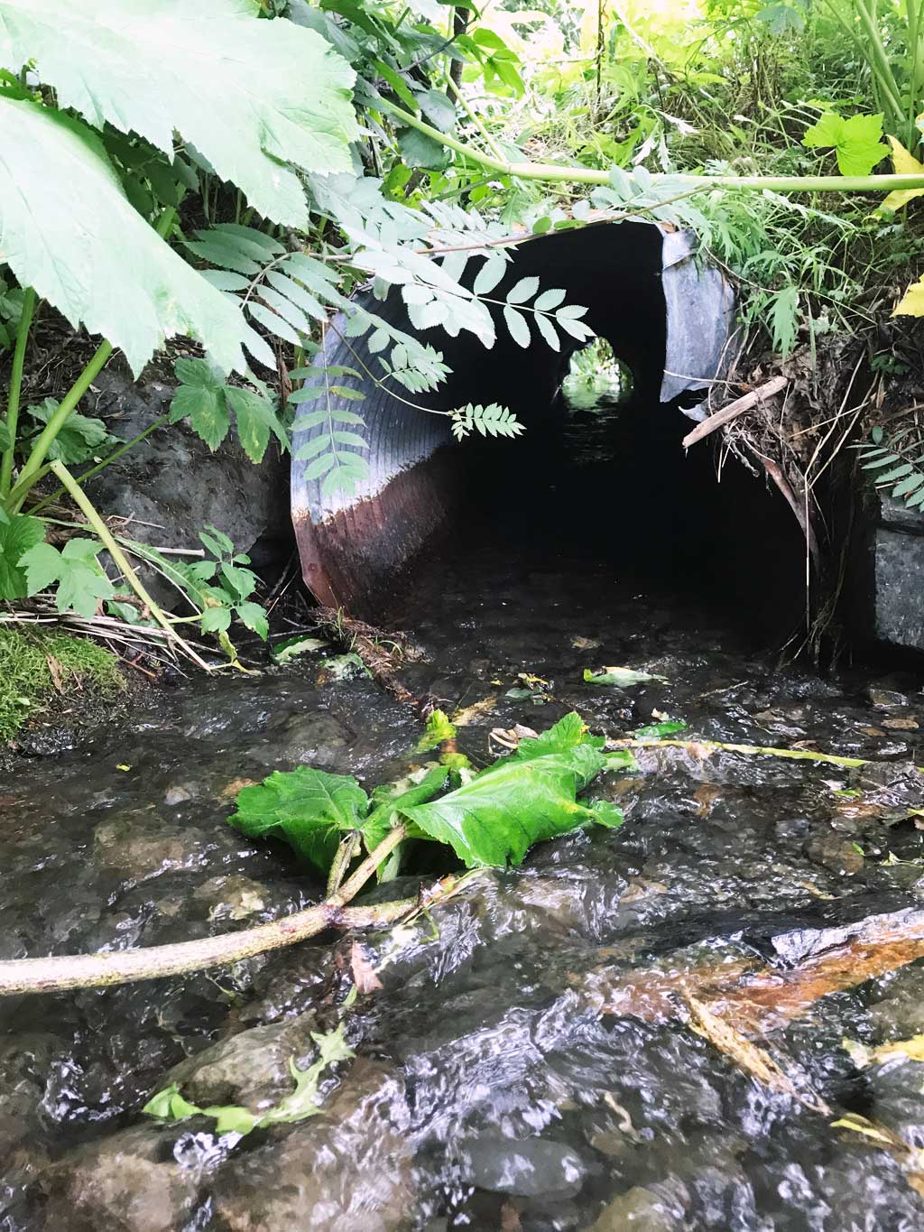
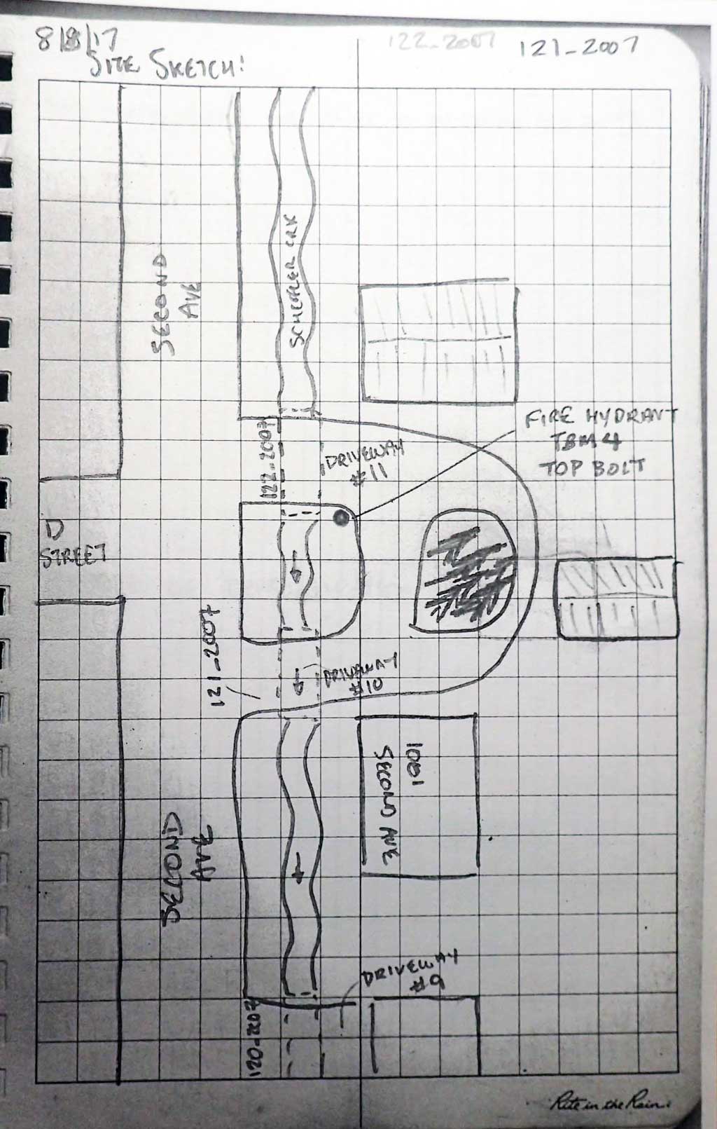
Site Comments: Culvert is the last line of a series of driveway culverts that runs next to Second Avenue. There is one more culvert upstream of this site.
Survey KEN17-122_2007
Observers: Jeff Sires, Louis Mitchell, Mary Richardson
Overall Fish Passage Rating:
Tidal: No
Backwatered: No
Step Pools: No
Construction Year:
Site Observations:
- Culvert gradient red
- Damage associated with ice problems
Comments: KWFRES_17_18. Culvert assessment and photographs submitted by Kenai Watershed Forum. Upstream and downstream ditched. Used downstream stream measurements below lower culvert 112_2007 for OHW for Constriction Ratio. Site 121_2007 is about 70 feet downstream. There is another culvert upstream about 250 feet.
Culvert Measurements
| ID: 1 | Structure Type: Circular pipe (Corrugated steel) | Fish Passage Rating: | |||||||||||||||||||||||||||||||||||||||||
|
|
|
|||||||||||||||||||||||||||||||||||||||||
Comments: Inlet and outlet damaged. |
|||||||||||||||||||||||||||||||||||||||||||
Culvert Observations:
|
|||||||||||||||||||||||||||||||||||||||||||
Stream Measurements
|
|
| Stream Width Type | Distance From Crossing (ft) |
Stream Width (ft) |
|---|---|---|
| Downstream ordinary high water | 19.0 | 4.16 |
| Downstream ordinary high water | 35.0 | 3.50 |
| Downstream ordinary high water | 50.0 | 3.25 |
| Upstream ordinary high water | 20.0 | 4.50 |
| Upstream ordinary high water | 45.0 | 4.80 |
| Upstream ordinary high water | 70.0 | 3.90 |
| Upstream ordinary high water | 110.0 | 4.40 |
Elevations
| Locator ID | Culvert Number |
River Distance (ft)1 |
Distance From Crossing (ft)2 |
Relative Elevation (ft) |
|---|---|---|---|---|
| Road Elev | 97.01 | |||
| D/S Grade Ctrl (Thalweg) | 0.00 | 90.70 | ||
| D/S Water Surface Elev | 0.00 | 90.82 | ||
| D/S Thalweg | 5.00 | 90.87 | ||
| D/S Water Surface Elev | 5.00 | 91.02 | ||
| D/S Grade Ctrl (Thalweg) | 33.00 | 92.01 | ||
| D/S Water Surface Elev | 33.00 | 92.13 | ||
| D/S Grade Ctrl (Thalweg) | 56.00 | 92.76 | ||
| D/S Water Surface Elev | 56.00 | 92.79 | ||
| D/S Water Surface Elev | 60.00 | 92.83 | ||
| D/S Tailcrest or 1st Thalweg | 60.00 | 92.37 | ||
| Outlet Pool Water Elev | 64.00 | 92.87 | ||
| Max Pool Depth | 64.00 | 91.89 | ||
| Outlet Invert (on pipe) | 67.00 | 92.77 | ||
| D/S Thalweg (substrate directly below culvert outlet) | 67.00 | 92.34 | ||
| D/S Water Surface Elev | 67.00 | 92.90 | ||
| Outlet Culvert Top | 67.00 | 95.15 | ||
| U/S Water Surface Elev | 97.34 | 94.08 | ||
| Inlet Culvert Top | 97.34 | 93.83 | ||
| Inlet Culvert Invert (on pipe) | 97.34 | 96.36 | ||
| U/S Thalweg | 99.34 | 94.06 | ||
| U/S Water Surface Elev | 99.34 | 94.25 | ||
| U/S Thalweg | 149.34 | 95.33 | ||
| U/S Water Surface Elev | 149.34 | 95.44 | ||
| U/S Grade Ctrl (Thalweg) | 194.34 | 96.47 | ||
| U/S Water Surface Elev | 194.34 | 96.71 | ||
| U/S Thalweg | 247.34 | 98.29 | ||
| U/S Water Surface Elev | 247.34 | 98.50 |
Notes:
- River distance is measured continuously throughout the survey reach along the thalweg of the stream.
- Measured from each end of the crossing along the thalweg of the stream.
Fish Sampling Efforts
| Gear Type: Minnow Trap (A) | Trap Duration(h): 1.0 | |
| Comments: Trap set about 2 feet downstream in outlet pool. | ||
Fish Observations
No fish observations occurred during this survey.
Photos
Questions or comments about this report can be directed to dfg.dsf.webmaster@alaska.gov