Fish Passage Site 20203724
Coordinates (dec. deg.): 60.11315°, -149.44383°
Legal Description: S001S001W03
Region: South Central
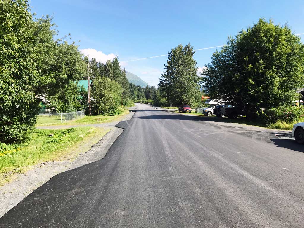
Road Name: Driveway
Datum: NAD83
Quad Name / ITM: Seward A-7
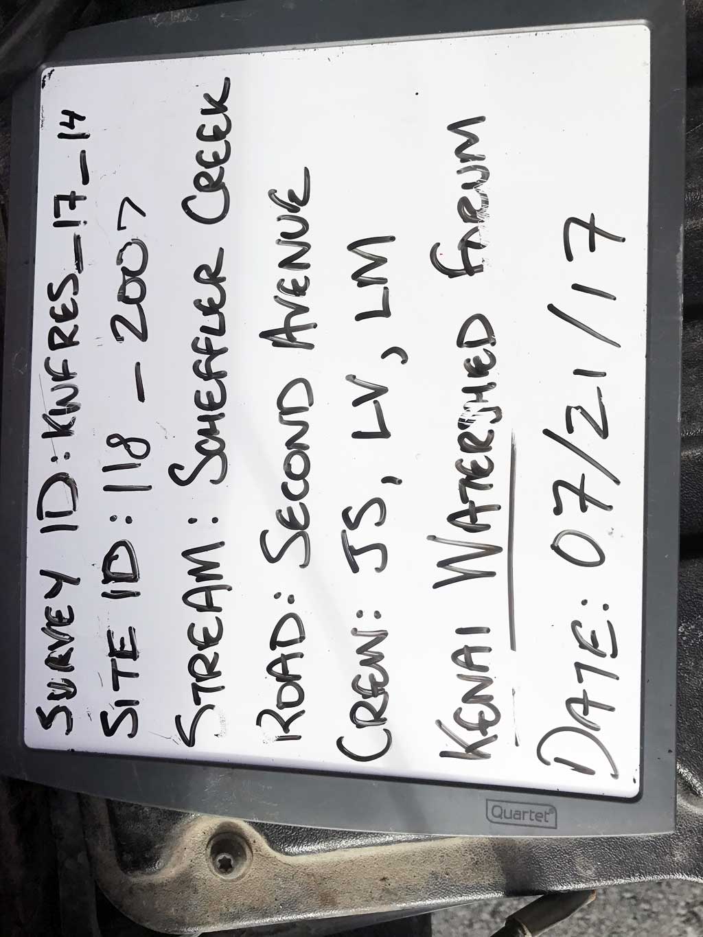
AWC Stream #: 231-30-10070-2009
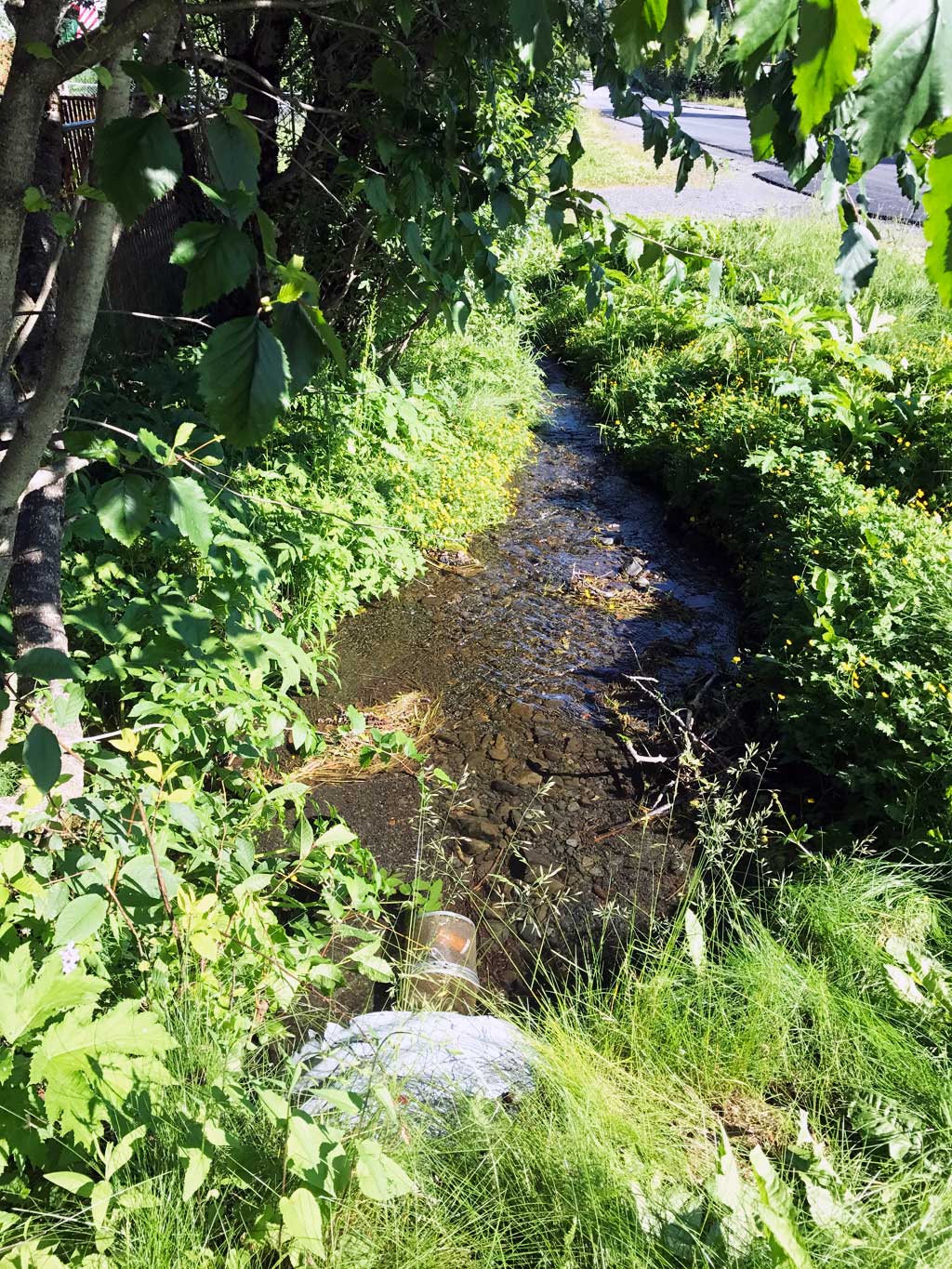
Stream Name: Scheffler Creek
Elevation:
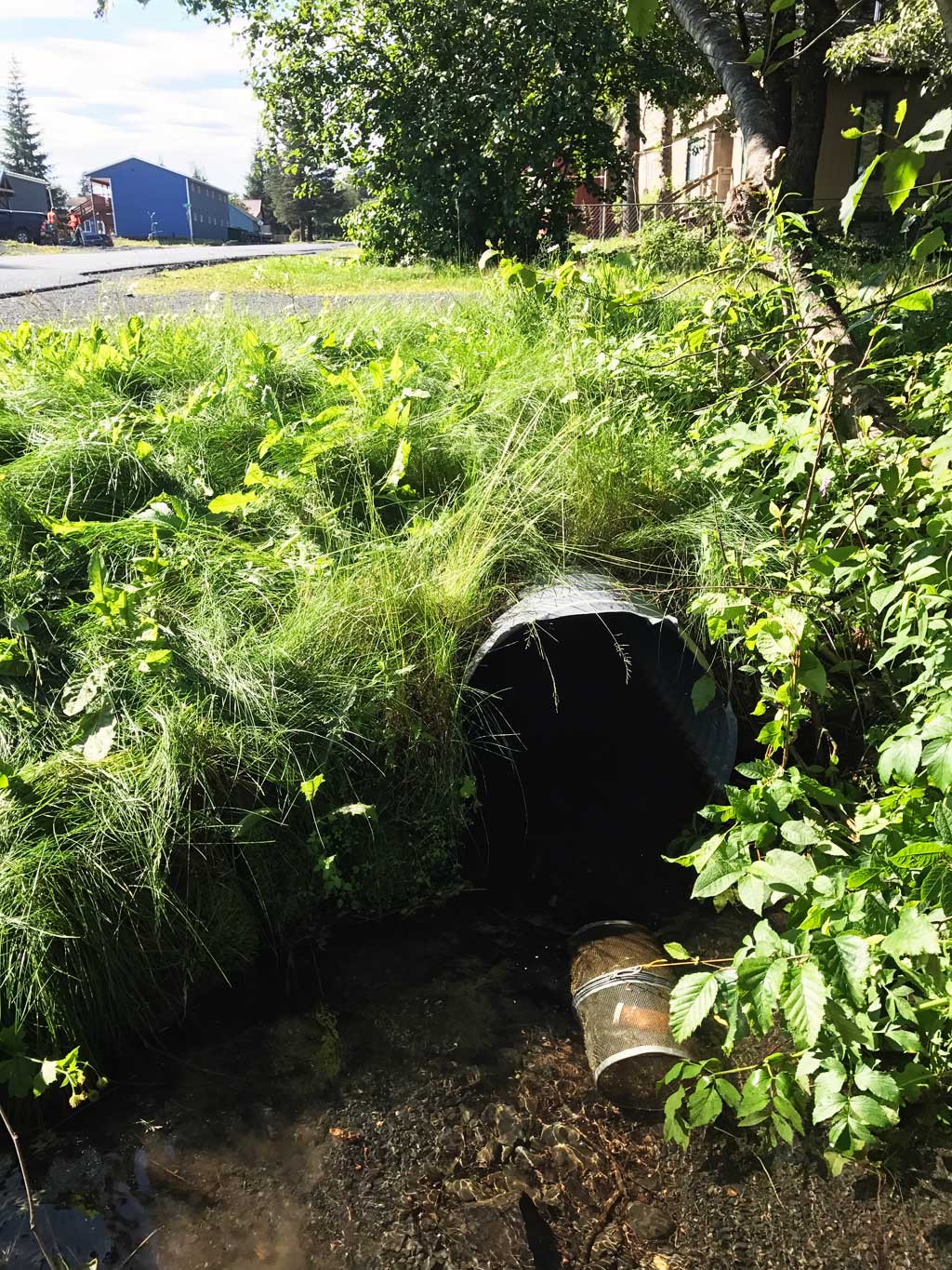
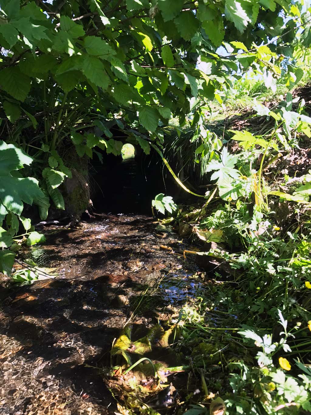
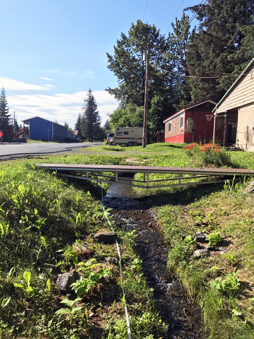
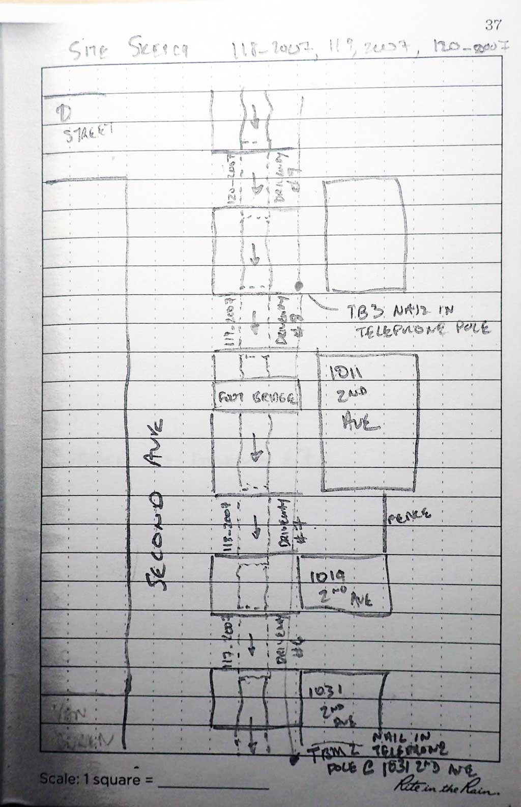
Site Comments: Site is located on a driveway off of 2nd Avenue. It is about 30 feet upstream from 117_2007 and about 60 feet downstream from 119_2007
Survey KEN17-118_2007
Observers: Jeff Sires, Luke Violette, Louis Mitchell
Overall Fish Passage Rating:
Tidal: No
Backwatered: No
Step Pools: No
Construction Year:
Site Observations:
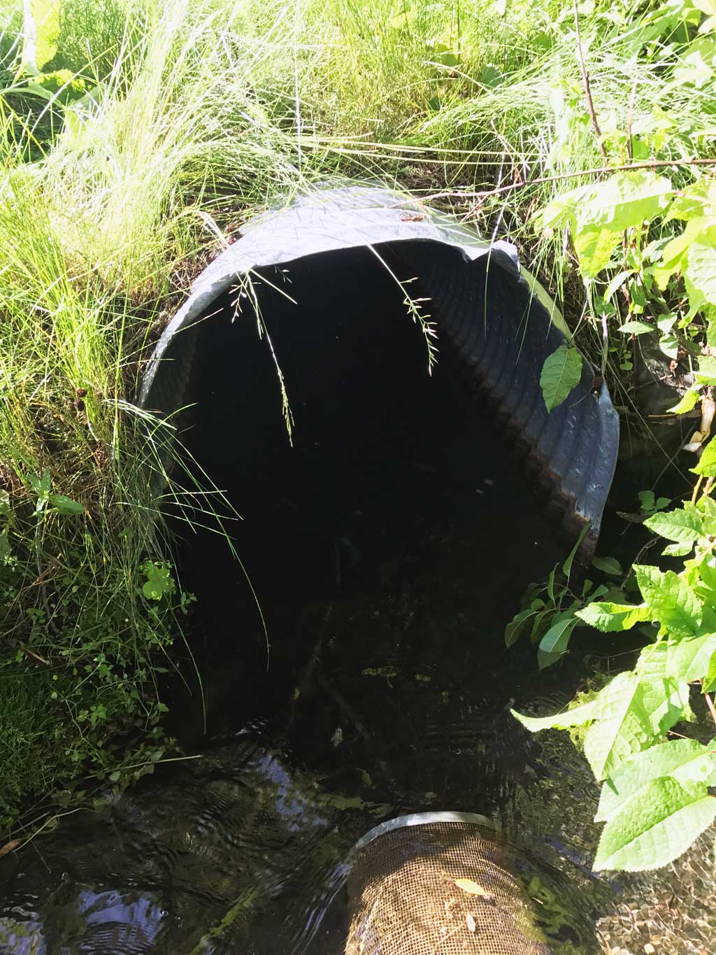
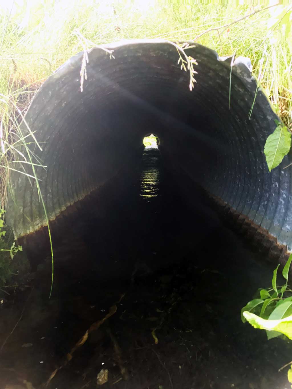
- Culvert gradient red
- Damage associated with ice problems
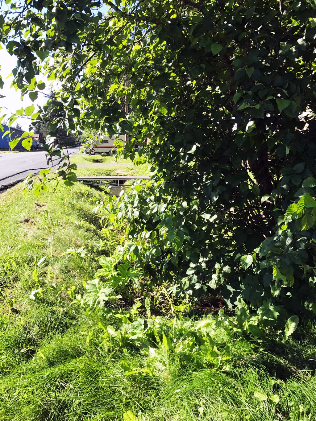
Comments: KWFRES_17_14. Culvert assessment submitted by Kenai Watershed Forum. Stream is ditched upstream and downstream from culvert. Multiple culverts above and below this site. Stream gradient and ordinary high water widths used for constriction were taken downstream below last culvert downstream (117_2007).
Culvert Measurements
| ID: 1 | Structure Type: Circular pipe (Corrugated steel) | Fish Passage Rating: | |||||||||||||||||||||||||||||||||||||||||
|
|
|
|||||||||||||||||||||||||||||||||||||||||
Comments: Top of culvert gradient 2.10%, water surface gradient though culvert 1.52%. |
|||||||||||||||||||||||||||||||||||||||||||
Culvert Observations:
|
|||||||||||||||||||||||||||||||||||||||||||
Stream Measurements
|
|
| Stream Width Type | Distance From Crossing (ft) |
Stream Width (ft) |
|---|---|---|
| Downstream ordinary high water | 5.0 | 7.30 |
| Downstream ordinary high water | 10.0 | 3.75 |
| Downstream ordinary high water | 15.0 | 3.00 |
| Upstream ordinary high water | 20.0 | 1.75 |
| Upstream ordinary high water | 40.0 | 4.50 |
| Upstream ordinary high water | 60.0 | 3.50 |
Elevations
| Locator ID | Culvert Number |
River Distance (ft)1 |
Distance From Crossing (ft)2 |
Relative Elevation (ft) |
|---|---|---|---|---|
| Road Elev (Driveway #7) | 103.64 | |||
| D/S Thalweg (TBM #2 used for survey 101.84 = TMB #1 - 100.) | 0.00 | 99.20 | ||
| D/S Water Surface Elev | 0.00 | 99.41 | ||
| D/S Grade Ctrl (Thalweg) | 8.00 | 99.50 | ||
| D/S Water Surface Elev | 8.00 | 99.84 | ||
| D/S Grade Ctrl (Thalweg) | 14.00 | 100.26 | ||
| D/S Water Surface Elev | 14.00 | 100.42 | ||
| D/S Thalweg | 32.00 | 99.66 | ||
| D/S Water Surface Elev | 32.00 | 100.35 | ||
| Outlet Culvert Top | 33.00 | 102.29 | ||
| Outlet Invert | 33.00 | 99.81 | ||
| D/S Water Surface Elev | 33.00 | 100.46 | ||
| Inlet Culvert Invert | 83.50 | 100.99 | ||
| U/S Water Surface Elev | 83.50 | 101.23 | ||
| Inlet Culvert Top | 83.50 | 103.35 | ||
| U/S Water Surface Elev | 84.50 | 101.24 | ||
| U/S Thalweg | 84.50 | 101.06 | ||
| U/S Thalweg | 101.50 | 101.87 | ||
| U/S Water Surface Elev | 101.50 | 102.01 | ||
| U/S Grade Ctrl (Thalweg) | 127.50 | 102.70 | ||
| U/S Water Surface Elev | 127.50 | 102.85 | ||
| U/S Water Surface Elev | 143.50 | 102.98 | ||
| U/S Thalweg | 143.50 | 102.64 |
Notes:
- River distance is measured continuously throughout the survey reach along the thalweg of the stream.
- Measured from each end of the crossing along the thalweg of the stream.
Fish Sampling Efforts
| Gear Type: Minnow Trap (A) | Trap Duration(h): 0.75 | |
| Comments: Trap set about 130 feet upstream above next culvert | ||
| Gear Type: Minnow Trap (B) | Trap Duration(h): 0.75 | |
| Comments: Trap set about 5 feet downstream. | ||
Fish Observations
No fish observations occurred during this survey.
Photos
Questions or comments about this report can be directed to dfg.dsf.webmaster@alaska.gov