Fish Passage Site 20203720
Coordinates (dec. deg.): 60.11431°, -149.44389°
Legal Description: S001S001W03
Region: South Central
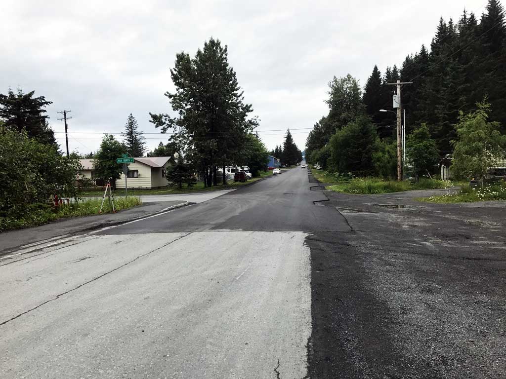
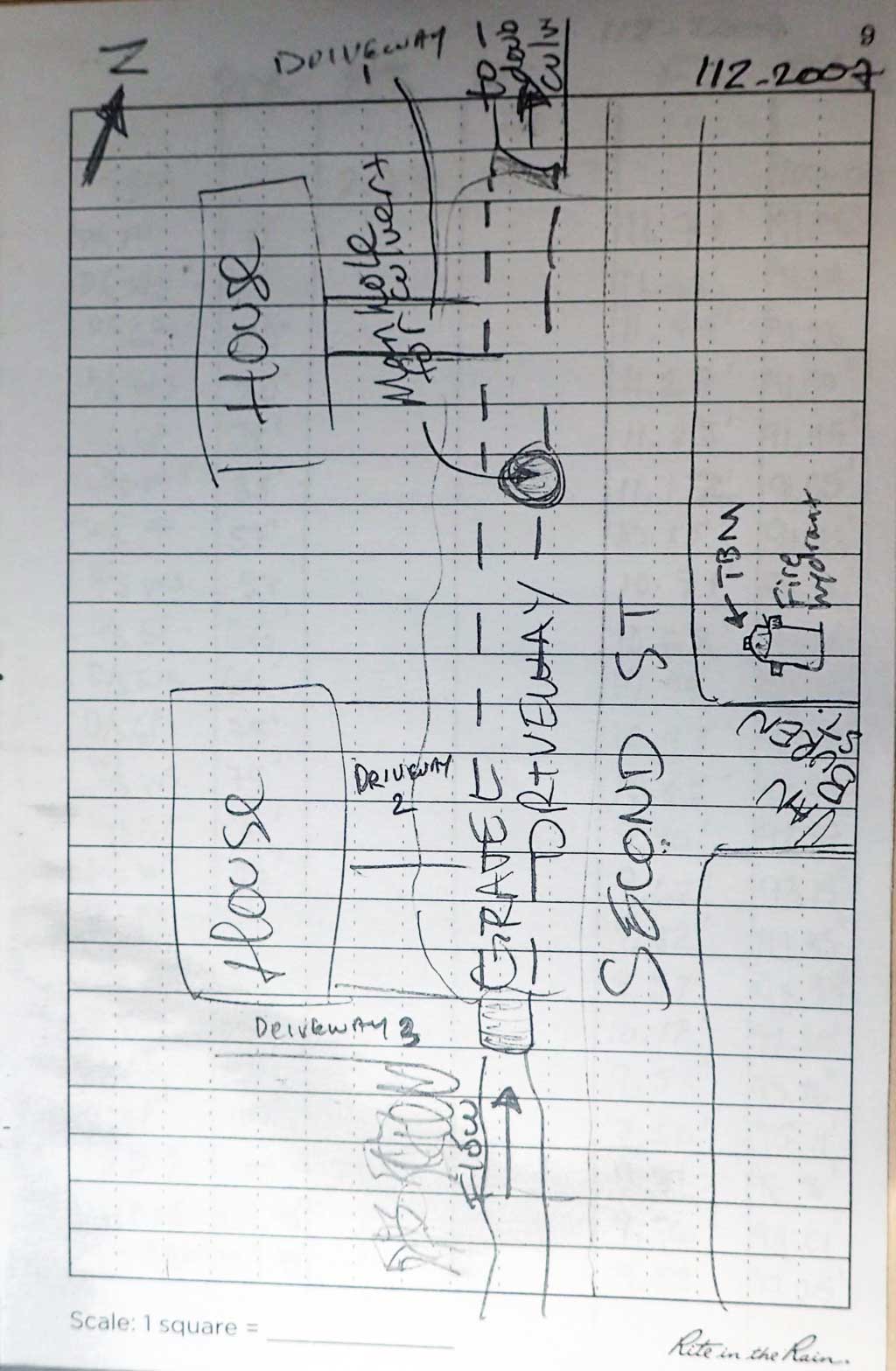
Road Name: Driveway
Datum: NAD83
Quad Name / ITM: Seward A-7
AWC Stream #: 231-30-10070-2009
Stream Name: Unnamed
Elevation:
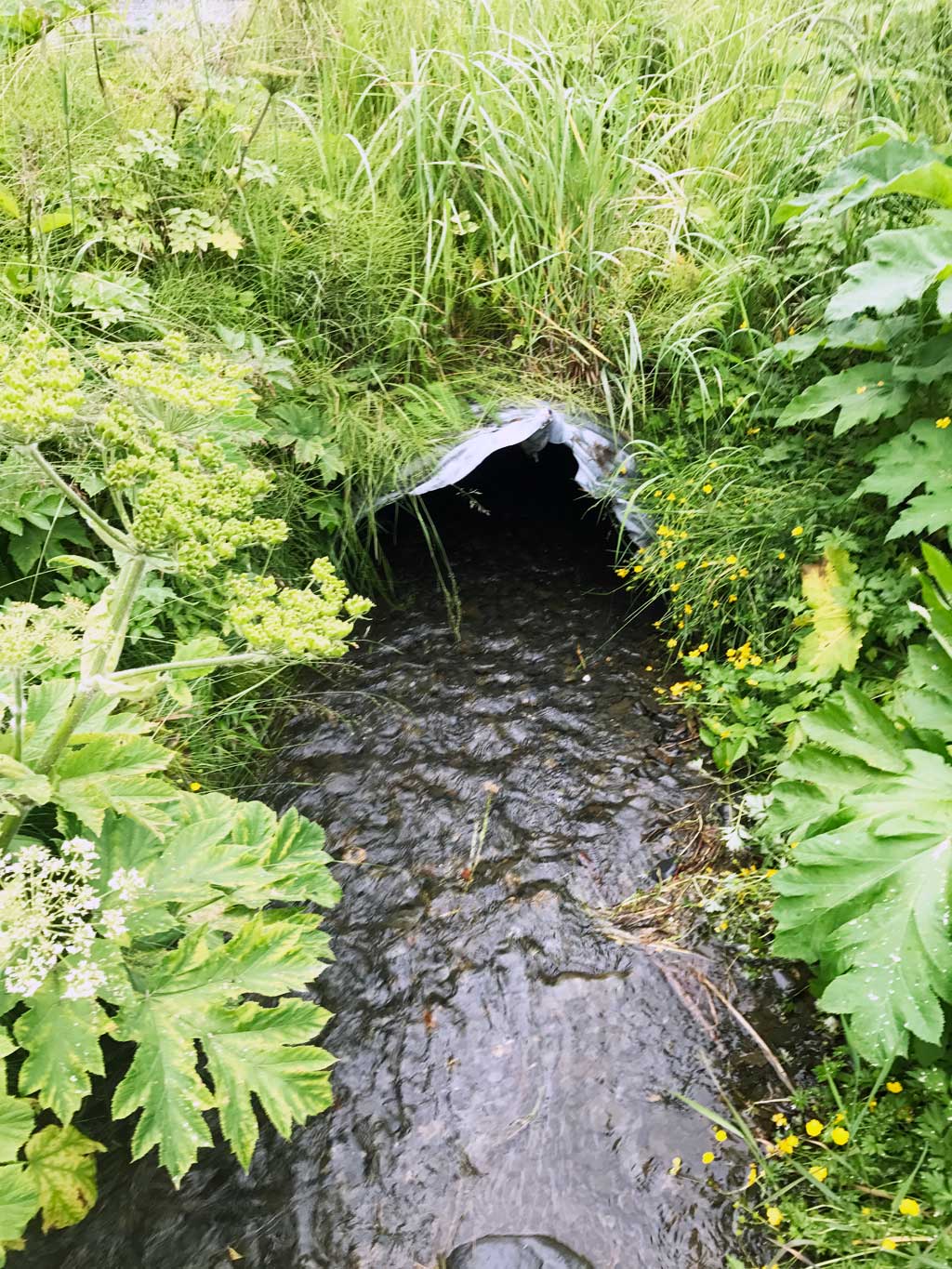
Site Comments: Culvert runs under connected driveways next to 2nd Avenue and outlet is right at intersection of 2nd Avenure and Van Buren St.
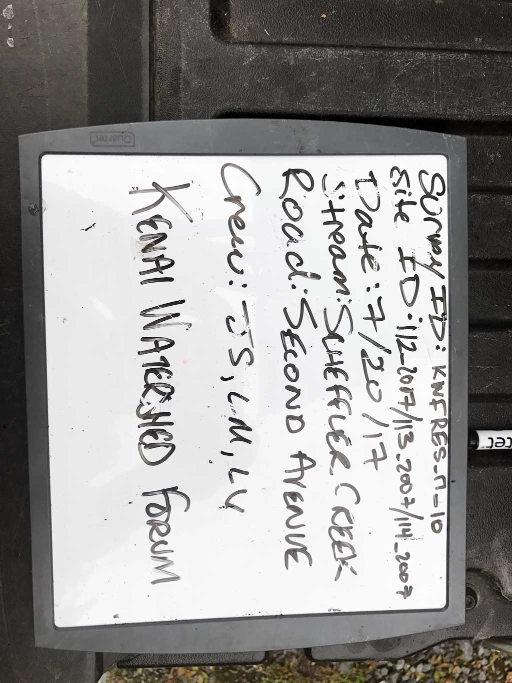
Survey KEN17-112_2007
Observers:
Overall Fish Passage Rating:
Tidal: No
Backwatered: No
Step Pools: No
Construction Year:
Site Observations:
- Culvert gradient red
- Compound gradient in pipe
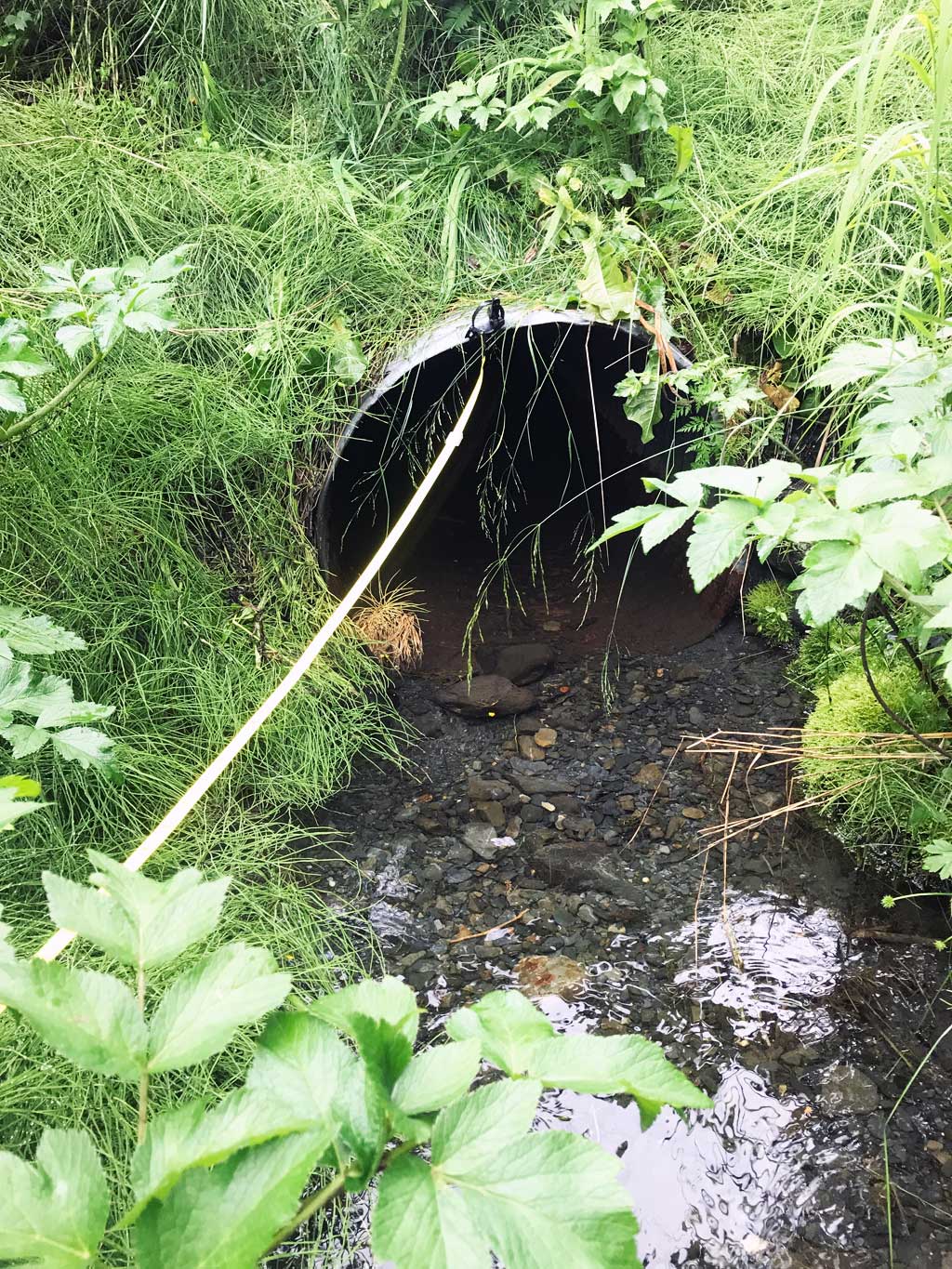
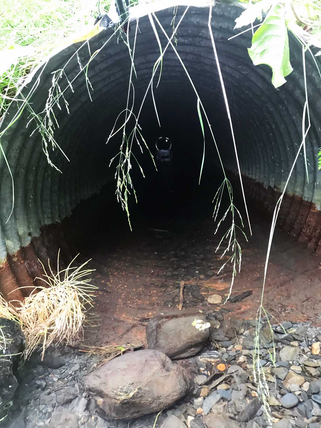
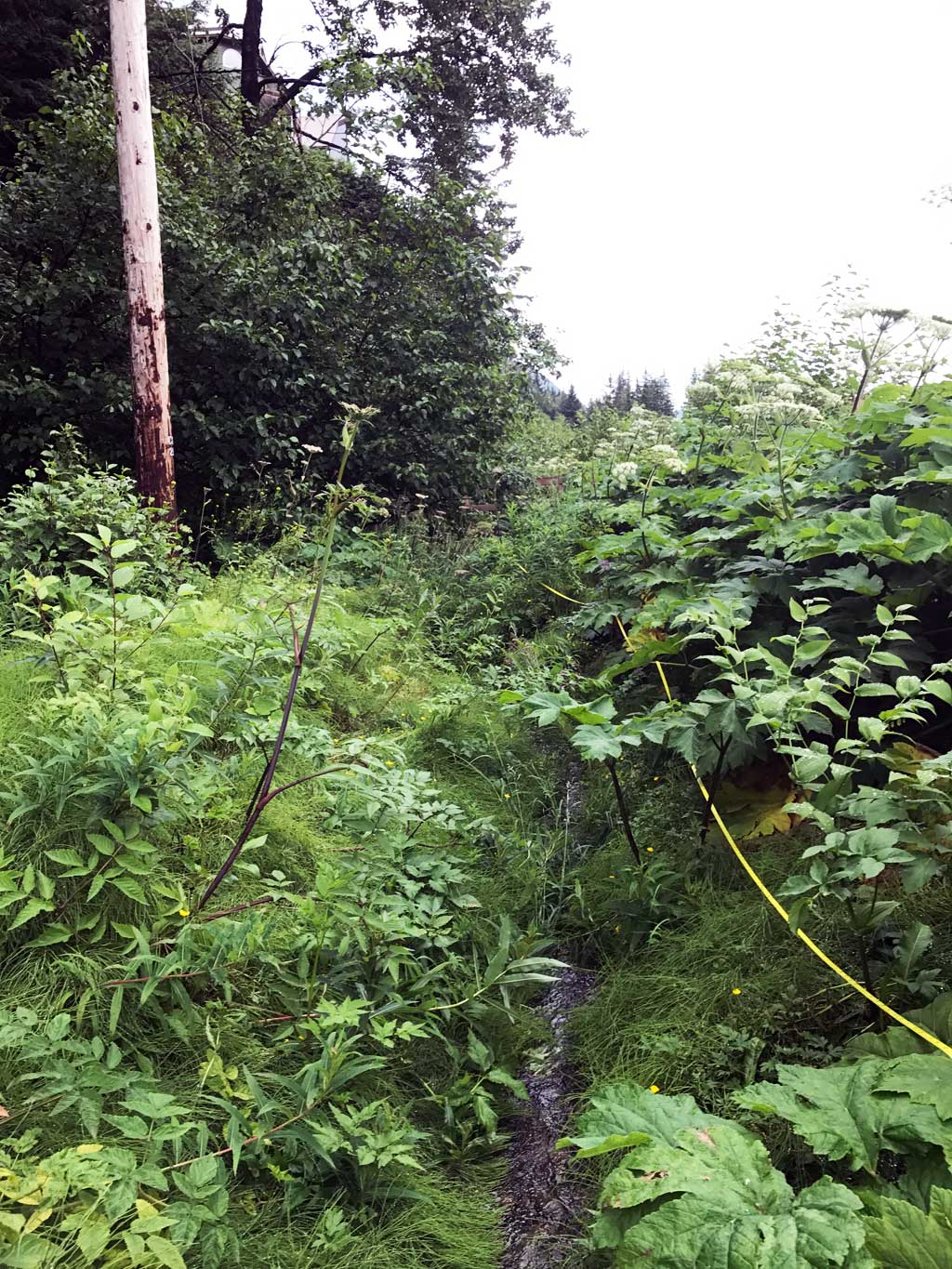
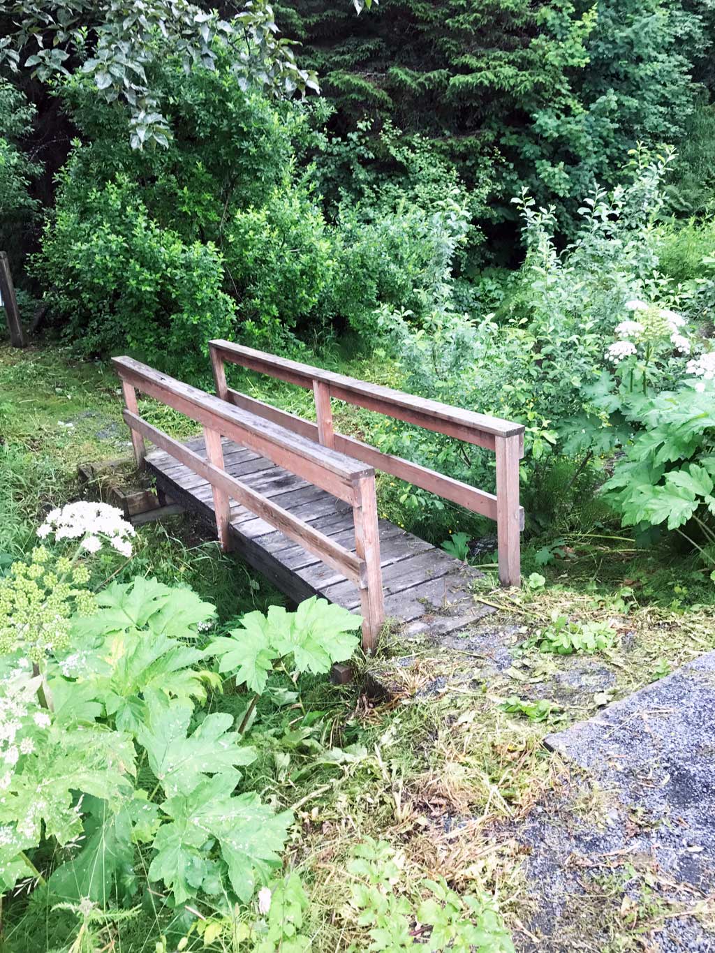
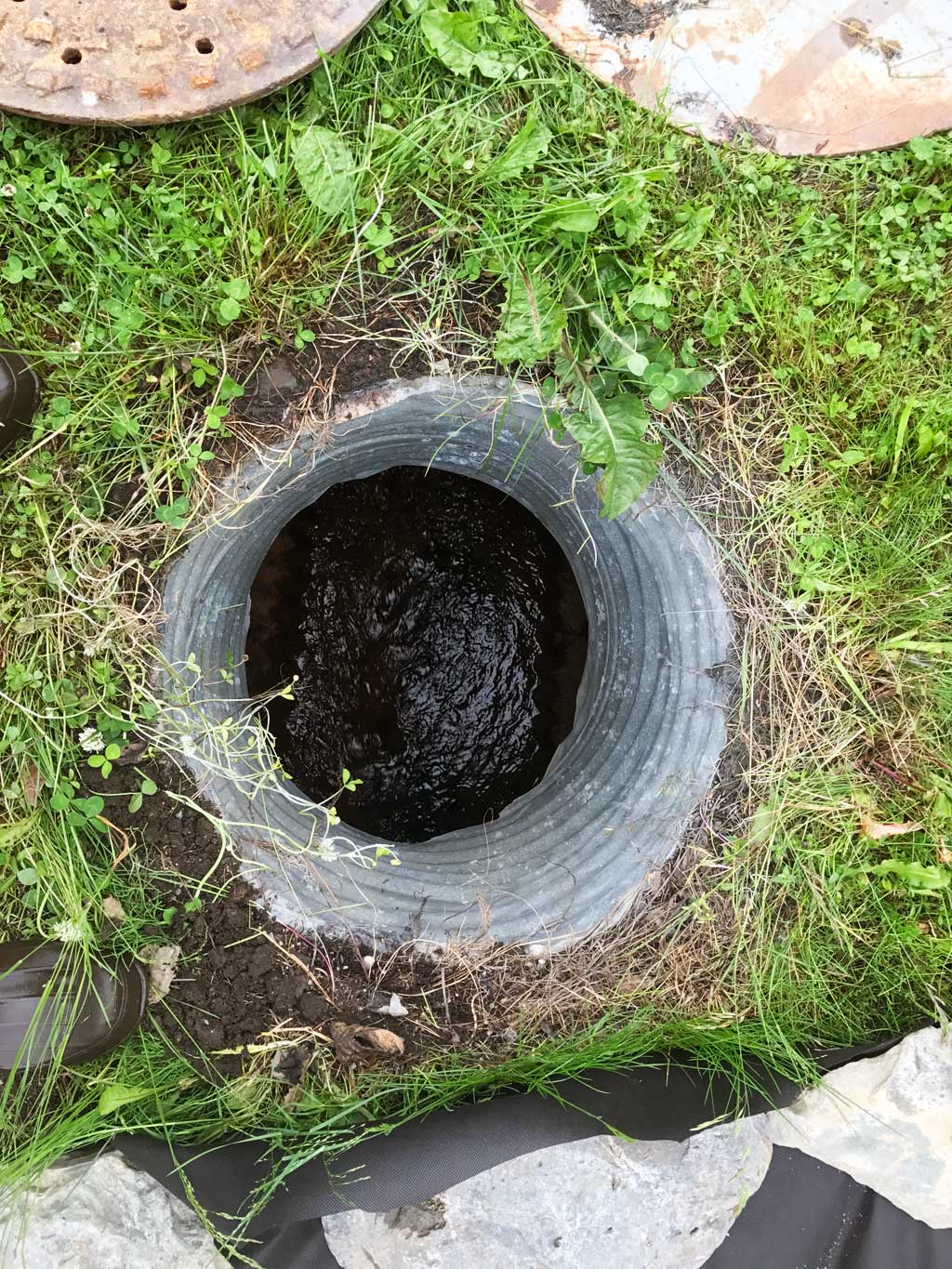
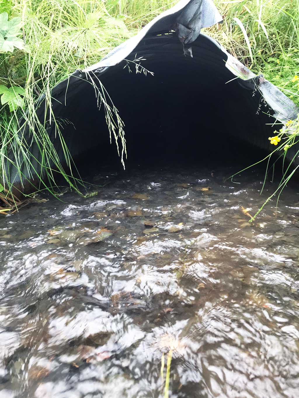
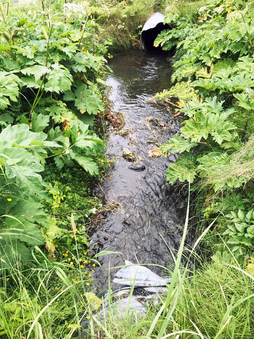
Comments: KWFRES_17_10. USFWS Site numbered 112_2007, 113_2007, 114_2007. Culvert assessment and photographs submitted by Kenai Watershed Forum. Site consists of one long connected culvert under multiple driveways. Once 3 separate sites all three culverts have been linked together. Clean out manhole located about halfway down culvert. Twin culverts downstream not functioning, residents report frequent flooding. Potentially many different sized culvert through run. Site is ditched upstream and downstream from culvert.
Culvert Measurements
| ID: 1 | Structure Type: Circular pipe (Corrugated steel) | Fish Passage Rating: | |||||||||||||||||||||||||||||||||||||||||
|
|
|
|||||||||||||||||||||||||||||||||||||||||
Comments: Water surface gradient through culvert 1.19%. No substate depth recorded at inlet, but photos show substrate. TOP elevations used for culvert gradient. Max gradient from outlet invert to elevation at manhole. |
|||||||||||||||||||||||||||||||||||||||||||
Culvert Observations:
|
|||||||||||||||||||||||||||||||||||||||||||
Stream Measurements
|
|
| Stream Width Type | Distance From Crossing (ft) |
Stream Width (ft) |
|---|---|---|
| Downstream ordinary high water | 20.0 | 1.50 |
| Downstream ordinary high water | 40.0 | 2.00 |
| Downstream ordinary high water | 60.0 | 3.75 |
| Upstream ordinary high water | 5.0 | 4.50 |
| Upstream ordinary high water | 10.0 | 5.00 |
| Upstream ordinary high water | 15.0 | 7.00 |
Elevations
| Locator ID | Culvert Number |
River Distance (ft)1 |
Distance From Crossing (ft)2 |
Relative Elevation (ft) |
|---|---|---|---|---|
| Road Elev (1st Driveway surface elevation) | 96.96 | |||
| Road Elev (3rd driveway surface elevation) | 97.60 | |||
| Road Elev (2nd driveway surface elevation) | 97.83 | |||
| D/S Thalweg (Downstream of footbridge) | 0.00 | 91.06 | ||
| D/S Water Surface Elev | 0.00 | 91.24 | ||
| D/S Grade Ctrl (Thalweg) (Upstream of footbridge) | 20.00 | 91.28 | ||
| D/S Water Surface Elev | 20.00 | 91.50 | ||
| D/S Water Surface Elev | 38.00 | 91.65 | ||
| D/S Grade Ctrl (Thalweg) | 38.00 | 91.49 | ||
| D/S Thalweg | 57.00 | 91.92 | ||
| D/S Water Surface Elev | 57.00 | 92.06 | ||
| D/S Grade Ctrl (Thalweg) | 66.00 | 92.09 | ||
| D/S Water Surface Elev | 66.00 | 92.33 | ||
| D/S Water Surface Elev | 75.00 | 92.72 | ||
| D/S Grade Ctrl (Thalweg) | 75.00 | 92.29 | ||
| D/S Grade Ctrl (Thalweg) | 90.00 | 92.87 | ||
| D/S Water Surface Elev | 90.00 | 93.15 | ||
| D/S Water Surface Elev | 95.00 | 93.24 | ||
| D/S Thalweg | 95.00 | 92.95 | ||
| Outlet Invert | 100.00 | 92.60 | ||
| D/S Water Surface Elev | 100.00 | 93.26 | ||
| Inlet Culvert Top | 100.00 | 95.11 | ||
| U/S Water Surface Elev | 157.48 | 93.25 | ||
| U/S Thalweg (elevation through manhole on pipe) | 157.48 | 93.01 | ||
| Inlet Culvert Invert | 267.00 | 95.16 | ||
| U/S Water Surface Elev | 267.00 | 95.25 | ||
| Inlet Culvert Top | 267.00 | 96.85 | ||
| U/S Water Surface Elev | 270.00 | 95.34 | ||
| U/S Thalweg | 270.00 | 95.20 | ||
| U/S Thalweg (Just downstream of next upstream driveway culvert.) | 282.00 | 94.66 | ||
| U/S Water Surface Elev | 282.00 | 95.62 |
Notes:
- River distance is measured continuously throughout the survey reach along the thalweg of the stream.
- Measured from each end of the crossing along the thalweg of the stream.
Fish Sampling Efforts
| Gear Type: Minnow Trap (A) | Trap Duration(h): 1.0 | |
| Comments: Trap set about 20 feet upstream | ||
| Gear Type: Minnow Trap (B) | Trap Duration(h): 1.0 | |
| Comments: Trap set about 100 feet downstream | ||
Fish Observations
No fish observations occurred during this survey.
Photos
Questions or comments about this report can be directed to dfg.dsf.webmaster@alaska.gov