Fish Passage Site 20203433
Coordinates (dec. deg.): 60.53981°, -145.75476°
Legal Description: C015S003W28
Region: South Central
Road Name: Copper River Highway
Datum: NAD83
Quad Name / ITM: Cordova C-5
AWC Stream #:
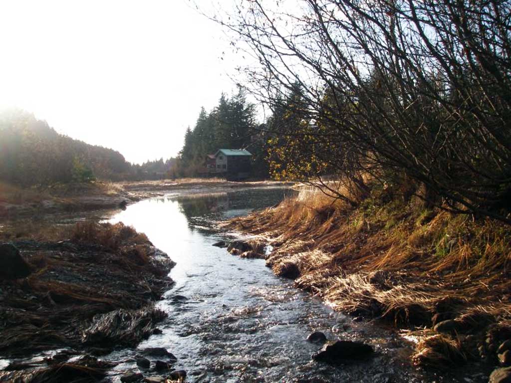
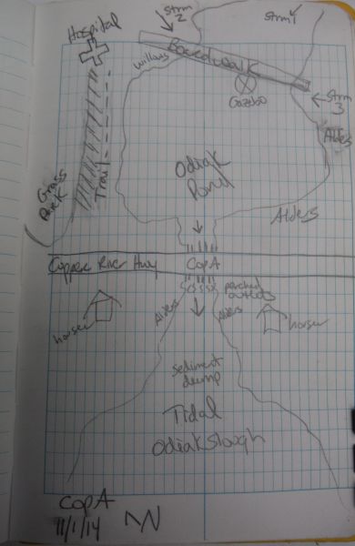
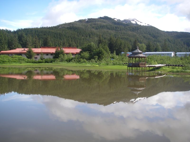
Stream Name: Odiak Pond outlet
Elevation:
Site Comments: None
Survey UPDATE-COPA
Project Supervisor: Gillian O'Doherty, ADFG
Observers:
Overall Fish Passage Rating:
Tidal: Yes
Backwatered: No
Step Pools: No
Construction Year:
Site Observations:
- Outfall height red
- Compound gradient in pipe
- Mechanical damage or joints parting
- Structural Problem
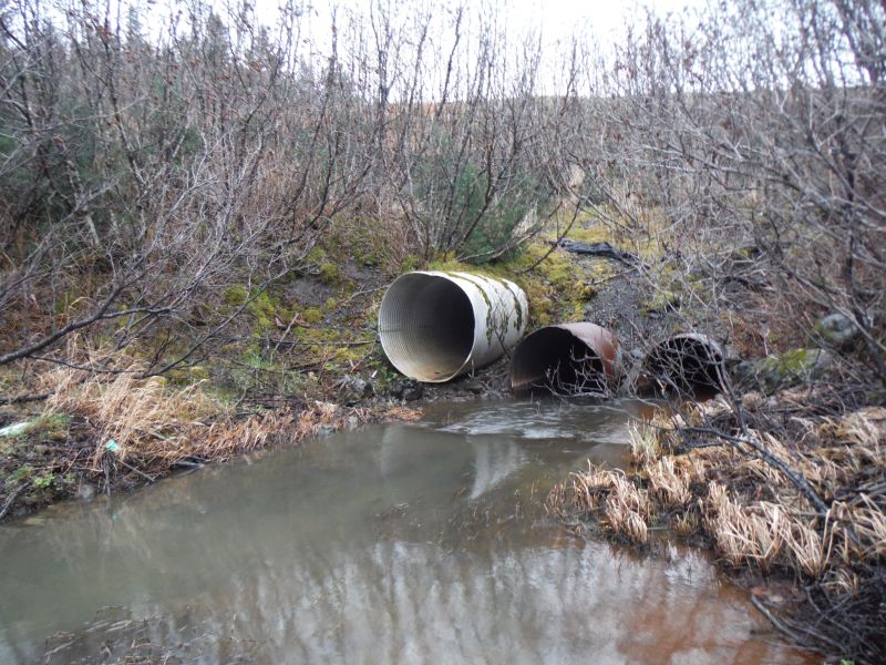
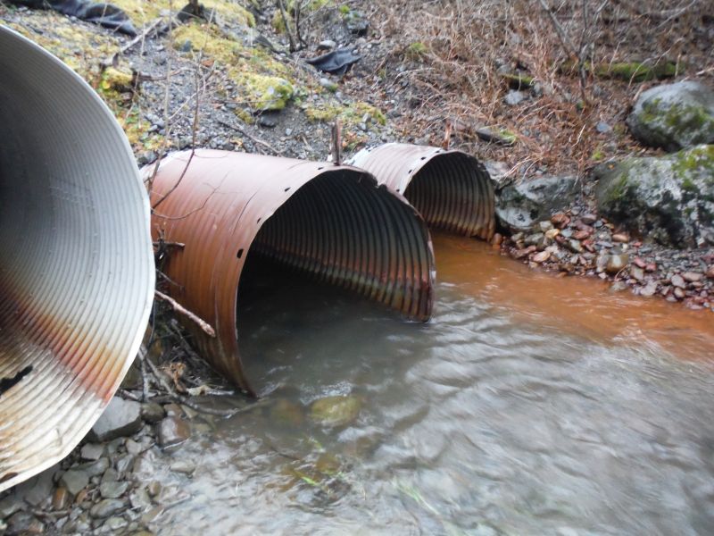
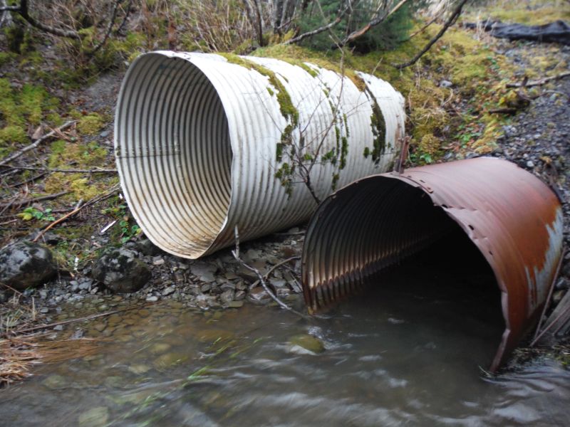
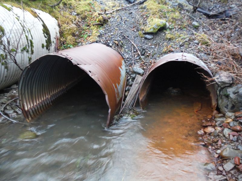
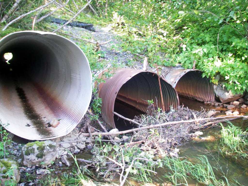
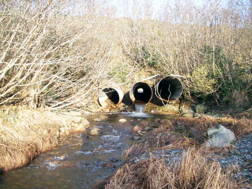
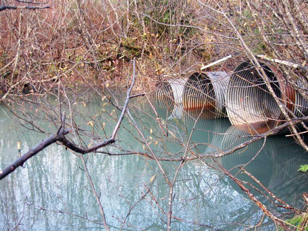
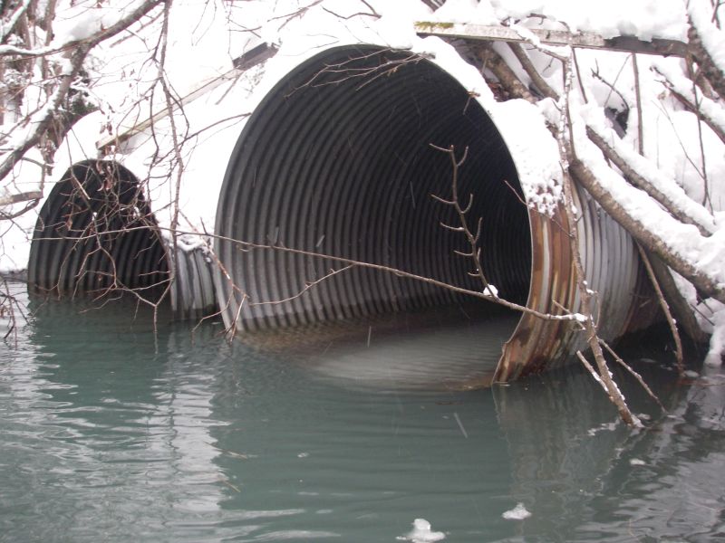
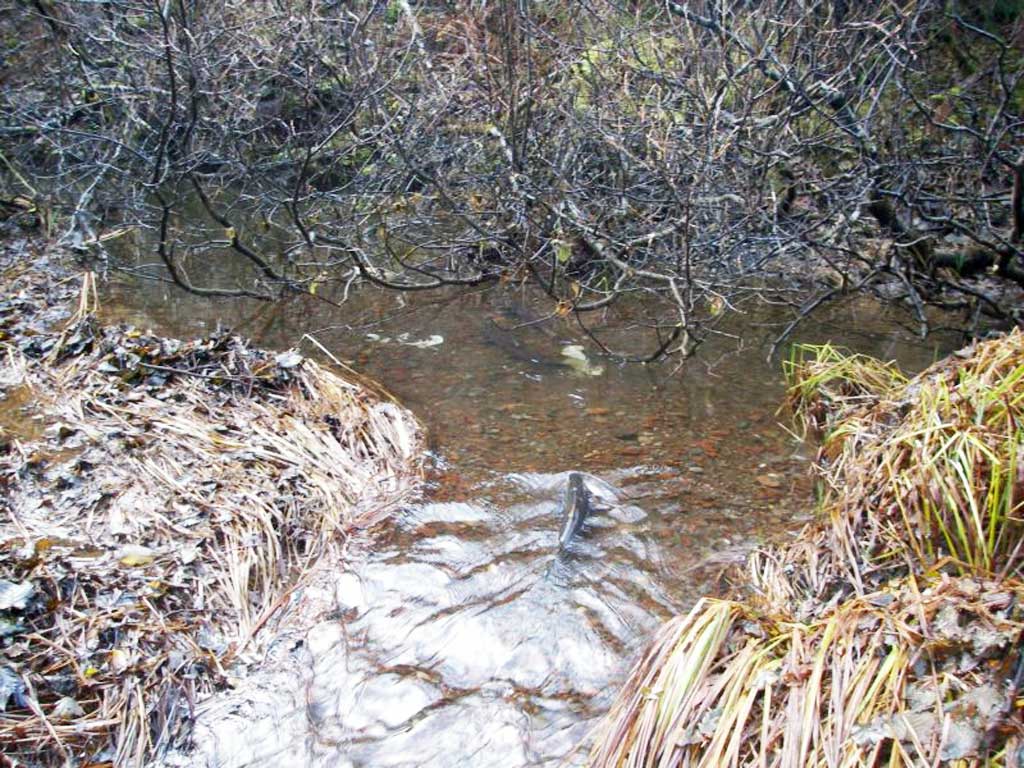
Comments: Survey complete by the CRWP. Adult and juvenile Coho are numerous in the pond and upstream creeks. Dolly Varden and cutthroat trout have also been observed. Outfalls have been calculated at low tide. Three streams converge upstream to flow though these culverts.
Culvert Measurements
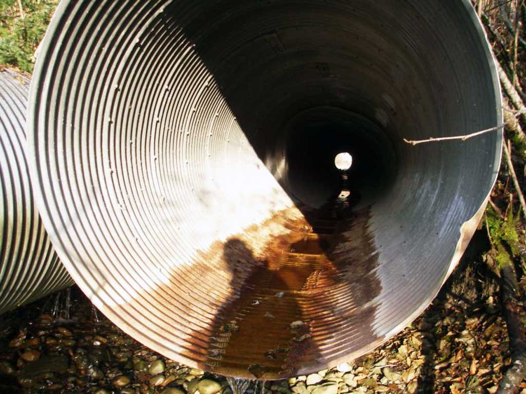
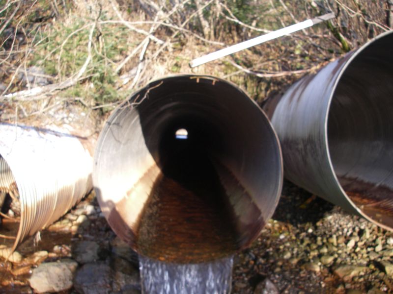
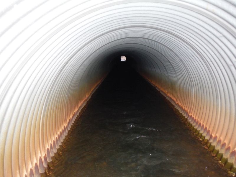
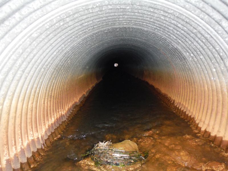
| ID: 1 | Structure Type: Circular pipe (Corrugated steel) | Fish Passage Rating: | |||||||||||||||||||||||||||||||||||||||||
|
|
|
|||||||||||||||||||||||||||||||||||||||||
Culvert Observations:
|
|||||||||||||||||||||||||||||||||||||||||||
| ID: 2 | Structure Type: Circular pipe (Corrugated steel) | Fish Passage Rating: | |||||||||||||||||||||||||||||||||||||||||
|
|
|
|||||||||||||||||||||||||||||||||||||||||
Culvert Observations:
|
|||||||||||||||||||||||||||||||||||||||||||
| ID: 3 | Structure Type: Circular pipe (Corrugated steel) | Fish Passage Rating: | |||||||||||||||||||||||||||||||||||||||||
|
|
|
|||||||||||||||||||||||||||||||||||||||||
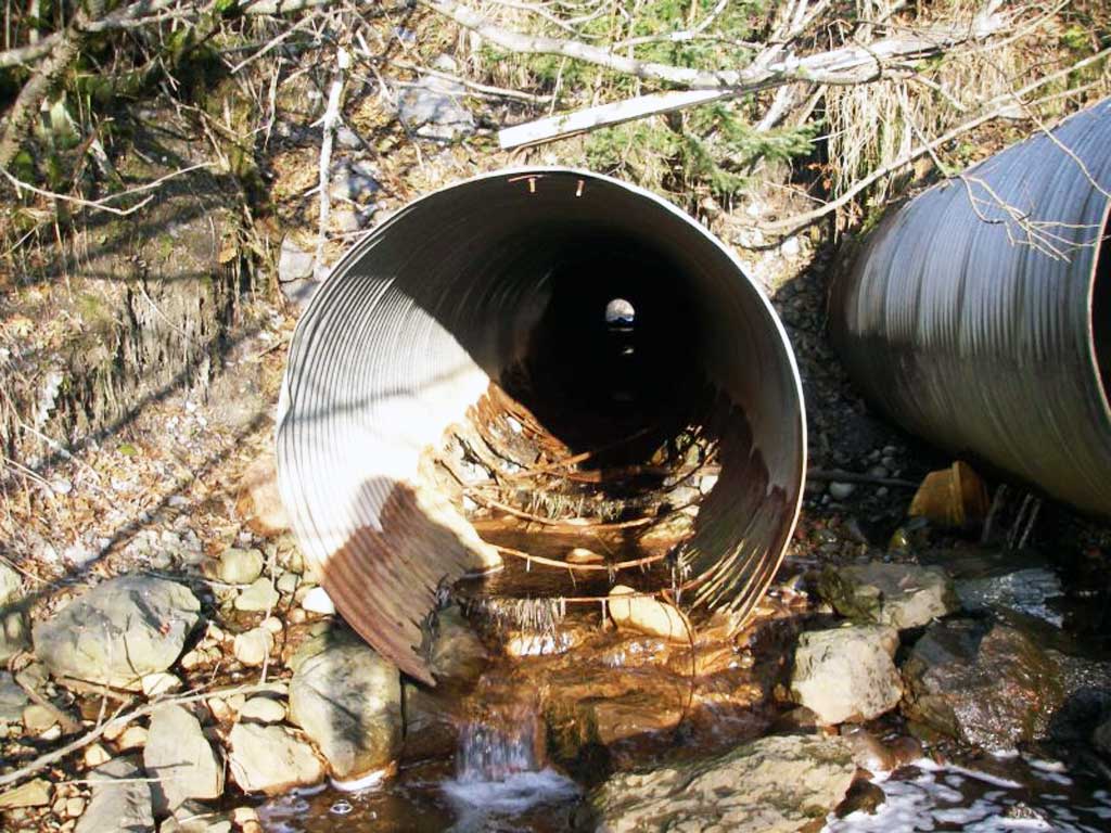
Comments: Culvert bottom rusted out. No bottom at inlet. |
|||||||||||||||||||||||||||||||||||||||||||
Culvert Observations:
|
|||||||||||||||||||||||||||||||||||||||||||
Stream Measurements
|
|
| Stream Width Type | Distance From Crossing (ft) |
Stream Width (ft) |
|---|---|---|
| Downstream ordinary high water | 10.0 | 16.30 |
| Upstream ordinary high water | 8.80 | |
| Upstream ordinary high water | 4.30 | |
| Upstream ordinary high water | 2.10 |
Elevations
| Locator ID | Culvert Number |
River Distance (ft)1 |
Distance From Crossing (ft)2 |
Relative Elevation (ft) |
|---|---|---|---|---|
| Road Elev | 43.78 | |||
| D/S Thalweg (Bottom of outlet fan, Sediment dump, tidal slough begins) | 0.00 | 7.75 | ||
| D/S Water Surface Elev | 0.00 | 8.57 | ||
| D/S Thalweg (Top of fan) | 33.00 | 8.75 | ||
| D/S Water Surface Elev | 33.00 | 9.10 | ||
| D/S Grade Ctrl (Thalweg) | 181.70 | 11.21 | ||
| D/S Water Surface Elev | 181.70 | 11.71 | ||
| D/S Tailcrest or 1st Thalweg | 204.50 | 12.54 | ||
| D/S Water Surface Elev | 204.50 | 12.73 | ||
| Outlet Pool Water Elev | 213.20 | 12.74 | ||
| Max Pool Depth | 213.20 | 9.71 | ||
| Outlet Invert | 2 | 217.90 | 14.12 | |
| D/S Water Surface Elev | 2 | 217.90 | 14.72 | |
| Outlet Invert | 1 | 217.90 | 14.91 | |
| D/S Water Surface Elev | 1 | 217.90 | 14.92 | |
| Outlet Invert | 3 | 217.90 | 13.16 | |
| D/S Water Surface Elev | 3 | 217.90 | 13.36 | |
| Outlet Culvert Top | 2 | 217.90 | 18.64 | |
| Outlet Culvert Top | 1 | 217.90 | 19.91 | |
| Outlet Culvert Top | 3 | 217.90 | 17.42 | |
| Inlet Culvert Top | 2 | 383.40 | 18.56 | |
| Inlet Culvert Invert | 1 | 383.40 | 16.88 | |
| U/S Water Surface Elev | 1 | 383.40 | 16.88 | |
| Inlet Culvert Invert | 3 | 383.40 | 15.72 | |
| U/S Water Surface Elev | 3 | 383.40 | 16.07 | |
| U/S Water Surface Elev | 2 | 383.40 | 16.21 | |
| Inlet Culvert Top | 1 | 383.40 | 21.92 | |
| Inlet Culvert Top | 3 | 383.40 | 18.92 | |
| Inlet Culvert Invert | 2 | 383.40 | 15.35 | |
| U/S Grade Ctrl (Thalweg) | 388.40 | 15.47 | ||
| U/S Water Surface Elev | 388.40 | 16.41 | ||
| U/S Water Surface Elev | 453.50 | 15.53 | ||
| U/S Thalweg (Top of weeds) | 453.50 | 13.78 |
Notes:
- River distance is measured continuously throughout the survey reach along the thalweg of the stream.
- Measured from each end of the crossing along the thalweg of the stream.
Fish Sampling Efforts
No fish sampling occurred during this survey.
Fish Observations
No fish observations occurred during this survey.
Photos
Questions or comments about this report can be directed to dfg.dsf.webmaster@alaska.gov