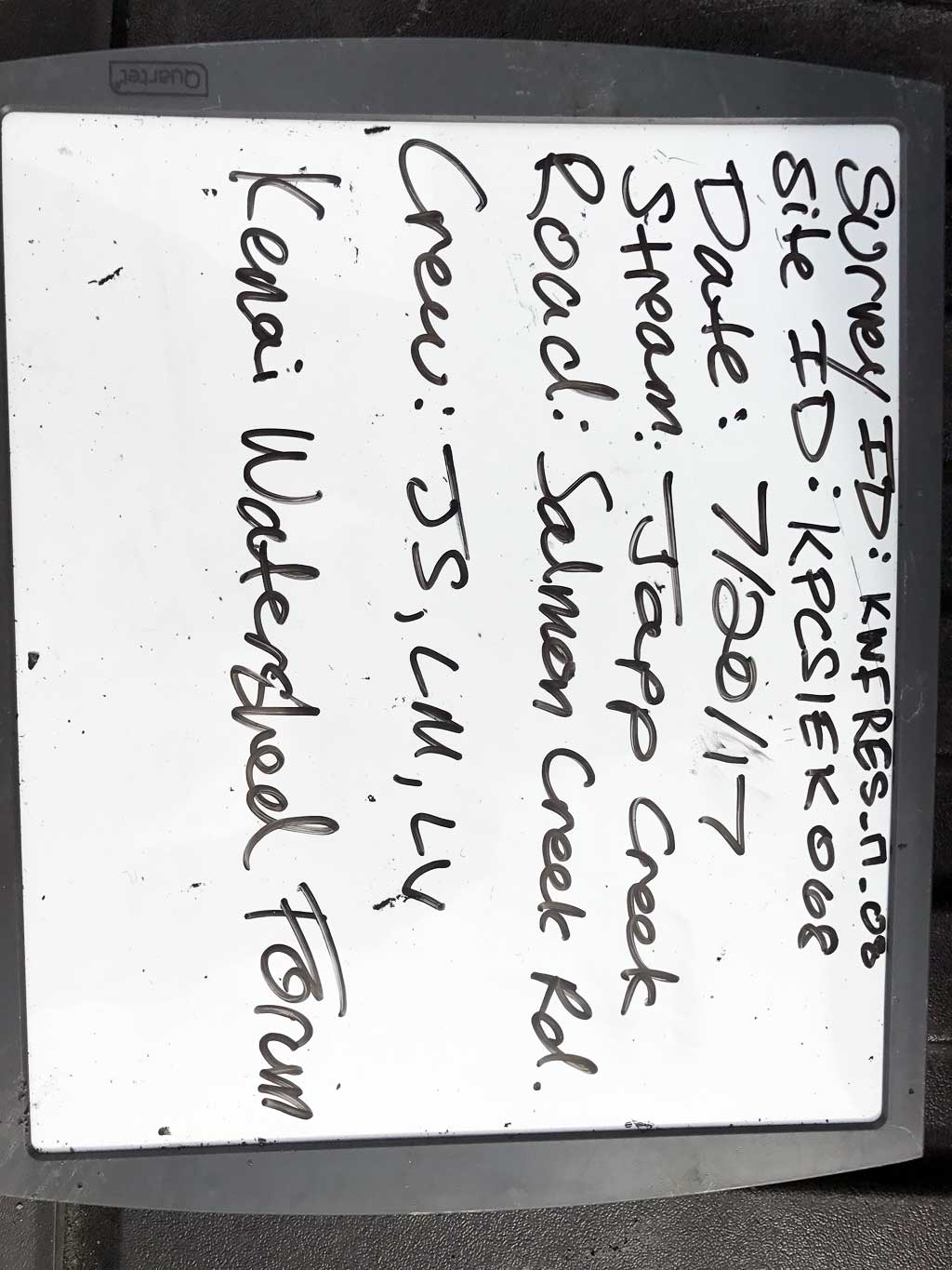
Fish Passage Site 20200944
Coordinates (dec. deg.): 60.14376°, -149.41443°
Legal Description: S001N001W26
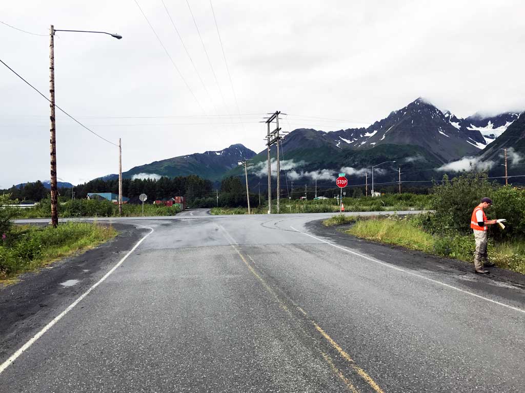
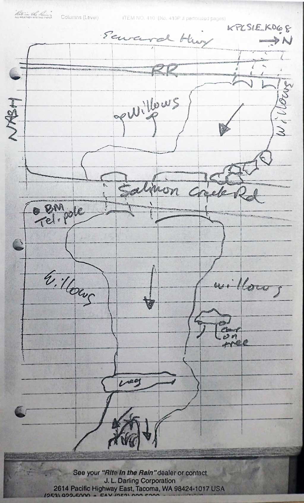
Region: South Central
Road Name: Salmon Creek Road
Datum: NAD83
Quad Name / ITM: Seward A-7
AWC Stream #:
Stream Name: Unnamed
Elevation:
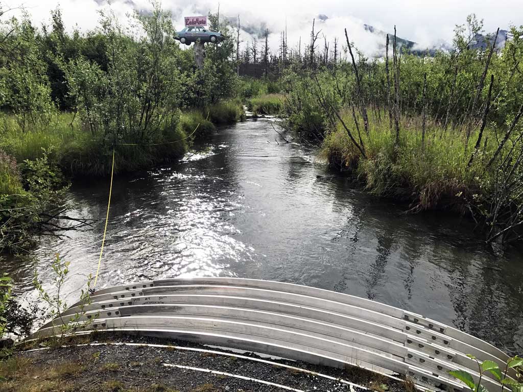
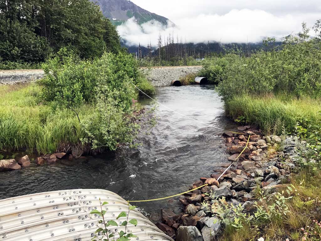
Site Comments: Distributary of Salmon Creek. Amount of water in this channel varies from year to year. Marshy on both sides of creek.
arrow to the right of the survey date below to choose a different report for this site.
Survey KEN17-17_08
Observers: Jeff Sires, Luke Violette, Louis Mitchell
Overall Fish Passage Rating:
Tidal: No
Backwatered: Yes
Step Pools: No
Construction Year: 2012
Site Observations:
- Sediment accumulation
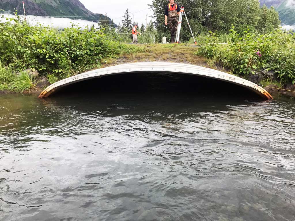
- Culvert sagging in middle
- Damage associated with ice problems
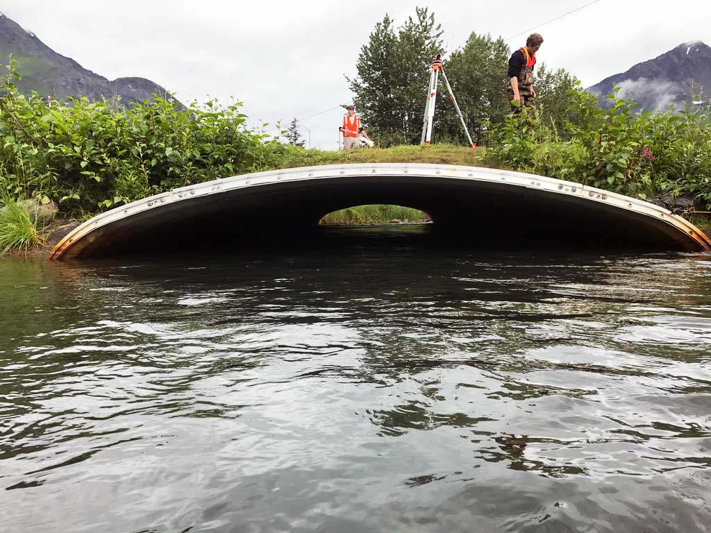
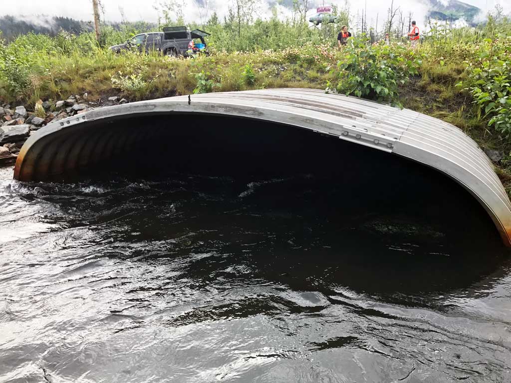
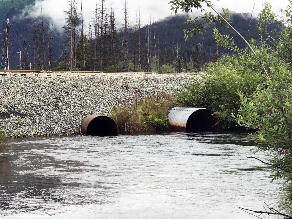
Comments: KWFRES_17_08. Culvert assessment data collection and photographs submitted by the Kenai Watershed Forum. Both culverts slumping in middle. C1 is main culvert. Downstream tailwater control higher than inverts, backwatering culvert, high flows at time of survey, at lower flows likely lower slow flow through culvert. C2 set higher more as an overflow and inlet invert higher than downstream grade point. Unsure is C2 takes flow at all water levels or only higher ones. Upstream water surface gradient to railroad track culverts 0.55%, downstream water surface gradient 0.17%.
Culvert Measurements
| ID: 1 | Structure Type: Box culvert (Structural aluminum plate) | Fish Passage Rating: | |||||||||||||||||||||||||||||||||||||||||
|
|
|
|||||||||||||||||||||||||||||||||||||||||
Comments: Water surface gradient through culvert 0.11%, substrate gradient through culvert -1.01%. |
|||||||||||||||||||||||||||||||||||||||||||
Culvert Observations:
|
|||||||||||||||||||||||||||||||||||||||||||
| ID: 2 | Structure Type: Circular pipe (Corrugated steel) | Fish Passage Rating: | |||||||||||||||||||||||||||||||||||||||||
|
|
|
|||||||||||||||||||||||||||||||||||||||||
Comments: Substrate depth at outlet not recorded, not sure if there is none. Substrate gradient through culvert 1.58%. Water surface gradient through culvert 0%. |
|||||||||||||||||||||||||||||||||||||||||||
Culvert Observations:
|
|||||||||||||||||||||||||||||||||||||||||||
Stream Measurements
|
|
| Stream Width Type | Distance From Crossing (ft) |
Stream Width (ft) |
|---|---|---|
| Downstream ordinary high water | 30.0 | 24.50 |
| Downstream ordinary high water | 67.0 | 20.50 |
| Downstream ordinary high water | 96.0 | 23.50 |
| Upstream ordinary high water | 23.0 | 16.00 |
| Upstream ordinary high water | 45.0 | 23.00 |
| Upstream ordinary high water | 60.0 | 24.50 |
Elevations
| Locator ID | Culvert Number |
River Distance (ft)1 |
Distance From Crossing (ft)2 |
Relative Elevation (ft) |
|---|---|---|---|---|
| Road Elev | 98.14 | |||
| D/S Thalweg (upstream of split in creek) | 0.00 | 91.43 | ||
| D/S Water Surface Elev | 0.00 | 92.97 | ||
| D/S Water Surface Elev | 15.00 | 92.92 | ||
| D/S Grade Ctrl (Thalweg) (Large log) | 15.00 | 90.33 | ||
| D/S Thalweg | 45.00 | 91.02 | ||
| D/S Water Surface Elev | 45.00 | 93.10 | ||
| D/S Water Surface Elev | 93.00 | 93.13 | ||
| D/S Thalweg (Stream begins to form channel from outlet pool here) | 93.00 | 91.62 | ||
| Max Pool Depth | 1 | 120.00 | 90.67 | |
| Outlet Pool Water Elev | 1 | 120.00 | 93.10 | |
| Outlet Culvert Top | 1 | 121.00 | 95.20 | |
| D/S Water Surface Elev | 1 | 121.00 | 93.13 | |
| Max Pool Depth | 2 | 121.00 | 90.70 | |
| Outlet Invert (measured on top of rib corrugation) | 1 | 121.00 | 90.66 | |
| Outlet Pool Water Elev | 2 | 121.00 | 93.07 | |
| Outlet Invert | 2 | 125.00 | 91.13 | |
| D/S Water Surface Elev | 2 | 125.00 | 93.18 | |
| Outlet Culvert Top | 2 | 125.00 | 94.92 | |
| Inlet Culvert Top (measured on top of rib corrugation) | 1 | 193.15 | 96.58 | |
| Inlet Culvert Top | 2 | 193.15 | 94.89 | |
| U/S Water Surface Elev | 1 | 193.15 | 93.21 | |
| Inlet Culvert Invert | 1 | 193.15 | 89.93 | |
| U/S Water Surface Elev | 2 | 193.15 | 93.07 | |
| Inlet Culvert Invert | 2 | 193.15 | 92.22 | |
| U/S Thalweg (inlet pool) | 2 | 198.15 | 92.07 | |
| U/S Thalweg (inlet pool) | 1 | 198.15 | 90.71 | |
| U/S Water Surface Elev | 2 | 198.15 | 93.19 | |
| U/S Water Surface Elev | 1 | 198.15 | 93.19 | |
| U/S Water Surface Elev | 243.15 | 93.47 | ||
| U/S Grade Ctrl (Thalweg) (Riffle over rip rap) | 243.15 | 92.29 | ||
| U/S Thalweg | 273.15 | 91.37 | ||
| U/S Water Surface Elev | 273.15 | 93.87 | ||
| U/S Water Surface Elev | 298.15 | 93.80 | ||
| U/S Thalweg | 298.15 | 89.90 | ||
| U/S Thalweg (at outlet of upstream culvert under railroad) | 313.15 | 90.59 | ||
| U/S Water Surface Elev | 313.15 | 93.82 |
Notes:
- River distance is measured continuously throughout the survey reach along the thalweg of the stream.
- Measured from each end of the crossing along the thalweg of the stream.
Fish Sampling Efforts
| Gear Type: Minnow Trap (A) | Trap Duration(h): 2.0 | |
| Comments: Trap set about 100 feet upstream. | ||
| Gear Type: Minnow Trap (B) | Trap Duration(h): 2.0 | |
| Comments: Trap set about 32 feet downstream. | ||
Fish Observations
No fish observations occurred during this survey.
Photos


Questions or comments about this report can be directed to dfg.dsf.webmaster@alaska.gov