Fish Passage Site 20103769
Coordinates (dec. deg.): 60.48426°, -145.43273°
Legal Description: C016S001W17
Region: South Central
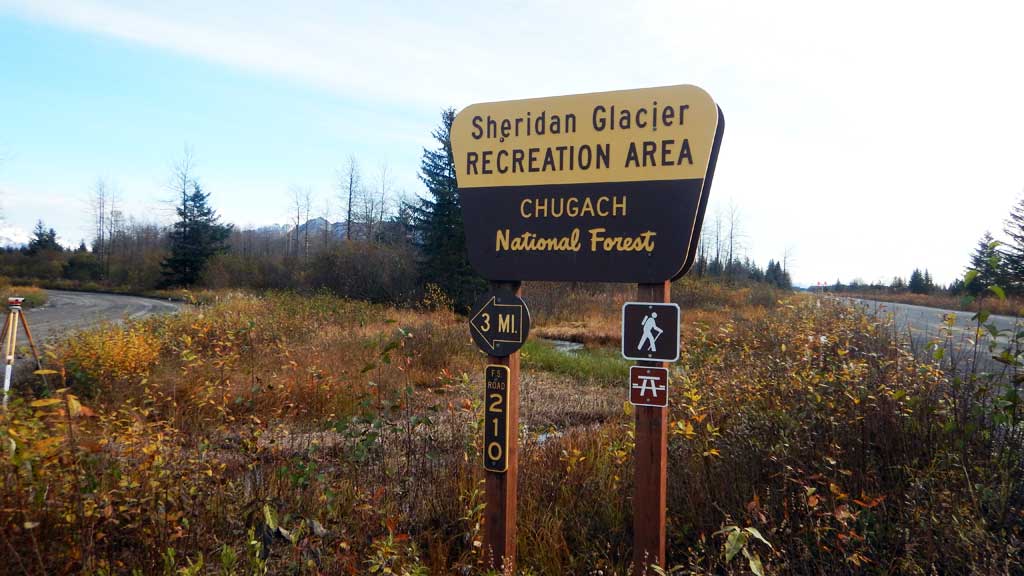
Road Name: Sheridan Glacier Road
Datum: NAD83
Quad Name / ITM: Cordova B-4
AWC Stream #: 212-10-10020-2019-3005
Stream Name: Unnamed
Elevation:
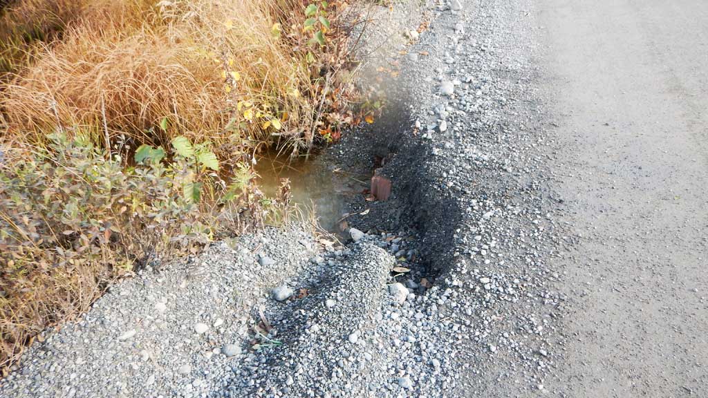
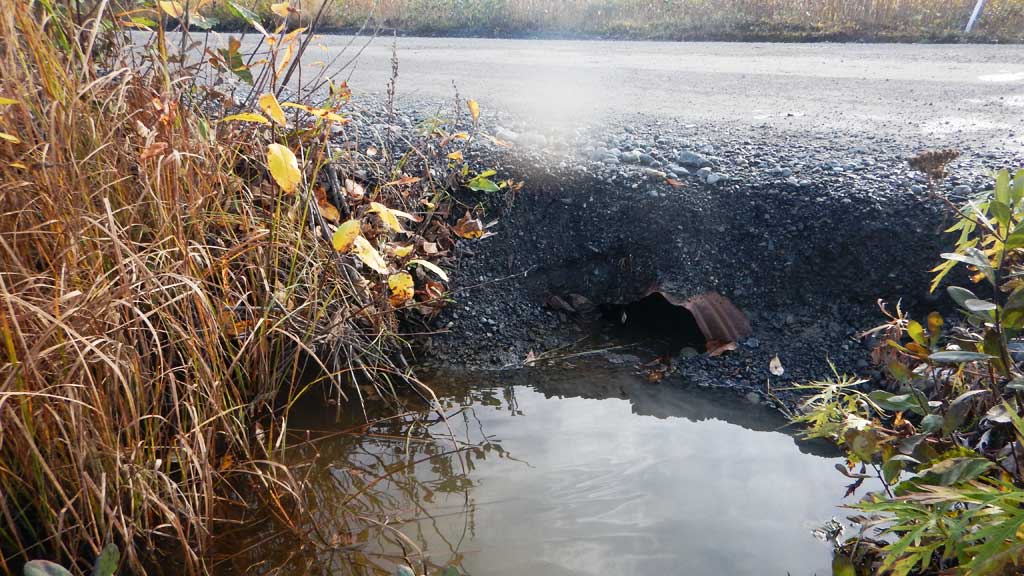
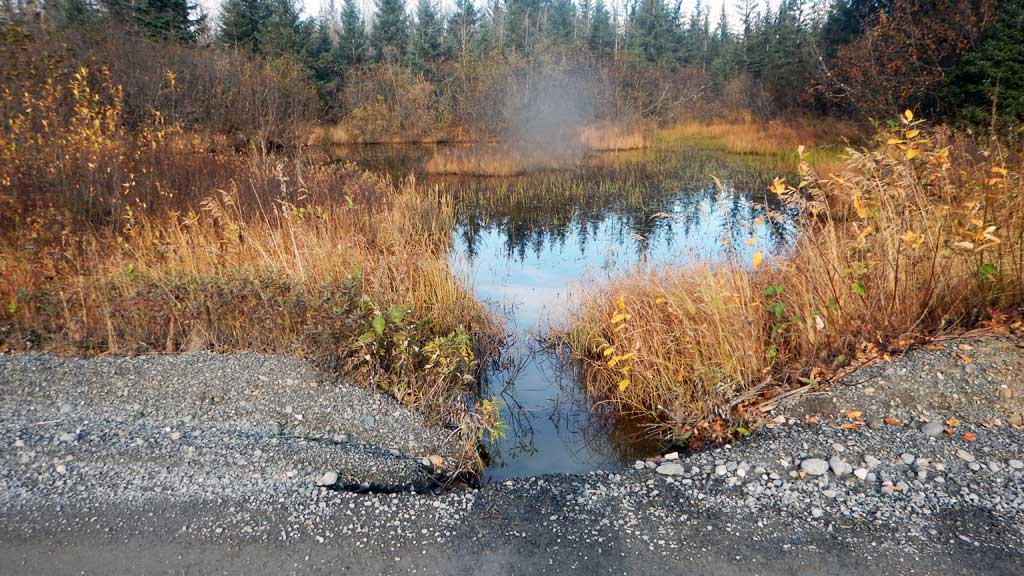
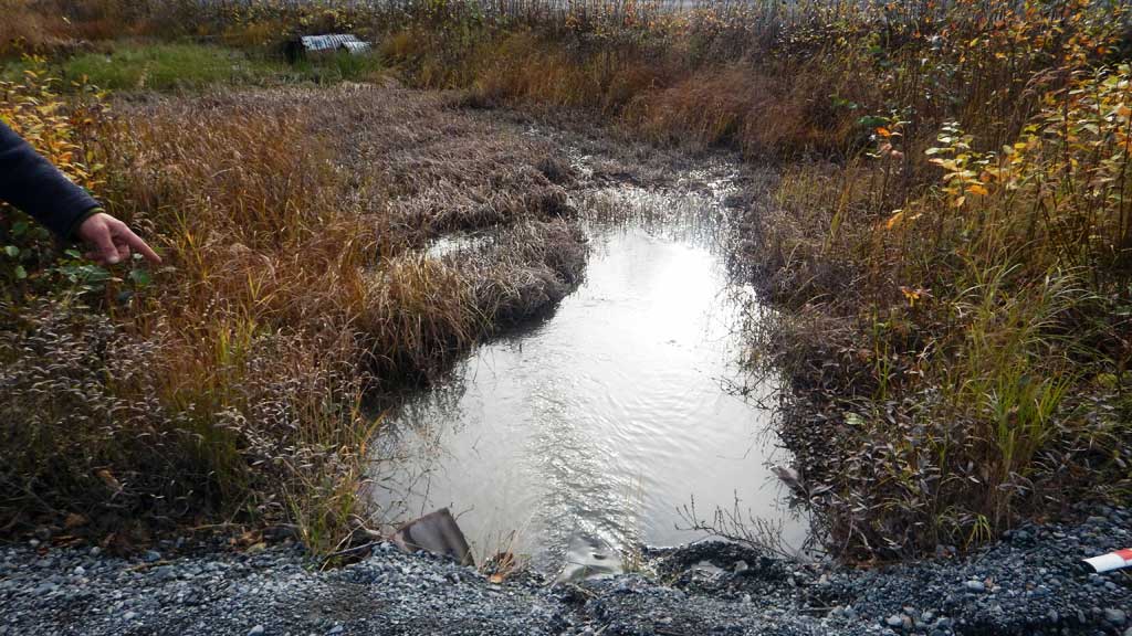
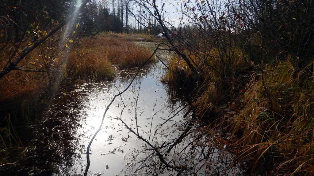
Site Comments: Site is at the intersection of Sheridan Glacier Road and the Glacier Highway.
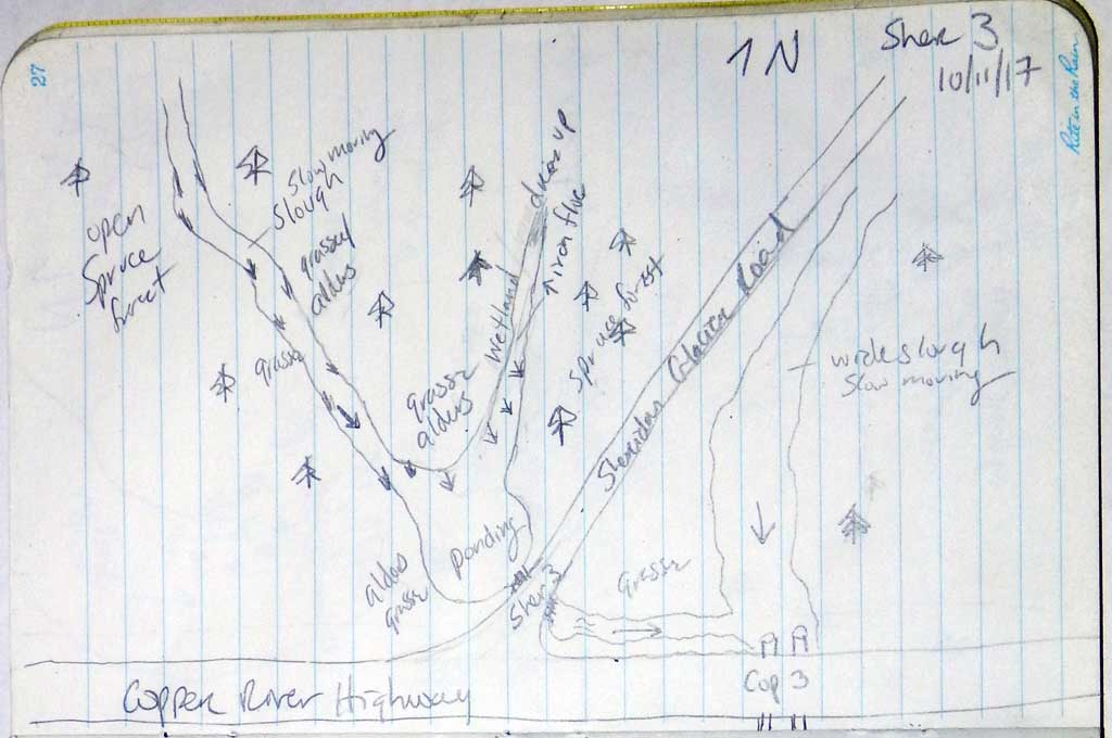
Survey CRWP17-Sher3
Observers: Kirsti Jurica, Hoots Witsoe
Overall Fish Passage Rating:
Tidal: No
Backwatered: No
Step Pools: No
Construction Year:
Site Observations:
- Constriction ratio red
- Shallow fill; inadequate roadfill volume above culvert
- Culvert is too short
- Mechanical damage or joints parting
- Structural Problem
- Road bank erosion
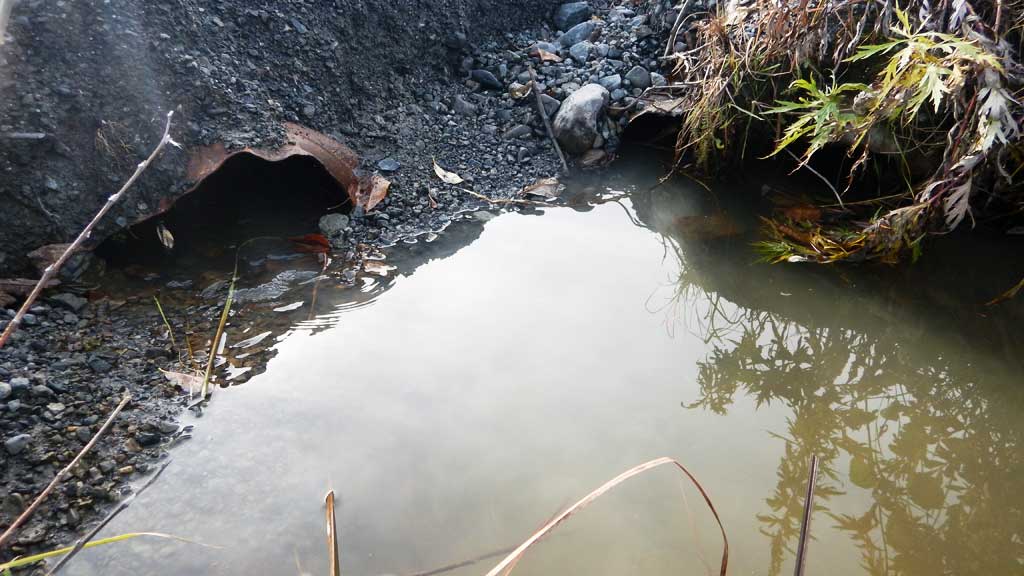
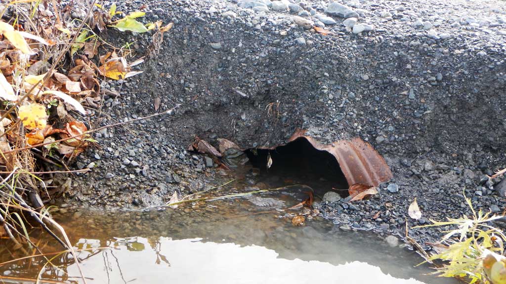
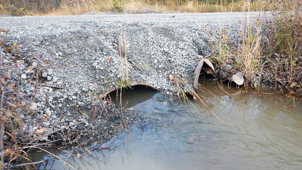
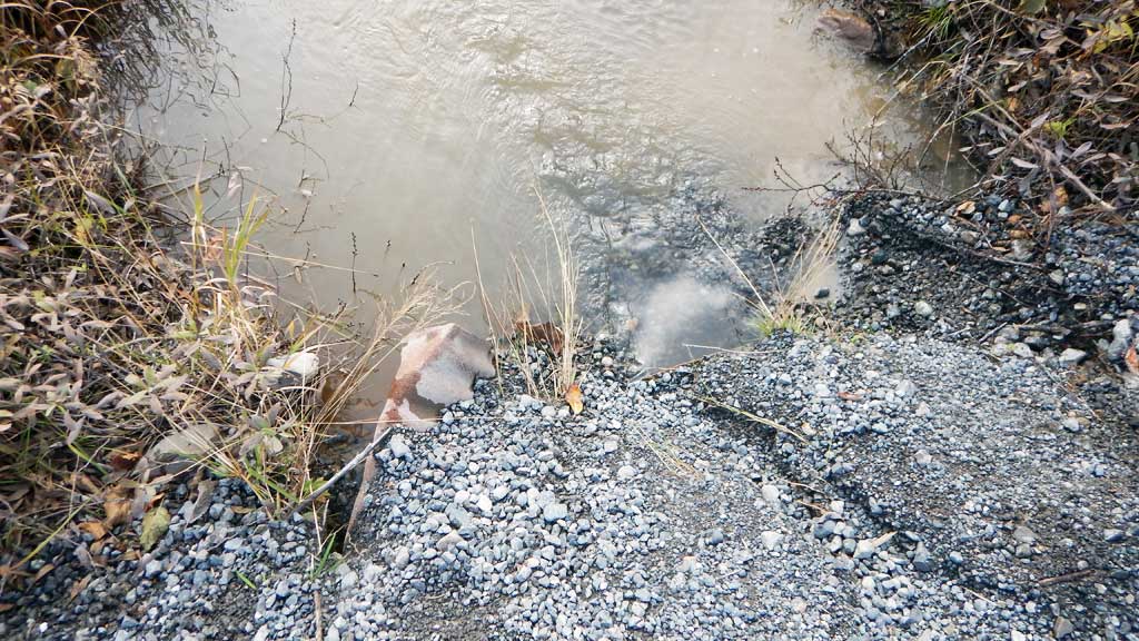
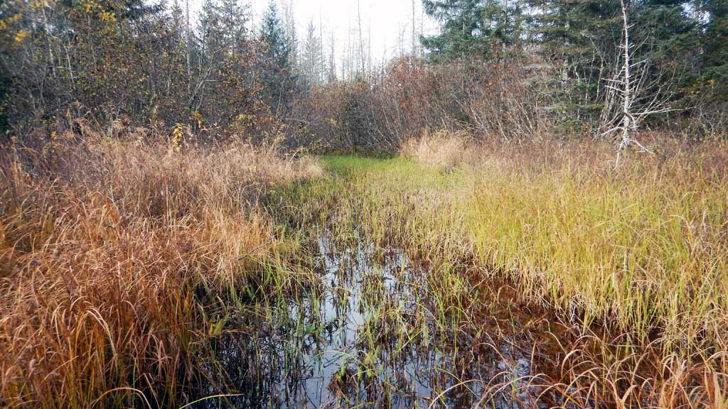
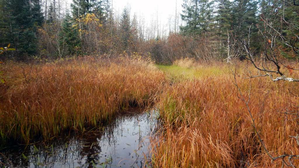
Comments: Culvert assessment performed and submitted by the Copper River Watershed Project. Site is just upstream from 20100469. Culverts severely damaged and too short for site. Numerous juvenile Coho salmon trapped upstream.
Culvert Measurements
| ID: 1 | Structure Type: Circular pipe (Corrugated steel) | Fish Passage Rating: | |||||||||||||||||||||||||||||||||||||||||
|
|
|
|||||||||||||||||||||||||||||||||||||||||
Comments: Inlet and outlet have been crushed and partially buried from road fill being pushed into creek and road bank erosion. |
|||||||||||||||||||||||||||||||||||||||||||
Culvert Observations:
|
|||||||||||||||||||||||||||||||||||||||||||
| ID: 2 | Structure Type: Circular pipe (Corrugated steel) | Fish Passage Rating: | |||||||||||||||||||||||||||||||||||||||||
|
|
|
|||||||||||||||||||||||||||||||||||||||||
Comments: Culvert gradient using top of culvert elevations but culvert is damaged. Inlet and outlet have been crushed and partially buried with road fill. |
|||||||||||||||||||||||||||||||||||||||||||
Culvert Observations:
|
|||||||||||||||||||||||||||||||||||||||||||
Stream Measurements
|
|
| Stream Width Type | Distance From Crossing (ft) |
Stream Width (ft) |
|---|---|---|
| Upstream ordinary high water | 14.6 | |
| Upstream ordinary high water | 15.1 | |
| Upstream ordinary high water | 16.8 |
Elevations
| Locator ID | Culvert Number |
River Distance (ft)1 |
Distance From Crossing (ft)2 |
Relative Elevation (ft) |
|---|---|---|---|---|
| Road Elev | 100.00 | |||
| D/S Thalweg (Top of DS site 20100469) | 0.00 | 99.62 | ||
| D/S Thalweg (Invert of DS site 20100469) | 0.00 | 96.00 | ||
| D/S Thalweg | 6.00 | 94.87 | ||
| D/S Water Surface Elev | 6.00 | 98.16 | ||
| D/S Thalweg (Sedimentation) | 42.00 | 96.93 | ||
| D/S Water Surface Elev | 42.00 | 98.16 | ||
| D/S Water Surface Elev | 49.00 | 98.17 | ||
| D/S Tailcrest or 1st Thalweg | 49.00 | 97.94 | ||
| Outlet Pool Water Elev | 55.00 | 98.18 | ||
| Max Pool Depth | 55.00 | 97.19 | ||
| Outlet Invert (on substrate) | 1 | 59.00 | 97.81 | |
| Outlet Invert (on substrate) | 2 | 59.00 | 97.89 | |
| D/S Water Surface Elev | 2 | 59.00 | 98.28 | |
| D/S Water Surface Elev | 1 | 59.00 | 98.18 | |
| Outlet Culvert Top (damaged) | 2 | 59.00 | 98.59 | |
| Outlet Culvert Top (damaged) | 1 | 59.00 | 99.00 | |
| Inlet Culvert Top (damaged) | 2 | 89.00 | 98.61 | |
| Inlet Culvert Top (damaged) | 1 | 89.00 | 98.79 | |
| Inlet Culvert Invert (on substrate) | 1 | 89.00 | 98.08 | |
| U/S Water Surface Elev | 1 | 89.00 | 98.23 | |
| U/S Water Surface Elev | 2 | 89.00 | 98.28 | |
| Inlet Culvert Invert (on substrate) | 2 | 89.00 | 97.72 | |
| U/S Thalweg | 94.00 | 96.63 | ||
| U/S Water Surface Elev | 94.00 | 98.32 | ||
| U/S Grade Ctrl (Thalweg) | 115.00 | 95.87 | ||
| U/S Water Surface Elev | 115.00 | 98.32 |
Notes:
- River distance is measured continuously throughout the survey reach along the thalweg of the stream.
- Measured from each end of the crossing along the thalweg of the stream.
Fish Sampling Efforts
| Gear Type: Minnow Trap (A) | Trap Duration(h): 18.0 | |
| Gear Type: Minnow Trap (B) | Trap Duration(h): 18.0 | |
Fish Observations
| Species: juvenile coho salmon | Life History: Anadromous | ||
| Total Fish Observed: 16 | Fish Measured: 2 | Fork Lengths (mm) Min: 85 Max: 95 Mean: 90 | |
| Collected/Observed by Gear Type: Not Recorded Minnow Trap (12) Not Recorded Minnow Trap (4) | |||
| Species: stickleback-unspecified | Life History: Unknown | ||
| Total Fish Observed: 9 | Fish Measured: | Fork Lengths (mm) Min: Max: Mean: | |
| Collected/Observed by Gear Type: Not Recorded Minnow Trap (3) Not Recorded Minnow Trap (6) | |||
Photos
Questions or comments about this report can be directed to dfg.dsf.webmaster@alaska.gov