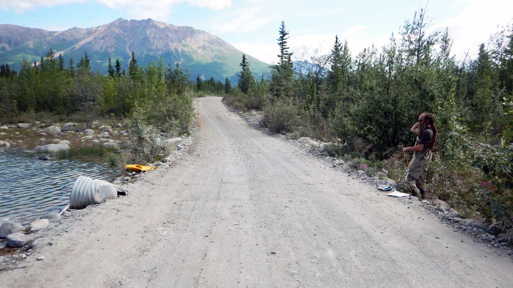
Fish Passage Site 20103766
Coordinates (dec. deg.): 61.43455°, -142.93198°
Legal Description: C005S014E17
Region: South Central
Road Name: McCarthy Town Road
Datum: NAD83
Quad Name / ITM: Mc Carthy B-6
AWC Stream #: 212-20-10080-2300-3511-4035-5018
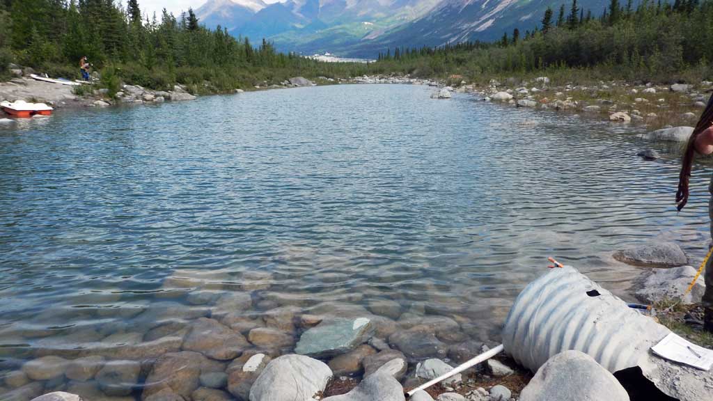
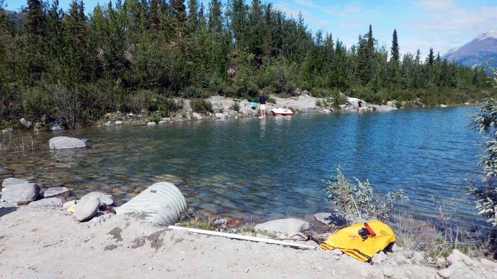
Stream Name: Swimming Hole
Elevation:
Site Comments: None
Survey CRWP17-Ken2
Observers: Kirsti Jurica, Hoots Witsoe
Overall Fish Passage Rating:
Tidal: No
Backwatered: No
Step Pools: No
Construction Year:
Site Observations:
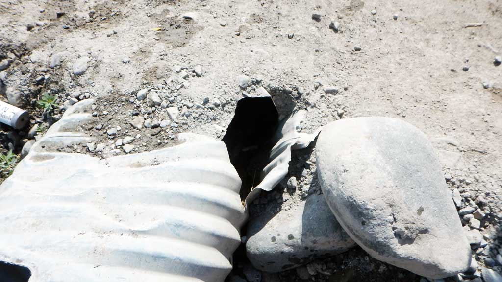
- Shallow fill; inadequate roadfill volume above culvert
- Mechanical damage or joints parting
- Structural Problem
- Culvert gradient red
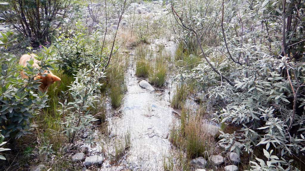
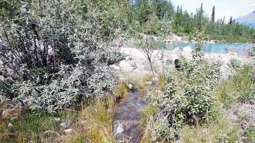
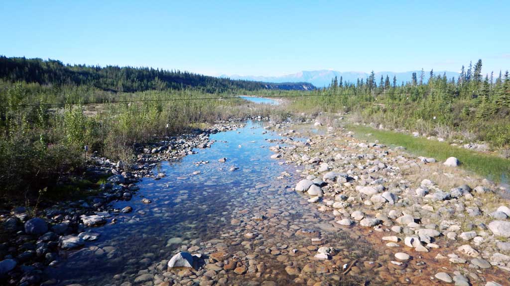
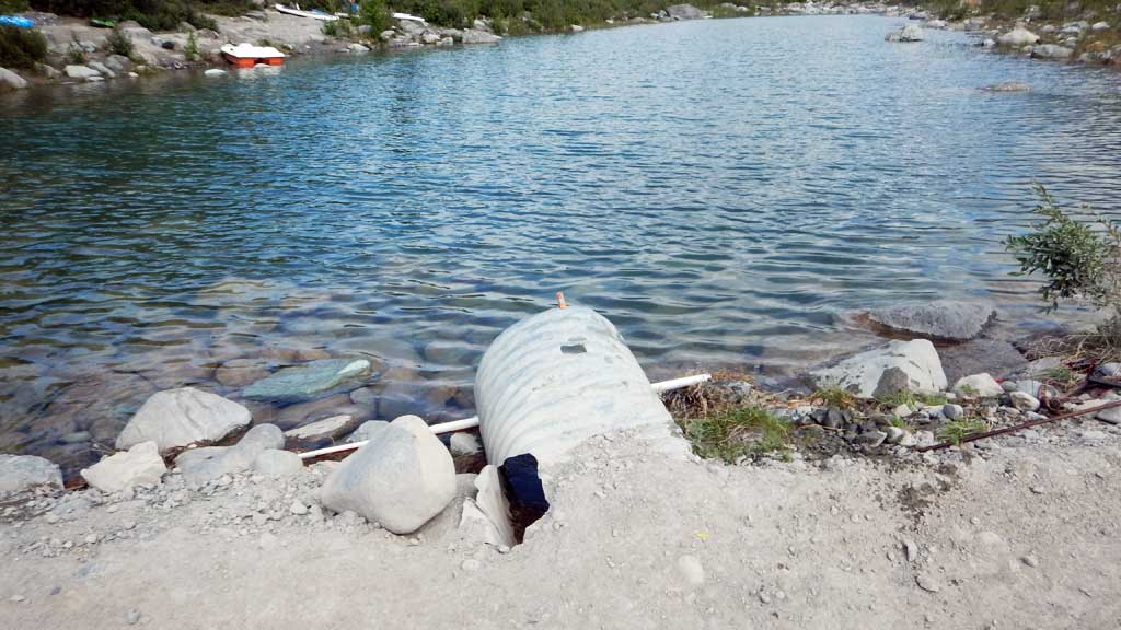
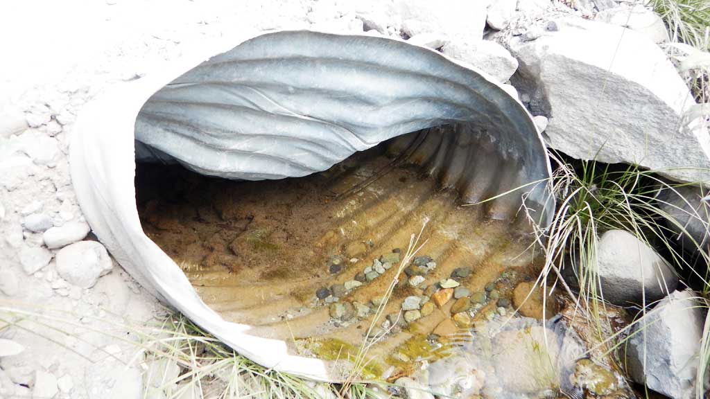
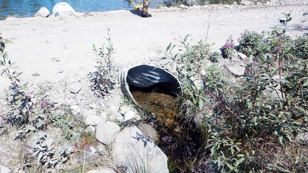
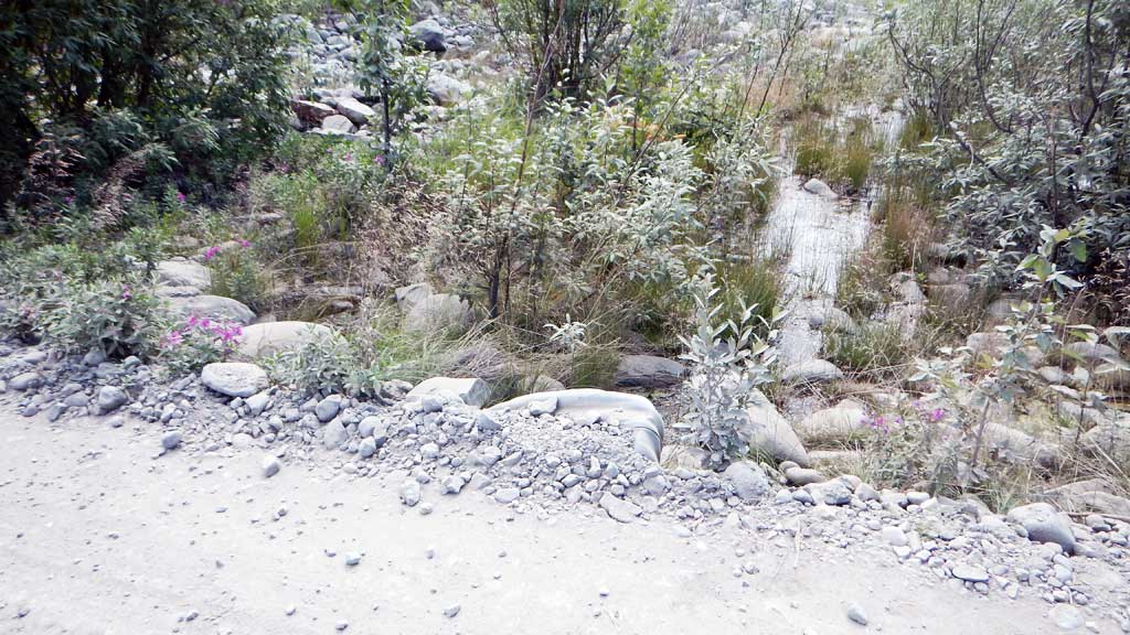
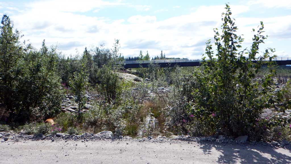
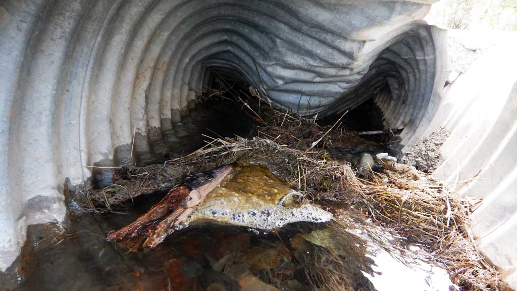
Comments: Culvert assessment performed and submitted by the Copper River Watershed Project. Off channel habitat of the Kennicott River. Limited and intermittent flow. Old Large side channel and proximal to Kennicott Glacier Lake. Interconnected pools downstream. Numerous juvenile Coho and Dolly Varden char caught in upstream pool. Culvert is crushed and barely passing water.
Culvert Measurements
| ID: 1 | Structure Type: Circular pipe (Corrugated steel) | Fish Passage Rating: | |||||||||||||||||||||||||||||||||||||||||
|
|
|
|||||||||||||||||||||||||||||||||||||||||
Culvert Observations:
|
|||||||||||||||||||||||||||||||||||||||||||
Stream Measurements
|
|
No stream width data available.
Elevations
| Locator ID | Culvert Number |
River Distance (ft)1 |
Distance From Crossing (ft)2 |
Relative Elevation (ft) |
|---|---|---|---|---|
| Road Elev | 100.00 | |||
| D/S Grade Ctrl (Thalweg) | 0.00 | 98.23 | ||
| D/S Water Surface Elev | 0.00 | 98.55 | ||
| Outlet Invert | 1.00 | 98.65 | ||
| D/S Water Surface Elev | 1.00 | 98.87 | ||
| Outlet Culvert Top (damaged) | 1.00 | 100.46 | ||
| Inlet Culvert Top (damaged) | 20.00 | 101.09 | ||
| Inlet Culvert Invert (on pipe) | 20.00 | 99.03 | ||
| U/S Water Surface Elev | 20.00 | 99.24 | ||
| U/S Water Surface Elev | 30.00 | 99.26 | ||
| U/S Thalweg | 30.00 | 96.16 |
Notes:
- River distance is measured continuously throughout the survey reach along the thalweg of the stream.
- Measured from each end of the crossing along the thalweg of the stream.
Fish Sampling Efforts
| Gear Type: Minnow Trap (A) | Trap Duration(h): 2.0 | |
| Gear Type: Minnow Trap (B) | Trap Duration(h): 2.0 | |
| Gear Type: Minnow Trap (C) | Trap Duration(h): 2.0 | |
| Comments: No fish caught | ||
| Gear Type: Visual Observation, Ground (D) | ||
| Comments: Coho Fry observed at outlet | ||
Fish Observations
| Species: juvenile coho salmon | Life History: Anadromous | ||
| Total Fish Observed: 10 | Fish Measured: 5 | Fork Lengths (mm) Min: 55 Max: 150 Mean: 113 | |
| Collected/Observed by Gear Type: Downstream Visual Observation, Ground (5) Not Recorded Minnow Trap (3) Not Recorded Minnow Trap (2) | |||
| Species: juvenile/adult Dolly Varden | Life History: Unknown | ||
| Total Fish Observed: 1 | Fish Measured: 1 | Fork Lengths (mm) Min: 130 Max: 130 Mean: 130 | |
| Collected/Observed by Gear Type: Not Recorded Minnow Trap (1) | |||
Photos

Questions or comments about this report can be directed to dfg.dsf.webmaster@alaska.gov