Fish Passage Site 20103762
Coordinates (dec. deg.): 62.02682°, -146.69510°
Legal Description: C003N008W21
Region: South Central
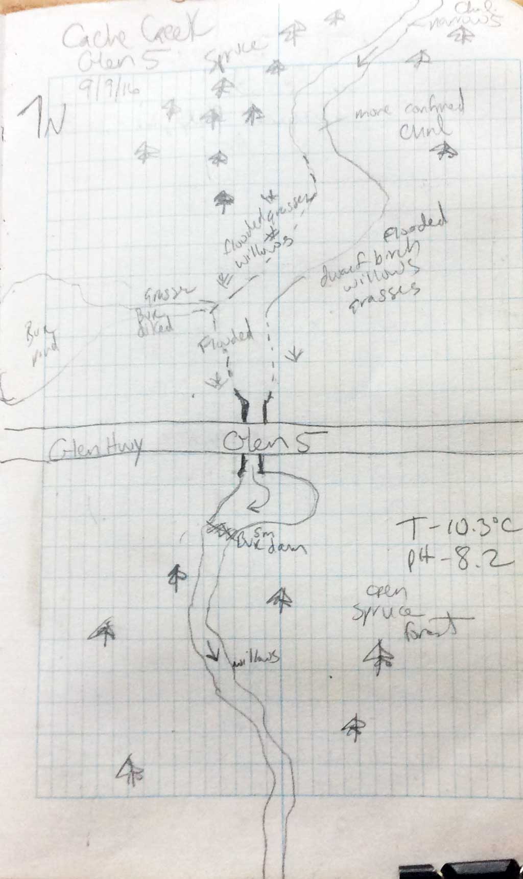
Road Name: Glenn Highway
Datum: NAD83
Quad Name / ITM: Gulkana A-6
AWC Stream #:
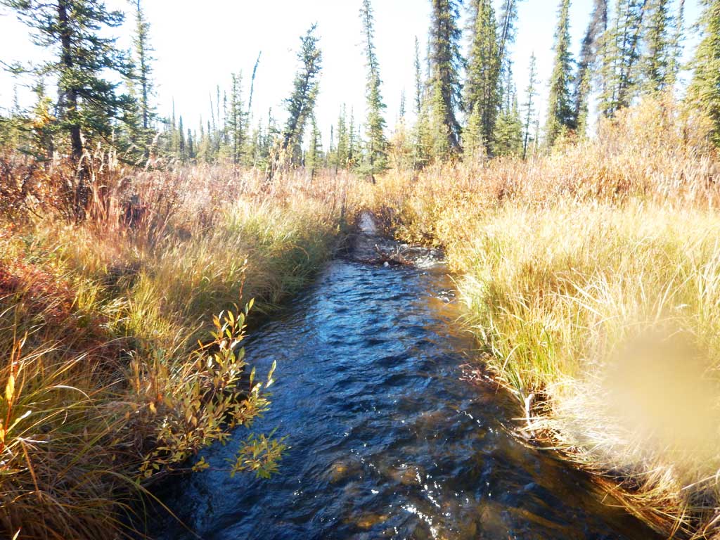
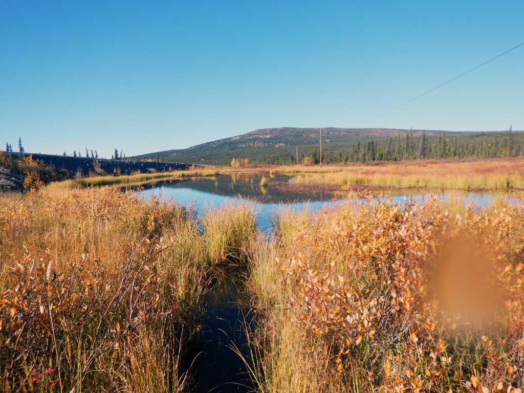
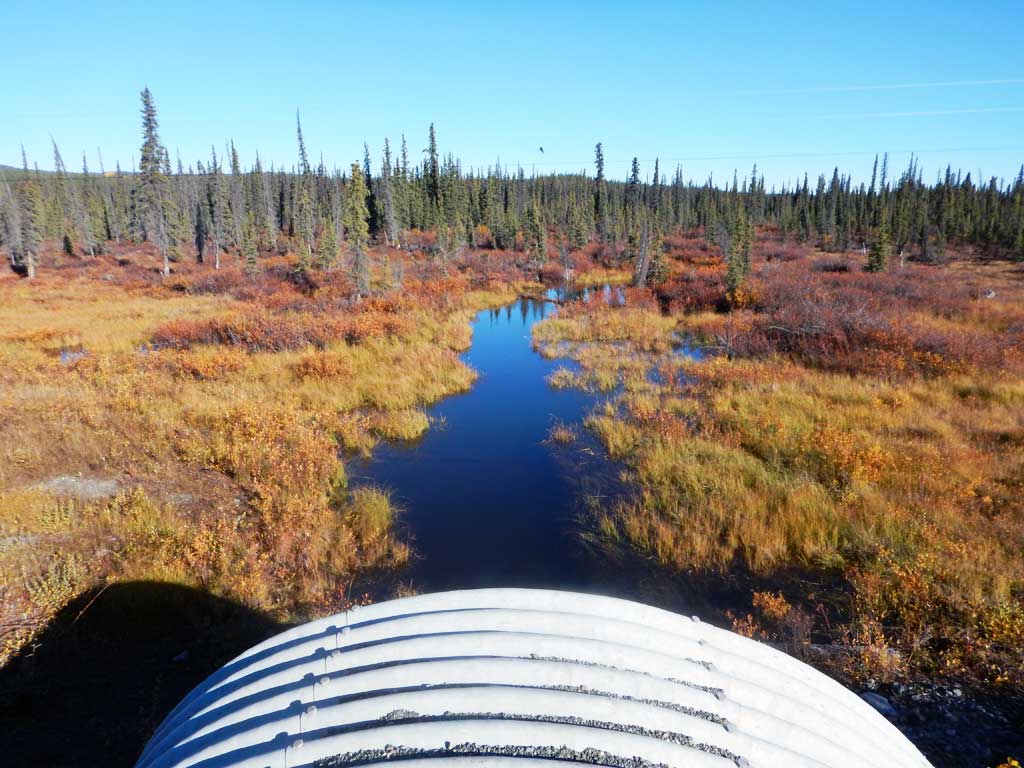
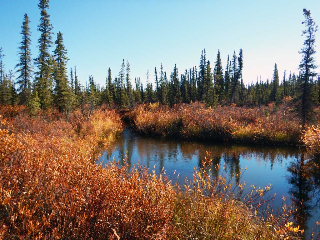
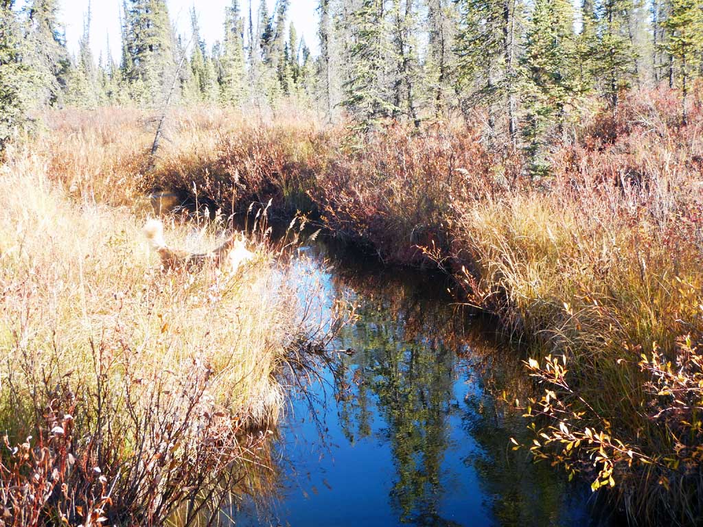
Stream Name: Cache Creek
Elevation:
Site Comments: Creek drains Snowshoe Lake upstream.
Survey CRWP17-Glen5
Observers: Kirsti Jurica, Hoots Witsoe
Overall Fish Passage Rating:
Tidal: No
Backwatered: No
Step Pools: No
Construction Year:
Site Observations:
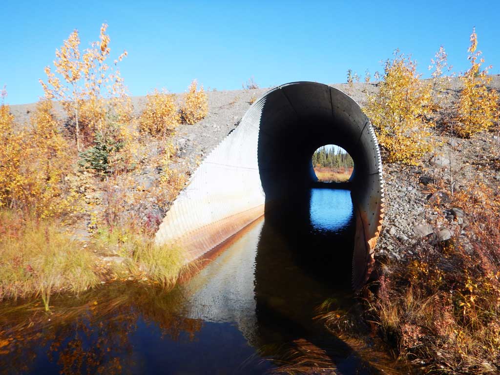
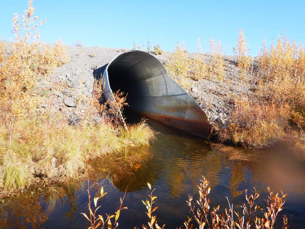
- Beaver Activity
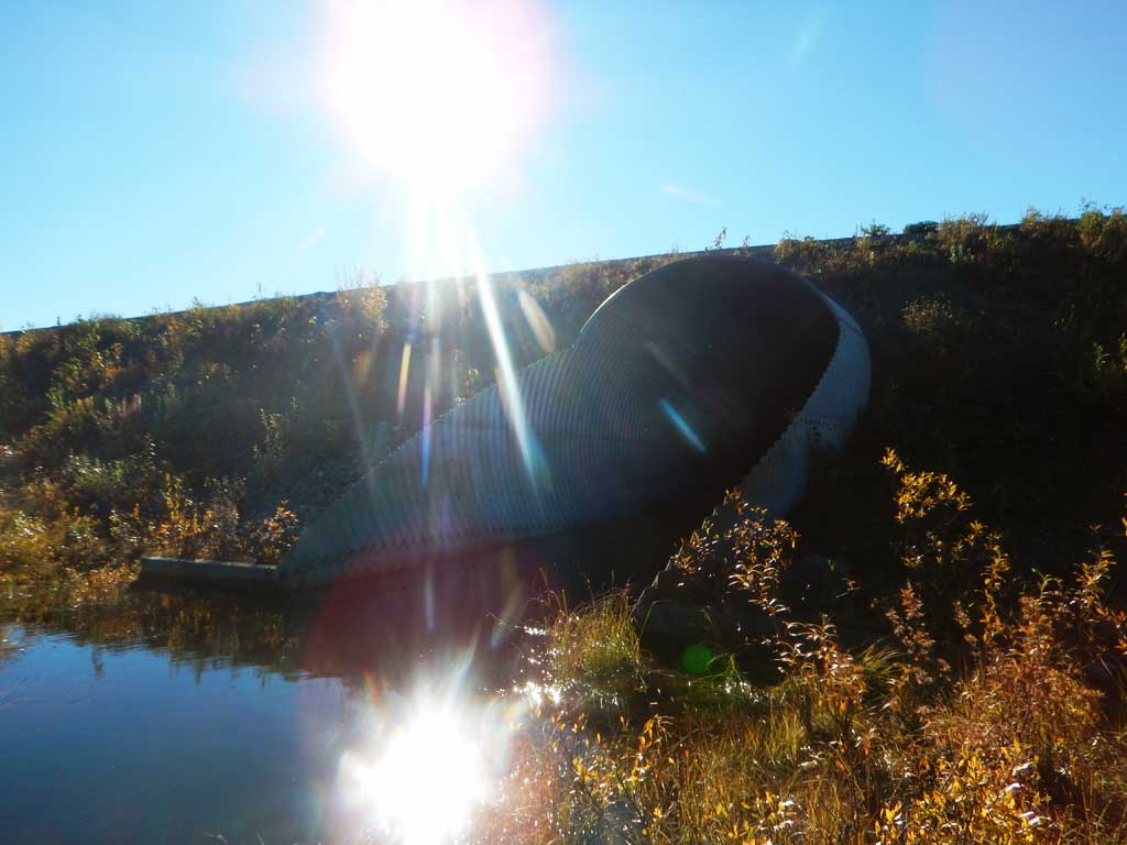
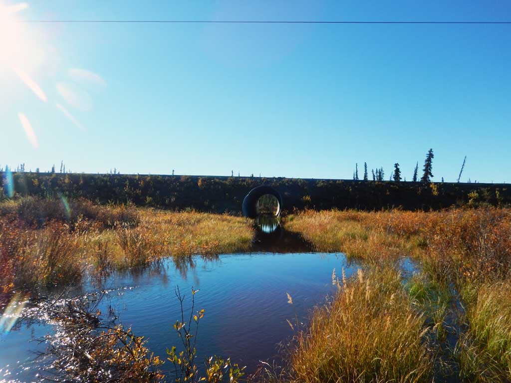
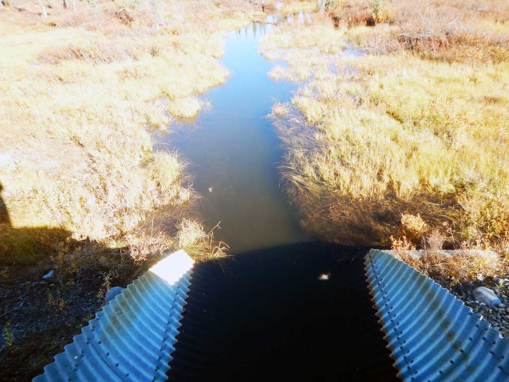
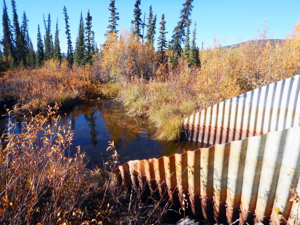
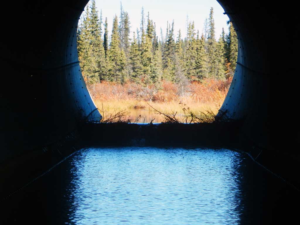
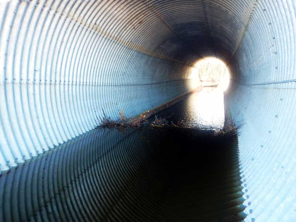
Comments: Culvert assessment performed and submitted by the Copper River Watershed Project. Deep palustrine channel. Beaver dam in culvert. Numerous Arctic grayling caught upstream.
Culvert Measurements
| ID: 1 | Structure Type: Circular pipe (Structural steel plate) | Fish Passage Rating: | |||||||||||||||||||||||||||||||||||||||||
|
|
|
|||||||||||||||||||||||||||||||||||||||||
Comments: Beaver dam inside of culvert near inlet. Water surface gradient through culvert 1.29%, substrate gradient on bottom of culvert is .62. Culvert gradient calculated using top of pipe elevations. |
|||||||||||||||||||||||||||||||||||||||||||
Culvert Observations:
|
|||||||||||||||||||||||||||||||||||||||||||
Stream Measurements
|
|
| Stream Width Type | Distance From Crossing (ft) |
Stream Width (ft) |
|---|---|---|
| Downstream ordinary high water | 5.90 | |
| Downstream ordinary high water | 7.70 | |
| Downstream ordinary high water | 7.80 | |
| Upstream ordinary high water | 7.90 | |
| Upstream ordinary high water | 9.80 | |
| Upstream ordinary high water | 5.40 |
Elevations
| Locator ID | Culvert Number |
River Distance (ft)1 |
Distance From Crossing (ft)2 |
Relative Elevation (ft) |
|---|---|---|---|---|
| Road Elev | 112.69 | |||
| D/S Grade Ctrl (Thalweg) | 0.00 | 88.26 | ||
| D/S Water Surface Elev | 0.00 | 89.96 | ||
| D/S Thalweg (bottom of beaver dam) | 115.00 | 90.77 | ||
| D/S Water Surface Elev | 115.00 | 91.72 | ||
| Max Pool Depth | 127.00 | 90.48 | ||
| Outlet Pool Water Elev | 127.00 | 93.27 | ||
| D/S Water Surface Elev | 150.00 | 93.27 | ||
| Outlet Invert (on substrate) | 150.00 | 91.52 | ||
| Outlet Culvert Top (estimated distance) | 158.00 | 107.12 | ||
| Inlet Culvert Top (estimated distance) | 268.00 | 107.46 | ||
| U/S Water Surface Elev | 276.00 | 94.90 | ||
| Inlet Culvert Invert | 276.00 | 92.30 | ||
| U/S Grade Ctrl (Thalweg) | 326.00 | 92.11 | ||
| U/S Water Surface Elev | 326.00 | 94.91 | ||
| U/S Water Surface Elev | 401.00 | 95.08 | ||
| U/S Grade Ctrl (Thalweg) | 401.00 | 91.08 |
Notes:
- River distance is measured continuously throughout the survey reach along the thalweg of the stream.
- Measured from each end of the crossing along the thalweg of the stream.
Fish Sampling Efforts
| Gear Type: Minnow Trap (A) | Trap Duration(h): 15.0 | |
| Comments: No fish caught | ||
| Gear Type: Minnow Trap (B) | Trap Duration(h): 15.0 | |
| Gear Type: Minnow Trap (C) | Trap Duration(h): 15.0 | |
| Comments: No fish caught | ||
| Gear Type: Minnow Trap (D) | Trap Duration(h): 15.0 | |
| Comments: No fish caught | ||
| Gear Type: Minnow Trap (E) | Trap Duration(h): 15.0 | |
Fish Observations
| Species: juvenile Arctic grayling | Life History: Resident | ||
| Total Fish Observed: 3 | Fish Measured: 3 | Fork Lengths (mm) Min: 95 Max: 105 Mean: 98 | |
| Collected/Observed by Gear Type: Not Recorded Minnow Trap (1) Not Recorded Minnow Trap (2) | |||
Photos


Questions or comments about this report can be directed to dfg.dsf.webmaster@alaska.gov