Fish Passage Site 20103760
Coordinates (dec. deg.): 62.10186°, -145.53893°
Legal Description: C004N002W26
Region: South Central
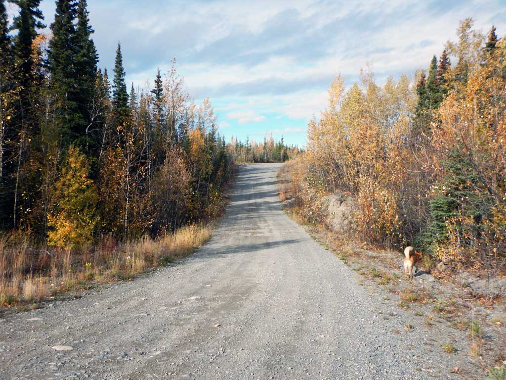
Road Name: Moose Creek Road
Datum: NAD83
Quad Name / ITM: Gulkana A-4
AWC Stream #:
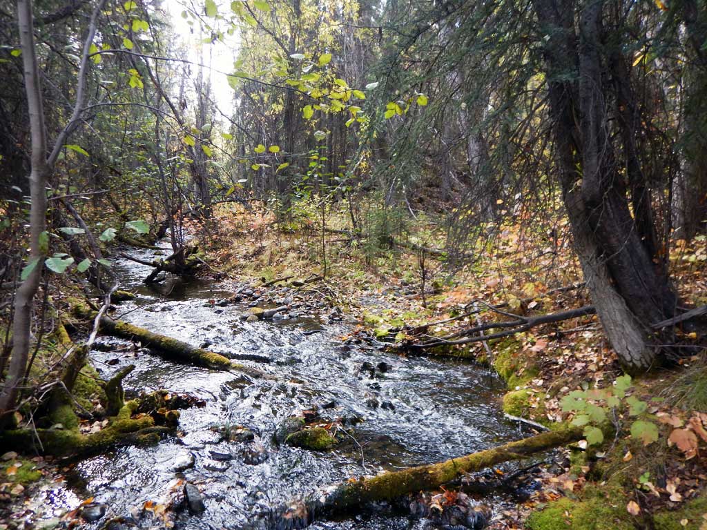
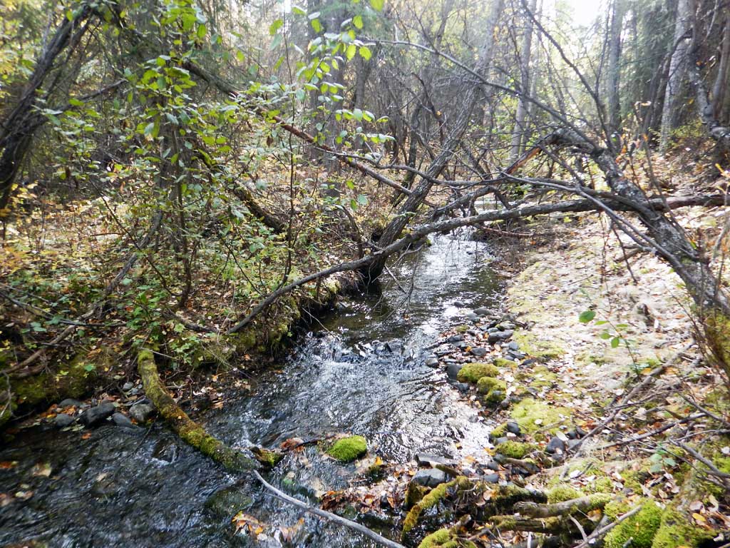
Stream Name: Unnamed
Elevation:
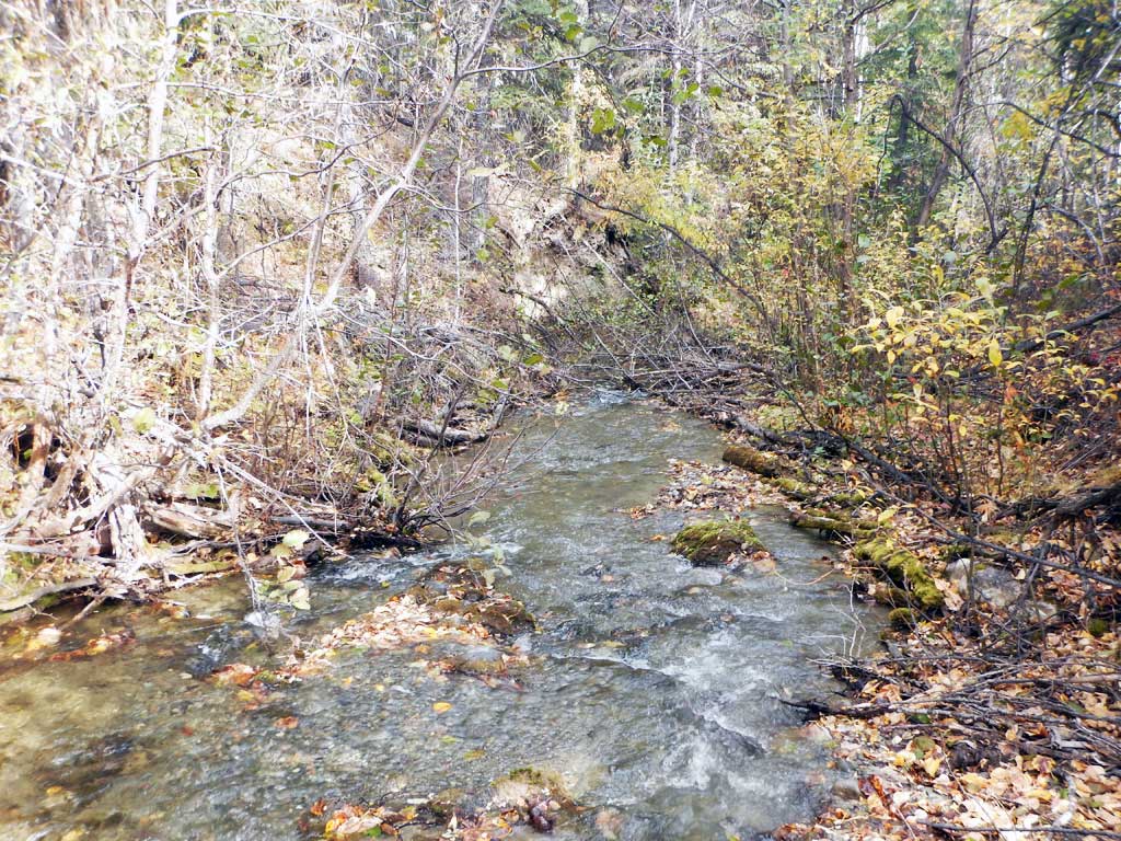
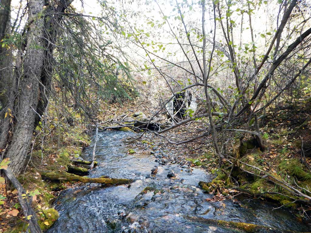
Site Comments: Tributary to Moose Creek
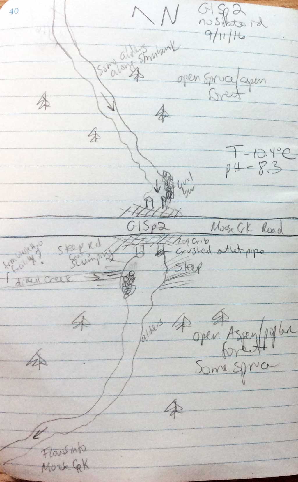
Survey CRWP17-GISp2
Observers: Kirsti Jurica, Hoots Witsoe
Overall Fish Passage Rating:
Tidal: No
Backwatered: No
Step Pools: No
Construction Year:
Site Observations:
- Outfall height gray
- Constriction ratio red
- Culvert gradient red
- Mechanical damage or joints parting
- Improper bedding
- Cut-slope slumping or sliding into culvert (single event)
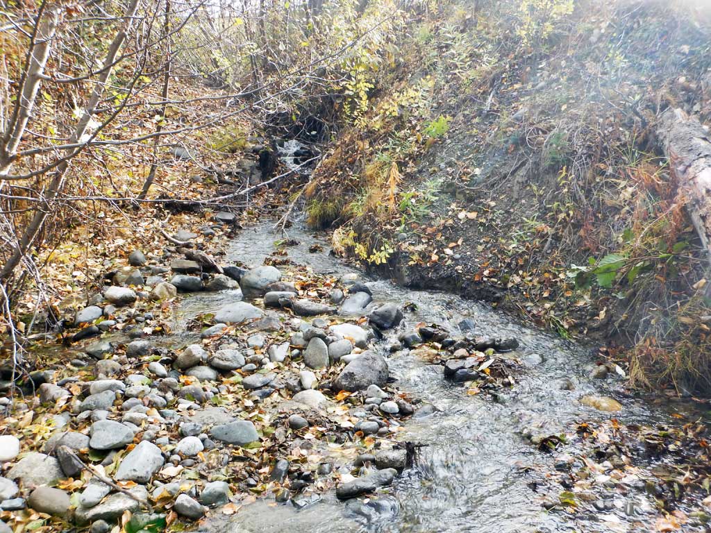
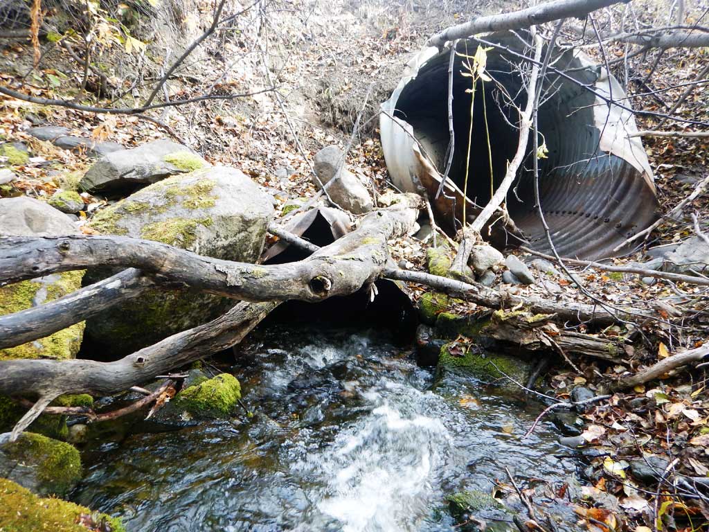
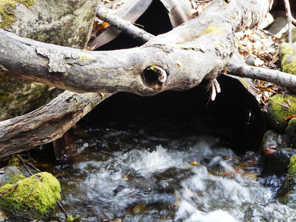
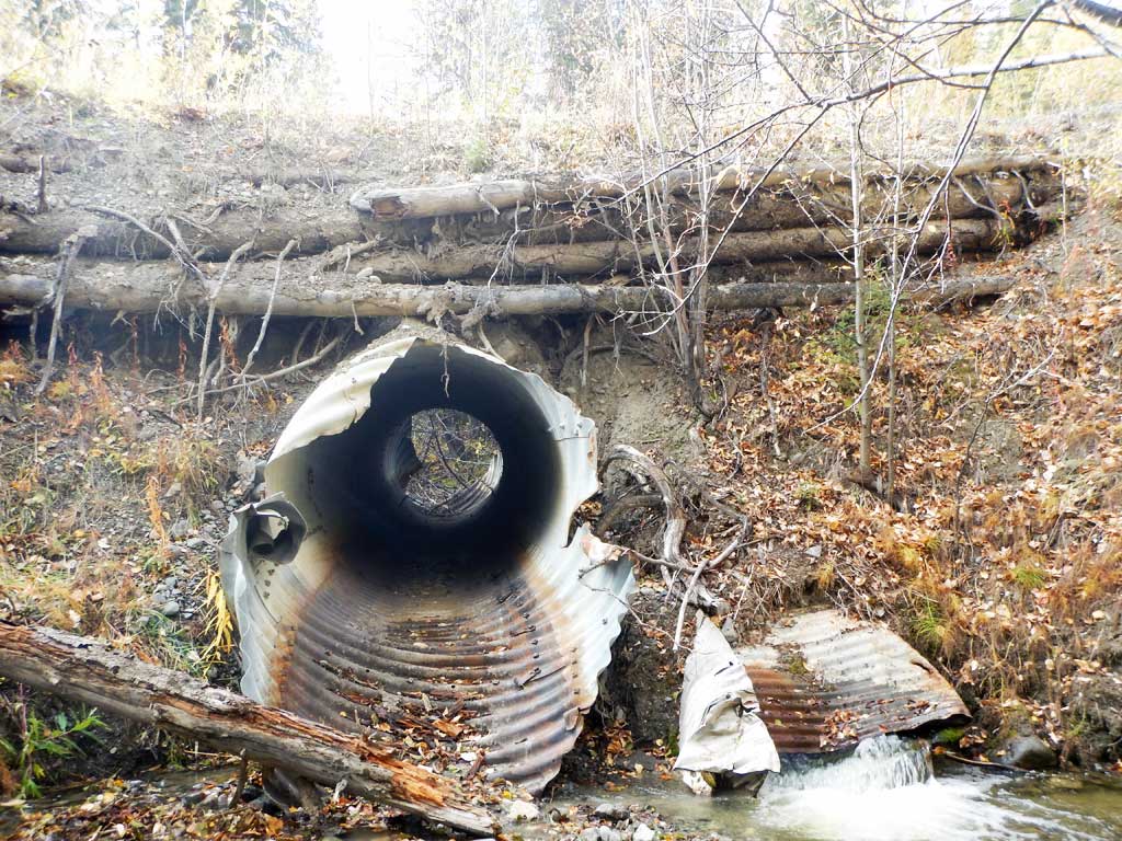
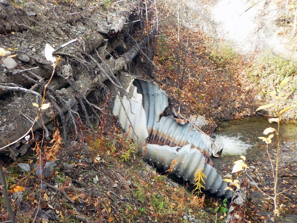
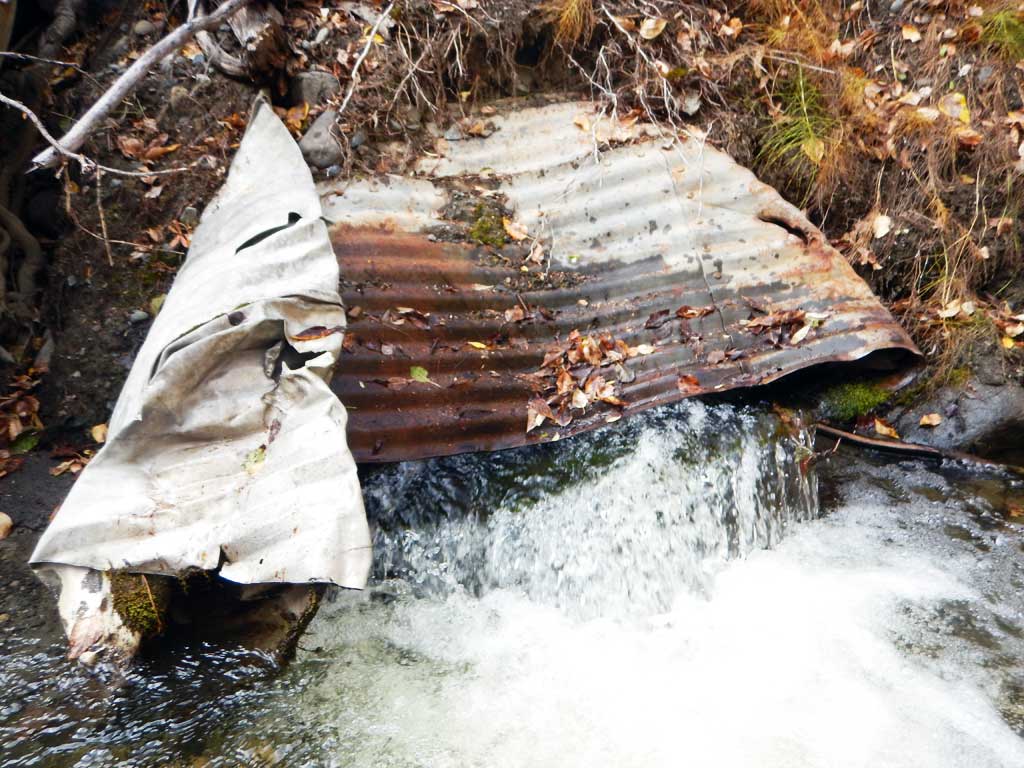
Comments: Culvert assessment performed and submitted by the Copper River Watershed Project. Rainbow trout caught downstream. C1 is taking all flow, C2 set as overflow pipe. Wood crib for road bed is rotting and slumping. Crushed outlet of C1 is making it a barrier to fish passage.
Culvert Measurements
| ID: 1 | Structure Type: Circular pipe (Corrugated steel) | Fish Passage Rating: | |||||||||||||||||||||||||||||||||||||||||
|
|
|
|||||||||||||||||||||||||||||||||||||||||
Comments: Culvert outlet crushed creating a fish passage barrier. Culvert length estimated. |
|||||||||||||||||||||||||||||||||||||||||||
Culvert Observations:
|
|||||||||||||||||||||||||||||||||||||||||||
| ID: 2 | Structure Type: Circular pipe (Structural steel plate) | Fish Passage Rating: | |||||||||||||||||||||||||||||||||||||||||
|
|
|
|||||||||||||||||||||||||||||||||||||||||
Comments: Culvert dry at time of survey, set higher than C1 as an overflow pipe. Outlet bent and damaged. |
|||||||||||||||||||||||||||||||||||||||||||
Culvert Observations:
|
|||||||||||||||||||||||||||||||||||||||||||
Stream Measurements
|
|
| Stream Width Type | Distance From Crossing (ft) |
Stream Width (ft) |
|---|---|---|
| Downstream ordinary high water | 10.2 | |
| Downstream ordinary high water | 11.6 | |
| Downstream ordinary high water | 12.1 | |
| Upstream ordinary high water | 6.9 | |
| Upstream ordinary high water | 9.1 | |
| Upstream ordinary high water | 10.9 |
Elevations
| Locator ID | Culvert Number |
River Distance (ft)1 |
Distance From Crossing (ft)2 |
Relative Elevation (ft) |
|---|---|---|---|---|
| Road Elev | 107.04 | |||
| D/S Grade Ctrl (Thalweg) | 0.00 | 87.07 | ||
| D/S Water Surface Elev | 0.00 | 87.89 | ||
| D/S Tailcrest or 1st Thalweg | 85.00 | 90.42 | ||
| D/S Water Surface Elev | 85.00 | 90.99 | ||
| D/S Thalweg (culvert directly below top of mitre, distance estimated) | 2 | 90.00 | 93.02 | |
| Max Pool Depth | 94.00 | 90.29 | ||
| Outlet Pool Water Elev | 94.00 | 91.22 | ||
| D/S Water Surface Elev | 1 | 95.00 | 91.41 | |
| Outlet Culvert Top | 1 | 95.00 | 91.44 | |
| Outlet Invert (End of pipe at end of mitre, dry) | 2 | 95.00 | 91.55 | |
| Outlet Invert | 1 | 95.00 | 91.20 | |
| Inlet Culvert Invert (on substrate) | 1 | 145.00 | 92.31 | |
| U/S Water Surface Elev | 1 | 145.00 | 92.85 | |
| Inlet Culvert Invert (Dry) | 2 | 145.00 | 93.77 | |
| Inlet Culvert Top | 1 | 145.00 | 95.27 | |
| Inlet Culvert Top | 1 | 145.00 | 100.00 | |
| U/S Water Surface Elev | 155.00 | 93.97 | ||
| U/S Grade Ctrl (Thalweg) | 155.00 | 93.53 | ||
| U/S Grade Ctrl (Thalweg) | 191.00 | 95.10 | ||
| U/S Water Surface Elev | 191.00 | 95.63 | ||
| U/S Grade Ctrl (Thalweg) | 258.00 | 97.17 | ||
| U/S Water Surface Elev | 258.00 | 97.75 |
Notes:
- River distance is measured continuously throughout the survey reach along the thalweg of the stream.
- Measured from each end of the crossing along the thalweg of the stream.
Fish Sampling Efforts
| Gear Type: Minnow Trap (A) | Trap Duration(h): 15.0 | |
| Gear Type: Minnow Trap (B) | Trap Duration(h): 15.0 | |
| Gear Type: Minnow Trap (C) | Trap Duration(h): 15.0 | |
| Comments: No fish caught | ||
| Gear Type: Minnow Trap (D) | Trap Duration(h): 15.0 | |
| Comments: No fish caught | ||
Fish Observations
| Species: juvenile longnose sucker | Life History: Resident | ||
| Total Fish Observed: 2 | Fish Measured: | Fork Lengths (mm) Min: Max: Mean: | |
| Collected/Observed by Gear Type: Not Recorded Minnow Trap (2) | |||
| Species: juvenile rainbow trout | Life History: Unknown | ||
| Total Fish Observed: 2 | Fish Measured: 2 | Fork Lengths (mm) Min: 65 Max: 75 Mean: 70 | |
| Collected/Observed by Gear Type: Not Recorded Minnow Trap (1) Not Recorded Minnow Trap (1) | |||
Photos
Questions or comments about this report can be directed to dfg.dsf.webmaster@alaska.gov