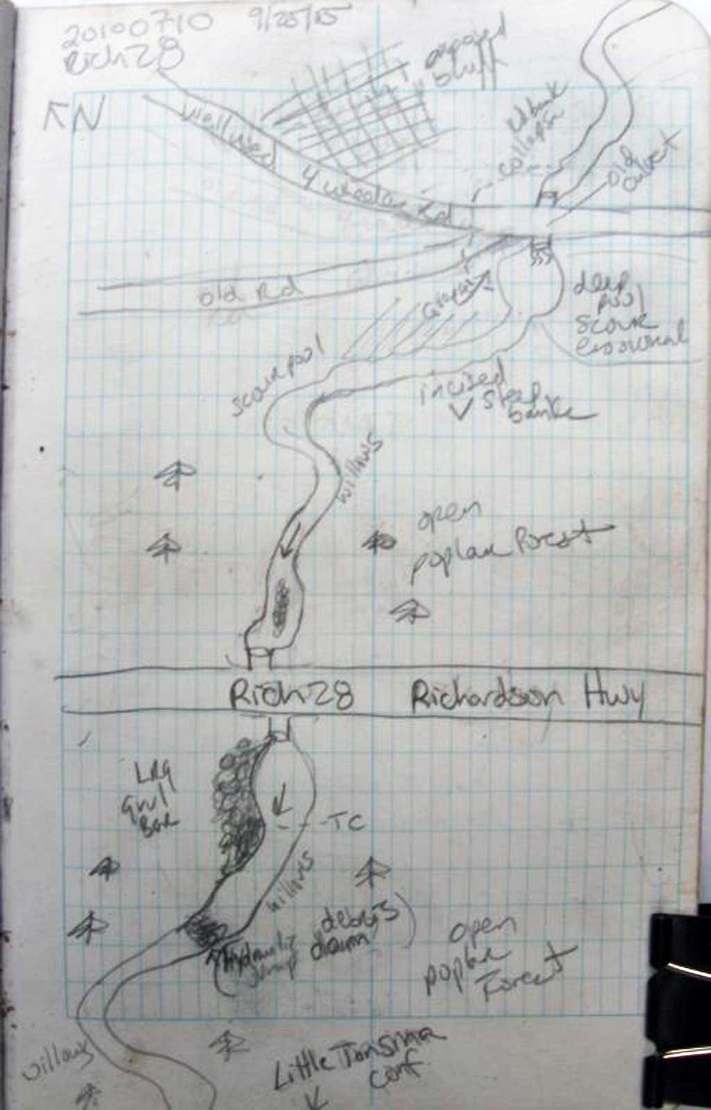
Fish Passage Site 20103687
Coordinates (dec. deg.): 61.59012°, -145.22079°
Legal Description: C003S001E22
Region: South Central
Road Name: ATV Trail
Datum: NAD83
Quad Name / ITM: Valdez C-4
AWC Stream #:
Stream Name: Unnamed
Elevation:
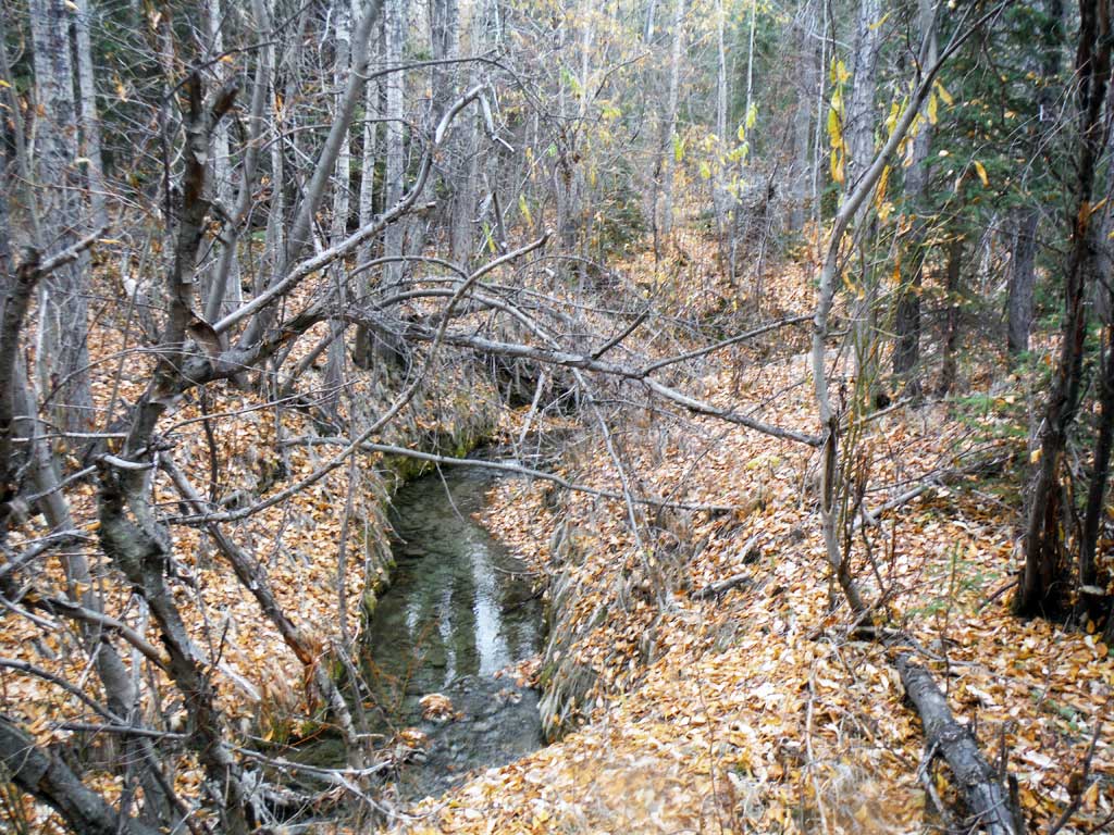
Site Comments: Site 20100710 on the Richarson Highway is about 500 feet downstream.
Survey UPDATE-ATV01
Project Supervisor: Gillian O'Doherty, ADFG
Observers: Mark Eisenman
Overall Fish Passage Rating:
Tidal: No
Backwatered: No
Step Pools: No
Construction Year:
Site Observations:
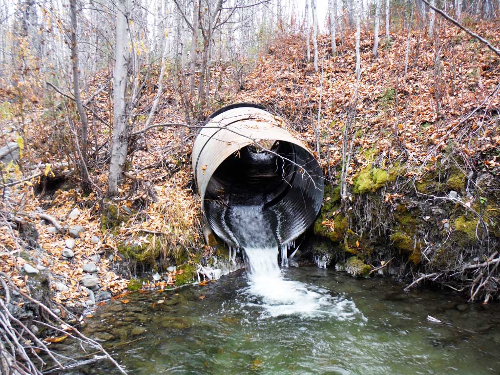
- Outfall height red
- Mechanical damage or joints parting
- Structural Problem
- Inlet perch
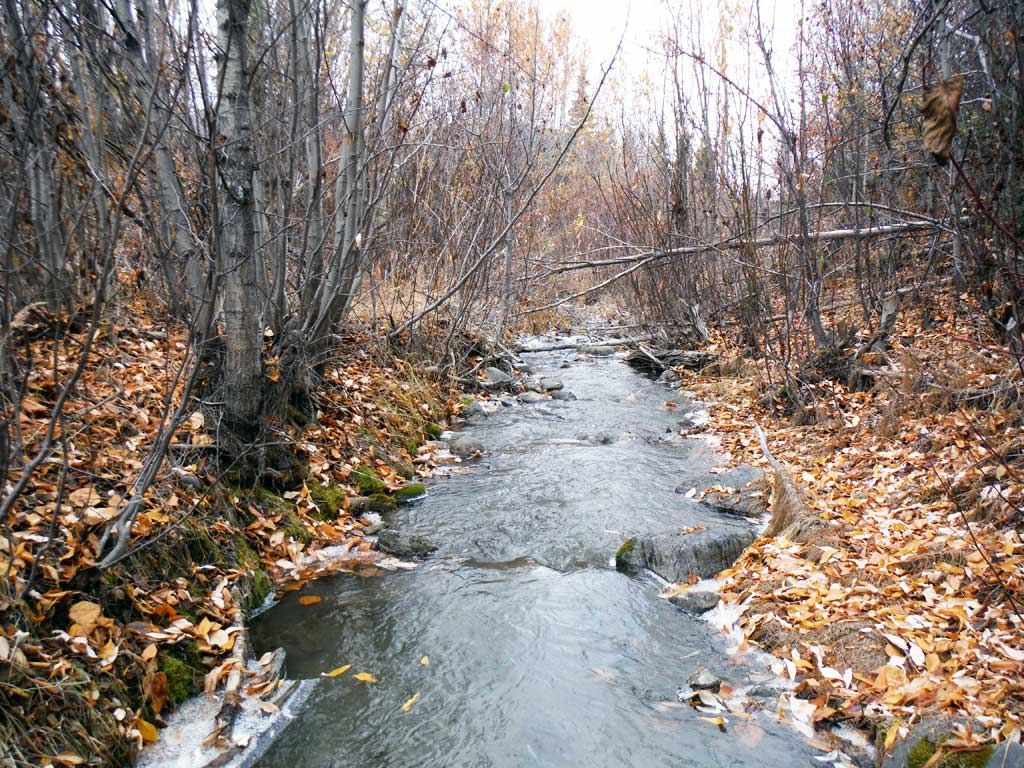
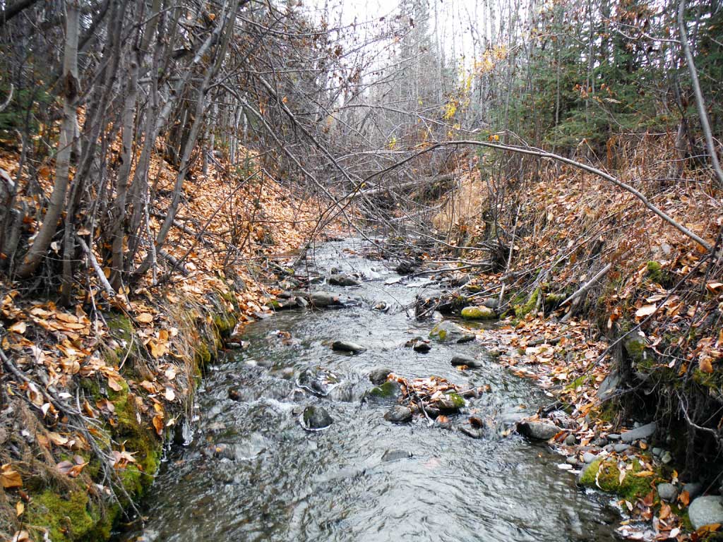
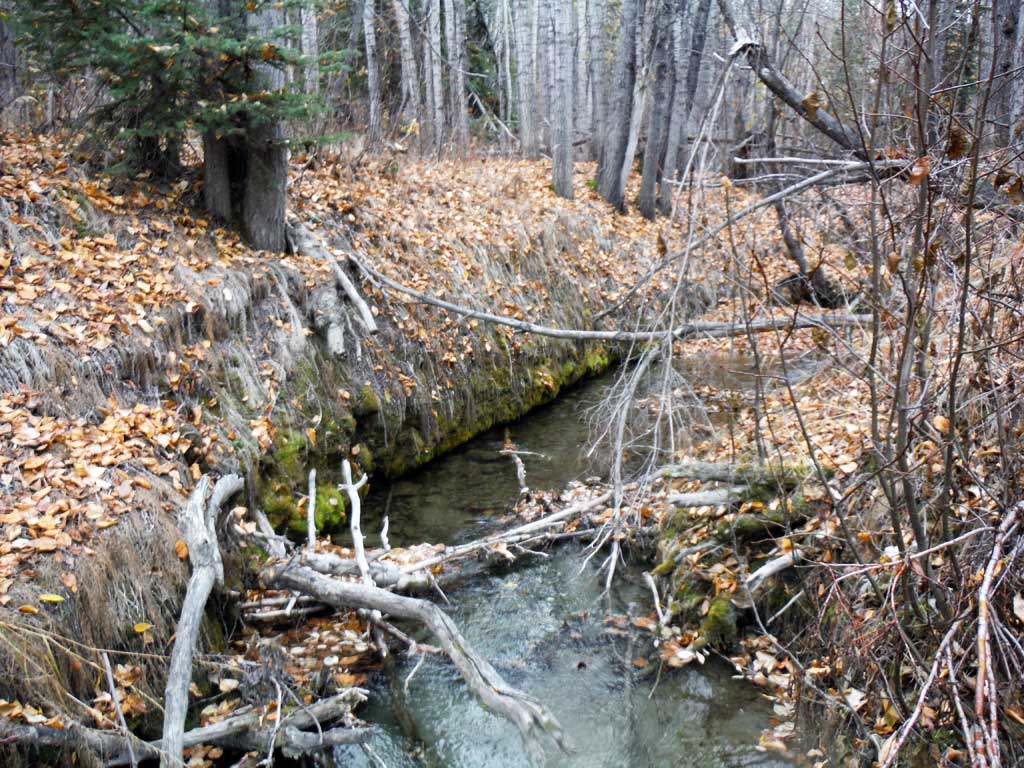
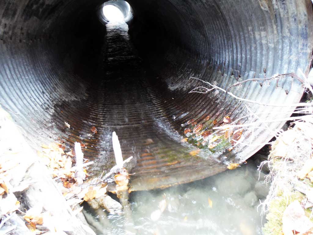
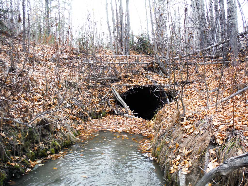
Comments: Site information submitted by the Copper River Watershed Project and USFWS. Creek flows into Little Tonsina. 2015 survey notes fish downstream. Coho and Kings below 20100710 and Dolly Varden below this site and the downstream culvert. Site has a Red Outfall. Site looks constricted and gradient may also be an issue.
Culvert Measurements
| ID: 1 | Structure Type: Circular pipe (Structural steel plate) | Fish Passage Rating: | |||||||||||||||||||||||||||||||||||||||||
|
|
|
|||||||||||||||||||||||||||||||||||||||||
Comments: Culvert outlet is breaking off, outfall visibly over 4 inches. It also looks like the site is constricted and may have a red gradient. |
|||||||||||||||||||||||||||||||||||||||||||
Culvert Observations:
|
|||||||||||||||||||||||||||||||||||||||||||
Stream Measurements
|
|
No stream width data available.
Elevations
No elevation data available.
Fish Sampling Efforts
No fish sampling occurred during this survey.
Fish Observations
No fish observations occurred during this survey.
Photos
Questions or comments about this report can be directed to dfg.dsf.webmaster@alaska.gov