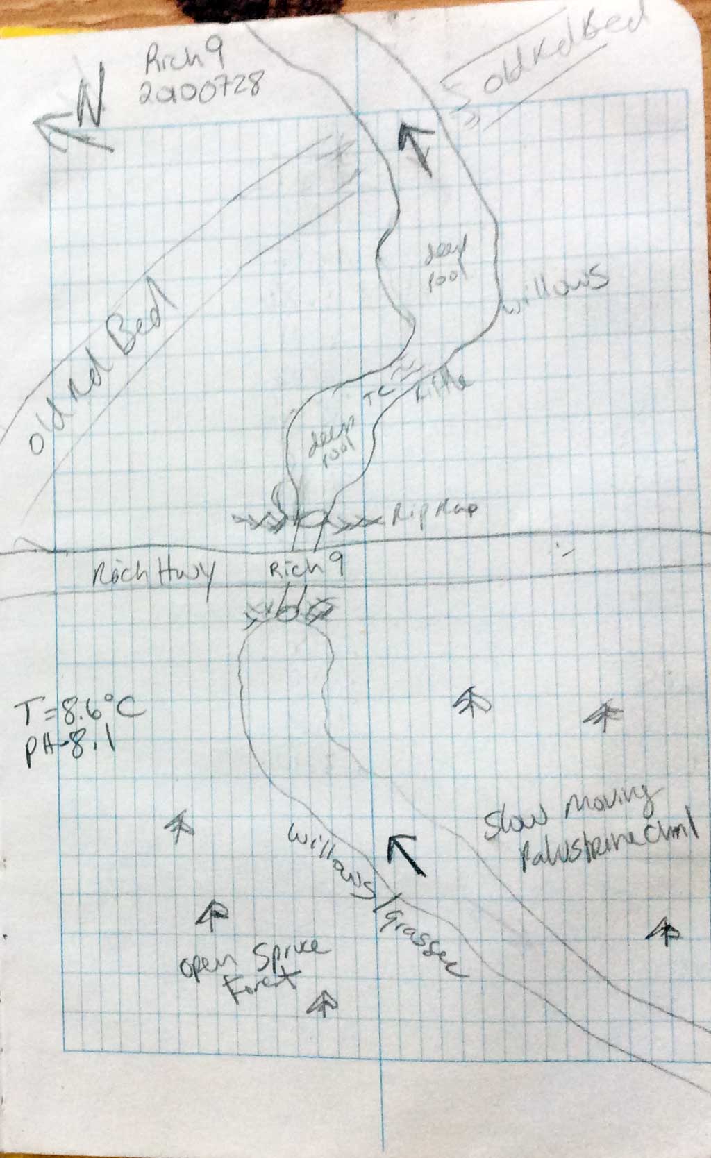
Fish Passage Site 20100728
Coordinates (dec. deg.): 62.69666°, -145.44904°
Legal Description: C011N001W32
Region: South Central
Road Name: Richardson Highway
Datum: NAD83
Quad Name / ITM: Gulkana C-3
AWC Stream #:
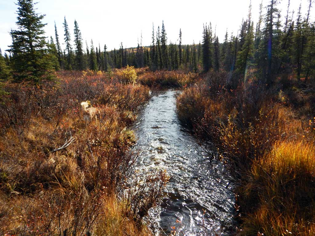
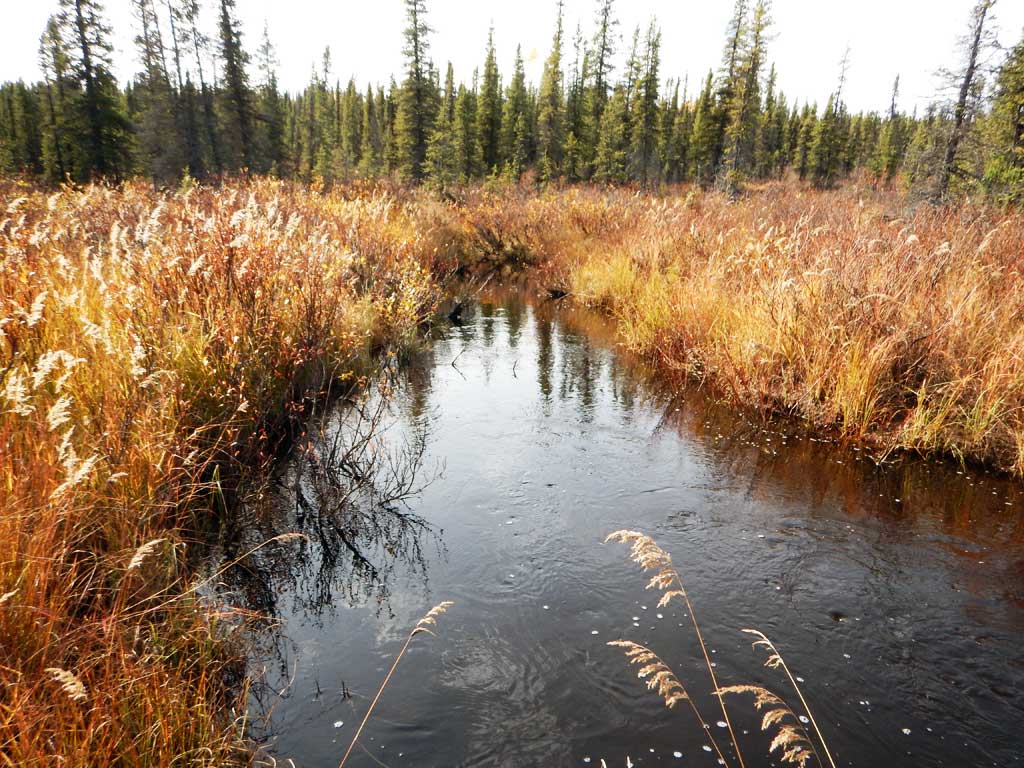
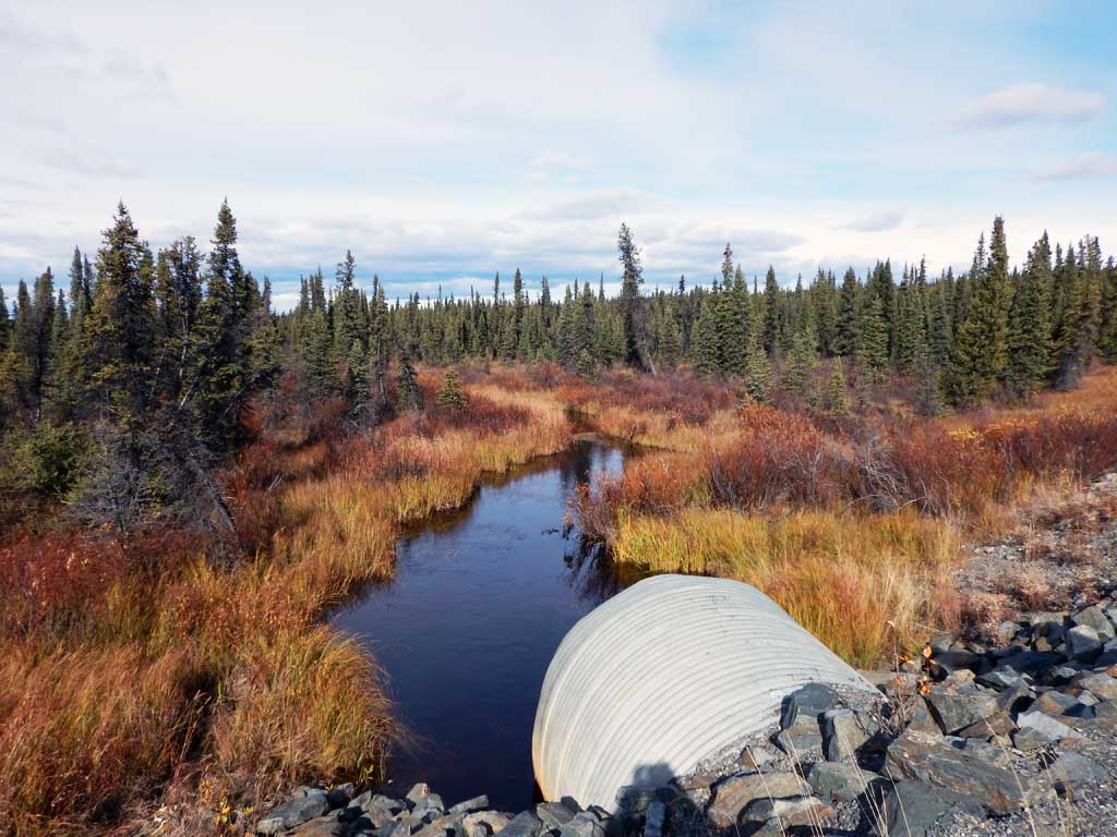
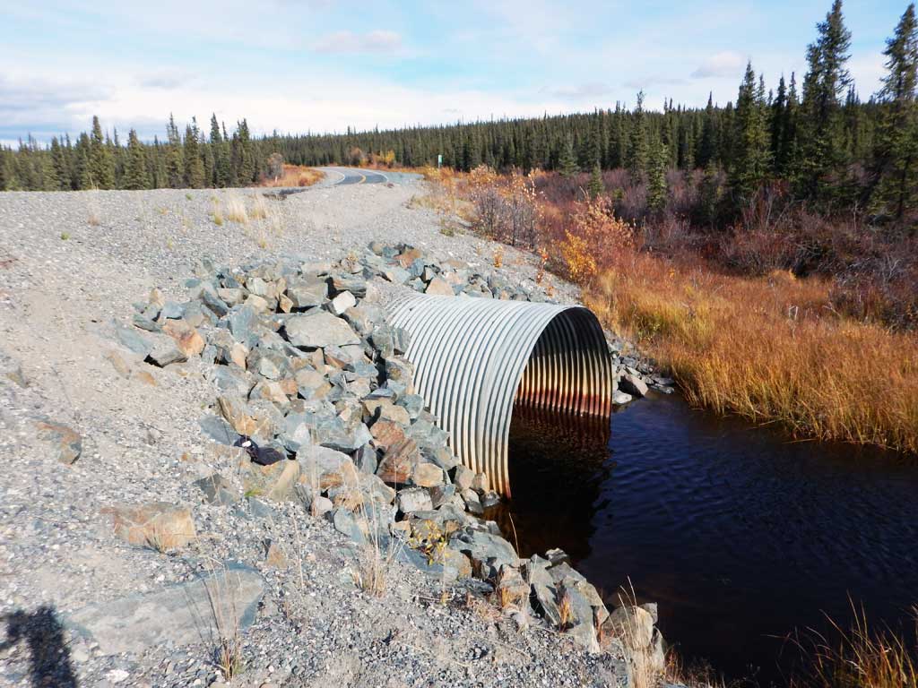
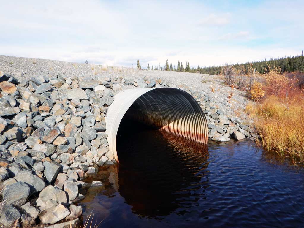
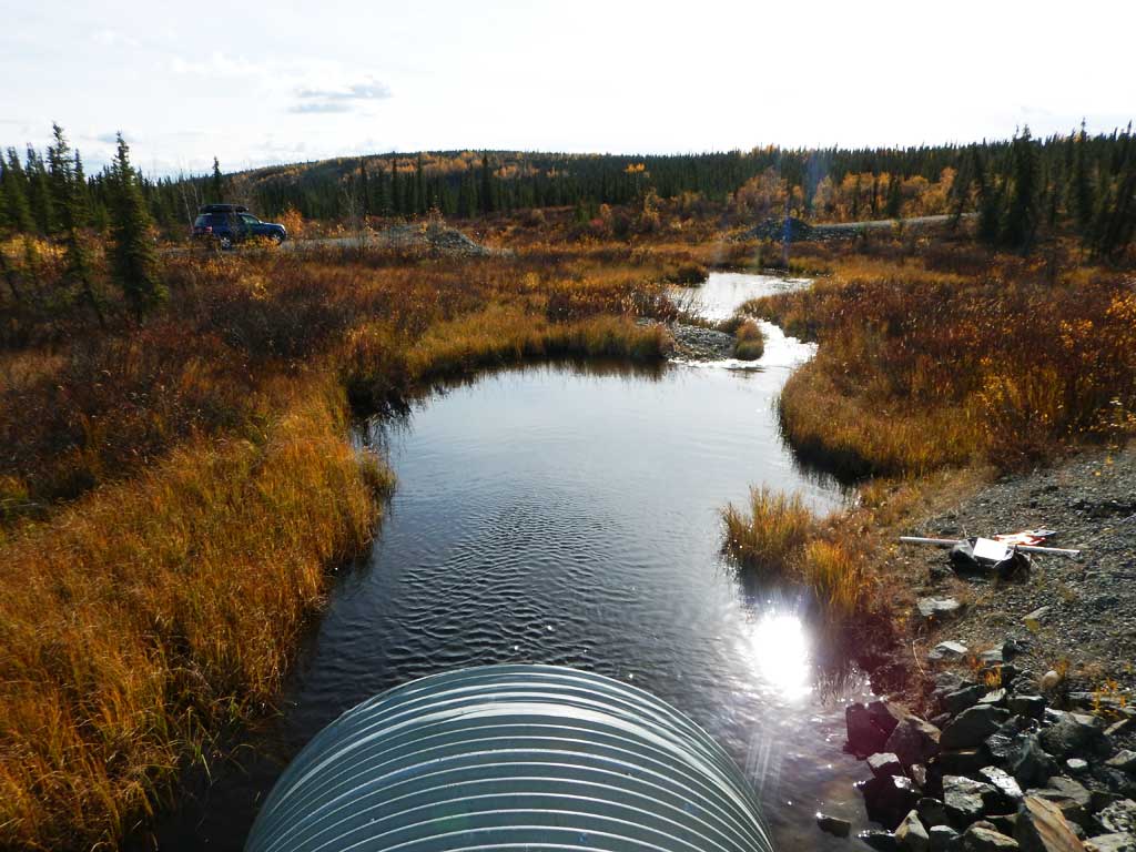
Stream Name: Haggard Creek
Elevation:
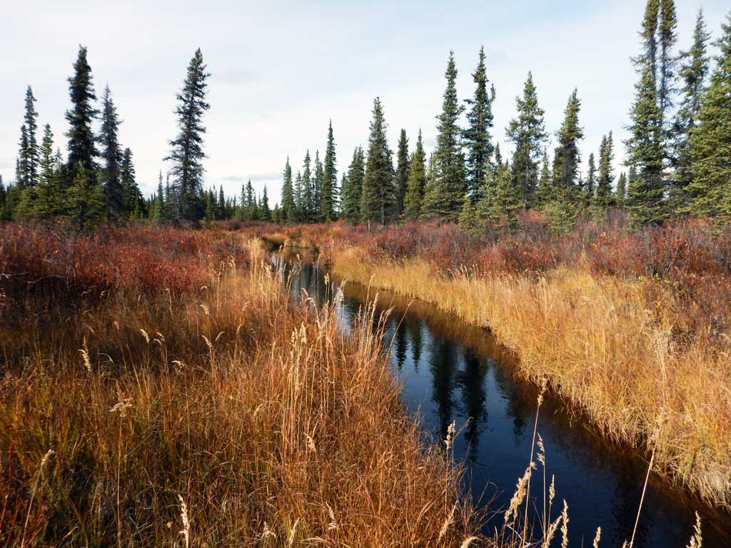
Site Comments: Tributary to Sourdough Creek
arrow to the right of the survey date below to choose a different report for this site.
Survey CRWP17-Rich9
Observers: Kirsti Jurica, Hoots Witsoe
Overall Fish Passage Rating:
Tidal: No
Backwatered: Yes
Step Pools: No
Construction Year:
Site Observations:
- Beaver Activity
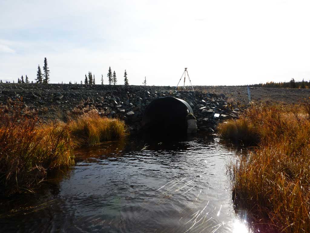
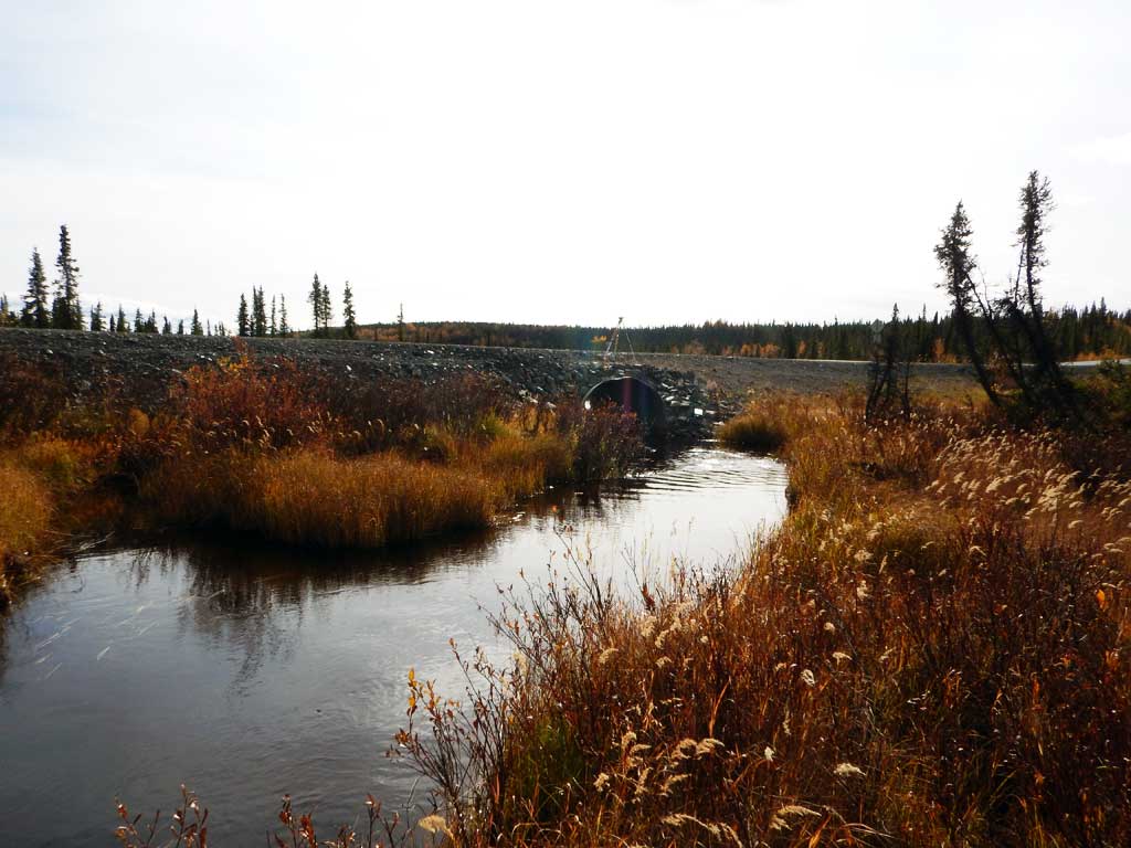
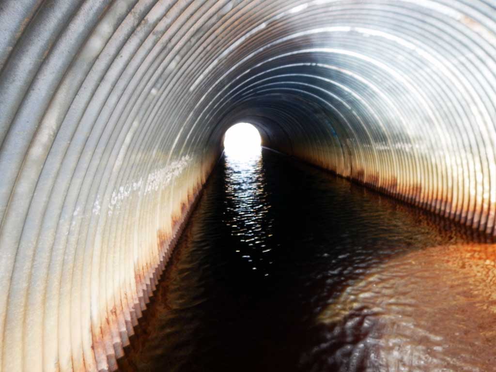
Comments: Culvert assessment performed and submitted by the Copper River Watershed Project. Slow moving deep palustrine system. Arctic grayling caught upstream. Culvert has been replaced since the 2002 assessment.
Culvert Measurements
| ID: 1 | Structure Type: Circular pipe (Corrugated steel) | Fish Passage Rating: | |||||||||||||||||||||||||||||||||||||||||
|
|
|
|||||||||||||||||||||||||||||||||||||||||
Culvert Observations:
|
|||||||||||||||||||||||||||||||||||||||||||
Stream Measurements
|
|
| Stream Width Type | Distance From Crossing (ft) |
Stream Width (ft) |
|---|---|---|
| Downstream ordinary high water | 7.50 | |
| Downstream ordinary high water | 6.80 | |
| Downstream ordinary high water | 7.50 |
Elevations
| Locator ID | Culvert Number |
River Distance (ft)1 |
Distance From Crossing (ft)2 |
Relative Elevation (ft) |
|---|---|---|---|---|
| Road Elev | 100.00 | |||
| D/S Grade Ctrl (Thalweg) | 0.00 | 87.00 | ||
| D/S Water Surface Elev | 0.00 | 90.70 | ||
| D/S Water Surface Elev | 53.00 | 91.07 | ||
| D/S Tailcrest or 1st Thalweg | 53.00 | 90.16 | ||
| Max Pool Depth | 87.00 | 85.73 | ||
| Outlet Pool Water Elev | 87.00 | 91.17 | ||
| Outlet Culvert Top | 107.00 | 96.29 | ||
| D/S Water Surface Elev | 107.00 | 91.17 | ||
| Outlet Invert (on pipe) | 107.00 | 88.22 | ||
| Inlet Culvert Invert (on pipe) | 187.00 | 88.46 | ||
| Inlet Culvert Invert | 187.00 | 88.46 | ||
| Inlet Culvert Top | 187.00 | 96.59 | ||
| U/S Water Surface Elev | 187.00 | 91.20 | ||
| U/S Water Surface Elev | 210.00 | 91.19 | ||
| U/S Grade Ctrl (Thalweg) | 210.00 | 88.12 |
Notes:
- River distance is measured continuously throughout the survey reach along the thalweg of the stream.
- Measured from each end of the crossing along the thalweg of the stream.
Fish Sampling Efforts
| Gear Type: Minnow Trap (A) | Trap Duration(h): 20.0 | |
| Gear Type: Minnow Trap (B) | Trap Duration(h): 20.0 | |
| Comments: No fish caught | ||
| Gear Type: Minnow Trap (C) | Trap Duration(h): 20.0 | |
| Gear Type: Minnow Trap (D) | Trap Duration(h): 20.0 | |
| Comments: No fish caught | ||
| Gear Type: Minnow Trap (E) | Trap Duration(h): 20.0 | |
Fish Observations
| Species: juvenile Arctic grayling | Life History: Resident | ||
| Total Fish Observed: 10 | Fish Measured: 7 | Fork Lengths (mm) Min: 50 Max: 130 Mean: 69 | |
| Collected/Observed by Gear Type: Not Recorded Minnow Trap (2) Not Recorded Minnow Trap (5) Not Recorded Minnow Trap (3) | |||
Photos
Questions or comments about this report can be directed to dfg.dsf.webmaster@alaska.gov