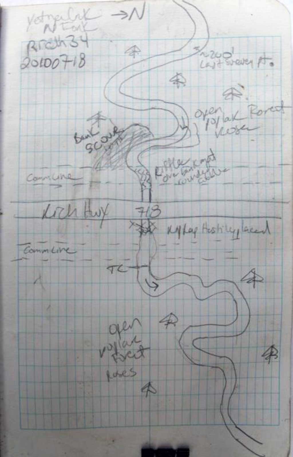
Fish Passage Site 20100718
Coordinates (dec. deg.): 61.99013°, -145.35716°
Legal Description: C002N001W02
Region: South Central
Road Name: Richardson Highway
Datum: NAD83
Quad Name / ITM: Valdez D-4
AWC Stream #:
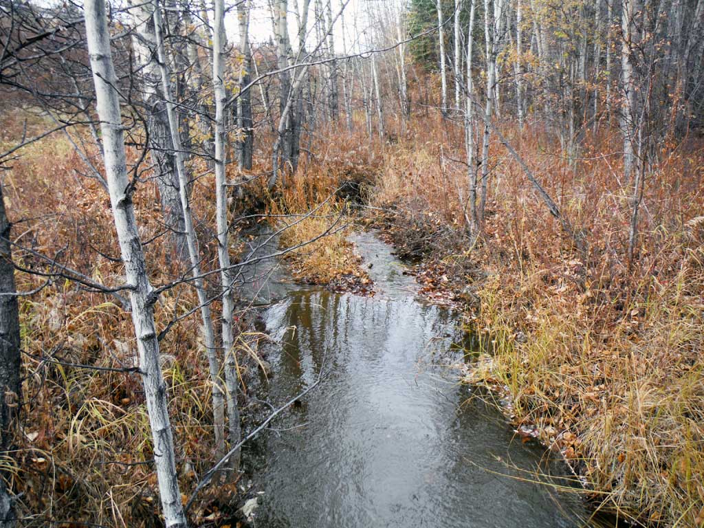
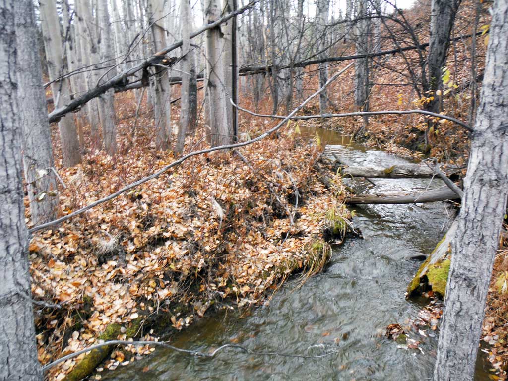
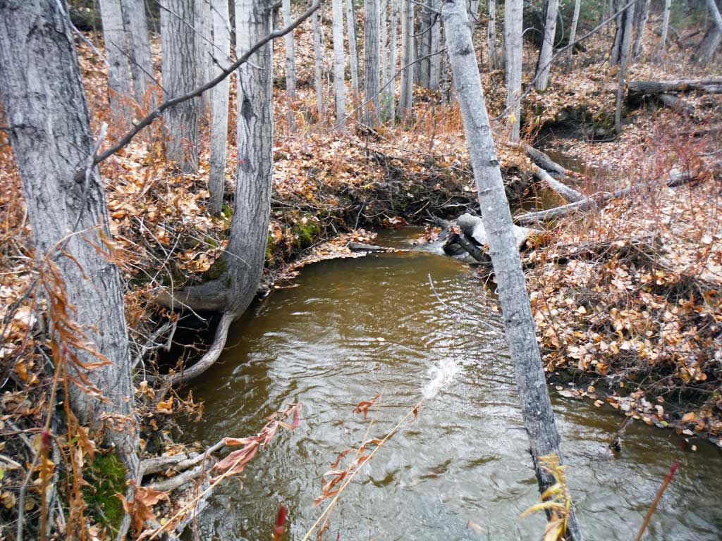
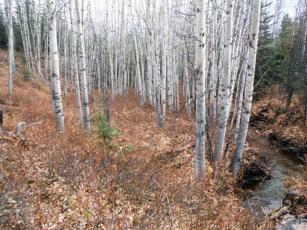
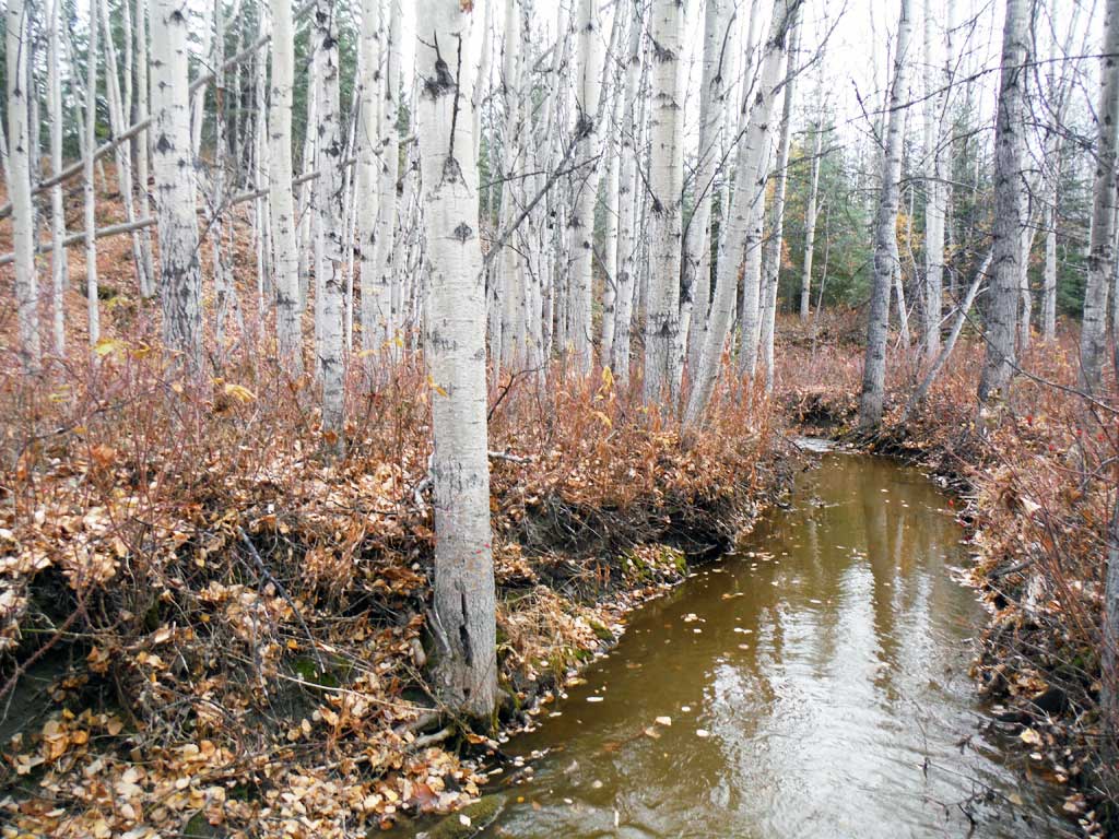
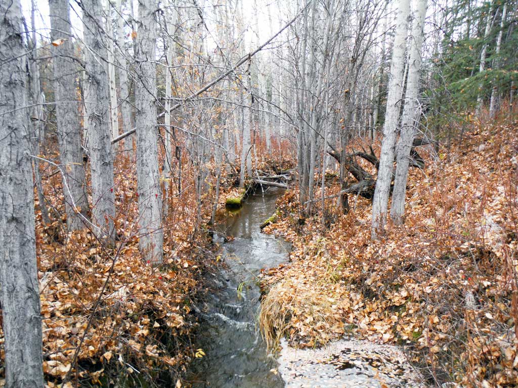
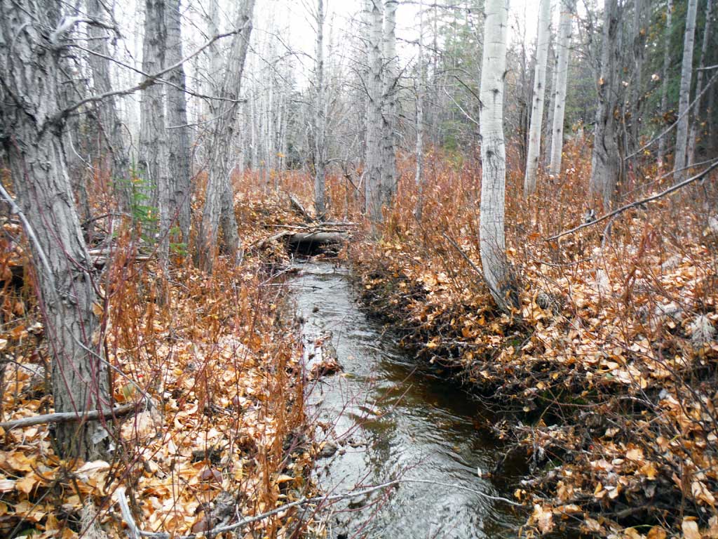
Stream Name: Yetna Creek
Elevation:
Site Comments: None
arrow to the right of the survey date below to choose a different report for this site.
Survey UPDATE-RICH34
Project Supervisor: Gillian O'Doherty, ADFG
Observers: Kirsti Jurica
Overall Fish Passage Rating:
Tidal: No
Backwatered: No
Step Pools: No
Construction Year:
Site Observations:
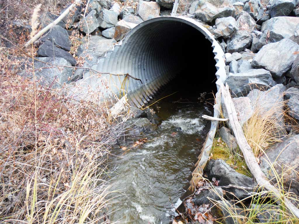
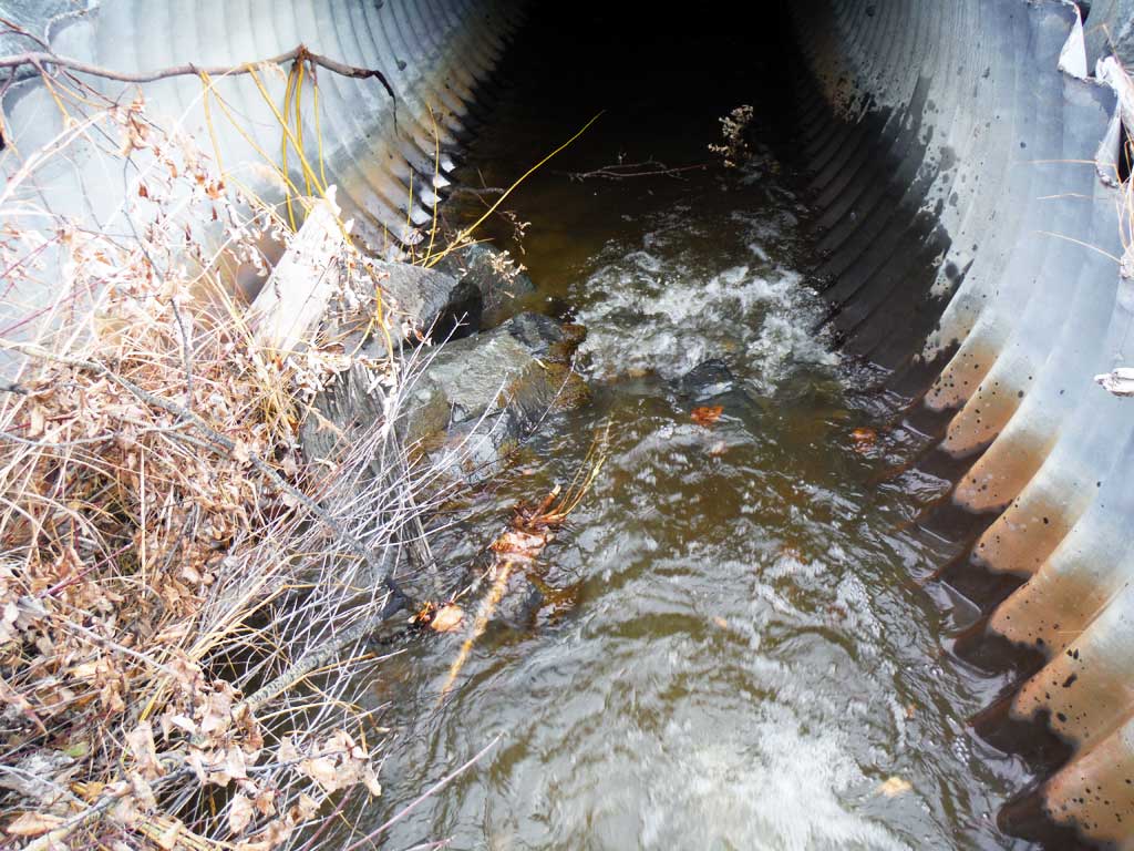
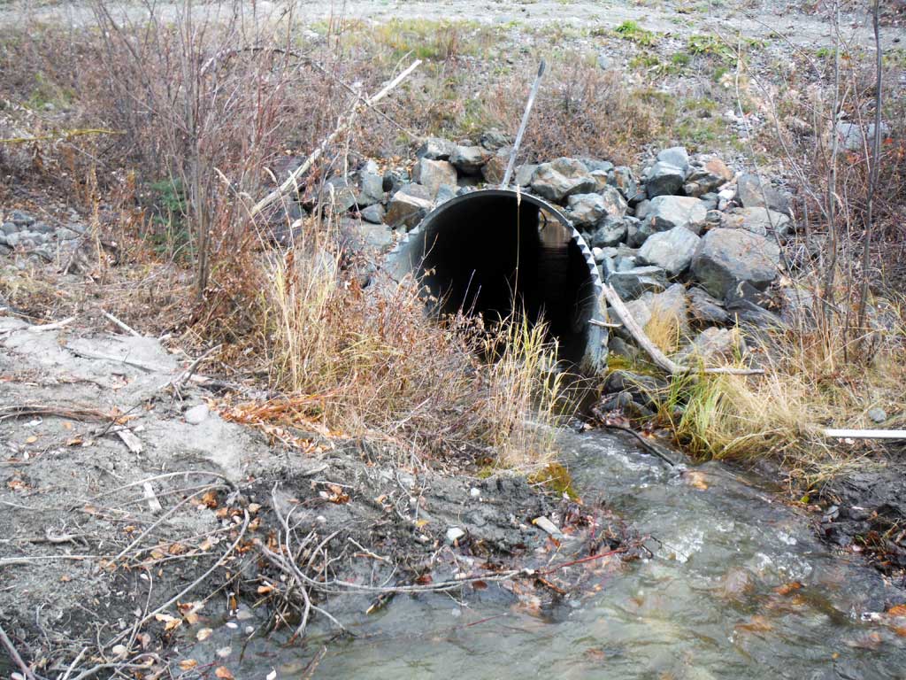
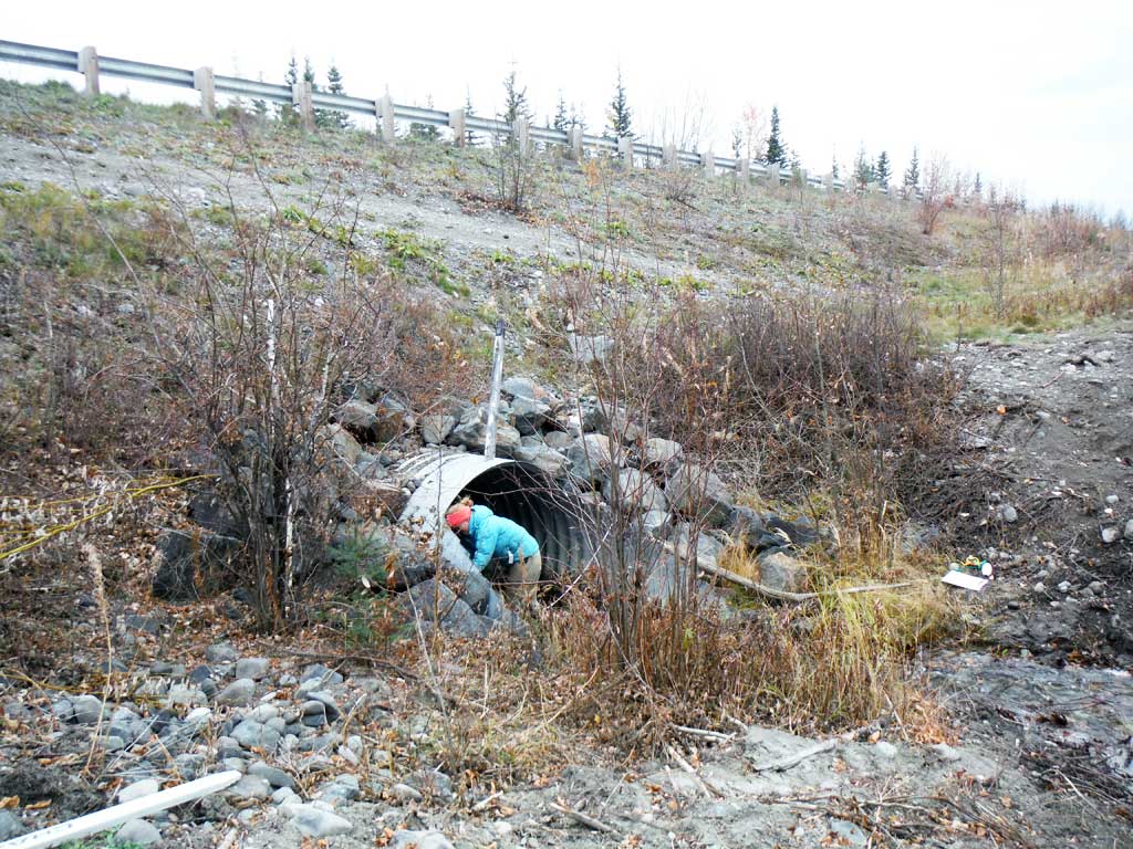
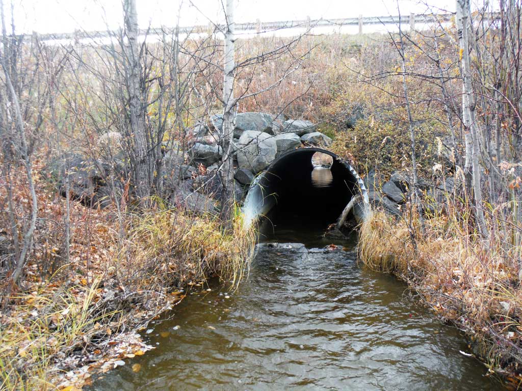
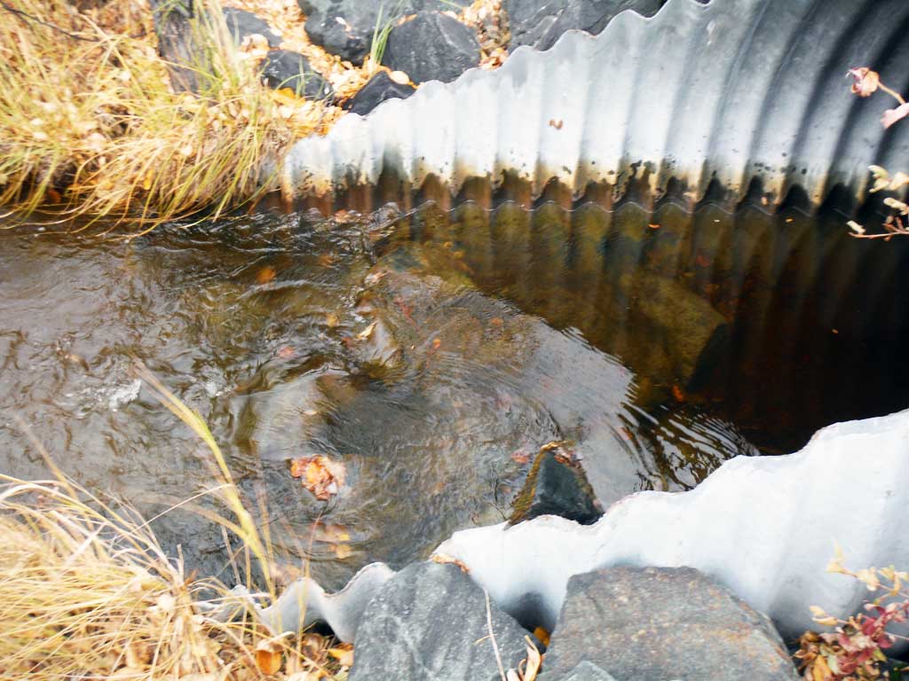
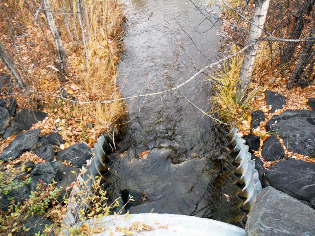
- Culvert is poorly aligned
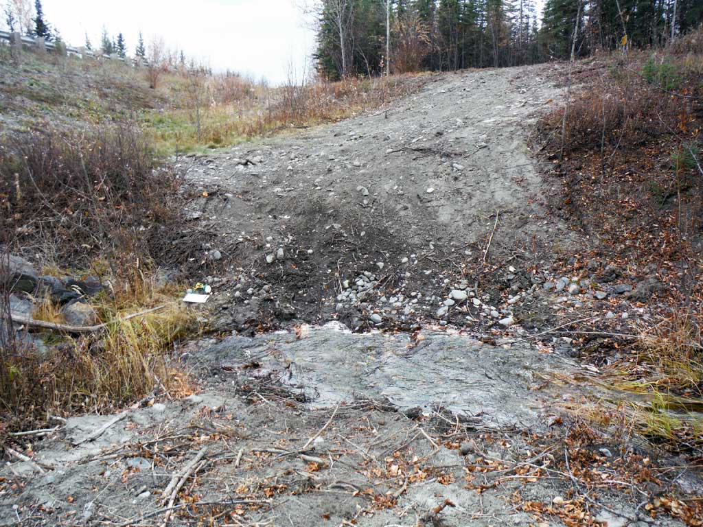
Comments: This assessment was performed by the Copper River Watershed Project. Large rip rap rocks at inlet and outlet
Culvert Measurements
| ID: 1 | Structure Type: Circular pipe (Structural steel plate) | Fish Passage Rating: | |||||||||||||||||||||||||||||||||||||||||
|
|
|
|||||||||||||||||||||||||||||||||||||||||
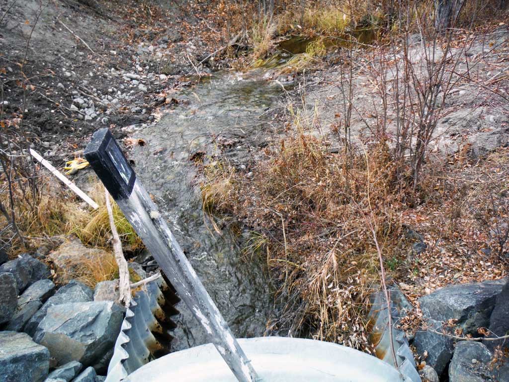
Comments: Rip rap at outlet causes an outlet riffle, but also looks like it hold back water through most of the culvert. Rip rap at inlet causing an a small hydralic jump in the miter. Stream slope taken with clinometer. |
|||||||||||||||||||||||||||||||||||||||||||
Culvert Observations:
|
|||||||||||||||||||||||||||||||||||||||||||
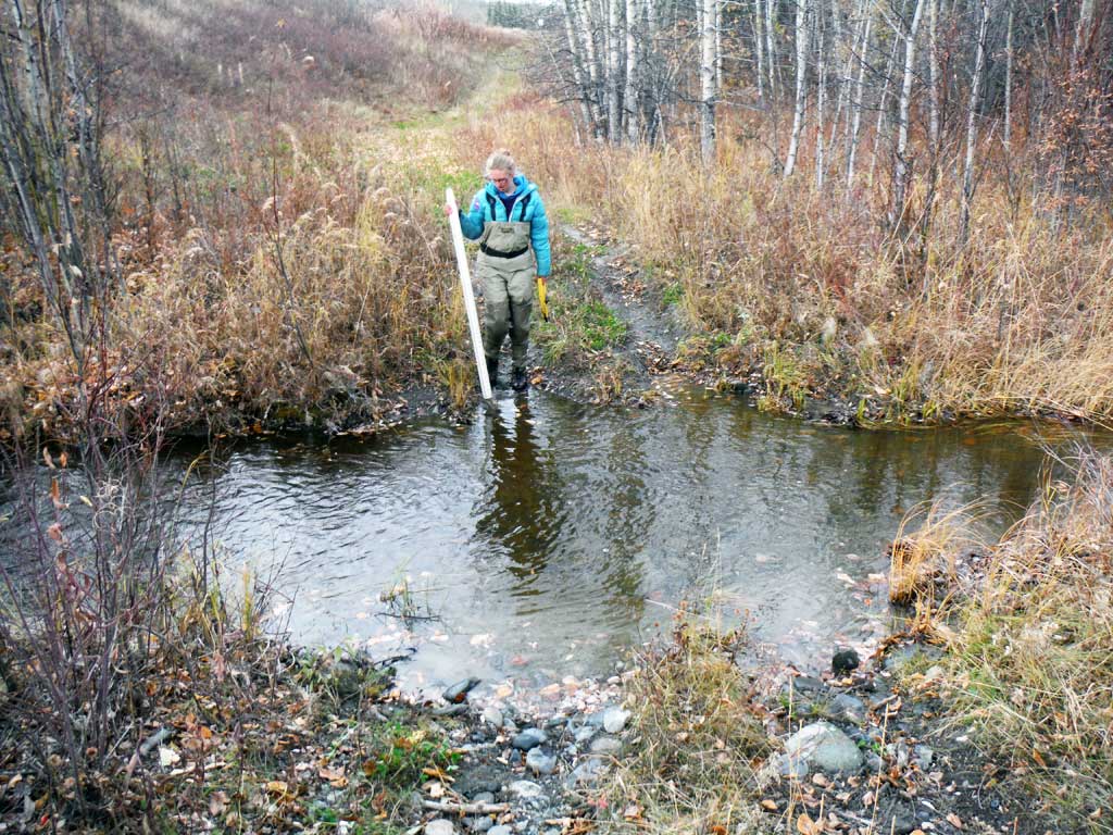
Stream Measurements
|
|
| Stream Width Type | Distance From Crossing (ft) |
Stream Width (ft) |
|---|---|---|
| Downstream ordinary high water | 5.50 | |
| Downstream ordinary high water | 7.20 | |
| Downstream ordinary high water | 5.60 | |
| Upstream ordinary high water | 5.10 | |
| Upstream ordinary high water | 5.00 | |
| Upstream ordinary high water | 4.70 | |
| Upstream ordinary high water | 5.20 |
Elevations
| Locator ID | Culvert Number |
River Distance (ft)1 |
Distance From Crossing (ft)2 |
Relative Elevation (ft) |
|---|---|---|---|---|
| Road Elev | 107.78 | |||
| D/S Grade Ctrl (Thalweg) | 0.00 | 86.14 | ||
| D/S Water Surface Elev | 0.00 | 87.33 | ||
| D/S Tailcrest or 1st Thalweg | 99.00 | 88.38 | ||
| D/S Water Surface Elev | 99.00 | 88.88 | ||
| Max Pool Depth | 122.70 | 86.76 | ||
| Outlet Pool Water Elev | 122.70 | 88.92 | ||
| D/S Water Surface Elev | 126.60 | 88.94 | ||
| Outlet Invert | 126.60 | 87.73 | ||
| Outlet Culvert Top | 135.20 | 93.50 | ||
| D/S Water Surface Elev | 135.20 | 89.04 | ||
| D/S Thalweg (below top of culvert) | 135.20 | 87.72 | ||
| U/S Thalweg (below top of culvert) | 240.00 | 88.49 | ||
| U/S Water Surface Elev | 240.00 | 89.19 | ||
| Inlet Culvert Top | 240.00 | 94.37 | ||
| U/S Water Surface Elev | 248.60 | 89.59 | ||
| Inlet Culvert Invert | 248.60 | 88.92 | ||
| U/S Water Surface Elev | 252.00 | 89.88 | ||
| U/S Grade Ctrl (Thalweg) | 252.00 | 89.36 | ||
| U/S Grade Ctrl (Thalweg) | 272.00 | 89.99 | ||
| U/S Water Surface Elev | 272.00 | 90.84 | ||
| U/S Water Surface Elev | 323.00 | 90.88 | ||
| U/S Grade Ctrl (Thalweg) | 323.00 | 88.56 | ||
| U/S Grade Ctrl (Thalweg) | 431.00 | 90.97 | ||
| U/S Water Surface Elev | 431.00 | 91.56 |
Notes:
- River distance is measured continuously throughout the survey reach along the thalweg of the stream.
- Measured from each end of the crossing along the thalweg of the stream.
Fish Sampling Efforts
| Gear Type: Minnow Trap (A) | Trap Duration(h): 19.0 | |
| Comments: 3 traps set upstream, no fish caught or observed | ||
| Gear Type: Minnow Trap (B) | Trap Duration(h): 19.0 | |
| Comments: 3 traps set downstream, no fish caught or observed | ||
Fish Observations
No fish observations occurred during this survey.
Photos


Questions or comments about this report can be directed to dfg.dsf.webmaster@alaska.gov