Fish Passage Site 20100714
Coordinates (dec. deg.): 61.79327°, -145.18979°
Legal Description: C001S001E11
Region: South Central
Road Name: Richardson Highway
Datum: NAD83
Quad Name / ITM: Valdez D-4
AWC Stream #:
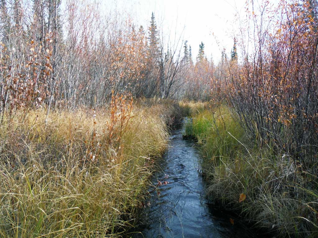
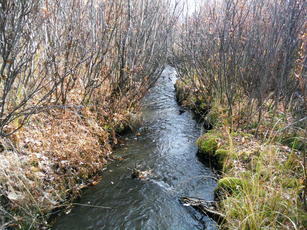
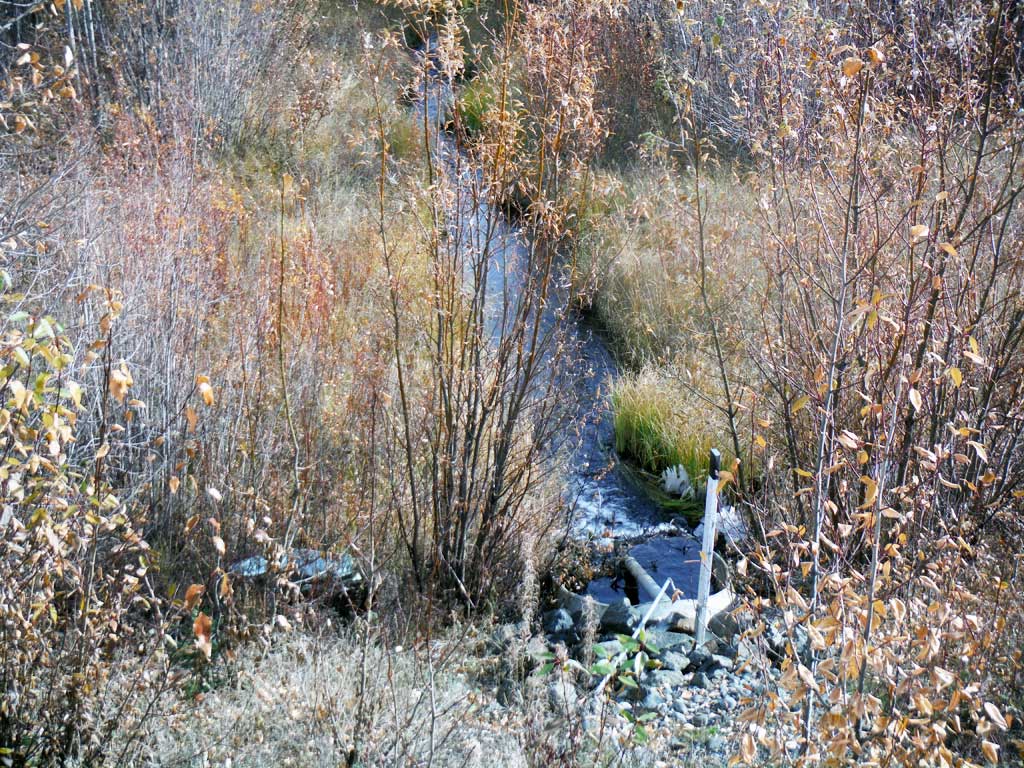
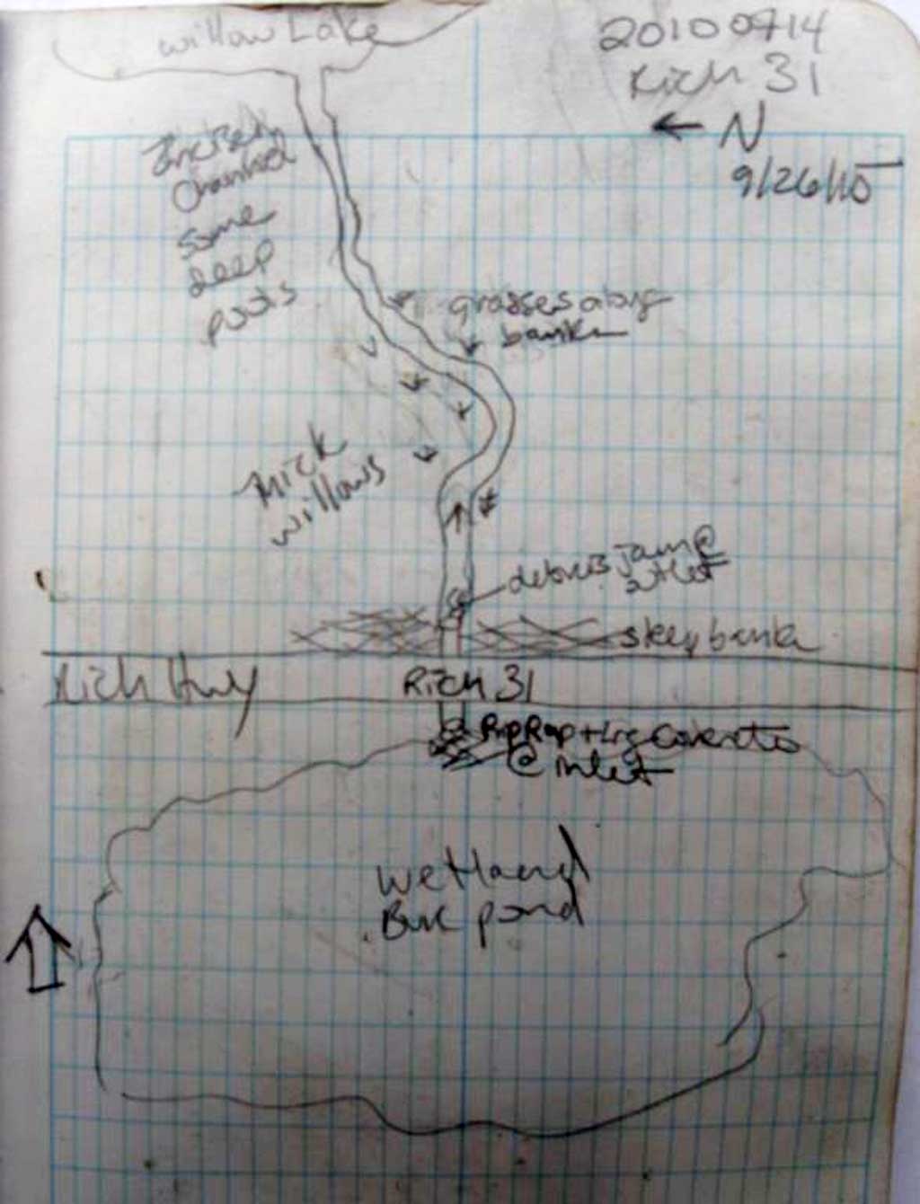
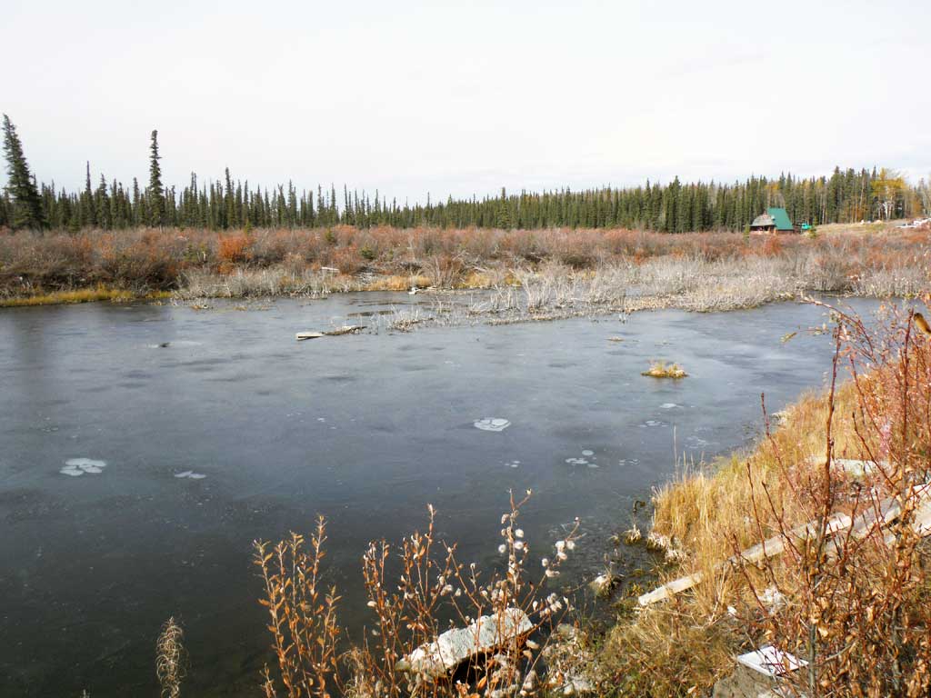
Stream Name: Willow Lake inlet
Elevation:
Site Comments: Milepost 88.8
arrow to the right of the survey date below to choose a different report for this site.
Survey UPDATE-RICH31
Project Supervisor: Gillian O'Doherty, ADFG
Observers: Kirsti Jurica
Overall Fish Passage Rating:
Tidal: No
Backwatered: No
Step Pools: No
Construction Year:
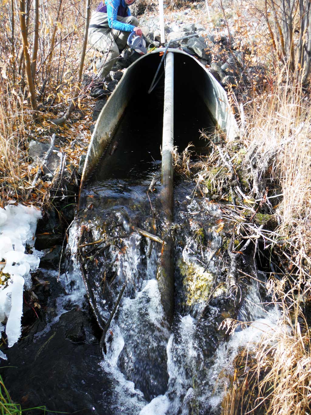
Site Observations:
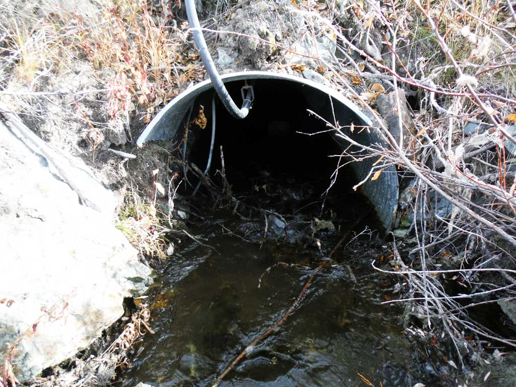
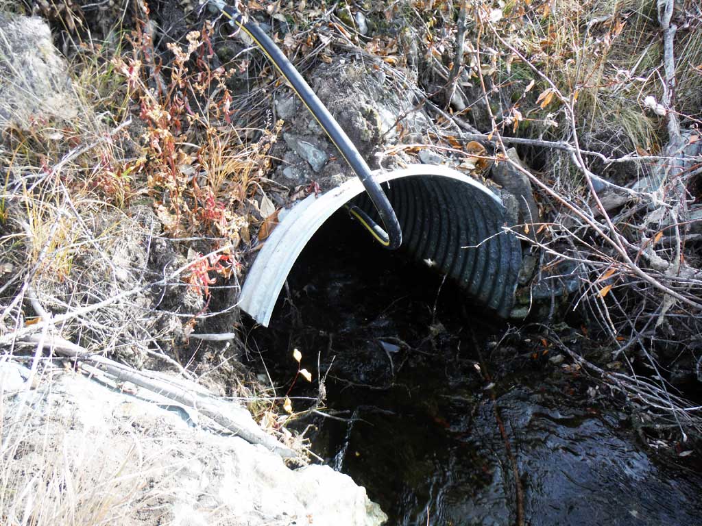
- Culvert gradient red
- Woody Debris
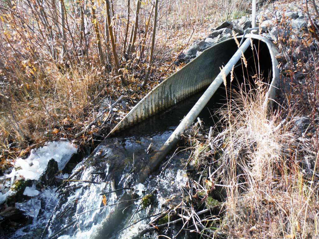
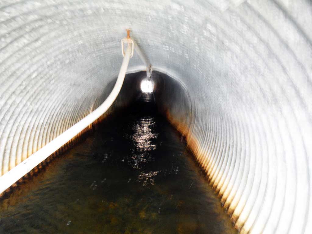
- Culvert sagging in middle
- Outfall height red
Comments: This assessment was conducted by the Copper River Watershed Project.
Culvert Measurements
| ID: 1 | Structure Type: Circular pipe (Corrugated steel) | Fish Passage Rating: | |||||||||||||||||||||||||||||||||||||||||
|
|
|
|||||||||||||||||||||||||||||||||||||||||
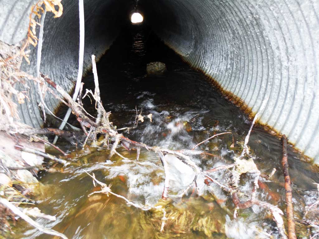
Comments: There is no sediment at outlet but there is a large debris jam at the end of the culvert miter that is about 1.19 feet deep. Outfall is a casacade over debris jam. Substrate gradient is 2.7%. Stream slope calculated with clinometer. |
|||||||||||||||||||||||||||||||||||||||||||
Culvert Observations:
|
|||||||||||||||||||||||||||||||||||||||||||
Stream Measurements
|
|
| Stream Width Type | Distance From Crossing (ft) |
Stream Width (ft) |
|---|---|---|
| Downstream ordinary high water | 4.10 | |
| Downstream ordinary high water | 3.70 | |
| Downstream ordinary high water | 4.20 |
Elevations
| Locator ID | Culvert Number |
River Distance (ft)1 |
Distance From Crossing (ft)2 |
Relative Elevation (ft) |
|---|---|---|---|---|
| Road Elev | 100.00 | |||
| D/S Grade Ctrl (Thalweg) | 0.00 | 80.56 | ||
| D/S Water Surface Elev | 0.00 | 81.36 | ||
| D/S Grade Ctrl (Thalweg) | 34.00 | 81.58 | ||
| D/S Water Surface Elev | 34.00 | 82.17 | ||
| D/S Water Surface Elev | 68.00 | 82.32 | ||
| D/S Grade Ctrl (Thalweg) | 68.00 | 81.38 | ||
| D/S Thalweg (Outlet Riffle) | 84.00 | 81.97 | ||
| D/S Water Surface Elev | 84.00 | 82.49 | ||
| D/S Water Surface Elev | 88.00 | 82.65 | ||
| Outlet Invert | 88.00 | 82.47 | ||
| D/S Grade Ctrl (Thalweg) (Top of debris jam) | 90.00 | 83.21 | ||
| D/S Water Surface Elev | 90.00 | 83.58 | ||
| D/S Water Surface Elev | 99.00 | 83.84 | ||
| D/S Thalweg (directly below top of culvert) | 99.00 | 82.40 | ||
| Outlet Culvert Top | 99.00 | 86.50 | ||
| Inlet Culvert Top | 203.00 | 88.50 | ||
| Inlet Culvert Invert (On substrate) | 203.00 | 85.62 | ||
| U/S Water Surface Elev | 203.00 | 85.92 | ||
| U/S Water Surface Elev | 208.00 | 86.10 | ||
| U/S Grade Ctrl (Thalweg) | 208.00 | 85.14 | ||
| U/S Water Surface Elev | 218.00 | 86.12 | ||
| U/S Grade Ctrl (Thalweg) | 218.00 | 84.03 |
Notes:
- River distance is measured continuously throughout the survey reach along the thalweg of the stream.
- Measured from each end of the crossing along the thalweg of the stream.
Fish Sampling Efforts
| Gear Type: Minnow Trap (A) | Trap Duration(h): 18.0 | |
| Comments: 3 traps set upstream, no fish caught or observed. | ||
| Gear Type: Minnow Trap (B) | Trap Duration(h): 18.0 | |
| Comments: 2 traps set downstream, no fish caught or observed. | ||
Fish Observations
No fish observations occurred during this survey.
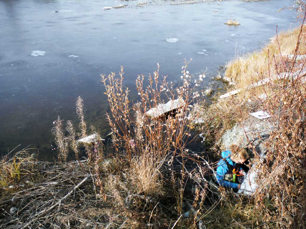
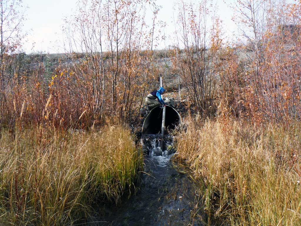
Photos

Questions or comments about this report can be directed to dfg.dsf.webmaster@alaska.gov