Fish Passage Site 20100612
Coordinates (dec. deg.): 62.56504°, -143.43504°
Legal Description: C009N011E18
Region: South Central
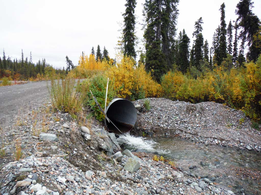
Road Name: Nabesna Road
Datum: NAD83
Quad Name / ITM: Nabesna C-5
AWC Stream #:
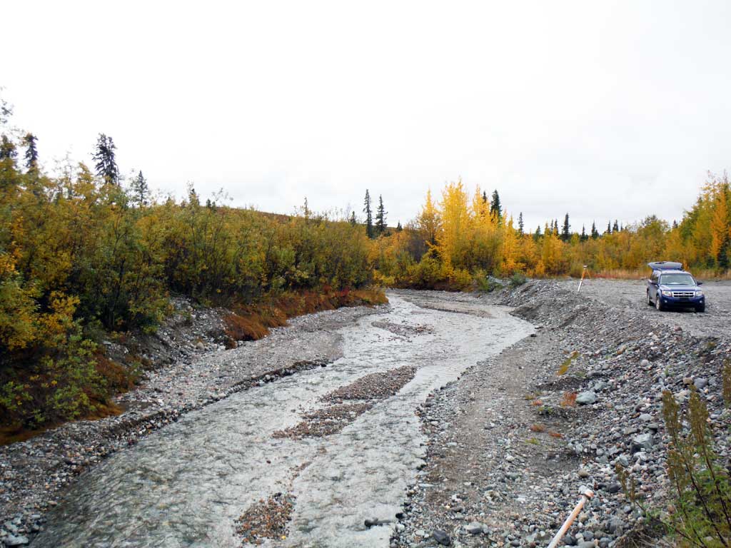
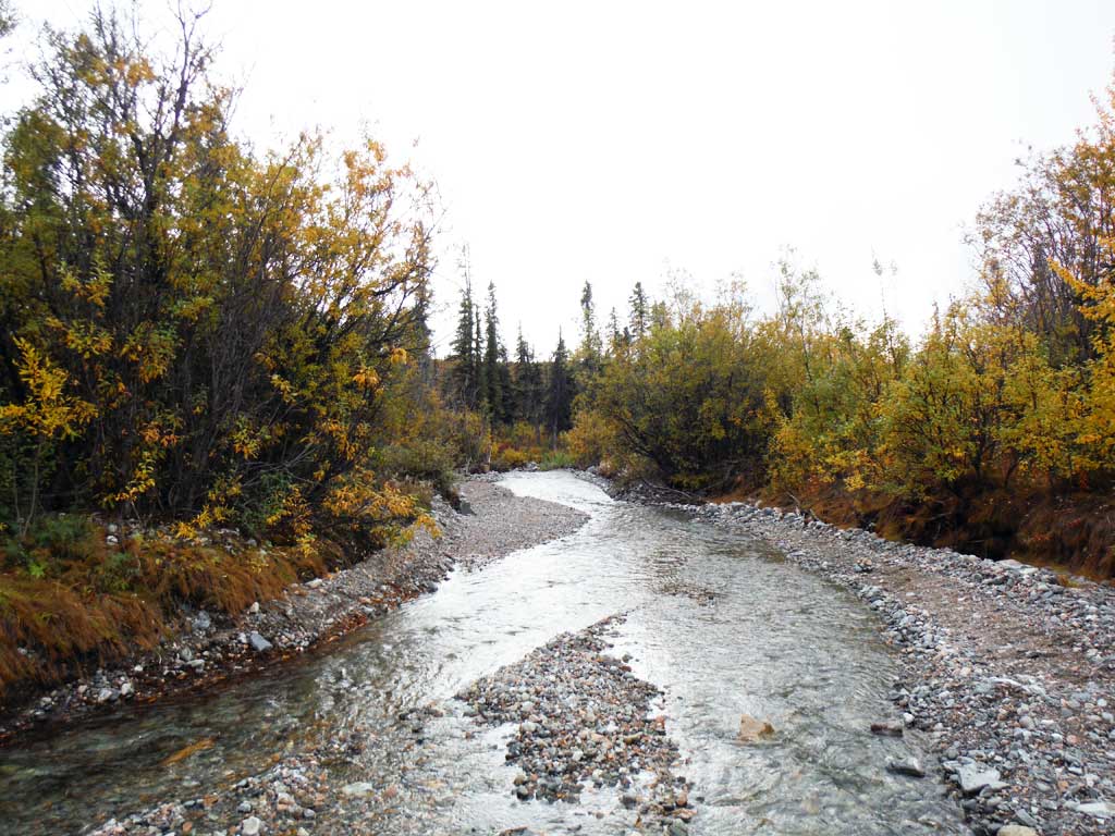
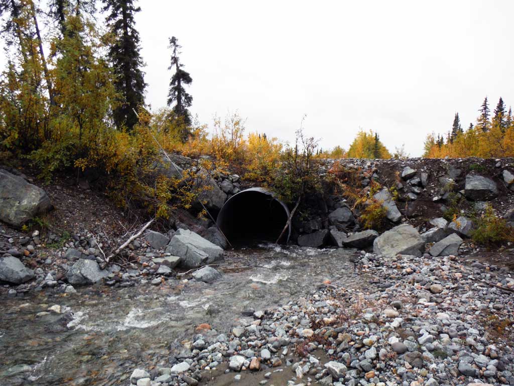
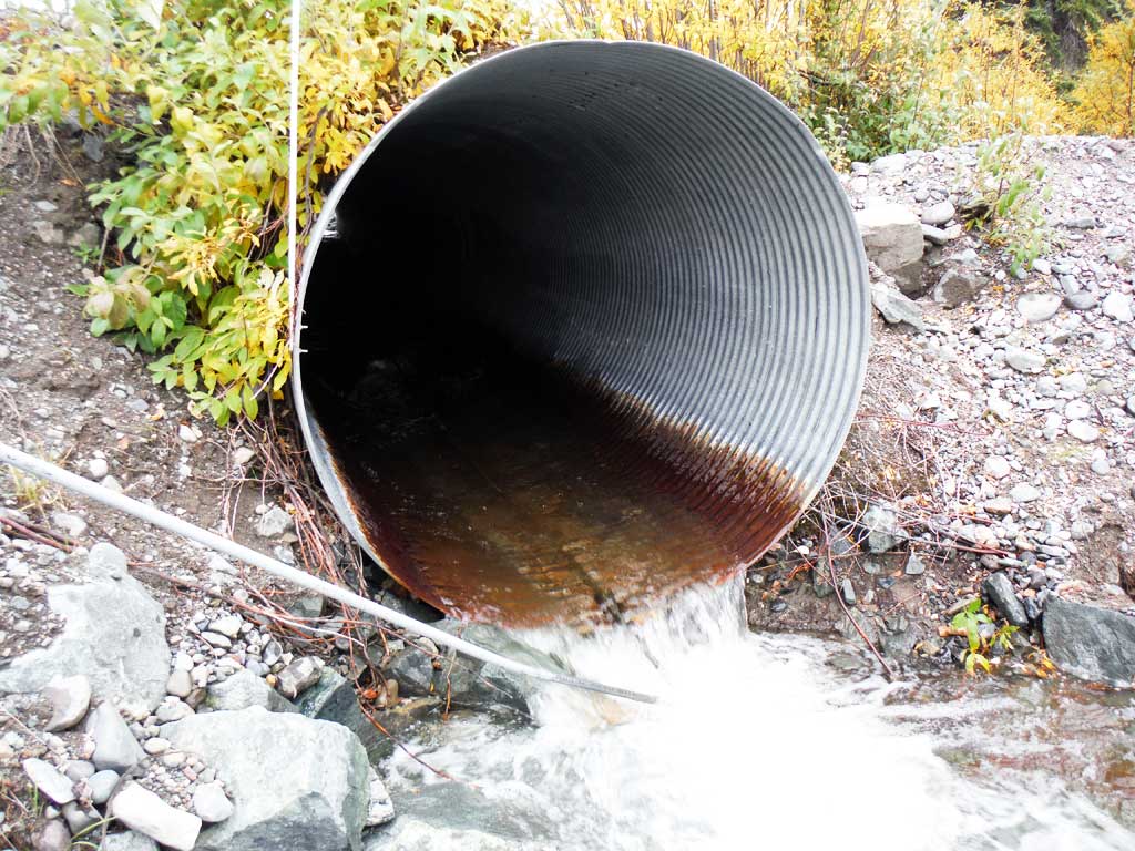
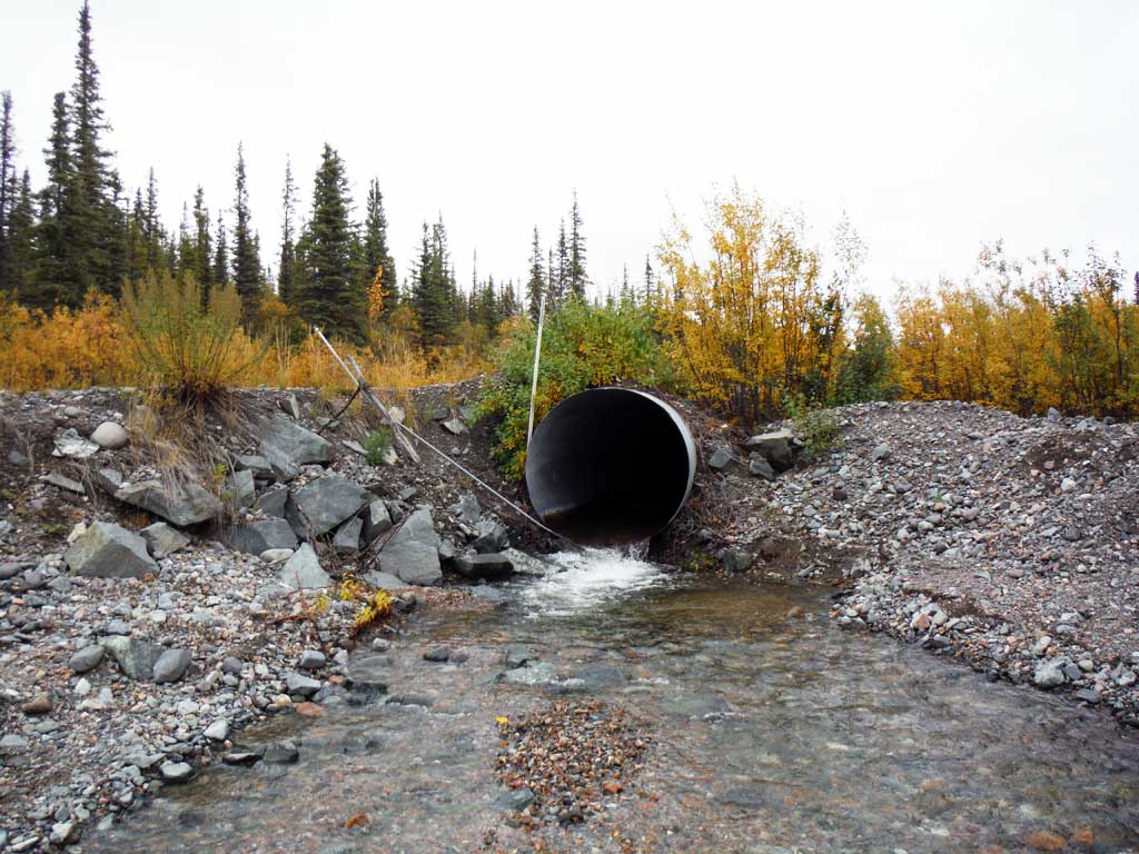
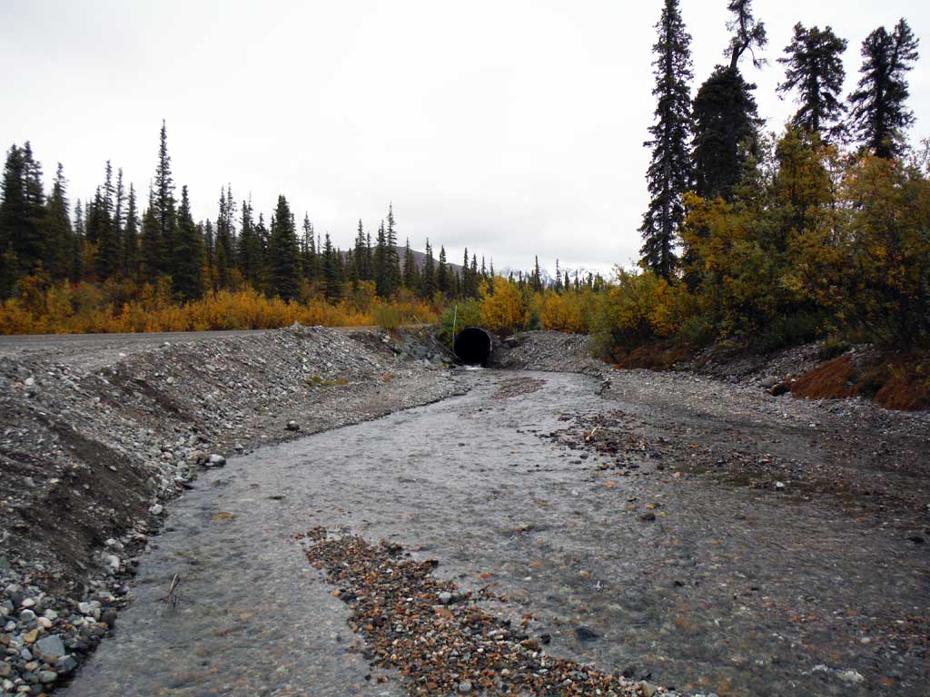
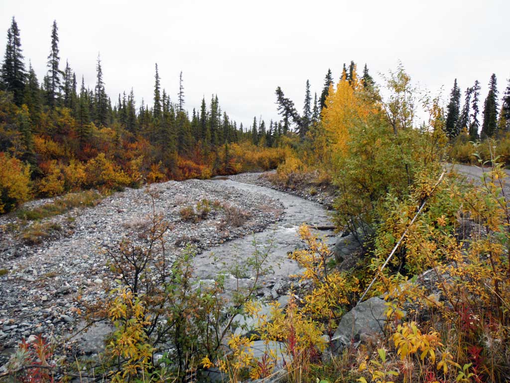
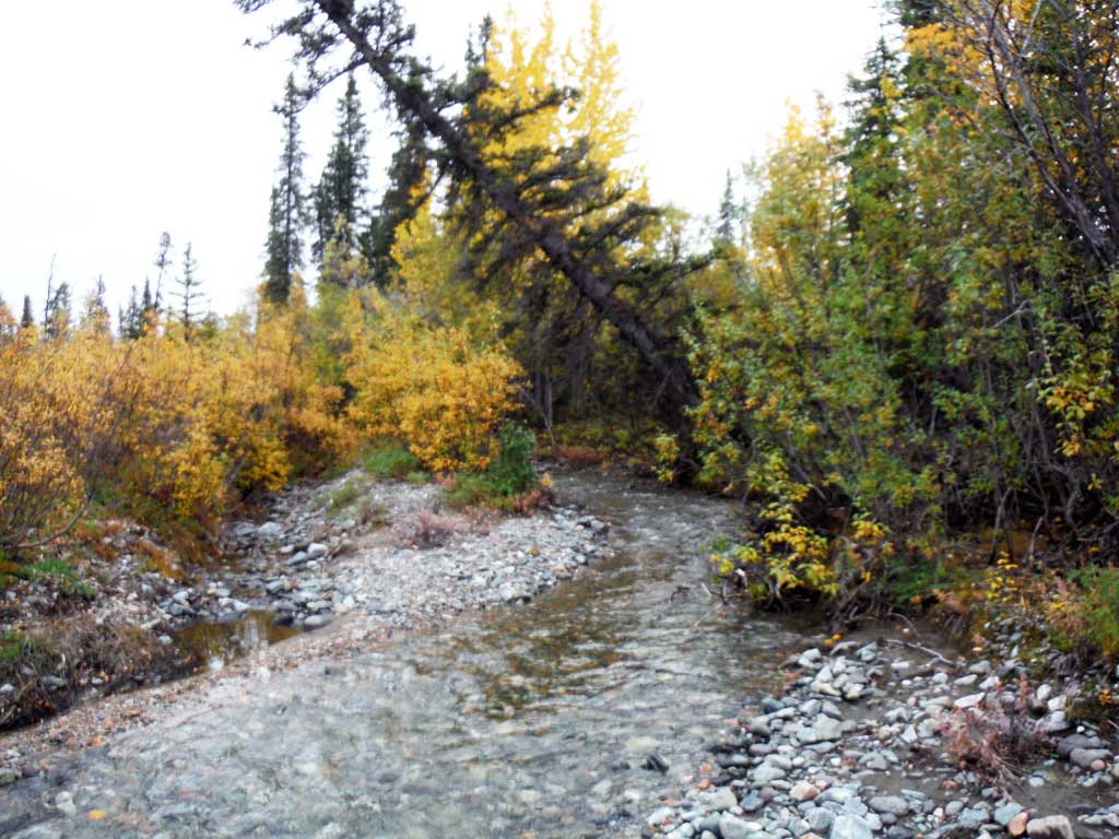
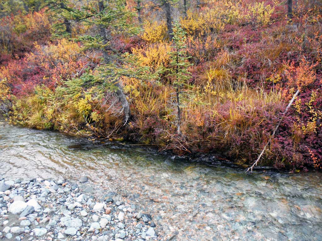
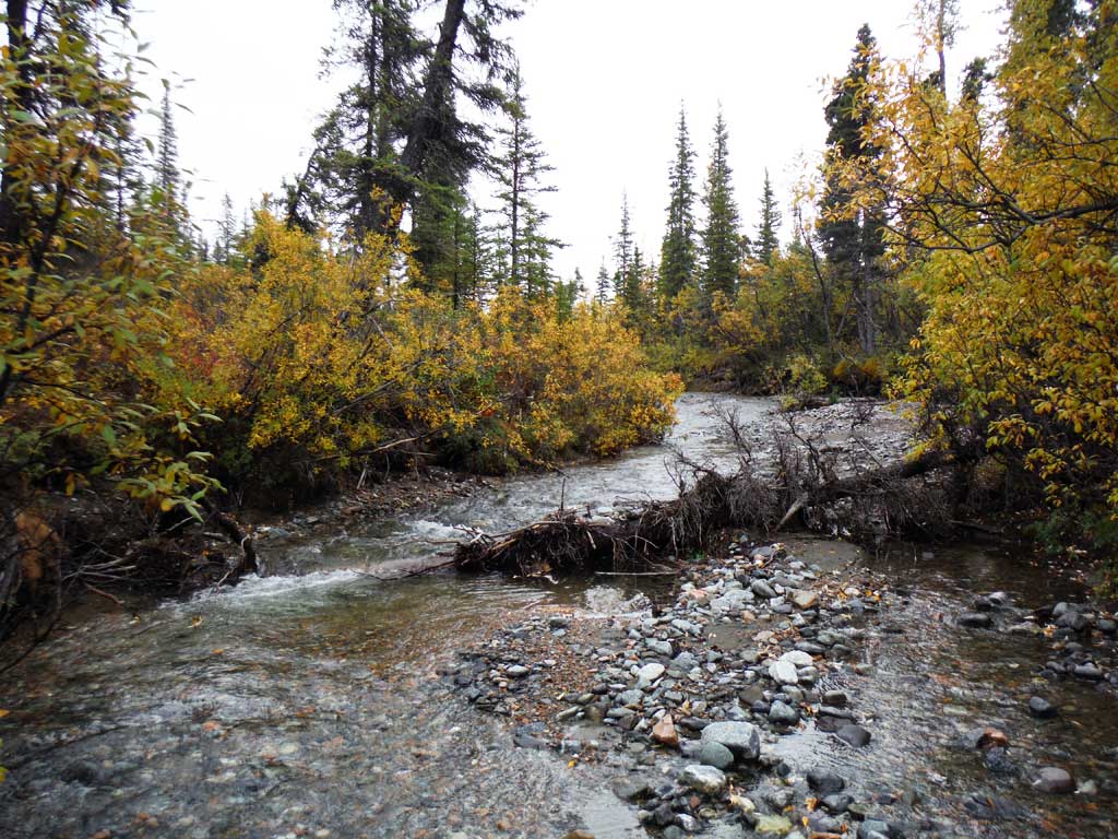
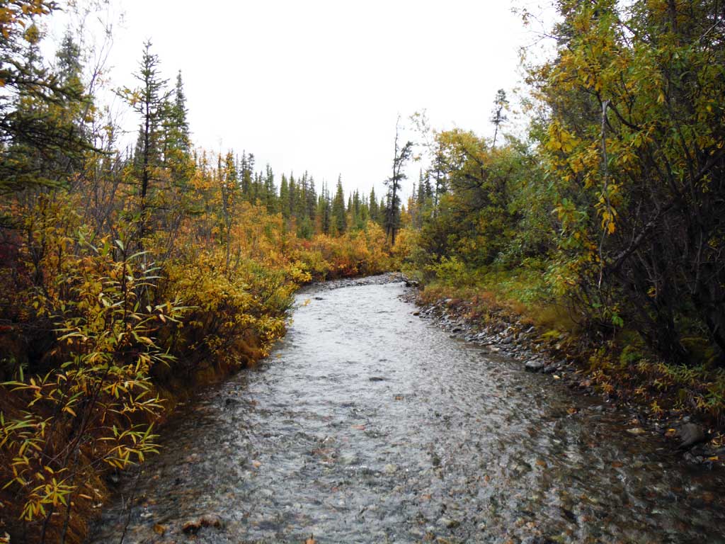
Stream Name: Rock Creek
Elevation:
Site Comments: None
arrow to the right of the survey date below to choose a different report for this site.
Survey UPDATE-NAB4
Project Supervisor: Gillian O'Doherty, ADFG
Observers: Andrew Kastning
Overall Fish Passage Rating:
Tidal: No
Backwatered: No
Step Pools: No
Construction Year:
Site Observations:
- Culvert gradient gray
- Outfall height red
- Constriction ratio red
- Inlet perch
- Road bank erosion
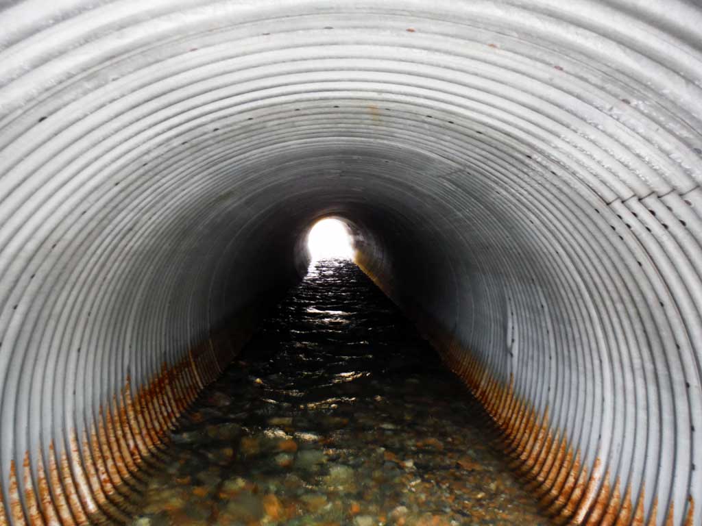
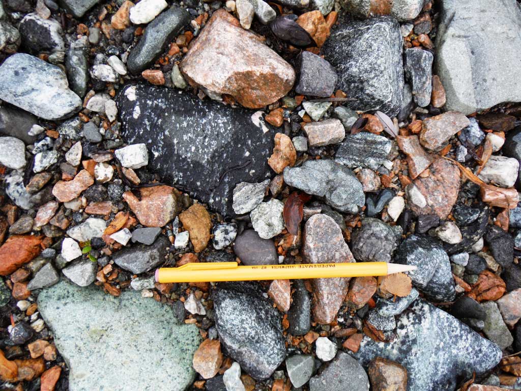
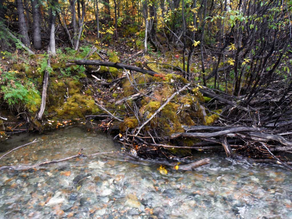
Comments: Site accessed and submitted by the Copper River Watershed Project. Large amount of bedload. Flashy mountain stream. Large outwash plain downstream of crossing.
Culvert Measurements
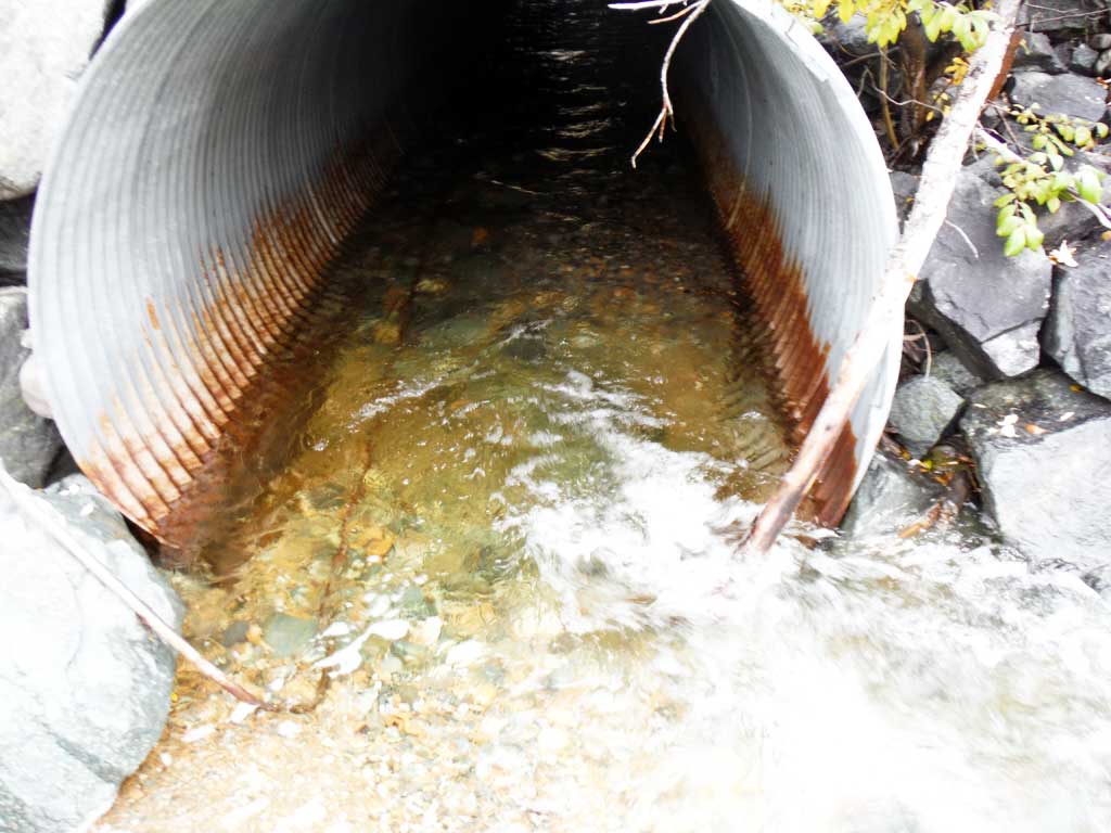
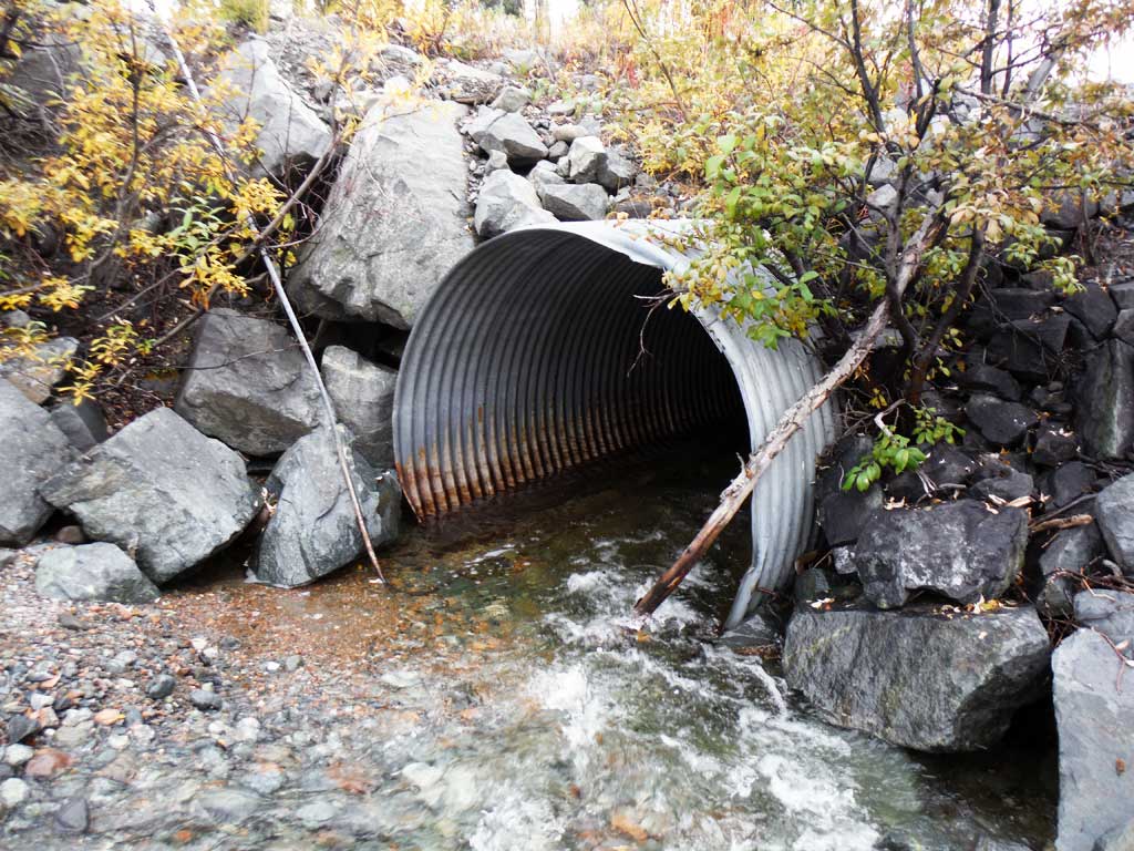
| ID: 1 | Structure Type: Circular pipe (Corrugated steel) | Fish Passage Rating: | |||||||||||||||||||||||||||||||||||||||||
|
|
|
|||||||||||||||||||||||||||||||||||||||||
Culvert Observations:
|
|||||||||||||||||||||||||||||||||||||||||||
Stream Measurements
|
|
| Stream Width Type | Distance From Crossing (ft) |
Stream Width (ft) |
|---|---|---|
| Downstream ordinary high water | 12.80 | |
| Downstream ordinary high water | 37.10 | |
| Downstream ordinary high water | 34.10 | |
| Upstream ordinary high water | 10.90 | |
| Upstream ordinary high water | 14.60 | |
| Upstream ordinary high water | 16.30 |
Elevations
| Locator ID | Culvert Number |
River Distance (ft)1 |
Distance From Crossing (ft)2 |
Relative Elevation (ft) |
|---|---|---|---|---|
| Road Elev | 100.64 | |||
| D/S Grade Ctrl (Thalweg) | 0.00 | 87.36 | ||
| D/S Water Surface Elev | 0.00 | 88.18 | ||
| D/S Grade Ctrl (Thalweg) | 100.90 | 88.93 | ||
| D/S Water Surface Elev | 100.90 | 89.35 | ||
| D/S Grade Ctrl (Thalweg) | 172.50 | 90.29 | ||
| D/S Water Surface Elev | 172.50 | 90.69 | ||
| D/S Tailcrest or 1st Thalweg | 242.00 | 91.79 | ||
| D/S Water Surface Elev | 242.00 | 92.36 | ||
| Outlet Pool Water Elev | 250.30 | 92.43 | ||
| Max Pool Depth | 250.30 | 90.29 | ||
| Outlet Invert | 256.00 | 92.78 | ||
| D/S Water Surface Elev | 256.00 | 93.42 | ||
| Outlet Culvert Top | 256.00 | 98.68 | ||
| U/S Water Surface Elev | 357.10 | 95.10 | ||
| Inlet Culvert Top | 357.10 | 99.46 | ||
| Inlet Culvert Invert | 357.10 | 93.88 | ||
| U/S Grade Ctrl (Thalweg) | 363.50 | 94.97 | ||
| U/S Water Surface Elev | 363.50 | 95.55 | ||
| U/S Water Surface Elev | 381.50 | 96.11 | ||
| U/S Grade Ctrl (Thalweg) | 381.50 | 95.50 | ||
| U/S Grade Ctrl (Thalweg) | 475.70 | 98.02 | ||
| U/S Water Surface Elev | 475.70 | 98.60 | ||
| U/S Grade Ctrl (Thalweg) | 523.10 | 98.88 | ||
| U/S Water Surface Elev | 523.10 | 99.44 |
Notes:
- River distance is measured continuously throughout the survey reach along the thalweg of the stream.
- Measured from each end of the crossing along the thalweg of the stream.
Fish Sampling Efforts
| Gear Type: Minnow Trap (A) | Trap Duration(h): 12.0 | |
| Comments: 3 traps set upstream, no fish caught or observed. | ||
| Gear Type: Minnow Trap (B) | Trap Duration(h): 12.0 | |
| Comments: 2 traps set downstream, no fish caught or observed. | ||
Fish Observations
No fish observations occurred during this survey.
Photos


Questions or comments about this report can be directed to dfg.dsf.webmaster@alaska.gov