Fish Passage Site 20100572
Coordinates (dec. deg.): 62.10951°, -145.55861°
Legal Description: C004N002W22
Region: South Central
Road Name: Glenn Highway
Datum: NAD83
Quad Name / ITM: Gulkana A-4
AWC Stream #:
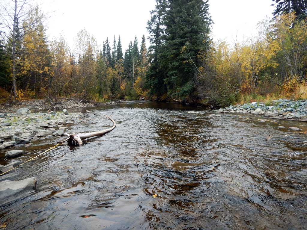
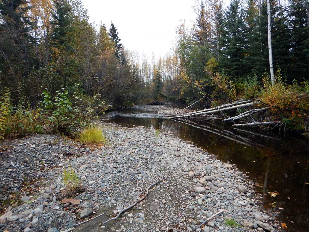
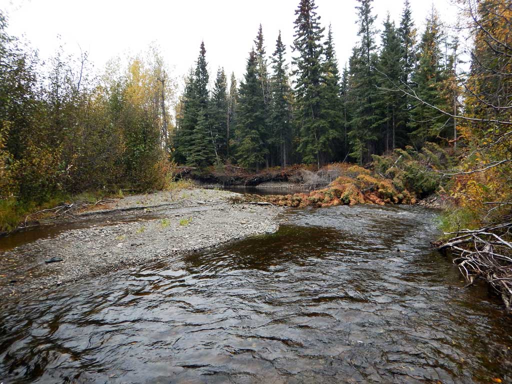
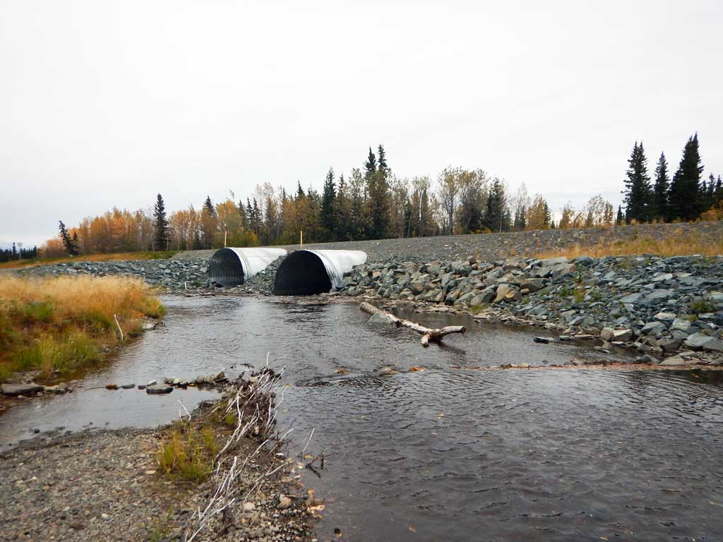
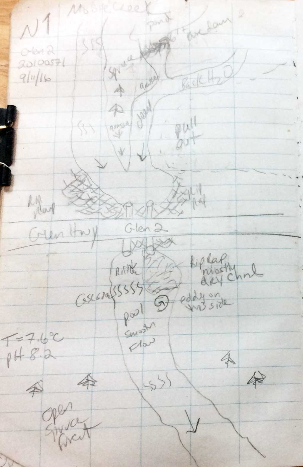
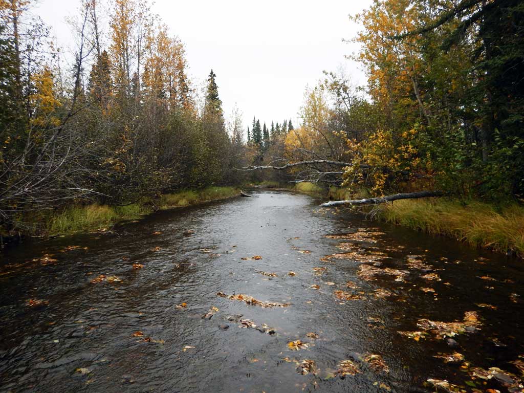
Stream Name: Moose Creek
Elevation:
Site Comments: None
arrow to the right of the survey date below to choose a different report for this site.
Survey CRWP17-Glen2
Observers: Kirsti Jurica, Hoots Witsoe
Overall Fish Passage Rating:
Tidal: No
Backwatered: No
Step Pools: No
Construction Year:
Site Observations:
- Constriction ratio gray
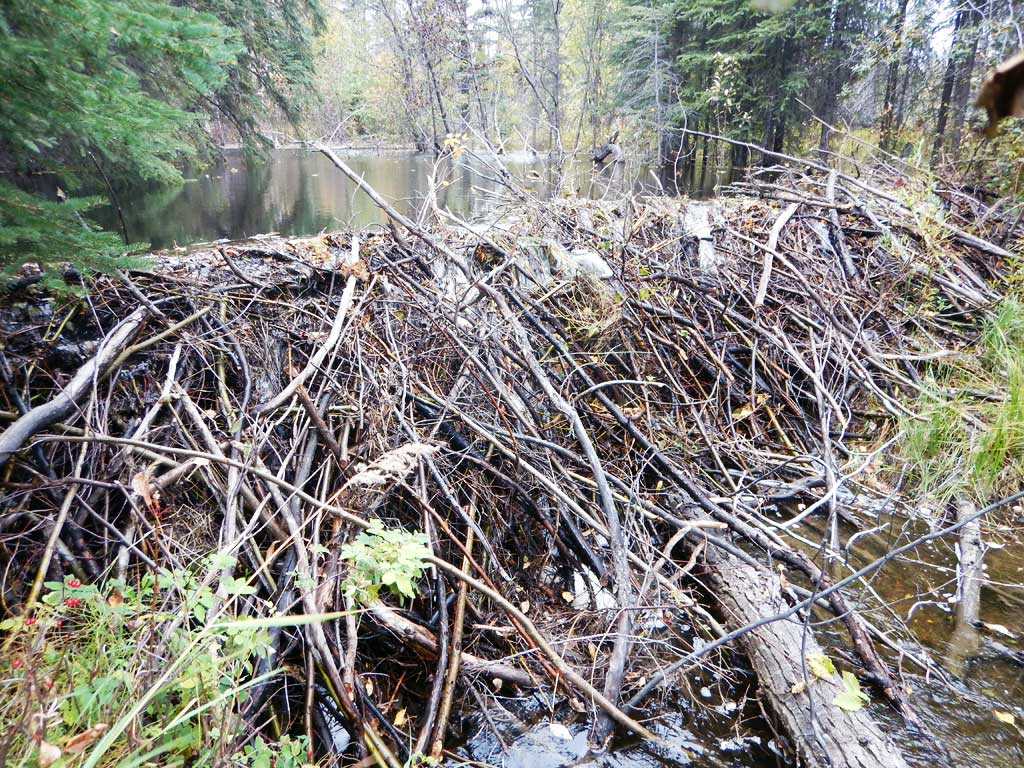
- Beaver Activity
- Culvert is poorly aligned
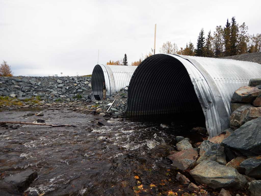
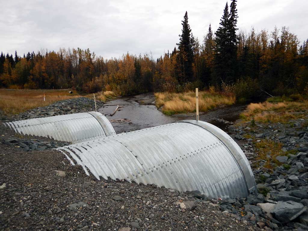
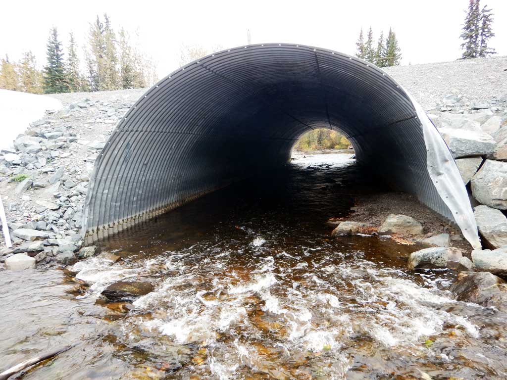
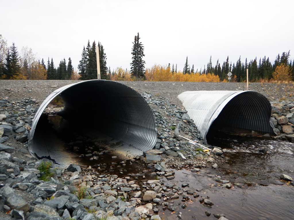
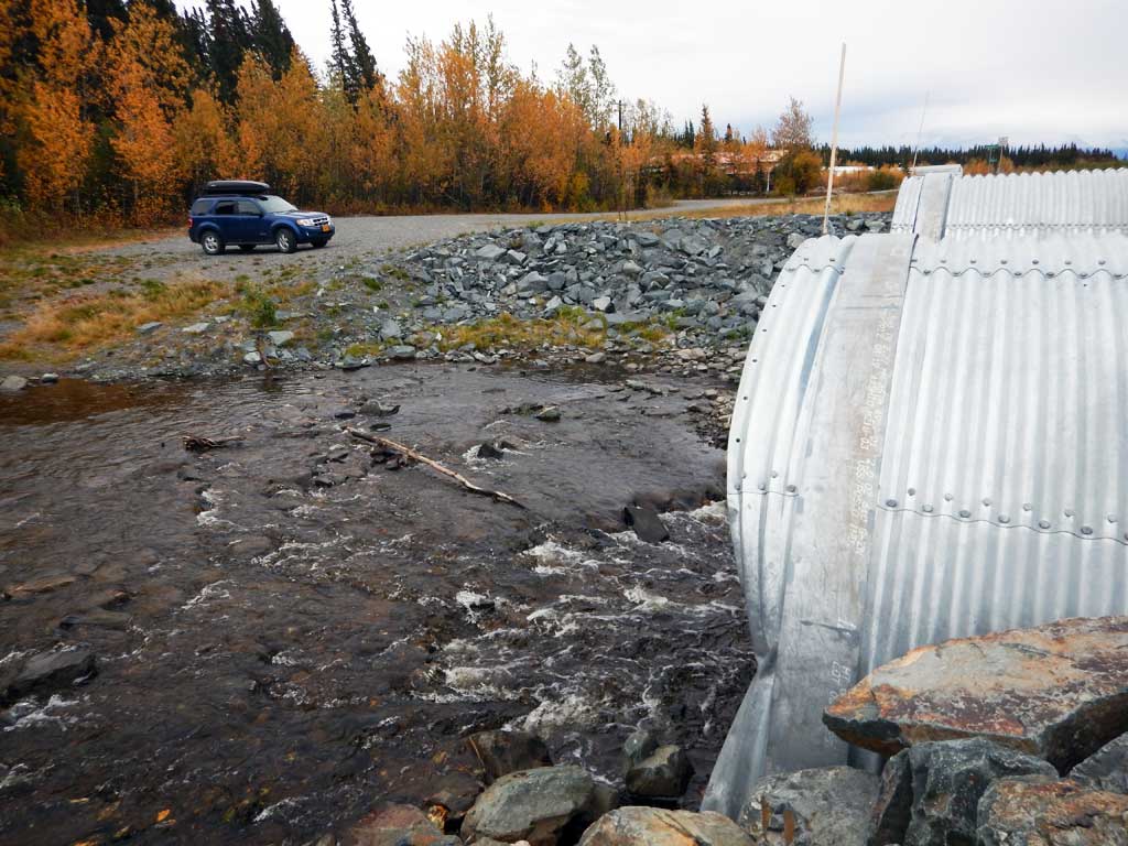
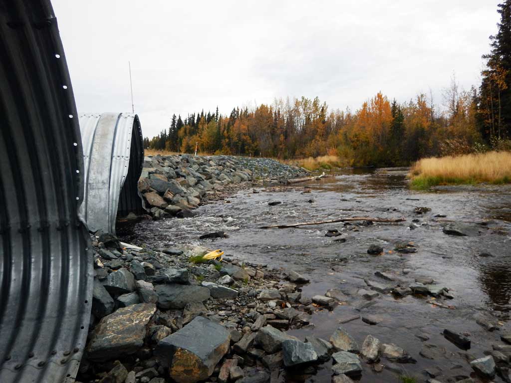
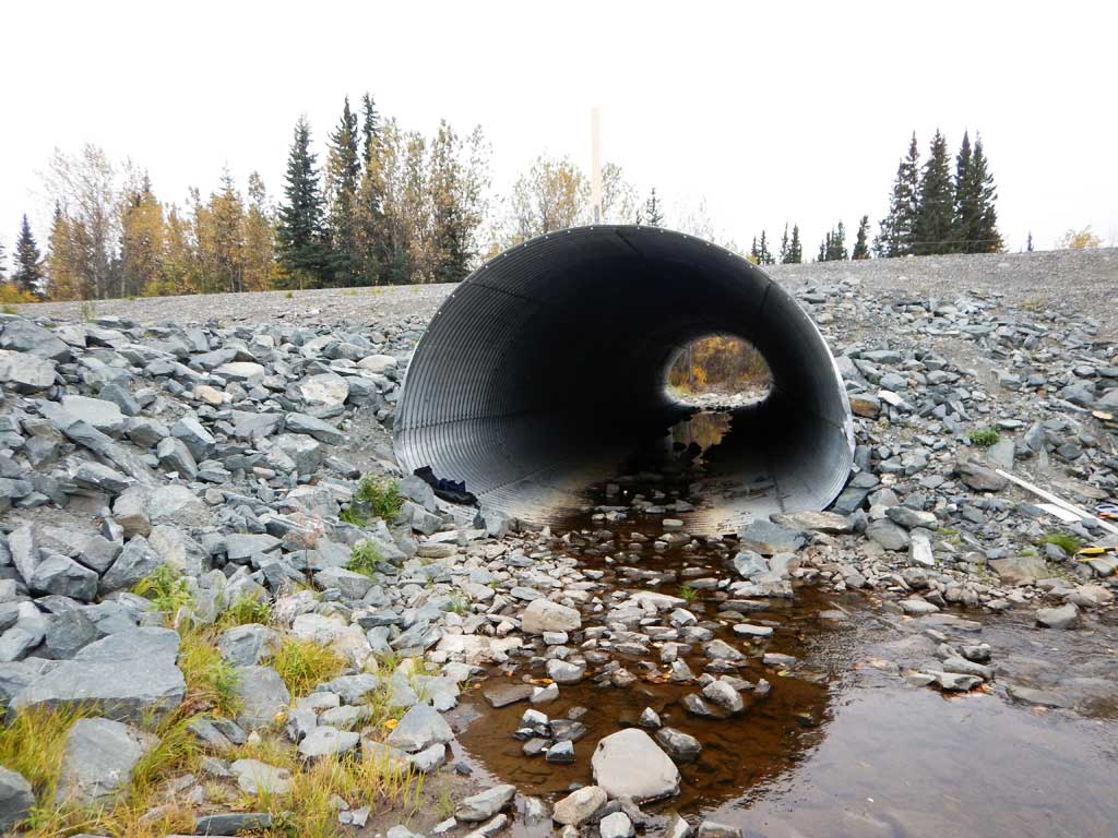
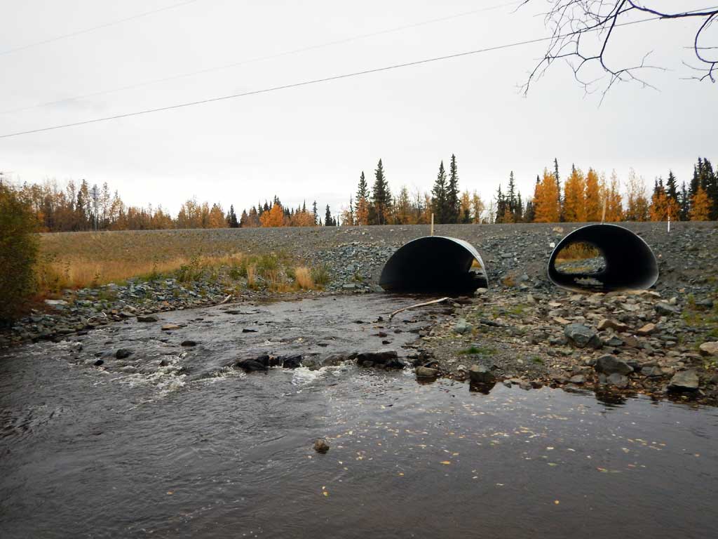
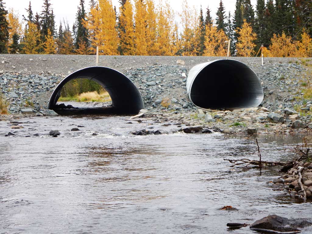
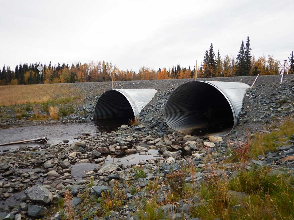
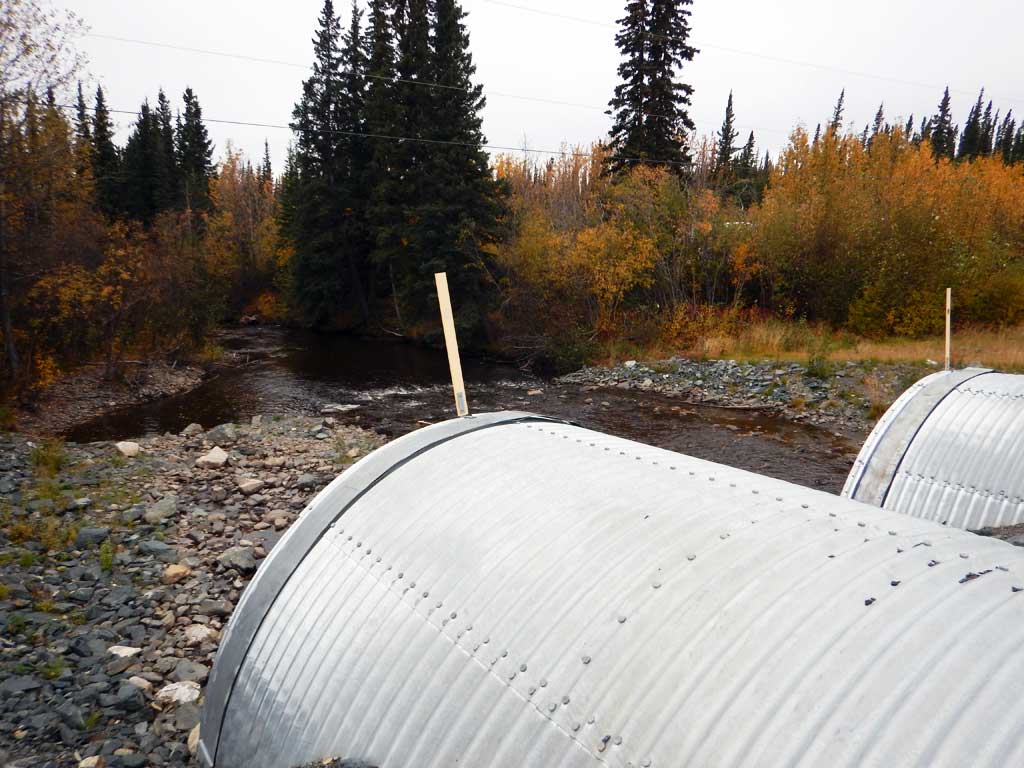
Comments: Culvert assessment performed and submitted by the Copper River Watershed Project. Majority of water flows through pipe 2. Inlet damage to pipe 2 due to poor alignment with upstream channel. Pipe 1 placed higher than Pipe 2 for flood control. Multiple channels upstream from culvert.
Culvert Measurements
| ID: 1 | Structure Type: Pipe-arch (Structural steel plate) | Fish Passage Rating: | |||||||||||||||||||||||||||||||||||||||||
|
|
|
|||||||||||||||||||||||||||||||||||||||||
Comments: Culvert set about 1.5 higher than C2. |
|||||||||||||||||||||||||||||||||||||||||||
Culvert Observations:
|
|||||||||||||||||||||||||||||||||||||||||||
| ID: 2 | Structure Type: Pipe-arch (Structural steel plate) | Fish Passage Rating: | |||||||||||||||||||||||||||||||||||||||||
|
|
|
|||||||||||||||||||||||||||||||||||||||||
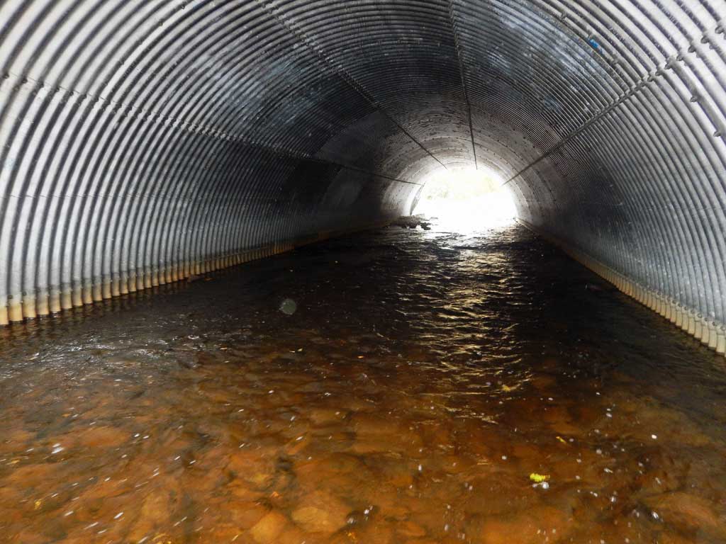
Comments: All flow through this culvert at lower flows. C1 set about 1.5 higher. Substrate depths could not be measured do to swift flows through culvert and water depth. Culvert gradient calculated using top of pipe elevations. |
|||||||||||||||||||||||||||||||||||||||||||
Culvert Observations:
|
|||||||||||||||||||||||||||||||||||||||||||
Stream Measurements
|
|
| Stream Width Type | Distance From Crossing (ft) |
Stream Width (ft) |
|---|---|---|
| Downstream ordinary high water | 30.60 | |
| Downstream ordinary high water | 34.10 | |
| Downstream ordinary high water | 40.80 |
Elevations
| Locator ID | Culvert Number |
River Distance (ft)1 |
Distance From Crossing (ft)2 |
Relative Elevation (ft) |
|---|---|---|---|---|
| Road Elev | 102.22 | |||
| D/S Water Surface Elev | 0.00 | 86.19 | ||
| D/S Grade Ctrl (Thalweg) | 0.00 | 83.67 | ||
| Max Pool Depth (2nd outlet pool) | 108.00 | 85.21 | ||
| D/S Water Surface Elev | 108.00 | 86.76 | ||
| Max Pool Depth | 148.00 | 86.91 | ||
| Outlet Pool Water Elev | 148.00 | 87.62 | ||
| Outlet Invert (on substrate) | 2 | 190.00 | 87.16 | |
| D/S Water Surface Elev | 2 | 190.00 | 88.04 | |
| Outlet Invert | 1 | 190.00 | 88.54 | |
| D/S Water Surface Elev | 1 | 190.00 | 88.60 | |
| Outlet Culvert Top | 2 | 190.00 | 97.98 | |
| Outlet Culvert Top | 1 | 190.00 | 99.60 | |
| Inlet Culvert Top | 1 | 290.00 | 100.00 | |
| Inlet Culvert Top | 2 | 290.00 | 98.61 | |
| U/S Water Surface Elev | 2 | 290.00 | 88.71 | |
| Inlet Culvert Invert | 1 | 290.00 | 89.31 | |
| U/S Water Surface Elev | 1 | 290.00 | 89.38 | |
| Inlet Culvert Invert (on substrate) | 2 | 290.00 | 87.68 | |
| U/S Water Surface Elev | 329.00 | 89.81 | ||
| U/S Grade Ctrl (Thalweg) | 329.00 | 89.16 | ||
| U/S Grade Ctrl (Thalweg) (upstream gradepoint in left channel (facing downstream)) | 386.00 | 89.44 | ||
| U/S Water Surface Elev | 386.00 | 90.11 | ||
| U/S Water Surface Elev | 520.00 | 90.36 | ||
| U/S Grade Ctrl (Thalweg) | 520.00 | 89.91 | ||
| U/S Grade Ctrl (Thalweg) | 730.00 | 92.14 | ||
| U/S Water Surface Elev | 730.00 | 92.64 |
Notes:
- River distance is measured continuously throughout the survey reach along the thalweg of the stream.
- Measured from each end of the crossing along the thalweg of the stream.
Fish Sampling Efforts
| Gear Type: Minnow Trap (A) | Trap Duration(h): 20.0 | |
| Comments: Soak Duration 20 hours for traps, placement not recorded. | ||
| Gear Type: Minnow Trap (B) | Trap Duration(h): 20.0 | |
| Gear Type: Minnow Trap (C) | Trap Duration(h): 20.0 | |
| Comments: No fish caught or observed. | ||
| Gear Type: Minnow Trap (D) | Trap Duration(h): 20.0 | |
| Gear Type: Minnow Trap (E) | Trap Duration(h): 20.0 | |
| Gear Type: Minnow Trap (F) | Trap Duration(h): 20.0 | |
| Gear Type: Minnow Trap (G) | Trap Duration(h): 20.0 | |
| Gear Type: Minnow Trap (H) | Trap Duration(h): 20.0 | |
| Comments: No Fish caught or observed | ||
| Gear Type: Minnow Trap (I) | Trap Duration(h): 20.0 | |
| Gear Type: Minnow Trap (J) | Trap Duration(h): 20.0 | |
Fish Observations
| Species: juvenile rainbow trout | Life History: Unknown | ||
| Total Fish Observed: 17 | Fish Measured: 9 | Fork Lengths (mm) Min: 20 Max: 65 Mean: 54 | |
| Collected/Observed by Gear Type: Not Recorded Minnow Trap (2) Not Recorded Minnow Trap (1) Not Recorded Minnow Trap (1) Not Recorded Minnow Trap (1) Not Recorded Minnow Trap (2) Not Recorded Minnow Trap (8) Not Recorded Minnow Trap (2) | |||
| Species: juvenile longnose sucker | Life History: Resident | ||
| Total Fish Observed: 2 | Fish Measured: 2 | Fork Lengths (mm) Min: 120 Max: 155 Mean: 137 | |
| Collected/Observed by Gear Type: Not Recorded Minnow Trap (2) | |||
Photos
Questions or comments about this report can be directed to dfg.dsf.webmaster@alaska.gov