Fish Passage Site 20100558
Coordinates (dec. deg.): 63.04714°, -145.83977°
Legal Description: F021S010E33
Region: South Central
Road Name: Denali Highway
Datum: NAD83
Quad Name / ITM: Mt Hayes A-4
AWC Stream #:
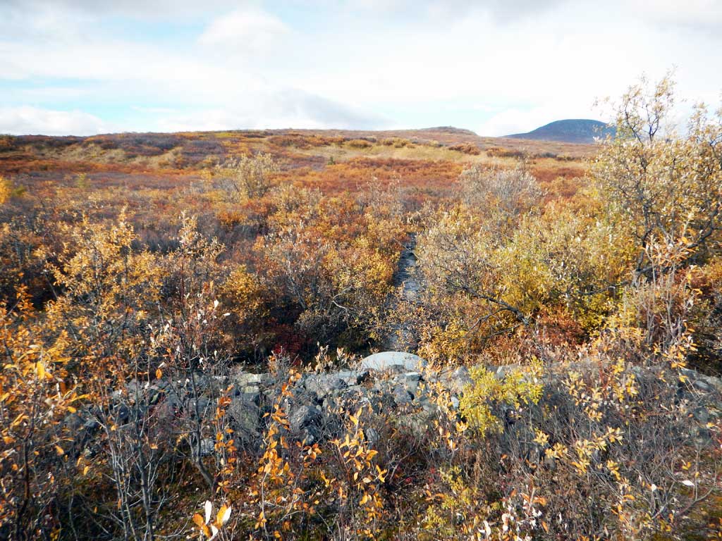
Stream Name: Unnamed
Elevation:
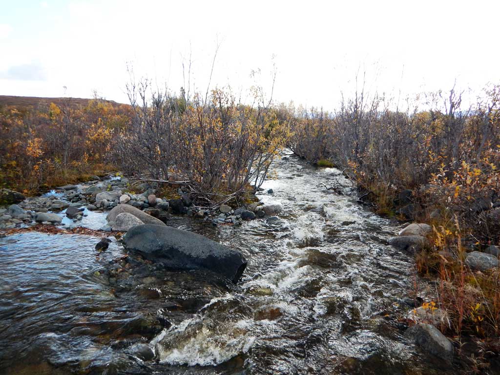
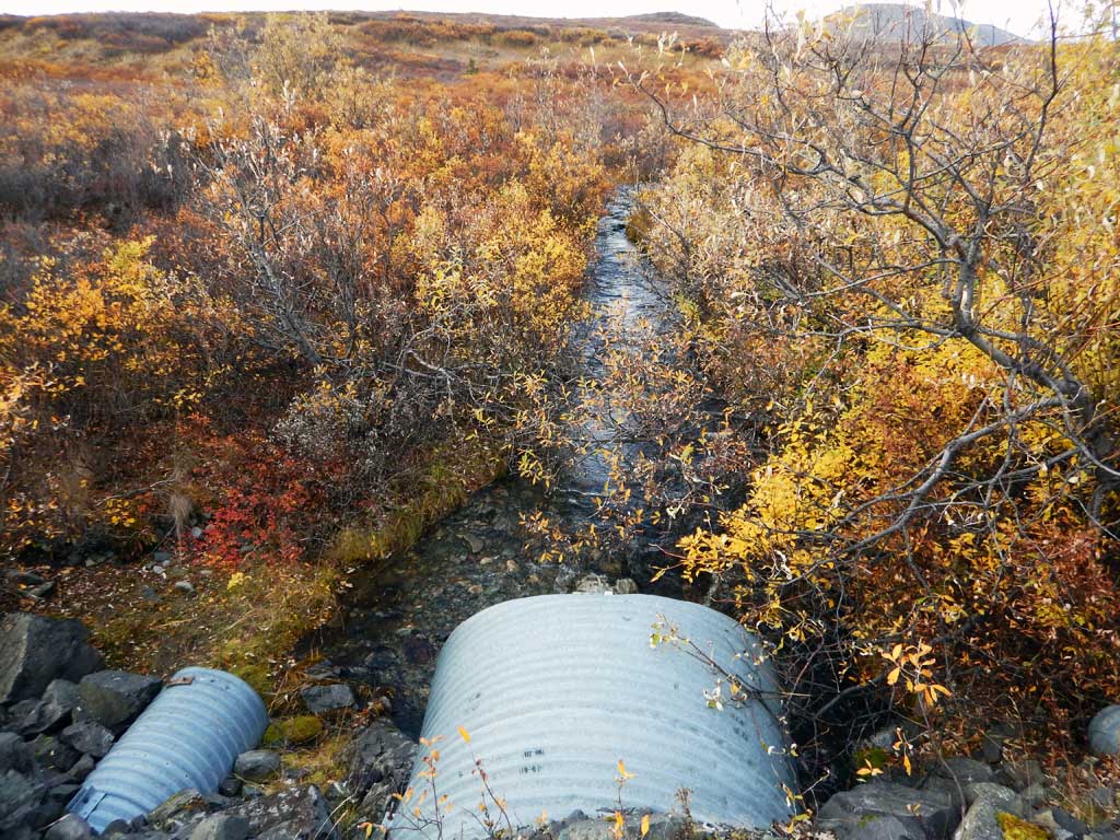
Site Comments: Tributary to Swede Lake
arrow to the right of the survey date below to choose a different report for this site.
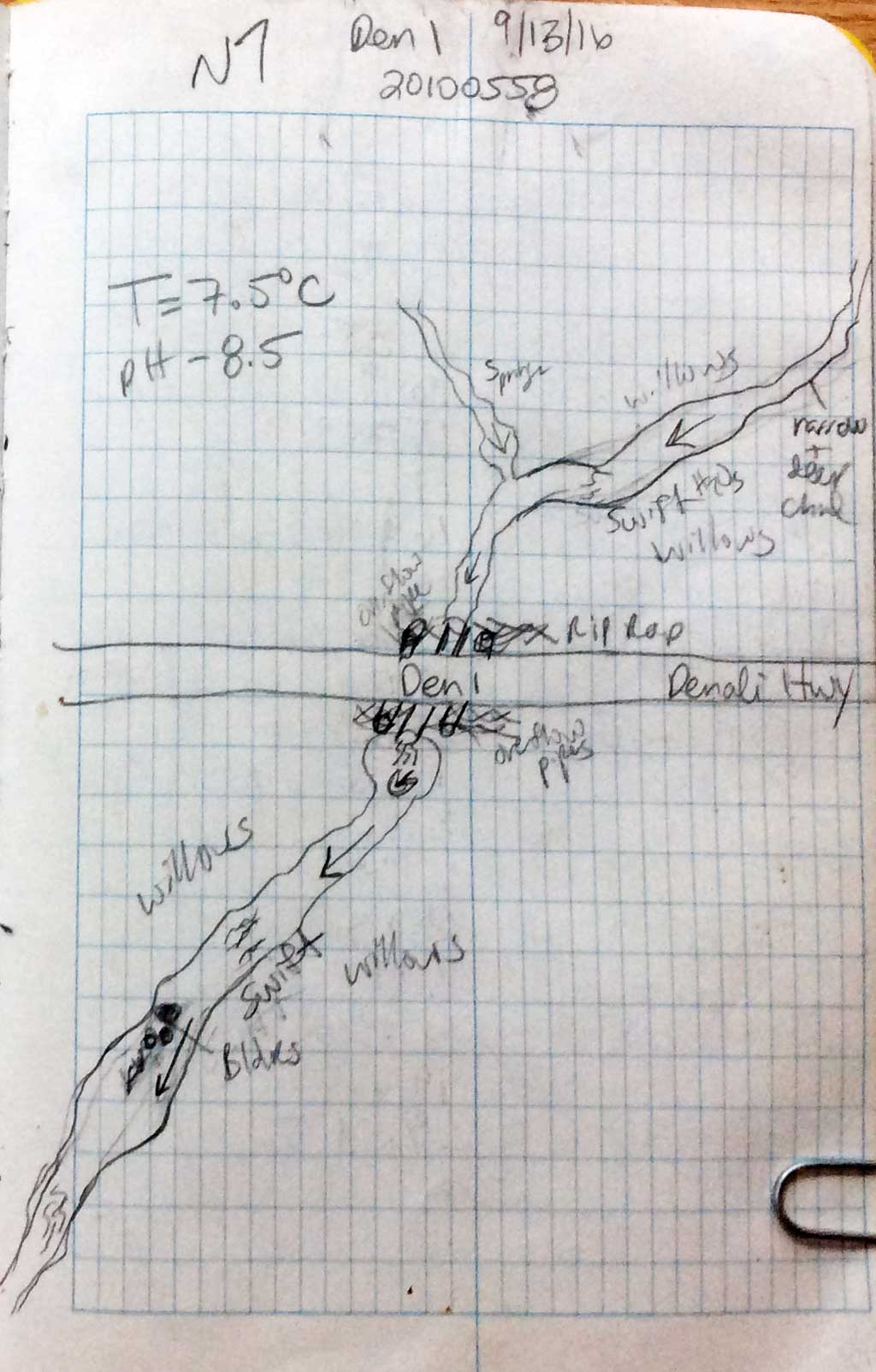
Survey CRWP17-Den1
Observers: Kirsti Jurica, Hoots Witsoe
Overall Fish Passage Rating:
Tidal: No
Backwatered: No
Step Pools: No
Construction Year:
Site Observations:
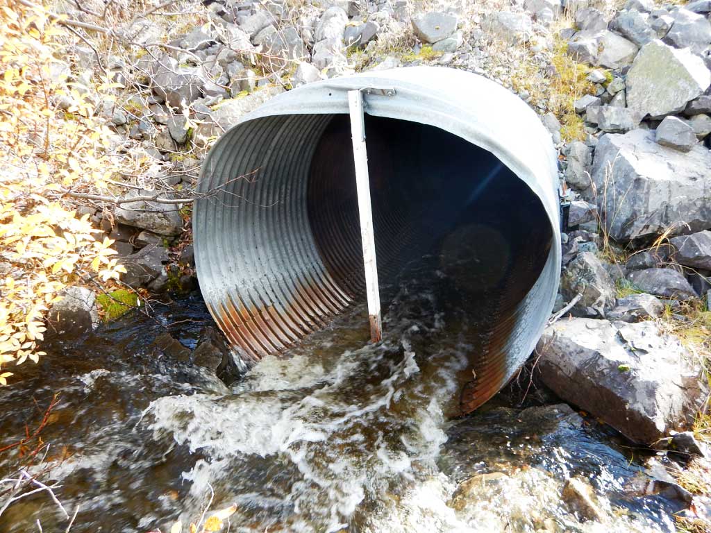
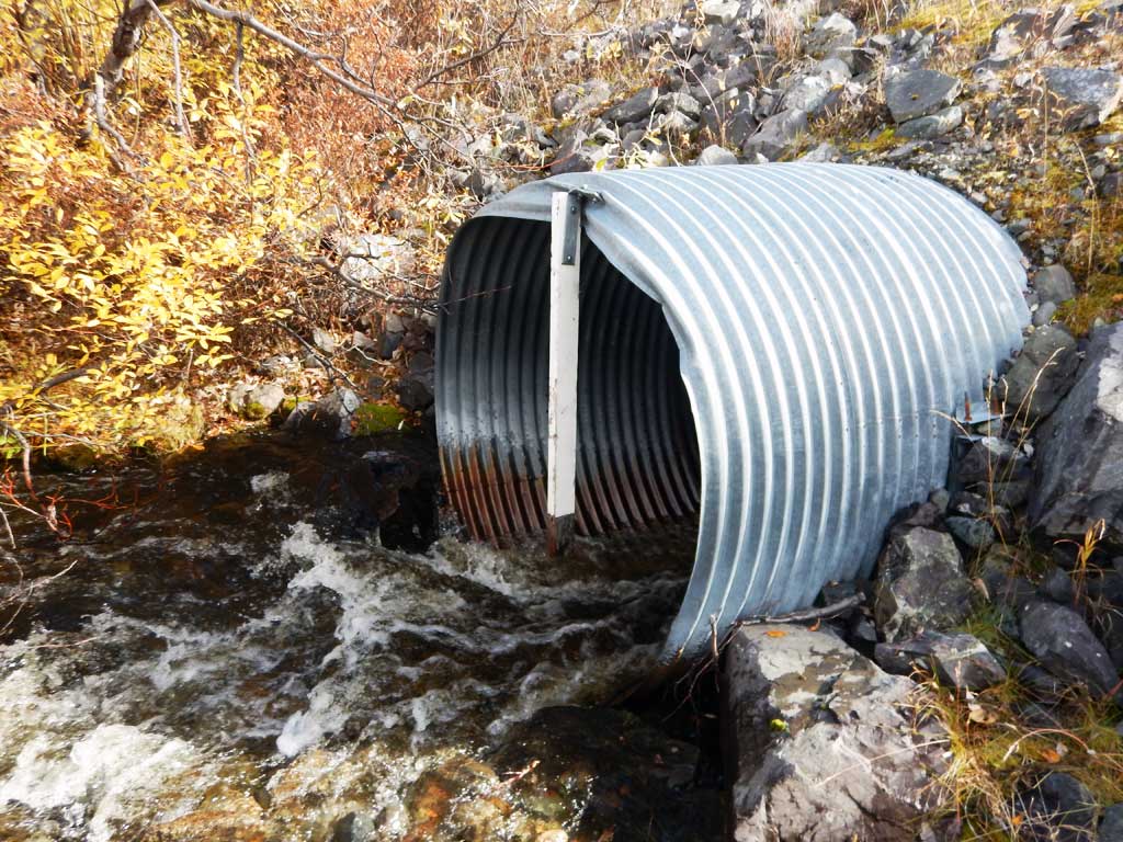
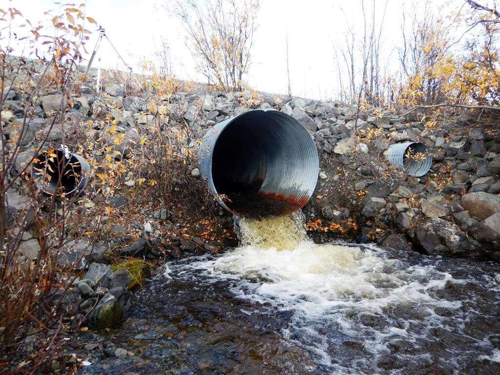
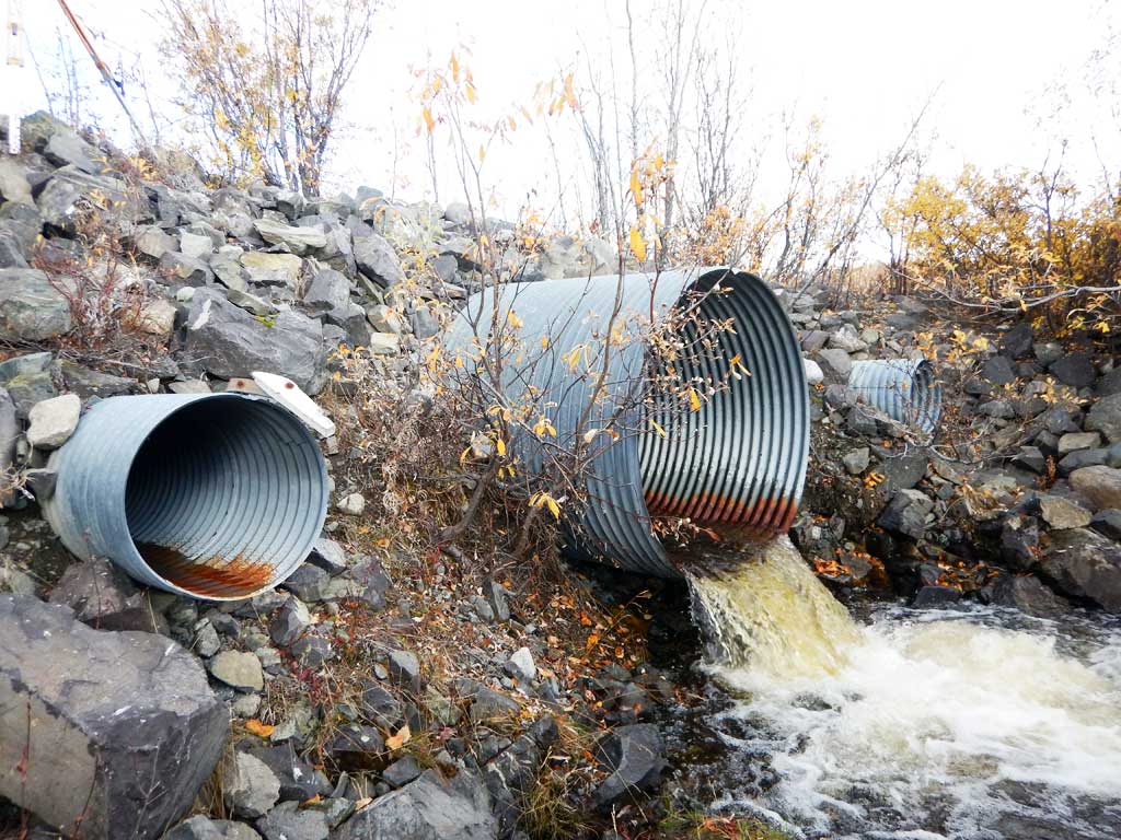
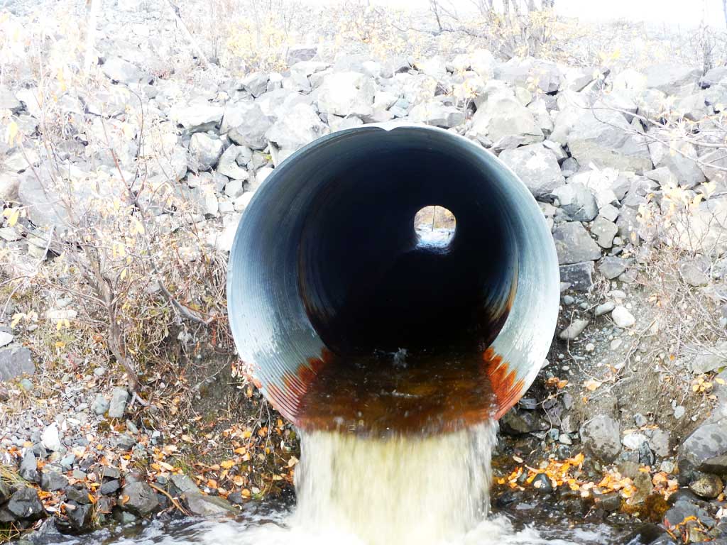
- Outfall height red
- Culvert gradient red
- Structural Problem
- Mechanical damage or joints parting
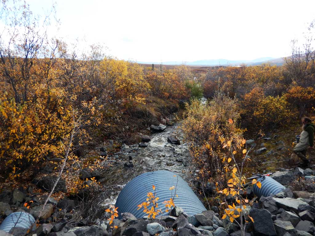
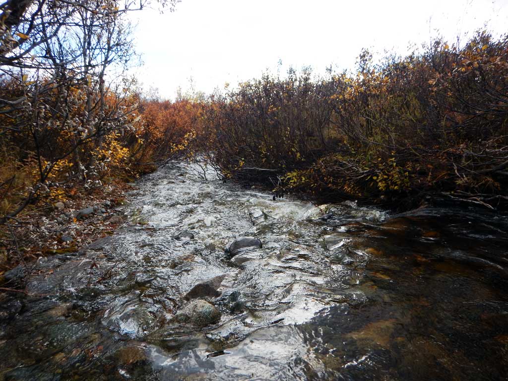
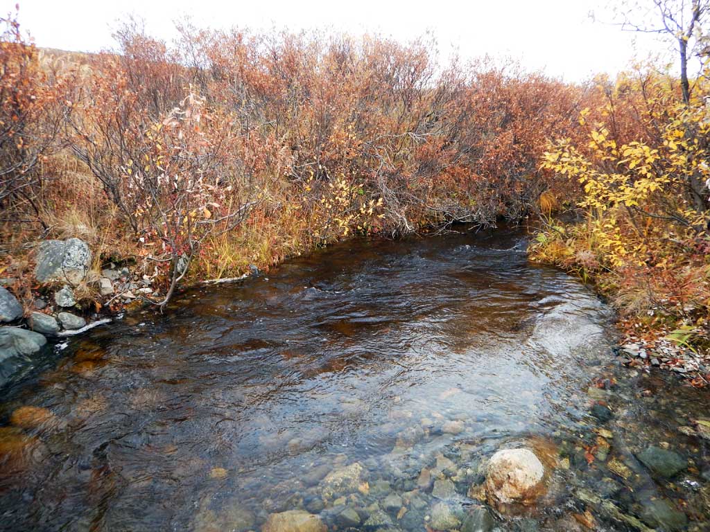
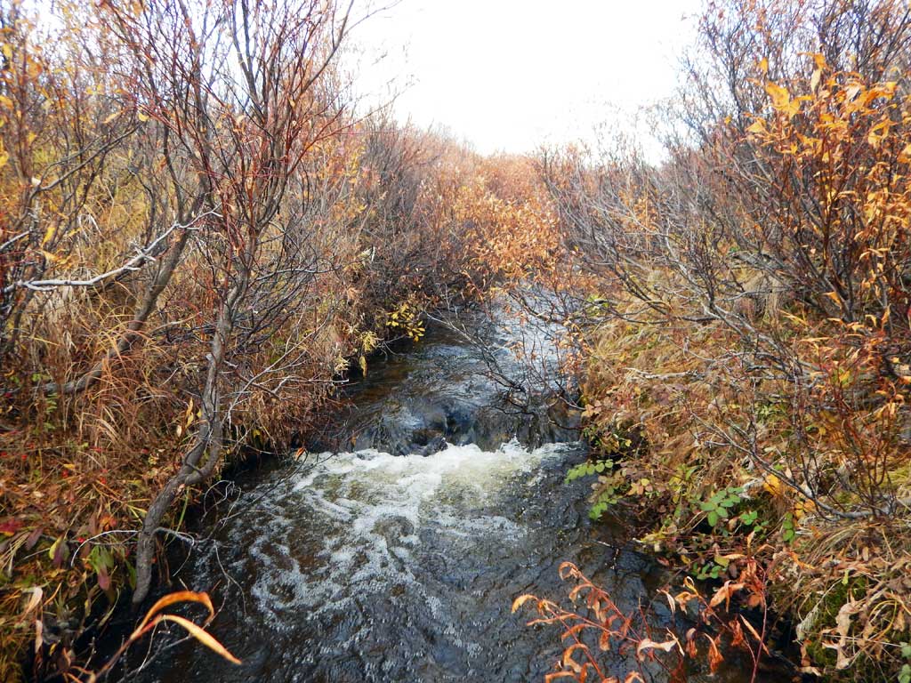
Comments: Culvert assessment performed and submitted by the Copper River Watershed Project. Fast moving upland channel. Arctic grayling caught downstream.
Culvert Measurements
| ID: 1 | Structure Type: Circular pipe (Corrugated steel) | Fish Passage Rating: | |||||||||||||||||||||||||||||||||||||||||
|
|
|
|||||||||||||||||||||||||||||||||||||||||
Culvert Observations:
|
|||||||||||||||||||||||||||||||||||||||||||
Stream Measurements
|
|
| Stream Width Type | Distance From Crossing (ft) |
Stream Width (ft) |
|---|---|---|
| Downstream ordinary high water | 12.10 | |
| Downstream ordinary high water | 11.20 | |
| Downstream ordinary high water | 13.10 | |
| Upstream ordinary high water | 6.90 | |
| Upstream ordinary high water | 10.60 | |
| Upstream ordinary high water | 6.30 |
Elevations
| Locator ID | Culvert Number |
River Distance (ft)1 |
Distance From Crossing (ft)2 |
Relative Elevation (ft) |
|---|---|---|---|---|
| Road Elev | 100.00 | |||
| D/S Grade Ctrl (Thalweg) | 0.00 | 74.86 | ||
| D/S Water Surface Elev | 0.00 | 75.91 | ||
| D/S Tailcrest or 1st Thalweg | 99.00 | 79.17 | ||
| D/S Water Surface Elev | 99.00 | 80.10 | ||
| Outlet Pool Water Elev | 106.00 | 80.21 | ||
| Max Pool Depth | 106.00 | 78.16 | ||
| Outlet Culvert Top | 115.00 | 87.20 | ||
| Outlet Invert (on pipe) | 115.00 | 81.21 | ||
| D/S Water Surface Elev | 115.00 | 81.85 | ||
| Inlet Culvert Invert (on pipe) | 242.00 | 84.73 | ||
| U/S Water Surface Elev | 242.00 | 85.50 | ||
| Inlet Culvert Top | 242.00 | 90.47 | ||
| U/S Grade Ctrl (Thalweg) | 251.00 | 86.06 | ||
| U/S Water Surface Elev | 251.00 | 86.54 | ||
| U/S Grade Ctrl (Thalweg) | 336.00 | 88.60 | ||
| U/S Water Surface Elev | 336.00 | 89.40 | ||
| U/S Grade Ctrl (Thalweg) | 432.00 | 89.75 | ||
| U/S Water Surface Elev | 432.00 | 91.78 |
Notes:
- River distance is measured continuously throughout the survey reach along the thalweg of the stream.
- Measured from each end of the crossing along the thalweg of the stream.
Fish Sampling Efforts
| Gear Type: Minnow Trap (A) | Trap Duration(h): 16.0 | |
| Gear Type: Minnow Trap (B) | Trap Duration(h): 16.0 | |
| Comments: No fish caught | ||
| Gear Type: Minnow Trap (C) | Trap Duration(h): 16.0 | |
| Comments: No fish caught | ||
| Gear Type: Minnow Trap (D) | Trap Duration(h): 16.0 | |
| Comments: No fish caught | ||
Fish Observations
| Species: juvenile Arctic grayling | Life History: Resident | ||
| Total Fish Observed: 1 | Fish Measured: 1 | Fork Lengths (mm) Min: 80 Max: 80 Mean: 80 | |
| Collected/Observed by Gear Type: Not Recorded Minnow Trap (1) | |||
Photos


Questions or comments about this report can be directed to dfg.dsf.webmaster@alaska.gov