Fish Passage Site 20100508
Coordinates (dec. deg.): 60.44235°, -145.13415°
Legal Description: C016S001E36
Region: South Central
Road Name: Copper River Highway
Datum: NAD83
Quad Name / ITM: Cordova B-4
AWC Stream #:
Stream Name: Unnamed
Elevation:
Site Comments: None
arrow to the right of the survey date below to choose a different report for this site.
Survey CRWP17-Cop43
Observers: Kirsti Jurica, Hoots Witsoe
Overall Fish Passage Rating:
Tidal: No
Backwatered: No
Step Pools: No
Construction Year:
Site Observations:
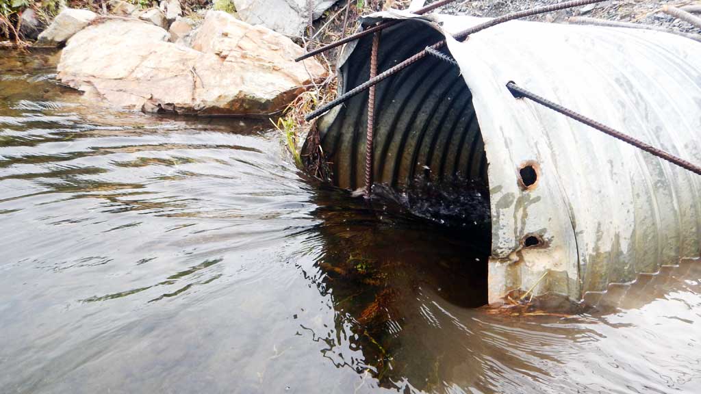
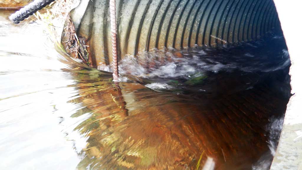
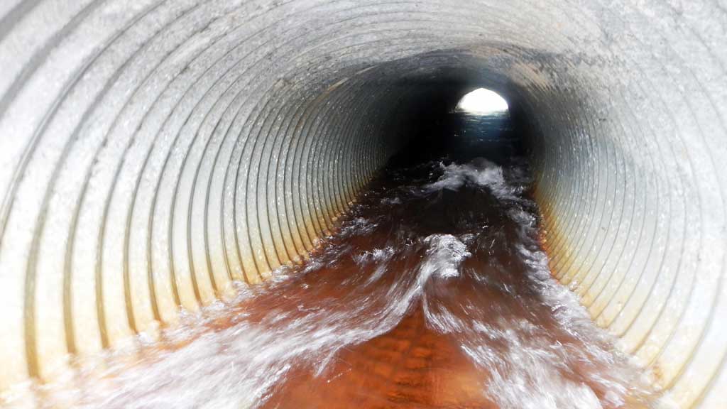
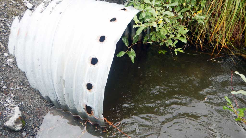
- Constriction ratio red
- Culvert gradient red
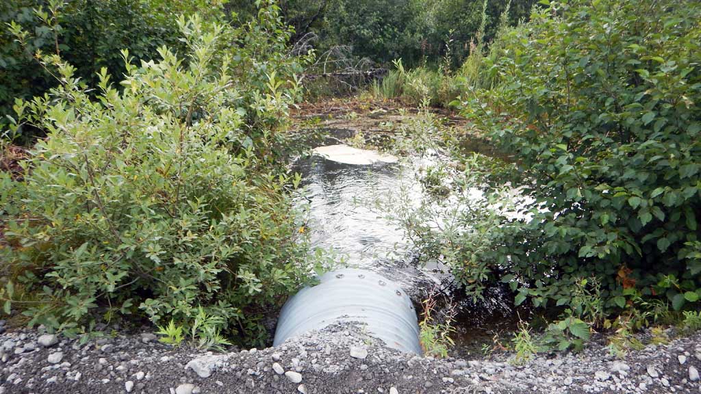
- Beaver Activity
- Shallow fill; inadequate roadfill volume above culvert
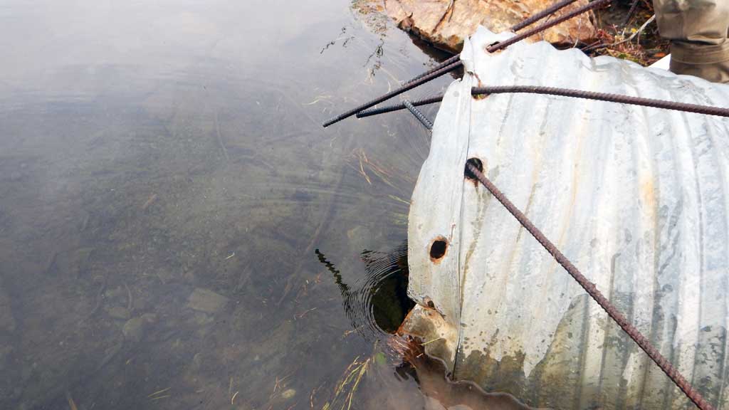
- Inlet perch
- Hydraulic flows exceeded capacity
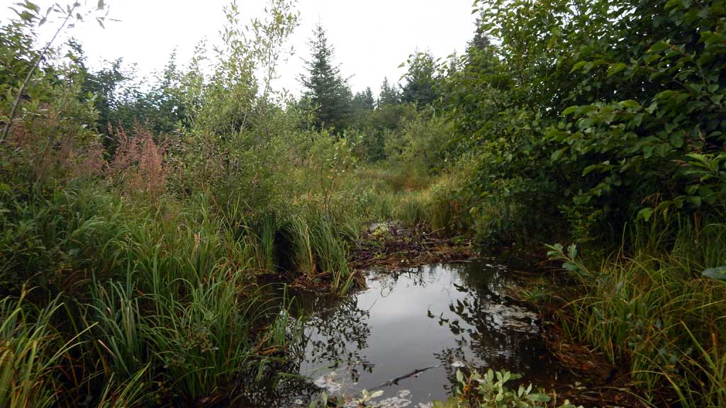
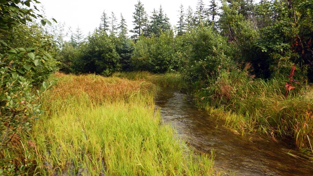
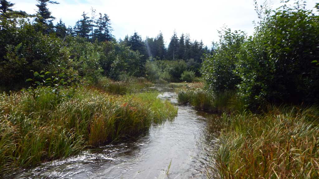
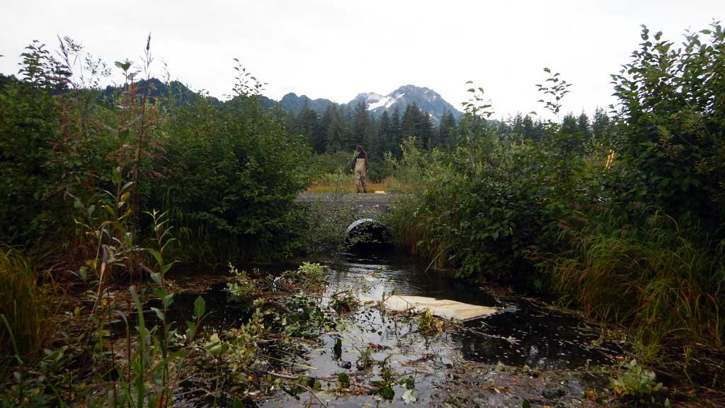
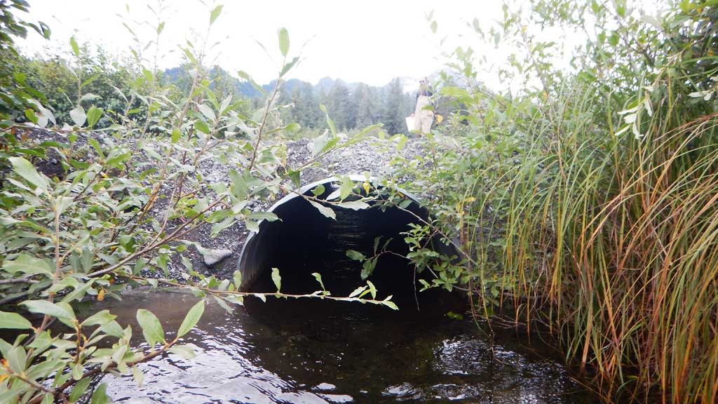
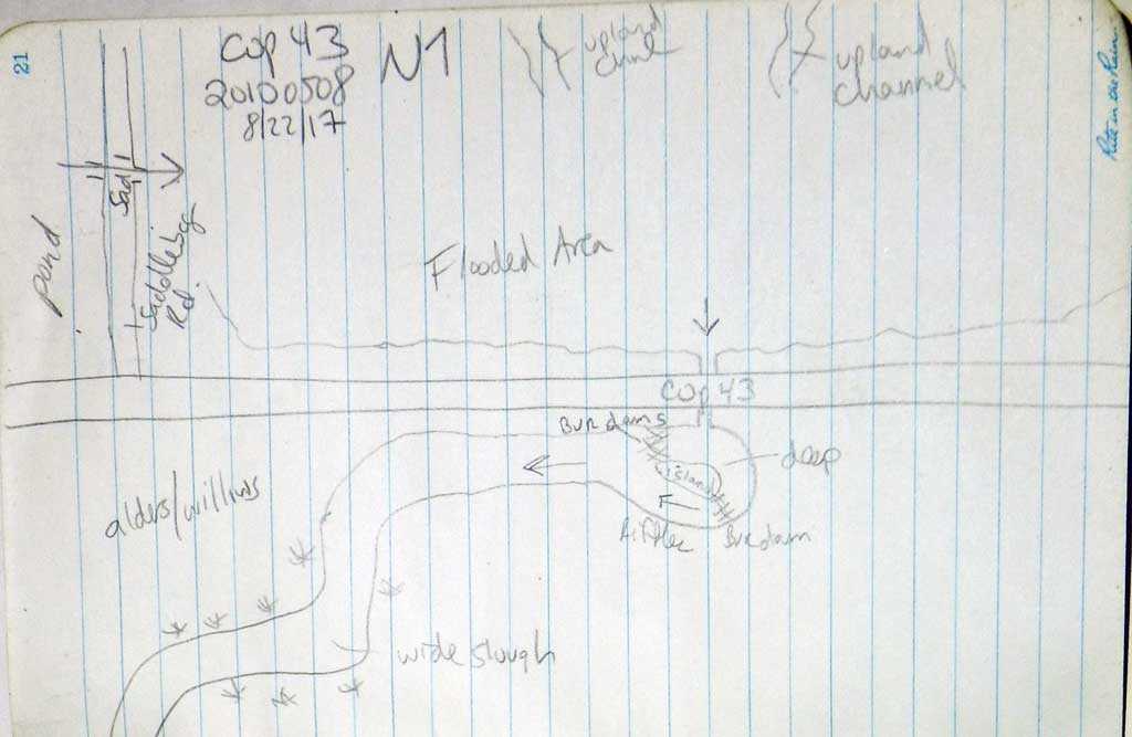
Comments: Culvert assessment performed and submitted by the Copper River Watershed Project. Abundant juvenile Coho salmon in system and adults. Downstream beaver dam acting as a tailwater control.
Culvert Measurements
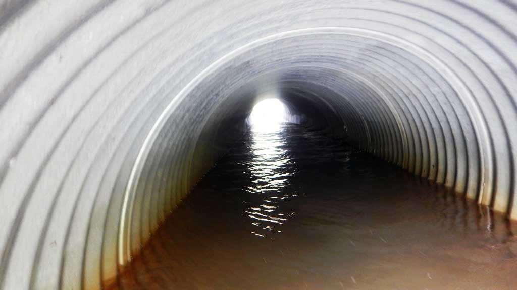
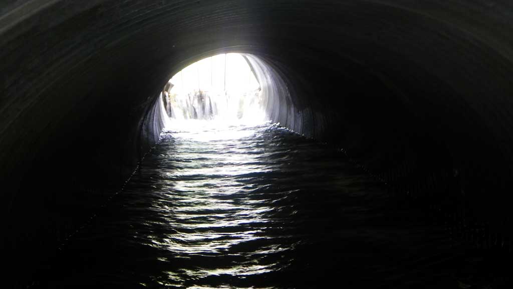
| ID: 1 | Structure Type: Circular pipe (Corrugated steel) | Fish Passage Rating: | |||||||||||||||||||||||||||||||||||||||||
|
|
|
|||||||||||||||||||||||||||||||||||||||||
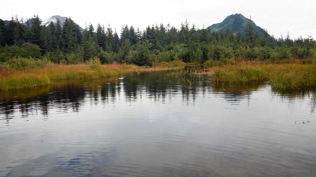
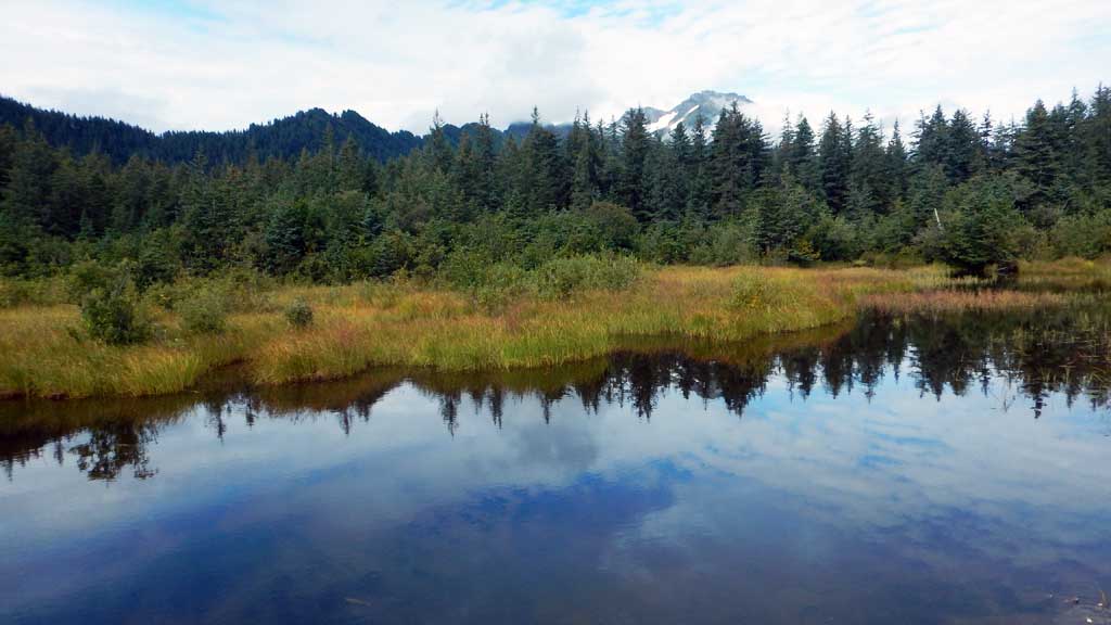
Comments: Constriction ration not completely representative. Downstream is a slow moving slough, upstream is ponded and has 4 upland channels flowing into it and may have multiple drainage points, however constriction is evident from inlet perch, scour, and occasional road flooding. Upstream channels has gravel substrate. Upstream mean widths sum of 4 upland channels. |
|||||||||||||||||||||||||||||||||||||||||||
Culvert Observations:
|
|||||||||||||||||||||||||||||||||||||||||||
Stream Measurements
|
|
No stream width data available.
Elevations
| Locator ID | Culvert Number |
River Distance (ft)1 |
Distance From Crossing (ft)2 |
Relative Elevation (ft) |
|---|---|---|---|---|
| Road Elev | 100.00 | |||
| D/S Grade Ctrl (Thalweg) | 0.00 | 93.08 | ||
| D/S Water Surface Elev | 0.00 | 96.56 | ||
| D/S Tailcrest or 1st Thalweg (Beaver dam) | 46.00 | 96.67 | ||
| D/S Water Surface Elev | 46.00 | 97.41 | ||
| Outlet Pool Water Elev | 76.00 | 97.53 | ||
| Max Pool Depth | 76.00 | 94.13 | ||
| D/S Water Surface Elev | 86.00 | 97.53 | ||
| Outlet Invert (on pipe) | 86.00 | 95.91 | ||
| Outlet Culvert Top | 86.00 | 98.93 | ||
| Inlet Culvert Top | 126.00 | 99.71 | ||
| U/S Water Surface Elev | 126.00 | 98.08 | ||
| Inlet Culvert Invert (on pipe) | 126.00 | 96.96 | ||
| U/S Thalweg | 131.00 | 94.51 | ||
| U/S Water Surface Elev (Pond) | 131.00 | 98.23 |
Notes:
- River distance is measured continuously throughout the survey reach along the thalweg of the stream.
- Measured from each end of the crossing along the thalweg of the stream.
Fish Sampling Efforts
| Gear Type: Visual Observation, Ground (A) | ||
Fish Observations
| Species: juvenile coho salmon | Life History: Anadromous | ||
| Total Fish Observed: 15 | Fish Measured: | Fork Lengths (mm) Min: Max: Mean: | |
| Collected/Observed by Gear Type: At Site Visual Observation, Ground (15) | |||
Photos
Questions or comments about this report can be directed to dfg.dsf.webmaster@alaska.gov