Fish Passage Site 20100503
Coordinates (dec. deg.): 60.44292°, -145.21853°
Legal Description: C016S001E33
Region: South Central
Road Name: Copper River Highway
Datum: NAD83
Quad Name / ITM: Cordova B-4
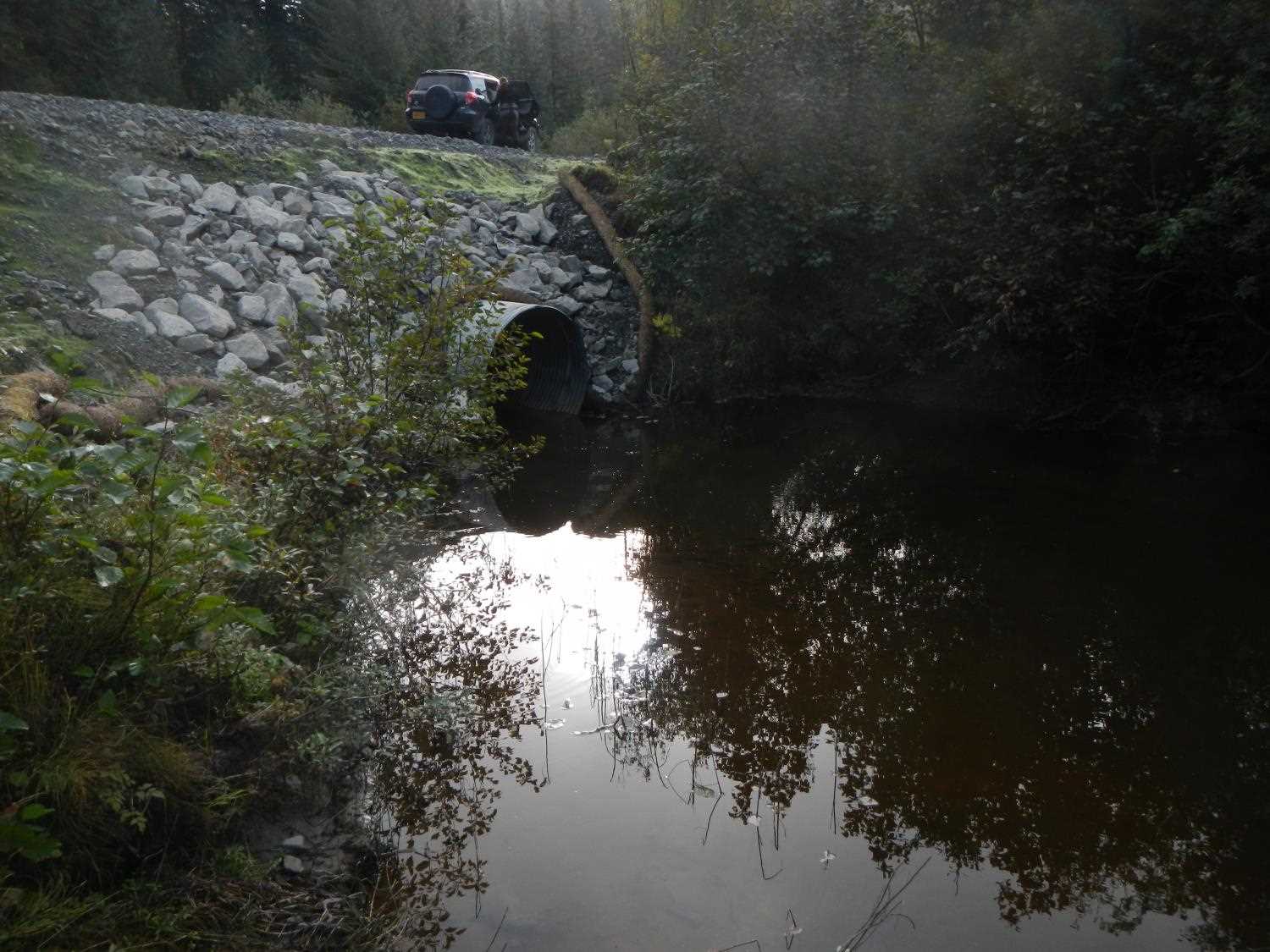
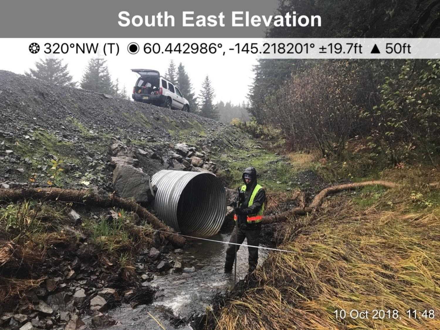
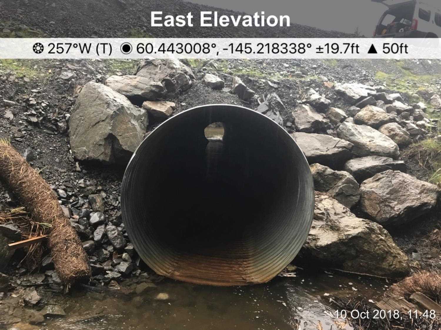
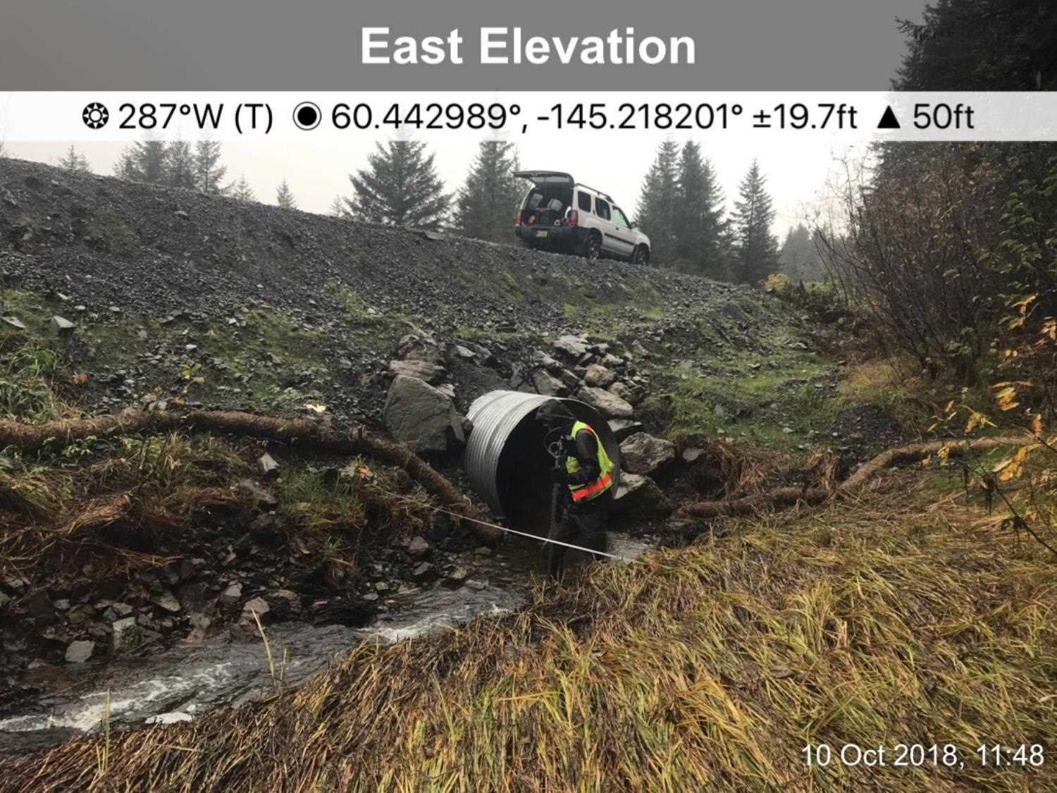
AWC Stream #: 212-10-10010-2057
Stream Name: McKinley Stream
Elevation:
Site Comments: None
arrow to the right of the survey date below to choose a different report for this site.
Survey UPDATE-0503
Project Supervisor: Gillian O'Doherty, ADFG
Observers: Franklin Dekker
Overall Fish Passage Rating:
Tidal:
Backwatered:
Step Pools:
Construction Year:
Comments: Site update and photos submitted by Heather Hanson, USFWS, Anchorage and Megan Marie, HB, ADF&G. Site was replaced under Fish Habitat Permit FH18-II-0124 with the condition that it be replaced with a larger Tier 1 Stream Simulation Fish Passage culvert no later than Dec. 31, 2021.
Culvert Measurements
| ID: 1 | Structure Type: Circular pipe (Corrugated steel) | Fish Passage Rating: | |||||||||||||||||||||||||||||||||||||||||
|
|
|
|||||||||||||||||||||||||||||||||||||||||
Comments: Culvert dimensions taken from Fish Habitat permit and have not been verified. Culvert was to be installed at 1% gradient or less. Culvert Height 5 ft, culvert width 5 ft. |
|||||||||||||||||||||||||||||||||||||||||||
Stream Measurements
|
|
No stream width data available.
Elevations
No elevation data available.
Fish Sampling Efforts
No fish sampling occurred during this survey.
Fish Observations
No fish observations occurred during this survey.
Photos
Questions or comments about this report can be directed to dfg.dsf.webmaster@alaska.gov