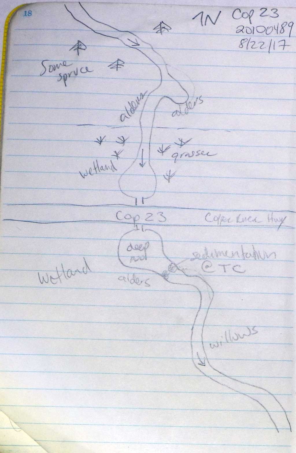
Fish Passage Site 20100489
Coordinates (dec. deg.): 60.46152°, -145.30328°
Legal Description: C016S001E30
Region: South Central
Road Name: Copper River Highway
Datum: NAD83
Quad Name / ITM: Cordova B-4
AWC Stream #:
Stream Name: Unnamed
Elevation:
Site Comments: None
arrow to the right of the survey date below to choose a different report for this site.
Survey CRWP17-Cop23
Observers: Kirsti Jurica, Hoots Witsoe
Overall Fish Passage Rating:
Tidal: No
Backwatered: Yes
Step Pools: No
Construction Year:
Site Observations:
- Mechanical damage or joints parting
- Shallow fill; inadequate roadfill volume above culvert
- Constriction ratio red
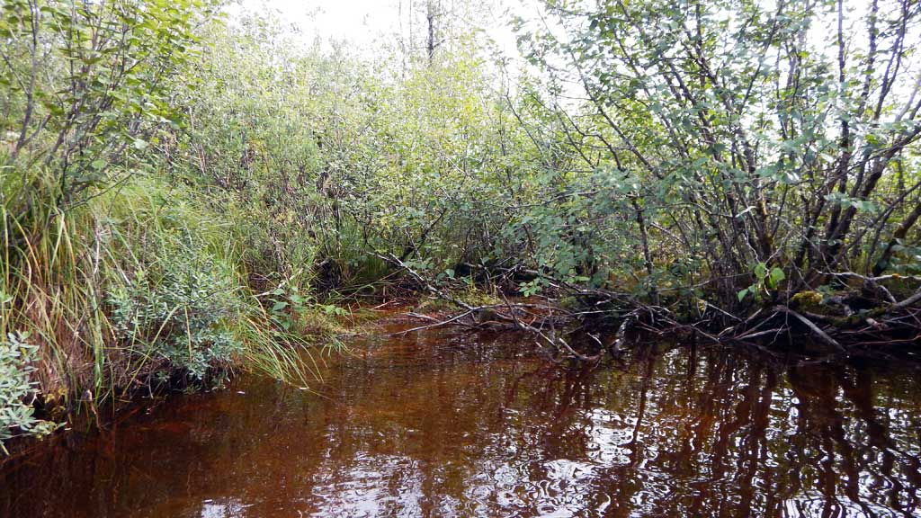
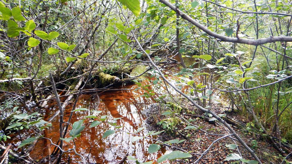
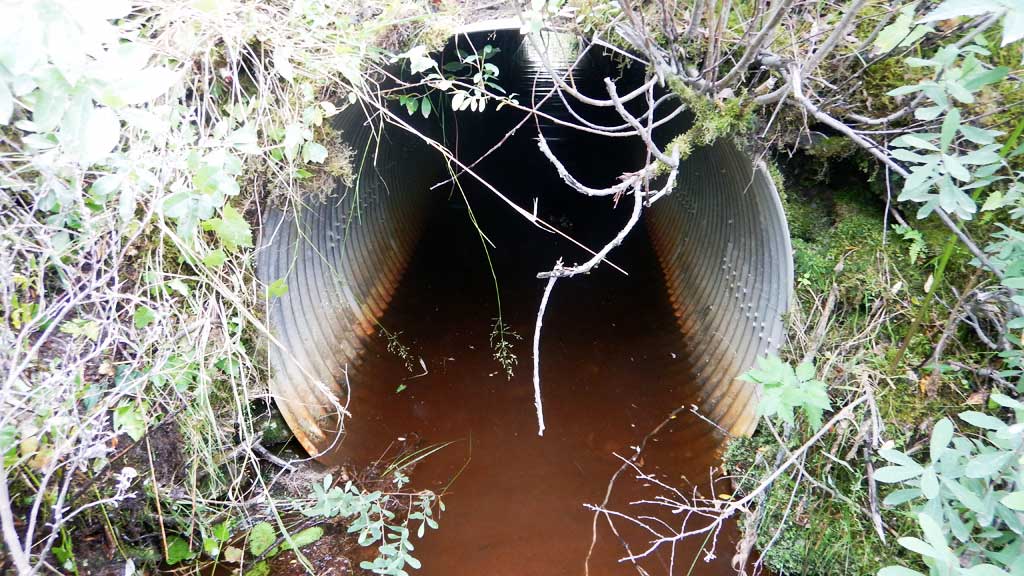
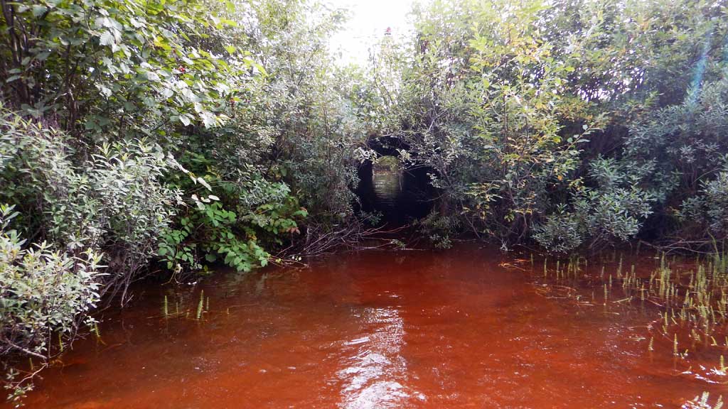
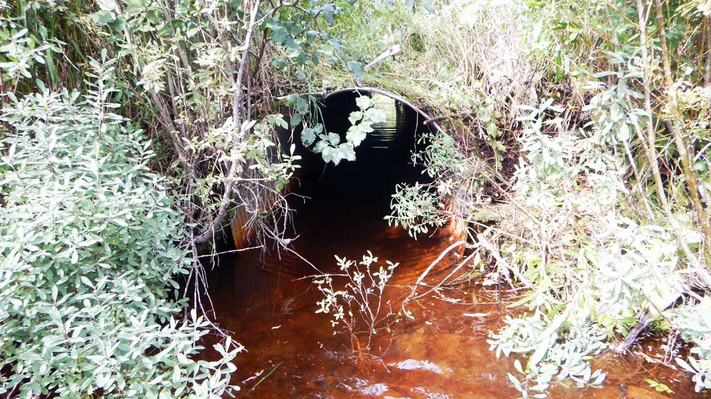
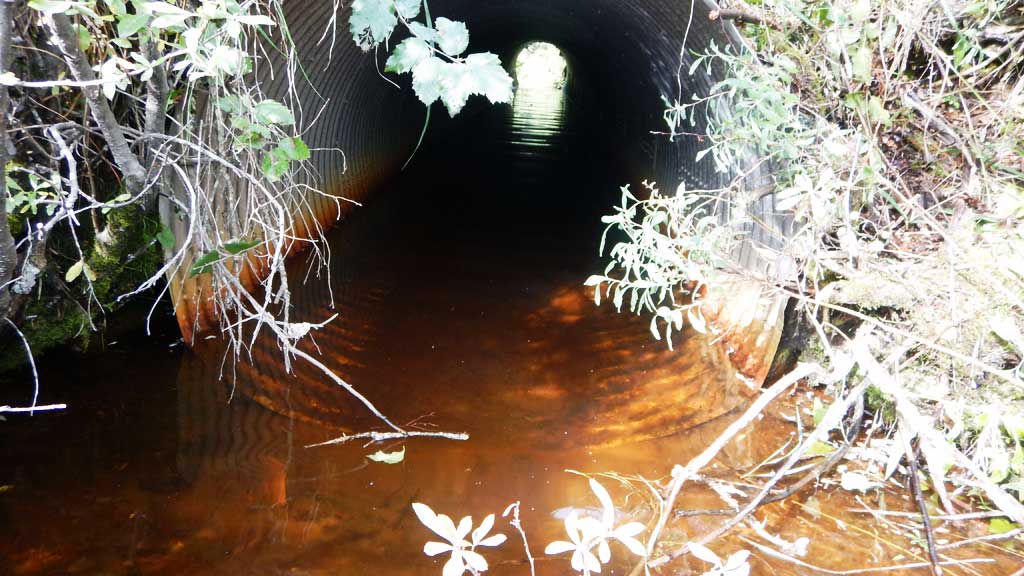
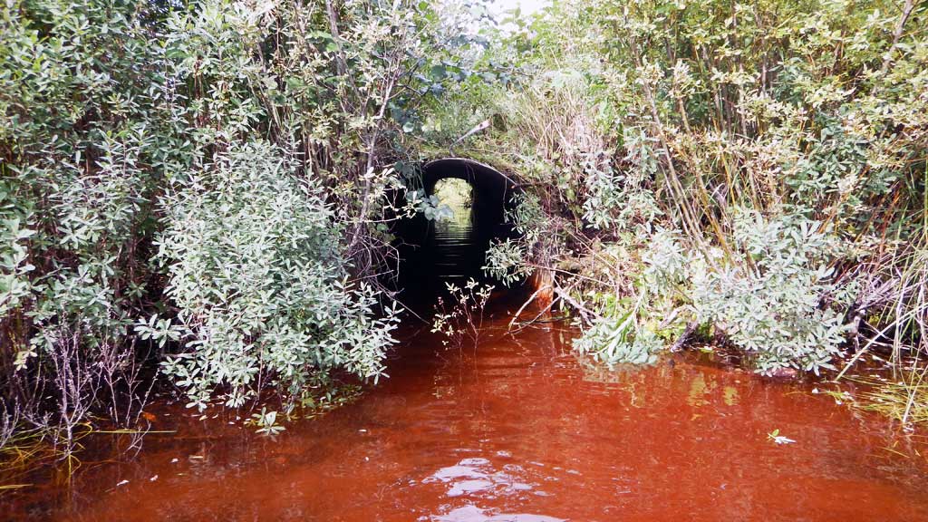
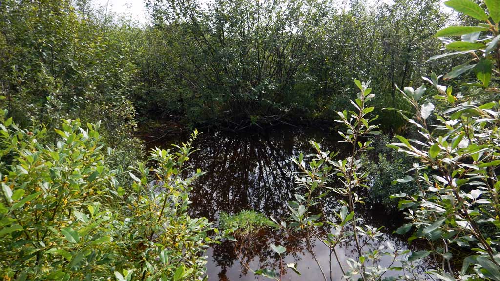
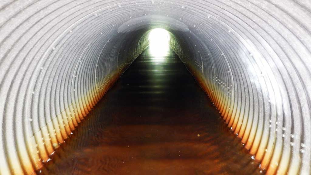
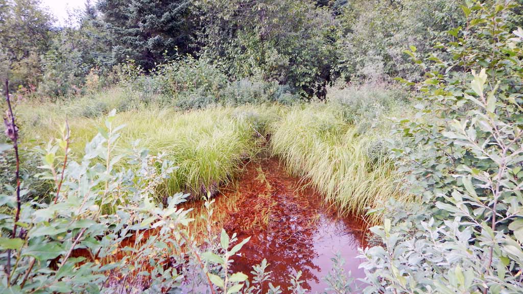
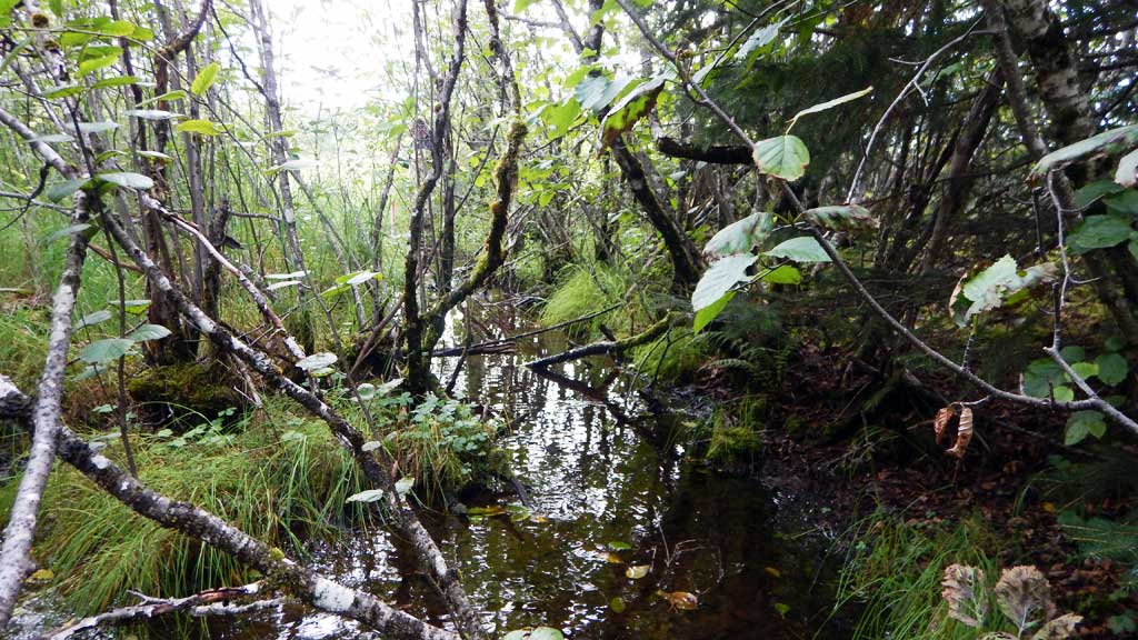
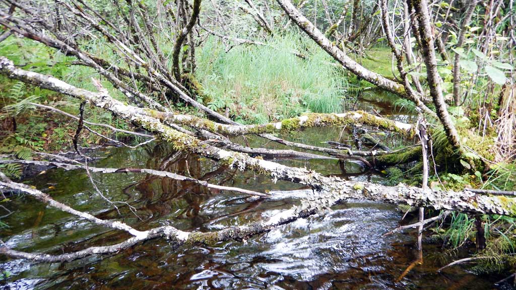
Comments: Culvert assessment performed and submitted by the Copper River Watershed Project. Lots of iron flocculant. Juvenile Coho caught upstream and downstream of crossing. Water surface elevations through culvert equal, downstream tail water control higher than inlet invert and water appears to be slow moving, site is backwatered. Culvert does appear to be undersized for crossing.
Culvert Measurements
| ID: 1 | Structure Type: Circular pipe (Corrugated aluminum) | Fish Passage Rating: | |||||||||||||||||||||||||||||||||||||||||
|
|
|
|||||||||||||||||||||||||||||||||||||||||
Comments: Seam starting to show signs of parting inside culvert. Inlet is distorted and width constricted. |
|||||||||||||||||||||||||||||||||||||||||||
Culvert Observations:
|
|||||||||||||||||||||||||||||||||||||||||||
Stream Measurements
|
|
| Stream Width Type | Distance From Crossing (ft) |
Stream Width (ft) |
|---|---|---|
| Upstream ordinary high water | 8.10 | |
| Upstream ordinary high water | 8.20 | |
| Upstream ordinary high water | 7.80 |
Elevations
| Locator ID | Culvert Number |
River Distance (ft)1 |
Distance From Crossing (ft)2 |
Relative Elevation (ft) |
|---|---|---|---|---|
| Road Elev | 100.00 | |||
| D/S Grade Ctrl (Thalweg) | 0.00 | 96.07 | ||
| D/S Water Surface Elev | 0.00 | 96.15 | ||
| Max Pool Depth | 14.00 | 93.09 | ||
| Outlet Pool Water Elev | 14.00 | 96.17 | ||
| Outlet Culvert Top | 34.00 | 98.92 | ||
| Outlet Invert (on pipe) | 34.00 | 94.83 | ||
| D/S Water Surface Elev | 34.00 | 96.17 | ||
| U/S Water Surface Elev | 87.00 | 96.17 | ||
| Inlet Culvert Invert (on pipe) | 87.00 | 95.29 | ||
| Inlet Culvert Top | 87.00 | 99.41 | ||
| U/S Grade Ctrl (Thalweg) | 99.00 | 95.21 | ||
| U/S Water Surface Elev | 99.00 | 96.17 | ||
| U/S Grade Ctrl (Thalweg) | 148.00 | 95.53 | ||
| U/S Water Surface Elev | 148.00 | 96.21 |
Notes:
- River distance is measured continuously throughout the survey reach along the thalweg of the stream.
- Measured from each end of the crossing along the thalweg of the stream.
Fish Sampling Efforts
| Gear Type: Minnow Trap (A) | Trap Duration(h): 6.0 | |
| Comments: No fish caught | ||
| Gear Type: Minnow Trap (B) | Trap Duration(h): 6.0 | |
Fish Observations
| Species: juvenile coho salmon | Life History: Anadromous | ||
| Total Fish Observed: 2 | Fish Measured: 2 | Fork Lengths (mm) Min: 45 Max: 50 Mean: 47 | |
| Collected/Observed by Gear Type: Not Recorded Minnow Trap (2) | |||
Photos
Questions or comments about this report can be directed to dfg.dsf.webmaster@alaska.gov