Fish Passage Site 20100481
Coordinates (dec. deg.): 60.46641°, -145.35297°
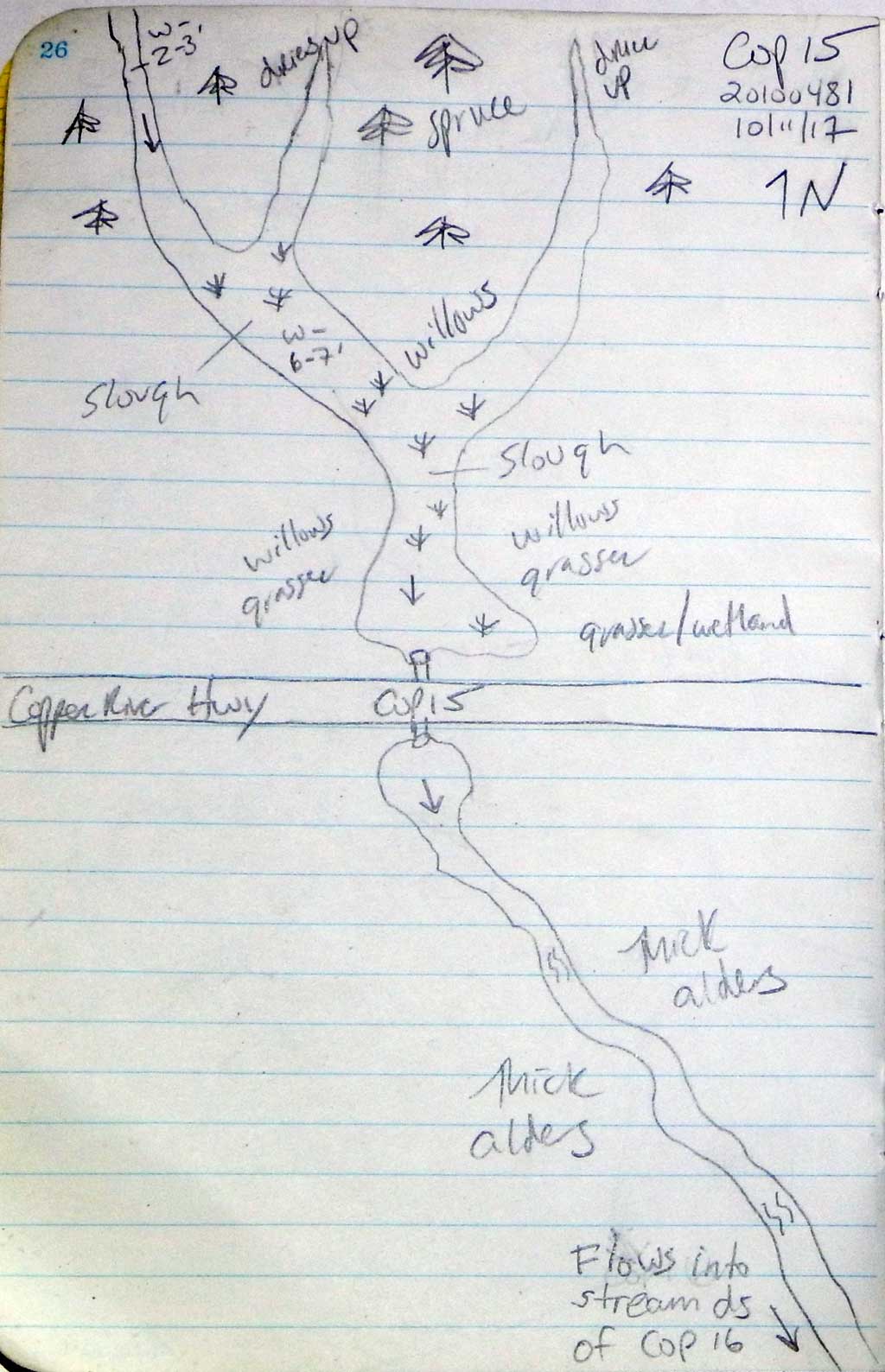
Legal Description: C016S001W23
Region: South Central
Road Name: Copper River Highway
Datum: NAD83
Quad Name / ITM: Cordova B-4
AWC Stream #:
Stream Name: Unnamed
Elevation:
Site Comments: None
arrow to the right of the survey date below to choose a different report for this site.
Survey CRWP17-Cop15
Observers: Kirsti Jurica, Hoots Witsoe
Overall Fish Passage Rating:
Tidal: No
Backwatered: No
Step Pools: No
Construction Year:
Site Observations:
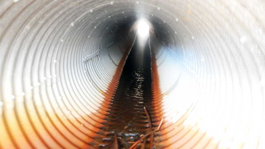
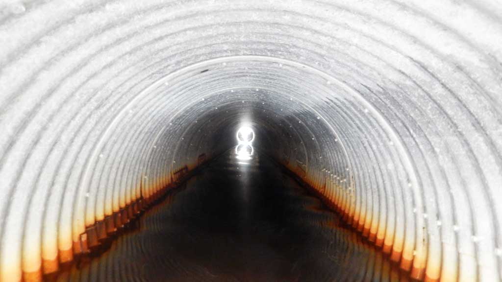
- Compound gradient in pipe
- Culvert gradient red
- Constriction ratio gray
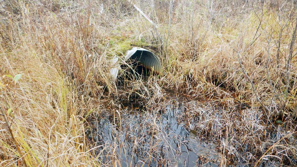
- Inlet perch
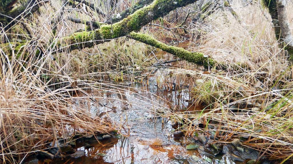
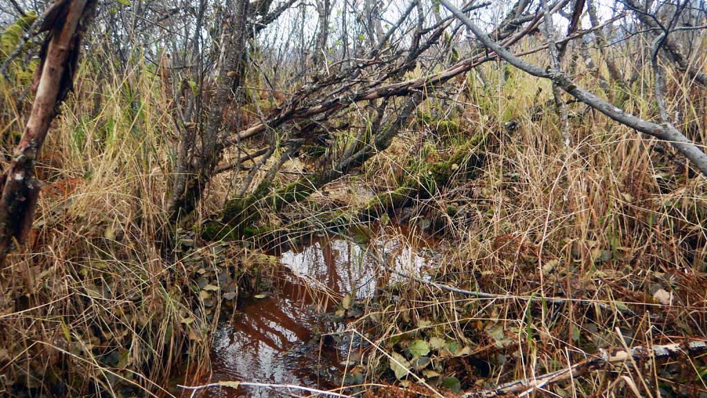
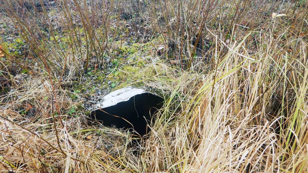
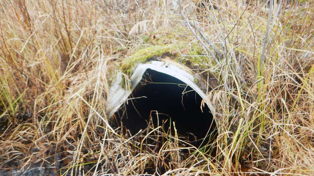
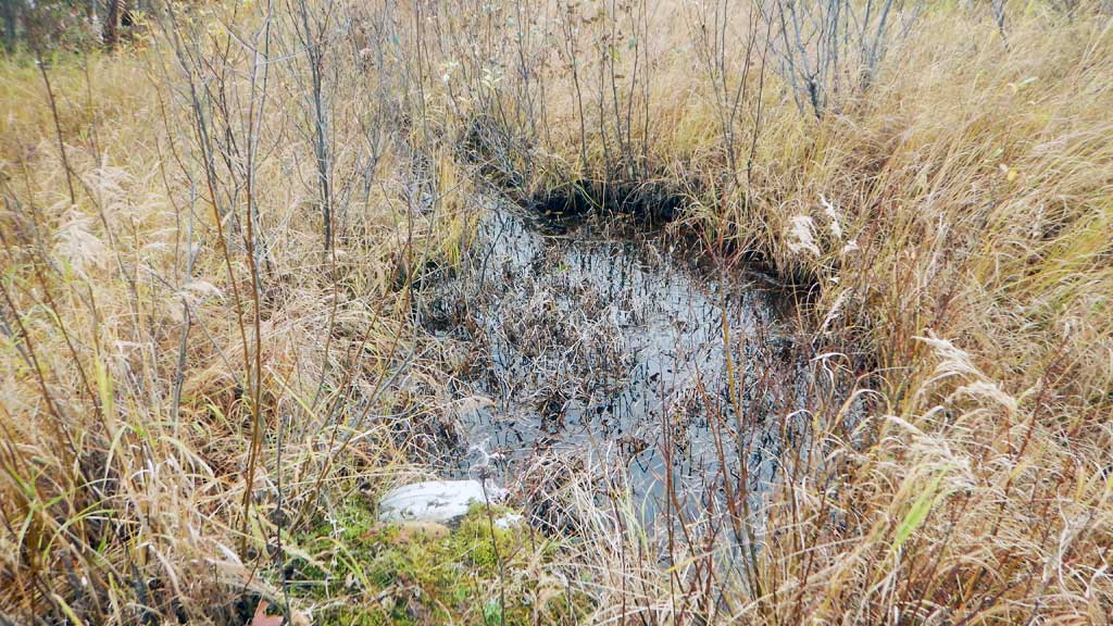
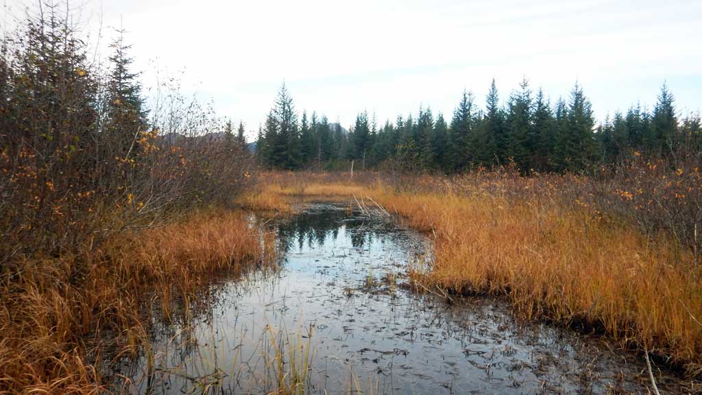
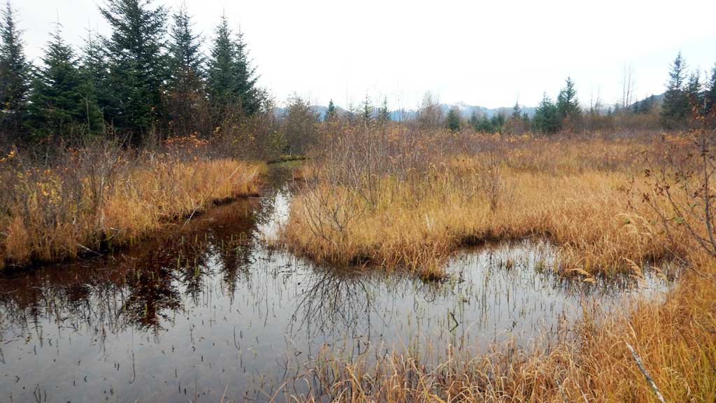
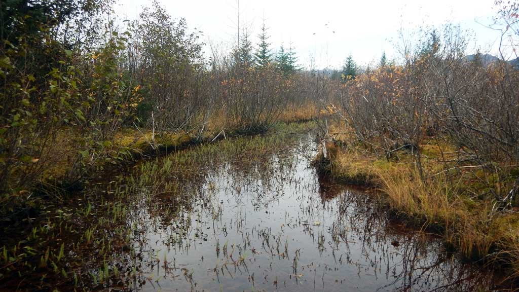
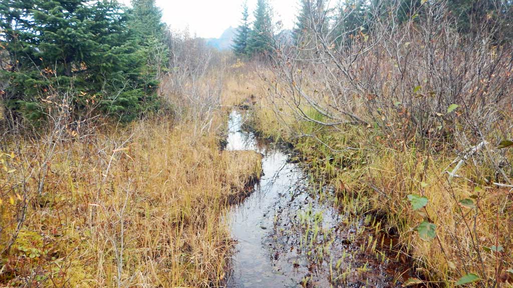
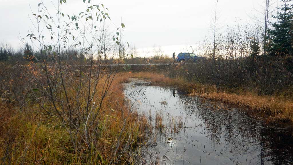
Comments: Culvert assessment performed and submitted by the Copper River Watershed Project. Surface water peters out upstream. Inlet partially overgrown causing inlet perch. Low water depth at inlet. Juvenile Coho salmon caught downstream of culvert. Sprawling channels upstream.
Culvert Measurements
| ID: 1 | Structure Type: Circular pipe (Corrugated aluminum) | Fish Passage Rating: | |||||||||||||||||||||||||||||||||||||||||
|
|
|
|||||||||||||||||||||||||||||||||||||||||
Comments: Inlet partially overgrown causing inlet perch. Inlet and outlet have some damage. |
|||||||||||||||||||||||||||||||||||||||||||
Culvert Observations:
|
|||||||||||||||||||||||||||||||||||||||||||
Stream Measurements
|
|
| Stream Width Type | Distance From Crossing (ft) |
Stream Width (ft) |
|---|---|---|
| Downstream ordinary high water | 3.50 | |
| Downstream ordinary high water | 4.00 | |
| Downstream ordinary high water | 4.10 |
Elevations
| Locator ID | Culvert Number |
River Distance (ft)1 |
Distance From Crossing (ft)2 |
Relative Elevation (ft) |
|---|---|---|---|---|
| Road Elev | 100.00 | |||
| D/S Water Surface Elev | 0.00 | 91.81 | ||
| D/S Grade Ctrl (Thalweg) | 0.00 | 91.34 | ||
| D/S Tailcrest or 1st Thalweg | 35.00 | 92.30 | ||
| D/S Water Surface Elev | 35.00 | 92.51 | ||
| Outlet Pool Water Elev | 42.00 | 92.55 | ||
| Max Pool Depth | 42.00 | 91.15 | ||
| Outlet Culvert Top | 48.00 | 94.36 | ||
| Outlet Invert (on substrate) | 48.00 | 91.42 | ||
| D/S Water Surface Elev | 48.00 | 92.55 | ||
| Inlet Culvert Top | 118.00 | 95.60 | ||
| Inlet Culvert Invert (on substrate) | 118.00 | 93.83 | ||
| U/S Water Surface Elev | 118.00 | 93.96 | ||
| U/S Water Surface Elev | 128.00 | 94.30 | ||
| U/S Thalweg | 128.00 | 93.20 |
Notes:
- River distance is measured continuously throughout the survey reach along the thalweg of the stream.
- Measured from each end of the crossing along the thalweg of the stream.
Fish Sampling Efforts
| Gear Type: Minnow Trap (A) | Trap Duration(h): 18.0 | |
| Comments: No fish caught | ||
| Gear Type: Minnow Trap (B) | Trap Duration(h): 18.0 | |
| Comments: No fish caught | ||
Fish Observations
No fish observations occurred during this survey.
Photos
Questions or comments about this report can be directed to dfg.dsf.webmaster@alaska.gov