Fish Passage Site 20100479
Coordinates (dec. deg.): 60.46778°, -145.35909°
Legal Description: C016S001W23
Region: South Central
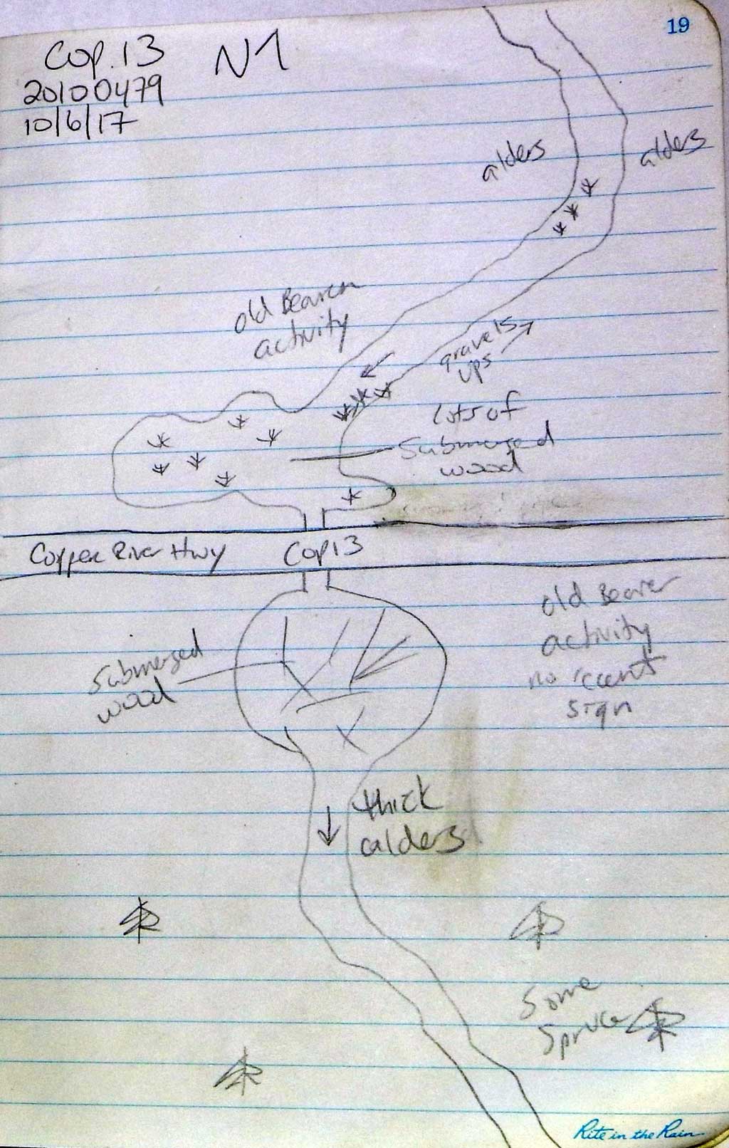
Road Name: Copper River Highway
Datum: NAD83
Quad Name / ITM: Cordova B-4
AWC Stream #:
Stream Name: Unnamed
Elevation:
Site Comments: None
arrow to the right of the survey date below to choose a different report for this site.
Survey CRWP17-Cop13
Observers: Kirsti Jurica, Hoots Witsoe
Overall Fish Passage Rating:
Tidal: No
Backwatered: No
Step Pools: No
Construction Year:
Site Observations:
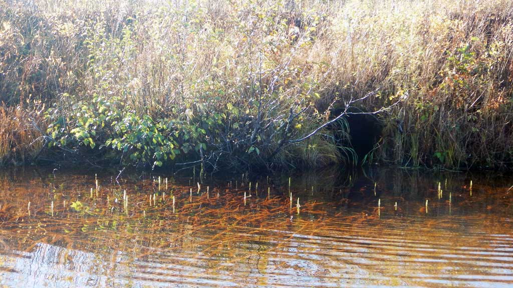
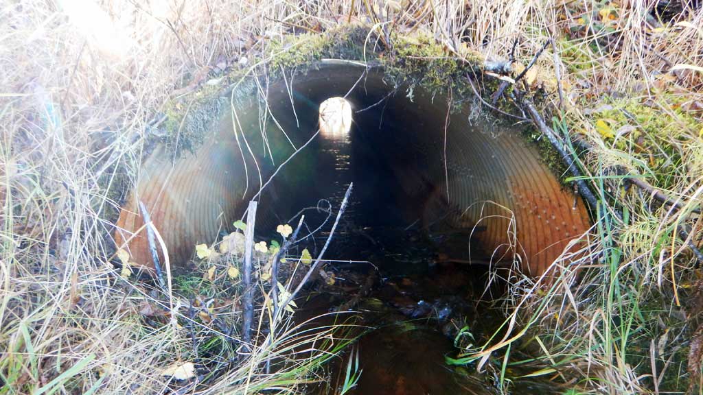
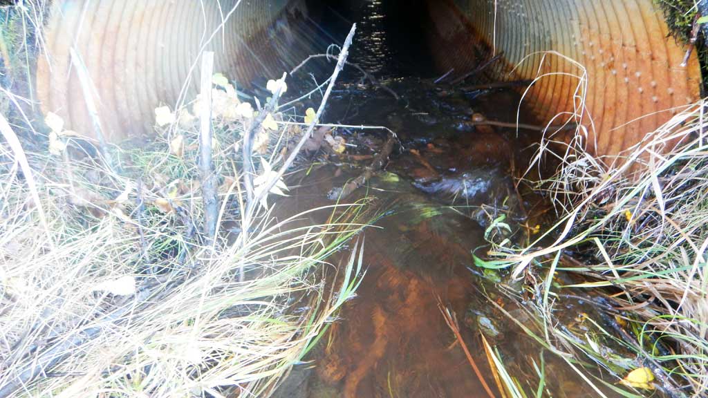
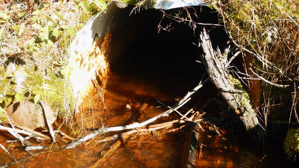
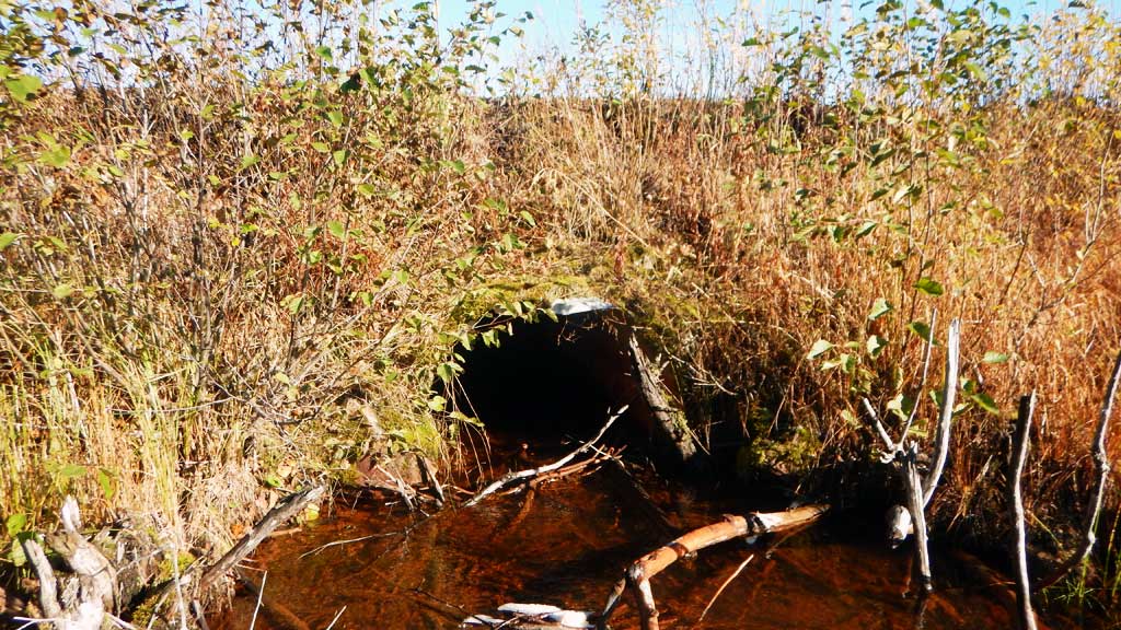
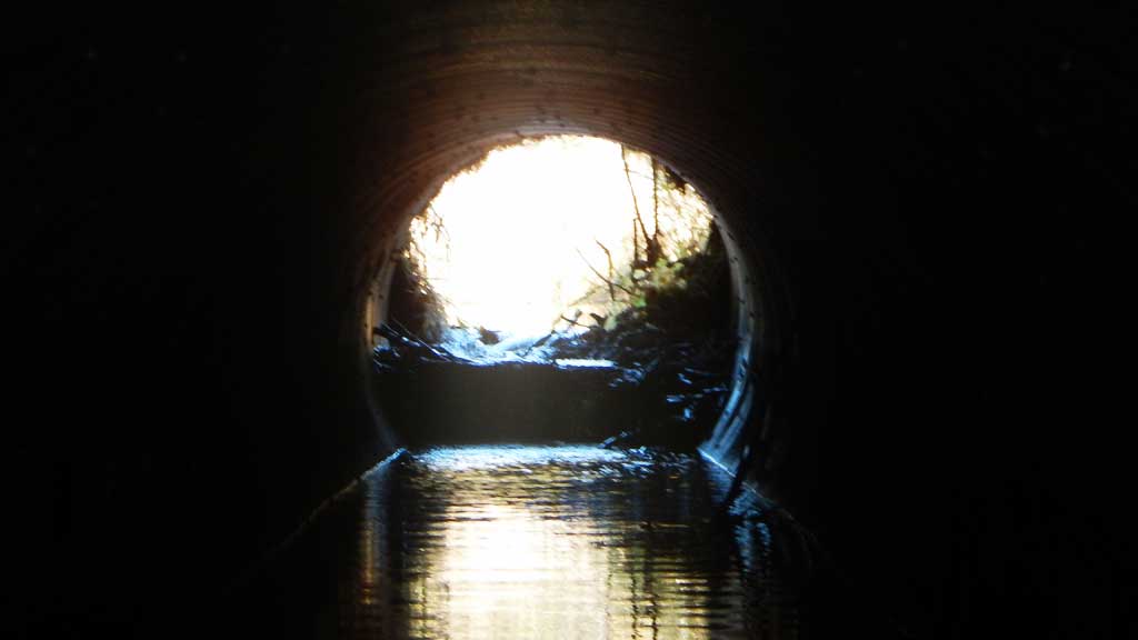
- Culvert is poorly aligned
- Constriction ratio red
- Culvert gradient red
- Inlet perch
- Beaver Activity
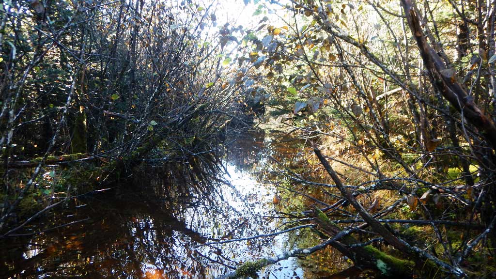
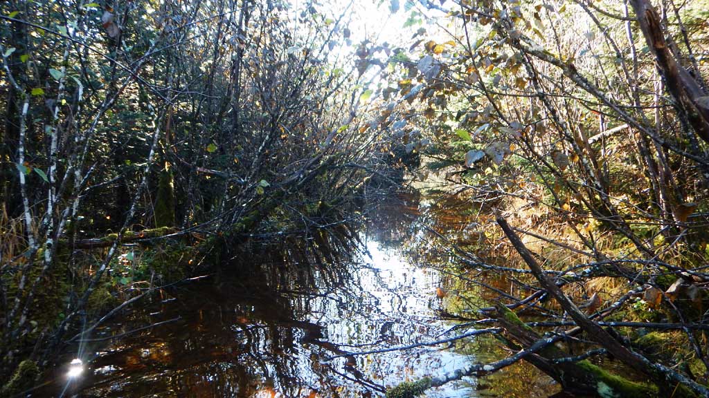
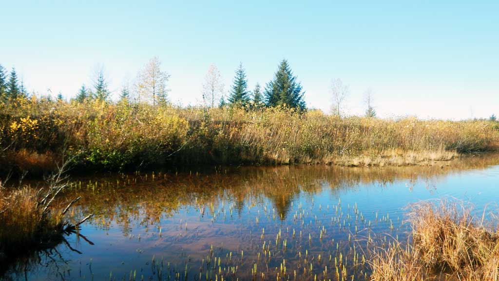
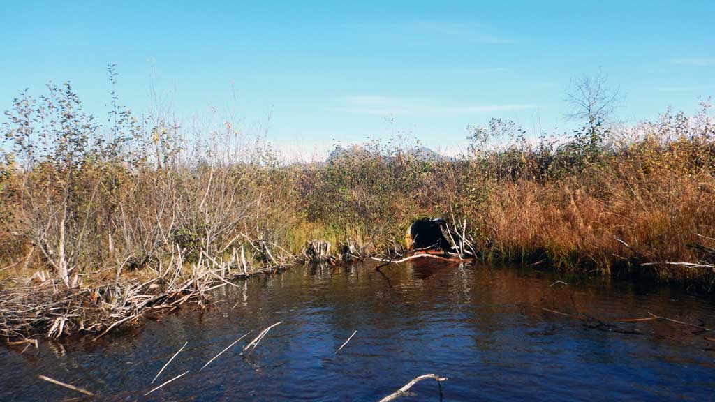
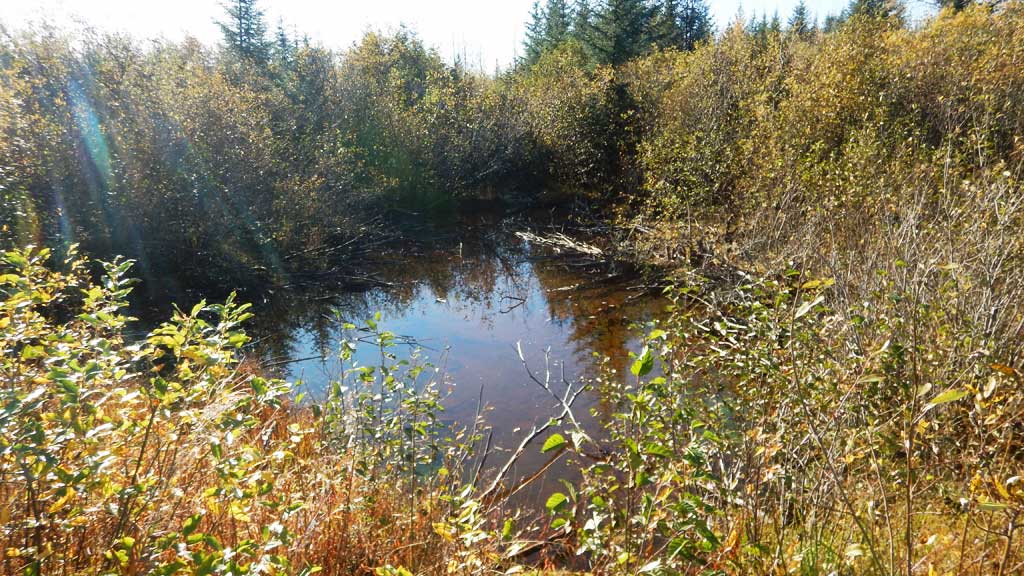
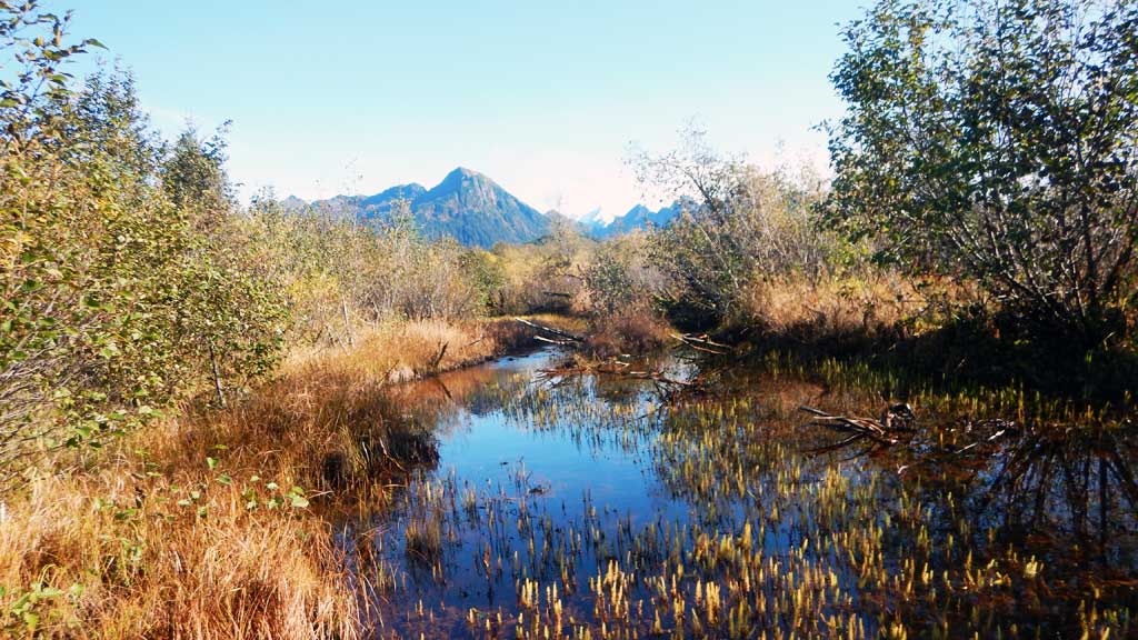
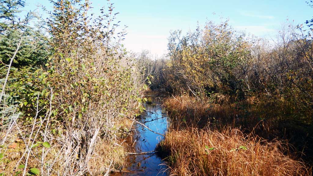
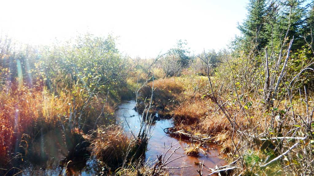
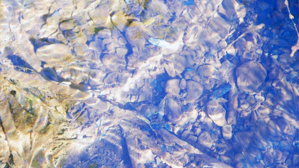
Comments: Numerous juvenile Coho salmon observed upstream and downstream of crossing. Old beaver activity, but nothing looks recent. Old glacial floodplain, connectivity of upstream surface water limited, but there is some flowing water with gravels upstream. Sprawling multi-channeled upstream. Partial blockage at inlet from organic and wood debris causing a hydraulic jump.
Culvert Measurements
| ID: 1 | Structure Type: Circular pipe (Corrugated steel) | Fish Passage Rating: | |||||||||||||||||||||||||||||||||||||||||
|
|
|
|||||||||||||||||||||||||||||||||||||||||
Comments: Debris at inlet causing inlet perch and jump. |
|||||||||||||||||||||||||||||||||||||||||||
Culvert Observations:
|
|||||||||||||||||||||||||||||||||||||||||||
Stream Measurements
|
|
| Stream Width Type | Distance From Crossing (ft) |
Stream Width (ft) |
|---|---|---|
| Upstream ordinary high water | 11.30 | |
| Upstream ordinary high water | 12.50 | |
| Upstream ordinary high water | 14.50 |
Elevations
| Locator ID | Culvert Number |
River Distance (ft)1 |
Distance From Crossing (ft)2 |
Relative Elevation (ft) |
|---|---|---|---|---|
| Road Elev | 100.00 | |||
| D/S Tailcrest or 1st Thalweg | 0.00 | 90.74 | ||
| D/S Water Surface Elev | 0.00 | 91.46 | ||
| Outlet Pool Water Elev | 45.00 | 91.49 | ||
| Max Pool Depth | 45.00 | 90.51 | ||
| Outlet Invert (on substrate) | 70.00 | 91.01 | ||
| D/S Water Surface Elev | 70.00 | 91.49 | ||
| Outlet Culvert Top | 70.00 | 94.09 | ||
| Inlet Culvert Top | 135.00 | 95.01 | ||
| U/S Water Surface Elev | 135.00 | 92.68 | ||
| Inlet Culvert Invert (on substrate) | 135.00 | 92.20 | ||
| U/S Grade Ctrl (Thalweg) | 139.00 | 90.42 | ||
| U/S Water Surface Elev | 139.00 | 92.72 | ||
| U/S Water Surface Elev | 241.00 | 92.79 | ||
| U/S Grade Ctrl (Thalweg) | 241.00 | 92.51 |
Notes:
- River distance is measured continuously throughout the survey reach along the thalweg of the stream.
- Measured from each end of the crossing along the thalweg of the stream.
Fish Sampling Efforts
| Gear Type: Minnow Trap (A) | Trap Duration(h): 18.0 | |
| Comments: No fish caught | ||
| Gear Type: Minnow Trap (B) | Trap Duration(h): 18.0 | |
| Gear Type: Minnow Trap (C) | Trap Duration(h): 18.0 | |
| Comments: No fish caught | ||
Fish Observations
| Species: juvenile coho salmon | Life History: Anadromous | ||
| Total Fish Observed: 2 | Fish Measured: 2 | Fork Lengths (mm) Min: 35 Max: 40 Mean: 37 | |
| Collected/Observed by Gear Type: Not Recorded Minnow Trap (2) | |||
Photos


Questions or comments about this report can be directed to dfg.dsf.webmaster@alaska.gov