Fish Passage Site 10303469
Coordinates (dec. deg.): 58.38678°, -134.74435°
Legal Description: C040S065E19
Region: Southeast
Road Name: Glacier Highway
Datum: NAD83
Quad Name / ITM: Juneau B-3
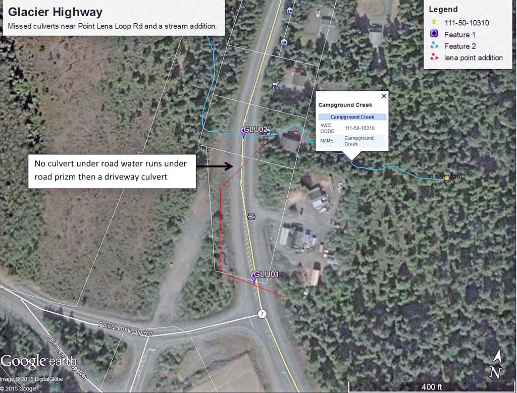
AWC Stream #: 111-50-10310
Stream Name: Campground Creek
Elevation:
Site Comments: None
Survey UPDATE-GLU02
Project Supervisor: Gillian O'Doherty, ADFG
Observers: Mark Eisenman
Overall Fish Passage Rating:
Tidal:
Backwatered:
Step Pools:
Construction Year:
Comments: Site was missed in the 2011-12 surveys. Creek flows under Glacier Highway and then downstream to sites 10302216 and 10302217. Stream also takes flows from a creek coming in just upstream that flows though a driveway culvert then though the road prism with no culvert and then back through the highway at site GLU01.
Culvert Measurements
| ID: 1 | Structure Type:N/A | Fish Passage Rating: | |||||||||||||||||||||||||||||||||||||||||
|
|
|
|||||||||||||||||||||||||||||||||||||||||
Stream Measurements
|
|
No stream width data available.
Elevations
No elevation data available.
Fish Sampling Efforts
No fish sampling occurred during this survey.
Fish Observations
No fish observations occurred during this survey.
Photos
Questions or comments about this report can be directed to dfg.dsf.webmaster@alaska.gov