Fish Passage Site 10303346
Coordinates (dec. deg.): 58.33997°, -134.52464°
Legal Description: C041S067E06
Region: Southeast
Road Name: Private Drive
Datum: NAD83
Quad Name / ITM: Juneau B-2
AWC Stream #: 111-40-10980
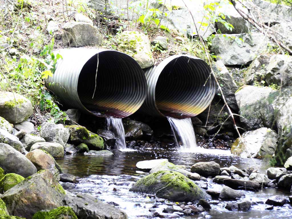
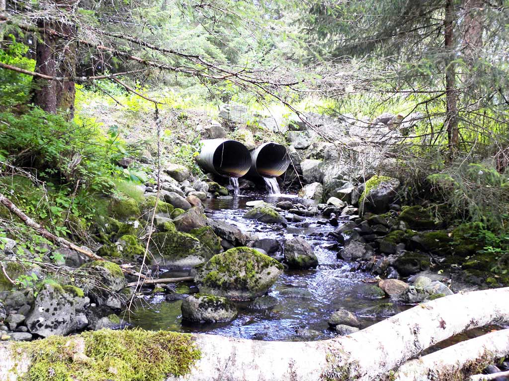
Stream Name: Hendrickson Creek
Elevation:
Site Comments: None
arrow to the right of the survey date below to choose a different report for this site.
Survey UPDATE-JUN01
Project Supervisor: Gillian O'Doherty, ADFG
Observers:
Overall Fish Passage Rating:
Tidal:
Backwatered:
Step Pools:
Construction Year:
Site Observations:
- Outfall height red
Comments: Information was provide by John Hudson with USFWS. Double culvert on a private driveway off of North Douglas Highway. Creek splits upstream and both tributaries have culverts that pass under the North Douglas Highway. Upstream culvert sites, NDH10 and NDH06. Both upstream tributaries are already cataloged as anadromous.
Culvert Measurements
| ID: 1 | Structure Type: Circular pipe (Corrugated steel) | Fish Passage Rating: | |||||||||||||||||||||||||||||||||||||||||
|
|
|
|||||||||||||||||||||||||||||||||||||||||
Culvert Observations:
|
|||||||||||||||||||||||||||||||||||||||||||
| ID: 2 | Structure Type: Circular pipe (Corrugated steel) | Fish Passage Rating: | |||||||||||||||||||||||||||||||||||||||||
|
|
|
|||||||||||||||||||||||||||||||||||||||||
Culvert Observations:
|
|||||||||||||||||||||||||||||||||||||||||||
Stream Measurements
|
|
No stream width data available.
Elevations
No elevation data available.
Fish Sampling Efforts
No fish sampling occurred during this survey.
Fish Observations
No fish observations occurred during this survey.
Photos
Questions or comments about this report can be directed to dfg.dsf.webmaster@alaska.gov