Fish Passage Site 10302915
Coordinates (dec. deg.): 59.26975°, -135.64398°
Legal Description: C030S058E16
Region: Southeast
Road Name: Haines Highway
Datum: NAD83
Quad Name / ITM: Skagway B-2
AWC Stream #:
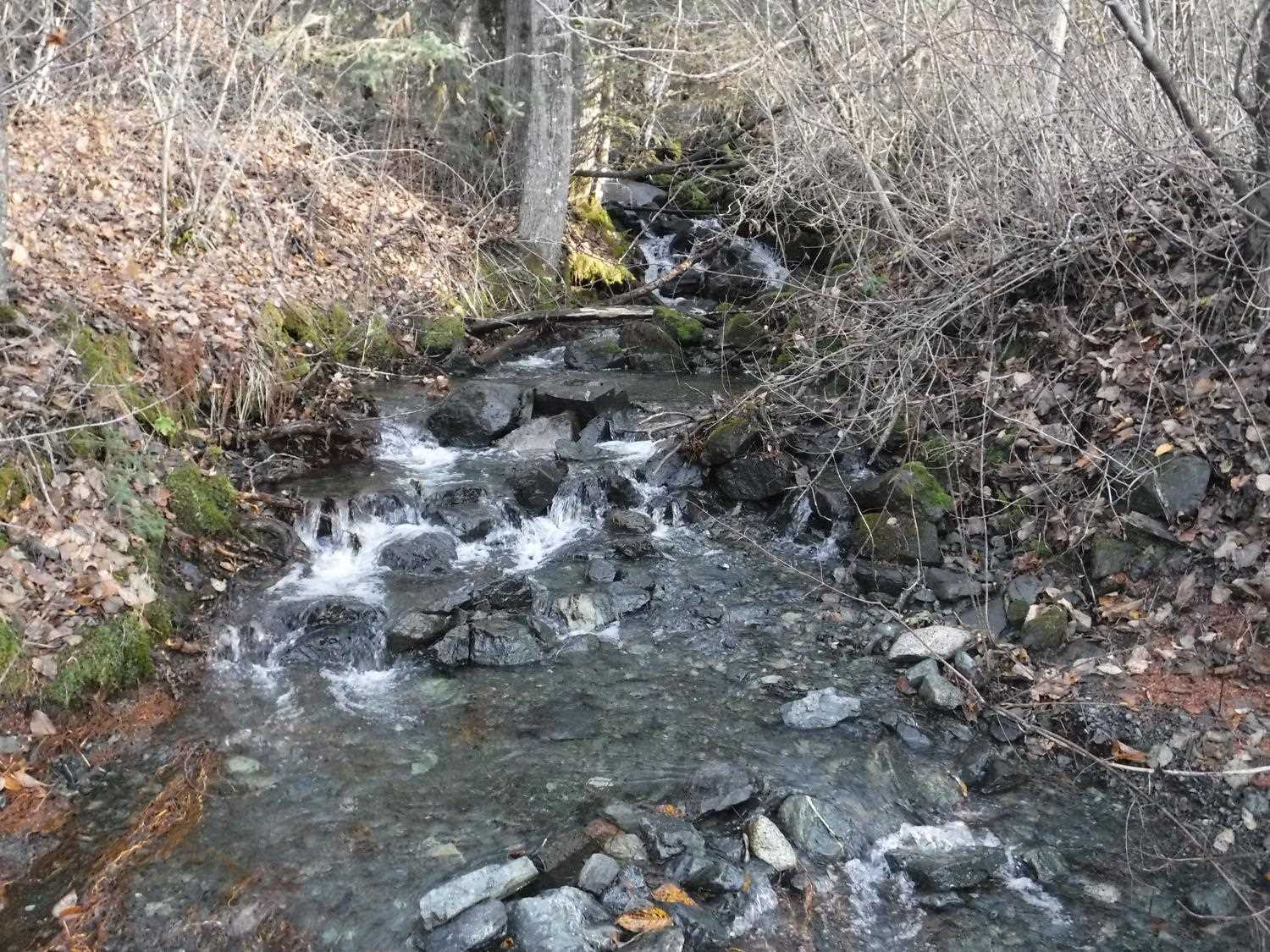
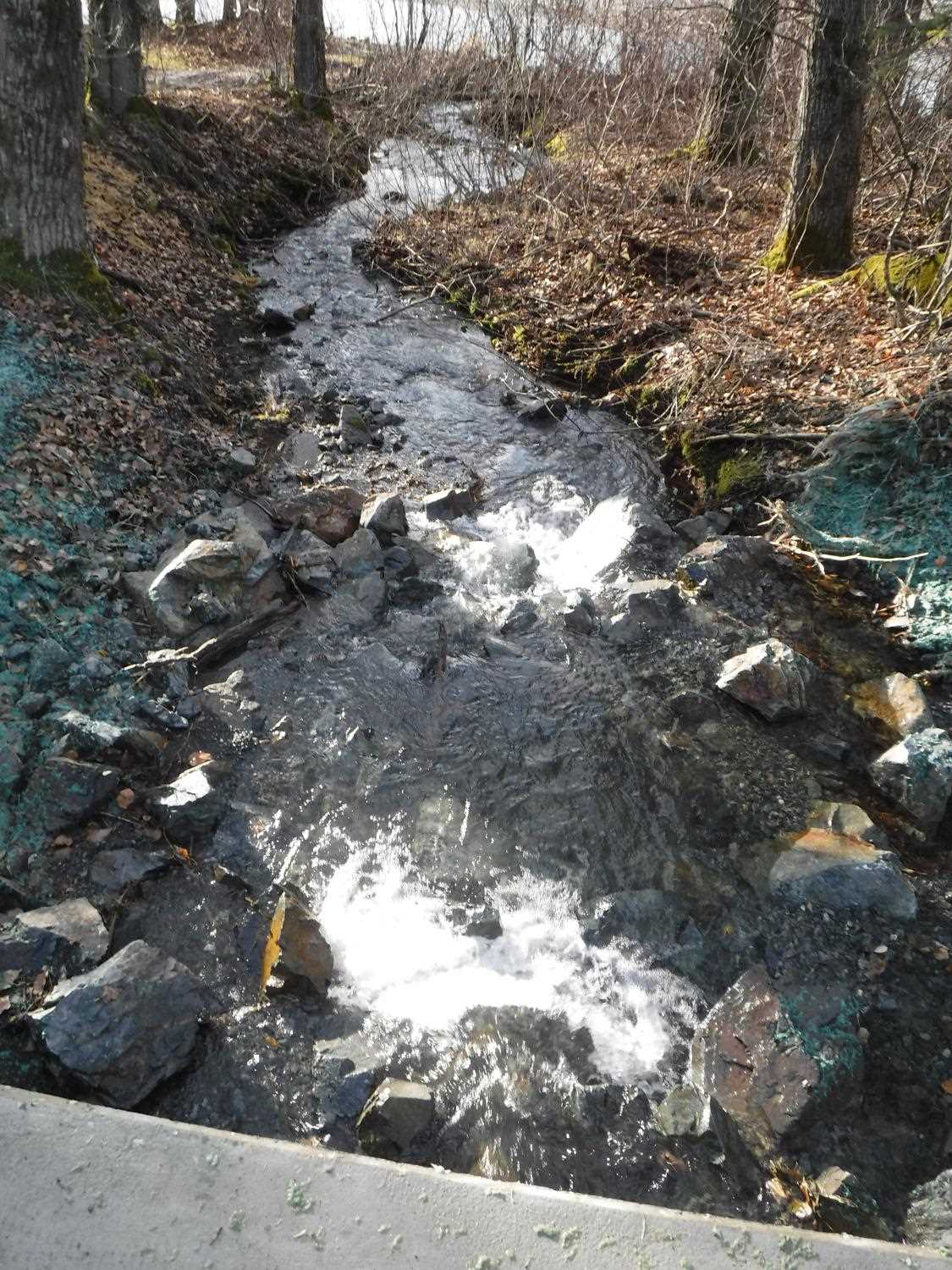
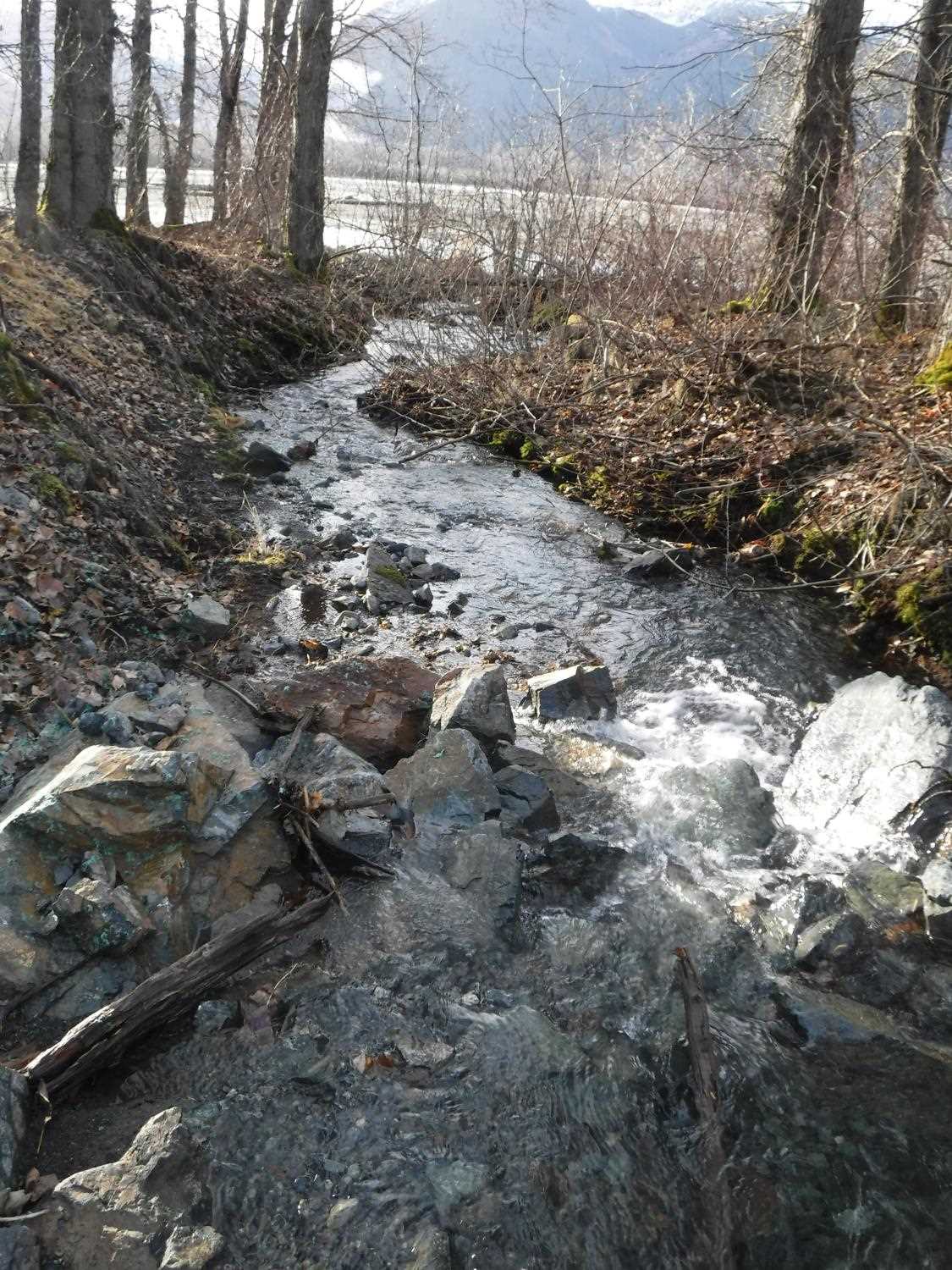
Stream Name: 8.5 Mile Creek
Elevation:
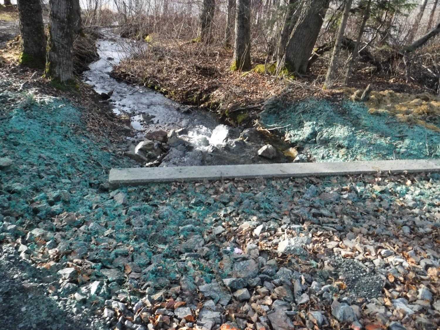
Site Comments: Creek joins Chilkat River about 100 feet downstream and becomes very steep about 100 feet upstream from culverts.
arrow to the right of the survey date below to choose a different report for this site.
Survey UPDATE-2915
Project Supervisor: Gillian O'Doherty, ADFG
Observers: Dylan Krull
Overall Fish Passage Rating:
Tidal:
Backwatered:
Step Pools:
Construction Year:
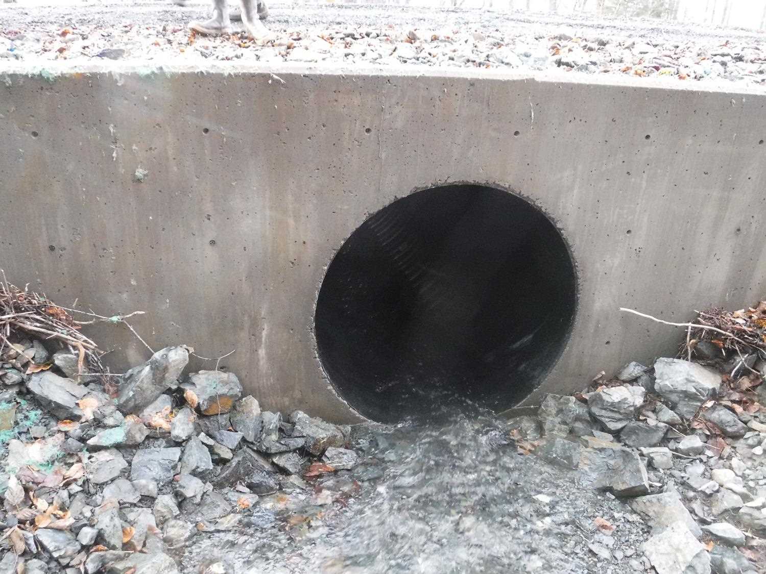
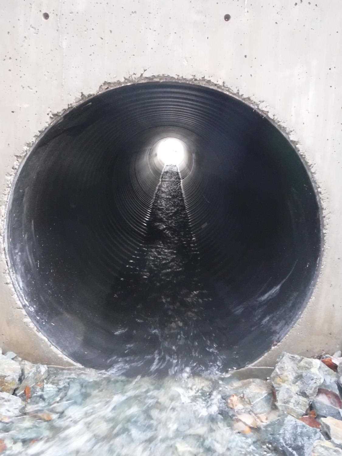
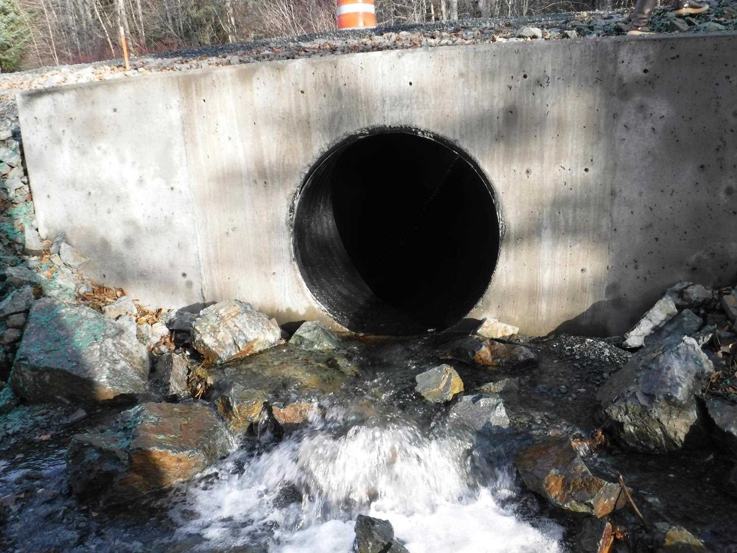
Comments: Update information and photos submitted by ADFG HB Dylan Krull. Site was replaced as part of the Haines Highway reconstruction project Phase I under Fish Habitat Permit FH17-I-0124. Fish Coho salmon, cutthroat trout, and sculpin caught downstream from culverts.
Culvert Measurements
| ID: 1 | Structure Type: Circular pipe (Corrugated plastic) | Fish Passage Rating: | |||||||||||||||||||||||||||||||||||||||||
|
|
|
|||||||||||||||||||||||||||||||||||||||||
Comments: Culvert measurements taken from trip report for reference and have not been verified. Culvert length 69 ft. Culvert diameter 4ft. Replaced culvert is a smoothed wall plastic pipe. |
|||||||||||||||||||||||||||||||||||||||||||
Stream Measurements
|
|
No stream width data available.
Elevations
No elevation data available.
Fish Sampling Efforts
No fish sampling occurred during this survey.
Fish Observations
No fish observations occurred during this survey.
Photos

Questions or comments about this report can be directed to dfg.dsf.webmaster@alaska.gov