Fish Passage Site 10302217
Coordinates (dec. deg.): 58.39279°, -134.75055°
Legal Description: C040S065E19
Region: Southeast
Road Name: Picnic Beach Road
Datum: NAD83
Quad Name / ITM: Juneau B-3
AWC Stream #: 111-50-10310
Stream Name: Picnic Creek
Elevation:
Site Comments: None
arrow to the right of the survey date below to choose a different report for this site.
Survey UPDATE-2217
Project Supervisor: Gillian O'Doherty, ADFG
Observers: Mark Eisenman
Overall Fish Passage Rating:
Tidal:
Backwatered:
Step Pools:
Construction Year:
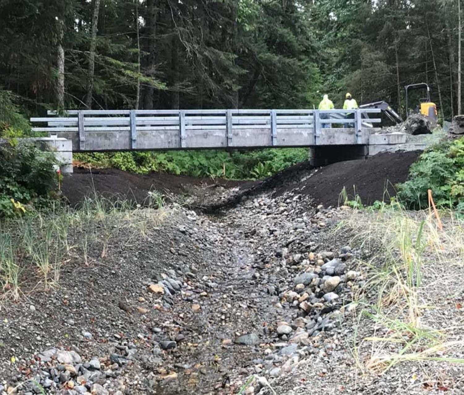
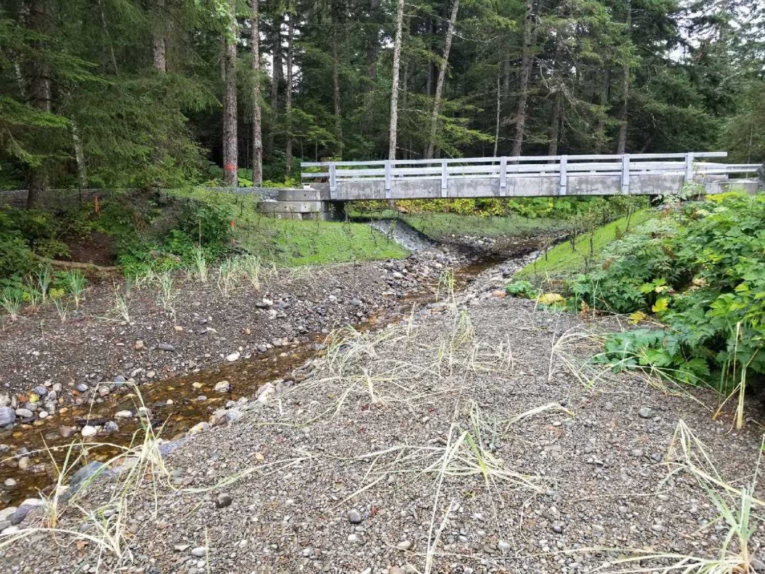
Comments: Information and photos provided by Neil Stichert, USFWS. Site has been removed and replaced with a foot bridge.
Culvert Measurements
No measurement data available.
Stream Measurements
|
|
No stream width data available.
Elevations
No elevation data available.
Fish Sampling Efforts
No fish sampling occurred during this survey.
Fish Observations
No fish observations occurred during this survey.
Photos


Questions or comments about this report can be directed to dfg.dsf.webmaster@alaska.gov