Fish Passage Site 10302178
Coordinates (dec. deg.): 58.33672°, -134.57640°
Legal Description: C041S066E02
Region: Southeast
Road Name: North Douglas Highway
Datum: NAD83
Quad Name / ITM: Juneau B-2
AWC Stream #: 111-50-10670
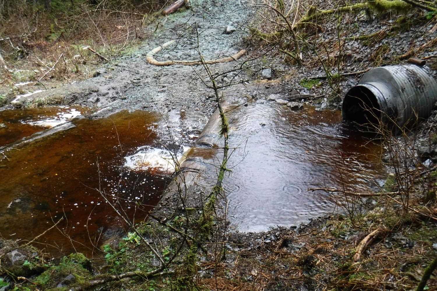
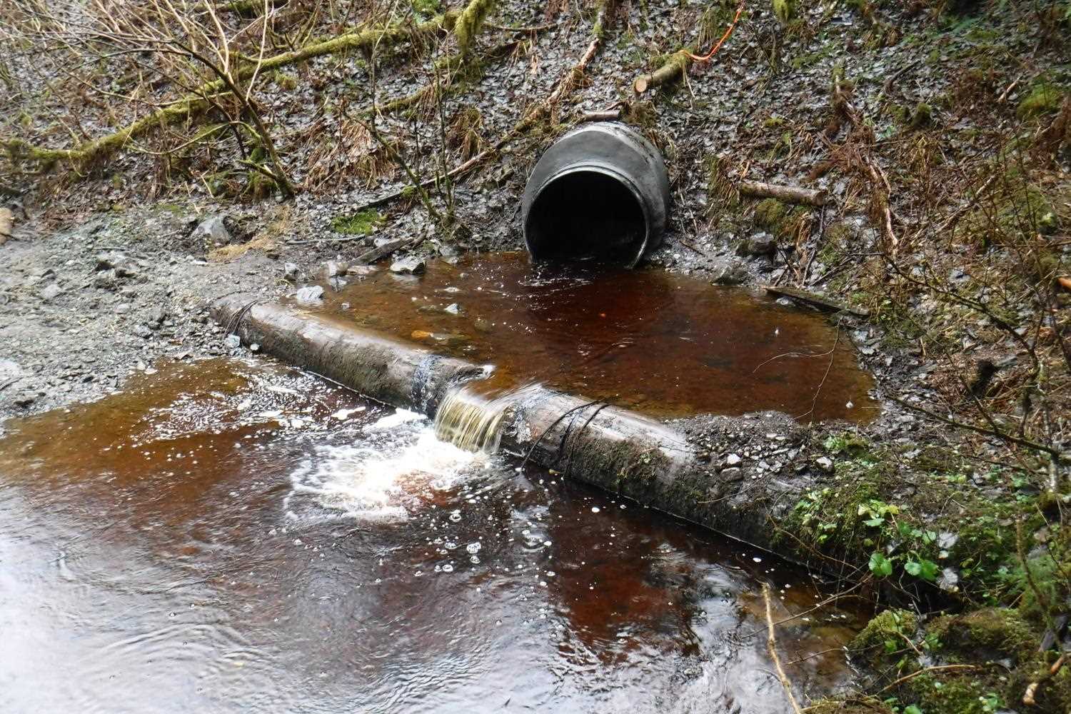
Stream Name: Ninemile Creek
Elevation:
Site Comments: None
arrow to the right of the survey date below to choose a different report for this site.
Survey UPDATE-2178
Project Supervisor: Gillian O'Doherty, ADFG
Observers: Gregory Albrecht
Overall Fish Passage Rating:
Tidal:
Backwatered: No
Step Pools:
Construction Year: 2018
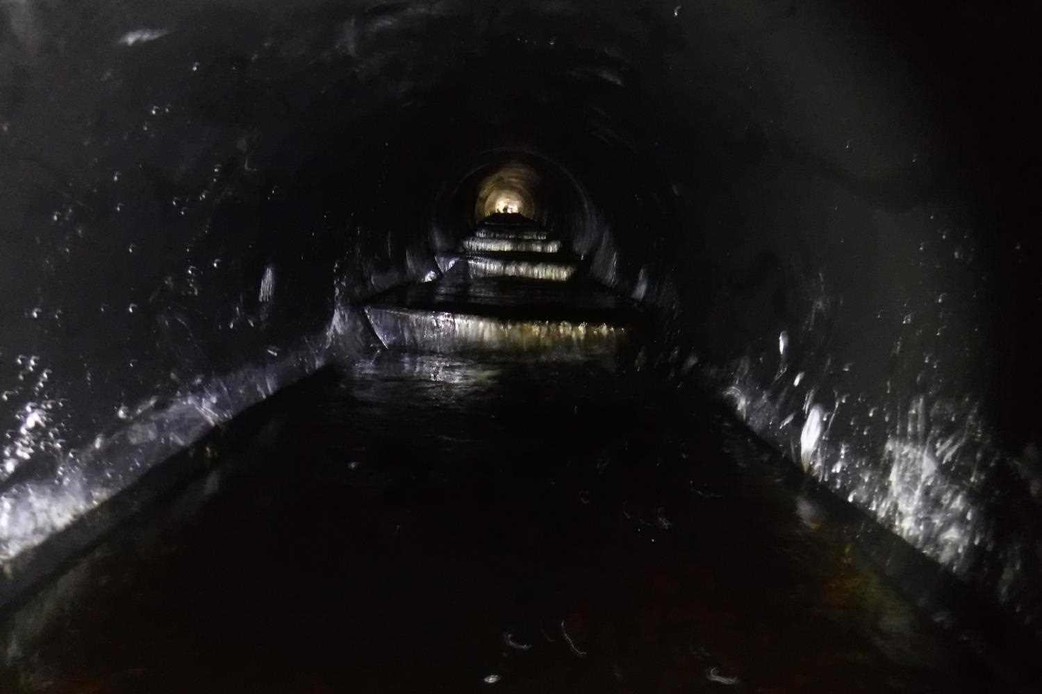
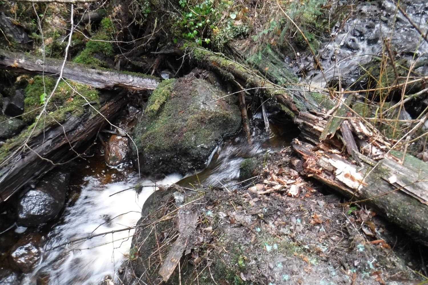
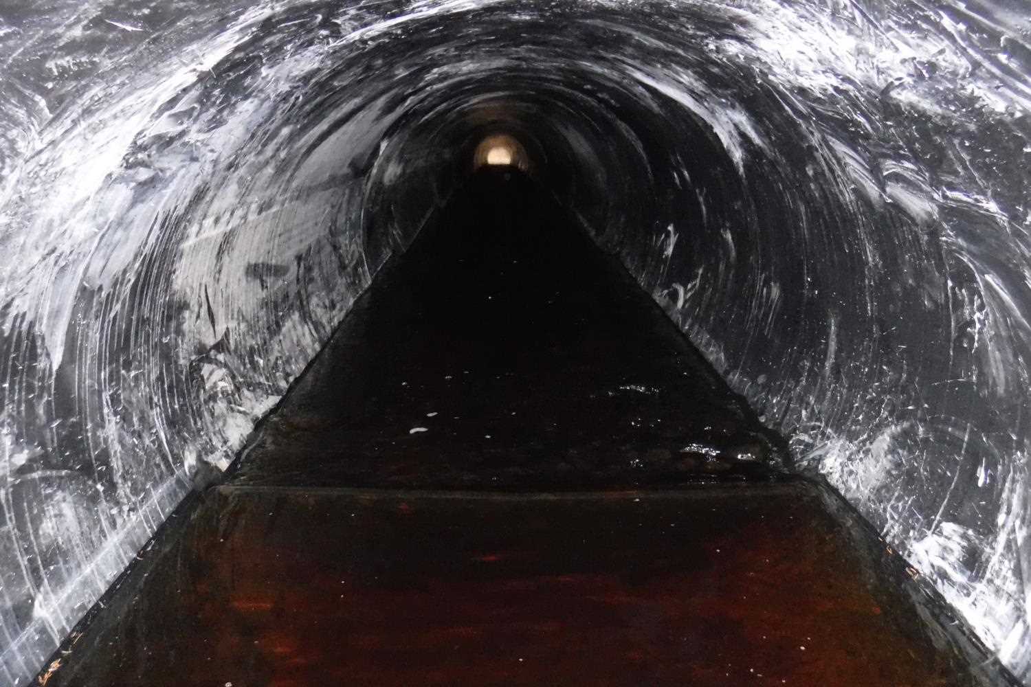
Comments: Culvert update and photos submitted by Greg Albrecht, ADF&G Habitat Biologist. This culvert was retrofitted with a 4.5 ft diameter plastic slip liner with 12 inch v-shaped baffles placed every 9 feet. Work was completed 11/5/18. It was noted in the follow up site visit trip report that the baffles had about one inch of water cresting over the baffles with jump heights all about 4 inches , except for the final baffle which had a jump of about 6 inches. Site rating remains Gray for baffles present. Notched log weirs present downstream for grade control.
Culvert Measurements
| ID: 1 | Structure Type: Circular pipe (Corrugated plastic) | Fish Passage Rating: | |||||||||||||||||||||||||||||||||||||||||
|
|
|
|||||||||||||||||||||||||||||||||||||||||
Comments: Culvert dimensions taken from trip report and have not been verified. Culvert width 4.5 ft, culvert height 4.5ft. |
|||||||||||||||||||||||||||||||||||||||||||
Stream Measurements
|
|
No stream width data available.
Elevations
No elevation data available.
Fish Sampling Efforts
No fish sampling occurred during this survey.
Fish Observations
No fish observations occurred during this survey.
Photos


Questions or comments about this report can be directed to dfg.dsf.webmaster@alaska.gov