Fish Passage Site 10103432
Coordinates (dec. deg.): 60.56318°, -145.68347°
Legal Description: C015S003W13
Region: South Central
Road Name: Eyak Lake Road
Datum: NAD83
Quad Name / ITM: Cordova C-5
AWC Stream #:
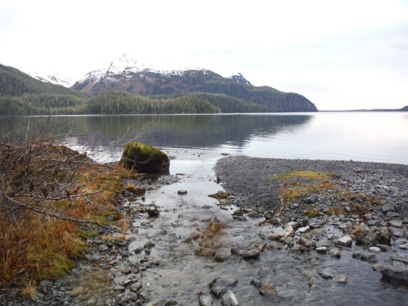
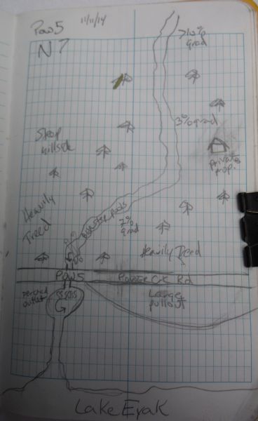
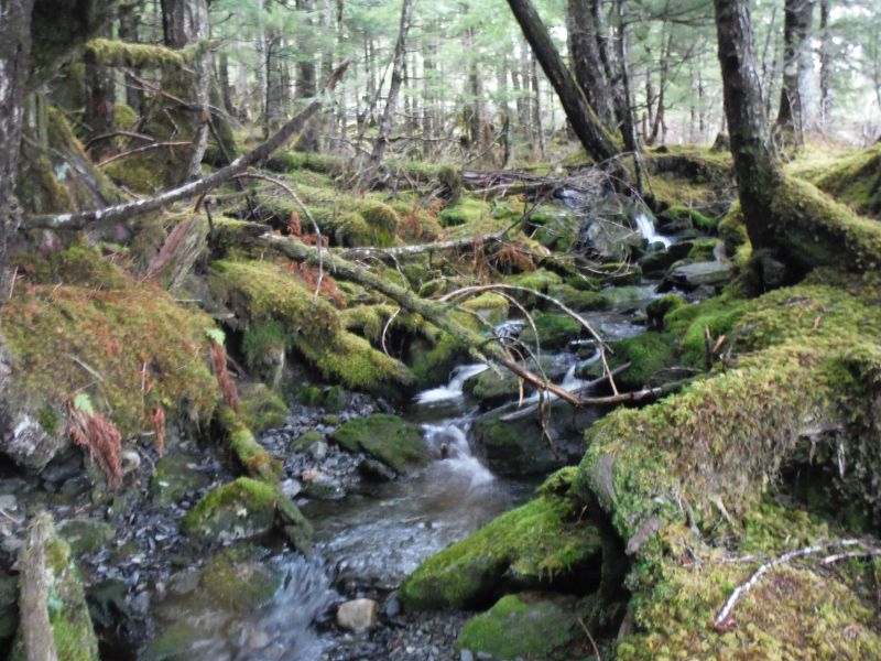
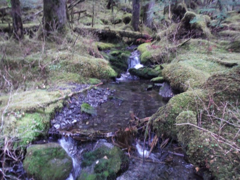
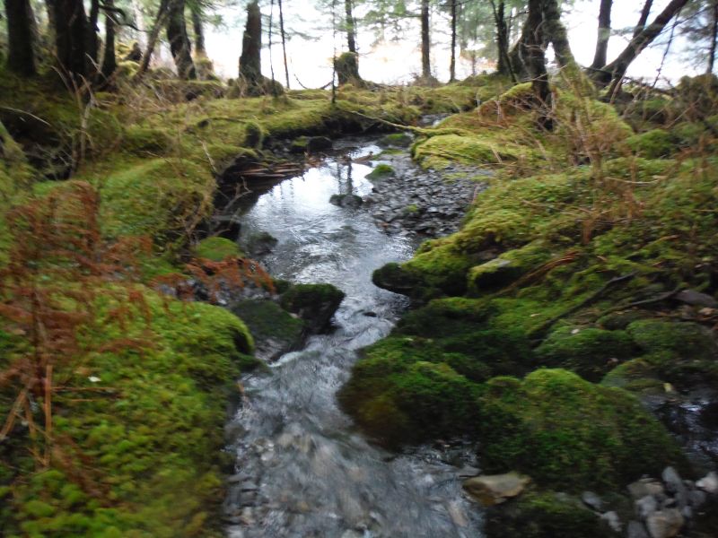
Stream Name: Eyak Lake Tributary
Elevation:
Site Comments: None
Survey UPDATE-POW5
Project Supervisor: Gillian O'Doherty, ADFG
Observers: Mark Eisenman
Overall Fish Passage Rating:
Tidal: No
Backwatered: No
Step Pools: No
Construction Year:
Site Observations:
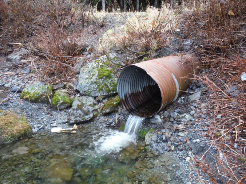
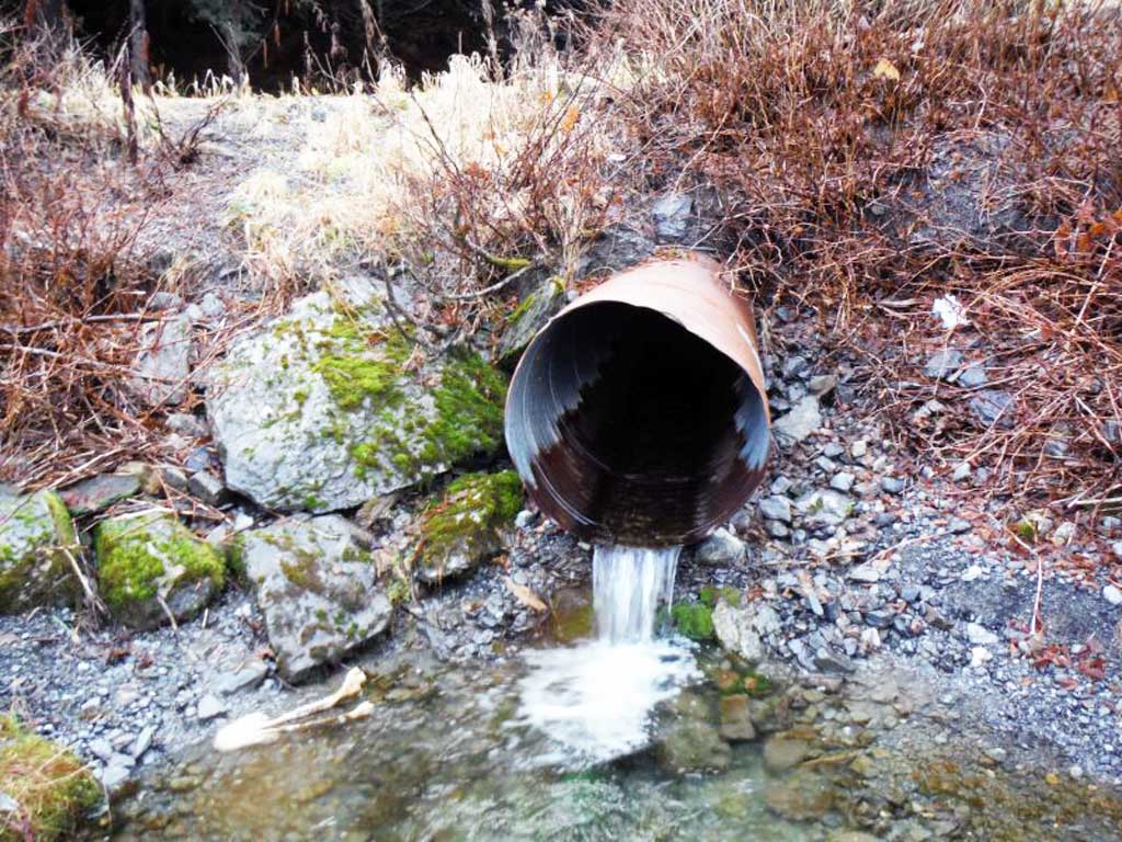
- Outfall height red
- Culvert gradient red
- Constriction ratio red
- Inlet perch
Comments: Site survey completed by the CRWP.
Culvert Measurements
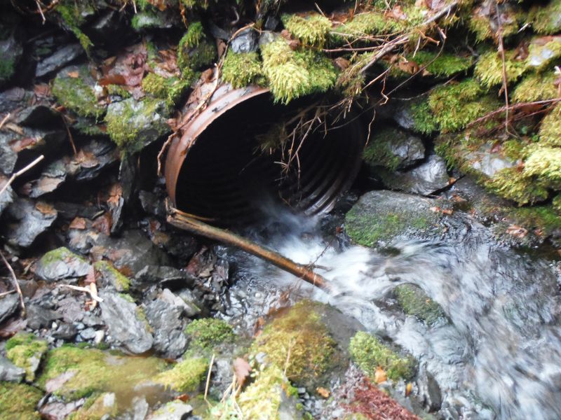
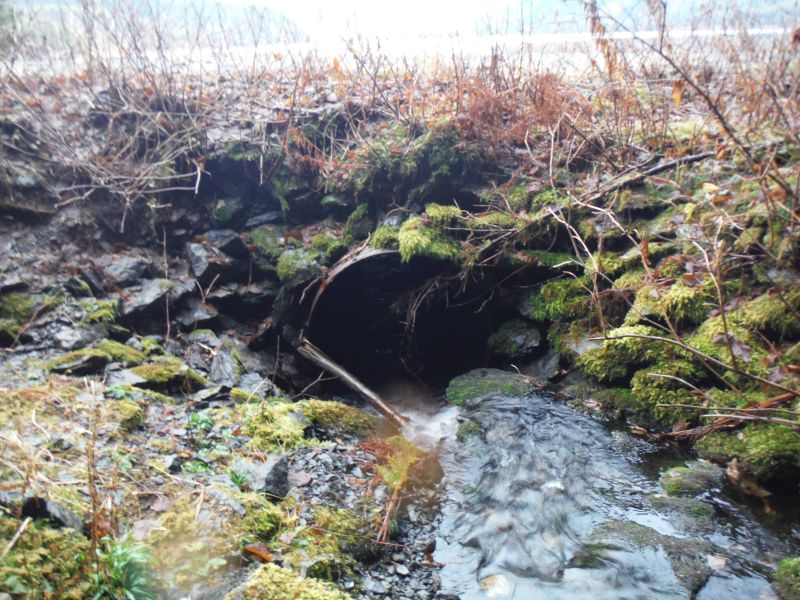
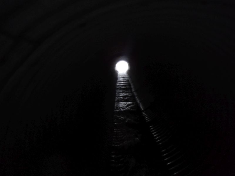
| ID: 1 | Structure Type: Circular pipe (Corrugated steel) | Fish Passage Rating: | |||||||||||||||||||||||||||||||||||||||||
|
|
|
|||||||||||||||||||||||||||||||||||||||||
Culvert Observations:
|
|||||||||||||||||||||||||||||||||||||||||||
Stream Measurements
|
|
| Stream Width Type | Distance From Crossing (ft) |
Stream Width (ft) |
|---|---|---|
| Upstream ordinary high water | 5.20 | |
| Upstream ordinary high water | 9.10 | |
| Upstream ordinary high water | 9.70 | |
| Upstream ordinary high water | 7.70 |
Elevations
| Locator ID | Culvert Number |
River Distance (ft)1 |
Distance From Crossing (ft)2 |
Relative Elevation (ft) |
|---|---|---|---|---|
| Road Elev | 22.51 | |||
| D/S Thalweg (In Eyak Lake) | 0.00 | 10.89 | ||
| D/S Water Surface Elev | 0.00 | 11.99 | ||
| D/S Grade Ctrl (Thalweg) | 24.80 | 12.38 | ||
| D/S Water Surface Elev | 24.80 | 12.82 | ||
| D/S Tailcrest or 1st Thalweg | 38.40 | 12.86 | ||
| D/S Water Surface Elev | 38.40 | 13.24 | ||
| Outlet Pool Water Elev | 45.20 | 13.27 | ||
| Max Pool Depth | 45.20 | 11.37 | ||
| Outlet Invert | 50.10 | 13.95 | ||
| D/S Water Surface Elev | 50.10 | 14.30 | ||
| Outlet Culvert Top | 50.10 | 16.99 | ||
| Inlet Culvert Invert | 112.90 | 17.07 | ||
| U/S Water Surface Elev | 112.90 | 17.62 | ||
| Inlet Culvert Top | 112.90 | 20.13 | ||
| U/S Grade Ctrl (Thalweg) | 116.30 | 18.38 | ||
| U/S Water Surface Elev | 116.30 | 18.68 | ||
| U/S Grade Ctrl (Thalweg) | 126.10 | 18.98 | ||
| U/S Water Surface Elev | 126.10 | 19.43 | ||
| U/S Grade Ctrl (Thalweg) | 146.00 | 22.43 | ||
| U/S Water Surface Elev | 146.00 | 22.63 | ||
| U/S Grade Ctrl (Thalweg) | 169.10 | 24.91 | ||
| U/S Water Surface Elev | 169.10 | 25.33 | ||
| U/S Water Surface Elev | 189.30 | 25.28 | ||
| U/S Grade Ctrl (Thalweg) | 189.30 | 24.91 | ||
| U/S Grade Ctrl (Thalweg) | 207.20 | 24.91 | ||
| U/S Water Surface Elev | 207.20 | 25.21 |
Notes:
- River distance is measured continuously throughout the survey reach along the thalweg of the stream.
- Measured from each end of the crossing along the thalweg of the stream.
Fish Sampling Efforts
| Gear Type: Minnow Trap (A) | ||
| Comments: No fish caught in trap | ||
| Gear Type: Minnow Trap (B) | ||
| Comments: No fish caught in trap | ||
| Gear Type: Minnow Trap (B) | ||
Fish Observations
| Species: juvenile Dolly Varden | Life History: | ||
| Total Fish Observed: 1 | Fish Measured: 1 | Fork Lengths (mm) Min: 85 Max: 85 Mean: 85 | |
| Collected/Observed by Gear Type: | |||
Photos

Questions or comments about this report can be directed to dfg.dsf.webmaster@alaska.gov